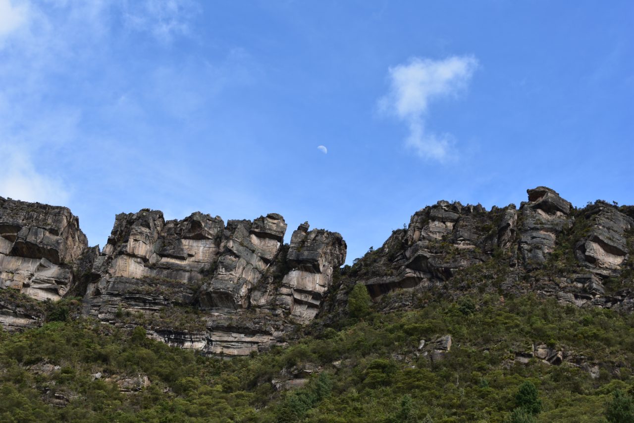

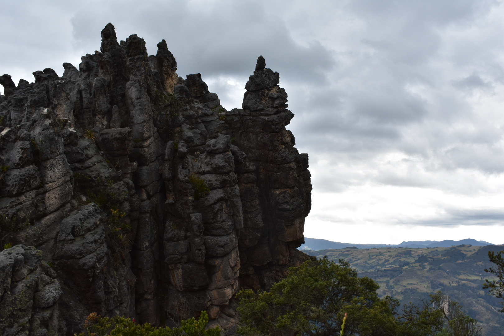
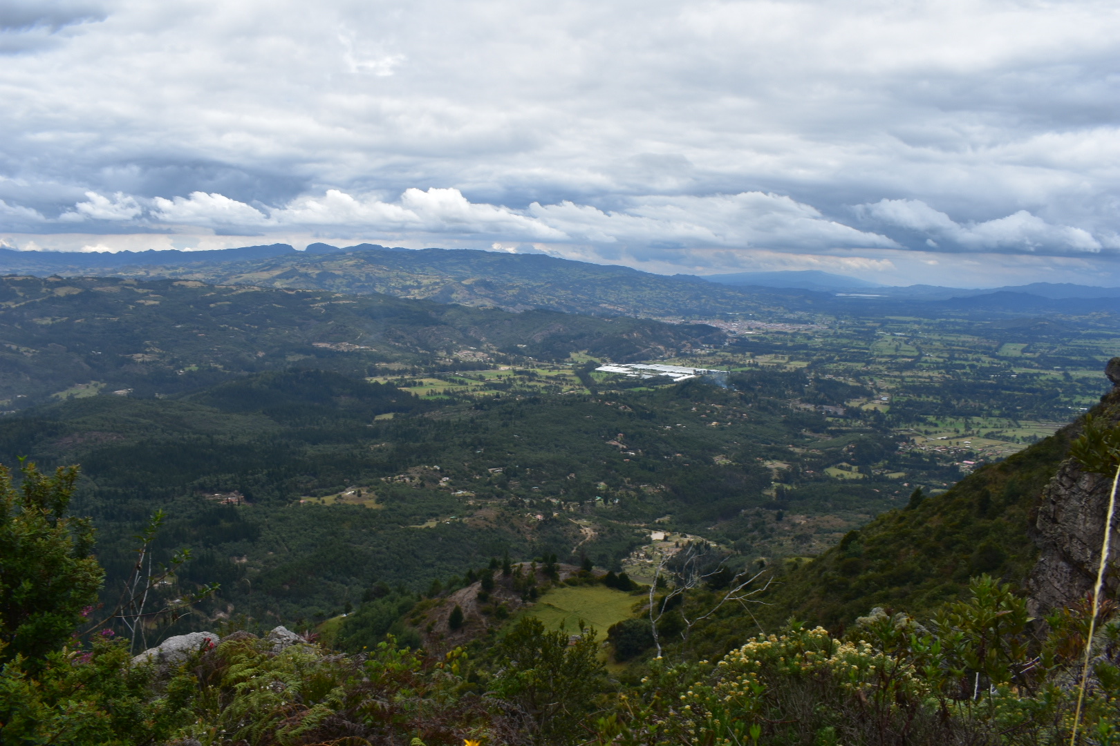
The Farallones de Sutatausa are a stunning rock formation that form the back drop of Sutatausa, a small mining town 90 minutes north of Bogotà. Sacred to the local indigenous peoples the 3000 metre peak is one place that you can see the Bogotá Savannah and surrounding valleys at the same time. As you climb to the top the views of the surrounding landscape unfolding below are phenomenal. The views combined with the unique rock structure and plant foliage make this a must visit destination.
The cliffs are a mecca for bouldering and the many hiking trails that wind their way up through the forest to the top of the cliffs offer a range in challenges. Once at the top there are plenty more options for bouldering as you scramble across the rocks along the entire ridge line. This is one experience that is not for the fainthearted so do make sure you have a level of experience before you attempt this hike.
The town is another weekend getaway akin to Suesca and Villa de leyva where you can visit for a day or spend the weekend enjoying the surrounding form the lush green valley floor. There are many beautiful hotels, hostels and camping spots all secluded in the valley with options to hike, climb, cycle or just relax. We hitched a life from a family who were returning home from a family birthday party. It is entirely possible to enjoy the cliffs from afar, but whatever level of adventure you decide is right then you are in for a a fun time.
If you enjoy hikes in the lush green mountains that surround Bogotà then mountains that try read my guides to Cuchilla El Tablazo, a downhill hike which starts overlooking lush green valleys from a palmero covered cliff at 3500 metres ends in a warm town at 1800 metres far below. Or head to Suesca where you can also go bouldering and spend a weekend enjoying hiking, camping or relaxing in restaurants.

Information

Our Experience
I was really excited to go to the Farallones de Sutatausa ever since read about the hike and saw photos of the views in another blog. There wasn’t much information in English, or Spanish for that matter, so I did my best to piece together the information and we had a fun, and at times scary adventure, but lived to tell the tale.
We set off to Terminal Norte early and had luck with a bus arriving pretty quickly. We needed to get a bus to Sutatausa, the final destination is Ubate. We were charged $12500 pesos as I had only told Angela the final bus destination, which we will come back to later. Do make sure you tell the bus driver that you want to get off at the Farallones de Sutatausa and you will be dropped off about 5 minutes south of the town, which is where the main trail starts. Despite having not told the driver of the location we were fairly confident that we would be able to get to the location as I had placed a pin in my map where I believed the tail started – we would later learn, several kilometres into the hike, that I had marked the wrong location. This was because I was transposing the map information from Google Maps to Maps.me and not having zoomed out enough on both to check. But back to the adventure.
If you get a direct bus to Satatuasa then the journey is around 90 minutes, the bus we flagged back to Bogota seemed to want to stop at every village and hamlet on the way resulting in a much longer journey. When we reached the town I surprised our driver by asking to be dropped off. Instead of heading straight up to the hike we decided to check out the town and I wanted to see if there was some tourist information to ask questions as this had been helpful for the Pionono Park hike and another blog had suggested that you can start the hike from the side of the church.

We arrived around 8:30am and the town was deserted. Later we found out that most the people that live in the town work in mines and they start early. There are a few shops along the main road but not so much further into town, at least not open, although if you follow the instructions below you will not come into the town. Make sure that you do bring what you need for the trip ahead of time. We didn’t have enough water with us, I had lost a bottle that week, and I was fairly confident there was a shop closer to the cliffs. We, however, didn’t find the shop but that is because we were looking in the wrong location.
The tourist information was closed, so we took a left and headed the 2km to where I have put the pin in the map. That was where we made another mistake as the route to the cliffs and the first point we had missed is accessed by taking a right from the church, as the blog had told me, and following the signs. We never saw any signs to the cliffs on any part of the journey. My advice would be go to to the location I flag below as I’m not sure the path from the Church is the best one to take.


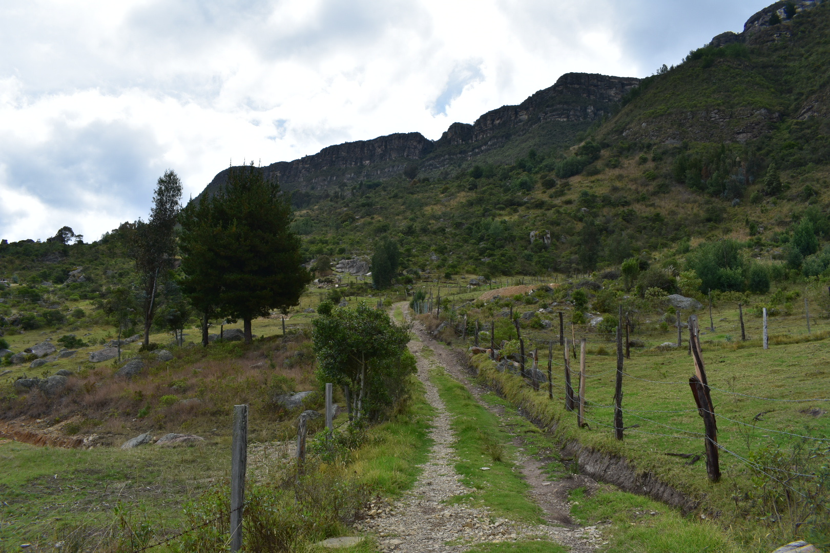
It was a few kilometres to where I believed the trail started and we made good progress along the road with Angela leading. I was excited to be hiking even if I had seen a completly blue sky slip behind the clouds. This is Bogotà after all. The road was a bumpy dirt track and a few cars and motorbikes passed us but very easy to walk on and pretty quiet.

We soon reached the pin I had placed in the map and expected the shop to be located. I still hadn’t realised that we were in the wrong place as there was a trail on the map which led up and we were right in track. There was no sign of the shop but I guessed it was either further ahead or no longer here.
We had a choice of turning right, which would have been a very long way around but would have instead taken us to the correct trail or turning left and follow the trail that I thought would take us to the top of the cliffs and then walk the 2-3 kilometres along the ridge line before descending on the south side. I think all in all I had guessed it would be around a 15 kilometre hike, which is not without the realm of reason, especially as it was still before 10am. Maps.me was behaving a little strangely but trails were marked on the map so I didn’t see any reason not to proceed, so we followed the road to the left and headed down into the valley below.


All the time we were walking down we were in good spirits, even though we knew we would have to go back up again. We walked past a couple of locals and for some reason I pushed Angela to ask for directions. They told us that there was a path up to the cliffs but this wasn’t the normal way for people to come. I may well have realised the mistake by now. The path that maps.me wanted us to follow disappeared across private land and we were told that landowner didn’t let people pass. But the man had pointed to a house in the distance and said that the owner did let people cross his land but to be careful as there was a dog.
We continued along the road which had turned into a very small track at this stage. Upon finding the house we decided to find the owner and ask for permission. I was a little concerned as we seemed to have to walk into the property and there had been a lot of barky dogs, who were not friendly as the other dogs had been at Pionono Park or Cerro Quininí. As we approached the hose we spotted a man working outside who was not friendly at all and did nothing when the vicious dog came to attack us. Luckily Angela didn’t panic and we walked away without incident. We followed the trail a little further to where is appeared as if it would join with the direction that Maps.me wanted us to head but we were blocked by another property. Again it seemed people were home but there were more dogs around and I didn’t want a repeat of what had just transpired so disappointed we retraced our steps. I definitely knew we were in the wrong place by this point, but we had been told there was a path up and up we wanted to go. After a few hundred metres we stopped at a place where Angel had picked up a pigs leg before and exactly at this spot there was a path that headed off in the direction we had been told to take. Although it wasn’t on the map and we were far form the actual trail head we decided to follow and see where it would take us rather than turn back.

The trail ran for a few hundred meters around the property we had just been forced off by the dog. It narrowed passing around a few more properties before ending in what appeared to be the back garden of a farm house. We passed through and found a road which I was temped to follow but sitting the other side of the house were two people who directed us up a path which they said led to the top. Happy we had come luck we eagerly began our steep ascent.


The path leading up to the top was steep from the beginning and was tough work but we made good progress and in good condition, to begin with. I was happy to finally be heading upwards after having walked down into the valley. We soon cam across a small barb wire fence that was a tiny bit tricky to cross, but thought nothing of it as there was nowhere else to go. Inside the field the path was not always clear and we took a could of wrong turns before finding the crossing out on the other side. We went up one more steep bank and found ourselves with a view across the valley. The path here had been washed away in many places but resulted in more rather than less to walk on. It was clear that we were not on the traditional path up.
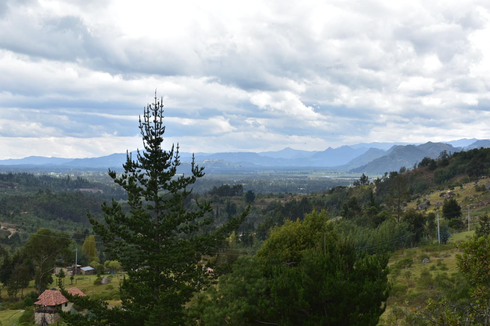
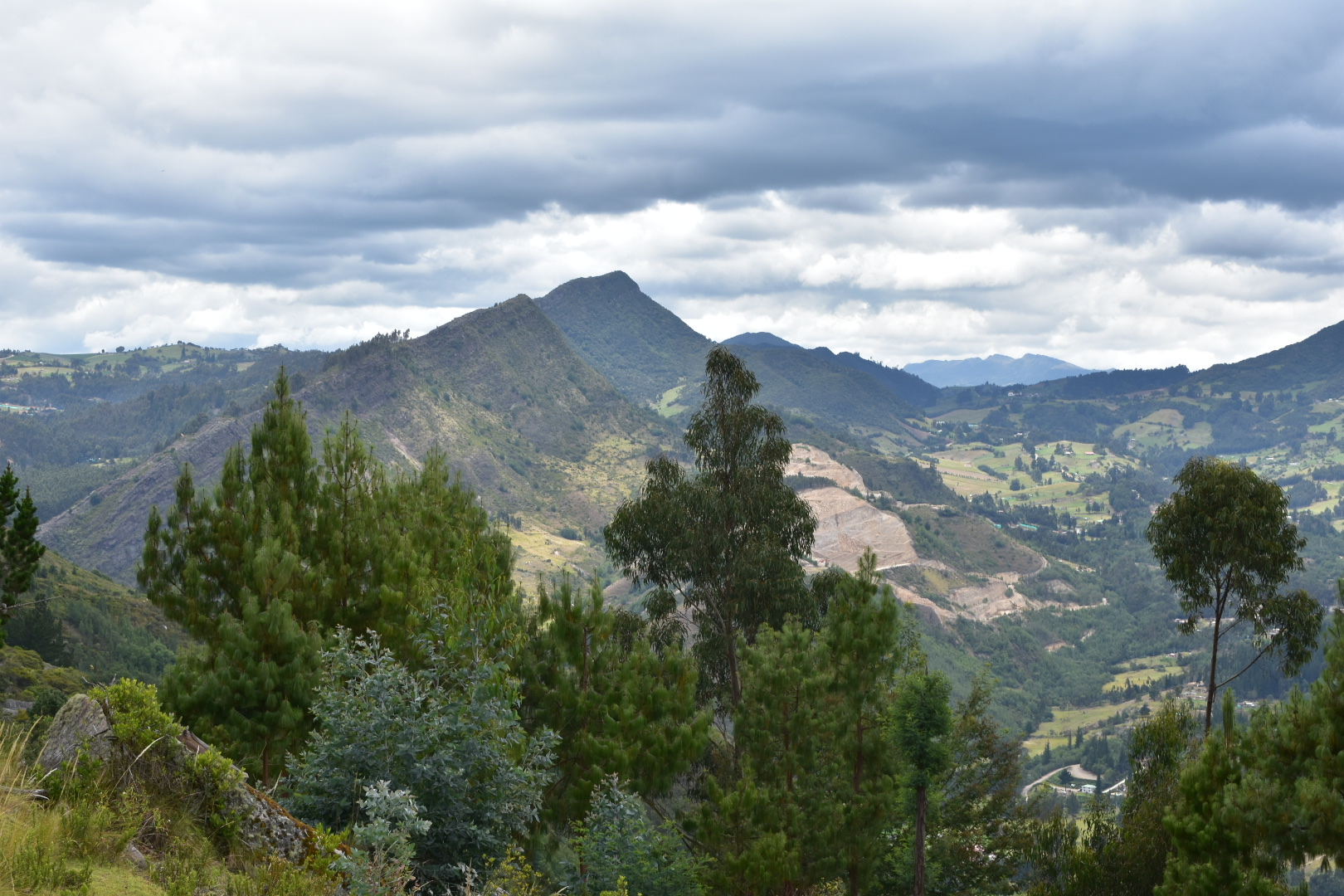
Soon after passed behind a water pumping station that supplied water to the valley, which the first man had told us about but made it sound as if it were 5 minutes away, not an hour as hit had been. After a few more turns the path opened up into a meadow where we took a short break and saw a mother and her young children pass. We continued up and the path kept splitting into several directions and saw more locals who helped in directing up upwards. After more twists and turns in the trees we arrived on the top of a crest and could see these beautiful mountains.


We took some more directions form the lovely people in this farm house who seemed to think that we were a little strange for coming this way but told us we were on the right path and then we started to climb up again.
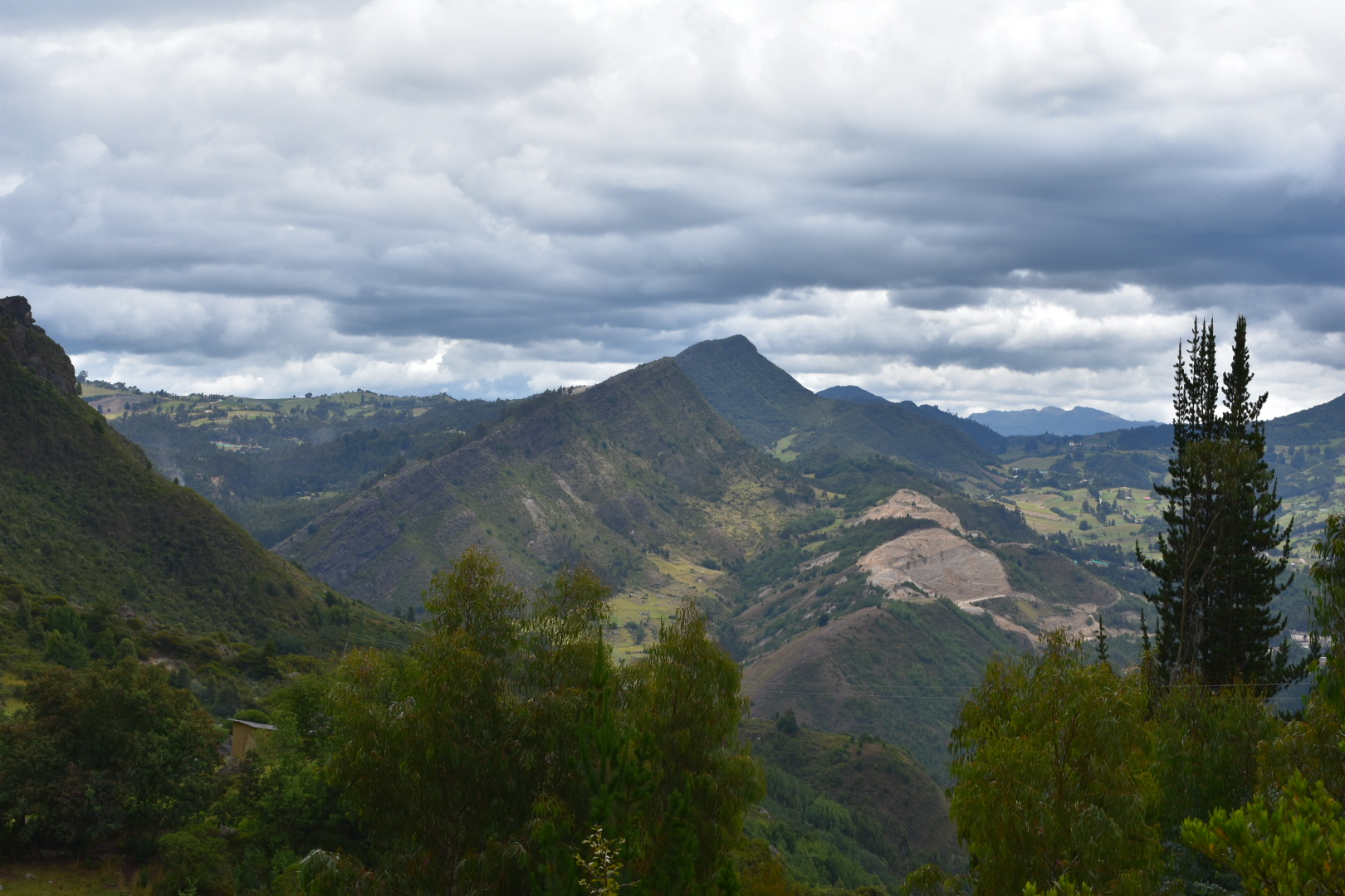
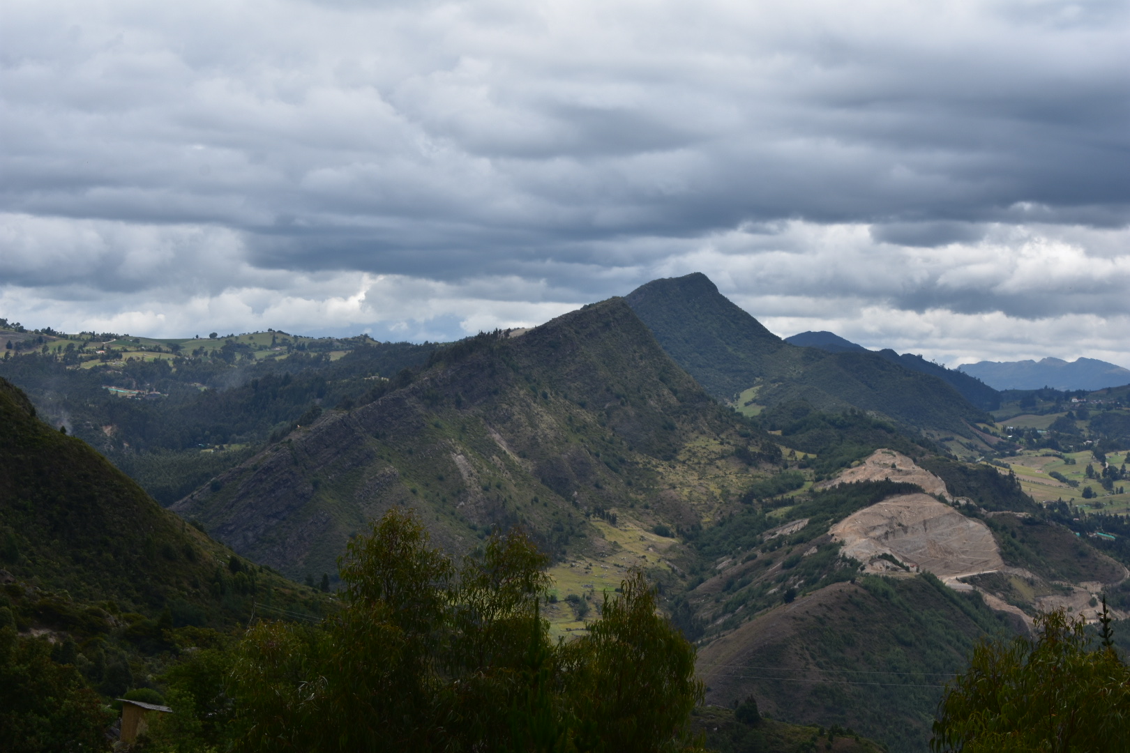
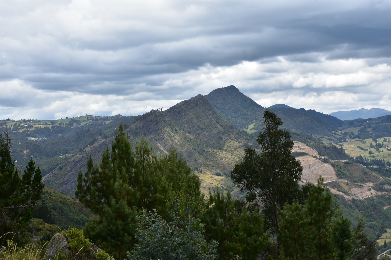
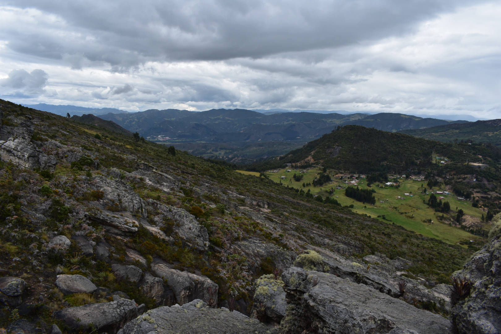
The image below gives you some idea of where we were headed and it became much steeper after this point. It didn’t feel too bad going up and there was nothing too challenging, most paths at the top of mountains are a little sketchy and you just have to go slowly and take your time. It didn’t feel like a long time and we kept on moving upwards. Soon we came to a cross roads with another trail, which when I looked at my map, was the trail the map had suggested we take. The one that had previously cut across private land. I felt pretty happy that we were back on the right track and so close to the top.

After a little more climbing the path levelled out and we arrived at the top. There was a lot of thick foliage, so we climbed a little higher and found some rocks to sit down on and eat lunch. For me the hard part was done, it really wasn’t, but in my mind all we had to do was walk along the ridge line and then come back down the other side – it was only a few kilometres away.
The view up there was a beautiful and sadly was obscured when it started raining, the wind struck up and it became really cold. We ate quickly, donned waterproofs and decided to follow the ridge to the path that led down. As I said it was 2-3 kilometres away.


We toyed with visiting another cerro close by but I rejected that and also the idea of heading back down the way we had come. So instead we started to pick out a path around the rocks and bushes which was initially a little tricky to find on the map. At the beginning there seemed to be a trail to follow but we kept hitting dead end and we were either above or below the path. But it was fine as we were quite easily following the ridge line. Soon after the path seems to lead ups off the cliff face, there was something really sketchy going down or a way to go up, which we started to follow but after a while that would have required climbing equipment. I stopped to take some photos before picking our way around on some quite tricky rocks.


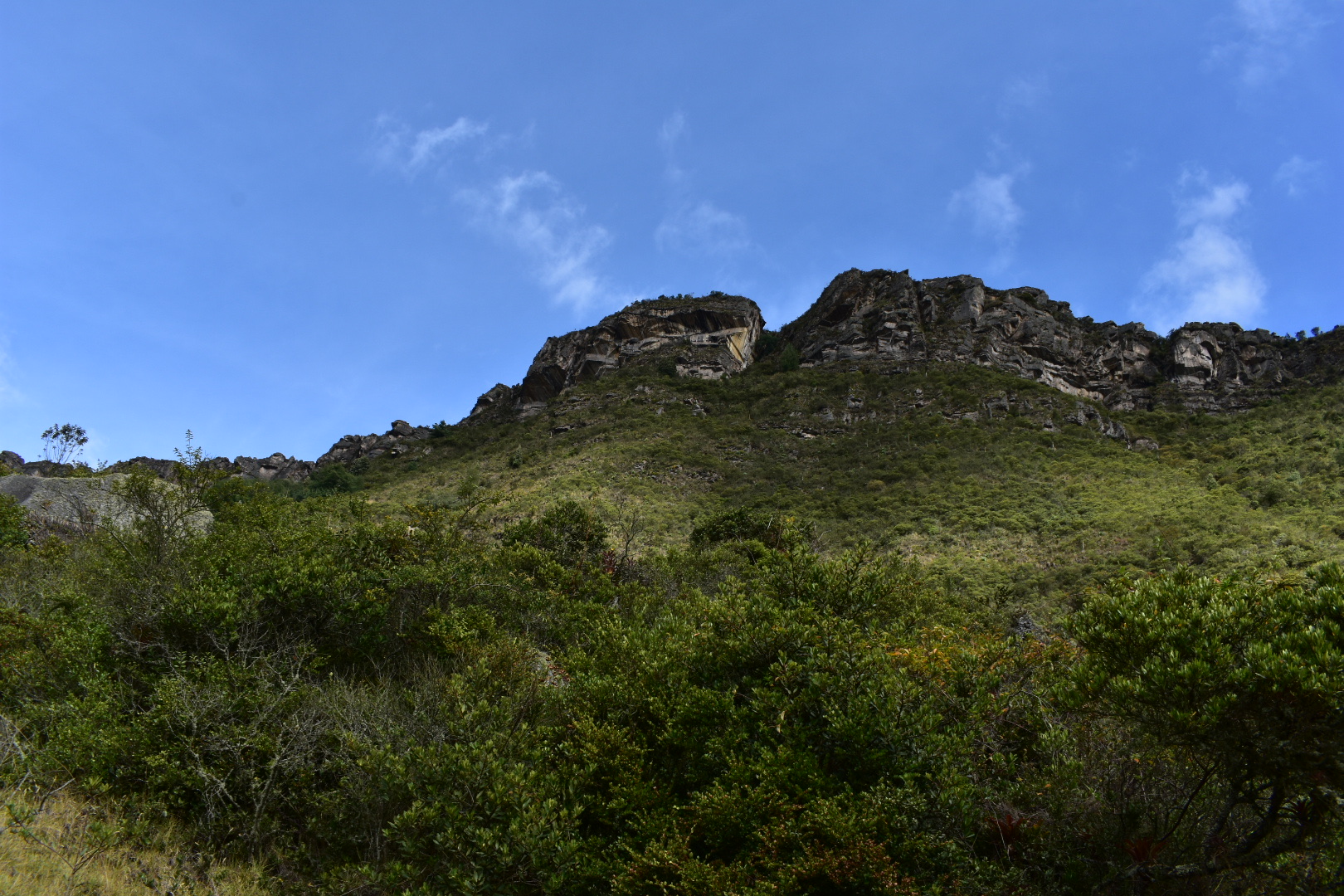
This is the view to the other-side of the mountain, it didn’t look at steep and there was no obvious path down but you can see there are houses there and keep this in mind as we will come back to it later.


Around the other side I found that we were far below the trial so I headed back up to where is should be using the GPS but I didn’t find anything obvious. The map kept telling me that we were above or below the right line. Luckily the rain had stopped before we went too far and we found ourselves coming to dead ends where there were deep drops and having to retrace our steps to find a way around. As we continued picking our way across the ridge and found some more beautiful views.


After a while of slowly working our way across the top we reached a series of trenches/gullys that we had to climb down into and then out of again. Some were a lot deeper than others and mostly it was fine but it was long and hard work. At this stage the sun started to come out and we had also ran out of water by this stage. I was really thirsty, tired and dehydrated. And the problem is when you get to that stage is that you start to get tired, and when you get tired you make mistakes.


We pushed on, rejecting the idea of going back as it would not have been any easier and then it was a long way back to the village, going up and down and up and down and then we got to this view, which caused us to have a moment of reflection as we realised we would at the very least need to get to the end you can see in the middle before we stared to go down. I looked at the map as I thought we had been making good progress and realised I had zoomed in a lot. So much so that we had only made it about a third of the distance along the ridge. There were two more peaks on the map which were around the same distance away that we had just come and then the path continued in the same direction for the same distance yet again before turning back to town. We didn’t know when the path would start to go down but it was now about 2pm and at our current speed it would have taken us around 2 more hours to get to the peaks and then who knows the rest. It gets dark in Colombia by around 6pm so I started to panic a little.


We looked at walking down the less steep side of the mountain, I didn’t know if that was even possible as you never know what obstacles you will come across but even if it was posible, and we could see a road it was a long long way to get us back to the road we would take to Bogota. I noticed a route on the map leading down but the path stopped a third of the way. We decided to head to the path and make a decision as to what to do.
After more climbing we arrived at the path, it was overgrown, covered in leaves and was a series of vertical drops, that led down over the side of the cliff before it disappeared out of view. I didn’t want to go. My instincts were to go back the way we had came or to continue but I don’t know if that would have been the correct choice. Sadly it was made for me as Angela decided to take a look and started heading down. At that point I nearly cried, and you can tell by my hiking that I’ve been up a fair few mountains now. The last time I felt this scared was in Bolivia when I hiked Pico Austria and we ended up walking on snow. It was so slippy that if I had slipped there was a long way for me to keep falling. That time I was with a guide. This time it was just us.
I had no choice but to follow as you shouldn’t split up on mountains. Luckily the rocks seemed stable, but honestly, one wrong move and we would have been flying down to the ground below. There were lot of dry leaves which could have made us slip but my biggest fear was that the path ended on the map. Did that mean it would end halfway down the cliff and we would have to go back up again? So the fist few giant steps down were difficult but soon after we were surrounded on three sides by mountain. Then we came out of the trees to a steep part where the path took a right angle and flattened out. Angela went painfully slowly and when I got there I understood. There weren’t really any handholds, imagine a bumpy slide and at the other end would have been your last drop. I got to the right angle, on my arse, and then proceeded to twist my body and slowly inch my way down. The path was no wider than my body so I was sitting on the edge of the cliff. I did not take any photos and had absolutely no urges to do so. All my concentration was placed on not falling.
After that we were surrounded by trees again but it was still steep and there was still the opportunity to go flying, but I at least had the guts to stand up for a while. Until the path left the trees and we had about 30 centimetres between the cliff face and the edge. I sat on my ass and manoeuvred along slowly grabbing on to all the plants I could for support, which is not generally advised as plants can come lose and the support is then gone. I can’t really describe how scary this part was but it happened twice and each time I inched along. After the second we entered back into the trees and found switchbacks and the path going became a lot less steep. I breathed a long sigh of relief and I think this is the closest I’ve come to falling off the side of the mountain. I’m not trying to make this too dramatic as I’m describing it how I remember the path.
My throat was so dry I was in pain and Angela’s legs were shaking so much she could barely stand but we had made it to relative safety. Typically the clouds broke up at this point and the sun came out to play and there was still a long way to go down.


Looking at the photos above and below I can’t really believe that we had just come down from there.


We kept walking following the path as it twisted around rocks ad small rises until we came to some deserted farms, except for some rowdy dogs who wanted to give chase and walked through them until we reached the road. It was at this point I realised that we still had a 5 km walk back to town. I was so tired and dehydrated and desperate to find a shop but there was nothing.


Here are the views from where we reached the farms.


We ended up walking along the main road, which I guessed was the one that we would have walked along if we had taken the right by the church, but the problem was none of the roads quite connected on the map and at this stage neither of us wanted to retrace our steps so we kept following the long road rather than attempting to take any shortcuts. We didn’t see any signs, either leading to the cliffs or the town so just kept walking. I was hoping for a car so we could ask for a ride but all we saw were a couple of motorbikes going in the wrong direction.
After about 2.5 kilometres, which is the longest 2.5 km I’ve walked in my life. My throat was burning and I had to force myself to keep moving forward. My throat was on fire, so let this be a lesson to take enough water! Eventually a car overtook us but we didn’t stop it. Luckily we came across it a short while later and the driver was on the road. At the same time a lorry pulled up behind us as it wanted to get by. Angela alerted the driver and at the same time saved us both by asking for a lift to the town. We were dropped at the main road and I found the first shop and brought the biggest bottle of water i could. We sat there for 20 minutes before Angela suggested we wait on the road for a bus. One came past pretty soon and after we were able to get a seat we both sat back and pondered about how we were still alive. Because honestly at the top I really wondered if we were going to make it. It had been an interesting day, we had had a lot of fun and some scares, having lived to tell the tale. But I was also a little sad that we hadn’t experienced the correct hiking path but we had experience something truly unique. I would advise that you follow the instructions below rather than try to follow our steps.

How to arrive at Farallones de Sutatsusa
Firstly go to the North Terminal in Bogota, you can get there by using the Transmileno or take a taxi or Uber. When you arrive at the station head to the main building. There are lots of little parts tot he station with busses going to different places. You want to get a bus to Ubate, but say Sutatsusa and it should be around $10000 and takes around 90 minutes to arrive once you are on the bus. Make sure that you tell the driver that you want to got to the Farallones de Sutatsusa he should drop you on the correct road which is before the town. If not try and get off near the road that leads toward the pin on the map.

There are several paths up form the shop but you can ask there for advice and this will take you to the top.
If you go too far and end up in town, walk to the church on the main plaza, you can see it from across the town. From here take the path to the RIGHT of the church and you should see signs to point you in the right direction. Ask at the town if you are unsure and it should take around two hours to reach the top from here.
As we did make a little bit of a mess of this one you can also follow the wikilock guides – many people have walked along this route so it should be easy to find.
Equipment to take
There is a serious hike and once you start there are no places to purchase food or water so make sure you have everything you need. The trek across the rocks along the ridge is tiring and you will need to take extra water for this part. Also the weather is changeable and can be cold so again before you attempt this one make sure that you bring the right equipment:
- Gortex hiking boots
- Waterproof jacket
- Waterproof trousers
- Dry bag or packback cover (I take both)
- Cell phone
- Cell phone battery
- Charger cable
- Sunglasses
- Sun Cream
- Painkillers
- Blister plasters (better if you have a small first aid kit)
- Hand soap
- Tissues
- Water filer
- Sun hat
- Food – you can never have too much and you will need it on this hike so pack appropriately.
- Water 3 litres minimum
Clothes
This is a high altitude hike which can get cold and also can often be wet so be prepared for the cold.
- Base layer
- Jumper
- Fleece
- Down Jacket
- Hiking trousers
- Hiking underwear
- Hiking socks
If you enjoy hikes in the lush green mountains that surround Bogotà then mountains that try read my guides to Cuchilla El Tablazo, a downhill hike which starts overlooking lush green valleys from a palmero covered cliff at 3500 metres ends in a warm town at 1800 metres far below. Or head to Suesca where you can also go bouldering and spend a weekend enjoying hiking, camping or relaxing in restaurants.
5 Pingbacks