
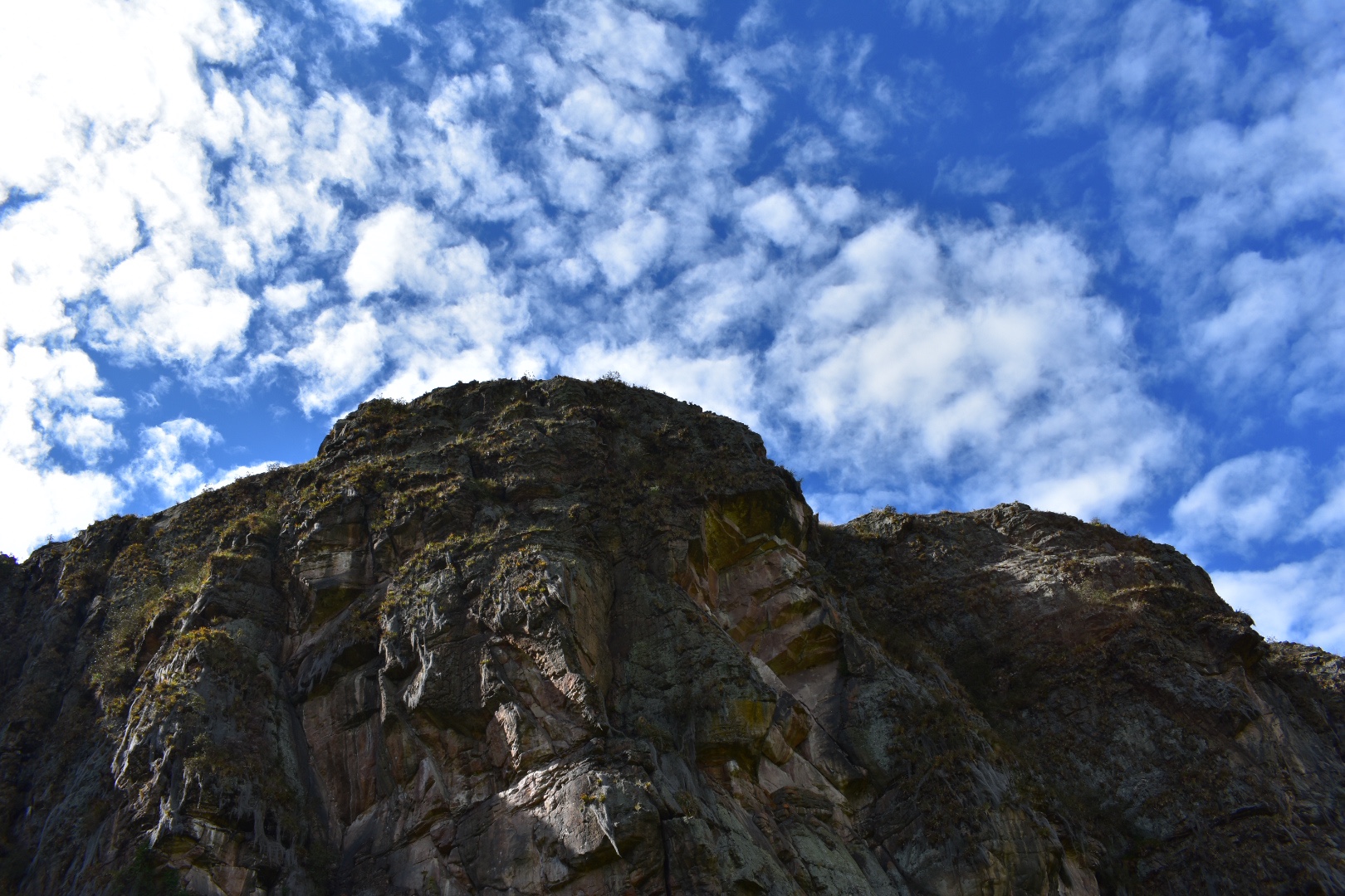
Situated on the northern edge of the Bogotà Savannah, an hour outside of Bogotà, is Suesca. Famous for the Rocas de Suesca (Suesca Rocks) it’s a mecca for the outdoor activities. For the adventitious there are 500 plus climbing routes across the rocks, plenty of hiking trails, and many cycling routes. For those who require less of an adrenaline rush can take time to relax by Lake Suesca or eat in one of the many restaurants. Hiking along the ridge line along the top of the cliffs provide views of the surrounding area for miles around. The scenery is breathtaking. Or follow the railway and recreate the scenes from the movies.
The town is well set up for outdoor sports and you can hire climbing equipment and guides from many places in the town. Visit Cañon de la Lechuza (Owl Canyon), Laguna de Suesca (Suesca Lagoon) and hike to Santa Rosita and for lunch. Its the perfect place to escape for a day or even longer. There are options for staying overnight either in the campsites situated at the bottom of the cliffs or in one of the many hotels.
If you enjoy hikes in the lush green mountains that surround Bogotà then mountains that try read my guides to Cuchilla El Tablazo, a downhill hike which starts overlooking lush green valleys from a palmero covered cliff at 3500 metres ends in a warm town at 1800 metres far below. Or head up to the rocky Farallones de Satausa where you can also go bouldering when you make your way along the ridge line.
Information

Our Experience
On one of the many holiday Mondays in Colombia I decided to visit Suesca. It was my first solo hike since returning to Colombia, which was actually quite nerve racking. Despite having hiked solo in more remote places this many, many times the year before I was out of practice. But my Spanish is better now and so is my planning. Angela was not well, which was a shame as the weather was beautiful, so I left her at home to enjoy some solitude and took an Uber to the North Terminal.
While in the taxi I realised that this is how we should have started all of the hikes. Getting across Bogotà is difficult, slow and not much fun. On so many occasions it had easily added 1-2 hours to the journey, just to get to the bus terminal to leave the city. Uber is cost effective enough that you are not really saving much in cost vs the time of taking public transport. This time it was it was really easy! The cycle paths had not opened and being a holiday there was much less traffic than usual. I arrived at the station just before 7am, brought a tickets, snacks and was on a bus by around 7:15 am. Initially I headed into the main building and was directed around to the far end of the terminal. When facing the terminal there are a set of more local busses that leave from the bottom right corner, there is a huge sign which details the destinations of the busses. I grabbed some water and walked around the complex and waited in line for my bus.
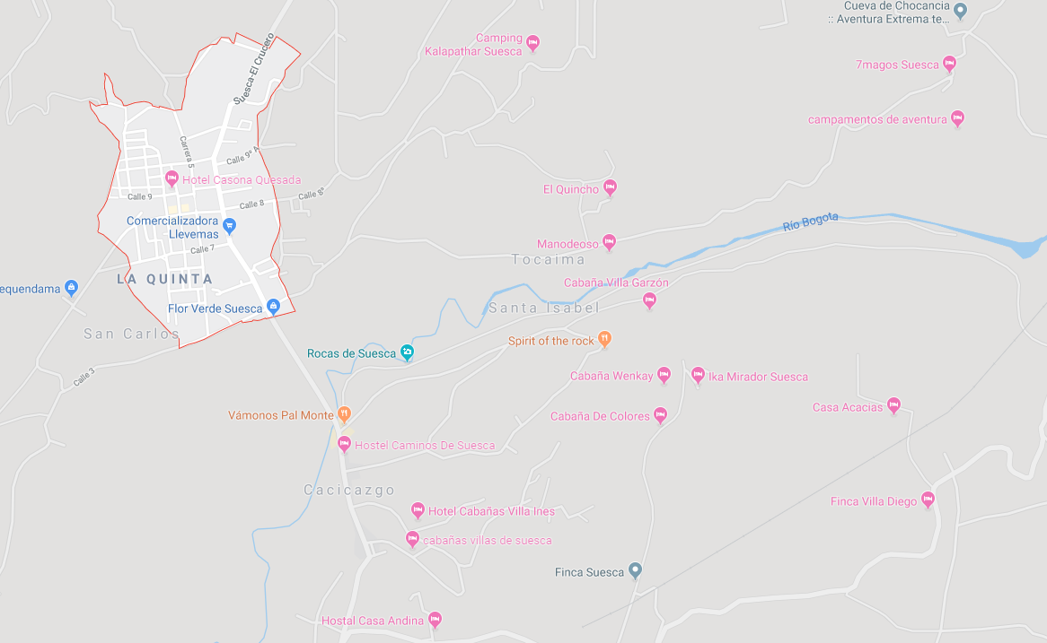
Tell the driver that you want to go to Rocas de Suesca and you will be dropped you off just before you reach the river, outside of the town itself. You do not want to go all the way into the town or you will have to walk back outside of the town. A single trip is $7600. Assuming you are dropped in the correct place, it will be on the same side of the road in which you leave the bus, then there is a short walk to the train tracks and you will see the views in the photos below.

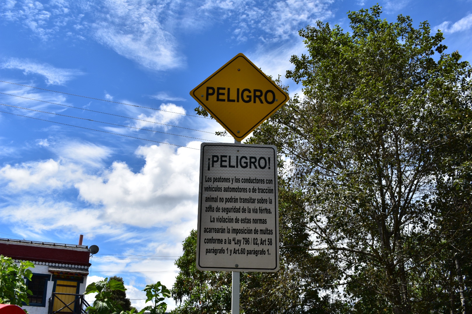
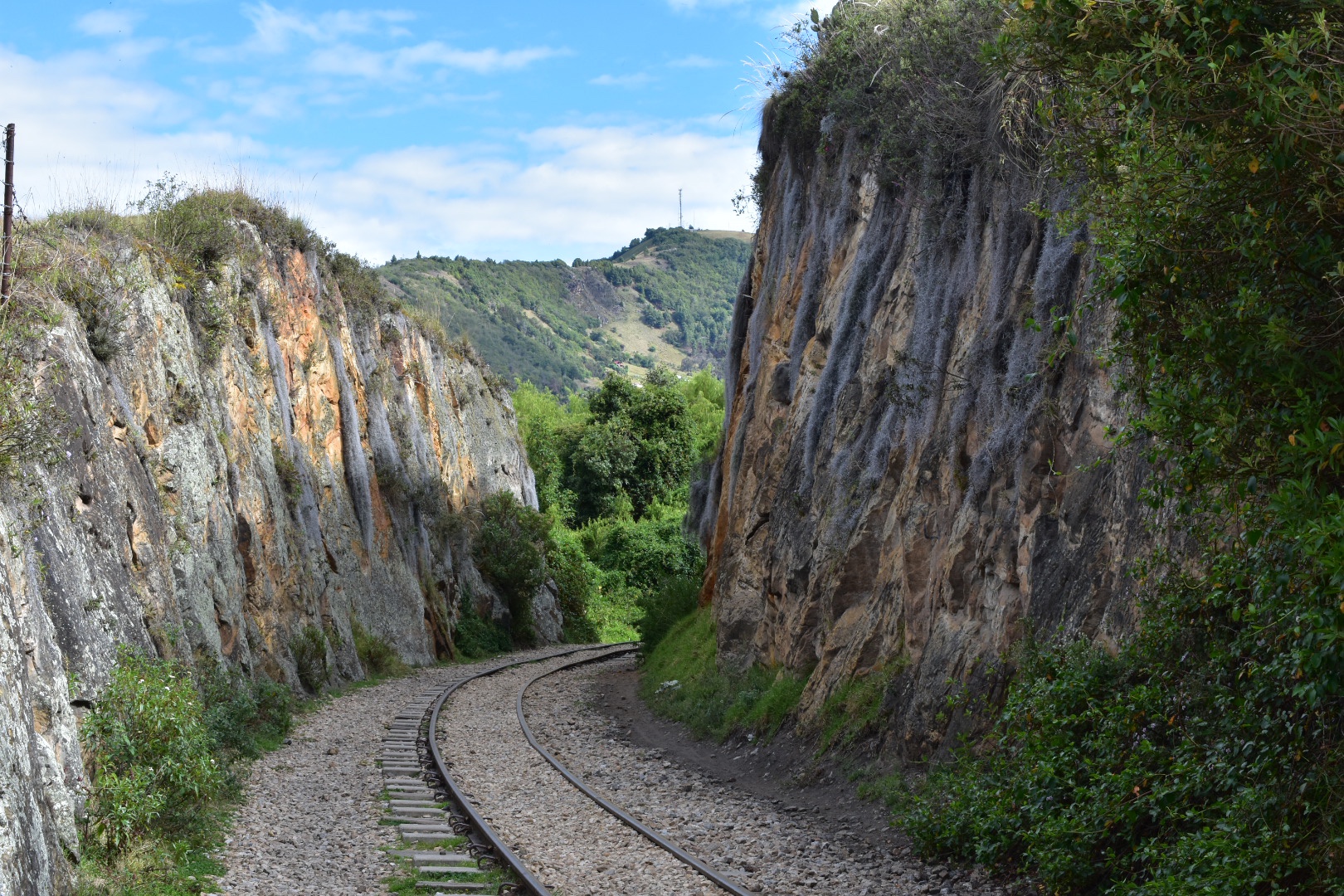
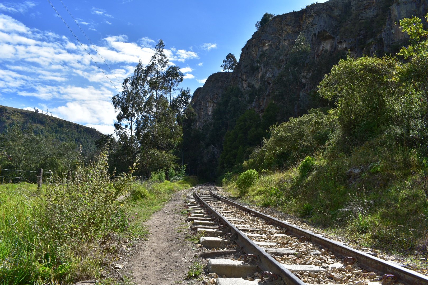
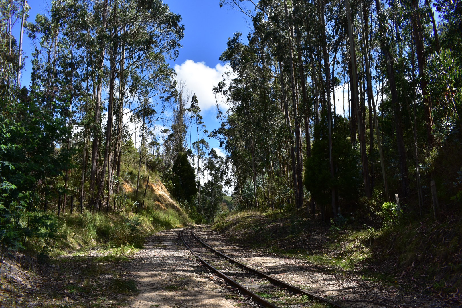
Despite the sign above telling you that its dangerous to walk along the tracks I decided to head off in that direction. This is a working railway but its only used for cargo trains. I don’t know how often they run and being a holiday I felt fairly confident I’d be safe. I didn’t see or hear any trains pass on the day that I hiked. The only way to access the bottom of the cliffs is along the railway line so there are plenty of people taking the route along the lines. But just take into consideration that a train could pass you at any stage during the hike. I didn’t see any areas where it would not be possible to stand back and let the train pass and you should hear it coming from a long distance but again, just be careful.
There is also a path that leads straight across the railway and up into the hills, this is where I ended up when I returned. I wanted to follow the train track and recreate scenes from the movies I watched as a child. In hindsight stones are not the best for hiking on but there are well trodden paths along the sides of the track and you can also walk along the sleepers. So after taking some photos I immediately headed to the left to follow the tracks.

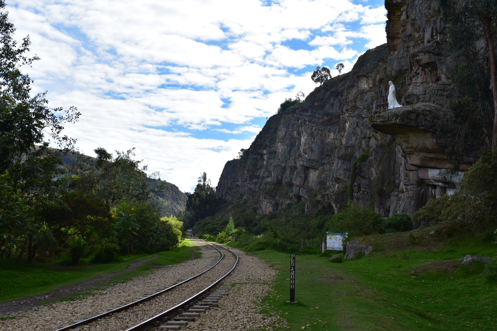
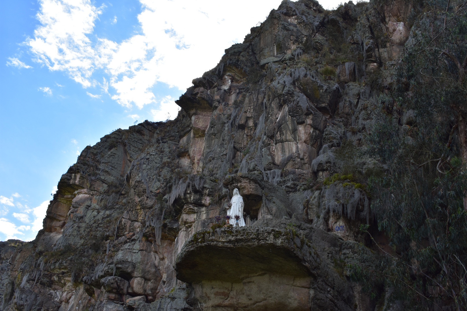
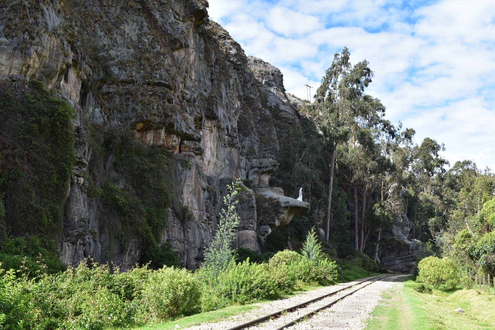
 After curving around to the right the track levelled out and I could see the cliffs and very soon saw climbers making their way up the rocks. I also spotted a Virgin Mary which I’m hoping is not a tribute to anyone who has died.
I was lucky to be able to hike on a beautiful day and it had only taken me an hour to arrive so I started early around 8:30am. The initial leg of my trip was just over 5km and I wanted to go to Cañón de la Lechuza, a mirador on maps.me which is you can find by just following the tracks and if you wanted to go further then just under 1 more kilometer takes you to the town of Santa Rosita. I decided not to walk that far, but you will see it in the photos below. There you could have lunch as there are some restaurants, bakeries and hotels if you wanted to stay. But this whole hike is easily done in 3-4 hours. I was on a but by 12pm and I stopped a lot to take photos.
 I really enjoyed the rugged terrain and the foliage growing out of the rocks. The photos don’t really do it justice but some of it seemed like giant spiderwebs.
 I soon came across a camp site where plenty of families had decided to spend the night. I also got the impression that any of the climbers were using it as a base because there were a lot of people in climbing gear walking to and from the camp. Although as I went further up the tracks I didn’t see so many people.
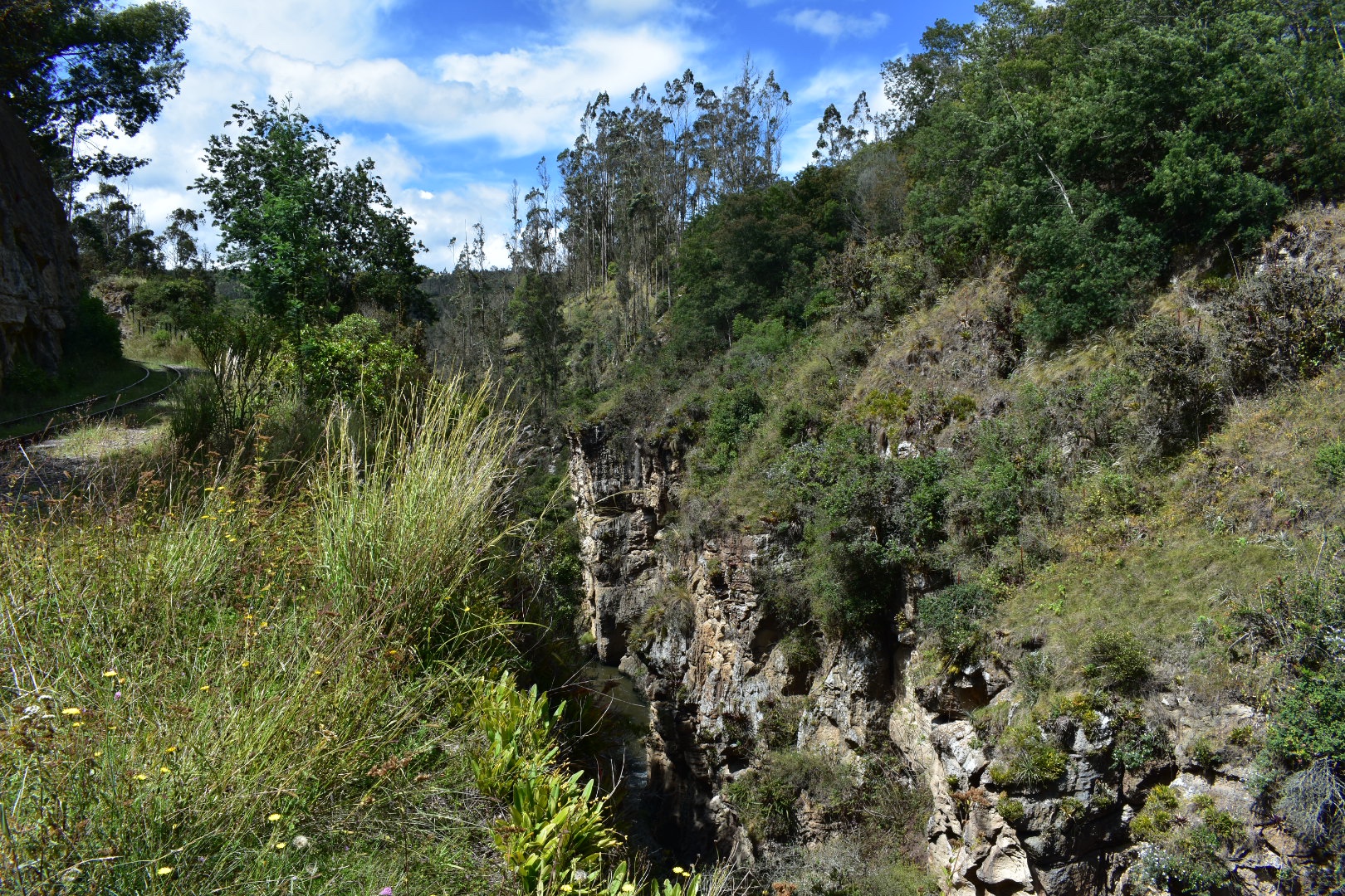
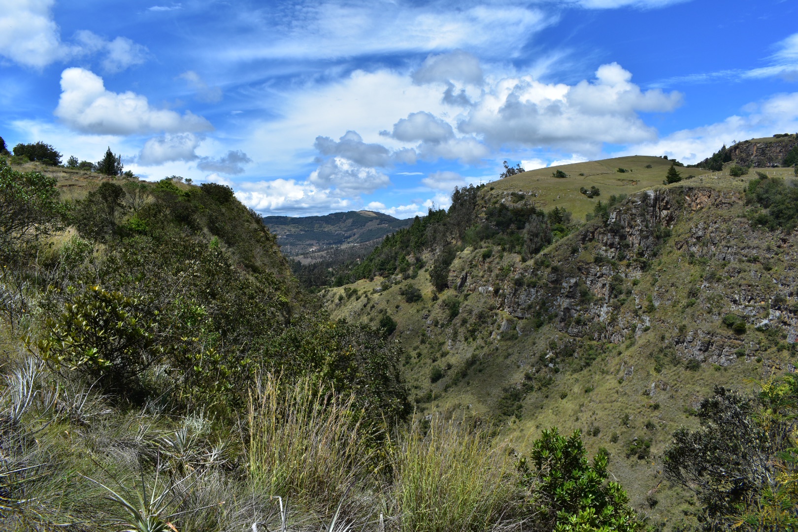
 The mountains close in as you travel further along the train line forming a canyon with the river right at the bottom it provided some beautiful views and sounds.


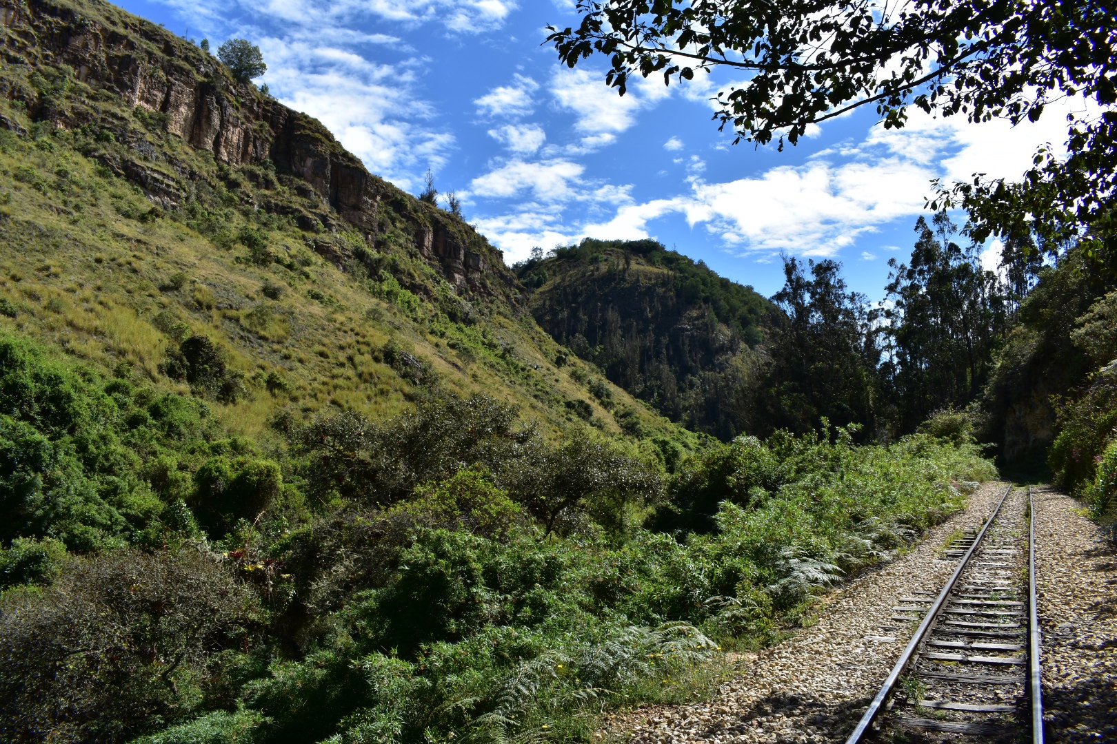 The surrounding trees and rocks were beautiful. Everything was so lush and green, I assume it was because I was here on a rare sunny day in the middle of rainy season, but the trees gave me the impression that it was autumn so the colours were particularly spectacular. Being close to the equator Colombia doesn’t really have seasons but the climate changes so much from place to place. The Bogota Savannah is around 2600 metres in altitude and you only have to travel 90 minutes and drop to 1500 to find the weather mush more tropical or head another way and go up to 4000 meters to find yourself in the middle of a Palermo where it is cold and wet. Its one reason I love mountainous regions.

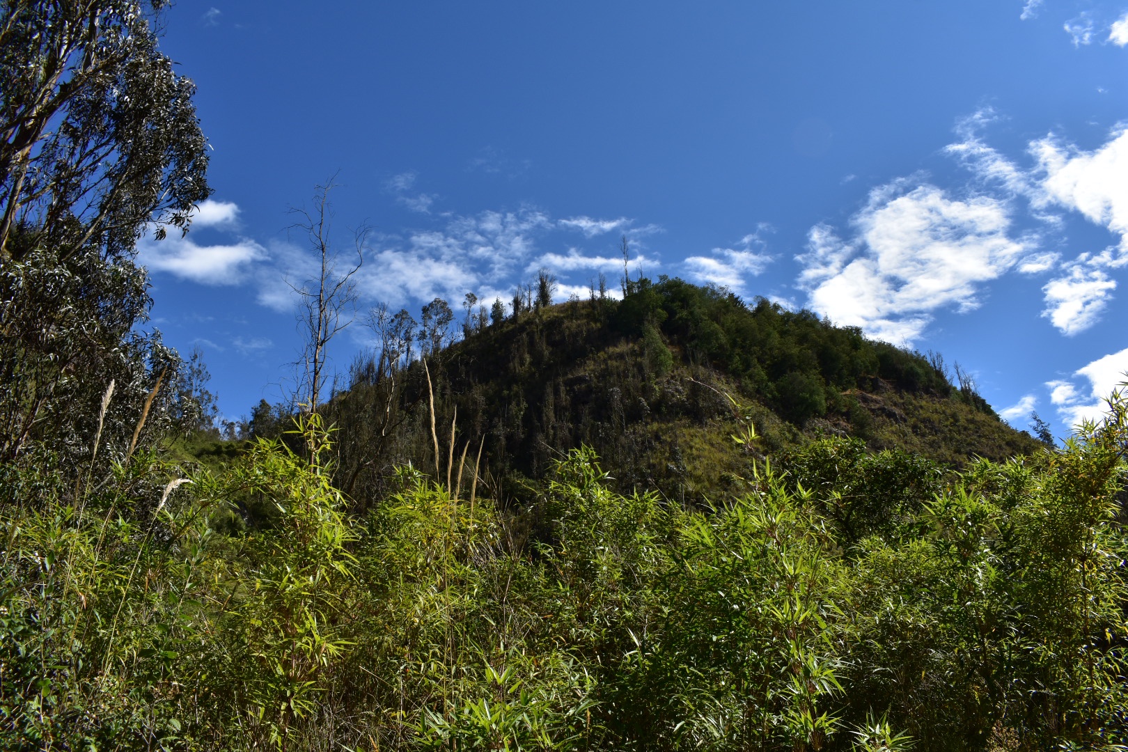
 After I came out of the rocks above the train line goes around in a huge circle, after seeing the landscape I can only assume that they were not given permission to build on someones land. Also take note of the photo above as this is the beginning of the path where you head up to hike along the top of the cliffs.
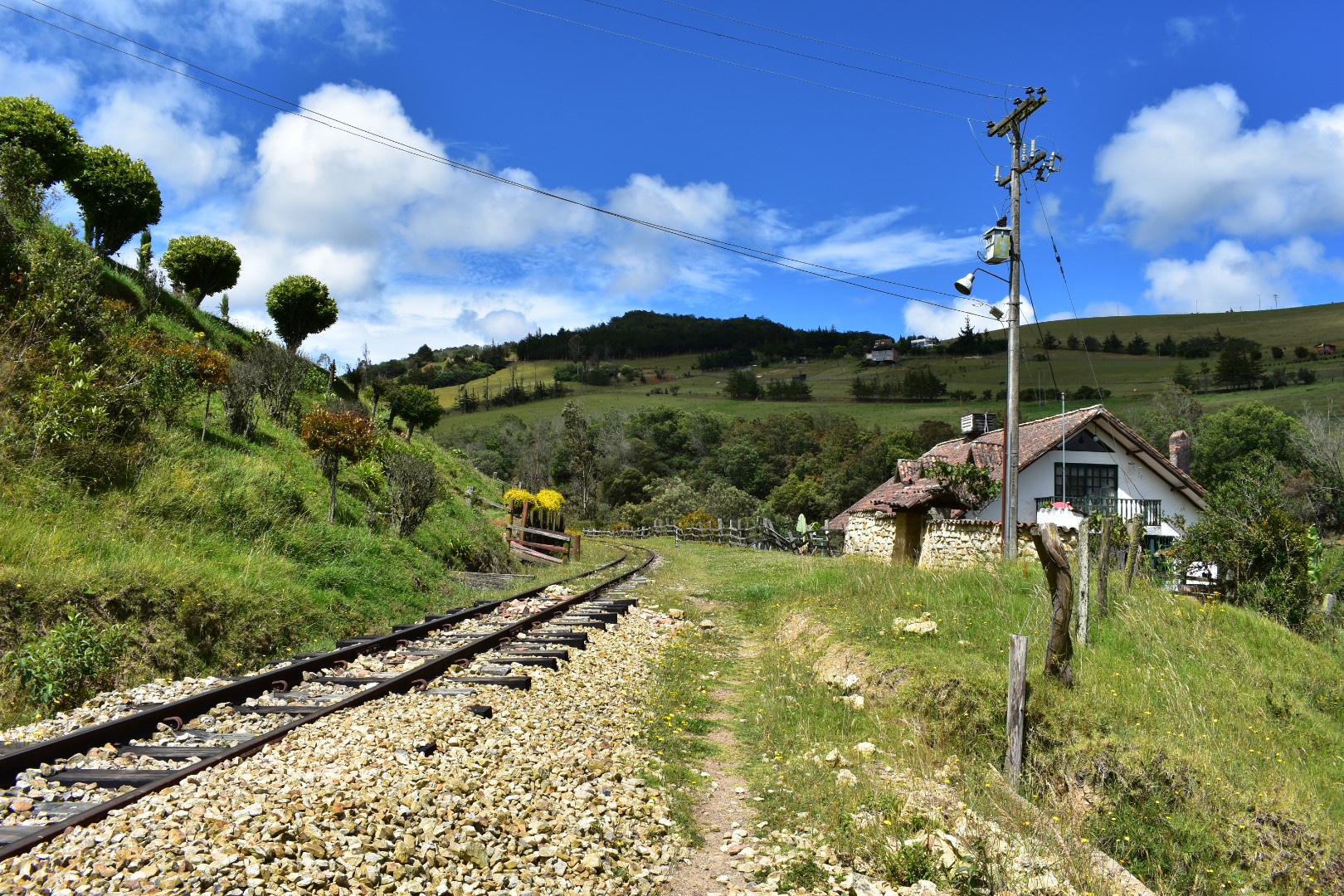
I continued to follow the tracks and then they took a turn to the right and I was surrounded by trees again and started seeing some properties. I thought there might be a way to meet the main road here but alas the properties were in the way. But soon I reached the mirador.

 It was around 10am when I arrived at the mirador and I saw some flowers which I took a some closeups. And very quickly got upclose and personal with a vulture, who I didn’t see until the last second as I was concentrating on sitting down to rest and eat my crisps.


 This was my intended endpoint but as views go I was a little disappointed. I sat and rested while a couple of groups passed me and then tried to take some photos. I had read that the canyon was a place you could view owls, hence the name, but its really difficult to get a decent view without half hanging off the edge and that was something I really didn’t want to do. I have seen videos of people kayaking along so maybe if that’s of interest its something you can opt for. I really wasn’t happy with my photos, which you can see below, but I wanted to take some to illustrate. But don’t let this put you off the hike as its beautiful, I just wanted to be realistic about the “mirador”. From here you can either continue to Santa Rosita.


 I wanted to see the town and continued to the point below. I decided that i didn’t want to add an extra two kilometres to my journey but I think it would be a nice place to stop on the outward journey.
 I retraced my steps along the track a little faster this time as I wanted to find the path that would take me along the top of the cliffs.
And soon I found it. I was about to head up when I saw a security guard with a very excited puppy, who ran up to me and wanted to play. I decided to ask for some directions and accidentally trod on the puppy’s tail as he lay down in front of me. Luckily the security guard took it with good grace and set me on the right trail.
I wouldn’t say it is particularly steep but there is definitely a good amount of up at this stage and I passed straight into the trees, passing a fair few hikers.

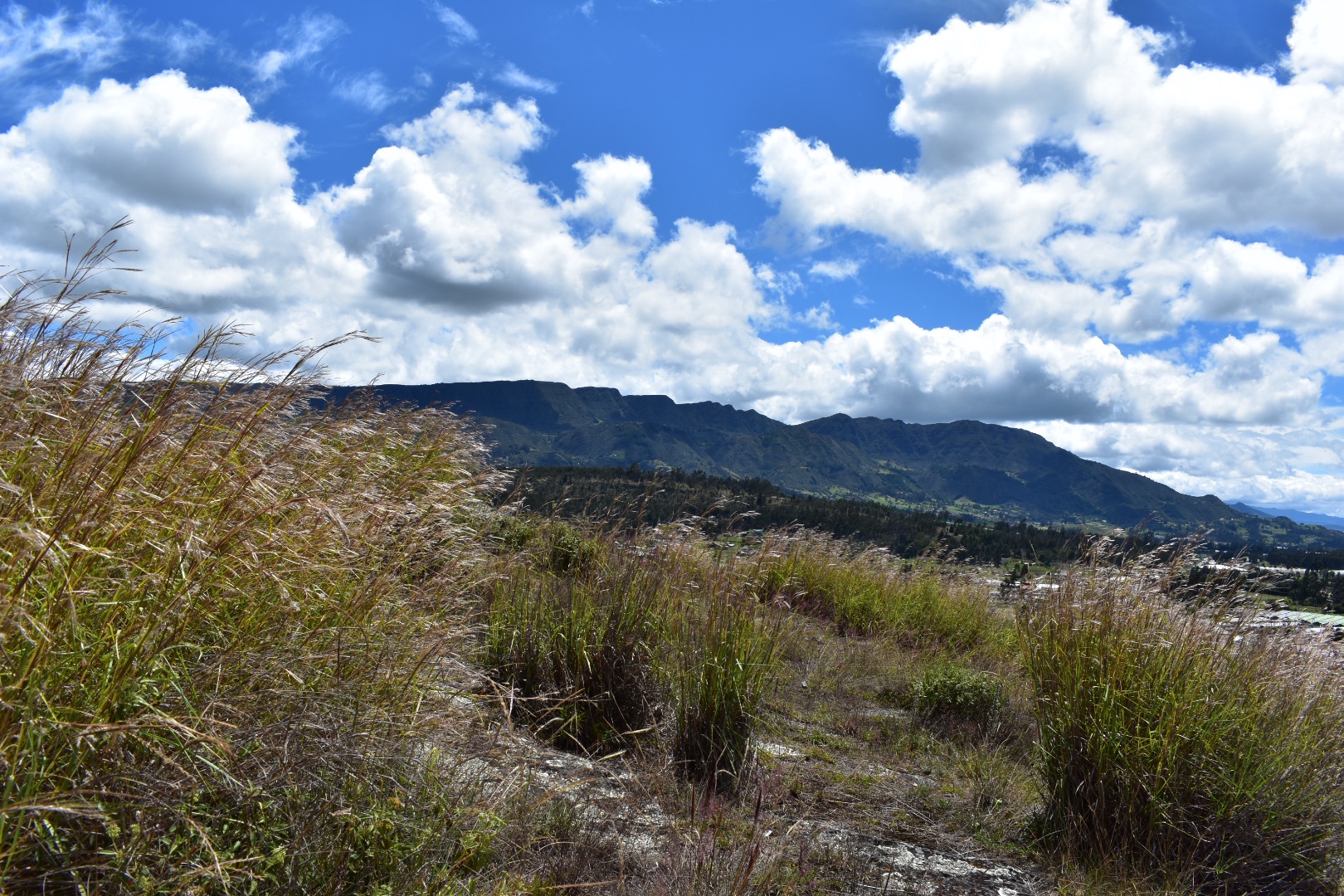
 You come out into a meadow and from here you can see views of all the surrounding mountains as well as a panoramic view of the canyon.


 When you reach this point you will want to take the path to the right, following the side of the canyon. The security guard overtook me on his bike and I found that there was a path leading down but it had a fallen tree across it. The tree was easily crossed but there was another large group coming form the path that came from the left. I thought I had gone the wrong way so took the path to the left and soon realised I wasn’t on the correct path according to Maps.me, but also I wasn’t too far away from it. Luckily the security guard and the dog came back and he informed me that I was going in the wrong direction. So I retracted my steps and headed back to the path going down, but I was quite happy as this is the direction I had originally wanted to travel.


 Here is the tree blocking the path.
 As the path led down I was treated to some great views and got closer and closer to the canyon itself. Soon I was able to see the places where climbers had reached the top and had left the bolts in the rocks.

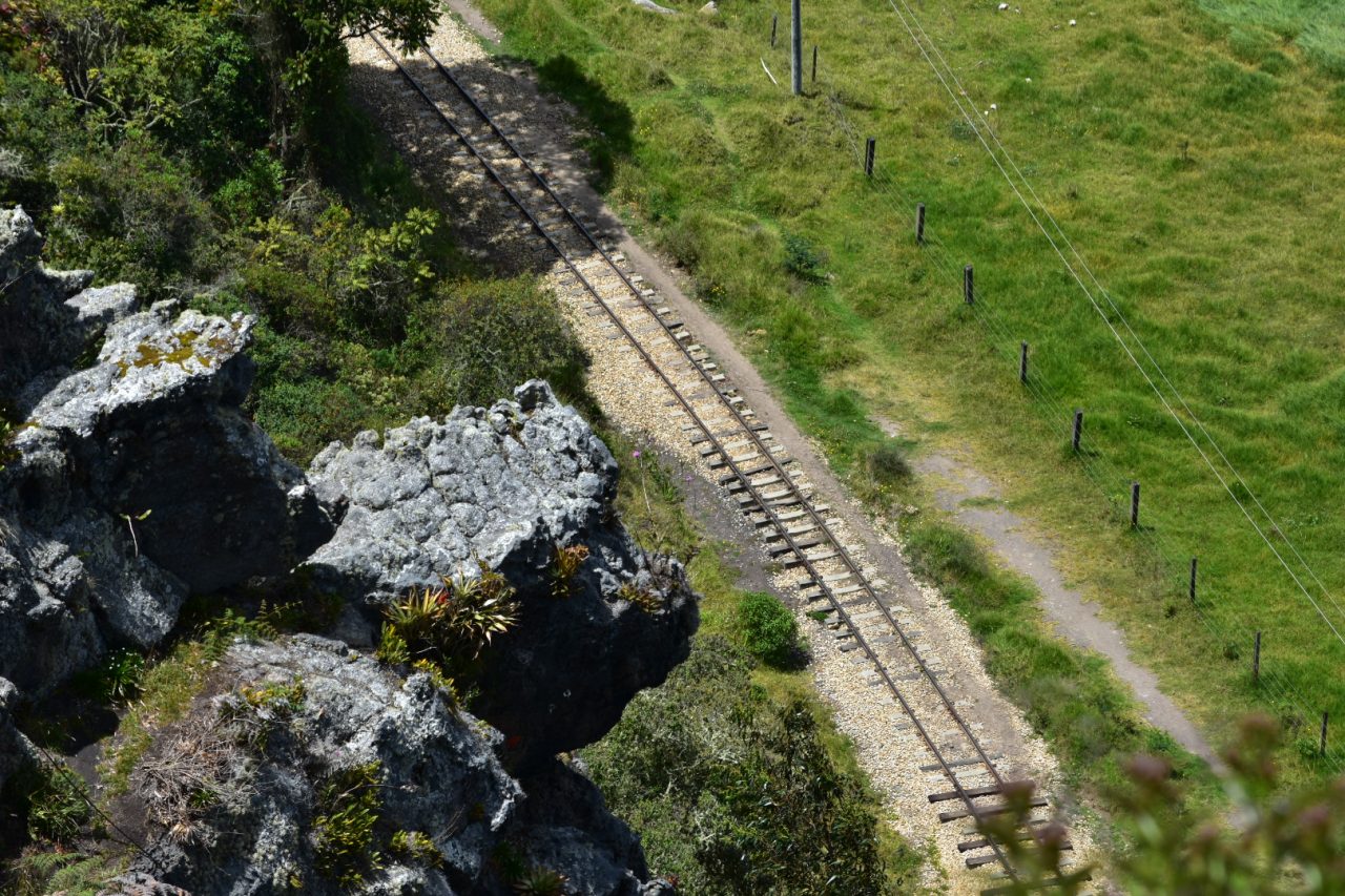
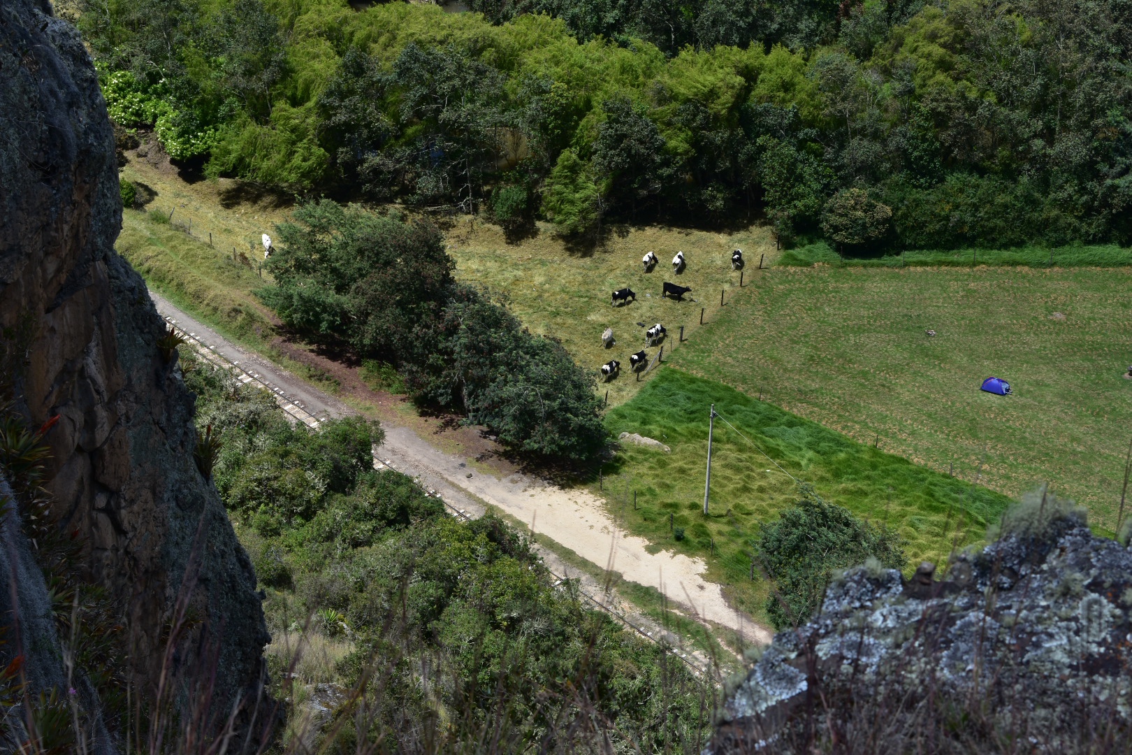
 I then got to see the train tracks from above which is something I was particularly excited about.
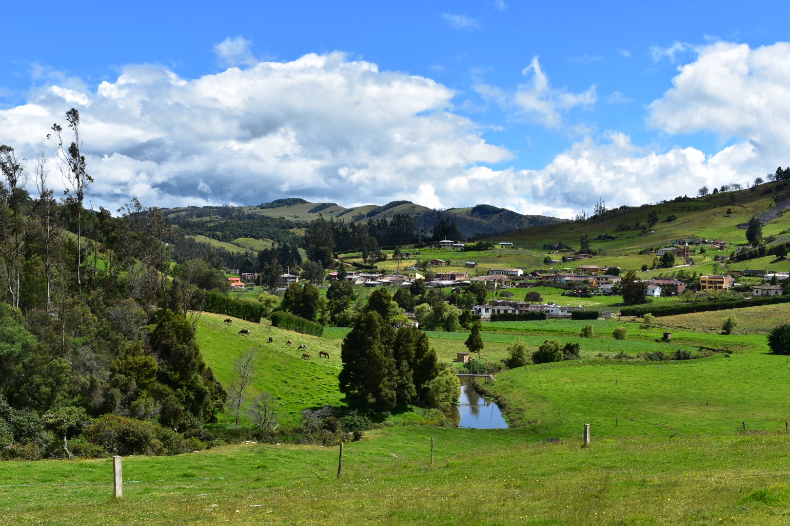
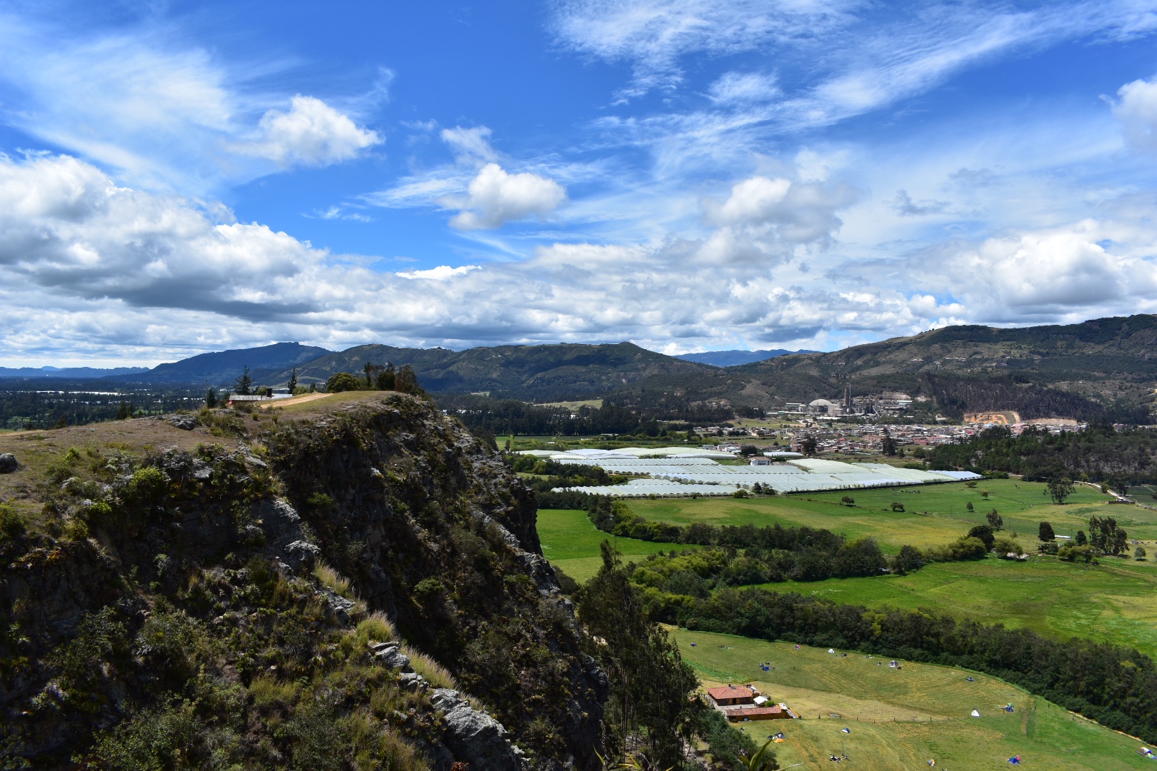
 And in the photos below you can see the town of Suesca and the camp site. The trip back is again around 5km and its not a hard route to follow. The path is often pretty wide and all you have to do is stay along the edge of the cliff.


 After a while you will start seeing properties and ar which will take other routes down to the main road, but make sure you stay to the right following the main route.

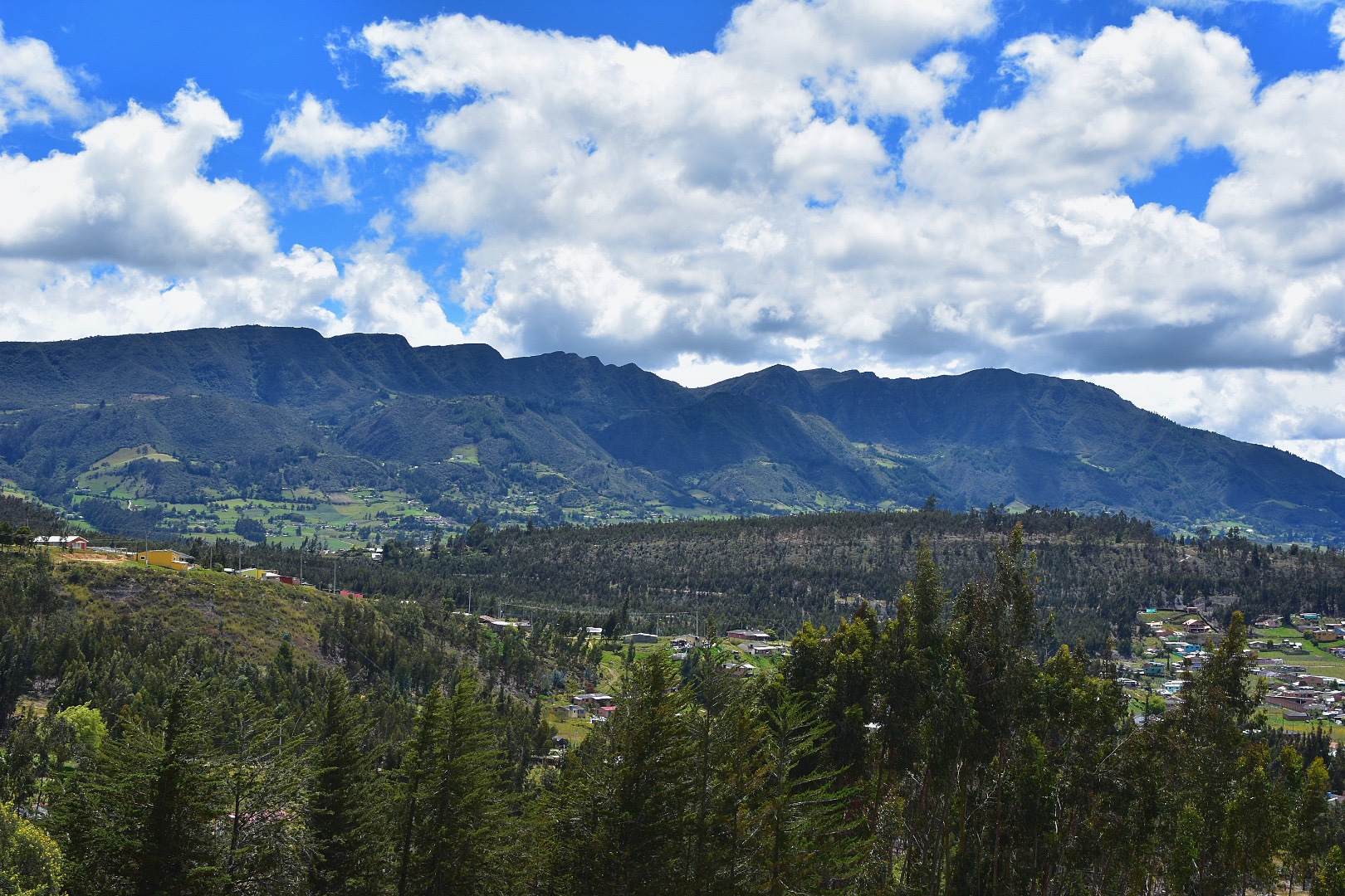
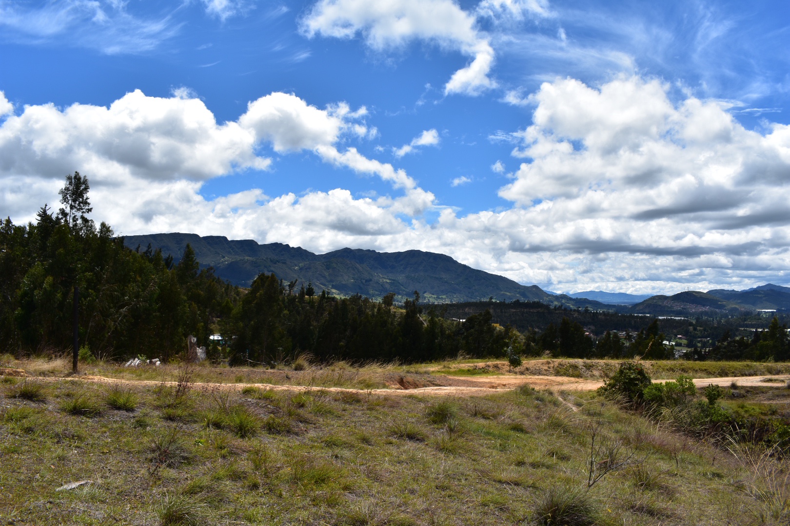
 Then I got to see some of the larger mountains surrounding the wider Bogota area.


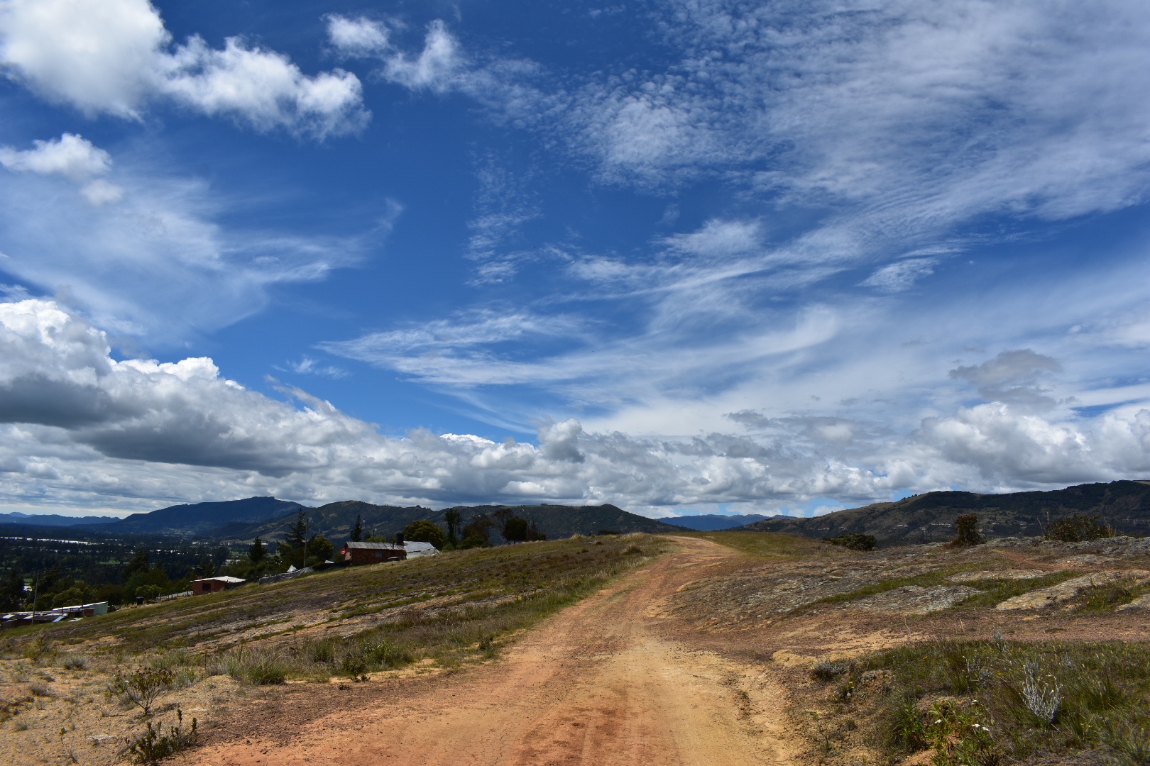
 As you can see the path above turns to rock. As I was busy taking photographs near the end of the hike I disturbed two vultures and was able to quickly switch lenses to photograph them.


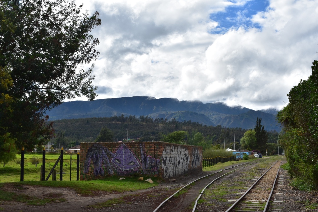
 And then it was time to head back down to the tracks where I had started. This part of the trail is pretty steep but nothing too crazy. There were a lot of local people walking towards me back to their houses. I arrived back into town around midday and decided to treat myself to a Colombiana. You can of course stop here for lunch as it is fairly touristy and there are a lot of restaurants – it all depends on how much you want to push yourself. When you are ready to head back to Bogota, cross the road and flag down a red and black bus. The return journey costs the same. I wasn’t waiting too long for a bus to arrive so they will be fairly frequent. I was back at home by around 1pm which was a record for our trips.
How to Arrive at Suesca
Its a very easy journey to Suecsa and takes around 1 hour when you are on the bus. You can either take the bus form Bogota’s main terminal or from Terminal Norte. My advice would be to go to Terminal Norte on the Transmilenio or take a taxi/Uber to the terminal. At the terminal do not go towards the main building, but instead head to the right and you will see signs for a lot of towns including Suesca listed on a sign. Follow the path around the bus park and you will see lines with one being for Suesca.
Wait here for the bus to arrive and get on. A one way ticket is $7600 and make sure you tell the driver that you want to go to Rocas de Suesca, which is outside the main town. They should drop you at the right place but look for Vamonos Pal Monte, restaurant, just before the river on the map below and that’s where you want to get off the bus. From here walk to the train line and to follow the tracks turn left, or to go up along the ridge go straight ahead. There are no entrance fees. Or otherwise just explore at your leisure. There are plenty of trains on maps.me and if you ask around in town then you will find out about all the activities that you can explore.

Equipment to take
This equipment list is aimed at those who are going to hike for a day. If you are camping or are planning on climbing then you will need to bring more equipment or hire it from one of the shops on the main street. Make sure you bring enough water and food. The route that I hiked was fairly short and I was back in a few hours. There are shops on the main road and again in any of the towns that you visit but its always best to be prepared, especially when it comes to water.
- Dry bag or packback cover (I take both)
- Cell phone
- Cell phone battery
- Charger cable
- Sunglasses
- Sun Cream
- Painkillers
- Blister plasters (better if you have a small first aid kit)
- Hand soap
- Tissues
- Water filer
- Sun hat
- Food
- Water 2 litres minimum
Clothes
It was a warm day when I hiked but this is my standard equipment which I would recommend. Remember you are on the Bogotà Savannah where it rains a lot and the weather can change quickly.
- Gortex hiking boots
- Waterproof jacket
- Waterproof trousers
- Base layer
- Jumper
- Fleece
- Down Jacket
- Hiking trousers
- Hiking underwear
- Hiking socks
If you enjoy hikes in the lush green mountains that surround Bogotà then mountains that try read my guides to Cuchilla El Tablazo, a downhill hike which starts overlooking lush green valleys from a palmero covered cliff at 3500 metres ends in a warm town at 1800 metres far below. Or head up to the rocky Farallones de Satausa where you can also go bouldering when you make your way along the ridge line.
j
amazing content!!! but just so u know, it’s bogotá, not bogotà. we actually dont have the à accent in spanish 🙂
ThirtySomethingTraveller
Thanks, will update if I ever have time!