One of the many many paths leading up into the mountains surrounding Bogotá is the Mirador Aguadora hike. This short hike is perfect for a Sunday Morning excursion and definitely one for the kids and when you reach the top you can see panoramic views of the city. Its a great little hike, especially if you have just arrived and want to get used to the altitude or if you are looking for something not to strenuous and want to avoid the crowds at Montserrat. And the best thing about the hike is that its absolutely free! Starting in Usaquen amongst the market and restaurants means you can finish off with a well deserved, beer, ice cream or pizza, whatever takes your fancy. For those looking for a slightly longer hike then this one is easily combined with the Camino del Indio, which follows straight on when you reach the top.
There are many stunning hikes up to the Cerros surrounding Bogota which start in the city itself. Read my post about the 4 different hikes that form part of Quebrada la Vija, including one that takes you up to the closest Palmero direct from Chapinero Or escape the city on a sunny afternoon and take the short walk up to Guadalupe.

Information
- Our Experience
- How to Hike to Mirador Aguadora
- How to combine with the Camino del Indio hike
- Equipment to take

Our Experience
This was our third attempt at the hike as on the two previous times we had been unlucky as the path was closed for maintenance. However that is a good thing as it shows that the path is well maintained. Angela and I went for the final attempt on a Sunday and you need to go early as the last admittance to the path is from 6am – 12pm everyday. We also decided to take Lorenzo along, who is five, but he misses out on most of our treks as he is still to young but seems to be a fan of the mountains. He had a great time and the path is perfectly safe for children. Towards the top it gets pretty steep but he was perfectly find holding my hand at this point.
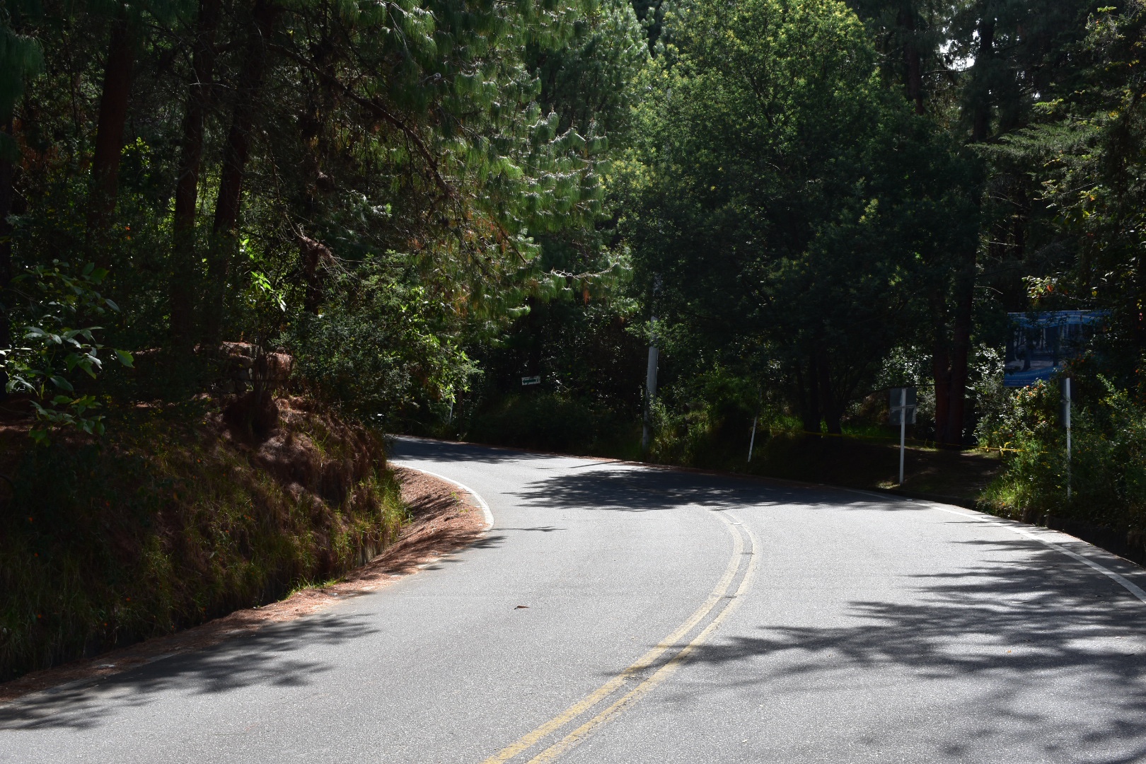
Typically with a lot of places in Bogota the train head is actually on private land, a members club called Aguadora, which means you have to pass through security in order to get there, and you can see the gates below.

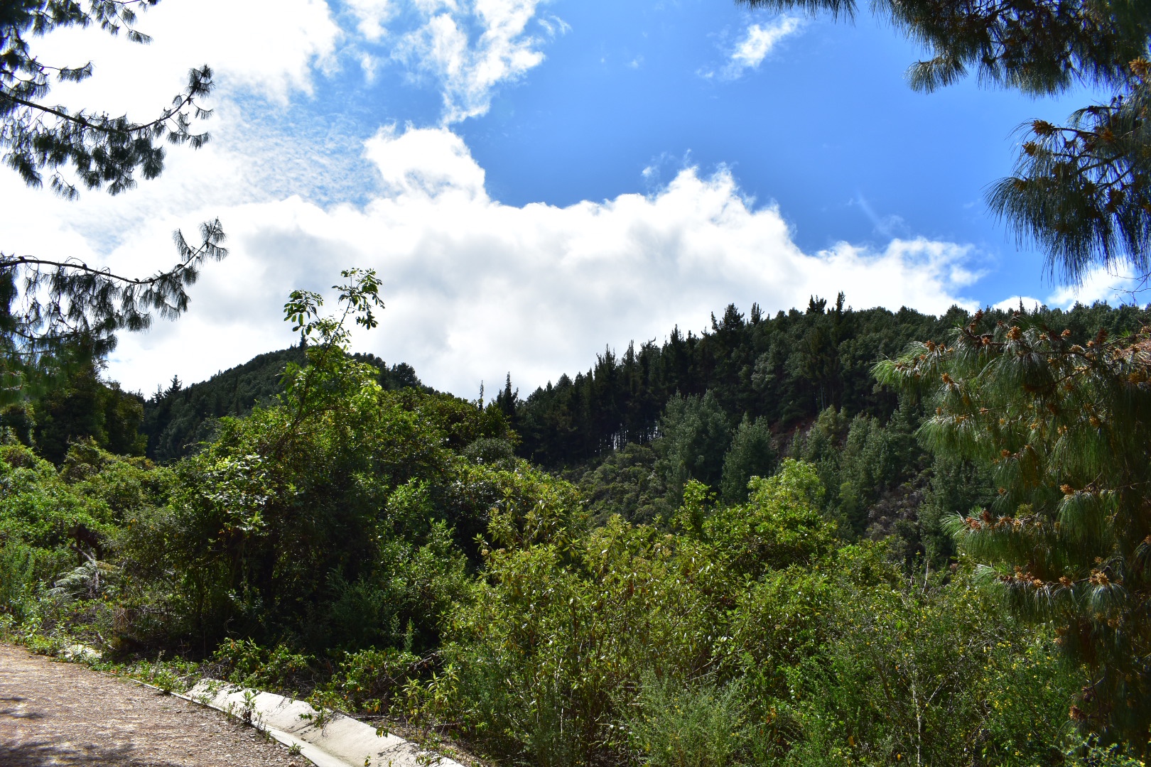
The first part of the hike is along the road to the club but you soon leave the city behind and are surrounded by the tranquile lush forest.


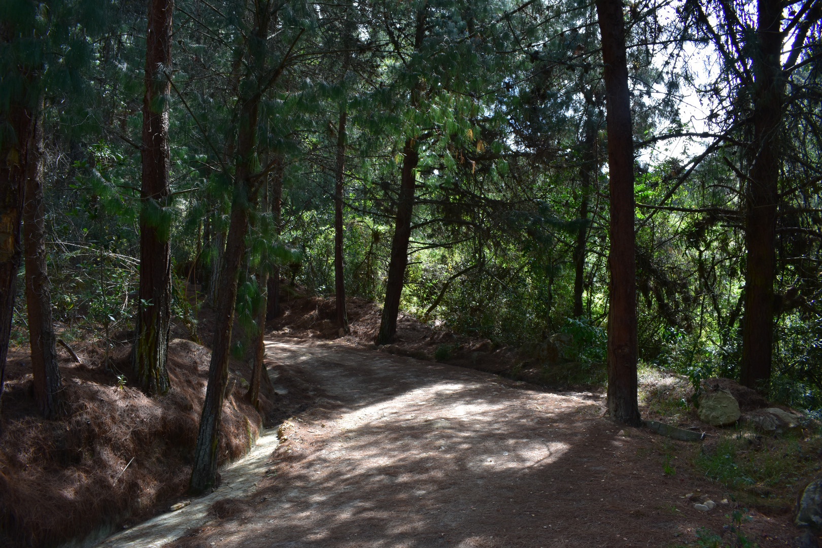
After a few bends the road bares off to the right and the trail starts. The first part is a dirt track where you will also find a lot of cyclists. We started later in the day as Lorenzo has a football lesson first thing and there were a lot of people coming back down.
I was complaining that all the people were ruining my photos but Angela suggested I should include them in some shots to show that other people used the trail. So here is a guy bravely cycling up the path.


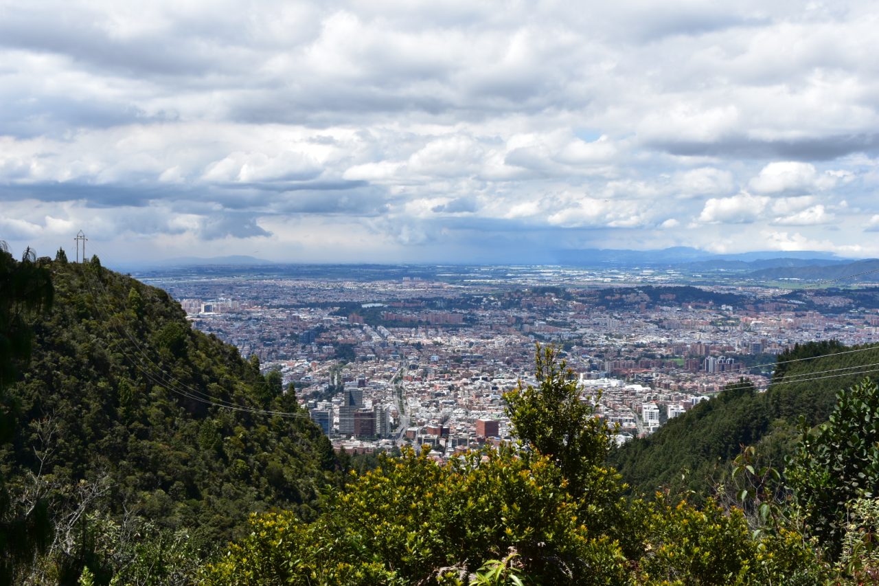
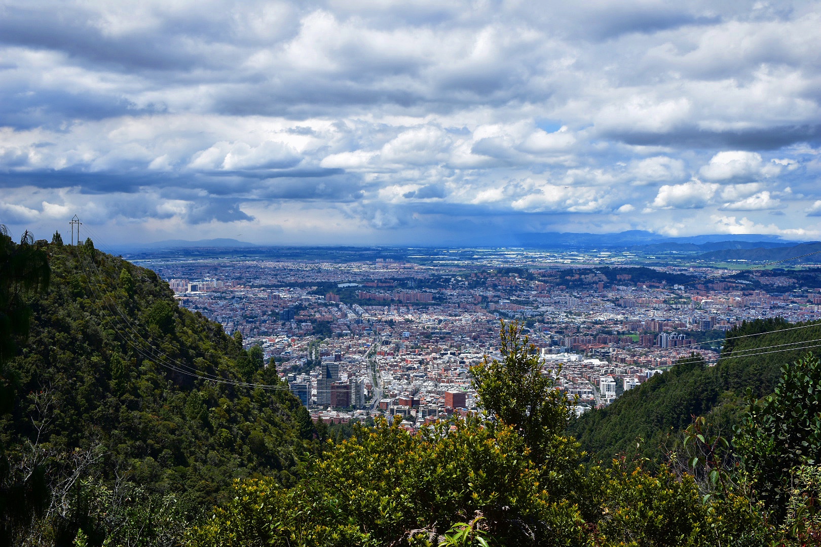
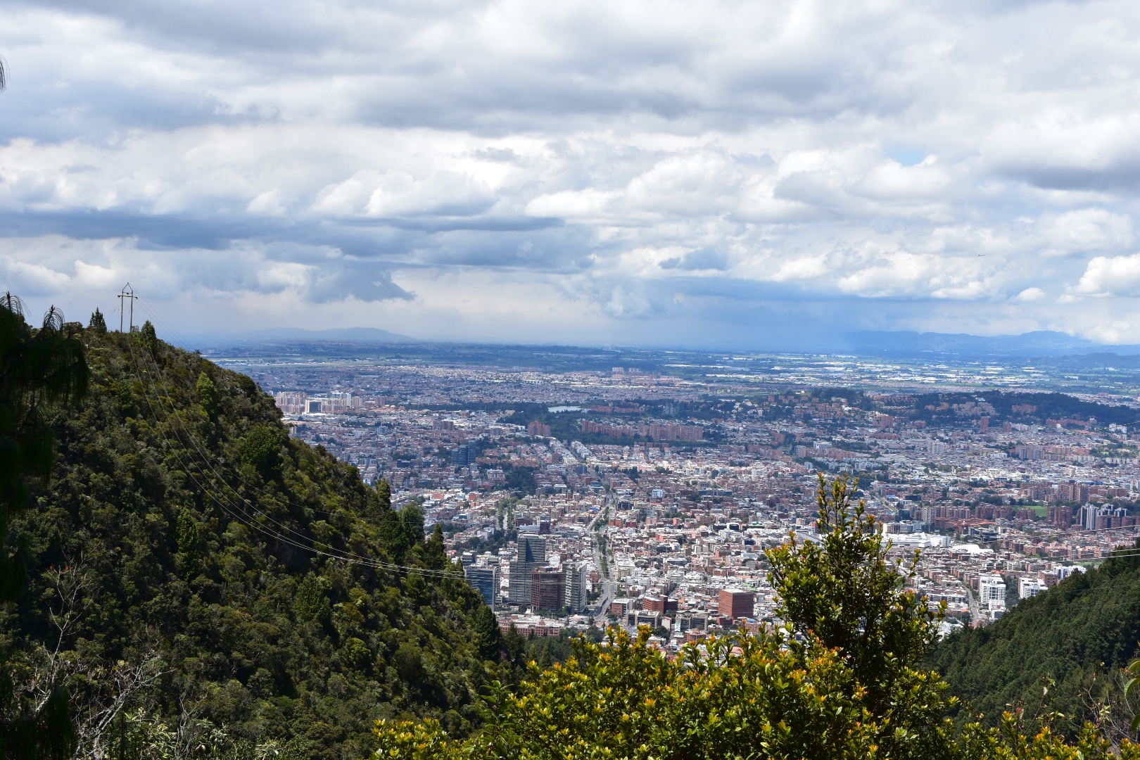
The path winds its way through the trees steadily going uphill and soon comes out into the open and you can see the mountains surrounding you and the city far below. I climbed up a bank to get a better view before we continued onwards and upwards.

Around halfway to the top there is a small water processing plant and this is where the road ends and the cyclists have to complete their journeys. Those on foot can cross the bridge and continue up the train and from this point onwards it becomes progressively steeper.


There are a lot of benches along the way so do take advantage of them if you need a break. There is no point becoming tired but I’d recommend having lunch with a view, if you brought food, and waiting until the very top.


It took us around 90 minutes to reach the top, and that was with a very energetic 5 year old. We did stop to take a log of photos and to rest so if you allow 2 hours it should be more than enough to reach the Mirador. Here there are some benches where you can sit down to enjoy the view.


We decided to turn right and walk a little further stopping in the clearing which has a view of Embalse de San Rafael and had lunch.


When you reach the ridge you can continue the hike by taking a left or right. If you go right then you will soon see the clearing as we did and then the path heads up to the top of the next mountain. Lots of people were hiking up and down this path, which follows the pipes, and if you look at Maps.me you will see the route continues and then there is a further route back down to Usaquen.
Despite being keen to climb up we felt it was a little dangerous for Lorenzo as it is steep and also we didn’t want to use up all his energy before the end of the hike. Instead we took a few photos of the surrounding area, headed back to the Mirador and headed left as I wanted to explore where the path went.


Going left from the Mirador takes you to a quite road and the entrance to some exclusive apartments. Straight across is another access road that takes you down and we walked a little way to get the views of the lake. If you wanted to go all the way down you need you turn left and follow the paths on Maps.me, although I’ve not tested these and the paths on the map are not always accessible, but it does show a route. Do let me know if you try this, I would if I had more time.


The whole area is beautiful and it makes a nice short hike close to the city which is great, even if you don’t climb to the very top. And there are a lot of routes to take once you get up here for the more adventurous. Just keep checking on Maps.me.
How to Hike to Mirador Aguadora
The entrance to the hike is via the access road to the Club La Aguadora, on Calle 119. First head to the Plaza de Usaquen and then take calle 119, the north size of the plaza (look for Mister Ribs) and turn right. After one block cross the road and from here just go straight until you reach the security gate. This is where the trail begins.
If you are taking a bus you want to reach Avenida Carrera 7 and calle 119. There are many busses that pass this part of town. If you are not sure then Moveit has all the Bogota bus routs as does Google Maps.
Once you start the hike it can take around 90 minutes to 2 hours to reach the top and a similar time to come back down depending on how fast you walk. There is no charge an the cost of travel is as little as $2400 for a Transmileno ticket.

How to combine with the Camino del Indio hike
Its possible to combine this hike with Camino del Indio and I would actually really recommend as when you reach the top of the ridge you are already at the Camino del Indio. Its a further 12km to La Calera, all downhill and will take you another 2.5 hours form this point giving you beautiful panoramic views of the lake, but trust me the hard-work is already done. .
When you reach the mirador at the top, rest for as long as you wish and then turn left, this will take you down to the road. From here take a left and you will be at the Camino del Indio trail that leads into the forest, which has the fence on the right. From here just walk all the way to La Calera.
Equipment to take
There is no food or water available once you leave Usaquen, but in all fairness Aguadora in itself is a couple of hours walk. Most people on the hike were wearing normal sports clothes and trainers but as I have the equipment and like to be prepared this is what I would always bring. Do take water as a minimum precaution.
- Gortex hiking boots
- Waterproof jacket
- Waterproof trousers
- Dry bag or backpack cover (I take both)
- Cell phone
- Cell phone battery
- Charger cable
- Sunglasses
- Sun Cream
- Painkillers
- Blister plasters (better if you have a small first aid kit)
- Hand soap
- Tissues
- Water filer
- Sun hat
- Food – you can never have too much and you will need it on this hike so pack appropriately.
- Water 1 litre minimum
Clothes
The hike is not high altitude and I found we brought too many layers getting warm quickly. Having said that is can always get cold in the eastern hills so its best to come prepared.
- Base layer
- Fleece
- Hiking trousers
- Hiking underwear
- Hiking socks
There are many stunning hikes up to the Cerros surrounding Bogota which start in the city itself. Read my post about the 4 different hikes that form part of Quebrada la Vija, including one that takes you up to the closest Palmero direct from Chapinero Or escape the city on a sunny afternoon and take the short walk up to Guadalupe.

Lauren Hobbs
Hi! Your article is very helpful! Is there parking available for the mirador aguadora trail head? Thank you!
david_lortal
Glad you found it helpful. There is parking in Usaquen. I’ve always taken public transport.