
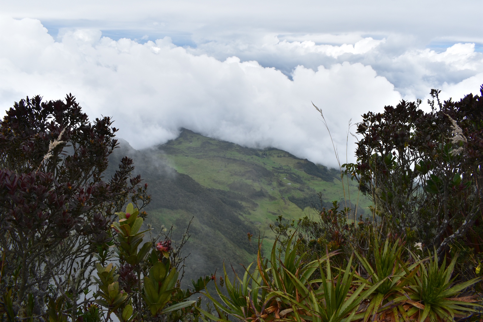
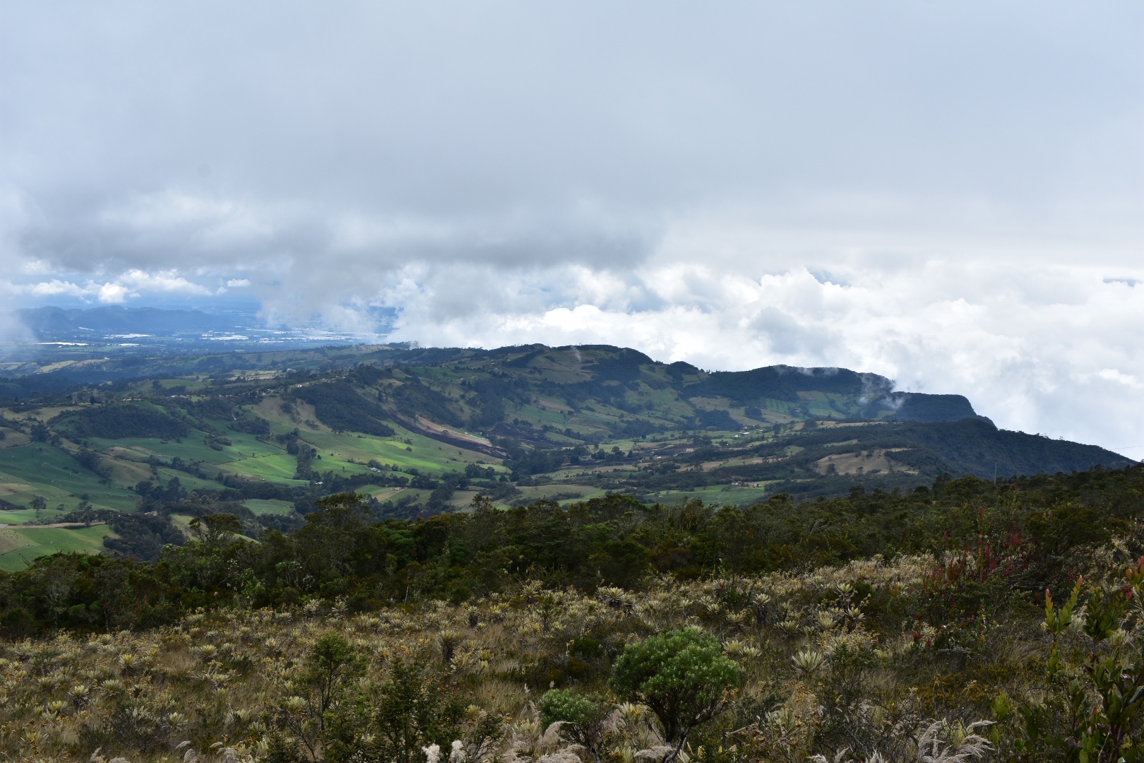
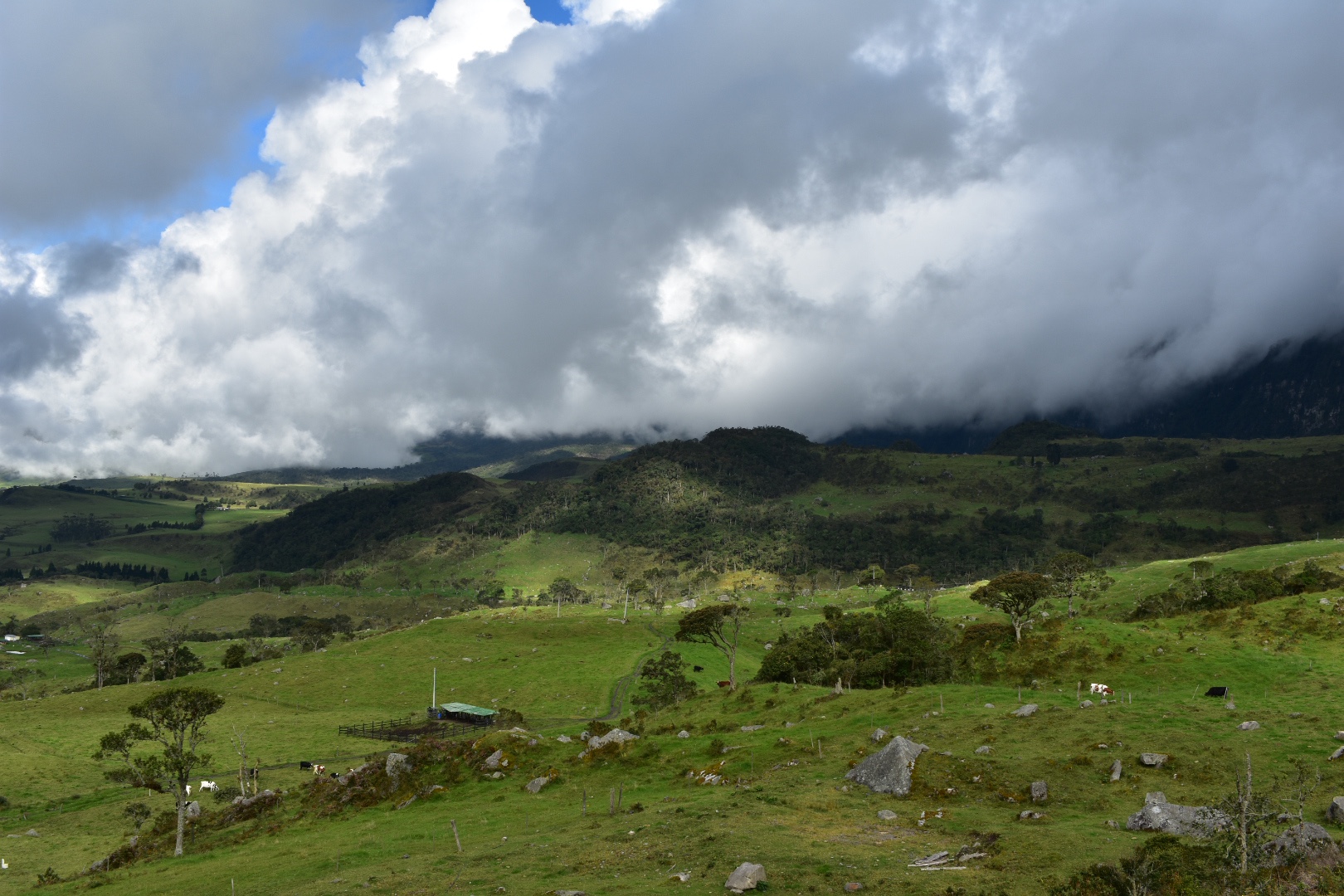
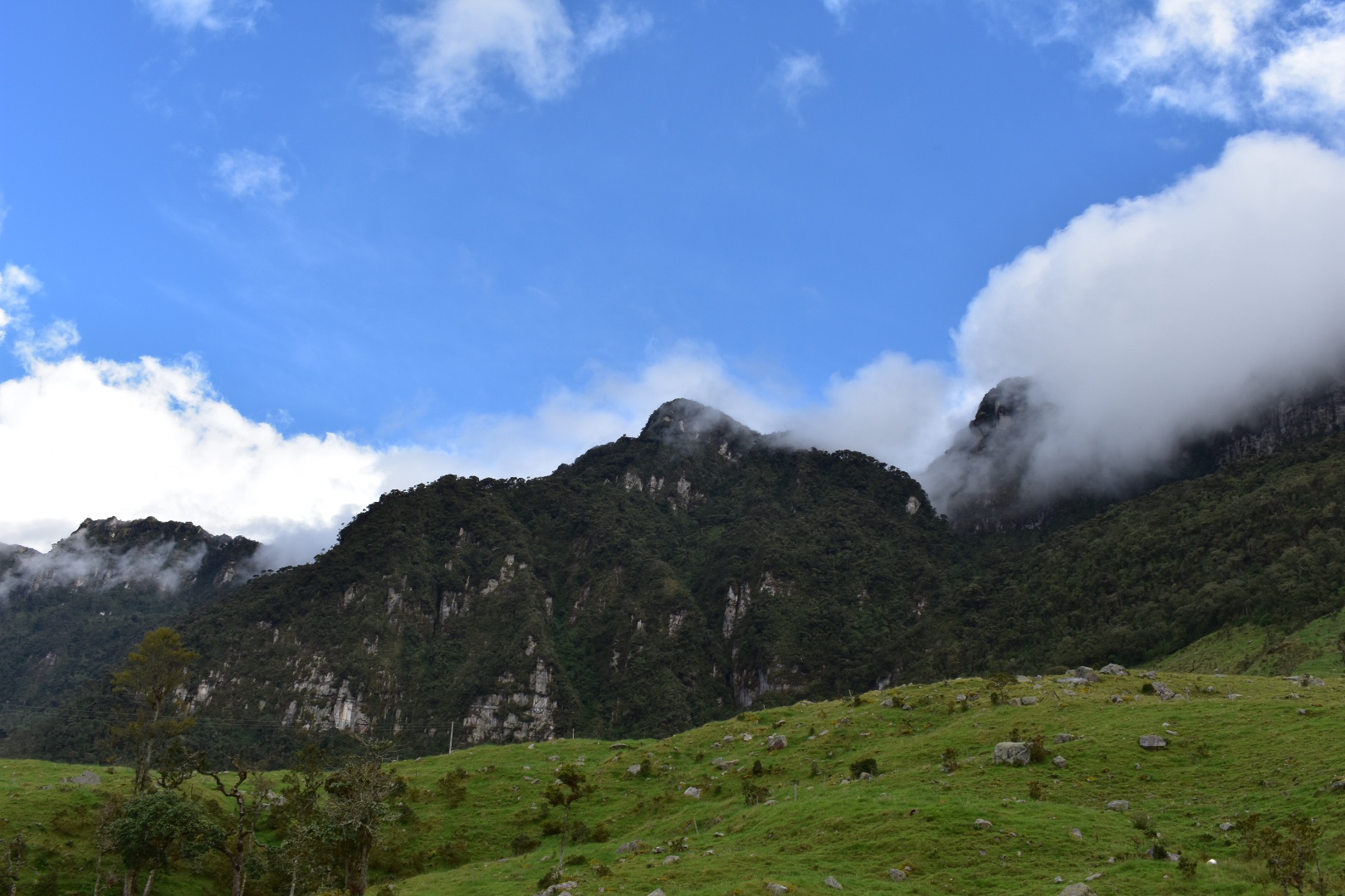
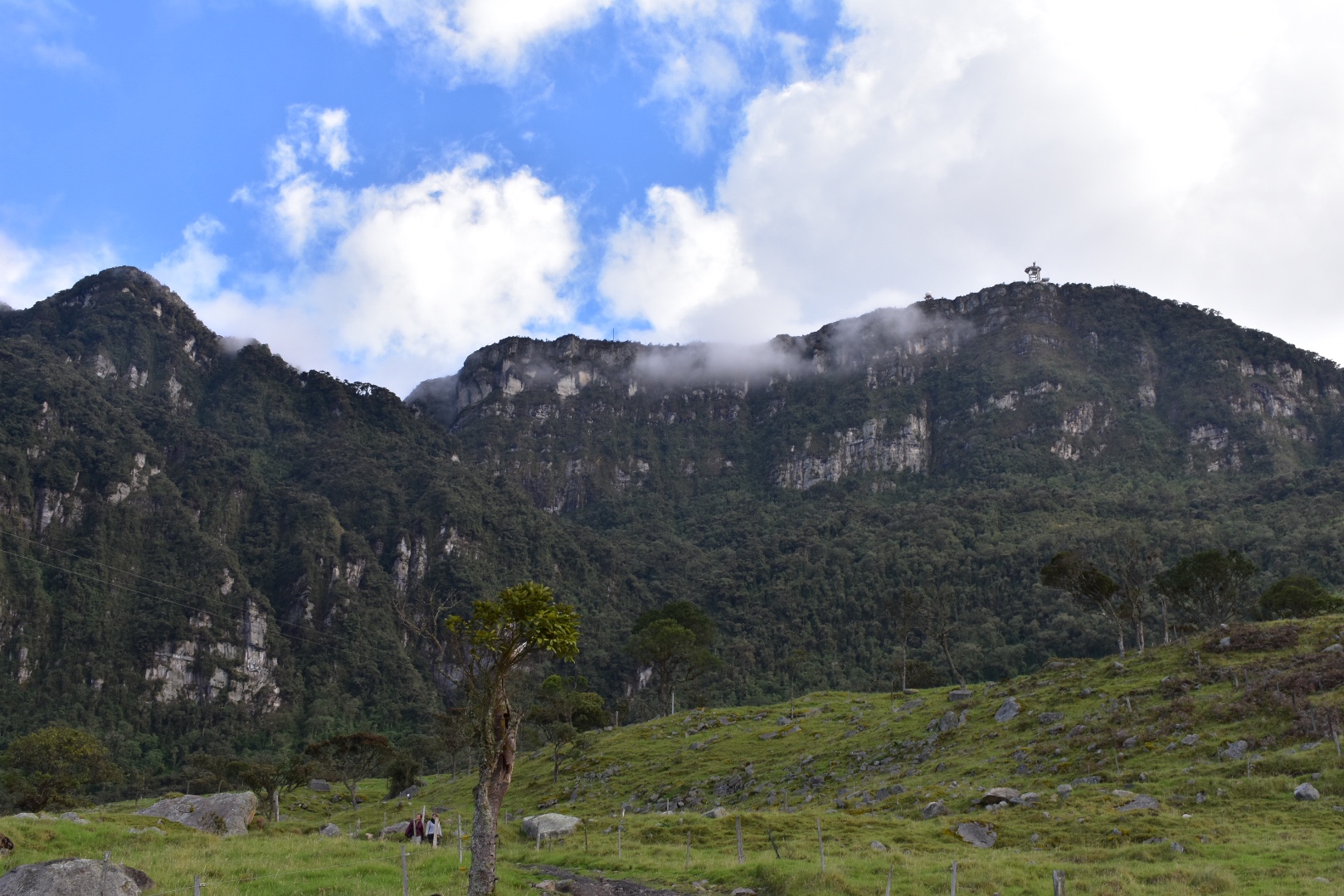
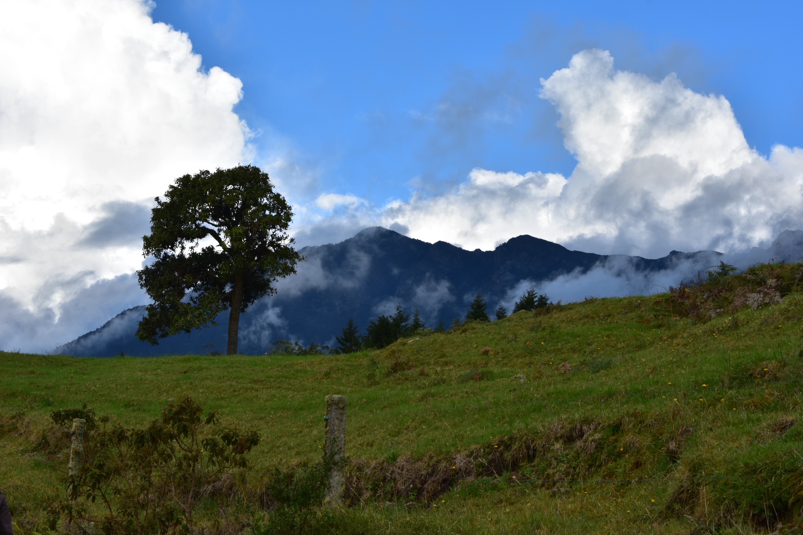
Cuchilla El Tabazo is considered the jewel in the crown of the Western Bogotà Savannah. Rising to 3500 metres high it serves as a natural wall the height of the cliff stops the clouds from the warmer climates in the regions below surrounding the palmero and forest in fog. This creates a mysterious landscape that is completly unique to this region. The wind currents that the birds use to glide reveal the beautiful landscape for miles and miles. From here you can hike down to Supatá, a small town set at 1800 metres where the temperature is tropical and you can wash back a beer before taking the bus back to Bogotà. Descending 1700 meters over the course of 14km, you will see the vegetation change feel the temperature rising. This hike is a truly one off experience where you can walk down from the dense cloud forests into the local dairy farms situated in the picturesque lush green valleys far below.
If you enjoy this hike and are looking to explore others then check out Parque Natural Chicaque set in a beautiful cloud forest and surrounded in mist. Or you can visit Parque Ecológico Matarredonda, a stunning palmro right on Bogotà’s doorstep.
Information
Our Experience
We had been toying with the idea of hiking with a groups since I arrived in Colombia. Organised tours, on the whole tend to be expensive here and can be a little hard to find. We found out later that many are organised in WhatsApp groups – once you have an invite all is good but getting invited into one can be a challenge. We tended to hike solo, which is something I would always recommend, but sometimes its not possible and sometimes its good to be sociable and spend time with other people. Angela somehow managed to get us invited to a group and their next hike was to Chichilla El Tablazo costing $5000 each for the guide plus transport.
This hike wasn’t on my list and is relatively unknown, at least on Google, but when I found out it involved hiking from a ridge of 3500 metres down to 1800 metres over a distance of 14km. I really like hikes with dramatic changes in altitude as you pass through so many different landscapes. We had also done our fair share of uphill hikes –Mirador Aguadora, Farallones de Sutatausa and Cerro Quininí to name a few – and I wanted to try something different.
It turned out that the group was largely a group of friends who go hiking regularly and the guide organises the trips for fun. Which is nice as he could easily charge $80,000 or more per person just for the hike. If you are interested contact Felipe (Spanish only) on +57 311 882 6358 and he can add you to the group.
Angela had instructions to turn up at Portal de la 80, so named because it is located on calle 80 on the western edge of Bogotá, for 7am, but we were told that we had until 7:30am to arrive. Being British I was there at 7am taking an Uber direct to the station. When we arrived we approached a couple of groups and Felipe was currently nowhere to be found. So we waited around tentatively until another woman approached us also looking for Felipe, I guess our clothes gave us away, and together we saw a slowly expanding group of people where at least some of them looked ready to hike. As stressed at 7:30 am we headed for the bus, at which point the group had grown pretty larger – I counted 23 plus two small dogs.
The first destination was Subachoque ($5400). Take the bus from the calle 80 outside the terminal – you will see the busses stop and the ticket collects will get out to get you on. Somehow we were all able to fit on board and most managed to grab seats but a few in the group were left to stand. It took us just over an hour to arrive at the town and we were told we had 30 minutes to grab some breakfast.
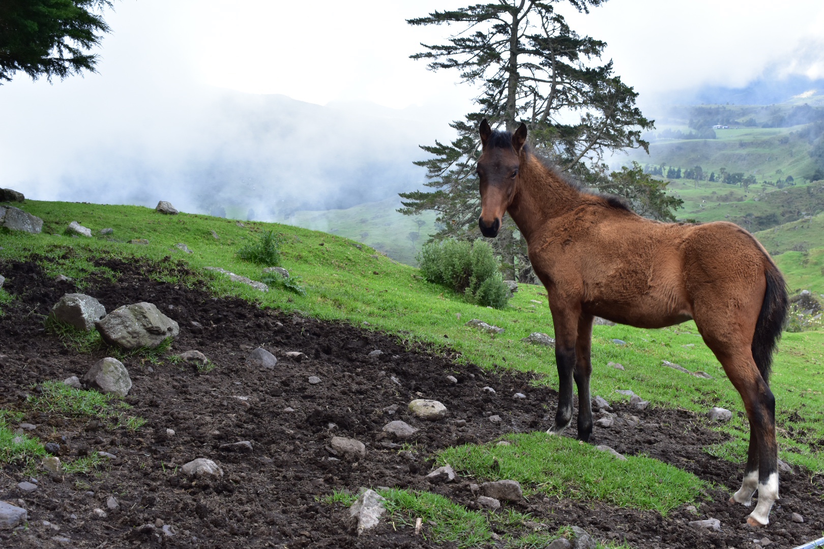
There were a lot of cyclists on this route and I think this town is one place they stop to eat food and take a break. There are several food places around the main plaza serving up Colombian breakfasts, so if you haven’t brought any food this is likely to be the last place you will be able to get something (on our hike there were people selling snacks form the back of their car up on the mountain but this is not guaranteed). We always bring lunch and breakfast, just in case, and normally eat more on the road.
After our 30 minutes were up we headed to the main church, Iglisia de Subchoque, on the north-eastern side of the plaza and then headed up Via El Plantano to the top of the cliffs. There is a bus stop marked around the corner on maps.me but the bus doesn’t seem to pass that stop. If in doubt ask the locals and you want to look for the bus which says Laguna de Arce – I didn’t actually get a chance to see the sign on the front but that is the last stop. Its due to leave at around 9am and there seems to be a regular service.
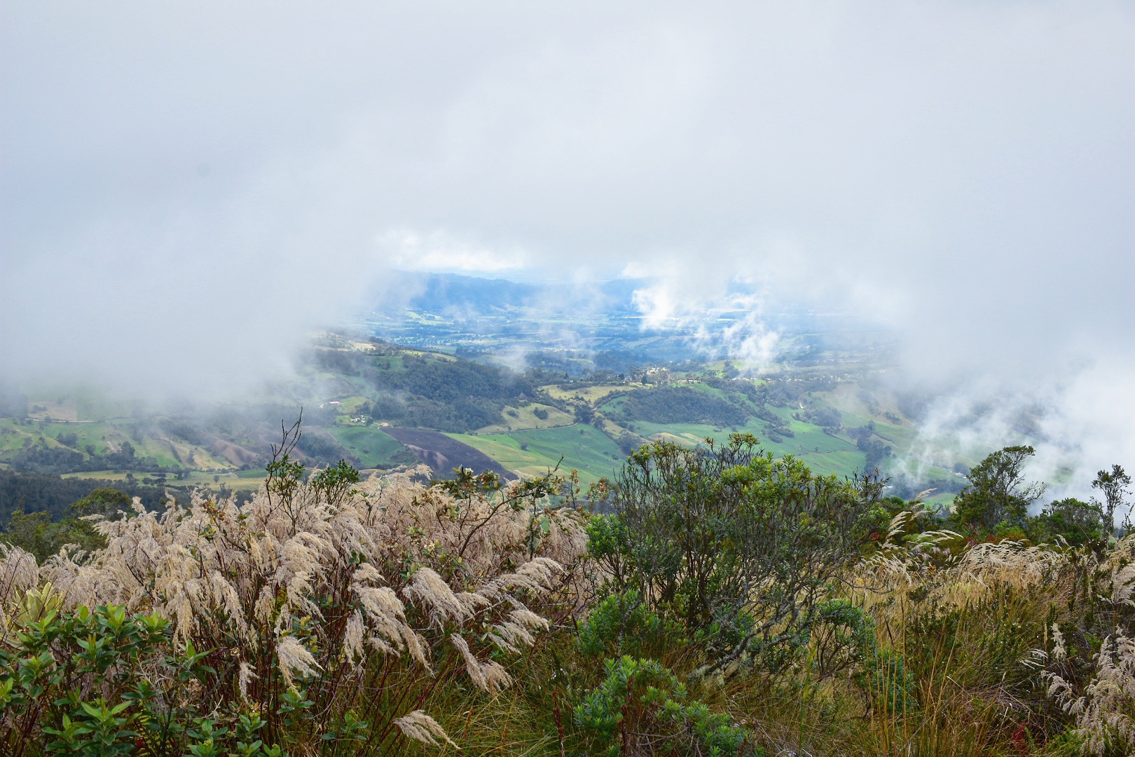
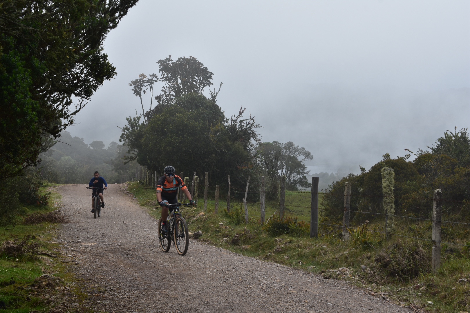
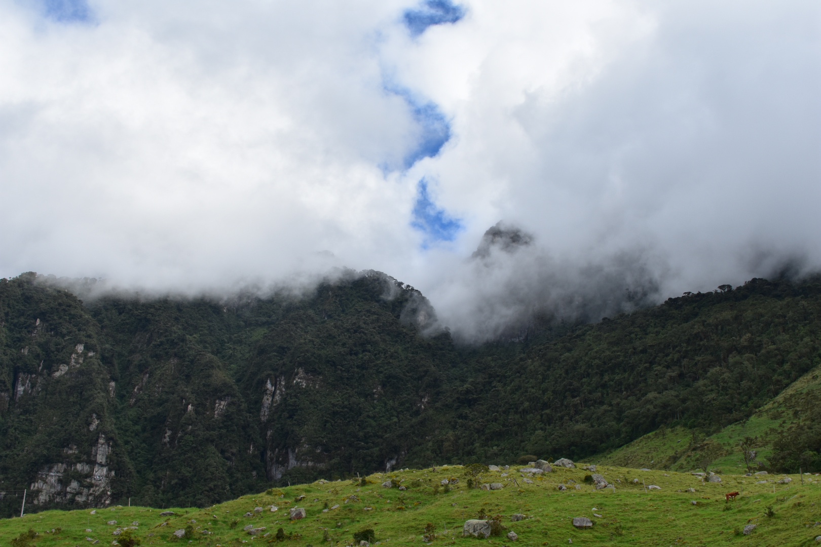
From the drop-off by the laguna it was a 2km walk to the top. Make sure you walk on the right of the road as there are cyclists coming down the gravel road really fast. One person in our group nearly managed to come close to causing an accident but luckily the rider had good breaks and reactions. The hike started off easy but the altitude did kick in pretty quickly. Angela started to feel a little sick and said I looked pale. There was no blue sky in sight and we were at times walking amongst the clouds. I knew I was definitely back hiking with Angela and she had brought the clouds with her that day.

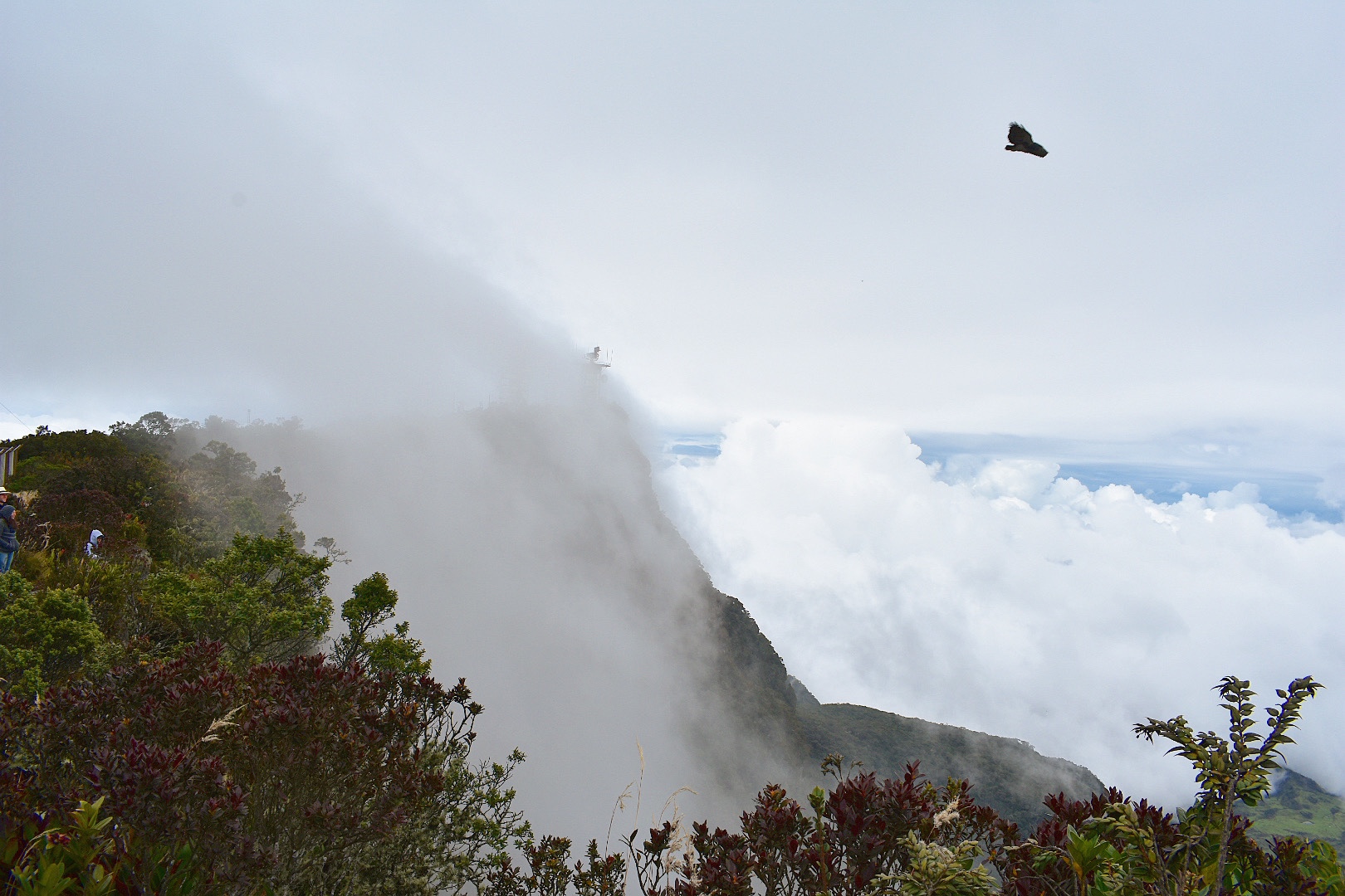
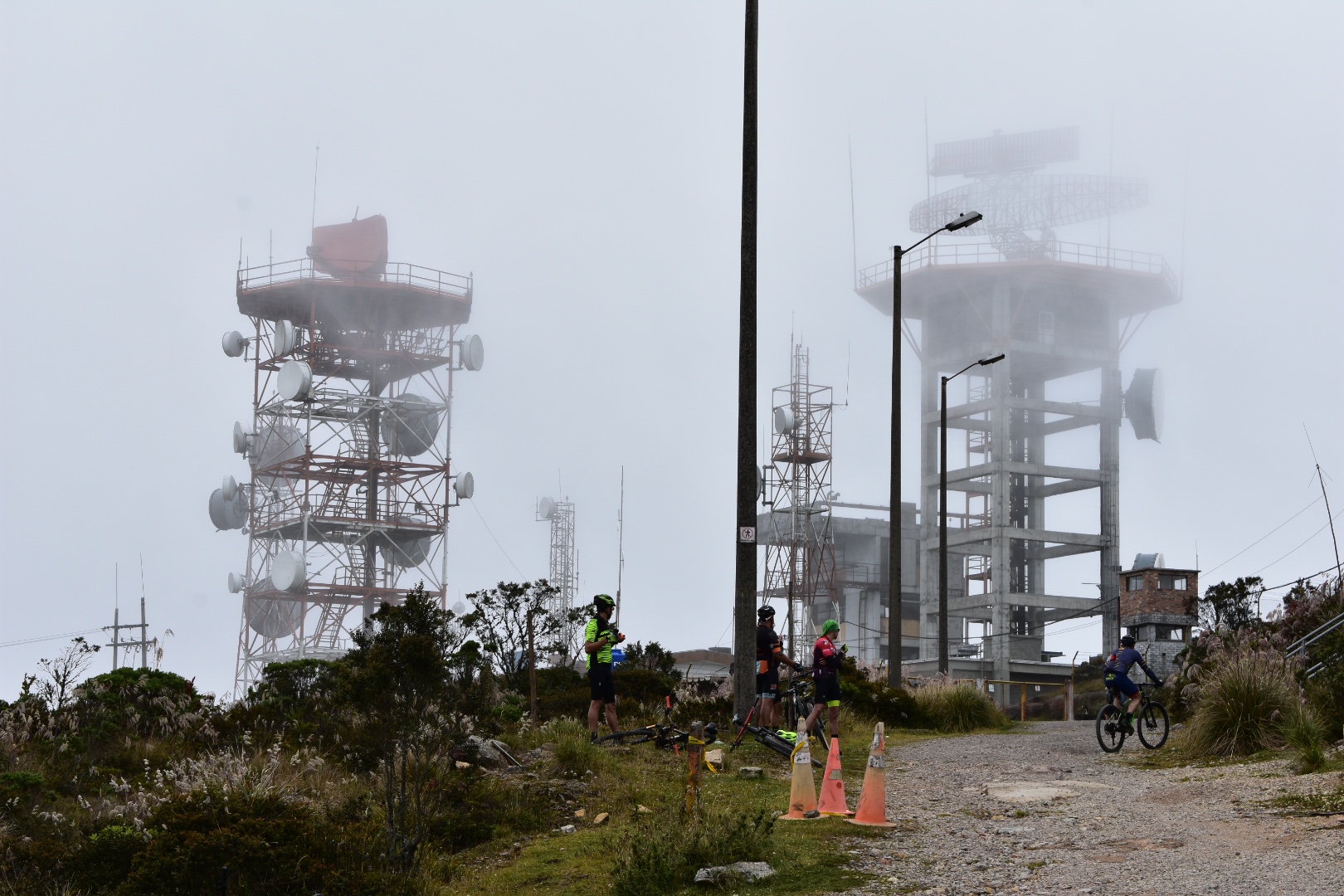
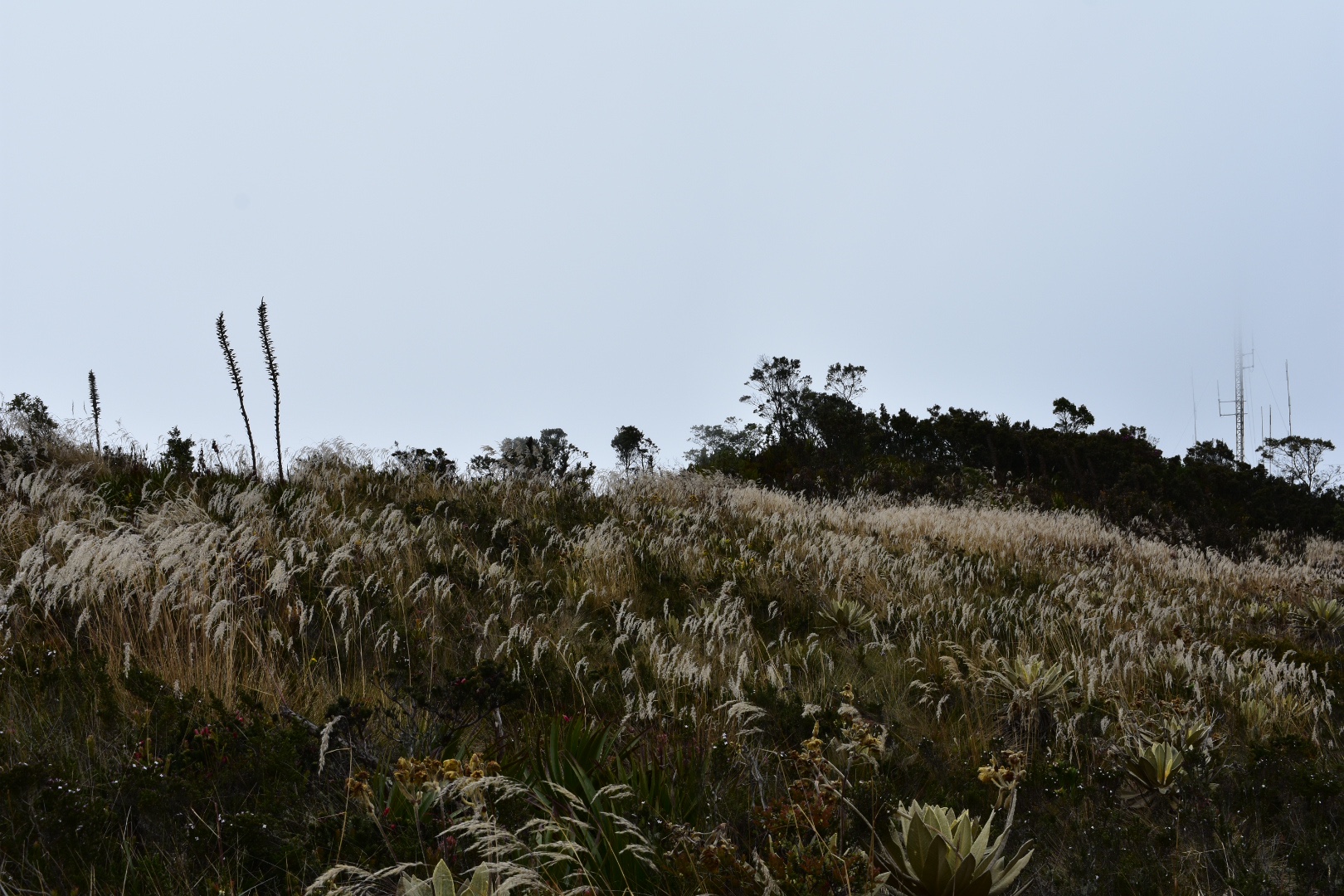
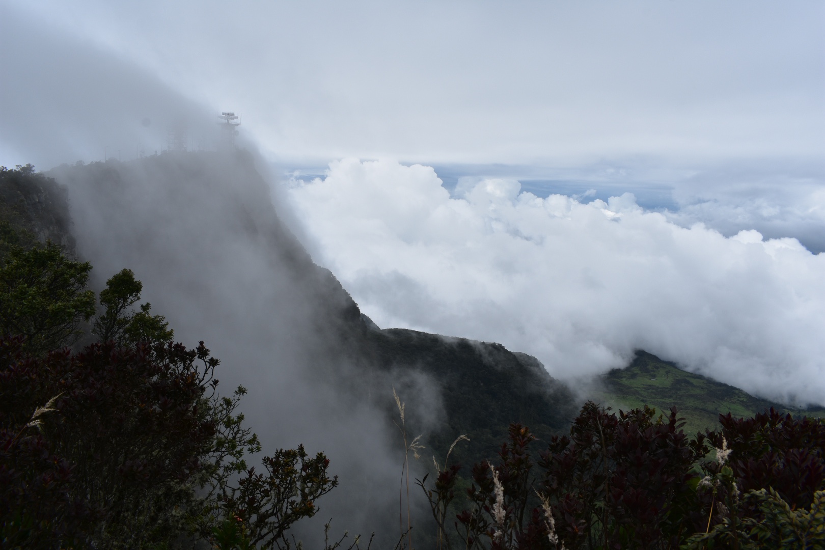
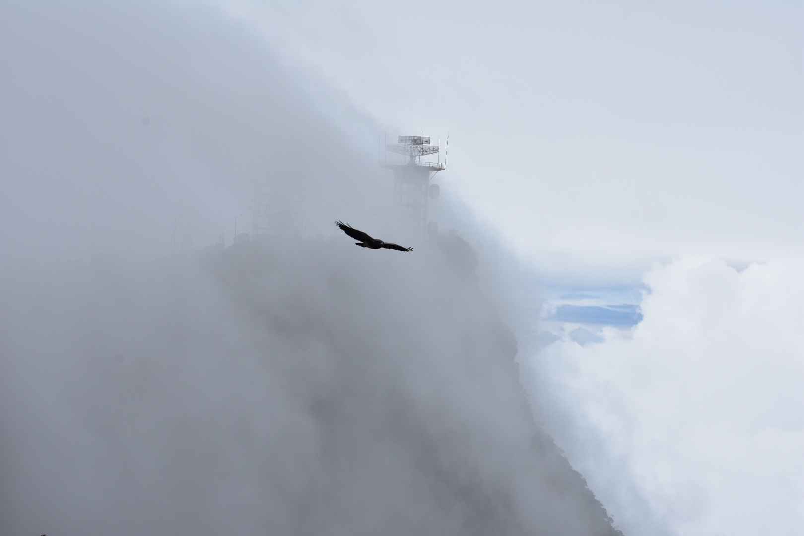
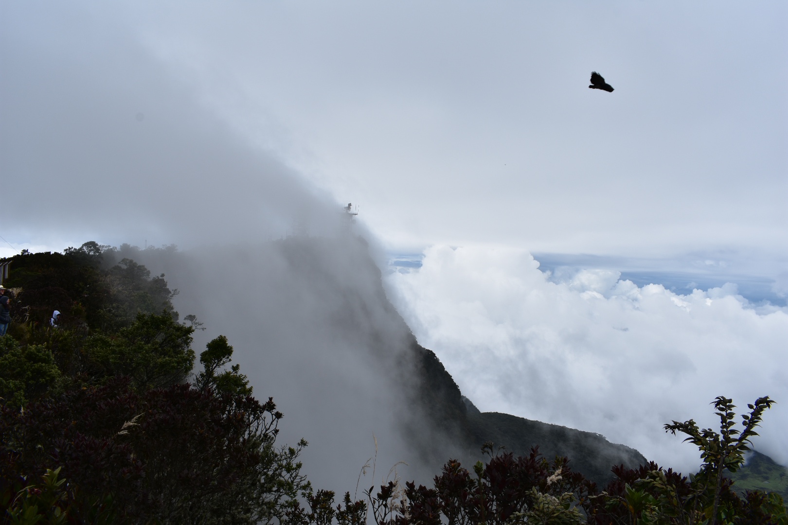
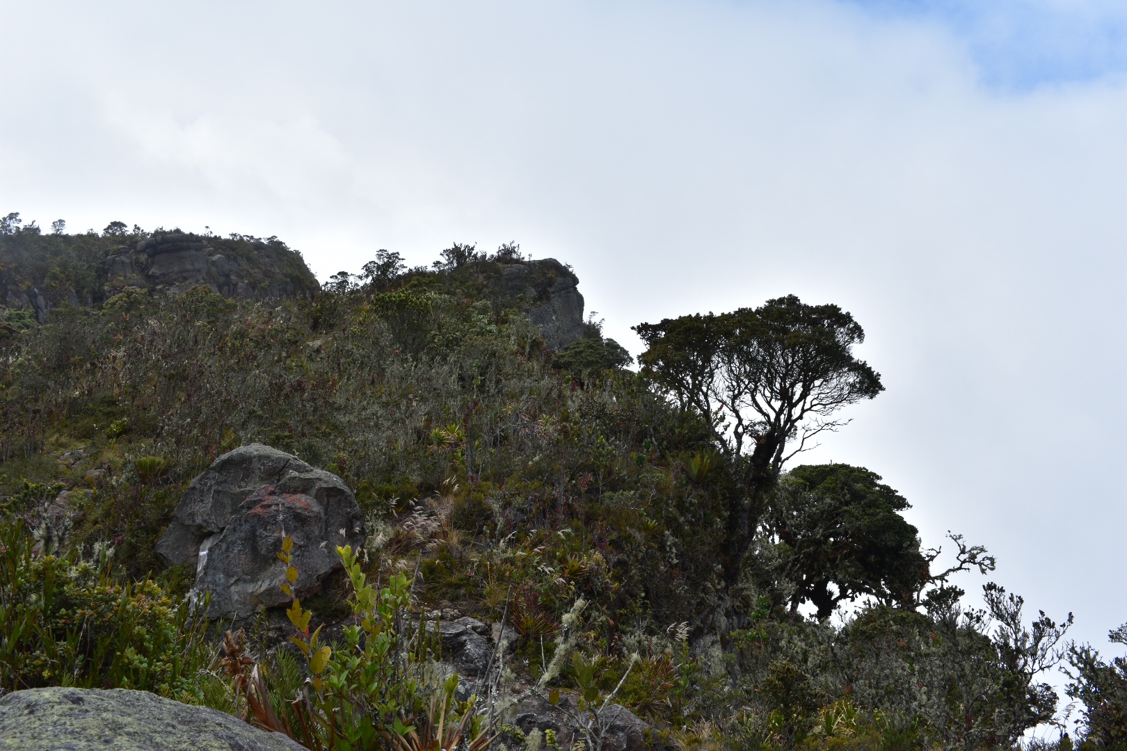
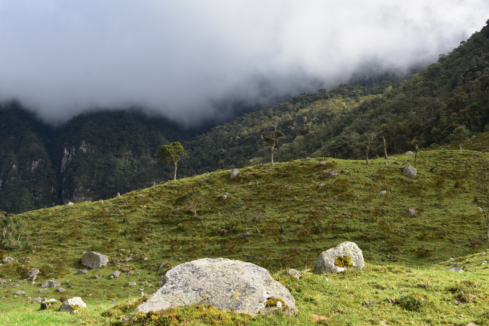
After around 40 minutes you will see the radar towers. They were covered in clouds when we arrived but Felipe had told us that last time he was here the sky had been clear. I can only imagine the full view which I could glimpse through the clouds. The reason the towers are here is due to several planes that have crashed into the mountains. On clear days you can spot some of the wreckage but there was nothing to see today.
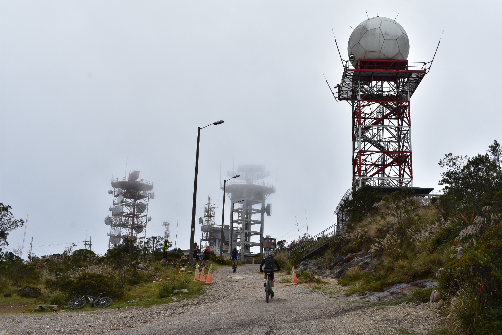
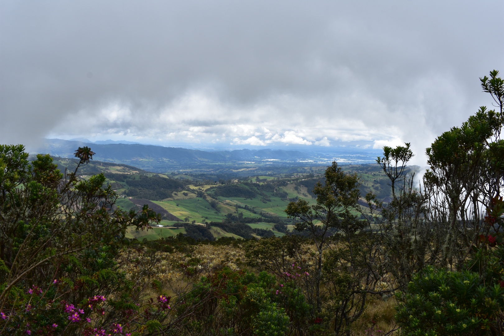
Just ahead of the towers take a right and walk along the top of the cliff edge. Here the you can get spectacular views over the edge of the cliff. Just don’t stroll to close unless you want to join the planes.
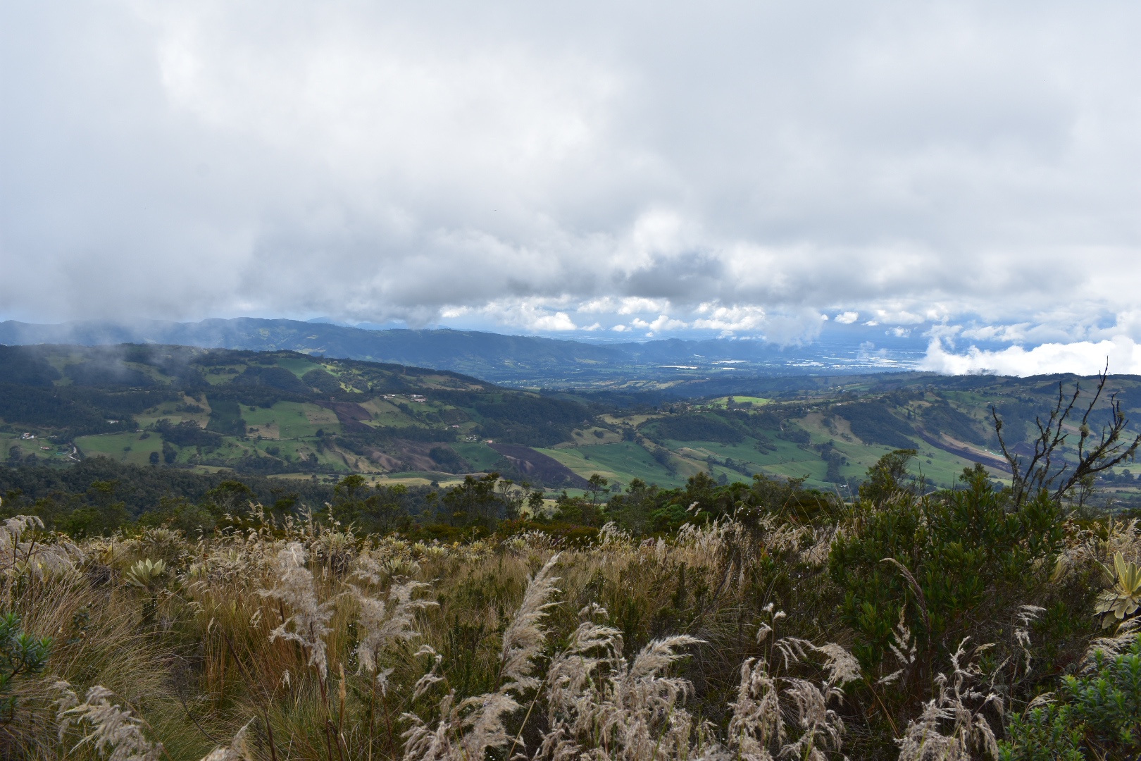
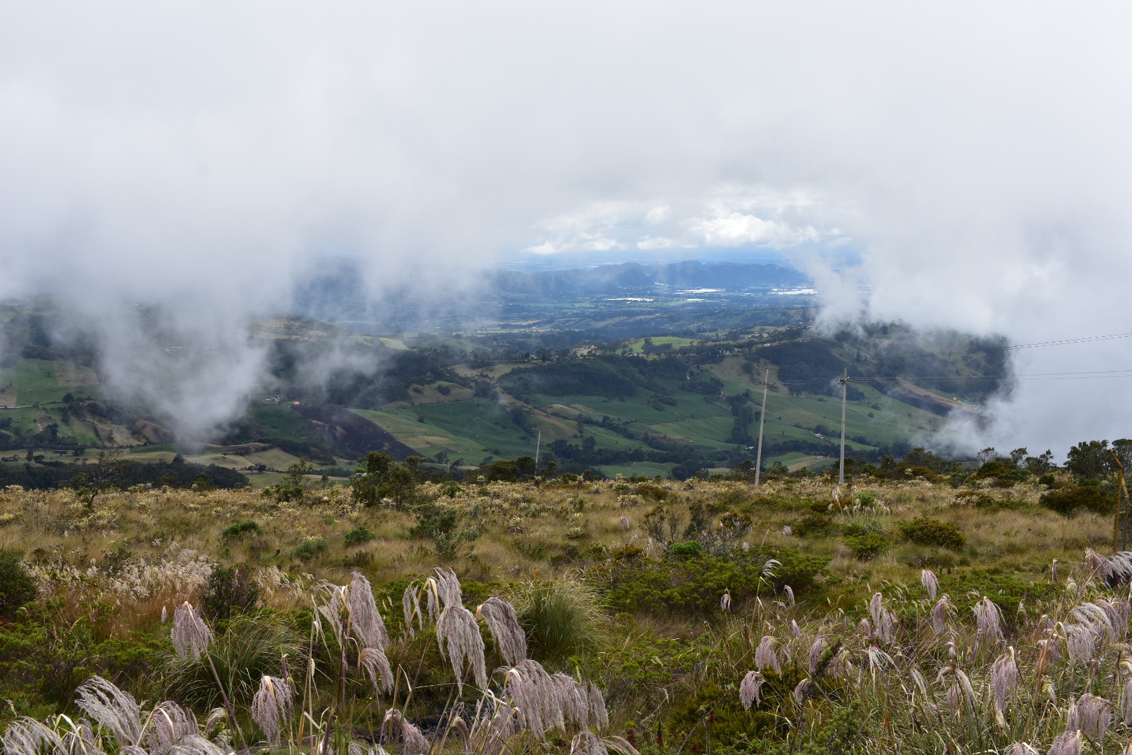
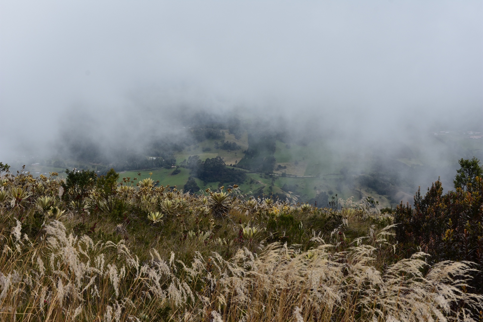
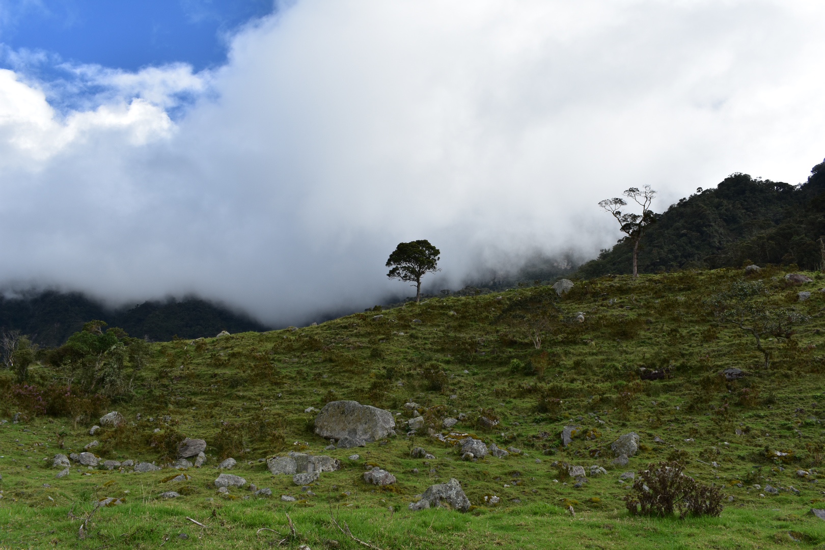
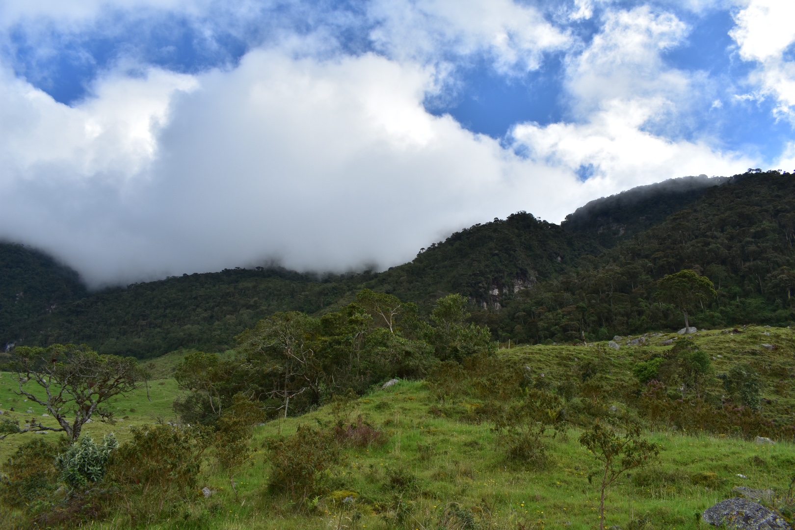
And you get an idea of the views through the clouds. We stayed around on the top for around 40 minutes, enough time for the clouds to clear a little for photographs.
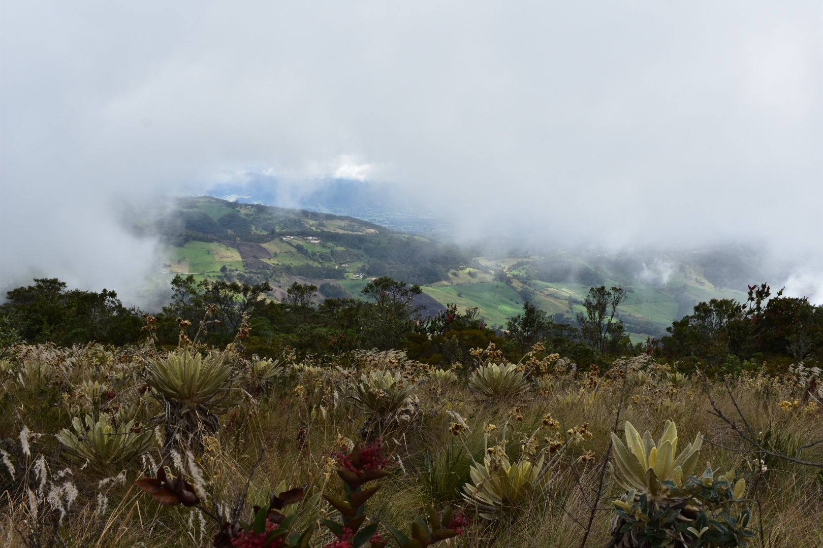
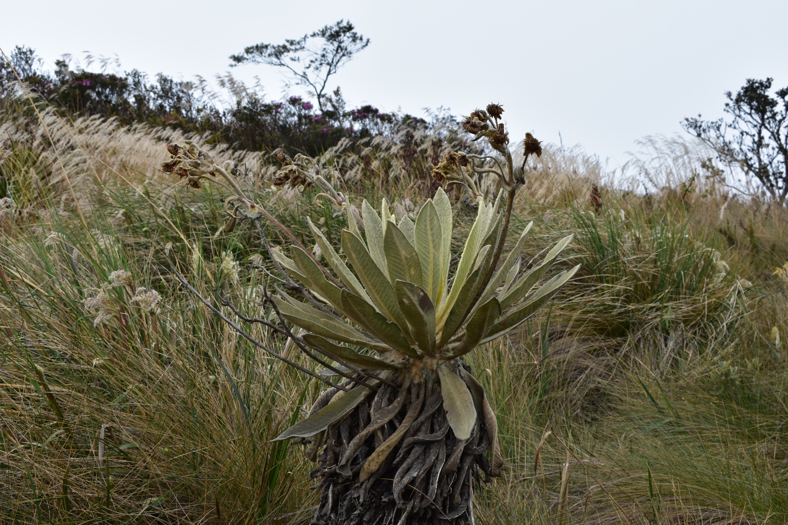
The clouds were blown around by the wind clearing a little at times. Its actually fascinating to see the clouds moving so quickly across the landscape, revealing the world through small holes in the cloud and quickly covering them up again.

Felipe motioned that it was time to move on and we followed him back to the car park. Here there were some people selling coffee, aperas and drinks from the back of their car. If you do want anything then this is your last chance to stock up. So do take advantage. Otherwise its a long wait until you arrive in Supatá. Some of the group were much slower and it took them a while to catch-up so I took advantage and took more photos.
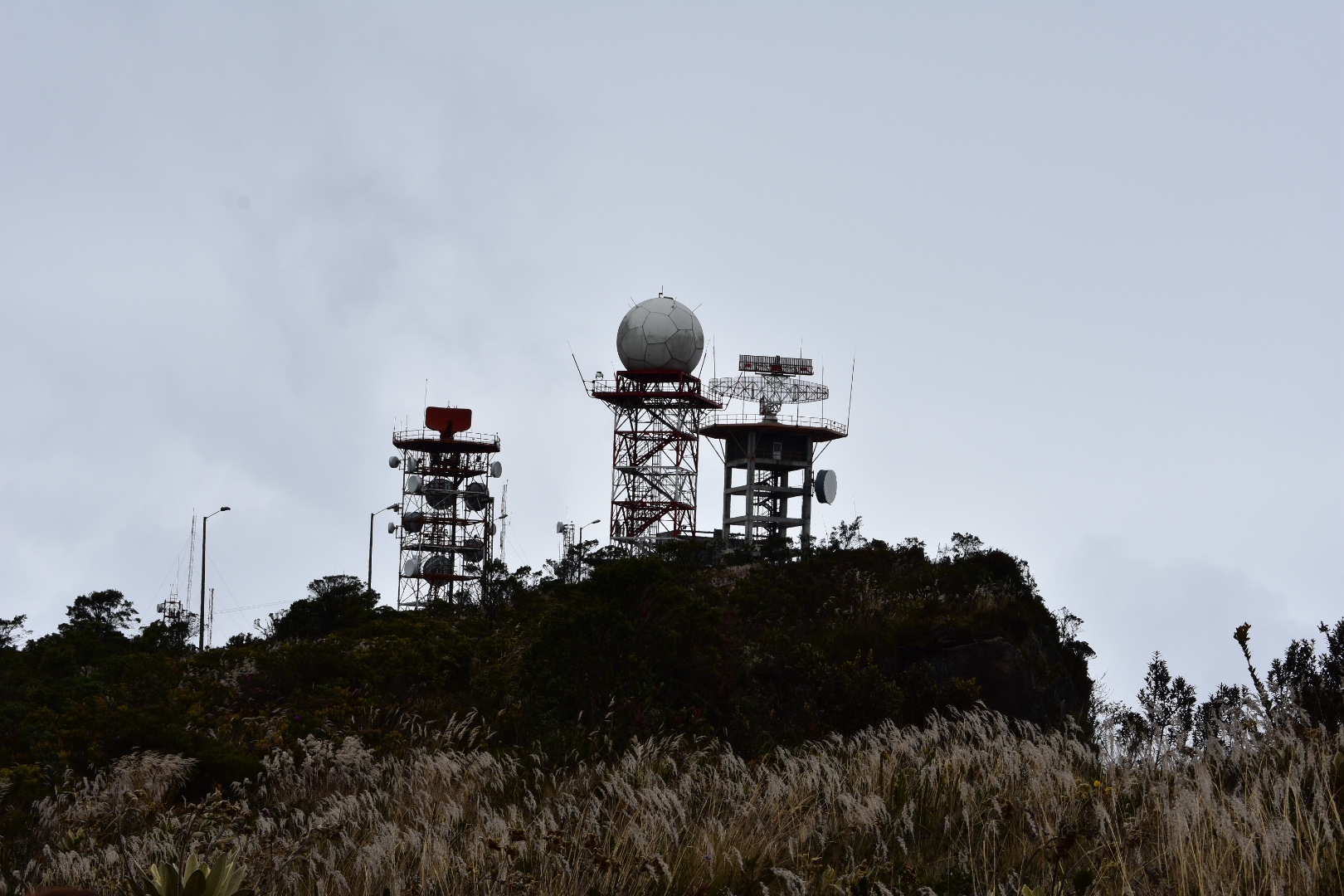
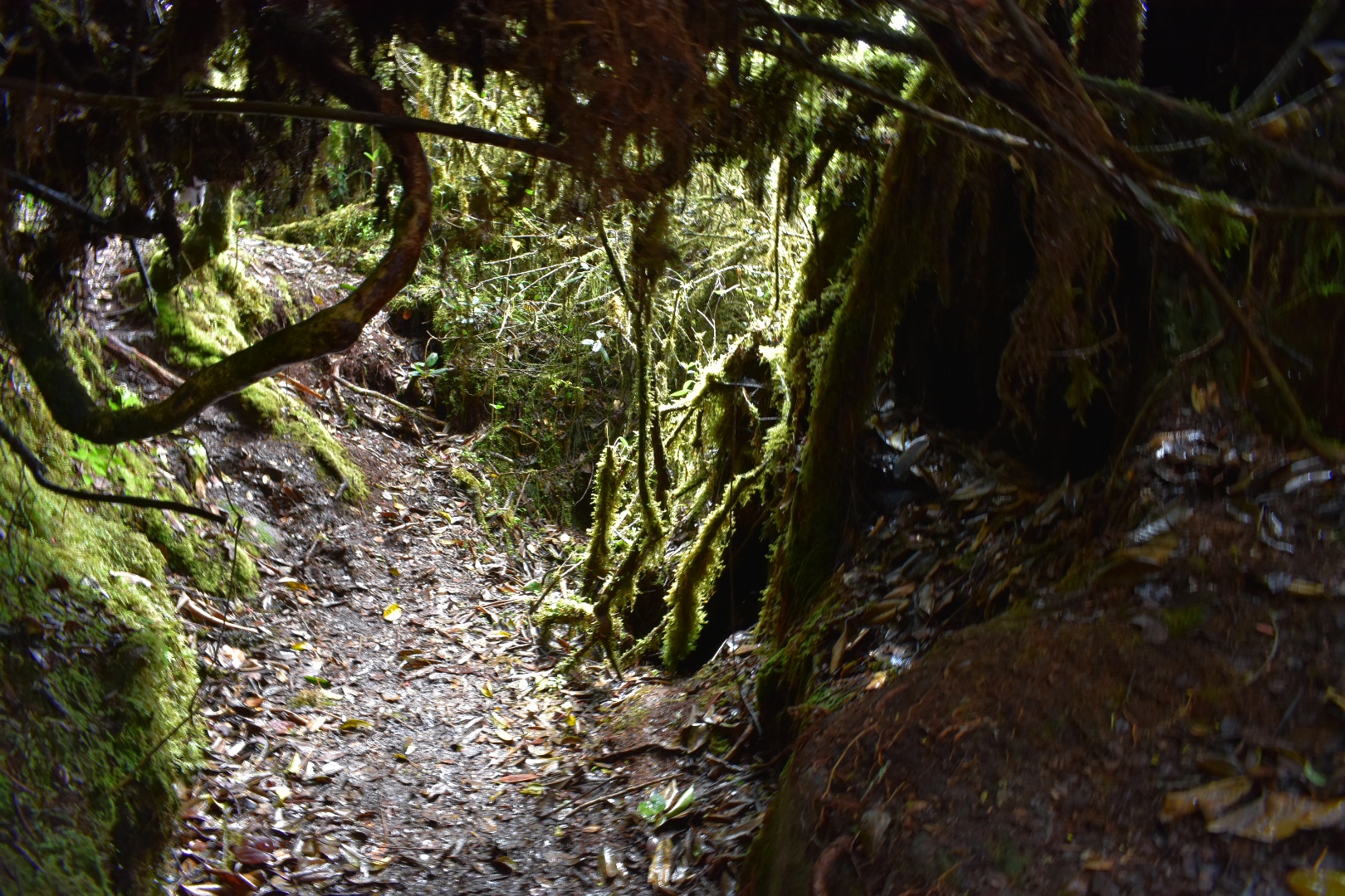
We walked past the towers and then followed the trail along the top of the ridge, around the fences of radar complex and a very aggressive dog. The trail was really wet and muddy and it was easy to slip. I was immediately happy about my waterproof boots and not having to skirt around puddles.
If you are hiking solo then make sure you have maps me and follow the path down from the mirador. We took a detour from the path, which I will come to later, but don’t. Stay on it. When you leave the forest make sure you follow the main road – Maps.me offers lots of shortcuts but I didn’t actually see them on the hike and I guess if you follow them you will end up walking across farmers fields. Instead stick to the main road. One key area you need to watch out for is a farm with a house. I think its the first farm you will come to, and there will be photos later on. There were several dogs and there is a T junction. Take the right path, its longer but it will take you to your destination.
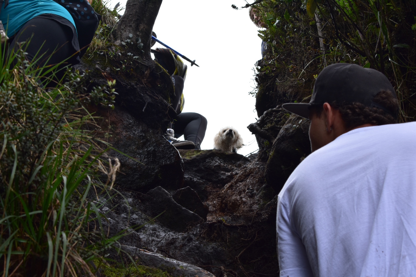
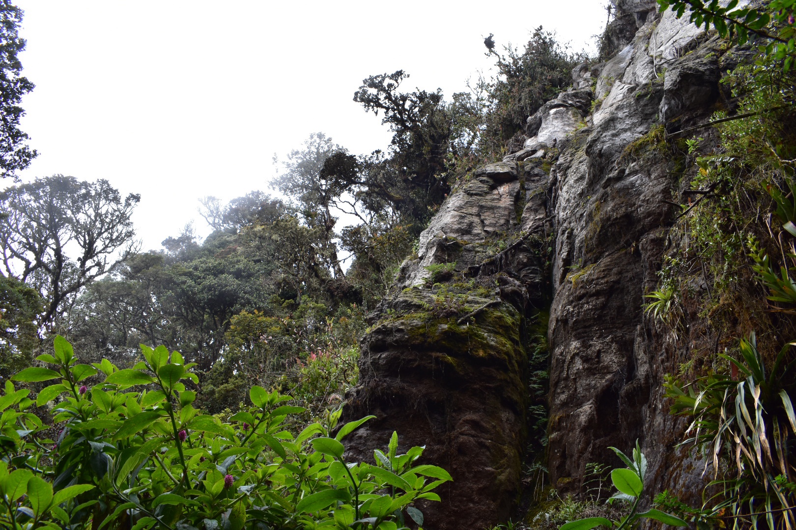
Eventually the path will take a right and into the bushes where there is a very steep descent. Its more of a climb than anything and is the height of 1.5 stories. Although we were near to the front it was initially hard to see why everyone was moving so slowly during this part. When I did reach the front of the line I could see that the path dropped vertically and it was necessary to climb down.
When it was my turn to go down a guy in the shell suit pushed past. I didn’t understand the what he has said but Angela told me to just let him go. He had said “let me go first I need to help” which turned out to be a curse as halfway down he took a fall and plummeted to the path below – luckily he didn’t get much further or we would have never seen him again. He was wearing white trainers with zero grip and I started my descent just in time to see him tumble down, which was pretty scary. It looked like a bad fall, and I hasted to get to the bottom without pancaking and thus falling myself. Another guy wanted to go first so I let him and he quickly reached the bottom and started dealing with the situation.
As you can see in the photo below it was a steep climb, essentially it involved climbing down clinging on to branches and roots. But if you go slowly and carefully and have decent boots you should be fairly safe. He was okay but had hurt his foot but didn’t have any broken bones or a concussion. Instead of turning back as he had been advised he insisted that he could continue but in front of us was about 14 kilometres of trekking and less then a kilometre and a climb were people with cars who could have taken him to safety. He would live to regret the decision – as would all of us.
At this point the some in the group who felt more confident with climbing formed a human chain to help everyone else down safety. It was slow going and took a long time to get everyone down, including the two dogs, but it was worth it.
Straight after this point was another slightly challenging climb. It wasn’t anywhere near as high but there is a rock you have to cross and to the left is a steep drop down the mountain. There is a bit of a tricky climb down and if you do see some wood to step on then just be careful as it wasn’t as study as it had appeared.
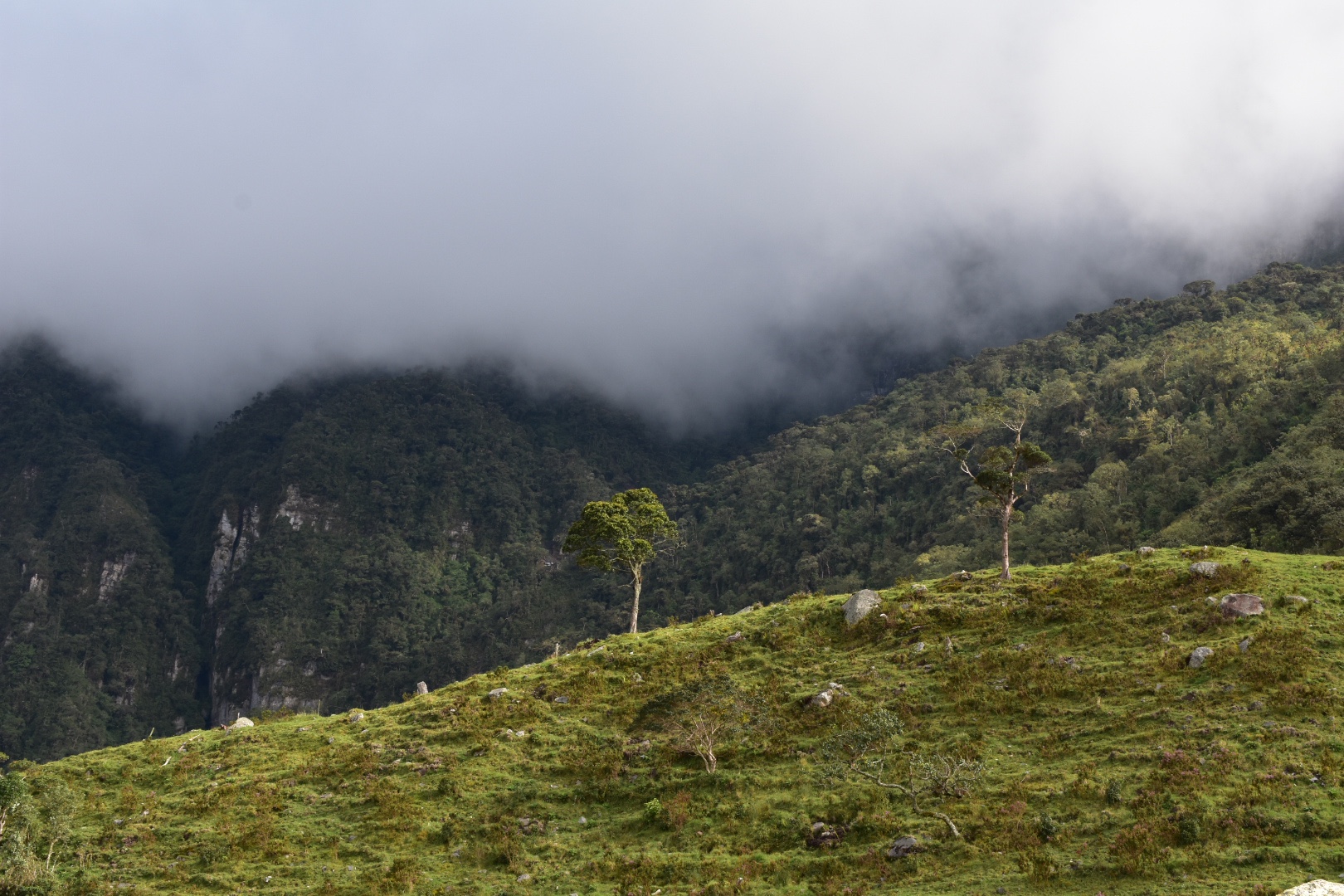
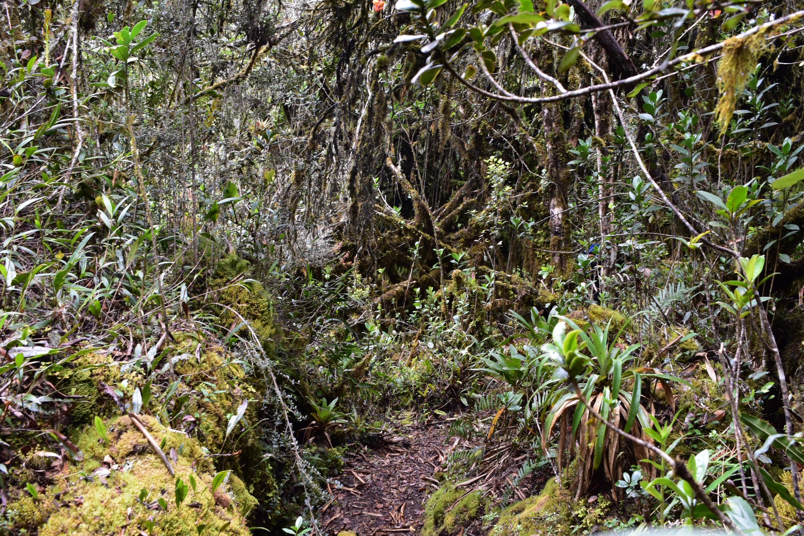
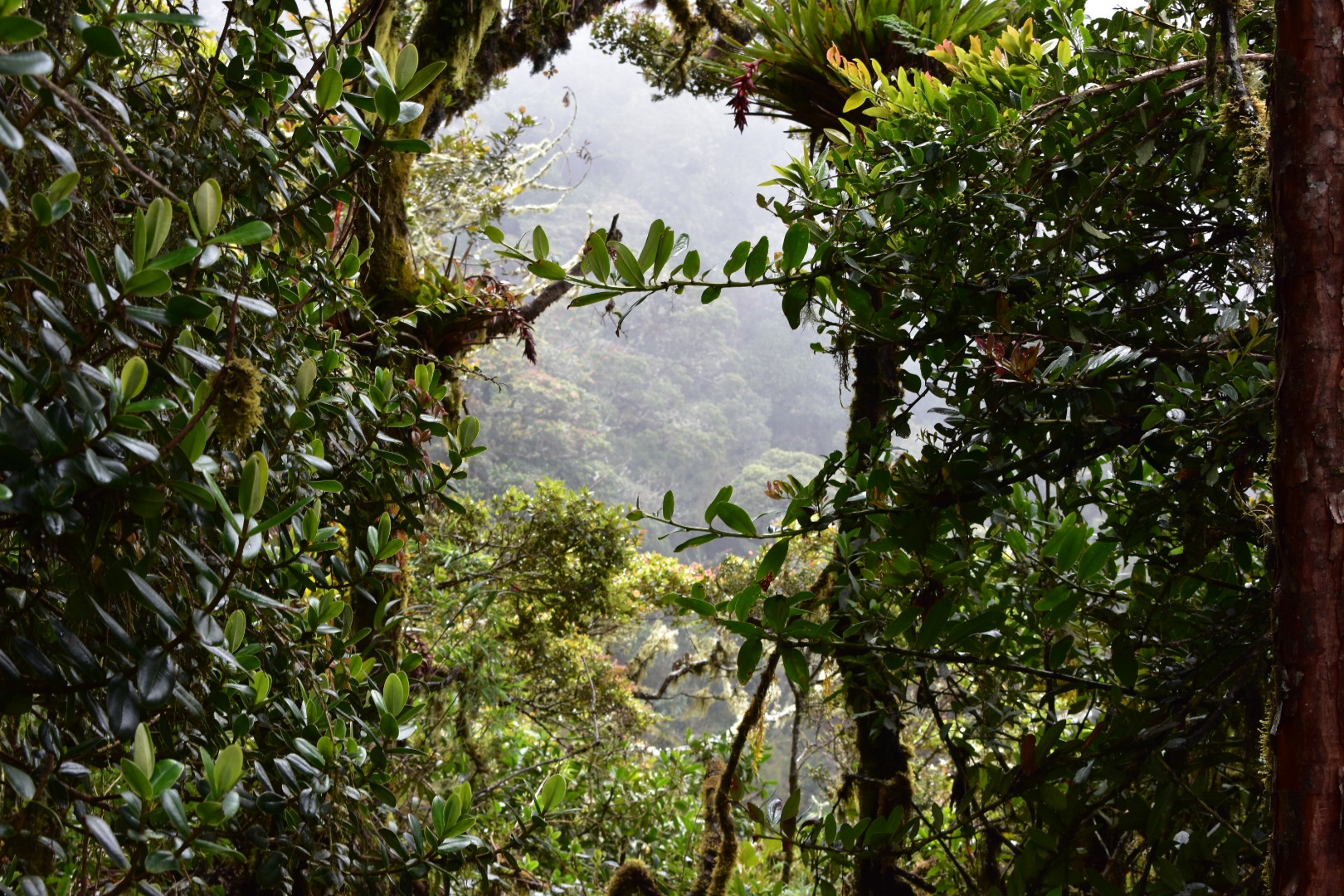
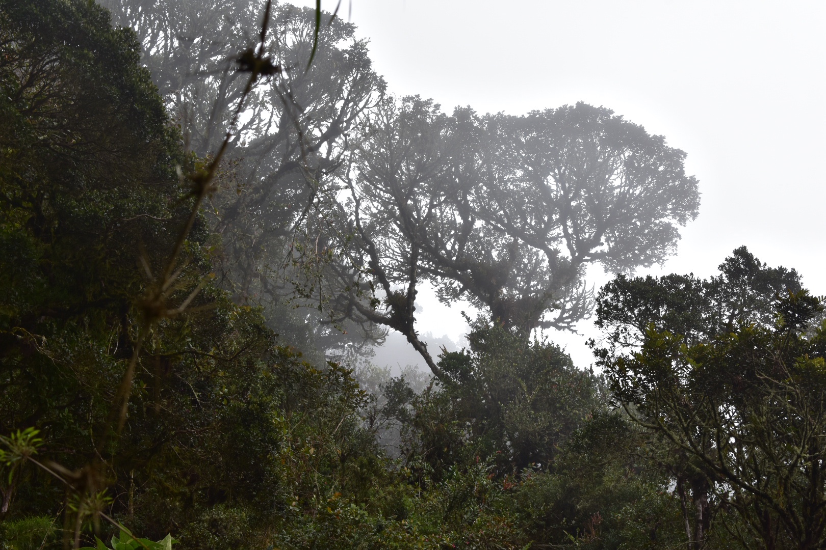
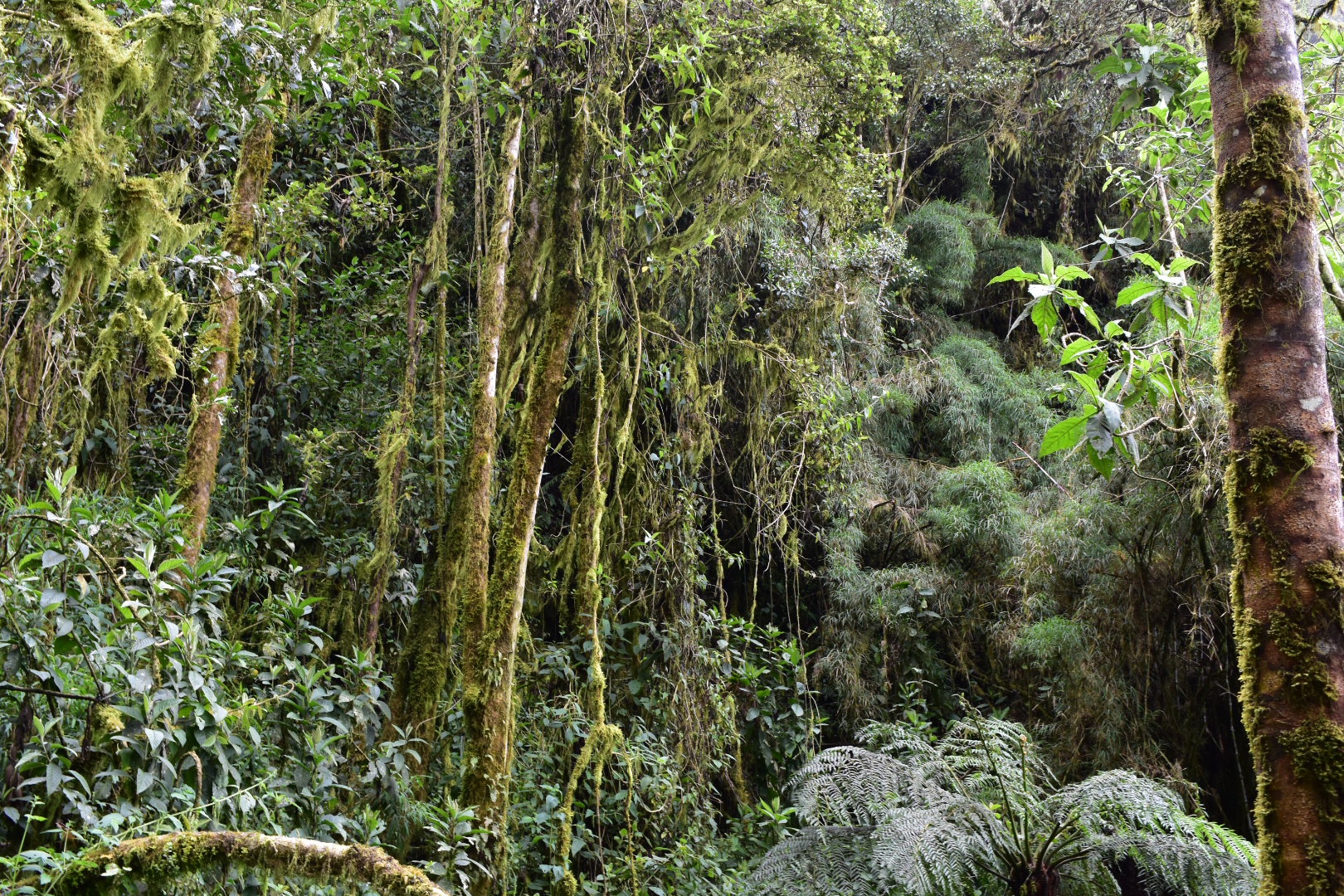
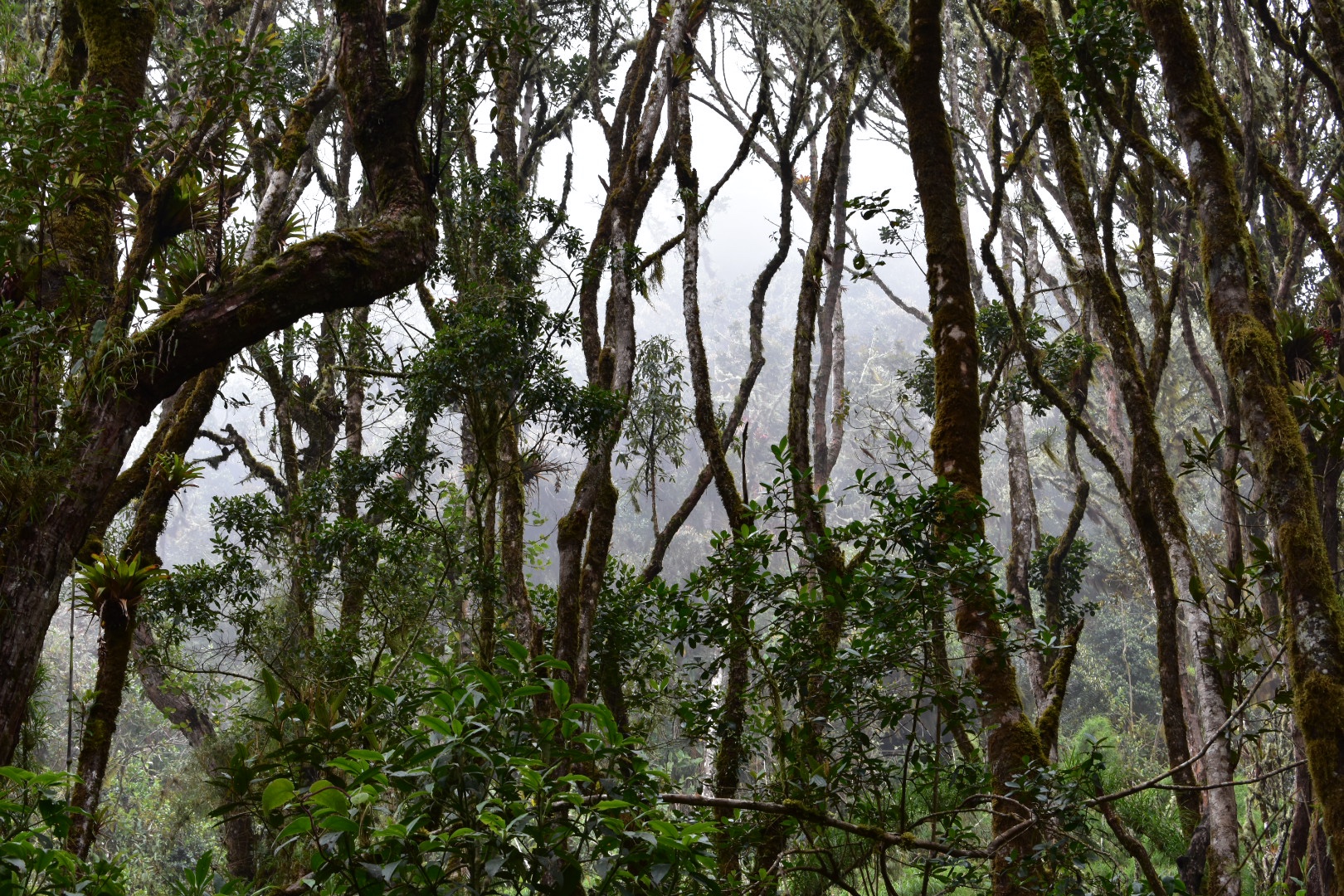
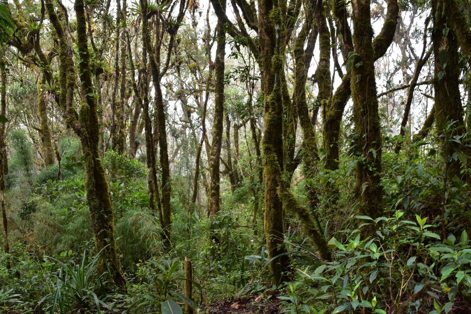
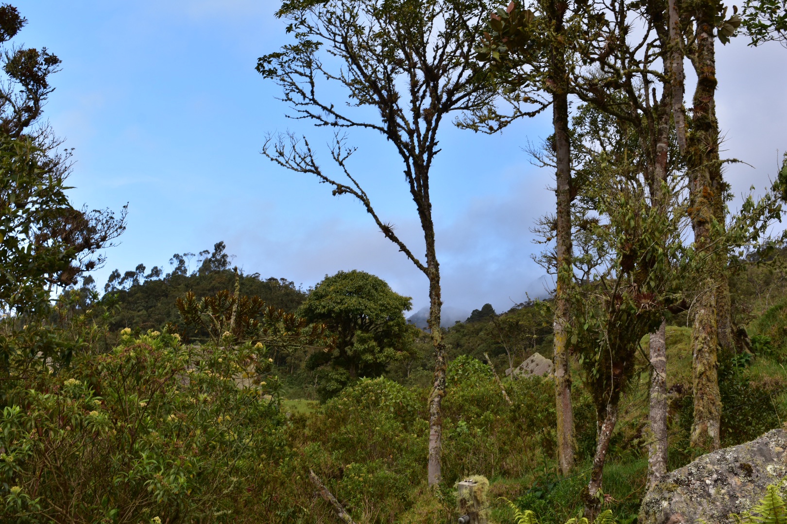
After this the next one hundred metres or so is fairly steep down into the forest it levels out and the path treks through the forest. But for the next few kilometres you will be heading down through the trees.
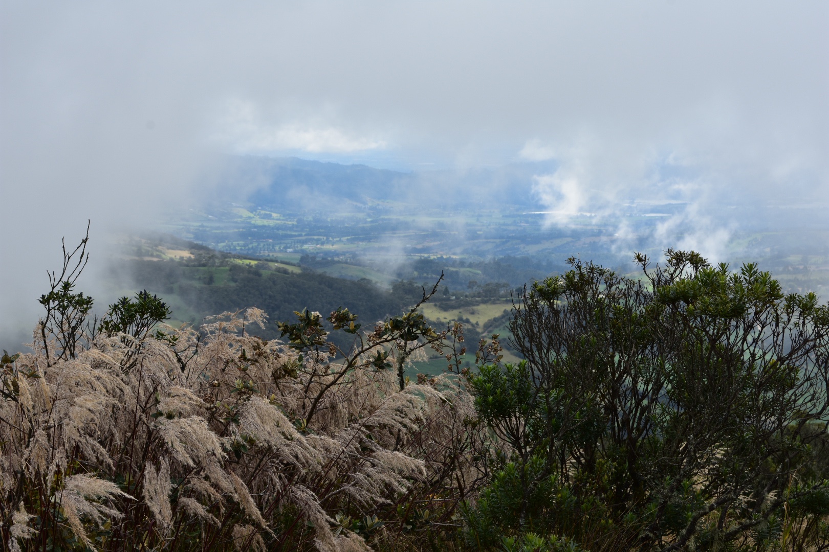
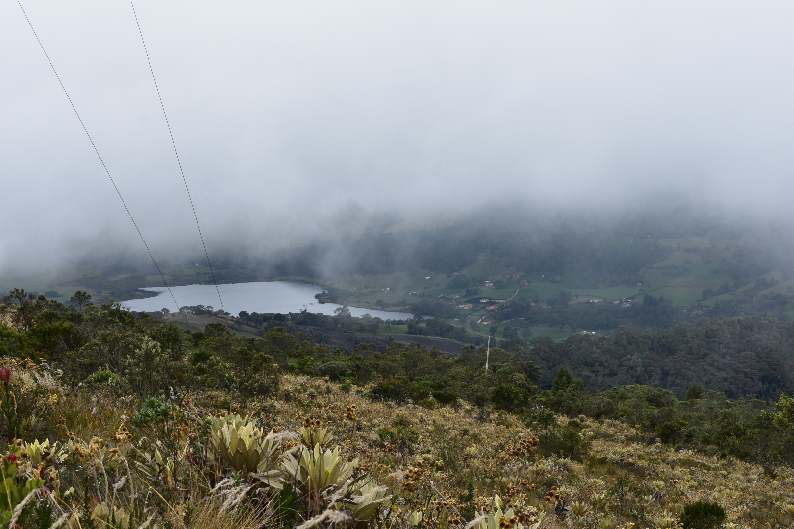
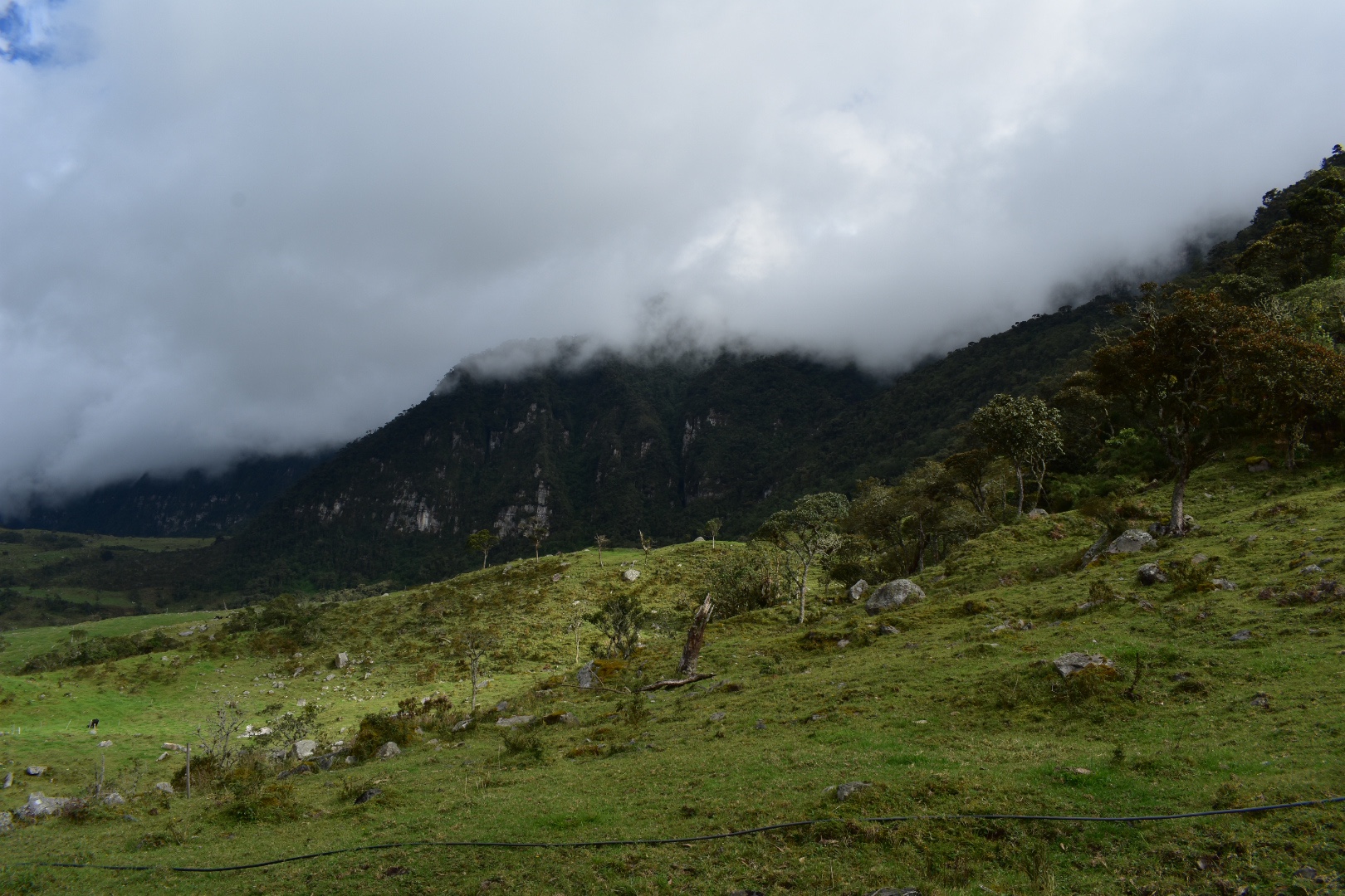
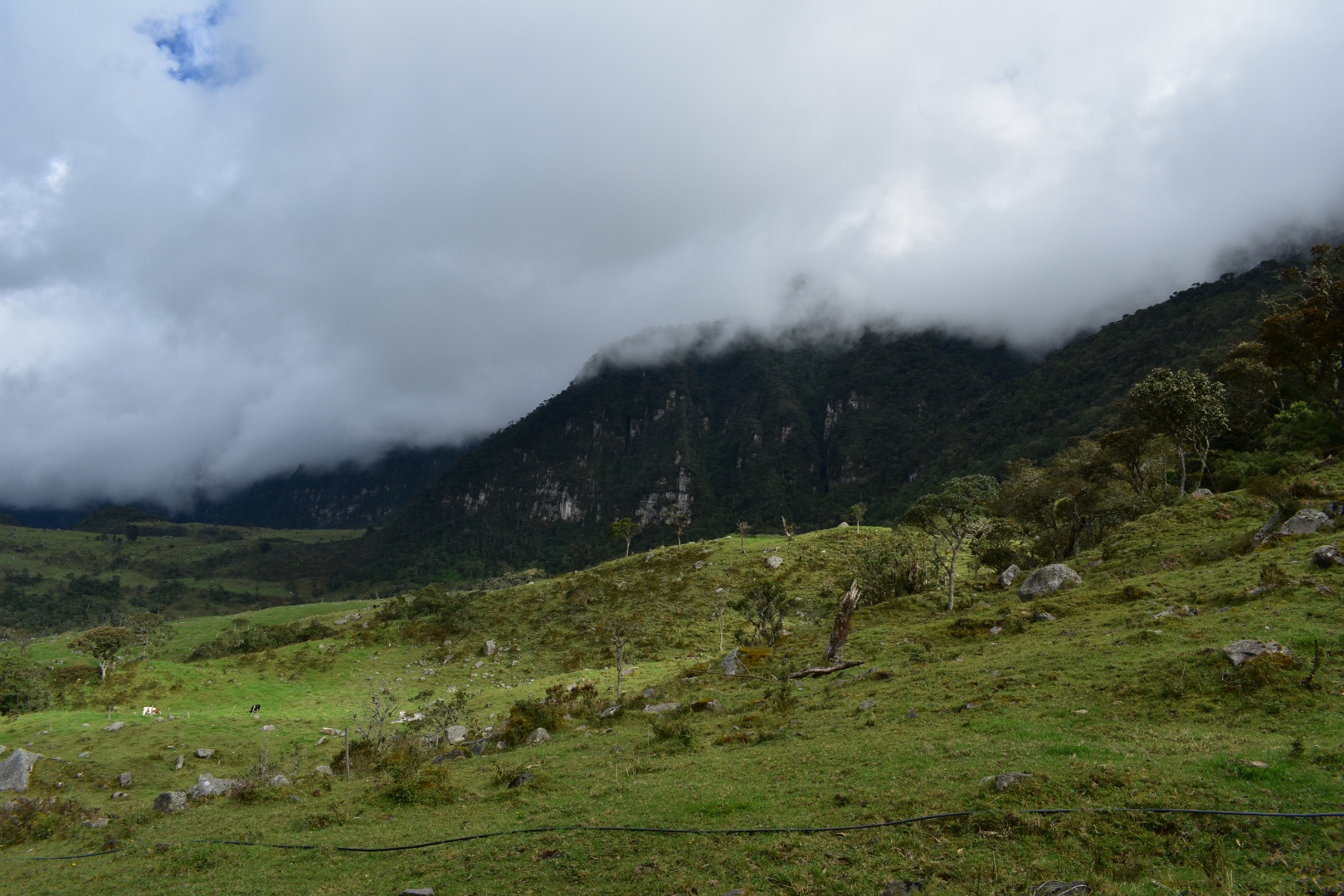
Very soon you will appear in a clearing which after the steepest part of the hike completed you can relax here for a time. We stopped to regroup and you could see the clouds moving around here as they did above. Its a nice place to relax for a time.
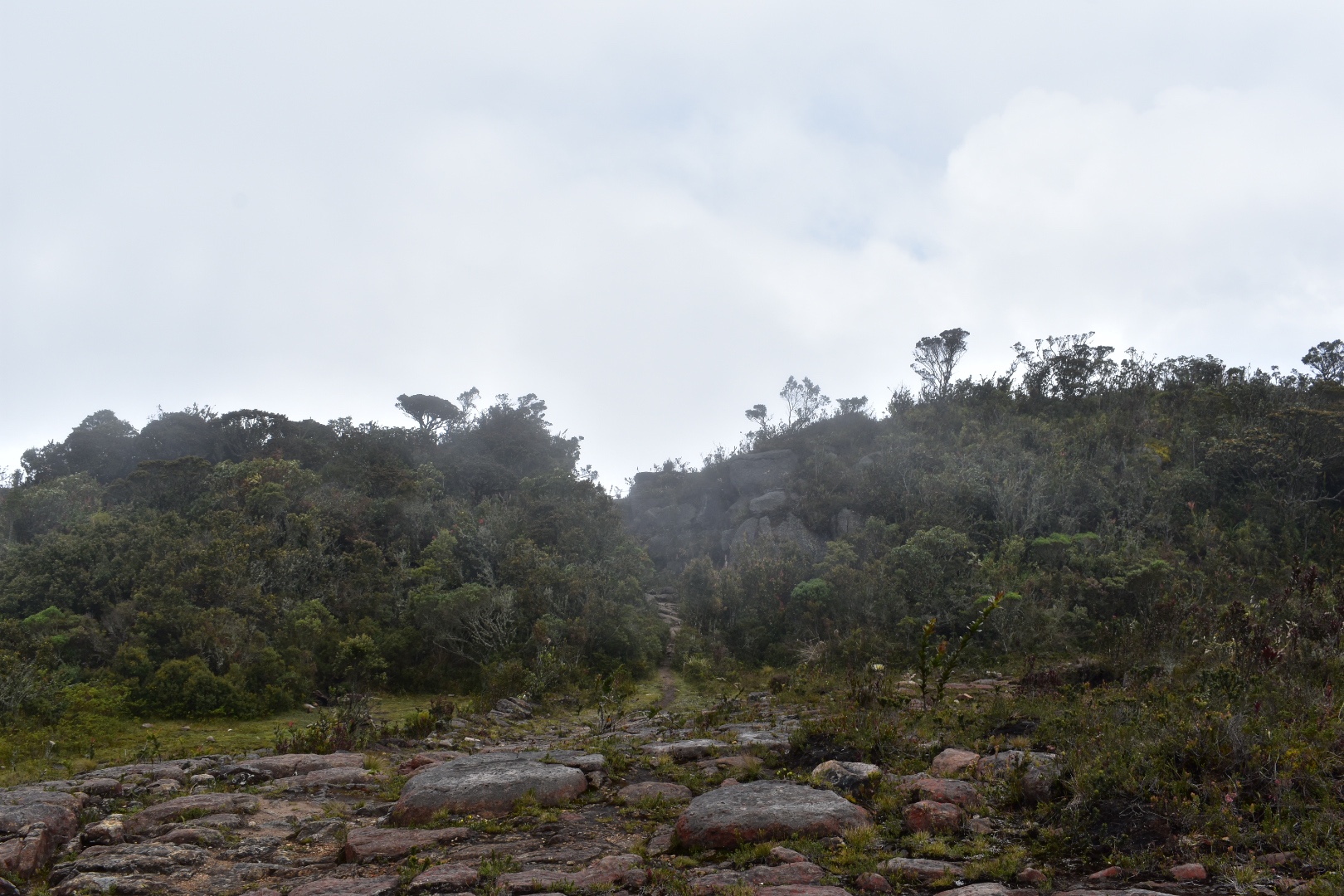
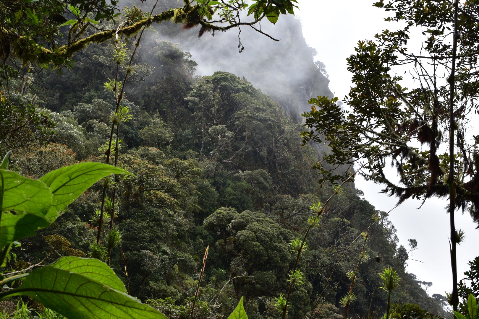
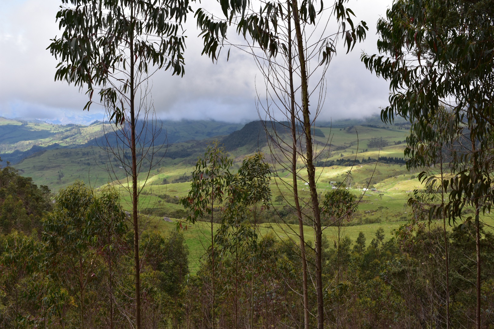
Once we had regrouped we headed back into the forest and everything is down for the next few hours. Just continue to follow the path on maps.me. We made slow progress for a time and I wondered why we kept stopping. The longer we kept walking the longer we were waiting and eventually I realised it was the guy with the hurt foot. Most people didn’t realise the distance we still has to travel as especially when you are on a forest trail you go so much slower and the scenery changes so quickly you don’t realise that the distance is much shorter. The views however were spectacular and it was beautiful to walk through the forest in the mist.
We hadn’t gone particularly far and were already far behind schedule when all the hungry people stopped for lunch. It was already about 12pm by this stage and I was left wondering where all the time had gone. I couldn’t believe it when I found out that some people hadn’t brought food with them. I don’t know what they were thinking but I suppose they thought there would be somewhere to stop.
After lunch we continued down and progress was even slower. The guy was obviously in a lot of pain but for each 20 minutes that we walked we had to then wait a further 30 minutes for the last of the group to catch-up. I calculated by the time we exited the forest we had lost over 2 hours just waiting. But it was fascinating to see the foliage change. This is one reason I like hiking in mountains over other terrain, especially when you deal in large changes in altitude, as everything changes so quickly.
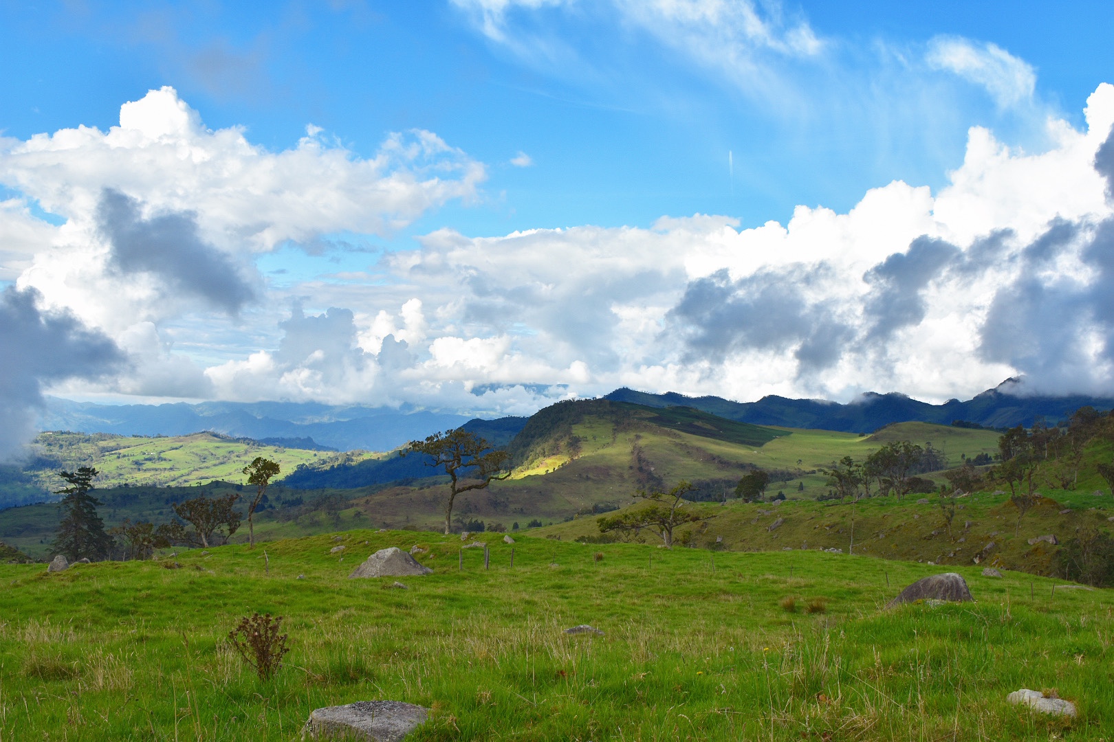
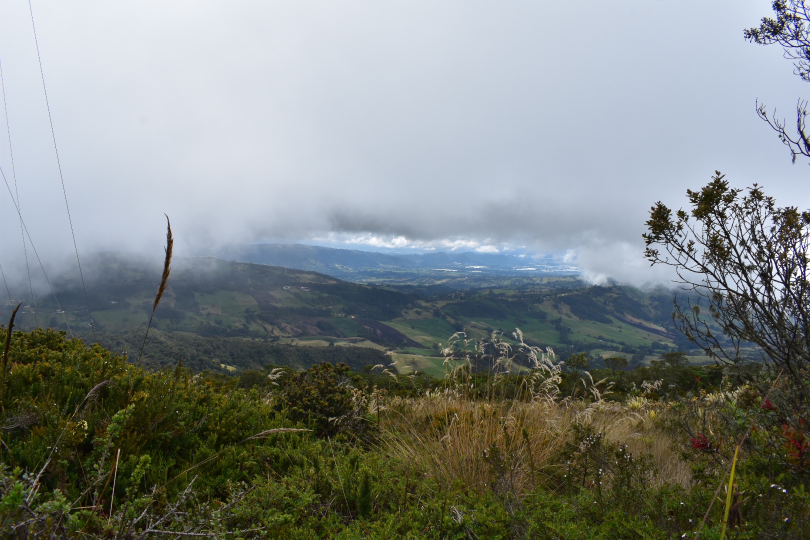
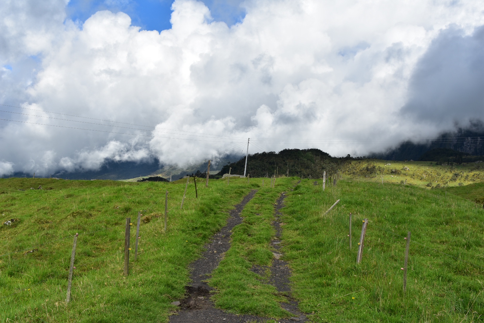
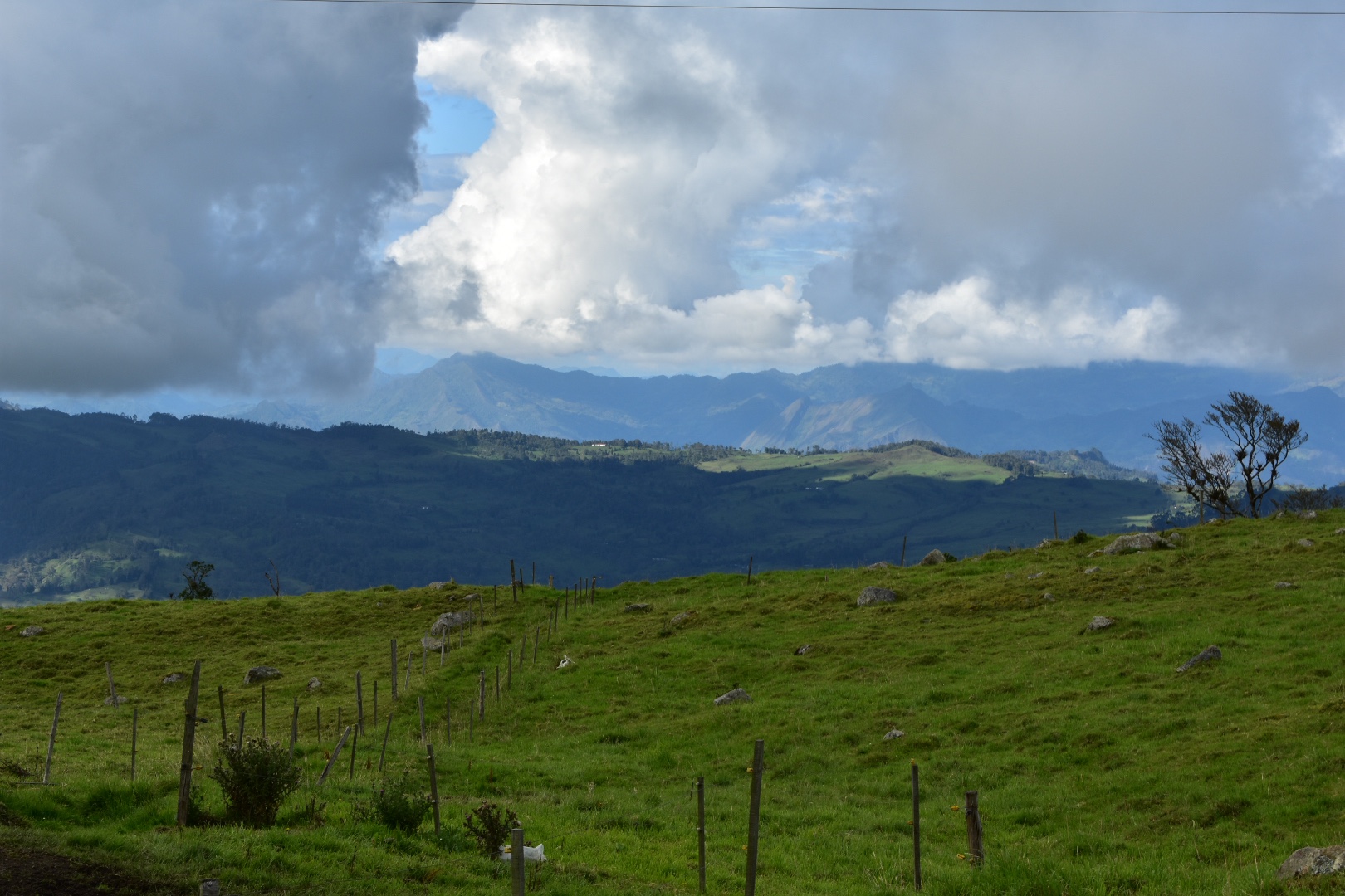
Eventually the forest started to thin out and we could see the beginning of the Savannah but there was still a long way to go down. Also looking at my map I could see that we had left the trail. Don’t do this as the main trail down is better. Felipe took the decision to take what he thought was a more direct route out of the mountain. In the end it didn’t help us and we had to cross a few barbed wire fences. Always trust your guide and he did his best to support the injured member of our party.
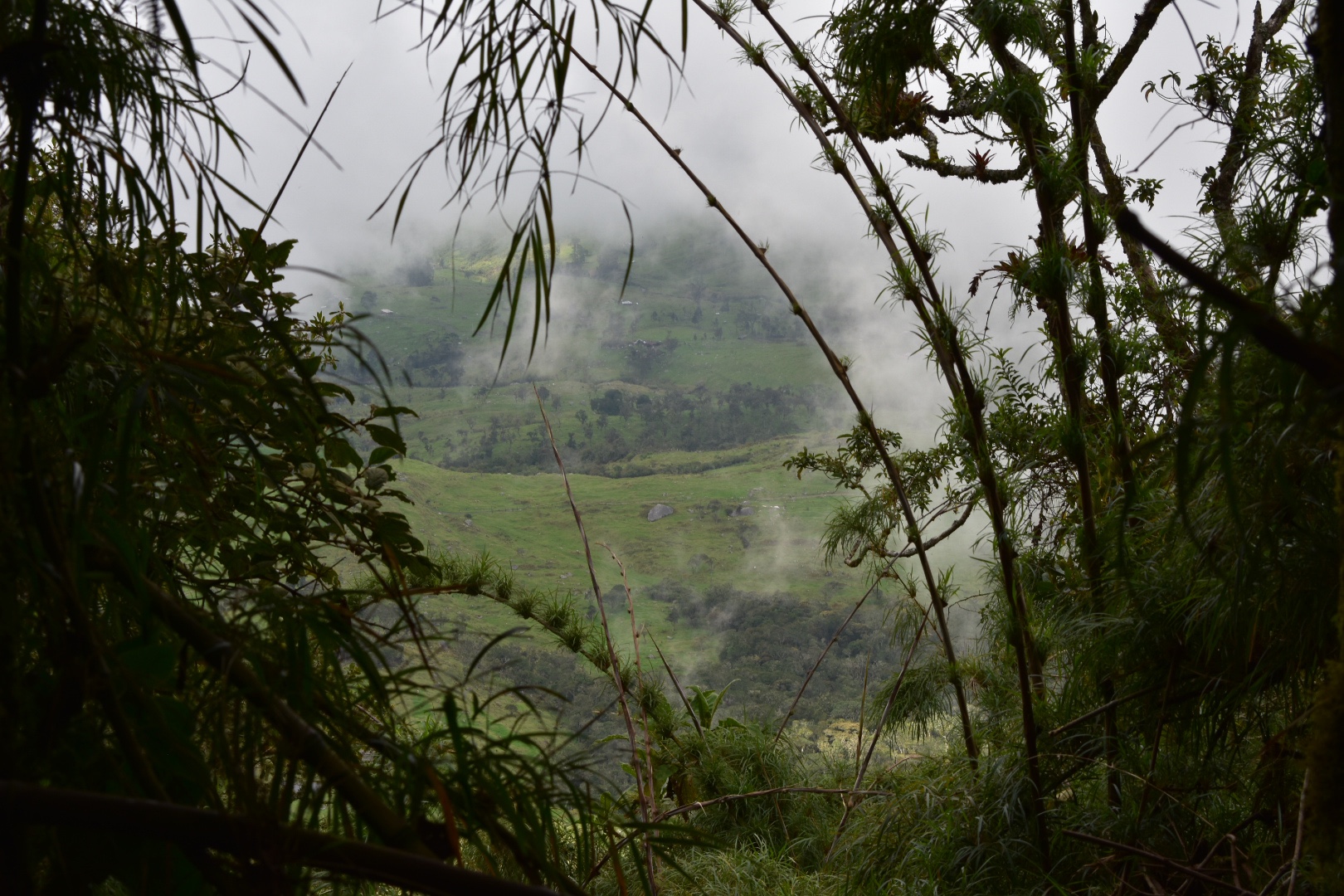
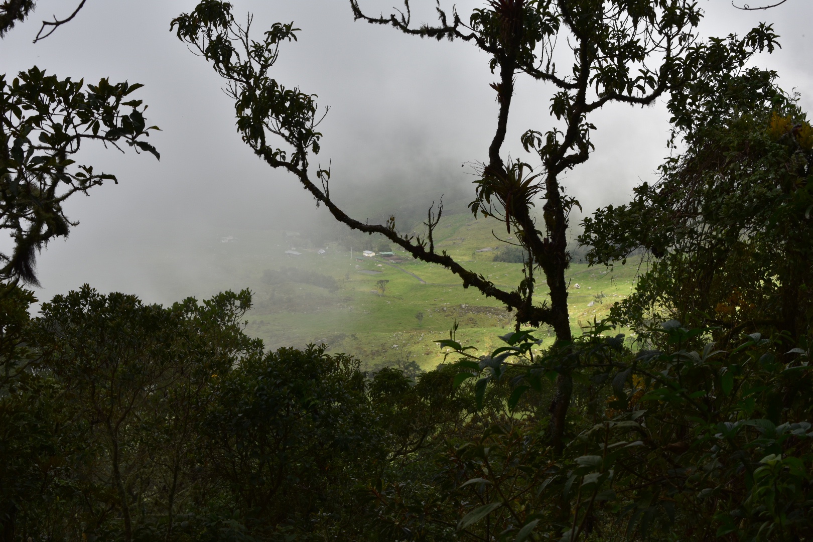
When we left the forest the sky had turned blue, well mostly blue. We took the direct path down to those buildings, climbing over a couple of fences and walking through fields. I was beginning to worry as the guy with the foot was in a lot of pain. I suggested to Angela that we should give him some pain killers.
We were then in the grasslands and still had a long way to go. It was now around 3pm and our last bus from the town of Supatá left at 5pm and I knew we had at least 7km to go. In the end it turned out we needed to walk much much further.
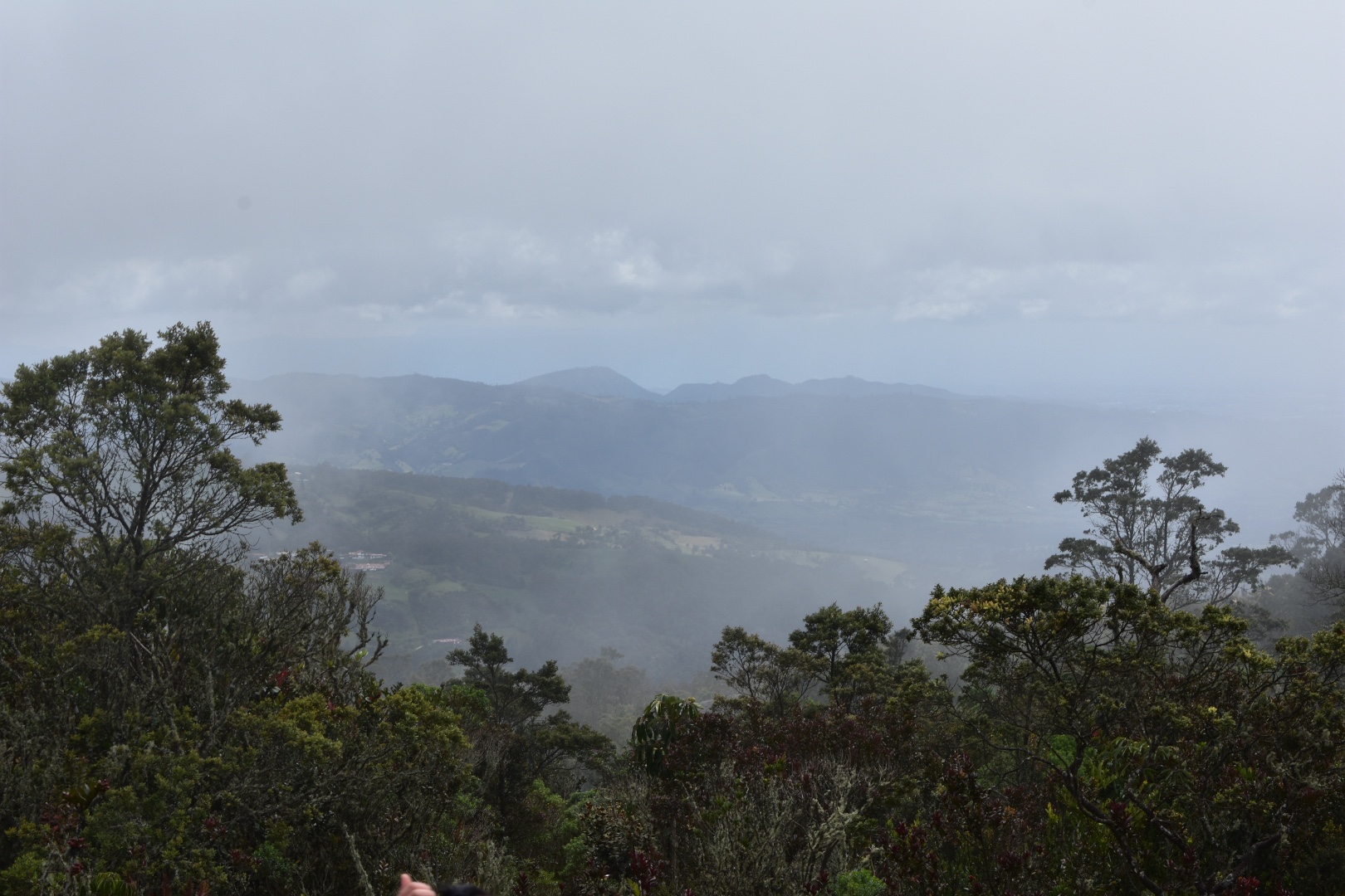
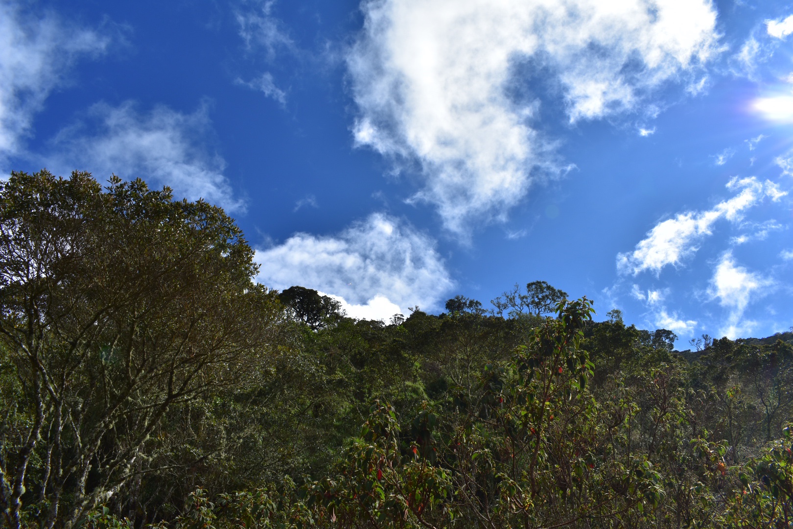
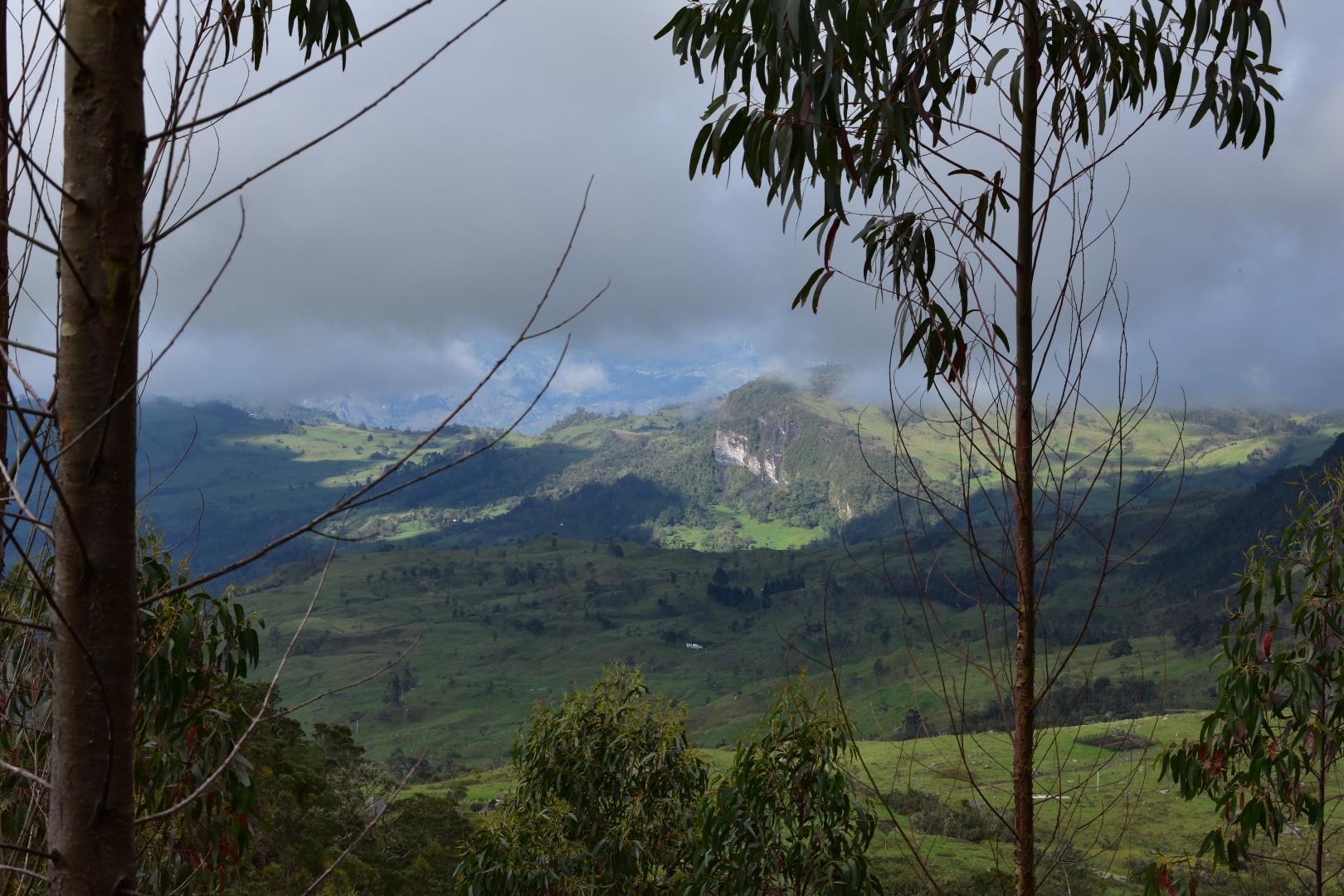
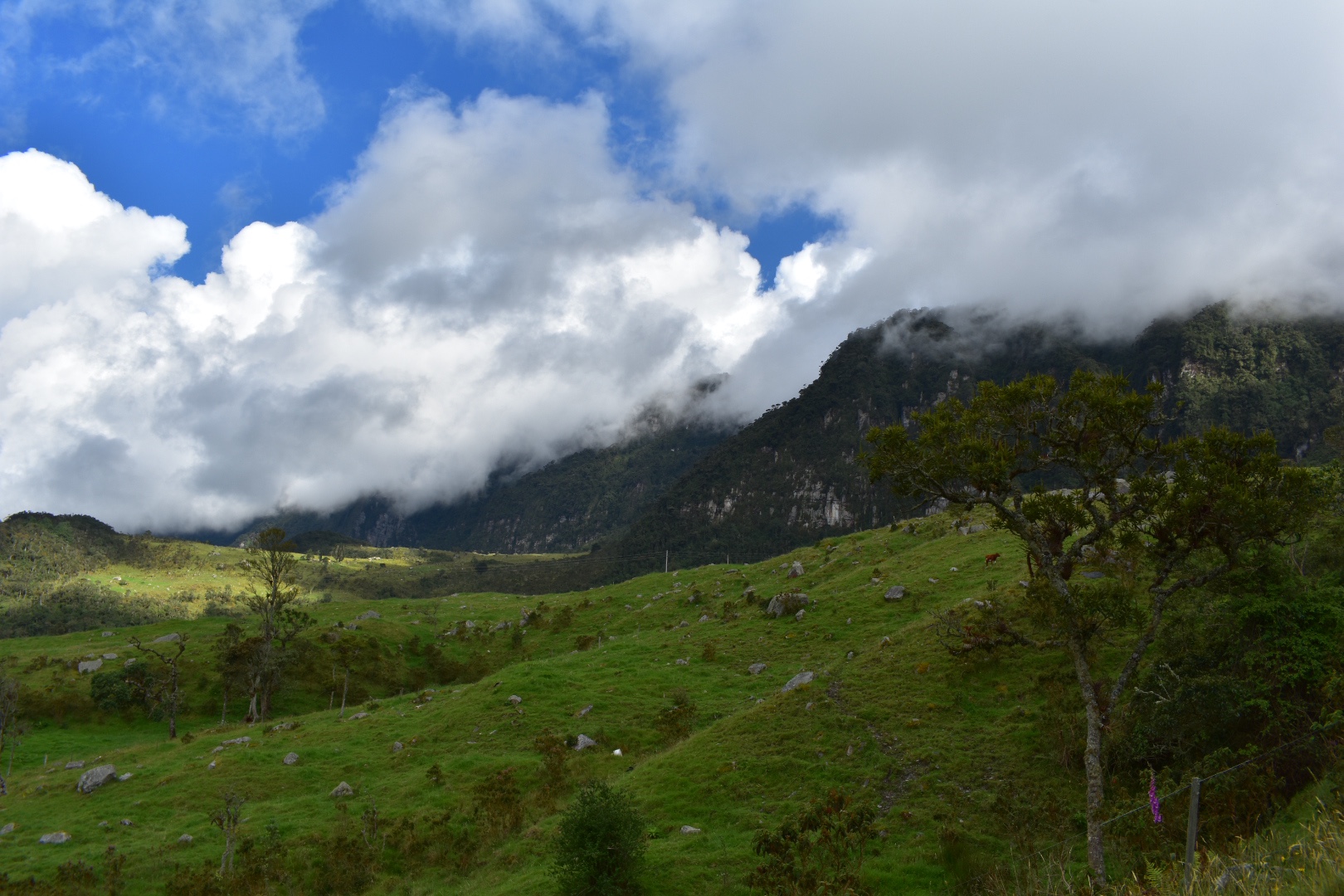
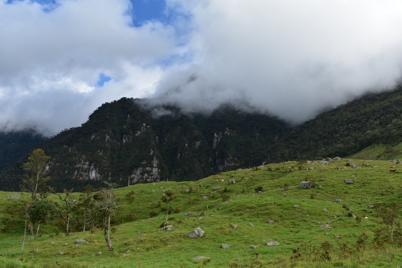
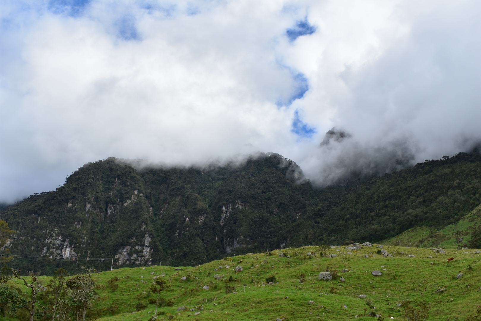
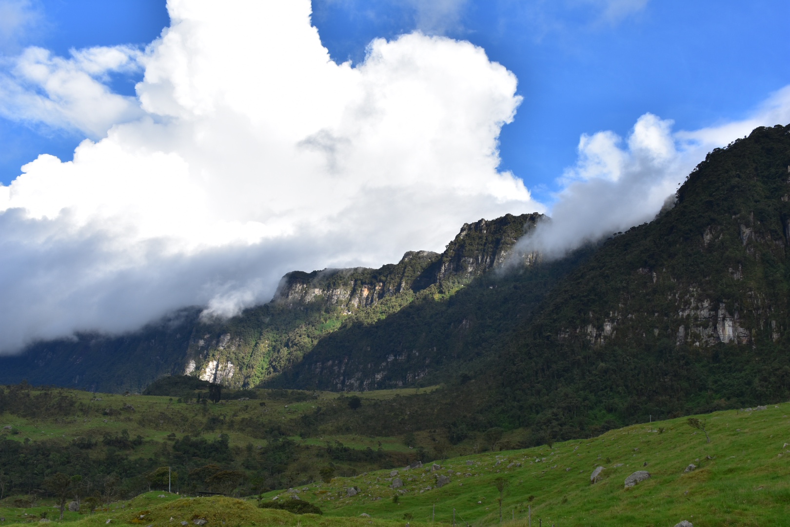
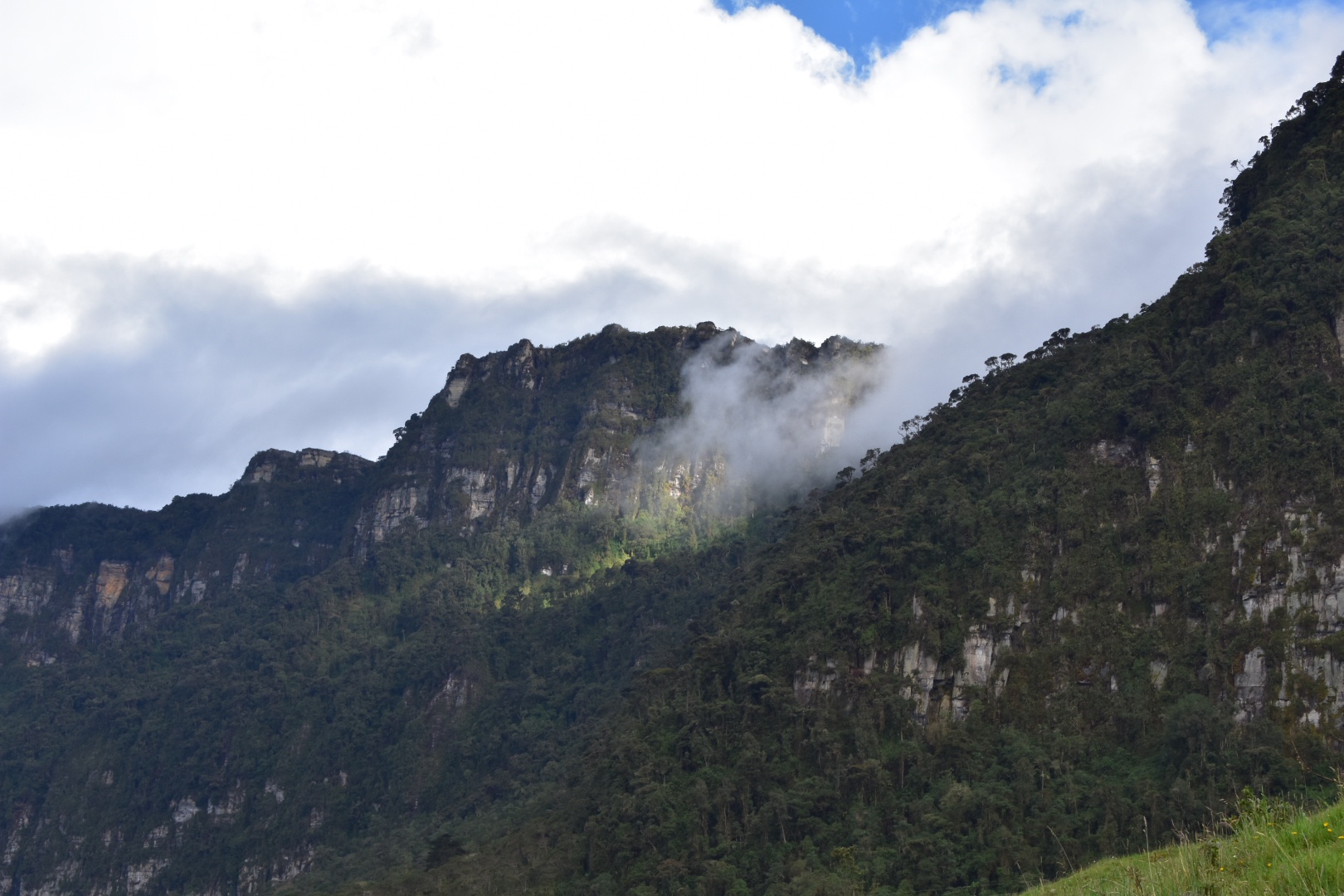
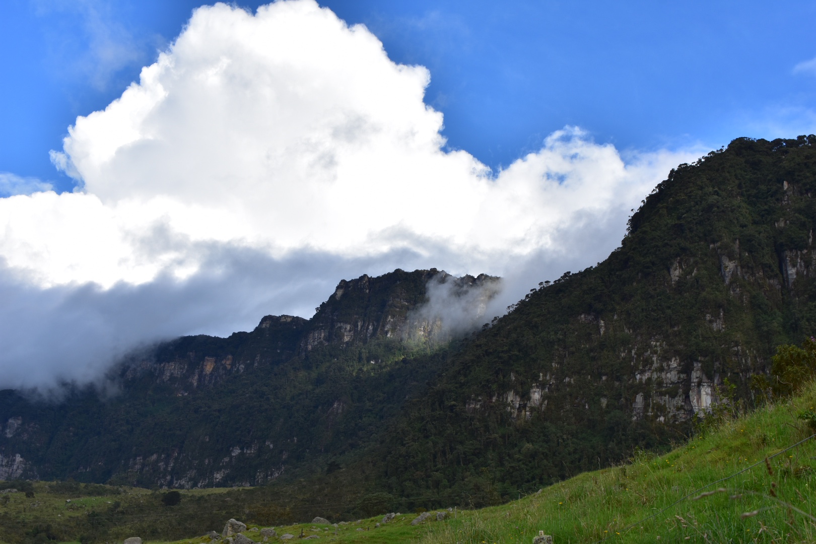
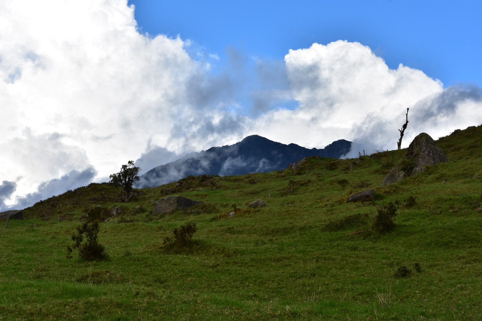
As we walked I was finally able to see the cliffs and for a time the sky cleared giving us some beautiful views and allowing us to see all of the mountains around. I took a lot of photos.
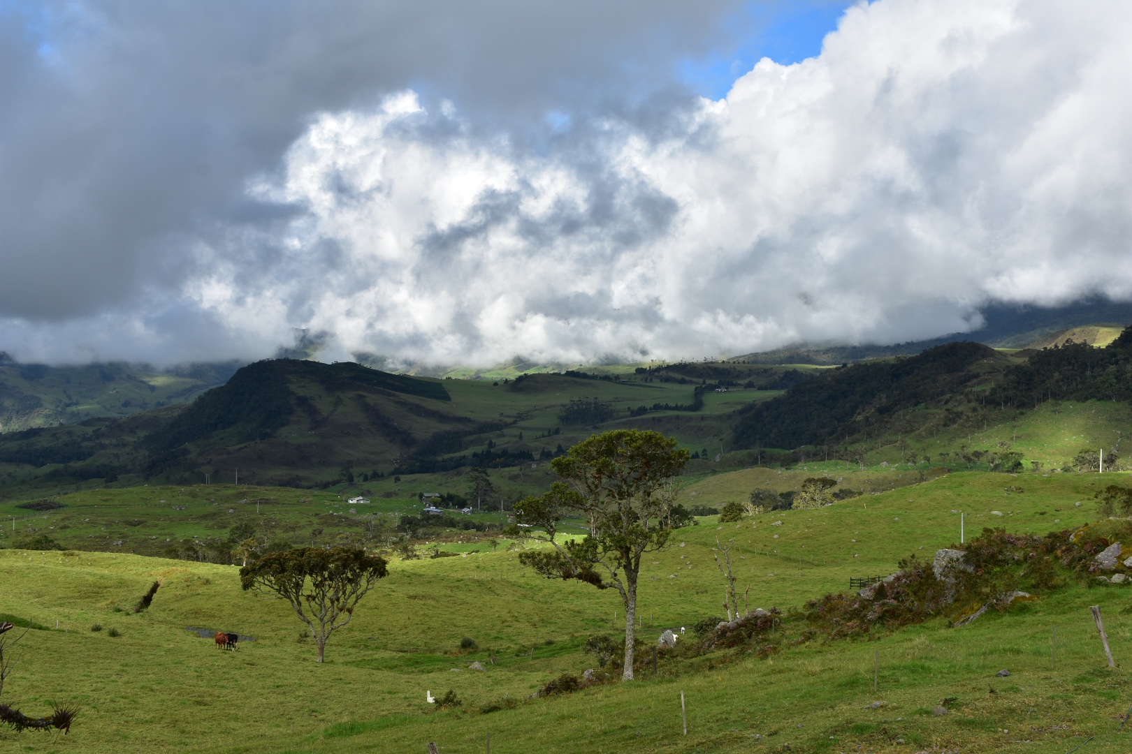
We began to walk across fields and the land became flatter. The sun was creating beautiful patterns through the clouds and bathing trees, cliffs and and rocks in sunlight highlighting their beauty.
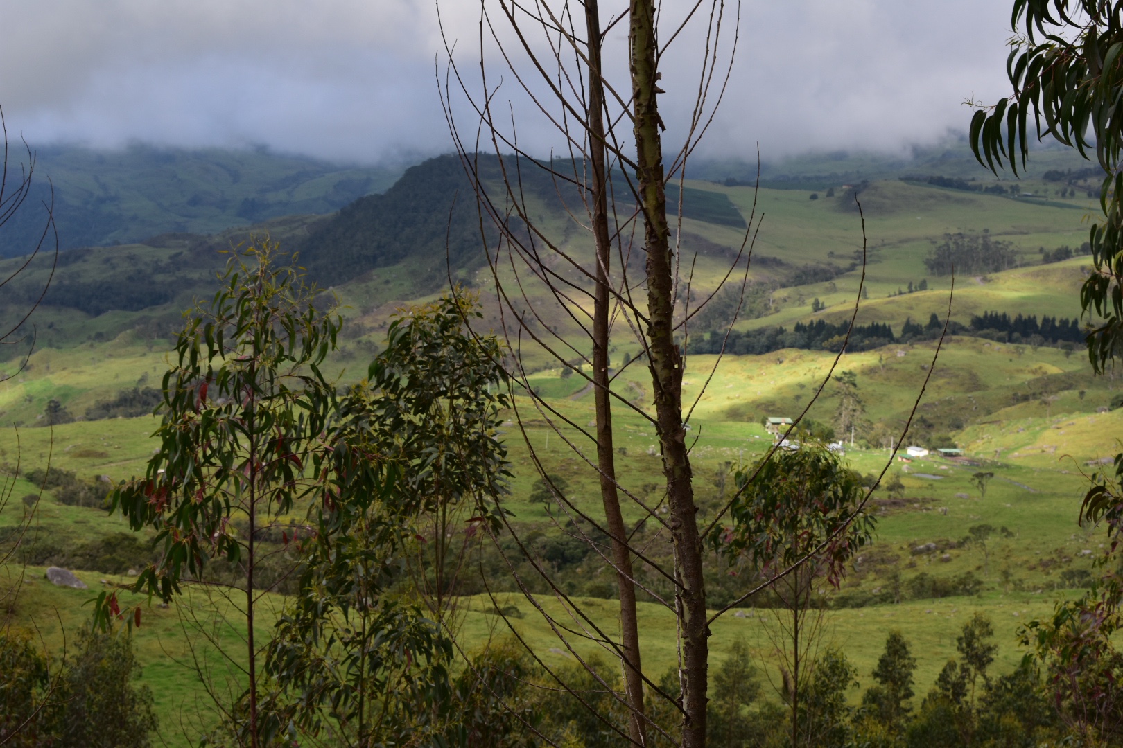
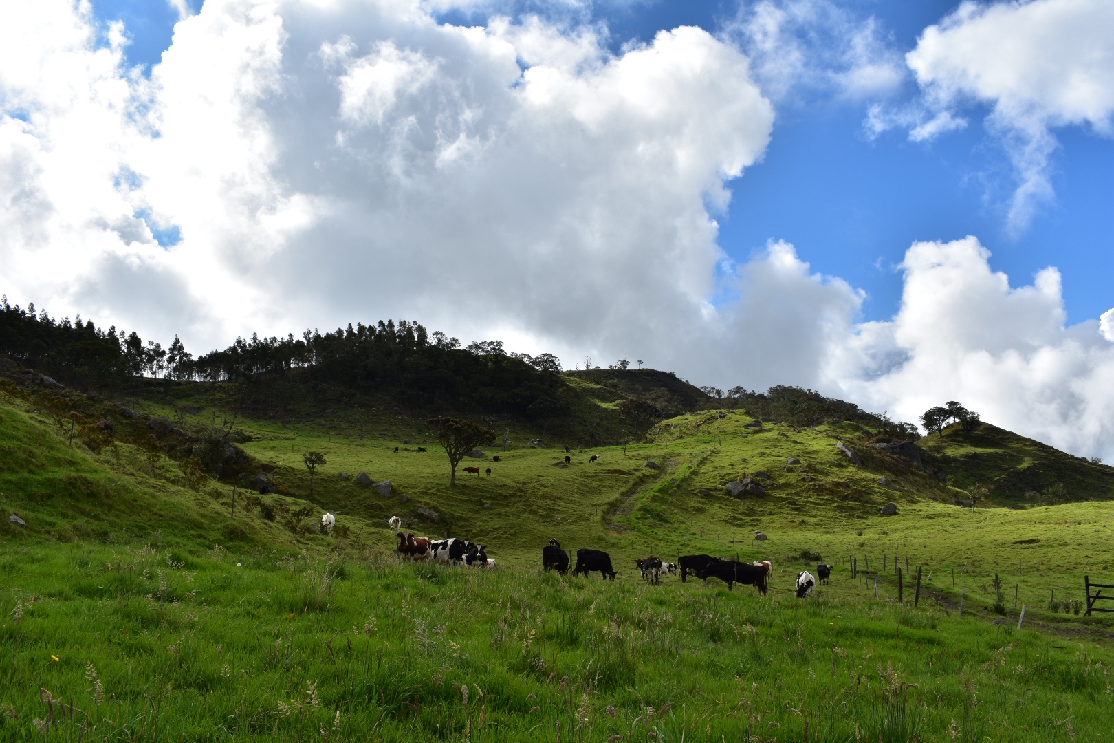
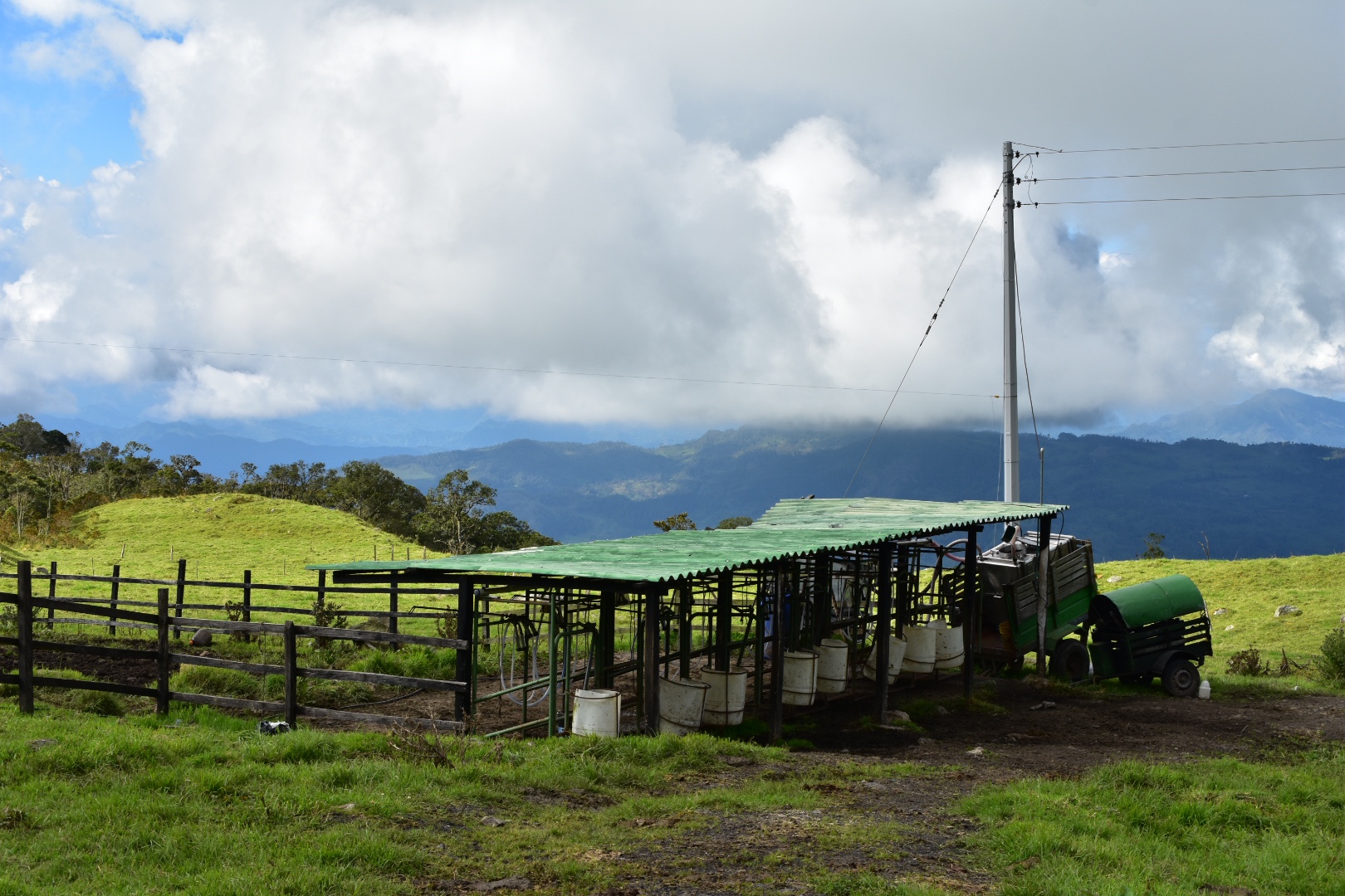
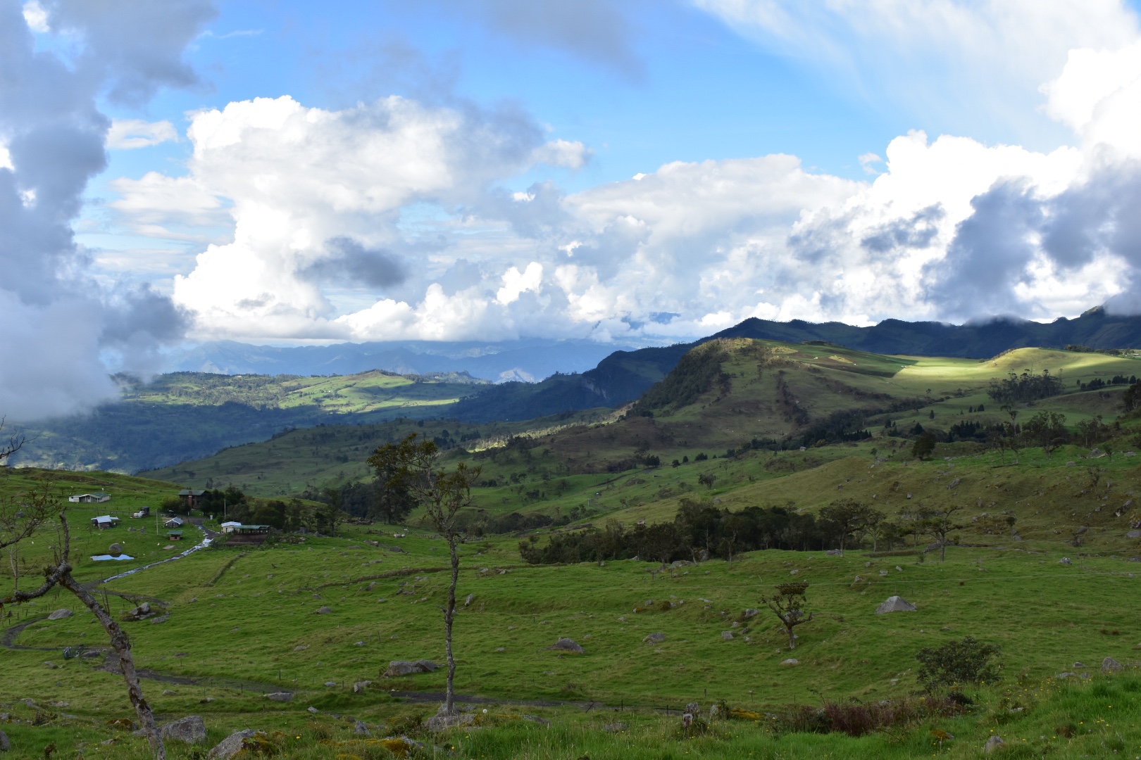
We waited by a dairy farm for him to catch-up, everyone sat around and then started taking group photos. I was desperate to keep going knowing how much further we had to walk and how long we had already waited. We headed off at speed following the first road we had seen since descending from the ridge to the nearest farm to ask for help.
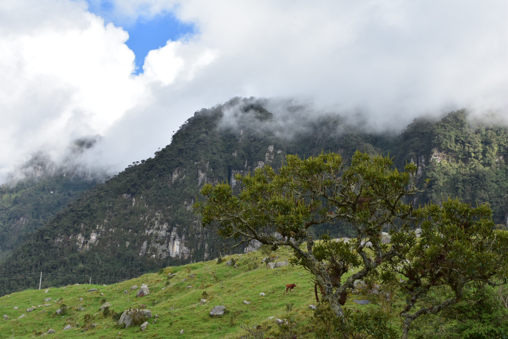
The sun was really opening the clouds up and while we were waiting for the other to catch-up I took advantage and snapped a lot of photos.
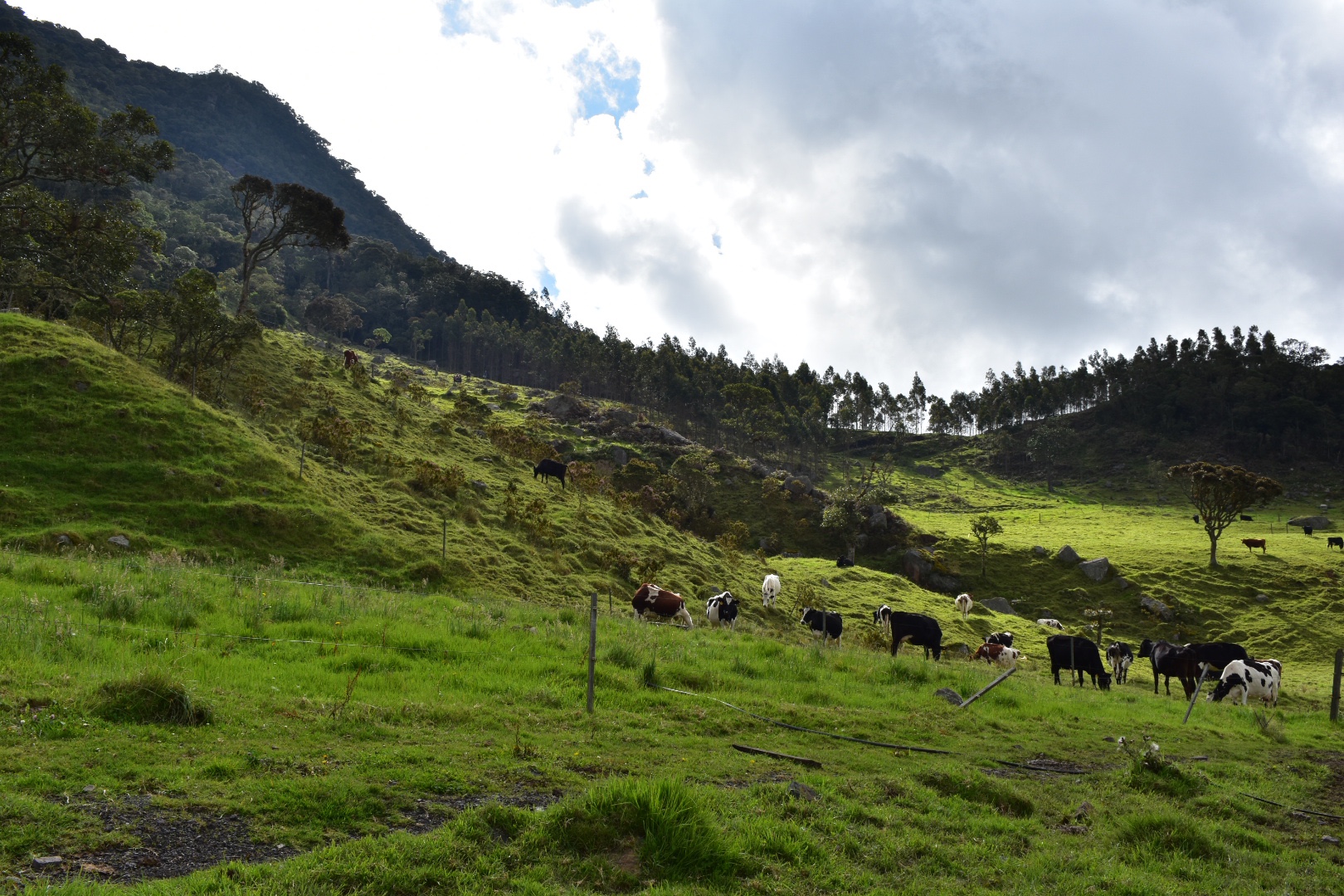
Everyone sped along on the hike, most people were now realising the distance that we still had to cover. the temperature was beginning to drop and people were hungry. The landscape was stunning and I was very happy to enjoy it emerging as we reached the crest of every hill.
The cliffs were now completly out of the clouds at times and we were able to enjoy them from afar.
We soon reached the farm but for now no one was home. We waited for everyone to catch up and it took a long time for the guy with the painful foot to join. In the meantime he was lucky as the farmers returned while we were waiting and Felipe bargained passage for the guy on a moto.
As soon as this was sorted Felipe gave us the lowdown and told us which road to follow all the way to the town. We all knew the bus would have left by the time we had arrived so we needed to find another way back to Bogotà. With the sun setting as still a long way to go time was of the essence! It was 4:10 pm and according to the map it was 6.5 km which is over an hours walk. Although it was more like 8 km by the end. We all walked off at speed to the town.
The final part of the journey was long and challenging. We had also run out of water by this point and I wished that I had brought my water filer with us. It wasn’t helped by the fact that we had to rush half of the hike in a few hours when we were tired. Then to top everything off it started to rain. I was thankful for the waterproof coat and trousers we had brought – Angela’s were a new addition. For a time it felt like we were hiking in a cloud but then we came out below it. It was all downhill which made it easier and walking along the road meant we made really good timer. There were a lot of large puddles crossing the entire road and a couple of streams to traverse.
The road was largely stones which makes it more challenging to walk but we kept up a fast pace. Soon the faster members were out of sight and had raced ahead on the road as it twisted downwards around fields and mountains. Occasionally there were switchbacks and I was more concerned about the half of the group that ended up behind us. Although later on I realised some of the better walkers had stayed behind to support the slower.
I knew that we would not reach the town before dark and was worried about the light – we only had our phones as I hadn’t anticipated needing a torch. This might be something that I pack in future as there have been a couple of times where I’ve worried about the night drawing in.
There wasn’t much in the way of houses or shops or passing traffic. About a third of the way into the journey the guy with the foot passed us on a motorbike waving and smiling to everyone. He didn’t seem to grasp that we were all in this situation because of his stupidity. Eventually I realised that the road we were on took us along the longest path on Maps.me. As I said above there are shorter paths but I didn’t see any obvious ones while walking. Then again we just wanted to get to the end of the road as we were pretty much alone by this point.
With about 1.5km to go it turned dark enough to require the torch so I used my phone as a light, and then a lot of motorbikes appeared leaving town. The closer we got the more houses appeared and then I realised we needed to take a left turn to get into the town. If you stay on the road it will take you out again.
There was no one waiting for us and we caught up with a few others at this stage, so as a group we headed for the Plaza and found Felipe and the rest of the group. It was just after 6pm. If you do arrive before the last bus for Bogotá has left then you catch it from here. I’m not quite sure where but ask around.
I went to get some water and crisps and while I did some transport had been arranged. It was for half the group and Angela volunteered to wait for the others. It turned out that the guy who hurt his foot was supposed to help arrange transport when he arrived in town but instead he sat in the plaza and did nothing, turning his phone off leaving Felipe in the dark. A nice way to pay everyone back.
The second half of the group arrived around 20 minutes later and we were soon in the back of a pickup transport to the main road. It was a long quie trip back in the pickup. We were cramped in and all tired so we sat recovering with our own thoughts for company. IT took us as far as the main road to Bogotà where we disembarked and paid the driver. He stayed with us and helped to flag a bus which took us the rest of the distance back t Portal 80. It went further but at this stage we jumped out and took and Uber back to the house. It was around 9:30pm at this stage and I didn’t want to mess around on the Transmileno.
I ordered Burger King as soon as we were in the taxi and it arrived just afer we did. We ate hungrily and sank some beers before we turned in and had a well earned rest.
>How to Hike Cuchilla El Tablazo Solo
You need to take two busses from Bogotá to arrive at the beginning of the trail, assuming that you are going downhill. You can hike starting in Supatá which is worth considering but you will be adding on 9km to the hike and the vast majority will be uphill.
Go to Portal 80 on Calle 80 and from here take a bus to Subachoque $5400, a small town, you can take the bus from the main road. From here you need to get to Laguna del Arce $5000. Its a 9km walk or you can take a bus from the plaza. There is one that leaves close to 9am and I believe that there is a regular service. I would not aim to leave any later than 9am as its a long hike.
When you are dropped off by the laguna take the road to the left, uphill, until you reach the radio towers at the top. From here you can get an amazing view from the top. Fro the car park walk right and away from the towers, which is basically walking along a path which takes you parallel, to the road you have just walked along. When you are finished head back to the car park at the top. Follow the road to the end and then walk around the remaining complex. At this point you should be on the trail that leads to Supatá. From here allow 6 hours to reach the town.
At Supatá head to the main Palza, its not on the map but you can’t miss it as you can see the church. From here you will be able to take a bus direct to Bogotá $10000 and will take at least 2 hours.
In total the busses will cost you around $20000 per person. There are no entry fees on the trail.
Equipment to take
Once you start the hike there is nowhere to buy supplies and with this being close to Bogotà make sure that you prepare for any eventuality. Bring the right equipment and make sure you have enough food and water. This is a long and relatively challenging hike..
-
-
- Gortex hiking boots, if you don’t bring anything else make sure you wear decent shoes. Boots are better as they offer ankle protection.
- Waterproof jacket
- Waterproof trousers (you could live without these on most day hikes but once you have them you won’t want to hike without them)
- Dry bag or packback cover (I take both)
- Cell phone
- Cell phone battery
- Charger cable
- Sunglasses
- Sun Cream
- Painkillers
- Blister plasters (better if you have a small first aid kit)
- Hand soap
- Tissues
- Water filer
- Sun hat
- Food (make sure you bring high calorie and this is also your change to binge on sugar – you are going to burn in)
- Water 3 litres minimum
-
Clothes
Again make sure you take decent clothes. I might go a little over the top as I brought all my equipment for Patagonia but you can’t go wrong with the following. I don’t always bring all the layers listed below but the layers will keep you warm.
-
-
- Base layer
- Jumper
- Fleece
- Down Jacket
- Hiking trousers
- Hiking underwear (trust me it stops the chafing)
- Hiking socks
-
If you enjoy this hike and are looking to explore others then check out Parque Natural Chicaque set in a beautiful cloud forest and surrounded in mist. Or you can visit Parque Ecológico Matarredonda, a stunning palmro right on Bogotà’s doorstep.
6 Pingbacks