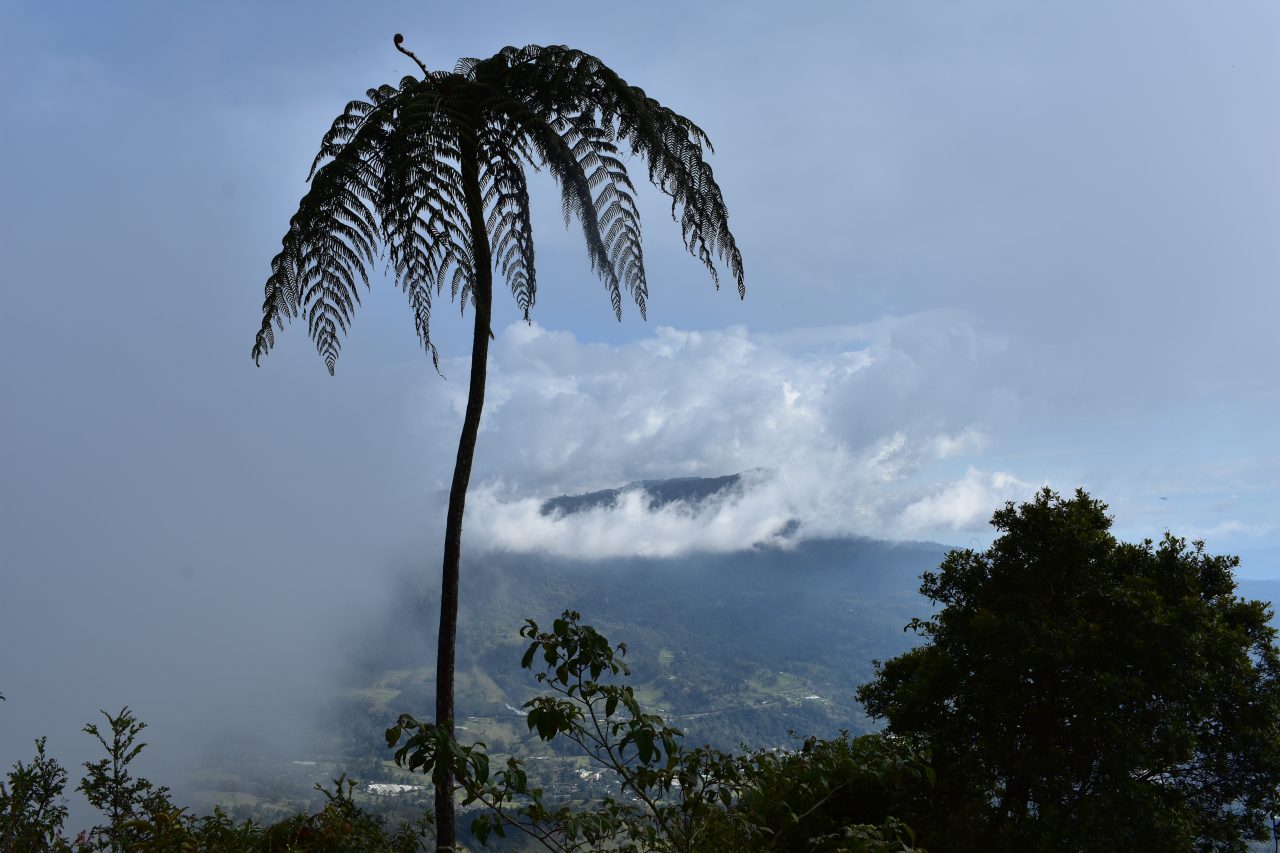
Parque Natural Chicaque is set in a high mountain cloud forest a stones throw away from Bogotá. The wind blows the clouds around the mountain tops allowing you to snatch glimpses of the valley below as you descend with an ever changing view. The lush green forest has so many unique plants you will feel as if you are in a jungle a world away from the smoggy capital and it is well worth a visit. The well marked paths are perfect for all ability hiking and the park is open for bird watching, camping and horse riding or you can ride in one of the jeeps to the hotel and relax.
If you enjoy cloud forests hikes and the lush green forest walks check out my guides to Cucilla El Tablaza a 20km downhill hike starting in the páramo west of Bogotá and Pionono Park just to the north of Bogota in Sopo where you can also visit Colombia’s favourite dairy.

Information

Our Story
We set out around 6am to get to the southern part of the city Sorcha. It’s about an hour to ninety minutes on the Transmilenio. Following the instructions I’d found online we crossed the bridge and ended up in a hectic part of Soacha. I could see some local busses one block further but we realised it was the wrong place and headed back to the bridge. There are a lot of bicycletaxi there and we spotted the guy in the orange coat who would take us to the park. The busses are due to leave at 7, 8 and 9am but take that with a massive pinch of salt. He wrote down our names and said we had time to get some breakfast so we headed to a cafe that he pointed out to us.
I was worried about the time so opted for a coke and after I realised Angela was having something more substantial I opted for some scrambled eggs. One thing I do like here is that they make scrambled eggs with tomatoes and spring onions. After a good 20 minutes we headed back to the bridge and were directed to a minibus. Under the bridge the smell of urine was so strong that it made our eyes water. But we were soon sitting on the mini-bus and were joined by another guy. I had read that the busses will only go when full and we waited a good 40 minutes before we were ushered into another full minibus. I noticed that some of the people from the cafe were also on the bus. So there is absolutely no reason to rush. Then we were on our way.
If you take this route then the park is about a 30 minute drive out of the city. As we disembarked we paid for the journey and were asked about the return journey where we put down our names. Busses return at 3, 4 and 5 pm each weekend. There is a restaurant when you first get off the bus and you have to again give your details which are written in a book. The restaurant looks really good so if you can it’s worth trying the food. It’s also cheaper than the shop close to the park entrance.

The day at the top here was beautiful and sunny and I could see clouds coming out of the valley. We stopped at the information point where they have a model of the park, with the trails, there are a fair few loops in the park and you should easily be able to trek around all of them, at a push, if you are fit enough. Afterwards we headed to the park entrance, which is a yellow building, which also sells some snacks, so stock up now. It was $17000 each and once we were through there was one main path down into the valley. Initially the steps are well paved as you begin the long descent. It wasn’t long before we saw a group of people practising yoga in the mist, I wasn’t sure how they had managed to arrive so early but we passed and continued to descend down the steep hill and soon the track turned into the forest and became a dirt path.


There are plenty of clear signs posted along the route so it is difficult to get lost. Our intention was to hike down to the lake, stopping at various points along the way and then after visit the waterfall, which is the path that traverses the far side of the park.
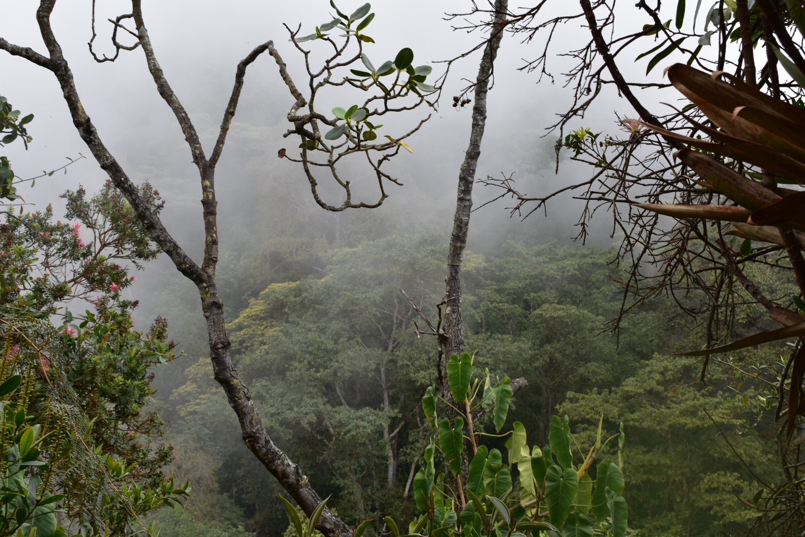
We look a left and followed the switch backs down through the forest. We were surrounded by clouds and couldn’t see far at times. It wasn’t temperature was mild and the trees made beautiful patterns in the clouds. A groups made of much younger hikers quickly passed us as they continued into the park. Following the signs we took another left which led us away from the main road and onto a trail, which levelled off, before taking a right and leading us back down the hill. We saw a sign for the black cliffs so decided to follow.
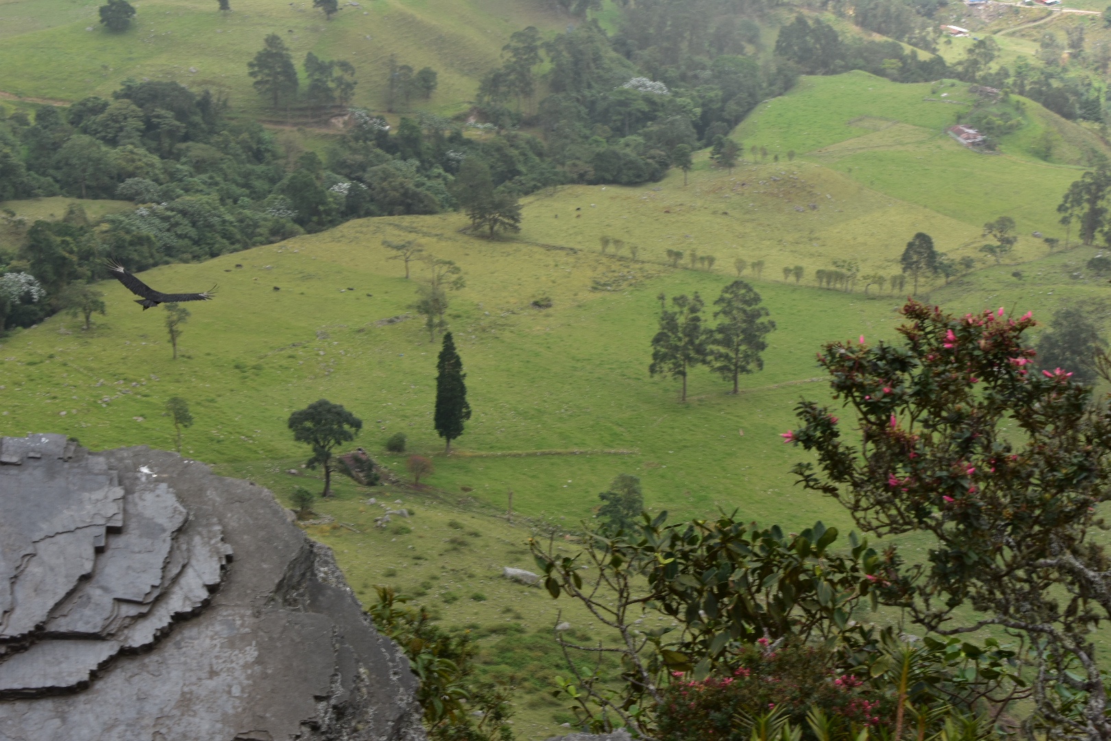
After a short climb we ended up in a maze of rocks from which you can traverse and climb up to the look out point. Its not particularly treacherous and we saw some very small children had also been pulled up when we arrived at the top. There was a lot of cloud so I held off taking photos as I had a feeling it would clear, which it did…a little.

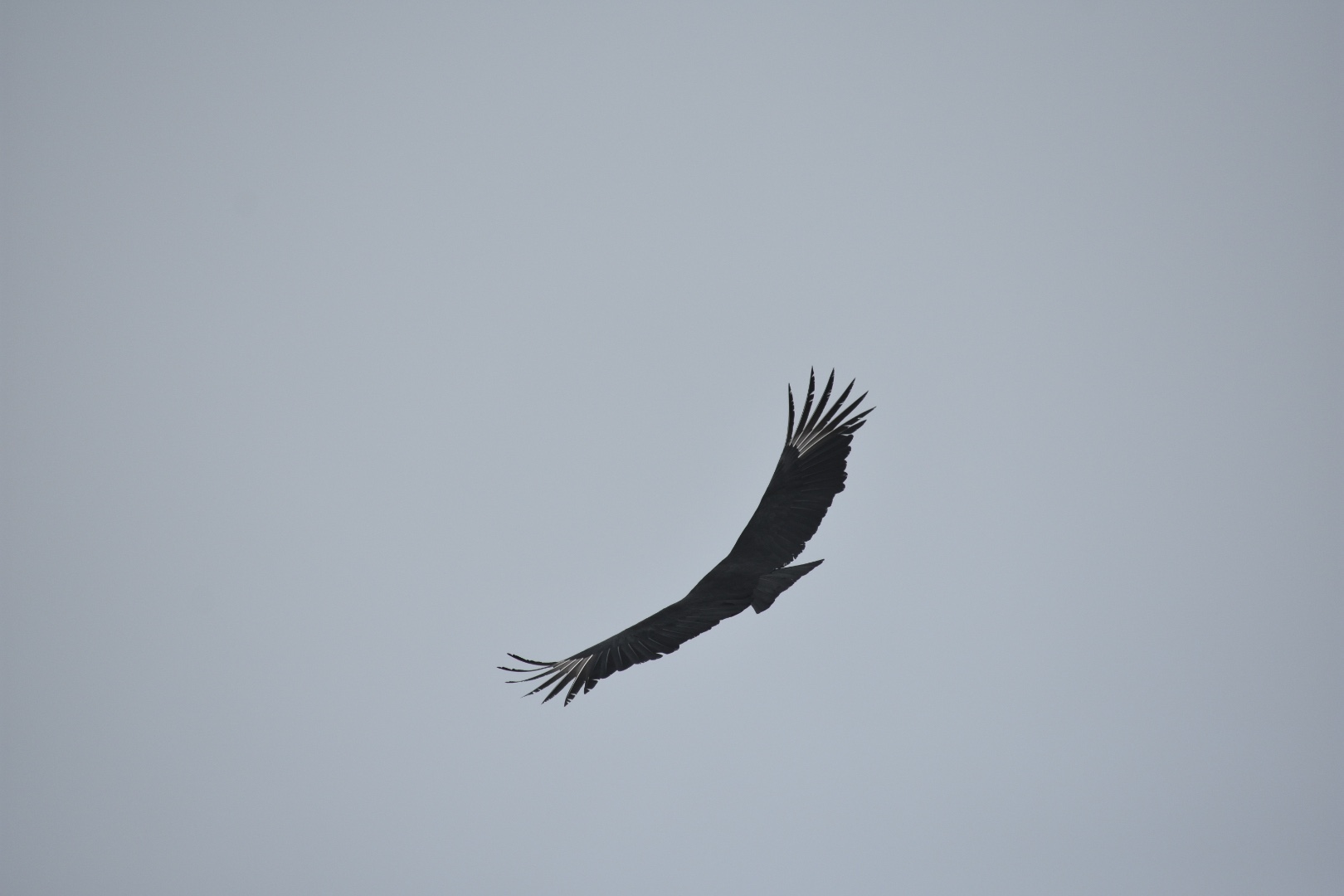
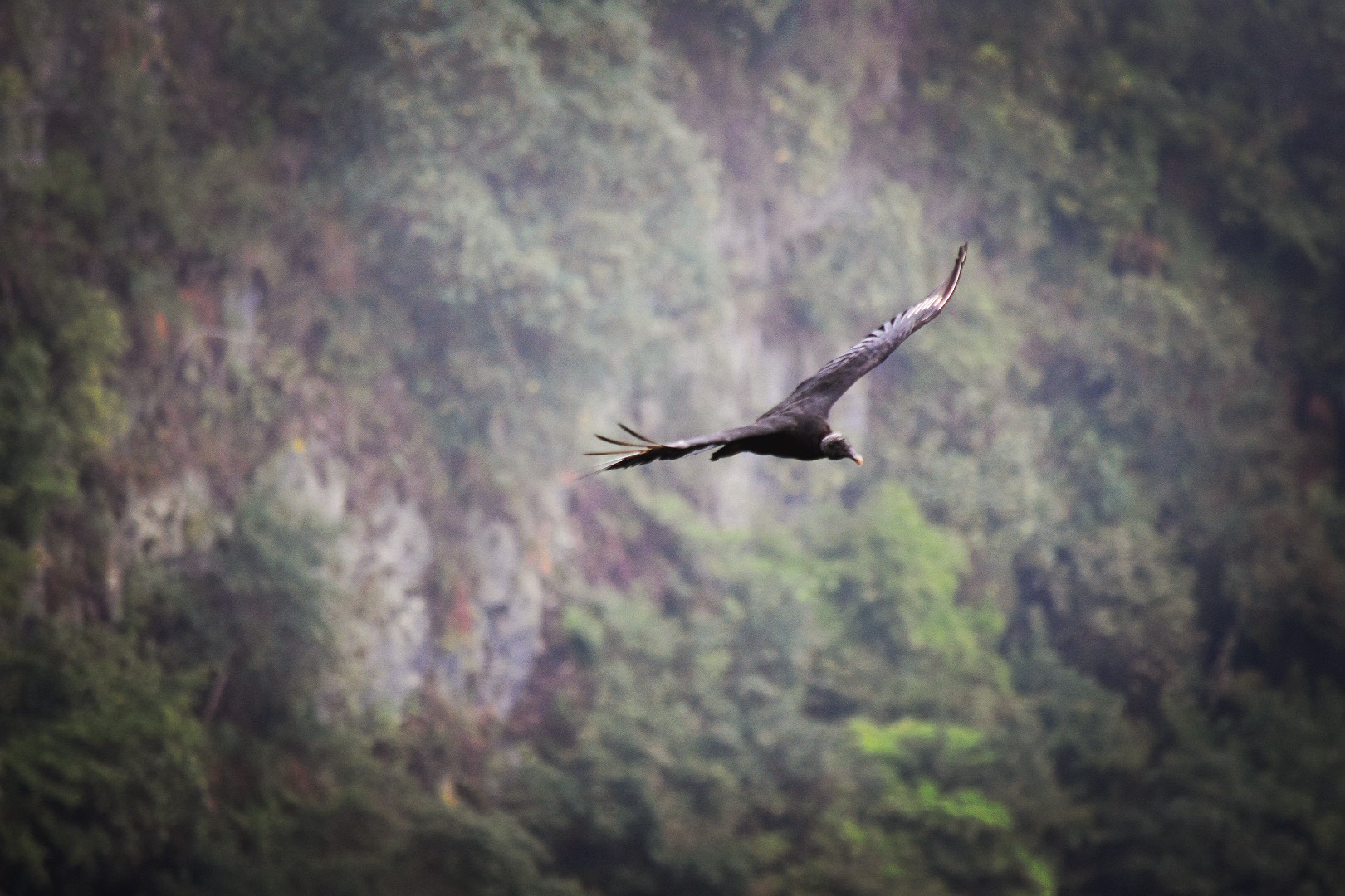
There were around 10 people there when we arrived and after they had left we took up a seat on a rock and noticed some birds circulating. I tried to shoot them as they passed, which was challenging, and then they landed on a rock nearby. We soon realised that we might have been sitting on their target rock but they seemed happy for us to be close.
I never had expected that I could get this close to the birds but they do say that this is a great place to do bird watching and now I can see why.


Another group of people arrived and the birds flew away we took that as our cue to leave, we had already eaten a lot of our snacks during this first stop and knew that we had a long way to go.
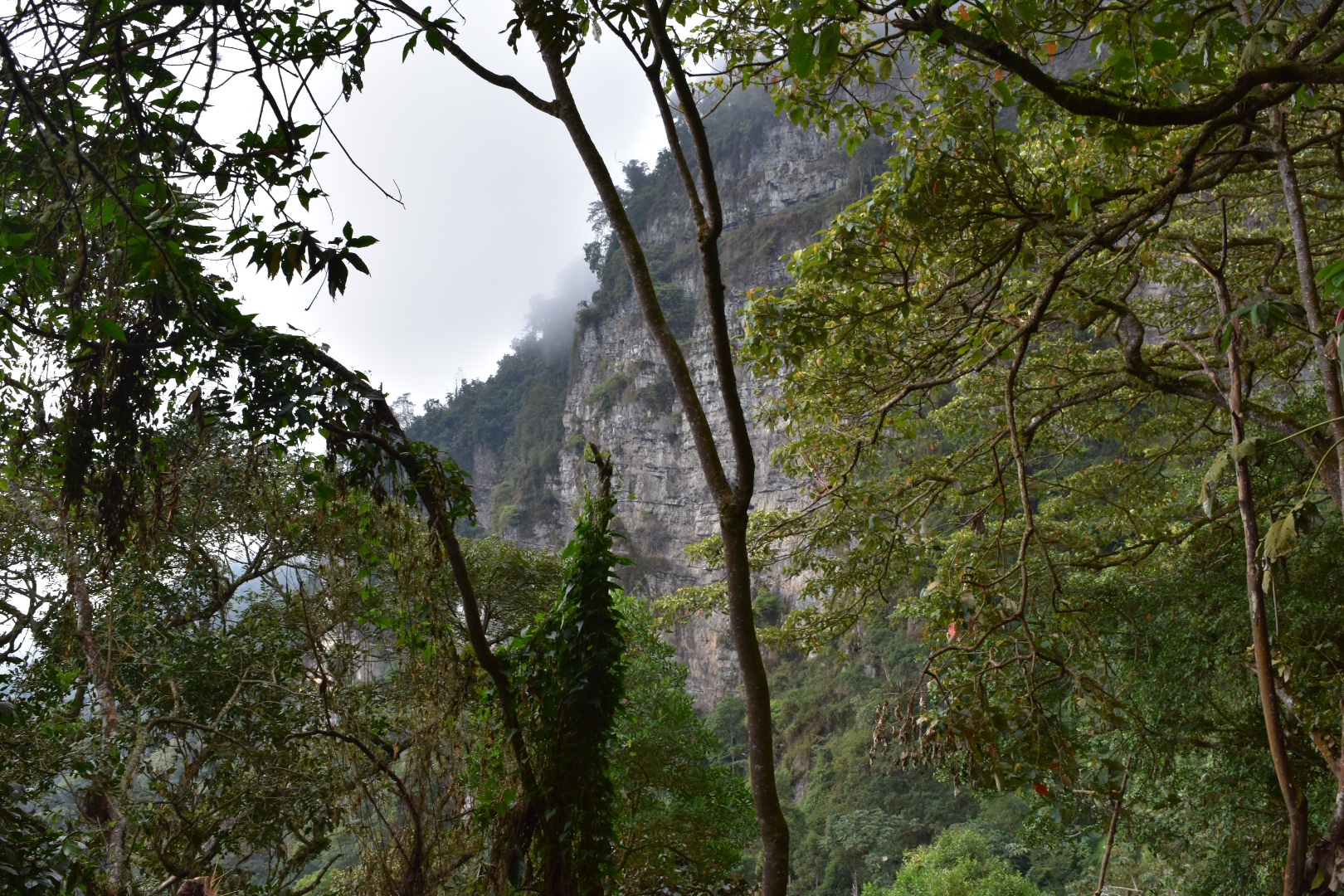
The photo below gives you a good illustration of why this is called a cloud forest.

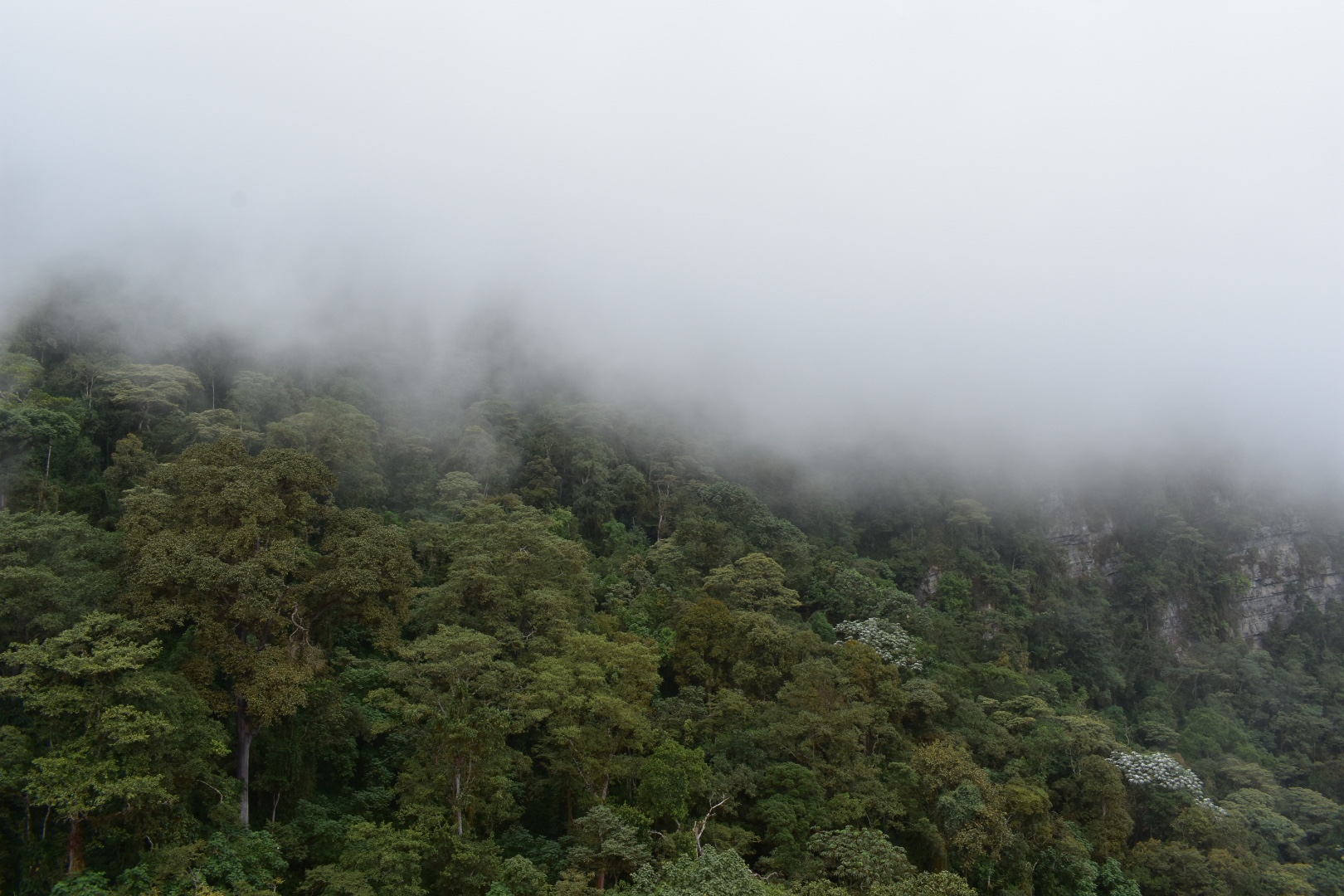
And the clouds did start to disperse a little so we were given a better view of the valley.


After reconnecting with the path towards the lake we continued for a short time before the red route cliffs path led off to the right. This led us up and along a ridge line in the clouds. It was a fun diversion and we had to climb over rocks and through some bushes – this was not the most frequented path. It was really cloudy and we didn’t really get to see any views. The path was challenging in places, and didn’t seem frequented by man people, I think you could easily give this one a miss as there is not a lot to see unless you wanted an additional climb – it’s not the same as the black rocks where there is a decenlt look out location at the top.
It took us a decent amount of time to get up and then back down to the main path and when we did a sign pointed to the lake being further back to the left than it had been before we started on the red path, in the direction that we had come. By taking the red path we had circled around it somehow. Being tired and having a long way to go we decided to continue to the right and explore the rest of the park. but by the time we had reached the end of the path the lake was a lot further away then it had been at the beginning.
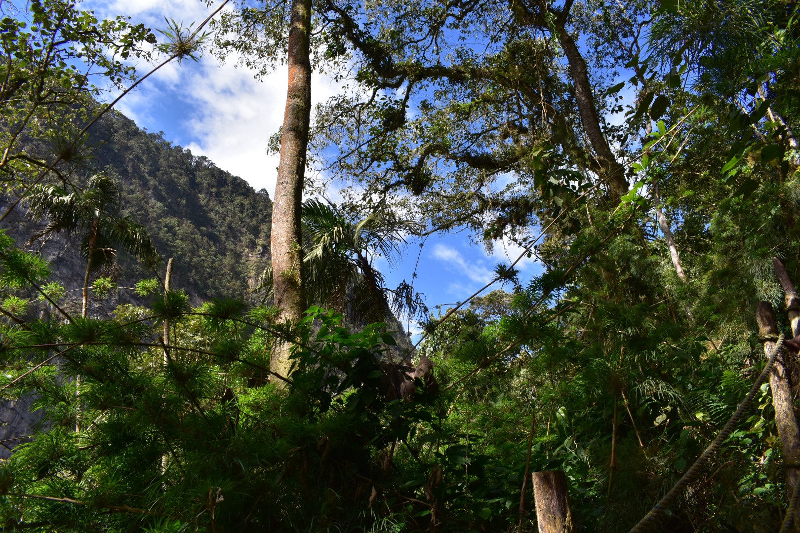
After a little more walking we found a clearing and stopped for lunch next to a boulder. A few people walked past and it was a pleasant place to stop. When we continued, we realised that we were not far from the lodge. We headed back into the forest and followed the path as it twisted through the trees and soon came out on another, much larger clearing, where you could see the cliffs surrounded by mist, and right in the middle was a giant lodge. We decided to quit and have lunch and afterwards continued along the waterfall path. This soon led us into a clearing where there was a hotel and you could see the famous rocks.


As we got closer a dog came out to greet us. You can actually stay in the lodge, if you wanted to spend more time in the park. I don’t know the costs but it is a beautiful place to spend a few days. There is also transport from the park entrance to the lodge if you want to take it. We didn’t see it but we did hear it pass several times on our ascent. There were moments when we did wish it would stop and wait for us.


There were some cats around so I took the obligatory animal photos before we continued towards the waterfall.


To hike to the waterfall you will head back into the forest. You can approach this from two directions and the path takes you around in a 5km loop starting and finishing in the clearing by the lodge. We took the left path which look as through a campsite with several tents – the group that had passed us hours ago was sat here relaxing having set up their tents already! We waved and carried on.
The walk to the waterfall from here is fairly flat, with the path weaving through the forest and up and down, but there are no major climbs. On a clear day you can see the valley and surrounding cliffs in the distance.

we made slow progress as Angela’s feet had starting hurting. It was on this hike that we realised the boots she had purchased were definitely too small and would need replacing. There was nothing I could do to help at this point as we were the furthest point in the park away from the entrance and there was nothing that we could do other than to hike back.
We took a few moments to enjoy the waterfall and then realising that we only had 3 hours to make it back for the last bus we decided to leave at a quick pace. We actually made it back to the entrance in two so needn’t have walked so fast. Angela’s boots were now causing a lot of pain and I don’t honestly know how she did it but I encouraged her and as I’ve said many times in this blog, if you just put one foot in front of the other sooner or later you will arrive at your destination. The only other thing to mention is that to get out of the park from here it is all uphill. That’s not strictly true as again its fairly flay until you reach the lodge, a fair few up and down hills but nothing sustained.


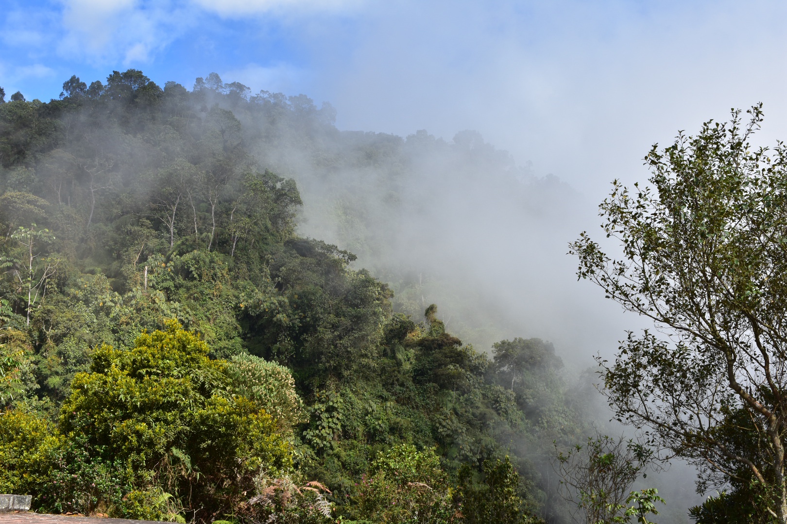
Once we had arrived back at the clearing with the lodge the cloud had cleared a little and we could get a much better view of the cliffs.


It was then time to start the climb back up to the entrance. We followed the signs away form the clearing and along a path we had trodden earlier. Taking a left we started heading up. I wouldn’t say this is relentless but it is by far the hardest trek in this path. That’s because it just takes you up, and up and up and up. There are steps in places and the path is clear and well cut. Its mostly switchbacks through the forest and it crosses the road occasionally.
The sun started to break through the clouds and we could begin to see the magical views that had been obstructed all day. But we kept climbing. At one point we had to follow the road and a few hikers caught up with us. There was a park ranger waiting at the corner at a shelter and we could have waited here for the elusive transport but at this stage we felt so close that we should continue. There were times when we both regretted this decision but in the end felt better for it.


The weather kept improving and we started to see swathes of blue in the sky. This is perfectly normal for Bogotá as often on one side of the mountain you will have blue skies and it can be completly cloudy on the other.


And after a hard climb we reached the top, well nearly there were a few more stairs. But this time we could see across the entire valley. There were more steps to climb, Angel took to them right away as she wanted to be done, as I took a few shots of the view. Back at the top we could see a few of the groups we had encountered during the day eating empanadas near the entrance and we grabbed a well needed coke. We were an hour earlier than expected and managed to get passage on the 4pm bus as there was enough space. We were soon on our way back to Bogotá and were dropped off close to the Transmileno station, which just meant we had to get across town before we could take a well deserved rest.


How to get to the Chicaque Park
The park is close to Bogotá being a 30 minutes from the south of the city. There are shuttle busses on Saturdays and Sundays, so I’d suggest you take one of these as if you use public transport then you are dropped at the main road and have to walk the extra 3 kilometres to the main entrance.
Shuttle bus
Each Saturday and Sunday there’s are shuttle busses that leave close to Terreros/Hospital Transmilenio station. When you arrive at the station walk to the bridge and turn right. After you cross the road and walk down the circular ramp you will see lots of bikes at the bottom waiting to give people a ride. In this area you should find someone wearing an orange coat who will take your name and give you an idea as to when the next shuttle will leave. Thy can also direct you to a cafe nearby if you need to get something to eat. The busses which leave at 7am, 8am and 9am and costs $6000 each way per person. In reality they leave when full and they return from the park at 3pm, 4pm and 5pm dropping you off at The Transmilenio station. For more information check out the parks website.
Entrance
The cost of entry to the park is $17000 per person. It is possible to camp, stay in the lodge or to stay in a tree house all of which sound like good options. Camping was around $30000 per person.
Before you get to the park there will be a model map of the park so do ask about which trails you can take. They are on maps.me but the trails seem to be a little out of date so make sure you follow the clear sings spread throughout the park to get to the various sections. You should easily be able to see several things in one day, including visiting the lake and waterfall. We saw a lot and also stopped for a long period several times to look at the views. But do listen to their advice and get them to help you plan out a day.
Equipment to take
There is a really good restaurant at the top adjacent to the car park and you can also buy snacks at the entrance. Once you enter the park there are no facilities to buy food, although I expect there is a good supply of food at the lodge. The altitude in the park is not too high and it is generally warm, just make sure you are prepared for the rain if you go during rainy season:
- Gortex hiking boots
- Waterproof jacket
- Waterproof trousers
- Dry bag or packback cover (I take both)
- Cell phone
- Cell phone battery
- Charger cable
- Sunglasses
- Sun Cream
- Painkillers
- Blister plasters (better if you have a small first aid kit)
- Hand soap
- Tissues
- Water filer
- Sun hat
- Food – bring a minimum of snacks as you might need the energy even if you can buy food.
- Water 2 litres minimum
Clothes
- Base layer
- Fleece
- Down Jacket
- Hiking trousers
- Hiking underwear
- Hiking socks
If you enjoy cloud forests hikes and the lush green forest walks check out my guides to Cucilla El Tablaza a 20km downhill hike starting in the páramo west of Bogotá and Pionono Park just to the north of Bogota in Sopo where you can also visit Colombia’s favourite dairy.
Ally
Is this safe as a solo female hiker ? Thanks !
david_lortal
Hi, the area where you take the busses is dangerous if you stray too far from the bus stations but the park itself is perfectly safe.