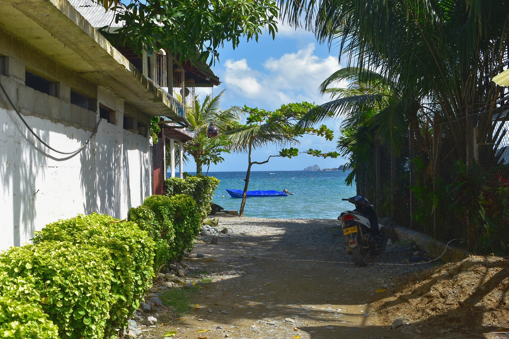
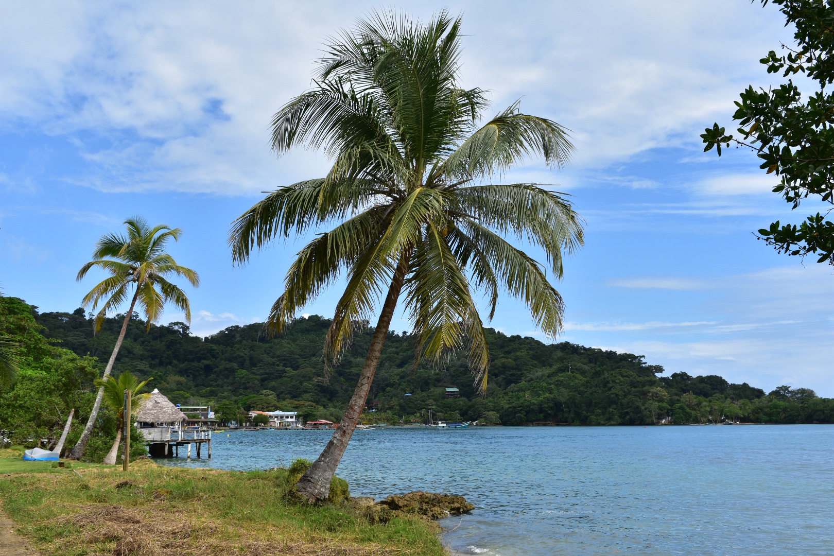
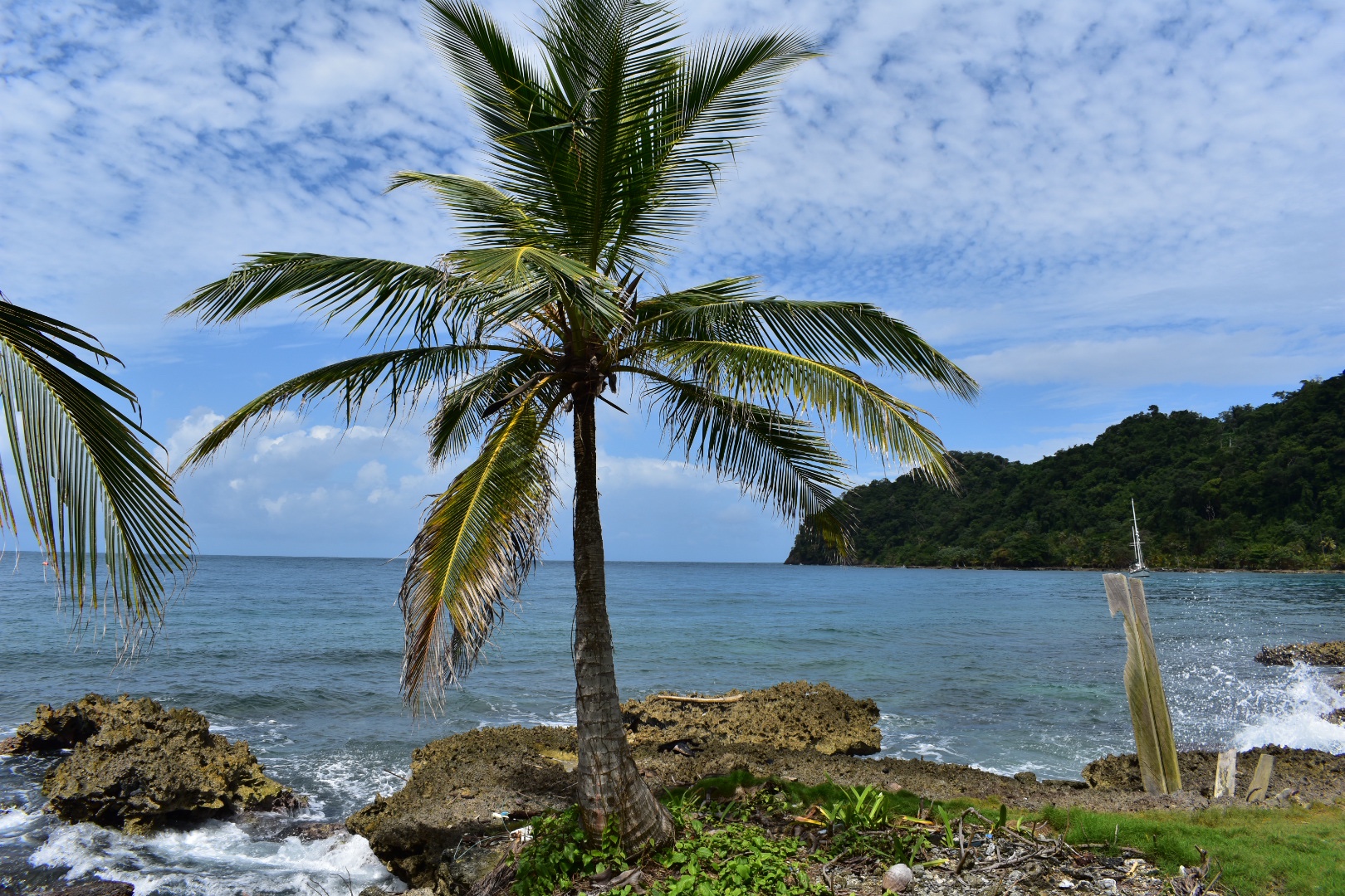
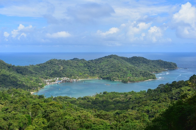
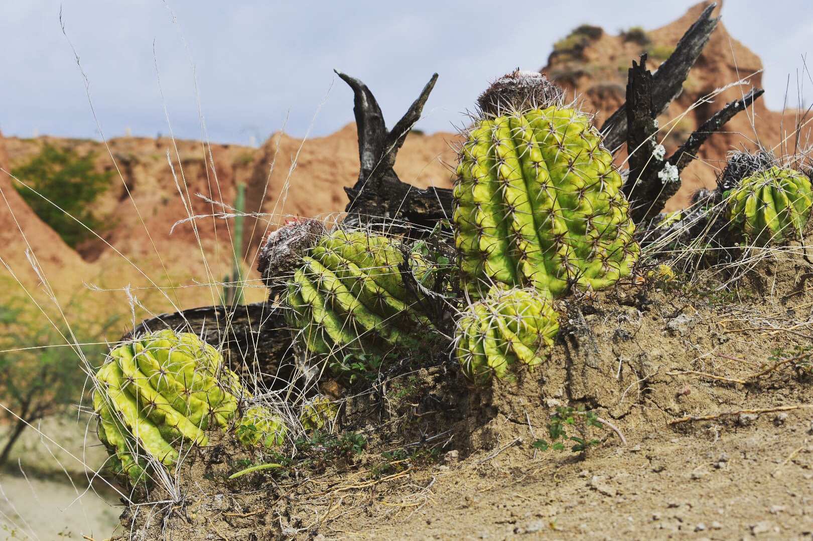
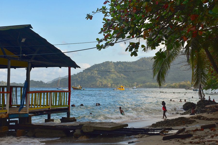
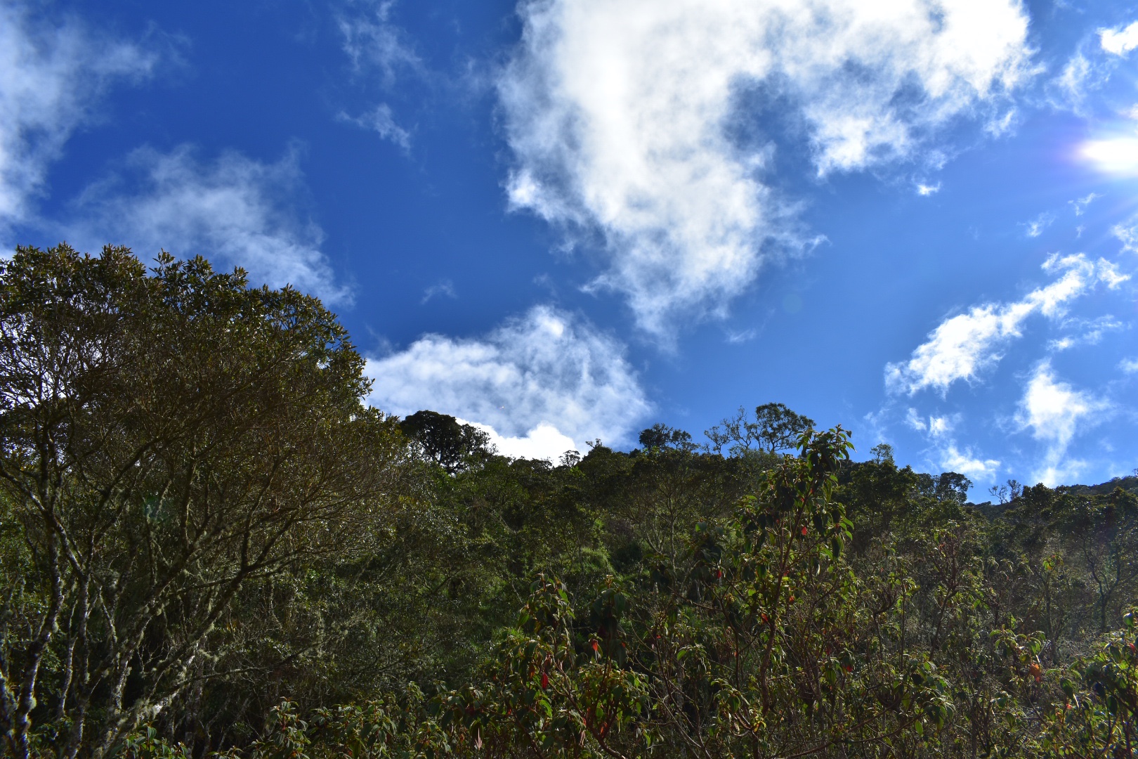
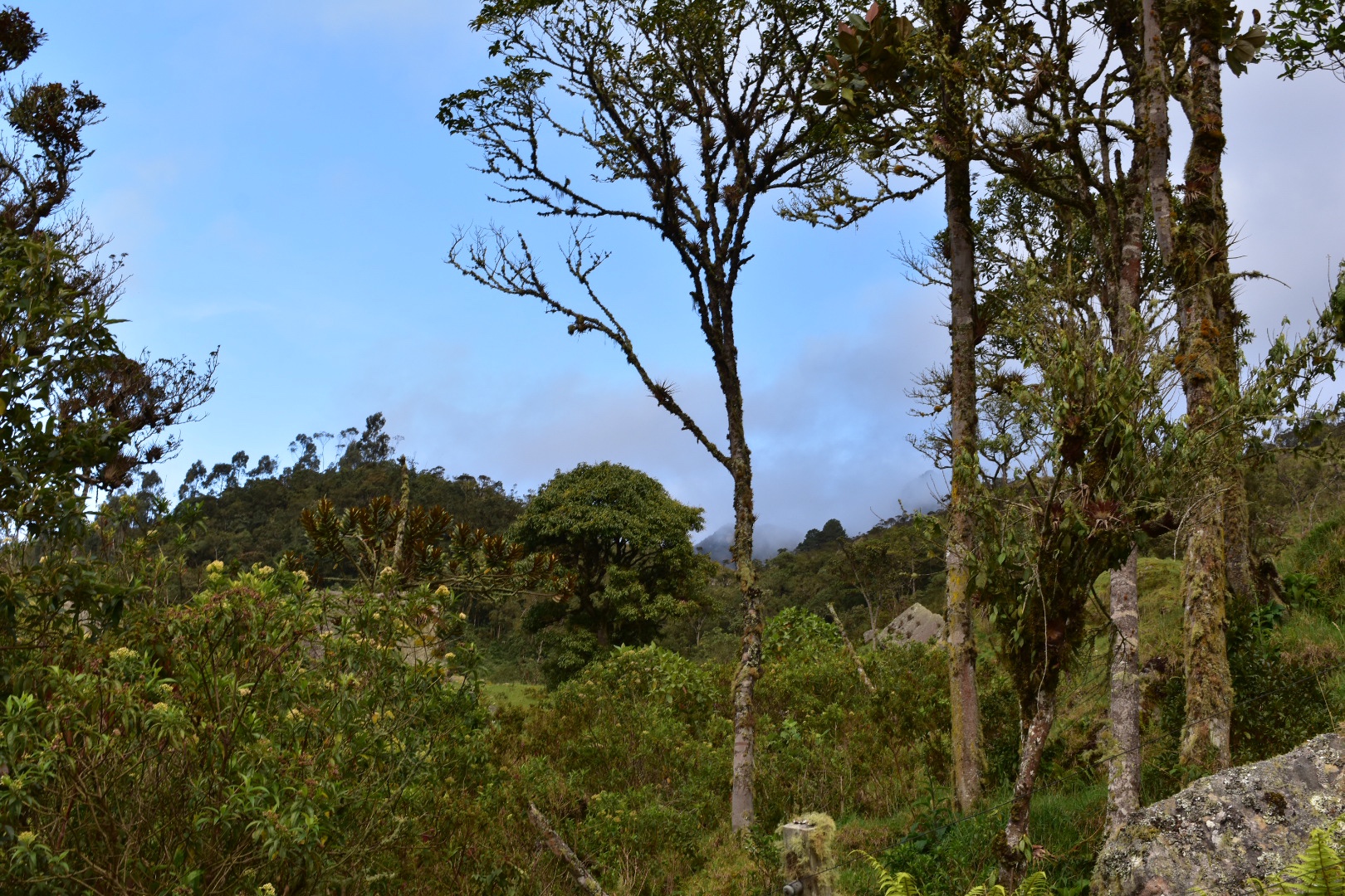
Thirty Something Traveller

Exploring Latin America 🇦🇷 🇧🇴 🇨🇱 🇨🇴 🇪🇨 🇲🇽 🇵🇪 🇺🇾

7 Stunning Locations You Will Want to Include on Your Visit to Colombia

In Colombia you can visit all the popular stops on the Gringo Trail, and you should, but for those with a more adventurous spirit you also have the opportunity to visit truly wonderful and stunning places that most tourists miss during their travels in Colombia. In this article I recommend visiting seven special places that you will regret missing and you will also experience a more authentic Colombia. From the high mountains of El Cocuy to the colourful rivers in the Amazonas, to the hidden Caribbean cost and the cool mountains of the far south, Colombia has much more to offer than tourist nightlife of Medellin or the organised tours in Cartagena. 

For more inspiration for your trip to Colombia read about 15 spectacular day and weekend trips across the Bogotá Savannah.

1. Capurganá

CapurganĂ  is a tropical seaside paradise located on the Caribbean in the north west of Colombia, close to Panama. The village is remote, on the doorstep of the Dorian gap, a  lush unspoiled jungle landscape. It is surrounded by tropical sandy beaches, is warm all year and is the perfect place to relax, hike and to get close to nature. You can spot monkeys, birds, iguanas and a multitude of species that inhabit Colombia’s jungle regions. Its the perfect place to escape from reality for a time, if you are adventurous enough to take the time to travel. The town could only be reached by boat and from here it was possible to walk across the border to Panama…more.

2. El Cocuy

One of the few opportunities in Colombia to hike amongst mountains with snow covered peaks. The huge National Park boasts of at least 15 peaks that top 5000 metres and an area of 306,000 hectares. The landscapes are truly beautiful containing unique fauna that is unseen outside of Colombia and some impressive hiking trails that are hard to beat. The park was closed from 2013 – 2017 while authorities negotiated with indigenous peoples in response to the damage and littering caused by tourists on the GĂĽicán–El Cocuy Circuit Trek, which is a shame as the trek looked stunning. Not its possible to hike three sections of the park. A local guide is mandatory and there is a fair amount of administration, so make sure you arrive the day before you want to hike, but the effort is worth it for this truly amazing unique Colombian hiking experience….more.

3. Caño Cristales

Caño Cristales is known as the River of Five Colours due to the striking colours of the Macarenia clavigera plants on the riverbed. The best time to visit is from June to November where the river is coloured yellow, green, blue, black and red. Although it is a treat for the eyes at any time of year. Practically inaccessible by road but a short flight from Bogotá or Villavicencio its located a short boat ride outside of the small town of La Macerina, a tropical paradise set deep in the Amazonas. The town is up and coming and has the fell the a party is about to break out at an minute. Surrounded by nature you can hire bikes and visit exquisite natural pools to cool off or have lunch in one of the more remote hotels and jump into the swimming pools or take a boat trip to see monkeys, dolphins and alligators…more. 

4. Tatacoa Desert

The second largest arid region in Colombia is a tranquil haven where you can take a few days out to relax and soak up the picturesque landscape. Surrounded by the Andes the sunset is specular as the colours change and  lightning strikes high over the mountains. Wake to the sun rise after a night in a hammock and spend the day hiking, cycling, horse riding or relaxing in the pool cooling off from the heat of the day. Tatacoa’s wonder is it’s remoteness, in the desert you really have the sense of solitude walking amongst the wildlife and at night you can slip away from the lights of the hotel and see the stars light up the sky… more.


5. San AgustĂ­n

A UNESCO heritage site situated in the lush green Andes of western Colombia famous for its archaeological park which contains the largest collection of pre-Colombian sculptures in Latin America. Little is known about their origins but it is believed they were created between 5-400AD. The sculptures are scattered around the surrounding mountains and you can taking walking, riding or car tours of the monuments. The town is more than just a stop off for the park and has a wealth of restaurants, including Arabic, and some beautiful hotels where you can escape the world for a time and just relax in this beautiful corner of Colombia…more.

6. Popayán and Volcan Puracé

Famous for its white buildings, colonial architecture and exuberant Holy Week processions Popayan is a beautiful local town to enjoy a few days. Enjoy the art, culture, food, museums and many churches that that make up this beautifully charming town. The proximity to Volcan PuracĂ©, a stratovolcano, topping 4600 metres is the prize of the PuracĂ© National Park. The park offers a multitude of hikes where you can enjoy bird watching and some beautiful waterfalls if climbing to the top a 4600 metre volcano is not your thing…more. 

Chicamoca Canyon

Chicamoca Canyon is the second biggest canyon in the world standing at 227 kilometres long and 2000 meters deep. Its an extensively beautiful  natural wonder not often explored by foreign tourists. I was sad to realise that it was not logistically possible for me to visit on my last trip to Colombia but it will be at the top of my list, along with hiking Parque de Los Nevados, when I return. The canyon is a mecca for adventurer seekers and hikers alike. Its an excellent place to go paragliding, canoeing, ziplining or take a helicopter flight. but the hiking is why I want to visit. The highlight for me is a three day trek through the canyon from Cabrera to Los Santos. For more information visit the National Park Website.

For more inspiration for your trip to Colombia read about 15 spectacular day and weekend trips across the Bogotá Savannah.

15 Spectacular Day Hikes Near Bogotá, Colombia

Bogotá, Colombia’s capital city, is sprawling a metropolis, which more than 10 million people call home. Situated on a high plateau in the Altiplano Cundiboyacense region of the Andes mountain rage, the average altitude is an eyewatering 2600 metres. Bogotá is surrounded by cerros easily exceeding 3000 metres and is the perfect base for numerous weekend and day trips where you can experience unique fauna and eco-systems of the Colombian high Andes which are not found anywhere else in the world.

This post is the result of seven months research and personal hiking activities. I took every opportunity to “escape the city” into the surrounding cerros and mysty valleys, exploring every opportunity that I could find. I have listed them here so that you can also easily find and enjoy the same treks.

For more inspiration read about 7 lesser known locations that you need to explore during your time in Colombia.

Day Hikes from Bogotá

There are a many day hikes that are easily reachable from Bogotá, some even start in the city itself and you can just walk up straight up into the cerros. Others are a short journey from one of Bogotá’s bus terminals or by car. The main problem with leaving the city is traffic and the slow bus system. Do make sure you leave early, and if taking public transport, which I would fully recommend take a taxi or Uber to the bus terminal. They tend to be cheap and the extra cost will save you the nightmare of crossing the city using the Transmilenio.

Note that all of this information was correct before COVID-19 restrictions were in place. Please do check before you travel.

1. Mirador Aguadora

23392a08-8345-448c-bea7-10953d24a9f1

One of the many many paths leading up into the mountains surrounding Bogotá is the Mirador Aguadora hike. This short hike is perfect for a Sunday Morning excursion and definitely one for the kids and when you reach the top you can see panoramic views of the city. Its a great little hike, especially if you have just arrived and want to get used to the altitude or if you are looking for something not to strenuous and want to avoid the crowds at Montserrat. And the best thing about the hike is that its absolutely free! Starting in Usaquen amongst the market and restaurants means you can finish off with a well deserved, beer, ice cream or pizza, whatever takes your fancy. For those looking for a slightly longer hike then this one is easily combined with the Camino del Indio (see below), which follows straight on when you reach the top…more.

2. Camino del Indio

c3aca45f-b122-4464-bcc4-f5fe7e4e96e1

Camino del Indio follows a path that the indigenous peoples of the Bogotá Savannah used to traverse that leads down through the evergreen mountain forests, east of Bogotá, to La Calera. It’s a stunning and short hike that takes you above the Emblase de San Rafael, the reservoir which is the lifeblood of Bogotá, which provides a visually stunning backdrop to this hike through the Andes. The 12km route can easily be completed in around 4 hours and there are a variety of ways to complete the trek as it can act as an extension to the Mirador Aguadora hike…more.

510b625c-0b43-4e2c-9478-9cb550d64246f9b7d404-0dc5-4432-8383-3487c3d7462a

3. La Quebrada la Vija

4ee4a08a-926a-4e4e-bae0-053fd9803015

Set in the Cerros Orientales, the mountains to the east of Bogotá, the great thing about Quebrada La Vieja is that it is 4 hikes in one. The hikes are short, well maintained, not too challenging and at the end you get a stunning view of Bogotá as your reward. Best of all they are completly free! Anyone who has been to Bogotá will know that surrounding the valley are lush green Cerros Orientales mountains often topping 3000 metres. The path was previously closed due to safety reasons and the number of hikers, over 2000 each day, causing damage. The government sensibly stepped in, have spend time re-cutting the paths, protecting the area and after ecological survey there is now limited access. You will need to make a reservation on the website and from there you can select a date and time to hike. The paths are open all year, except on Mondays for maintenance, or if a holiday falls on a Monday they will be closed on the Tuesday. It’s not a complex as it sounds…more.

94c6f909-b9c3-407c-9952-c591cd51a323780cf65d-e424-4d7b-b2fc-a2c1b441f1c9

4. Cerro de Monseratte

ba1efb8f-a8e5-49cf-913c-25bf2d7dc5e9

Perhaps the number one destination for panoramic views of  downtown Bogotá, for both tourists and locals alike, is CerrĂł de Monserrate. Famous for its church, where on Sundays legions of parishioners make their way up, via cable car, train and hiking, for the weekly service, the Cerro provides a little sanctuary from the bustling city below. Travel up in the evening to enjoy the sun set over the Andes and see the skyline come alive with lights or take an early morning hike and reward yourself with a deserved Agua de Panela when you arrive…more.

98210d91-9fa3-4afb-9c43-08aed0cd4963

5. Cerro de Guadalupe

542da4c9-de84-449f-8228-3d02933f71b5

The stunning CerrĂł de Guadalupe stands out in Bogotà’s skyline where the statue of the Virgin of Guadalupe, built by sculptor Gustavo Arcila Uribe in 1946 and the accompanying chapel are visible from vantage points across the city. Situated in the eastern hills across from CerrĂł de Monserrate, Bogotá’s premier tourist attraction, which also offers great views of the statue. CerrĂł de Guadalupe is much less popular, but arguably the more beautiful cousin, and is well worth a trip. The views of the BogotĂ  Savannah are  stunning, with a better angle to see more of the city and being less popular means that you can have the peak to yourself and enjoy a tranquil respite from the metropolis…more.

92c7894b-facf-4660-ba84-ebadf3c89935

6. La Chorrera Waterfall

e629ae3a-45d5-4d8b-8849-a9e5597da8da

One of the more frequented hikes near Bogotá, the La Chorrera waterfall is the highest waterfall in Colombia with a 590 metre drop and the sixth highest in South America. A short one hour trip on the bus will transport you to a different world, away from the polluted metropolis of Bogotá, where you can explore the green Colombian Andes valleys and trek Latin America’s 6th highest waterfall. Once off the bus you can either choose to hike along the 4km road or catch a lift in of the 4Ă—4 cars that will whisk you there from the main road. To see the waterfall at it’s best make sure you visit in rainy season or soon after as the falls can reduce to a trickle in the dry season. It’s a great day out and the perfect starter hike if you have recently arrived in Bogotá and want to acclimatise…more.

ecf125c9-ef87-478d-b7ed-bc76cc6b384c67087bae-0f43-4cb1-80b2-d4c21950a21b

7. Matarredonda Ecological Park

7beb7559-d74f-4930-a6e7-30818e30d99b

Parque EcolĂłgico Matarredonda is a páramo situated right on Bogotá’s doorstep. Less than an hours travel by bus you are transported into a different world far away from the pollution and noise of the bustling metropolis. The park is very accessible with well marked and maintained trails taking you through the unique páramo landscape, around blue lagoons and up mountain peaks of 3600 metres. The weather will also change your experience, expect anything from clear blue skies to deep rolling fog, meaning repeat visits are a must. Once you are dropped off by the bus you can grab a hot chocolate to warm you up before the hike and after you hike stop for lunch in the small restaurant close to the entrance…more.

22275f37-8149-4610-a651-b9fb59b8d904b74770b7-7abf-45fb-bcea-f3c598672458

8. Chicaque Park

bc8d42c1-5280-4e86-b6de-898b95432cbf

Parque Natural Chicaque is set in a high mountain cloud forest a stones throw away from Bogotá. The wind blows the clouds around the mountain tops allowing you to snatch glimpses of the valley below as you descend with an ever changing view. The lush green forest has so many unique plants you will feel as if you are in a jungle a world away from the smoggy capital and it is well worth a visit. The well marked paths are perfect for all ability hiking and the park is open for bird watching, camping and horse riding or you can ride in one of the jeeps to the hotel and relax…more.

120c8d7b-b5b9-46d4-a8c6-61f2ca3cd72a4a979ea0-eb4e-4798-a221-e447d404f965

9. Cerro Quinini

Cerro QuininĂ­, Bogota, Colombia

Cerro QuininĂ­ is located in a natural park situated high in the Colombian Andes. Surrounded by green mountains from horizon to horizon you can see birds of prey hunting in the warm coffee growing region. Located a only two hours drive from Bogotá you will be amazed how much the landscape and climate change in the short distance as the constant cold is replaced with warm and sunny days, with enough cloud cover to keep you protected when hiking. The small towns in the region make this the perfect weekend getaway from the bustle, cold and pollution of Bogotá. You can come and stay on one of the many coffee farms or in one of the small towns and enjoy playing Tejo with the locals…more.

Cerro QuininĂ­, Bogota, ColombiaCerro QuininĂ­, Bogota, Colombia

10. Chuchilla Cerro El Tablazo

2b795013-57c4-4561-aaf8-63fd4d313344

Cuchilla El Tabazo is considered the jewel in the crown of the Western BogotĂ  Savannah. Rising to 3500 metres high it serves as a natural wall the height of the cliff stops the clouds from the warmer climates in the regions below surrounding the palmero and forest in fog. This creates a mysterious landscape that is completly unique to this region. The wind currents that the birds use to glide reveal the beautiful landscape for miles and miles. From here you can hike down to Supatá, a small town set at 1800 metres where the temperature is tropical and you can wash back a beer before taking the bus back to BogotĂ . Descending 1700 meters over the course of 14km, you will see the vegetation change feel the temperature rising. This hike is a truly one off experience where you can walk down from the dense cloud forests into the local dairy farms situated in the picturesque lush green valleys far below…more.

74ac33fb-db4c-4017-8c84-5fa231444bb18c9647e3-84c1-46da-96e4-2138e8d285b7

11. Laguna de Guatavita

8ca3d084-1aa6-4591-930a-98fd8115c436

Laguna de Guatavita, one of the fabled locations of El Dorado, was once filled with with Gold and Emeralds. The small lake in a crater was considered sacred by the Musica people who left offerings for their Gods. Today its easily accessible from Bogotá by bus or car and for the more active there is a 7km hike along country green country roads to the entrance. The park is well maintained by CAR and their knowledgeable guides will take you on an extensive tour of the national park giving you detailed information on the history of the laguna…more.

3ca34b49-b93d-4461-b180-8b25b5342365

12. Pionono Park

d4684cc8-6c70-4b36-a02f-3b55347ed074

Located just 45 minutes north of Bogotá, Pionono Park is a peaceful mountain paradise located above the small town of SopĂł, which is home to Colombia’s favourite dairy, Alpina. After hiking up to the park, or taking transport to the entrance, you will experience the beautiful panoramic views of Guatavita on one side and the Valle de SopĂł on the other. You can relax in The Cabana Alpina enjoying freshly prepared deserts and sweet treats as a reward. The park itself is not too large, which makes it perfect for all abilities, and it will be a welcome relief for those who, like us, decided to walk up the steep road from the town…more.

7951216e-8151-4495-9a94-4b9eb1f5b60c

13. Suesca

a1db6a89-a1d1-409c-9fab-753d6a57c080

Situated on the northern edge of the BogotĂ  Savannah, an hour outside of BogotĂ , is Suesca. Famous for the Rocas de Suesca (Suesca Rocks) it’s a mecca for the outdoor activities. For the adventitious there are 500 plus climbing routes across the rocks, plenty of hiking trails, and many cycling routes. For those who require less of an adrenaline rush can take time to relax by Lake Suesca or eat in one of the many restaurants. Hiking along the ridge line along the top of the cliffs provide views of the surrounding area for miles around. The scenery is breath-taking. Or follow the railway and recreate the scenes from the movies…more.

d4c33c0e-5dab-4ba3-b3bf-0851568532a3d67e2a6b-060b-4623-96dc-de0cf49302565eeed405-5503-4cd0-ab8f-003e9f333c58

14. Farallones de Sutatausa

d0eb46b1-20cd-4b60-a4de-1f7260f505ee

The Farallones de Sutatausa are a stunning rock formation that form the back drop of Sutatausa, a small mining town 90 minutes north of BogotĂ . Sacred to the local indigenous peoples the 3000 metre peak is one place that you can see the Bogotá Savannah and surrounding valleys at the same time. As you climb to the top the views of the surrounding landscape unfolding below are phenomenal. The views combined with the unique rock structure and plant foliage make this a must visit destination…more.

20c675d6-7b57-4b49-bd93-433b3804047c0f464644-2564-4f1a-b82e-75d899c85d98

15. Laguna de Iguaque

01dd6f33-3750-4a7e-9064-497bfeb83f67

The Sacred Laguna de Iguaque (Lake Iguaque) is a high altitude Andean lake surrounded by stunning páramo. The Muiscas, the indigenous peoples from the region, believed that humanity originated from the lake when the Goddess BachuĂ© who appeared from the lake with a baby in her arms. The 14 kilometre hike starts in the green valleys of the Bogota Savannah and upwards through cloud forests which slowly let way to lush mountains giving you a panoramic view of the surrounding area. A three hour dive north of Bogota the hike necessitates staying in the beautiful colonial UNESCO World Herritage town Villa de Leyva for at least one night, which is perfect, as the culinary delights are a treat to feast upon the night before and to reward yourself with cold beers and delicious food the night after…more.

3220cd63-a64f-4b7e-8094-dff775dbcf925b564d42-0e83-44a5-8597-7411d078c0d4

There are of course a few places missing form this list as sadly I ran out of time. There is of course Chingaza National Park, which is only accessible by car, and a few more in the list below if you care to explore:

Along with many, many more. You only have to look at the trails that appear on maps.me to find the places that you can visit. Enjoy!

All the above links are to external sites and I have no control of the information that they provide.

For more inspiration read about 7 lesser known locations that you need to explore during your time in Colombia.

Plan a day trip to Parque Ecológico Matarredonda, Bogotá

Parque EcolĂłgico Matarredonda is a páramo situated right on Bogotá’s doorstep. Less than an hours travel by bus you are transported into a different world far away from the pollution and noise of the bustling metropolis. The park is very accessible with well marked and maintained trails taking you through the unique páramo landscape, around blue lagoons and up mountain peaks of 3600 metres. The weather will also change your experience, expect anything from clear blue skies to deep rolling fog, meaning repeat visits are a must. Once you are dropped off by the bus you can grab a hot chocolate to warm you up before the hike and after you hike stop for lunch in the small restaurant close to the entrance.

Read my guides to the La Chorrera waterfall, Latin America’s sixth highest waterfall, and Cerro de Guadalupe, that provides panoramic views of Bogotá which are both located on the same road.

Once inside the park there are two main walks you can easily explore without a guide, one to a beautiful blue laguna, and afterwards you can climb the cerro where you might be lucky enough to see Bogotá. The second is to another lake and a waterfall where you can cool off and swim in the very cold water. Both hikes are flat and each one can be completed in half a day.

b74770b7-7abf-45fb-bcea-f3c598672458

Information

  1. Our Experience
  2. How to arrive at Parque EcolĂłgico Matarredonda
  3. Equipment to take

22275f37-8149-4610-a651-b9fb59b8d904

Our Experience

The day after the hiking Quebrada la Vija I woke everyone up early to go to Parque Matarredonda. This was another hike that had been in my sights for some time and with the clear blue skies we experienced in Bogotá for the first 10 days of January 2020, which is unprecedented, I wanted to squeeze in one last hike before we left Colombia for Buenos Aires. In the end it was a perfect choice as it wasn’t too challenging for Lorenzo and we had a stunning day and landscape to explore.

We took an Uber to the bus station on Calle 6, Prarda de Bus Intermunicipal Transoriente, in Bogota. You can also take a Transmileno to Tercer Mileno, which is on Avenida Caracas one block away. Leave by the south entrance and cross the road walking directly to the terminal. You will be safe here as you will see the heavily guarded police station and also you are fine in the terminal. I would not advice exploring this area any further as it is a little notorious.

It was a Sunday and we had taken the bus from here previously on a Friday and Saturday with relative ease. Despite it being around 7am the station was full of people heading to the Inglesa in Choachi, which is the final destination of the bus you want to take. You will also see a lot of people heading to the Inglesa at the top Cerro de Guadalupe when you are on the bus. We managed to get passage on one of thebusses leaving taking the last seats next to the driver. Ask the driver to be drop you at Matarredonda, tickets are $4000 each.

The road is narrow, with twists and turns around the mountains. On Sundays, as well as the increased bus traffic, it seems that cyclists, joggers and people walking to the Churches like to dice with death on the road. As our bus and numerous other vehicles were overtaking cyclists riding double on a single lane road with oncoming traffic I was waiting for someone to be hurt or killed. My heart was in my mouth on every corner. Ordinarily, for Colombia, this is a fairly safe road and it wasn’t us on the bus I was fearful for, as the cyclists seems to have no care or knowledge of personal space. My advice would be just to avoid this road on a Sunday.

After around an hour we were dropped off in the car park which is right on the main road. We headed to the restaurant to pay the $8000 entrance fee. This is one place you don’t need bring food as the restaurant serves a wide variety, including hot breakfast and lunch. We stopped to eat our pre-prepared breakfast and brought some hot chocolate and took advantage of the flushing toilets before heading out. We started walking around 9am and I was really excited as the skies were perfectly clear and, as you can see in the photos, there was no one else around as you can see.

There are many hikes in the park, but most of them require a guide to be booked in advance. Luckily there are two which are easily completed in a day. Both should take around 2 hours, but it didn’t quite work out like that for us. You can go to the waterfall, we saw lots of families heading in that direction later on, which is the path that leads away form Bogotá or you can head to Laguna del Verjon, in the opposite direction. I wanted to go here as I had read there was a mirador from which you could see Bogotá on a clear day and I wanted to see if today it would be possible, so we headed to the lake.

The vast open landscapes were stunning and I felt particularly special as normally much of this would be covered in cloud. A distinctive feature of páramo is that it is wet most of the time but for the past few days there had been no clouds.

We began walking and Lorenzo started mimicking me taking pictures with his invisible camera. We played some games as we hiked slowly allowing Lorenzo to enjoy the surroundings.

The paths are well maintained and start off as the gravel trail above and then soon turn into stones. This makes it harder to hike but as this is often wet I understand the reasoning.

I particularly love this landscape, especially with the mountains in the distance. The plants almost seem not of this world and it a huge contrast to the green cerros surrounding Bogotá.

Lorenzo’s little legs don’t allow him to walk as fast as adults, although he does try, and a 2km hike is more like a 4km hike for him. He enjoyed exploring, looking at the plants and asking questions. Soon the other walkers caught up with us and went ahead and we were left alone again to explore.

There were puddles and tiny streams crossing the path in places so I can only imagine how wet this can get when there is a lot of rain.

As we got closer to the lake the cerros became much larger.

Okay maybe it was me taking a lot of photos taking up all the time as Lorenzo kept running to catch-up with Angela.

Close to the lake we saw this cross.

And soon after we reached the lake. It has taken us around 90 minutes to reach this point and all the other hikers were here already. Although upon our arrival they left as a group and continued. We decided to sit by the lake and enjoy the view.

I saw the other group on one of the cerros and I quickly looked at my map. They had reached their destination pretty quickly and I knew it was close so I said to Angela I wanted to take a look, thinking I would be around 20 minutes. Angela was feeling tired still from all the packing so stayed by the lake. Lorenzo decided to come with me as he thought the lake would be boring, so off we went to climb up the cerro.

The path takes you past the lake before turning right and starting slowly gradually goes uphill to the right of the ridge-line.

From here the path continues around to the other side of the ridge but you need to take a sharp left at the sign pointing to the mirador. From here the path becomes increasingly steep. It was fine on the day we were climbing but I can imagine it is much more challenging in wet conditions.

As is typical when climbing mountains each time you think you get to a point that might be the top you then quickly realise it was a false summit that there is still more to climb. I was keen to reach the top of the ridge where I had seen the others and when we reached that point I realised there was a mirador close to us. Lorenzo was enjoying the climbing and each time we reached one point he wanted to go to the next one, so we kept on walking.

This was one of the last false summits, I could see the other hikers going up and I nearly stopped when we became a little lost in the small peat bog at the bottom, imagine that on a wet day.

And the views made the challenge completly worth while.

From here we could also see Bogota. The Church in the photos below is Monserrate.

As we approached the top it became windy in places and I had to keep taking Lorenzo’s hat so it didn’t blow away. The path was narrow with some big drops, which and made me a little worried, but Lorenzo is pretty sensible and held my hand. I realised later that it might not have been the wisest thing to do to take a 5 year old up to the top of a 3600 metre mountain, but in my defence neither of us realised it at the time. He was loving the views and I feel he is sensible enough to follow my instructions.

The views kept getting better the higher we climbed. As we reached the summit I realised that we have been gone for around an hour, having left Angela at the lake. We also didn’t have any food and I only took a little water as I had thought it would only be a short journey. After taking a few minutes to admire the view we started back down. In my haste I forgot to take any photos of Lorenzo at the top which was something I regret as I feel it is a major achievement for him.

From here we could also see Bogota. The Church in the photos below is Monserrate.

And more photos from the top.

Going down was slow, it was steep and I kept holding back Lorenzo as he wanted to go faster. I ended up sliding a couple of times but he was fine. At one point we took a wrong turn and somehow left the path, walking down what must have been a small stream when it rained. When we got to the path there was a small drop, easy enough for me to climb down, but not Lorenzo. Luckily for me a couple of other hikers had followed us so between us we helped each other down.

Returning to the lake Angela was relaxed, although she had a headache having being in the sun with no shade to hide in. The climb to the cerro had taken us about two hours in total. We replenished out water and had lunch enjoying the view by the lake.

Afterwards the clouds started to arrive, but the day was still really bright. We were all suffering from tiredness and a little from the altitude as we walked back to the entrance.

It had been my intention to go to the waterfall after the lake as it wasn’t too far but the climb had taken Lorenzo’s energy and he couldn’t walk any further. To be fair we were all a little tired but I think I could have pushed on the the waterfall. Instead we decided to head to the restaurant and rested, before we crossed the road and flagged down a bus that was heading to Bogotá. This time the roads were much clearer and the journey was faster. Once back at the main terminal we took an Uber back home.

How to arrive at Parque EcolĂłgico Matarredonda

Getting to the Park is really simple. Go to the bus station on Calle 6, Prarda de Bus Intermunicipal Transoriente, in Bogotá. Take a taxi or the Transmileno to Tercer Mileno, which is on Avenida Caracas one block away. Leave by the south entrance and cross the road walking directly to the terminal. You will be safe here as you will see the heavily guarded police station. I would not advice exploring this area any further as it is a little notorious.

Once at the station book a ticket on a bus heading to Choachi, but tell them you are going to Parque Matarredonda, $4000 one way, and you will be dropped at the park gates. The bus journey takes around an hour. Coming back you can just cross the road and flag down another bus heading to Bogotá. We didn’t wait long and one bus passed us that was already full.

My advice would be not to go on a Sunday as the road and the busses are busy. The park is open from 8am –  4pm daily and it costs $8000 to enter. There is a restaurant selling full breakfast and lunch options as well as drinks and snacks. My advice would to bring food, just in case, and to make sure that you have enough water for the trip.

There are two main hiking trails:

  1. Cascada del Abuela – this walk will take you around 40 minutes and is the steeper of the two trails. Turn left when you enter the park and follow the signs. We didn’t try this due to time but I saw lots of families going there. You can swim in the water, but I think its really cold, but do bring swimming costumes if you want to try. Ther are paths marked on the map up to the cerros but I’m not sure if you are permitted to go further without a guide but the trails are clearly marked on Maps.me.
  2. Laguna del VerjĂłn – this is the tail we took which is described in more detail above. Turn right when you enter the park and the walk to the lake should take around one hour each way. You are not permitted to swim in the lake. The walk is on a well maintained path and is flat, so you don’t worry about getting lost. If you continue after the lake it is possible to climb to the mirador, Alto los Tunjos, as we did, but I was following a group with a guide, and I wouldn’t recommend doing in bad conditions or if you do not have much experience.

If you want more information especially regarding guides try the following contact details: Call 3178657320 or Email vjmatarredonda@gmail.com.

There is a lot to explore in the park and I think a couple of repeat visits are needed to see everything.

7beb7559-d74f-4930-a6e7-30818e30d99b

Equipment to take

There is a well stocked restaurant but I would always advice to bring some food and all of your water just in case it is not open. Once you enter the park there are no facilities to buy anything outside of the restaurant. This is a high altitude hike in a páramo, which is normally wet and cold, so unless you are in a heatwave, which we were be prepared for the rain and cold:

  1. Gortex hiking boots
  2. Waterproof jacket
  3. Waterproof trousers
  4. Dry bag or packback cover (I take both)
  5. Cell phone
  6. Cell phone battery
  7. Charger cable
  8. Sunglasses
  9. Sun Cream
  10. Painkillers
  11. Blister plasters (better if you have a small first aid kit)
  12. Hand soap
  13. Tissues
  14. Water filer
  15. Sun hat
  16. Food – you can never have too much and you will need it on this hike so pack appropriately.
  17. Water 2 litres minimum

Clothes

  1. Base layer
  2. Fleece
  3. Down Jacket
  4. Hiking trousers
  5. Hiking underwear
  6. Hiking socks

If you like páramo hike then read the guides to Laguna de Iquaque a high altitude lake near Villa de Lleva or Cucilla El Tablaza a 20km downhill hike starting in the páramo west of Bogotá.

Hiking the Quebrada la Vija in the Cerros Orientales, Bogotá

Set in the Cerros Orientales, the mountains to the east of Bogotá, the great thing about Quebrada La Vieja is that it is 4 hikes in one. The hikes are short, well maintained, not too challenging and at the end you get a stunning view of Bogotá as your reward. Best of all they are completly free! Anyone who has been to Bogotá will know that surrounding the valley are lush green Cerros Orientales mountains often topping 3000 metres. The best known is Monserrate with its Church and market, but increasingly the other cerros hills are opening up to hikers and walkers of all abilities. One is Mirador Aguadora, in Usaquen, and in November 2019 the Quebrada La Vieja reopened its doors to hikers.

The path was previously closed due to safety reasons and the number of hikers, over 2000 each day, causing damage. The government sensibly stepped in, have spend time re-cutting the paths, protecting the area and after ecological survey there is now limited access. You will need to make a reservation on the website and from there you can select a date and time to hike. The paths are open all year, except on Mondays for maintenance, or if a holiday falls on a Monday they will be closed on the Tuesday. It’s not a complex as it sounds.

If you enjoyed this hike read about the Mirador Aguador hike, which is a shirt walk to the cerros from the main plaza in Usaquen and can be combined with Camino del Indio. Or escape the city on a sunny afternoon and take the short walk up to Guadalupe.

780cf65d-e424-4d7b-b2fc-a2c1b441f1c9

Information

  1. Our Experience
  2. How to book and hike Quebrada La Vieja
  3. Equipment to take

Our Experience

After the Laguna de Iguaque hike I was hungry for more, even though Christmas was close and we had two weeks to pack, move twice and one of those was to Argentina. I was pushing Angela to go again the week after Christmas but after we started packing I realised that the “afternoon” I thought it would take turned out to take three whole days. I had given up on the idea entirely, as obviously packing took preference, when suddenly in the new year Bogotá was hit by a freak weather condition of cloudless skies. After three solid days of blue skies Angela suggested we go out and take advantage, so we looked for hikes that we could take Lorenzo on. I had wanted to hike Las Moyas, but it turns out this is still closed, but I also had Quebrada La Vieja on my list which had recently opened.

After a little research I was confused as there are four different hikes that are possible and we were only going to have time to do one. I was torn between a Cerro with a view over Bogotá and Páramo. In the end we opted for a Cerro as it appeared that the páramo hike was harder and I wanted to see the city when there were blue skies. I reserved three spaces for the Alto de la Cruz hike. To book you need to go to the website and select a hike, then a date and a time. You will then be sent an email confirmation which is scanned at the entrance, you don’t have to print despite the instructions. If you miss your time then you will not be let in, so make sure you are on-time.

I booked us on a 7am slotas it felt a more realistic achievement over 6am. We later found out that if you want to see the Los Nevados then you need to start at 6am or event better 5amon a weekday. These clear days were the perfect time to view but sadly for us we couldn’t rush as it wouldn’t be fair on Lorenzo.

We jumped into an Uber and were soon as the starting location Avenida Circunvalar with Calle 71. There is a short road with a stream to the south and residential buildings to the north and there should be people ready to check your tickets as you arrive. Once inside we saw more stewards and police and started walking uphill. Before long we came to the final steward position. Here one of the stewards was doing a presentation while the others scanned the tickets and issued all the hikers with numbers. Make sure you don’t lose the sticker as they will want to take it back to know you have checked out and its probably easier if you don’t fold it away in your coats in a bag. Bogotá is generally pretty chilly at this time in the morning but soon after we were warm from walking and packing the additional clothes away.

The first part of the path, Claro de Luna which is also bookable in its own right, is where all of the hikers have to walk until the three trails split off. I did wonder why anyone would just want to walk the first part but on the way back we saw several families with toddlers so it might be something to consider if you are unsure and a great starter hike for anyone with young children.

After being checked in we started walking up the trail. Much of the land is located on the water companies property and this trail is also used for access. Lorenzo was tired and after a Christmas and New Year of random bedtimes he wasn’t best pleased to be up and about hiking at this time. Soon after I gave him some trail mix he perked up and step by step was more enthused about the hike as he discovered new sounds, smells and challenges.

After a few hundred metres you leave the road for a well maintained path, that crosses some small streams several times and starts climbing a little more steeply. There is nothing really challenging in this section other than is can be a little muddy and slippery on some of the rocks. It also gets quite busy as everyone has to hike this section of the path.

As you can see above Lorenzo was having great fun climbing over all the rocks and running ahead. This part of the trail lasts for around 1km and after this you will reach a small clearing with more police and stewards. They will once again check your tickets and will send you onward for your chosen hike, or back if you only selected to hike Claro de Luna.

We had a quick break before continuing and walked further into the forest along the path close to a stream which became a little waterlogged at times.

There are clear signs to make sure that you can’t get lost. Some of the paths have been closed, for good reason, and you can clearly see the tape that has been used. If you look on maps.me, and you may see a sign on the trail, but it is possible to hike to Monserrate from here. I would not advise as the paths were not only closed for preservation reasons but also they come close to some of the poorer neighbourhoods in Bogotá which puts you at risk of robbery. Hence the heavy police presence during these times. It’s completly safe but if you decided to wonder off piste then you might find yourselves in trouble in more than one way.

There was another much larger clearing and we found a farm as well as being able to look at all the animals. We also had our first look at Bogotá from above.

The path keeps climbing steadily through the forest. Nothing crazy but you will work lots of muscles with the constant up.

It was a really beautiful day and the sun shining through the trees made it a little magical. Soon the trees start to change and as you get closer to the top you end up walking through a pine forest.

Soon after you start to see the surrounding mountains.

And then you come out of the forests into the bushes for that last push. This part is the steepest and we were not helped by the strong sun and lack of cloud, oh the irony of all my complaining in previous blogs, is that the sun, even at this early time of around 8am, was really strong and made climbing to the top a little more thirsty work than it might otherwise have been.

Still the scenery was beautiful and once we arrived on the ridge line we were teased with these views. As you can see by this time the sun has warmed up Bogotá and a combination of either clouds in the distance or pollution has made it impossible to see the Los Nevados.

A shot of Angela climbing the final stretch.

Another view of the city just before the top.

The cross in the photos below marks the top of the cerro.

And then just over the ridge above is the Mirador, which I think provides a much better view of Bogota than Monserrate. At the top there were around 40 people and a couple of police officers recovering and enjoying the view. There was a trail that led straight on into one of the more dangerous neighbourhoods and you can see why the police presence is necessary. Honesty, if I lived in those conditions I would probably see it as fair game to take money and phones from richer hikers too. But we are not here to discuss politics, we just want to hike in safety. We overheard an interesting conversation where people were discussing that the hike starts in one of the richest neighbourhoods in the city and in just a few kilometres ends in one of the poorest. Something worth considering.

We rested at the top for a good 30 minutes as we were in no rush. It had taken us a little more over an hour to get here, but we stopped many times for photos, for Lorenzo to discover things and to play. It was a beautiful day and had been fun. We left as we were not sure how long the police would be staying, but were told the police made sure no one was left behind when they returned. Angela was joking with the officer about how fit he must be getting coming up here each day.

We returned via the same way and checked out, jumped in a taxi and were back in the house by 11am, at which point Angela’s brother and his family were still asleep. I smiled as I realised I had turned into one of those people. All in all I really enjoyed the hike and if I had more time in Bogotá I would take on the others. As I’ve said they are short and perfect for children of all ages. Also it doesn’t take long to get out of the city and onto the fresh air, which really is amazing. The paths are aimed at everyone and are free, they are not congested with sellers so they really are a perfect family outing.

How to book and hike Quebrada La Vieja

You will need to book tickets to all of the hikes at least 24 hours in advance and the space on each hike is limited for each time slot. Entrance is free for all but you will not be permitted to enter if you have not booked. Head to the booking website and using the Google Map select the hike you want. Then you will need to enter a date. Remember that the park is closed every Monday, or the Tuesday if the Monday is a holiday. Choose a time, 5 – 9am on weekdays and 6 – 10am at weekends, making sure there are enough spaces on the hike for everyone you are booking for and then you will need to enter the information for each person indivudally. They are all grouped together for the tickets which will be emailed and there is no need to print them as they will scan form your phone.

It is possible to see the Los Nevados from the miradors on the hikes, providing the day is clear, but you will need to be there early, ideally starting at 5am and make you way quickly to the top. If you do start this early it will be dark so bring a light.

There are several other bookable hikes listed on this map and at this stage I don’t have any information about the others. I will update this section if I can find more information but for now the four hikes that make up Quebrada La Vieja are:

  1. Claro de Luna (1.6km 1 hour) – Is a hike that you will need to complete if you are hiking any of the other hikes listed below but it is also bookable in its own right. Its pretty easy, the first third is along a service road and then it follows a well cut, clear path that has a gentle incline. I’d recommend this for small children and those who are not looking for too much of a challenge. This path can get a little busy as all hikers must walk along to reach the starting point of the longer hikes.
  2. Alto de la Cruz (3.2km 2.5 hours) – Is the longest hike and we were told that is was the hardest, although Páramo Piedra Ballena goes higher and is further away from the city. This is the hike that we attempted, see above. It begins in the forest and is uphill for the duration. The last part is the steepest and there are a few small challenges along the way, but nothing taxing. The forest changes to soft pine about halfway and the final stretch takes up out of the trees and up to the top of the cerro where you can get a panoramic view of Bogotá and the surrounding mountains.
  3. La Virgen (2.9km 2 hours) – Is a slightly shorter and lower trail than Alto de la Cruz, which ends at a different Cerro offering views of Bogotá and the surrounding mountains.
  4. Páramo Piedra Ballena (2.6km 3 hours) – Takes you to a páramo close to Bogotá but up to one of the much higher ridges overlooking the city. Instead of circling back you keep heading east up into the higher ridges. I imagine this path is much steeper than the others as it is higher and its advisable to bring warm clothing.

If you do hike either La Virgen or Páramo please do leave a comment as I would like to provide more information.

How to Arrive

You can begin the walk from Avenida Septima with Calle 72, but the checkpoint is at Avenida Circunvalar with Calle 71. We started form the check point taking an Uber to arrive, but you can also take a taxi or Transmileno busses.

4ee4a08a-926a-4e4e-bae0-053fd9803015

Equipment to take

There is no food or water available on the trial itself, but the hikes are so short you don’t need to plan for the day. I would not advice trying this without water. I’ve seen some comments that you should not take expensive equipment on this hike, even with the police presence, but I felt really safe and will never hike without my camera and phone for maps.me. Although the hike is sort and is done by trail runners and day walkers I always take the following on a hike:

  1. Gortex hiking boots
  2. Waterproof jacket
  3. Waterproof trousers
  4. Dry bag or backpack cover (I take both)
  5. Cell phone
  6. Cell phone battery
  7. Charger cable
  8. Sunglasses
  9. Sun Cream
  10. Painkillers
  11. Blister plasters (better if you have a small first aid kit)
  12. Hand soap
  13. Tissues
  14. Water filer
  15. Sun hat
  16. Food – you can never have too much and you will need it on this hike so pack appropriately.
  17. Water 1 litre minimum

Clothes

The hike is not high altitude and I found we brought too many layers getting warm quickly. Having said that is can always get cold in the eastern hills so its best to come prepared.

  1. Base layer
  2. Fleece
  3. Hiking trousers
  4. Hiking underwear
  5. Hiking socks

If you enjoyed this hike read about the Mirador Aguador hike, which is a shirt walk to the cerros from the main plaza in Usaquen and can be combined with Camino del Indio. Or escape the city on a sunny afternoon and take the short walk up to Guadalupe.

How to hike to Laguna de Iguaque and Mirador El Santo from Villa de Leyva

The Sacred Laguna de Iguaque (Lake Iguaque) is a high altitude Andean lake surrounded by stunning páramo. The Muiscas, the indigenous peoples from the region, believed that humanity originated from the lake when the Goddess Bachué who appeared from the lake with a baby in her arms. The 14 kilometre hike starts in the green valleys of the Bogota Savannah and upwards through cloud forests which slowly let way to lush mountains giving you a panoramic view of the surrounding area. A three hour dive north of Bogota the hike necessitates staying in the beautiful colonial UNESCO World Herritage town Villa de Leyva for at least one night, which is perfect, as the culinary delights are a treat to feast upon the night before and to reward yourself with cold beers and delicious food the night after.

In other blogs there was talk of camping and even a hostel in the park. I can confirm that when we went in December 2019 there was no provision for staying on site and the restaurant was closed. We could see the facilities but they were closed. If it is you intention to camp on site check that this is operating before you go. If you hear that the camping is open again please leave a comment so I can update this message.

For other hikes which you can combine with a weekend getaway take a look at my guides to Cerro Quininí, where the temperature is much warmer than Bogotá and you can relax in the surrounding coffee farms. Or head to Parque Natural Chicaque and spend the weekend camping, or relaxing in the hotel, while hiking,bird watching or horse riding.

3220cd63-a64f-4b7e-8094-dff775dbcf92

Information

  1. Our Experience
  2. From Bogota to Villa de Leyva
  3. How to Hike to Laguna de Iguaque
  4. Equipment to take
  5. How to Hike to Mirador El Santo

2f0b6d21-a0b9-47a3-bd4d-ae3835c2974f

Our Experience

Angela came home excited one evening after having spoken to her work colleagues  about our hiking they recommended the trail to Laguna de Iguaque. I happily added it to the growing list of hikes but as it required an overnight stay and we were in the middle of rainy season we held off. With our relocation to Buenos Aires fast approaching I selected this as one hike that I wanted to try and it payed off as it has to be the most beautiful hike I’ve taken with Angela.

The hike is 14km by road north of Villa de Leyva. There is one bus that leaves the town at 7am each day and if you are driving make sure you arrive before 10am or you will not be permitted to hike. Villa de Leyva is 3 hours north of BogotĂ  which makes it tricky to get there and back in one day unless you want to wake up at around 2am. We decided to make a longer trip and go up the day before, returning to BogotĂ  the same day as the hike. Although I’d recommend staying longer if you can as there are plenty of things to do in Villa de Leyva and it will give you the opportunity to relax after a had days hike.

We arrived at Terminal Norte in BogotĂ  a little before 10am. We were hiking the next day so decided to take things easy, having dropped our son of at his abuelos. Again we arrived via Uber, I was pretty happy with this transport choice as BogotĂ  is not the easiest city to leave, for all the wrong reasons, and we had fallen into that trap far too many times. And that day we saw what can only be described as a Transmileno tail back as due to someone parking their car upside down in the middle of the bus lane. But on a normal day you can get there easily on the Transmileno. There were three bus companies that go to Ville de Leyva from this terminal and we opted for Libertadores as their bus left next at 10:30 so we booked passage on that.

It turned out the bus was more of a mini-van than a bus and the driver must have needed the bathroom and the closest one was located in Villa De Leyva because that is how he drove. I had the fortune to sit in the back and spent half of the journey in the air as each bump was amplified. Angela sat up front which was less bumpy but the location of here seat meant she couldn’t see out of the windows, which was fine on the freeway, but not helpful when we were driving around tight curvy mountain roads as if replicating the car chase in Quantum of Solace. She was a little car sick when we arrived.

Our hostel was close to the bus terminal and as soon as we started walking we could see why the special town is a world heritage site and it is surrounded by mountains. Straight away I made a mental note of which ones I wanted to climb, all of them.

We dropped our bags and then went in search of places to eat. Just check Tripadvisor as there are some expensive duds but food in this town is a delight. I wanted a decent sandwich so we headed to Entrepanes, a French restaurant specialising in sandwiches. They are expensive compared to Colombian prices but they are delicious. Service was typically slow, French combined with Colombian does not combine well for speed, but its the end result that counts.

We ordered Roast Beef and Pork. They were hot and the meat was tender and delicious. There is also a good range for vegetarians so put this on your list of places to visit.

Afterwards we had a quick tour of the city as this would be the only real time we had to see it in daylight due to the hike the following day. We didn’t spend long as I wanted to hike up to Mirador El Santo, tomorrows challenge was not enough.

Mirador El Santo

There is a statue of Jesus on the mountain above the town. I had read about it in the blog and the receptionist at our hostel was quick to point it our as one of the local sights. From the trail head the path is 1km to the statue and then 1km to return to the town. We were told that it would take about 2 hours for a round trip but Maps.me said 45 minutes each way and I’m always keen to beat the times, however there is one caveat… the entire path is uphill and its a fairly steep climb. However we had at least 7km of up tomorrow so I wanted to give it a go. We left the hostel around 4pm which is leaving things a little late as the sunsets around 6pm in Colombia. The path starts on Calle 12, you can see it clearly marked on maps.me. You need to walk through the football pitch before you can head up. Seeing this and me happy as its good locals still have parts of the town left for themselves and they don’t have to share everything with the tourists.

The photo below was taken right at the beginning so you can see the up begins right form the start. you begin by going through the trees and soon you climb above them.

Unusually for Colombian hikes with Angela around it was sunny, between the clouds and it became hot pretty quickly. We negated to bring water so don’t make the same mistake as us.

As you go up up get more and more beautiful views of the town.

And also the statue appears.

With maybe a third left of the climb the path turns to rock and gets a little steeper. The plants turn to grasses and its quite challenging to walk on, especially going down.

Angela was still feeling a little sick from the bus so decided to sit out the final part of the climb, but never one to let tiredness get in the way of a decent photograph I decided to press on. And very soon the statue appeared again. After a fair scramble over the rocks the path levelled out and became an easy walk for the last hundred metres.

And then as if someone was watching the sun shined though the clouds.

There was a sign politely requesting that visitors stopped at this point. There is a route on maps.me that will take you further up the mountain. I don’t like to invade natures space I decided to stop and rest before heading back down to Angela. By now the sun was also setting and without a torch I would not have gotten far. The whole trip took us around 90 minutes, but we didn’t stay around for long at the top. Going down was much faster and easier, although the exposed rock did slow me down as I didn’t want to fall in this section.

After we headed back to town we wanted to buy supplies for the next day. There is a D1 and an Ara along with a whole host of local shops. We also found the Astral bakery which bakes delicious bread, another rarity in Colombia, to make sandwiches for the next day. They do a whole range of backed good and are located on Calle 12, near the main plaza, or just keep walking straight when you return from El Santo, and are well worth a visit.

It was soon dark with a beautiful sunset, I actually regret not waiting for in on the mountain as there were a few people going up, but I didn’t have a torch and would not have wanted to return in the dark. Instead we went to the main square to look at the Christmas lights.

On the way back to the hostel we noticed a little restaurant called Comida Corena tucked away on Carrera 7. Intrigued we googled and it had excellent reviews so we decided to make it our destination for the night. Its a tiny restaurant with about 5 tables and was busy when we arrived. We took a little walked around town and returned to an empty table that had been saved for us. The restaurant is run by a Korean woman and her Colombian husband. She does all the cooking and he is the waiter and does everything else, they both seem lovely and the food is devine. Its interesting as Angela has noted several times with husband and wife teams in Colombia where the woman does all the work and the husband just takes the money but here it was definitely a team effort. They were both so polite and after talking to them we found out they wanted to keep it small as they felt the size of the restaurant was manageable. The menu is small but is was all chopped and cooked fresh in front of us. To be honest you are doing yourselves a disservice if you don’t come here at least once during your trip.

We returned to the hostel, which had been empty all day, and was now bustling with people getting ready to party. It was here that I had realised my error of forgetting ear plugs which was something I would regret a lot over the course of the night. The room was hardly soundproof, not that I’m complaining, and the town itself is known as a party town. Angela had been a few times and remembers being pretty drunk in the main square for the Kite Festival. So what should we really expect? And our fellow guests did their best to be quiet but to be honest drunk people trying to be quiet is about as successful as my 5 year old son attempts to be a professional ninja on the walk home from school. Actually he has an equivalent ability of attempting to sneak and whisper at any time of the day. So I didn’t get much sleep that night which was not ideal ahead of the hike the next day.

Laguna de Iguaque

The Laguna de Iguaque is located within the Páramo Iguaque, one of Colombia’s many national parks. This area is protected and the rare páramo is what supplies water to Bogotá. This unique landscape only found at high altitude is particularly sensitive, important and carefully guarded. There is one official path into the reserve, although I’ve read and been told there are others, but people the park is protected for a reason and one trail is more than enough for us humas who have now cultivated 70% of the planets surface to leave the rest to nature. There is a restriction on the number of visitors but you will be fine to just turn up as there were only around 20 people hiking they Saturday that we went. I imagine it is less in the week.

The best time of year to hike is outside of the rainy season either in December – March  June – September. You can try in rainy season but the ground was pretty wet for us in places and I’ve read some horror stories about the rain in some blog posts. The park is open 8am – 5pm and you need to begin hiking before 10am. Which is not a problem if you take the bus. The bus leaves from the main station at 7am everyday, when its mostly full and costs $4000 each way. You will be dropped off on the main road and it adds 2.5km to you hike each way. The caveat is also that you need to return to the road by 4pm to catch the bus back to town, otherwise its a long walk. You can pay for your return journey in advance to ensure there is a seat for you on the way back. On the way there some people tried to flag the bus on the main road but were refused passage as it was already full.

A lot has been made of the difficulty of the hike, while I appreciate that some people might have had much more extreme weather than we did on the day, this is not a difficult hike. I would say it say 3 out of 5 or a 3.5 at most based on my experience. Yes, its all uphill and the last third is steep, at high altitude, and hard its no where near as scary or as the route we took at Farallones de Sutatausa. While I appreciate that you need to be reasonably fit and that the hike is not for all but scaring hikers and putting them off before they start is not a good idea. I wouldn’t do the hike if you are overweight, unfit, have a broken leg, are under 5 or are elderly…although I did read a post from a guy in his 70s who completed it so who knows. I mean its a challenge, an enjoyable one that is not easy but its not climbing a vertical rock face which is how it was sold to us.

We were dropped on the corner of the road to the entrance to the park at around 7:40. There were 4 other hikers on the bus which was reassuring. Two of them were pretty fit and were soon far ahead and two were not so fit and ended up behind. It was largely a clear day at this stage and starting to get hot. Its 2.5km to the main entrance and I felt the pressure of time. Which is something else which affected us on this hike. Having to be back by 4pm, as you feel that you are under constant pressure to move. We pressed ahead as fast as we could but in reality you have a decent amount of time to take breaks, especially at each numbered part of the trail. Also note there is nothing to buy in the park, so make sure you bring plenty of food and water.

The first part of the hike takes place on a small road.

And you begin to see the mountains, and yes you will be going up to the top there somewhere.

Around where this photo was taken you will see a small store which sells you insurance. I thought it was a con but Angela insisted so we brought it. Turns out she was right as they asked for it when we reached the park. The insurance was around $6000 pesos per person. This is the only place you can buy supplies, but there is no guarantee it will be open so I’d bring everything you need from the town.

The path here was beautiful and is well worth the extra walk. Those in cars don’t get to experience it.

We reached the entrance by around 8:20am and I was happy with progress. Angela had been feeling sick and was lacking energy all along the road, which worried me as that was the easiest part of the hike. I, perhaps selfishly, tried to persuade her to stop here but also didn’t want to deal with an emergency higher up the mountain, but she insisted on going as far as she could. And actually completed the trail without slowing us down.

We had to chat with the park ranger, pay the entrance fee and then attend a safety announcement which took around 20 minutes. The cost is $18000 for nationals and $52000 for gringos. You can find up to date prices for all Colombia’s parks here. There are flushing toilets so make sure you take advantage of them as they will be the last you will see until you return to this point. Also the hike is broken down into numbered sections. This works quite well until you reach section 7, which is the part where they say many people quit and return, but after that I didn’t see any signs after this point. Its in the run up where this becomes important. Here is a map of the hike.

We began hiking from the main entrance at around 8:40am and section 1 of the hike is along this stone path. Its actually not particularly nice to walk along and can be slippery so be careful. You soon cross a stream which you will hear and come close to many times on the hike. The water is safe although we did not sample it and it might be worth taking this opportunity to stock up on supplies.

After a decent amount of time hiking through the forest you will come out in this clearing where there was a hostel and restaurant. Everything had long been closed although the buildings were kept in good condition, so they may well reopen in the future.

Soon after you enter the forest you will see the sign for section two. Its all uphill and sections two, three and four roll into one. They are not too long and vary from steep uphill, to flat to going downhill, which is always annoying when you have spent a lot of effort going up and know you will have to climb again. There is not much down so enjoy it while you can.

The path is pretty safe, and although muddy in places was mainly dry when we hiked. It does get close to the edge of the mountain in places but there is nothing crazy. Just the relentless up. Also I always find that hikes go more slowly in the forest. You think you have walked a kilometre and its only 200 metres. There is nothing to judge the distance against. Make sure you stop for a few minutes at each sign to get some rest, it will help rejuvenate you. Just watch out for section five which is particularly long.

Section six takes you out of the forest and you can start to see the surrounding cerros. We were pretty anxious at the point as I was waiting to see a wall of rock that we would have to climb.

And then we arrived at the dreaded section 7 and I started laughing. My imagination had run wild but all I saw was a steep scramble up boulders. This steep climb lasts for 700 metres, which I will tell you now is no easy feat. But its not near impossible as I had been led to believe. I’m not sure that the photos do it justice but you start climbing at a very steep angle. First over small boulders and then the track turns to mud. I completly understand that people would find this section difficult and even dangerous on a wet day, today was not exactly a walk in the park, but keep pushing, rest, count your steps, catch your breath and you will make it up.

Almost immediately the views become stunning as you can see the surround valleys and mountains and more is revealed with each step.

We saw some interesting coloured insects and at this point you have reached the páramo where the plants take on a unique look.

And before you know it you reach the top. There are a few short climbs here but mostly this next section is flat. This is the highest altitude part of the trek so take it easy and just enjoy the view. Here you are on top of the world, well not quite but around the surrounding mountains. Enjoy as the hard work has now been done.

I was walking faster than Angela and so went a little ahead as she wanted to rest. I cam around a corner and then I saw the prize of the hike. The lake! It was pretty cloudy when I first arrived so I sat on a rock and dealt with the altitude while i waited for Angela to catch up, and in that time the clouds started to clear. I was excited as this entire time I had been unsure if we would reach the lake but now I could see it I was happy. When Angela arrived I suggested stopping but she was happy to push on and the next part of the hike down to the lake is largely downhill.

As we got closer still the skies became bluer still and the sun started casting shadows on the mountains.

When you reach the lake there is a feeling of something special. It was around 12:30pm at this time. There were only around 6 other people here and it was so peaceful and quiet. You could imagine the indigenous peoples believing the lake was special. And that is because it is.

We stopped here and had lunch. I’ve read that people do go further and climb the mountain behind the lake but this is now restricted and signs ask you not to go any further.

We waited around half an hour until around 1pm giving us three hours to get back to the bus. On the way back we still saw people coming to the lake and hoped they would make it down in time. The first part of the return journey is up which was tiring as we were already exhausted from the initial climb but after that the return journey is much quicker, although harder on the knees, as it is all downhill.

We took out time and stopped to rest on plenty of occasions on the way back down and made it to the entrance in around two hours. On the way we made a new friend who made up for the lack of dogs on this trail.

We spoke to the rangers to inform them that we had left, which is really important as they might otherwise go looking for you and had plenty of time to walk to the bus stop. We were enjoying the sunny afternoon when some of the other hikers stopped in their car and offered us a ride back to town. We took this opportunity to have a well earned rest and upon arriving headed to the bus station to take the bus back to Bogota. We were exhausted and would have stayed in town for another night if we didn’t have plans the next day.

From Bogotá to Villa de Leyva

Busses regularly leave Terminal Norte, which would be my recommended bus station. You can cake busses from the main terminal in Salitre, but these will al pass through Terminal Norte, so unless Salitre is on the way head straight to Terminal Norte. You can arrive here on the Transmileno or taxis are not too expensive.

The bus ticket is between $25000 and $28000 each way depending on which company you use. There are three, Libertadores, Omega and Valle de Tenza (Timetable), just check all the windows when you arrive and book the next bus. If you are travelling on the weekend make sure you arrive early as this is a weekend destination for people from Bogotá.

The journey will take between 2.5 – 3 hours, more so if the bus decides to stop in other towns, but will take you direct to the main bus station in town.

5b564d42-0e83-44a5-8597-7411d078c0d4

How to Hike Laguna de Iquaque

Its not possible to make this hike in one day from Bogotá so I advise that you stay a night in Villa de Leyva. There is a bus that leaves the main bus station each day at 7am and will drop you at Casa de Piedra returning to collect you at 4pm. It’s $4000 each way. When you arrive just ask for the bus to Parque Iquaque and after the laughter subsides you will be pointed to the bus.

Make sure you arrive early as there is only one bus each day and it can fill up, as it did for us and people flagging on the road did not get in. Also buy your return ticket when on the bus so that they save space for you. Its a long walk back if they can’t pick you up.

It take around 40 minutes to drive to the drop off point at Casa de Piedra and from here its a 2.5km walk along the track to the park entrance. It should take around 40 minutes and if you are offered insurance along the route at a snack store then make sure you buy for around $6000. It feels like a scam but it actually required and you don’t want to have to walk back.

Arriving at the park you will be met by the ranger who will give you some safety instructions, scare you about the difficulty of the hike and charge the entrance fee of $18500 for nationals and $52000 for gringos. You can find up to date prices for all Colombia’s parks here. There are flushing toilets here and make sure you take advantage of them as they will be the last you will see until you return to this point.

The hike is broken down into numbered sections. This works quite well until you reach section 7 and here is a map of the hike. Once you start on the trek its hard to get lost. Just stay on the path.

Its mostly uphill with one very steep section but take it slowly and you will be fine. Make sure you head back at 1pm as instructed to make the bus. It took us 3 hours to reach the top and then 2 hours to come back down, but you also need to factor in the extra 2.5km at the end to reach the bus.

01dd6f33-3750-4a7e-9064-497bfeb83f67

Equipment to take

There is no food or water available once you get on the bus so make sure that you stock up the day before. There are supermarkets in town, a D1 and an Ara as well as numerous local businesses so prepare the day before. In addition to food and water I would recommend the following:

  1. Gortex hiking boots
  2. Waterproof jacket
  3. Waterproof trousers
  4. Dry bag or packback cover (I take both)
  5. Cell phone
  6. Cell phone battery
  7. Charger cable
  8. Sunglasses
  9. Sun Cream
  10. Painkillers
  11. Blister plasters (better if you have a small first aid kit)
  12. Hand soap
  13. Tissues
  14. Water filer
  15. Sun hat
  16. Food – you can never have too much and you will need it on this hike so pack appropriately.
  17. Water 3 litres minimum

Clothes

This is a high altitude hike which can get cold and also can often be wet so be prepared for the cold.

  1. Base layer
  2. Jumper
  3. Fleece
  4. Down Jacket
  5. Hiking trousers
  6. Hiking underwear
  7. Hiking socks

dsc_0355

How to Hike to Mirador El Santo

There is a short 2 hour walk that will take you into the mountains above Villa de Leyva, its perfect to do in the afternoon the day before you hike to Laguna Iguaque. In total the walk is around two hours. Starting in Calle 12, head up towards the statue for 1km before enjoying the city and then heading back down again. Its a steep path with one little tricky section which shouldn’t cause too many problems. The route is on Maps.me if you need help finding the path.

There are lots of other things to do in Villa de Leyva so you can make a weekend trip or stay longer. For some suggestions check out this blog. Its also a big party town, most famous for the Kite Festival where Angela has fond but blurry memories drinking in the main square. You can find out more about the different festivals here.

For other hikes which you can combine with a weekend getaway take a look at my guides to Cerro Quininí, where the temperature is much warmer than Bogotá and you can relax in the surrounding coffee farms. Or head to Parque Natural Chicaque and spend the weekend camping, or relaxing in the hotel, while hiking,bird watching or horse riding.

How to hike the Camino del Indio from Bogotá’s Cerros to La Calera with the stunning Emblase de San Rafael backdrop

Camino del Indio follows a path that the indigenous peoples of the Bogotá Savannah used to traverse that leads down through the evergreen mountain forests, east of Bogotá, to La Calera. It’s a stunning and short hike that takes you above the Emblase de San Rafael, the reservoir which is the lifeblood of Bogotá, which provides a visually stunning backdrop to this hike through the Andes. The 12km route can easily be completed in around 4 hours and there are a variety of ways to complete the trek as it can act as an extension to the Mirador Aguadora hike that I published recently.

There are many stunning hikes up to the Cerros surrounding Bogota which start in the city itself. Read my post about the 4 different hikes that form part of Quebrada la Vija, including one that takes you up to the closest Palmero direct from Chapinero Or escape the city on a sunny afternoon and take the short walk up to Guadalupe.

81a9bf07-e8d3-4be9-8467-f7c51b652118

Information

Our Experience

Once again we decided to put ourselves in the hands of Filipe, which I wasn’t sure I would want to do again after the Cuchilla El Tablazo hike. The the week precious our excursion to Chingaza had been cancelled and it was somewhere I had been excited to visit since I arrived. To make up for the disappointment Angela suggested that we take this easy hike instead as we were tired and for a long time I had also wanted to explore what was behind the mountains I see everyday from my windows so it felt like a good opportunity.

We were again instructed to meet at 7am but this time at Calle 85 y Carrera 7, which is pretty close to us. We ordered an Uber at 6:45 and arrived at the petrol station to see a much smaller and very different group. I was pleased to see there were no small dogs and that only a couple of the better hikers were on board for this excursion. In total we were 12, which was a much better size and more manageable in terms of walking.

After some brief introductions and a quick coffee stop for myself and Angela we headed off, to the bus stop which is pretty much opposite. You will see a road, almost like a slip road, leading up to Carrera 5, and we headed over there to wait for the bus to La Calera,  your final stop if you are hiking the hard way. Tell the bus driver that you want to be dropped at Porteria Arboreto, which on Maps.me is close to a bar called Compostela and and hostel called Pachamama. The road you want to find on the maps.me is called Camino del Meta. You pay when you get of the bus and it should cost $3500 per person. And if this starting point is tricky to find then I’d recommend that you combine with the Mirador Aguadora hike as I detail below.

After about 15 minutes we had reached our destination. We crossed the road and Filipe worked his magic on the security guards. So this part of the hike, which is only necessary to walk if you do not combine with Mirador Aguadora, is on a private estate. They have to let you in if you are going to the Mirador Aguadora. So tell them you are going to see the mirador and not completing the hike. They won’t ask any questions and you will be let in. From here you will need to walk a few kilometres up the road to the mirador. Its a gentle incline and if you are walking this way the only part of the hike which is uphill.

dsc_0163

I’m not sure this is so much a part of an estate as a millionaires playground. We must have been walking for about 30 minutes before the houses came into view, with their unobstructed view over the lake.

It was a little cloudy, but better than the rain the day before and pockets of blue were fighting their way through the clouds as we arrived at the lake.

The road continued for a little longer and then we found the first mirador which gave unobstructed views of the lake.

Continuing along the road a little longer we came to the point we had reached before, which is the end of the Miradora Aguadora hike. Walk through the barrier and here the road splits, you want to stay to the left where you will see a track that look like the photos below. A fence on the right and trees on the left. From here just follow this straight for at least an hour or more.

You do lose sight of the lake here but you get to walk through some evergreen forests and the air is so deliciously fresh. You really don’t have to go far from Bogotá to find fresh air and peace and quiet.

There are quite a few different paths marked on Maps.me but I only saw one possible turnoff at this stage. There is a road leading to some houses, which is clearly blocked off and you will hear the dogs. There are also signs pointing you to Camino del Indio, so follow these.

As you leave the forest there is another mirador and a place to sit. We arrived here by around 9:30 am and stopped for a break. By this point the road has turned into a path and from here you just follow it along the ridge with panoramic views of the lake.

Watch out when the path comes out on a small dirt road. You want to turn/keep to the right, I didn’t actually realise this was happening as I was talking to other members of the group but note when you are on the road. You need to look for the post in the photo below which takes you to the last part of the trail. At this point he road starts to go downhill steeply, but instead you will take a left at the post and follow the path. From here its about 5.5km to La Calera.

The path heads back into the trees and the view of the lake is lost its stone and all downhill so hard on the knees but easy on the lungs. At one point we rested by a small waterfall which makes a nice stop, again there are some benches if you want to rest.

The path starts to widen and become more green and open as it heads downhill. After a while you will come out on to the roads again and you will see La Calera in the distance. You need to walk there to get the bus back to Bogota. Turn right and follow the road until the end and you will get some beautiful views of the mountains.

At the junction turn left and follow this road into the town. You will end up on calle 3 and you want to turn left into calle 5. If in doubt walk towards the church which can be seen from the whole town. This will take you to the main plaza.

Cross the main plaza in a diagonal to calle 7 and turn right towards the main road. You will cross a few blocks and a bridge. Straight after the bridge is a market where you can have some food, we decided to stop for lunch as it was around 11:45 by this time or you can flag a bus from the main road back to Bogotá. The bus will take you to downtown but you can jump off anywhere you want once you are back. It will be another $3500 to return.

How to hike Comino del Indio

The hike is pretty simple when you have started as you are mostly following the road as it weaves its passage around the mountains to La Calera.

To begin go to Calle 85 y Carrera 7. Cross to the eastern side of Carrera 7 and look for the road connecting to Carrera 5. Wait on this small road which is going up hill and flag the bus for La Calera, which is not the final destination so it will not be at the top in the busses window, $3500.

To follow the same route that we took, as you could easily to this in reverse, you need to get off just after you pass through San Luis. Ask the driver to drop you at Porteria Arboreto, which is a security gate for a private complex. Its on the main road close to a bar called Compostela and a hotel called Pachamama. If you can’t find it then there are other options below. Once you arrive, tell the security guards that you want to see the Mirador Aguadora and they should let you through.

Follow the road until you are close to the Mirador Aguadora, you will see the beginning of the clearly marked trail to your left. Keep going forward but take the left and then its pretty simple form there, just follow the path. When you arrive at the next road from the track make sure you look for a post on your left. Follow this path to La Calera and when you come out on to the road for the third time walk towards the church in the town and catch a bus back to Bogotá on the main road, $3500.

Hiking Options

In Reverse

If you wanted a little more of a challenge you could always hike in reverse as this way the entire hike is uphill. This is also an option if you are unable to find the starting point. In this case take the bus all the way to La Calera. Take Carrera 5 from the plaza and turn right on to calle 3. Follow this out of town and turn right at the first main junction follow this until you see the clearly marked sign that the trail begins, this will be on your left after about 500 metres. From here you just need to follow the trail. When you come to the first road, take the right and make sure you see the trail again on your left and afterwards just keep straight until you get back to the main road. From here you can flag a bus back to Bogotá.

Combining with Mirador Aguadora hike

Its possible to combine this hike with Mirador Aguadora and I would actually really recommend that you do as the first part of the hike as we did it can be confusing and also its a little boring to walk along the road. Before you leave make sure you check out the Mirador Aguadora blog.

The Mirador Aguadora hike is 2.6km and begin on calle 119 in Usaquen. Go to Usaquen along Carerra 7 and then walk straight up towards the mountains, again you will need to pass a security checkpoint but this path is open so you con’t need to provide a reason. You will walk up the road for a few hundred metres but then take the obvious track to the left, the track changes to a path when you reach the water plant but continue upwards.

When you reach the mirador at the top, rest for as long as you wish and then turn left, this will take you down to the road. From here take a left and you will be at the trail that leads into the forest, which has the fence on the right. From here just walk all the way to La Calera.

If you are hiking in reverse when you come out on the main road from the forest look for the path to Mirador Aguadora on the right, which is clearly marked, and it will take you down to Usaquen where you can get some well deserved rest, a beer and some decent food.

Equipment to take

There is no food or water available on the trial itself, but once you reach the end, no matter which way you hike, food is in plentiful supply. Its a half day hike but there are plenty of beautiful spots to stop for lunch. Although the hike is sort and is done by trail runners and day walkers I always take the following on a hike:

  1. Gortex hiking boots
  2. Waterproof jacket
  3. Waterproof trousers
  4. Dry bag or backpack cover (I take both)
  5. Cell phone
  6. Cell phone battery
  7. Charger cable
  8. Sunglasses
  9. Sun Cream
  10. Painkillers
  11. Blister plasters (better if you have a small first aid kit)
  12. Hand soap
  13. Tissues
  14. Water filer
  15. Sun hat
  16. Food – you can never have too much and you will need it on this hike so pack appropriately.
  17. Water 2 litres minimum

Clothes

The hike is not high altitude and I found we brought too many layers getting warm quickly. Having said that is can always get cold in the eastern hills so its best to come prepared.

  1. Base layer
  2. Fleece
  3. Hiking trousers
  4. Hiking underwear
  5. Hiking socks

There are many stunning hikes up to the Cerros surrounding Bogota which start in the city itself. Read my post about the 4 different hikes that form part of Quebrada la Vija, including one that takes you up to the closest Palmero direct from Chapinero Or escape the city on a sunny afternoon and take the short walk up to Guadalupe.

The complete guide to Capurganá, Sapzurro, La Miel and Necocli, Colombia

CapurganĂ  is a tropical seaside paradise located on the Caribbean in the north west of Colombia, close to Panama. The village is remote, on the doorstep of the Dorian gap, a  lush unspoiled jungle landscape. It is surrounded by tropical sandy beaches, is warm all year and is the perfect place to relax, hike and to get close to nature. You can spot monkeys, birds, iguanas and a multitude of species that inhabit Colombia’s jungle regions. Its the perfect place to escape from reality for a time, if you are adventurous enough to take the time to travel. The town could only be reached by boat and from here it was possible to walk across the border to Panama. 

Information

a6730110-b6ce-4248-ad64-fee72753c893

Our Experience

I decided to take Angela to Capurganà for her birthday to get away from the cold in Bogotà, we have a tendency to take trips instead of buying presents, and after Angela said that she could choose the cost over mountains (I only seem to know two terrains).  To reach Capurganà you need to take a boat from either Necoclí or Turbo. After researching the various travel options I decided on Necoclí, its a shorter crossing, cheaper, (although still an eye watering $75000 each way) and I read a prettier and safer town. Necoclí is a 2.5 hour bus journey from Montería, the closest large town with an airport that has regular cheap flights to Bogota. So we signed up for a plane, bus and boat. The boats leave Necoclí at 8am every day and you need to be at the dock to buy a ticket from 7am, so we decided to spend a night in Necoclí.

Due to the extra stop  I booked the trip for 5 days, 1 to reach Necoclí, one to get to Capurgana and give us 3 days on the beach and the last to spend the day travelling to Bogota. I was concerned that there would not be enough time on day 5 to get back, and it was tight, but we still made it.

Angela helping to model the obligatory seaside town sign.

Day 1

Our flight was out of Bogota’s Aeropuerto El Doraldo and took less than an hour to reach MonterĂ­a. The airport in MonterĂ­a is small, new and efficient and we were soon outside in the 30 degree heat. It was before 8am and as we headed outside we were swamped by taxis. Angela managed to negotiate passage to the bus terminal, a 15 minute drive, for $10000 per person. There is a clearly marked bus stop outside and if you have time to play with consider waiting for the bus. The taxi drivers told us it came once every two hours, but I don’t believe that and there was a person waiting. But as our journey was short we decided to take the offer of the collectivo and were soon at the bus terminal.

Here there were several options to NecoclĂ­ and we settled with a bus over a mini bus or shared car, which was $30000 each as opposed to $56000 each, and I always prefer busses, even if they are slower as you have more space. The journey time was supposed to be 2.5 hours, but ended up being 3.5 as the driver stopped leaving the city. This was more of a concern for the return leg as I had banked on the journey taking 2.5 hours. We arrived in NecoclĂ­ around 11:30 am which was great as it meant we had the whole afternoon to relax on the beach –  there are a few things to do in NecoclĂ­ if you do want to spend a day in the town but I wouldn’t recommend more than that.

Then began one of the worst hotel experiences I’ve had the misfortune to have. We opted to stay at the Casa Hotel en Necocli which had a 9.7 rating on Booking.com. We were told on arrival that there was no water, until 8pm that night, and that it would be off again form 6am. We couldn’t check-in until 2pm, despite there being no one else in the hostel and there were no other services offered. That night the noise from the plaza was loud and annoyingly I had forgotten my earplugs, this was not helped by some arsehole playing music at club level volume at midnight – not the hostels fault but my advice would be to stay somewhere away from the main plaza.

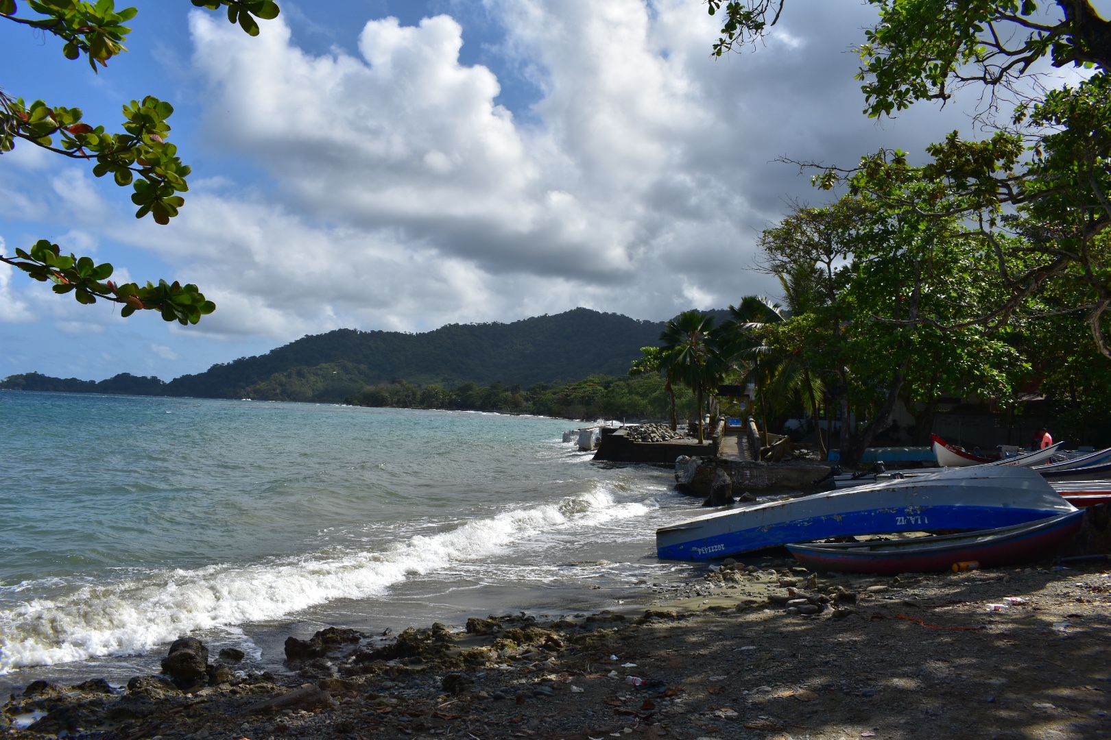
But back to the afternoon. Despite the lack of shower after arriving  we headed straight to the beach and gabbed a beer, before taking a walk around the town to find the dock, stock up on supplies and find some food for later. There are a few supermarkets in town, including D1, Justo & Bueno and some independent. We stocked up on rum and the Peruvian rum in D1 was actually delicious for the price $35000 a bottle. 

By this time we could check in and there was still no and I was in a predicament as I hadn’t taken a shower that morning due to the early flight and now in the heat I felt particularly pleasant. There were not many restaurants in town so we headed to El Ganadero on the main plaza, opposite which had running water. The food was good, if not a little pricey, and afterwards we returned to the beach drinking rum and beers while watching the sun set. It was bliss. Angela always brings a metal thermal bottle full of rum and then just topes up with coke. The restaurants never seem to notice/mind.

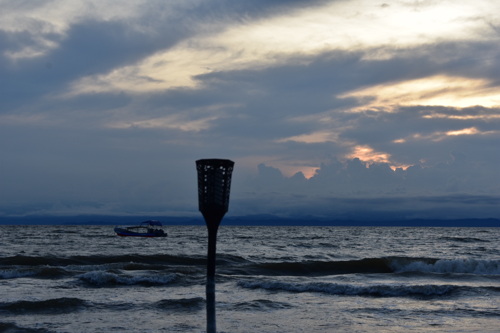
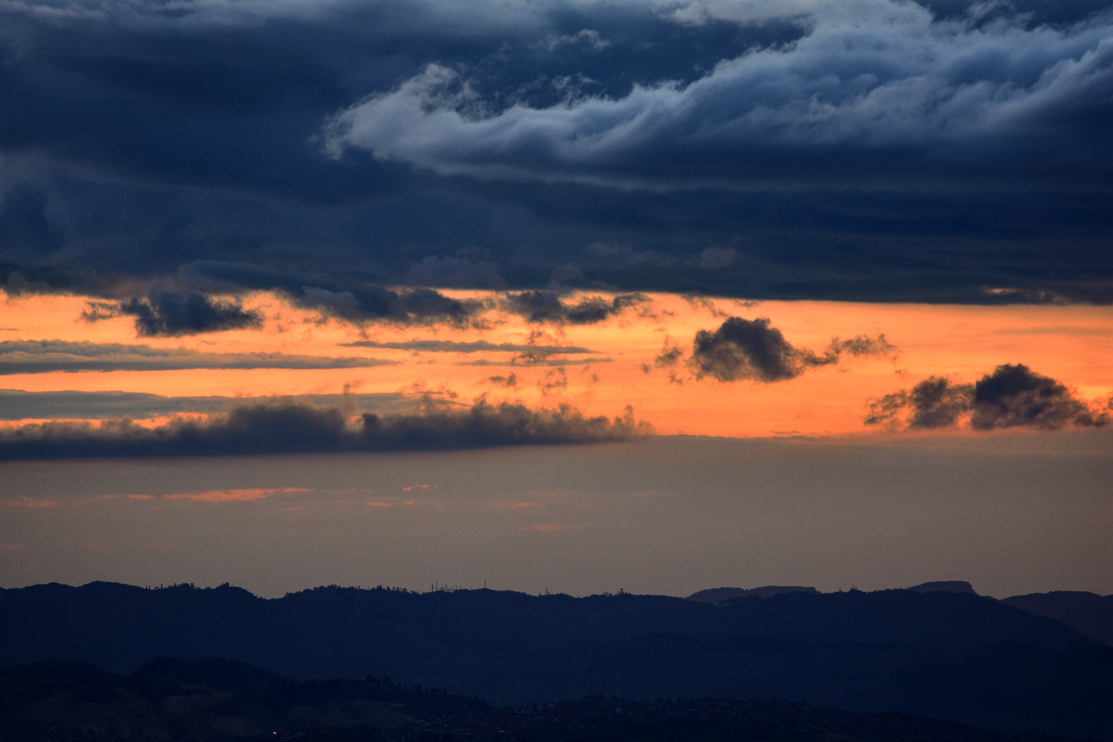
We stayed and watched the sunset.

Afterwards we returned to the hotel and finally  I could take my first cold shower of the trip, but it was a relief to have a break from the heat. We grabbed a burger from Burger Tin which was in the alley outside of the hostel, opposite the main plaza and the promise of gourmet burgers was exciting and decided to take an earlyish night.. 

Day 2

We awoke just before 6am the next day, to find he water cut off, meaning we had to leave a fun surprise for the hostel in the bathroom. We were a little late leaving so took a moto-taxi to the pier. Its advised to get there for 7am to book passage, there is only one company, and can be a risk of the boat selling out. The pier is situated on Carrera 51, its on  Maps.me and is situated about halfway along the road. You will see a pier, which is either under-construction or has been badly damaged –  I can’t quite tell and you will need to buy your ticket for $75000 each way, we oped for a return and booked our return journey back as soon as we arrived in CapurganĂ .

Make sure you bring a waterproof bag to put your belongings in. There is likely someone selling bin liners so you can wrap your bags in that, but the journey can be choppy and your bags can get really wet.

There will be some time as they load the bags to buy some food from the restaurants close by but as the boat arrives in Caprugana around 10am and I would advise that you get breakfast before you arrive. I have nothing bad to say about the food near the pier. But Angela decided to eat and then regretted it when we were out on the choppy sea.

It takes a while to get the boats loaded. If you have a small bag you can take it as hand luggage but any larger bags will need to be stowed and you have to wait for them to be loaded and unloaded – try not to bring a large bag if you can. During this process my bag was searched by immigration along with all the other gringos. They call out everyone’s names for boarding so stay close and once on board you can choose your seat. We were one of the last and the boat left around 8am.

The sea had been rough the day before and was still surging today. We were splashed several times when the boat was tied to the dock. If you can sit in the middle of the boat as you are less likely to get wet. The crossing is supposed to around 90 minutes, but can be faster or slower depending on the weather. We had a pretty choppy crossing and when the waves seemed higher than the boat I was a little scared. The captain seemed to know what he was doing and it felt very safe but being in a speedboat put your really close to the water. 

But after a sketchy journey, which I vowed never to repeat, we arrived. Its also hard to remember that we were not on an island, more a remote part of jungle which is close to Panama. But for the entire trip I couldn’t quite get the idea of the island out of my head.

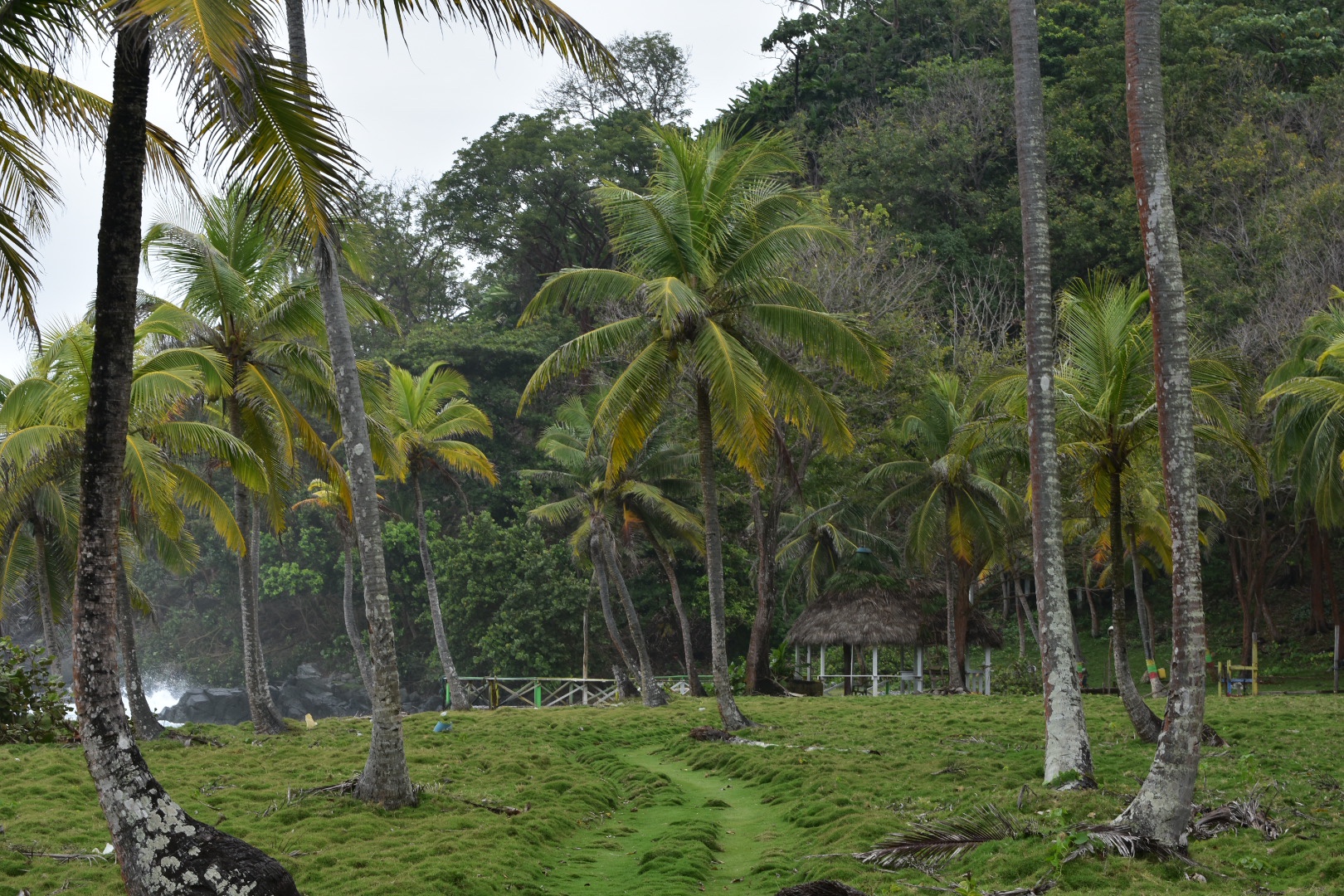
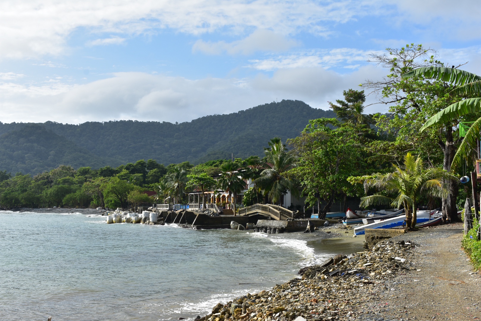
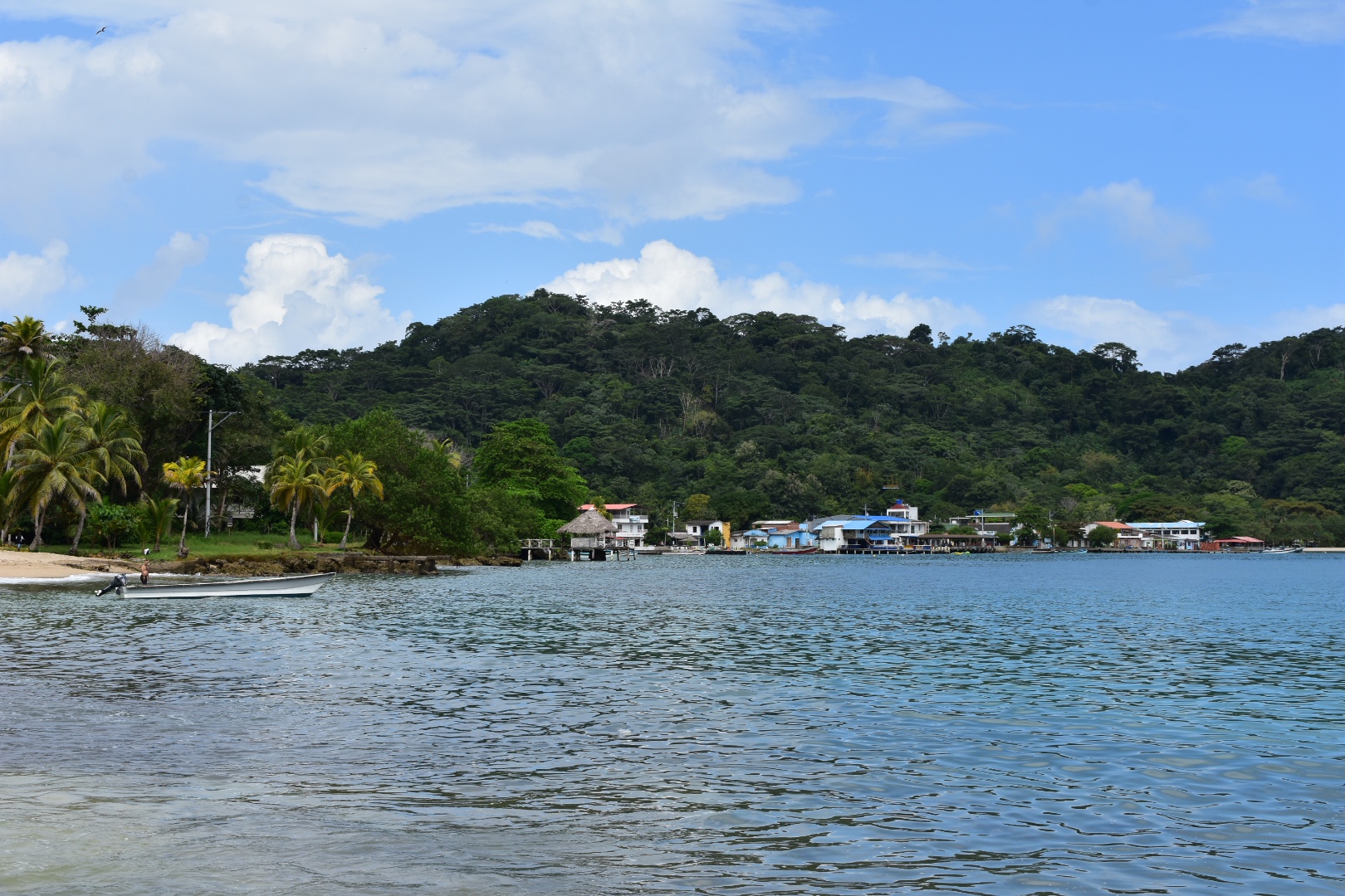
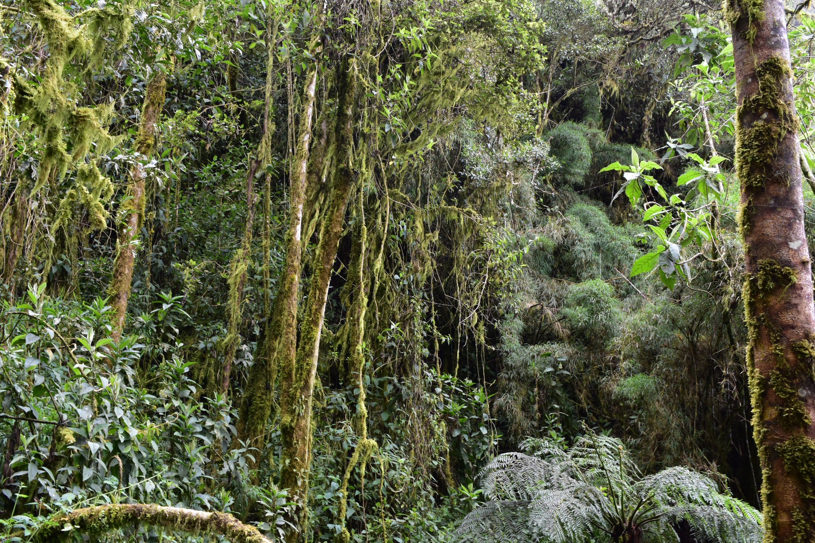
We checked into our hostel, Dive and Green CapurganĂ , which also operates as a diving school and is close to the pier. We were welcomed with some water and taken to our rooms. This time the water was working but the electricity was not. I suppose I shouldn’t really complain about the lack of electricity or running water when being this remote and during our stay there blackouts periodically affected the entire town. We found the electricity would die during the night which meant the fan stopped working and on one occasion we lost the water. This wouldn’t be so bad if I hadn’t seen that several other hostels had generators. We lost cell signal for much of the trip and losing WIFI wasn’t much of a problem but the minimum basic for a hostel to provide is running water and electricity and they should make provisions for that. One time when I stayed in the Amazon in Peru all they had were buckets of water to wash in and flush the toilets and this was much better than nothing! There are also lots of other places in the area more remote and you can stay in Sapzurro, if you want. If you want the full jungle experience by all means do go remote and some people say they want to stay away from the noise of the busy town. Having spent many years in London and arriving from Bogota I found the town quiet a good location to base yourself.

We grabbed breakfast and found a more traditional restaurant on the road leading to the main plaza. If you do want cheap local food or need to stock up on anything like, beer, water or soda come to this side of town – it’s expensive on the main road, on the beaches and by the dock. We had a couple of breakfasts along here, which were typical Colombian, but great. Plantain, scrambled eggs, rice etc.

We quickly sketched out a three day plan and Angela decided that today should be a beach day. So both being walkers we decided to hike to El Aguacate.

Hike to El Aguacate

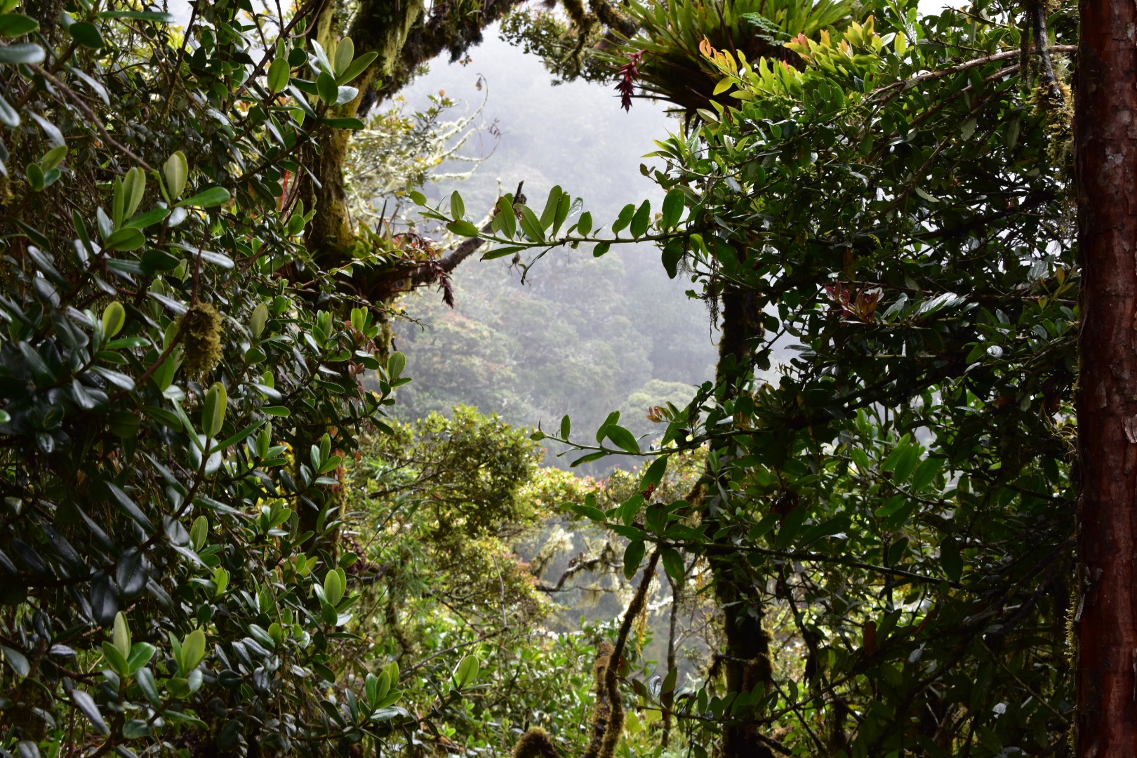
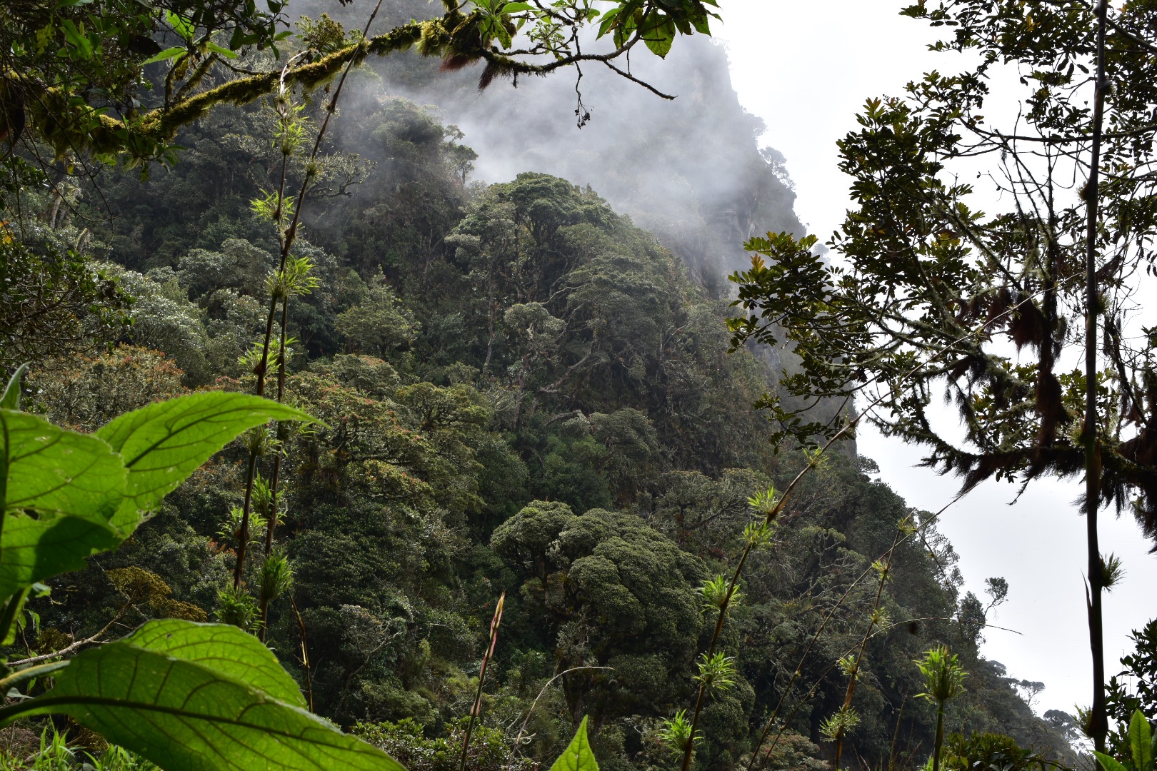
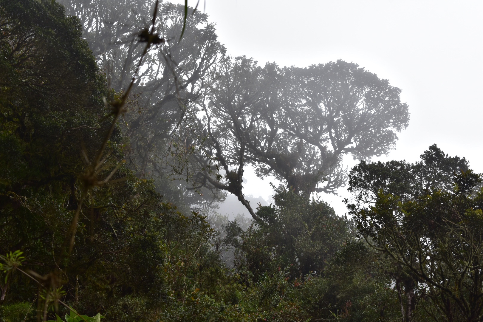
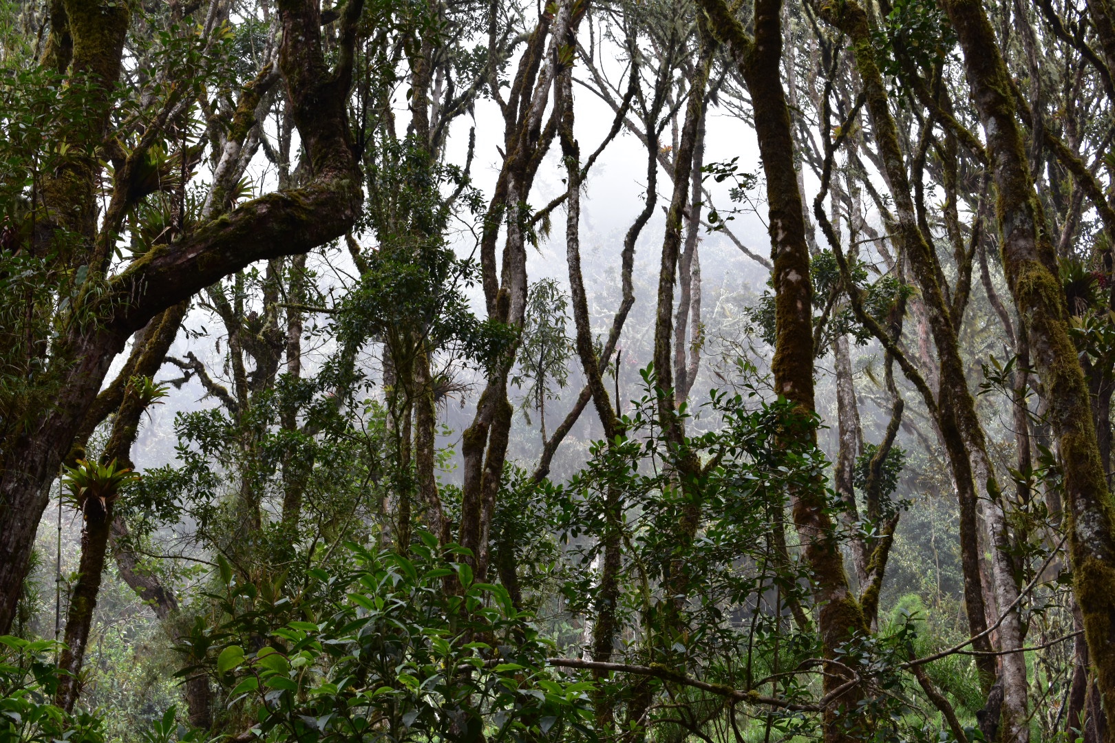
I’ll say it now so I don’t sound as if I’m complaining but we were unfortunate when we visited El Aguacate. A supposed sandy beach in a cove in the tropical Caribbean. You will see from the photos that we had a particularly grey day – something that seems to put a downer on any terrain and due to large amounts of rain turned the water murky. Do check the photos on Google as on a sunny day its beautiful. So choose your day carefully, but the hike is not for everyone…

It 4km and I read it should take an hour and a half. Take the road that runs along the east of the airport and then take the second left away from the airport and then take the first right that is obviously another road. Check on Maps.me for more information as the path is clearly marked on the map.

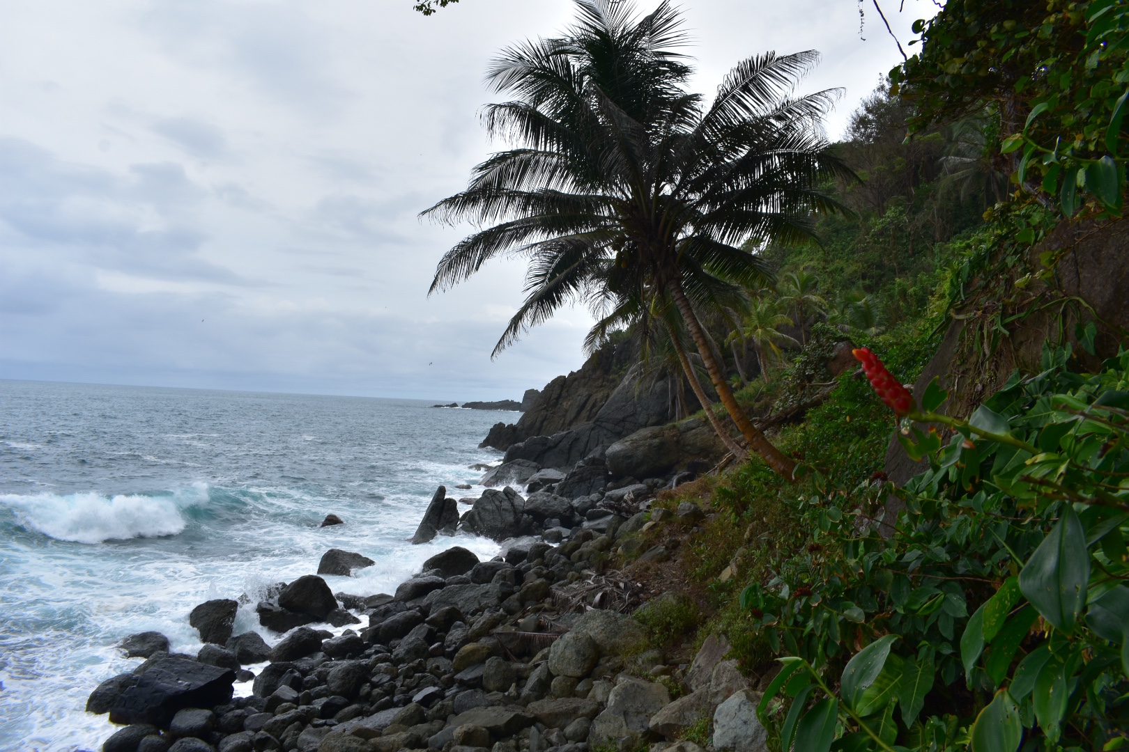
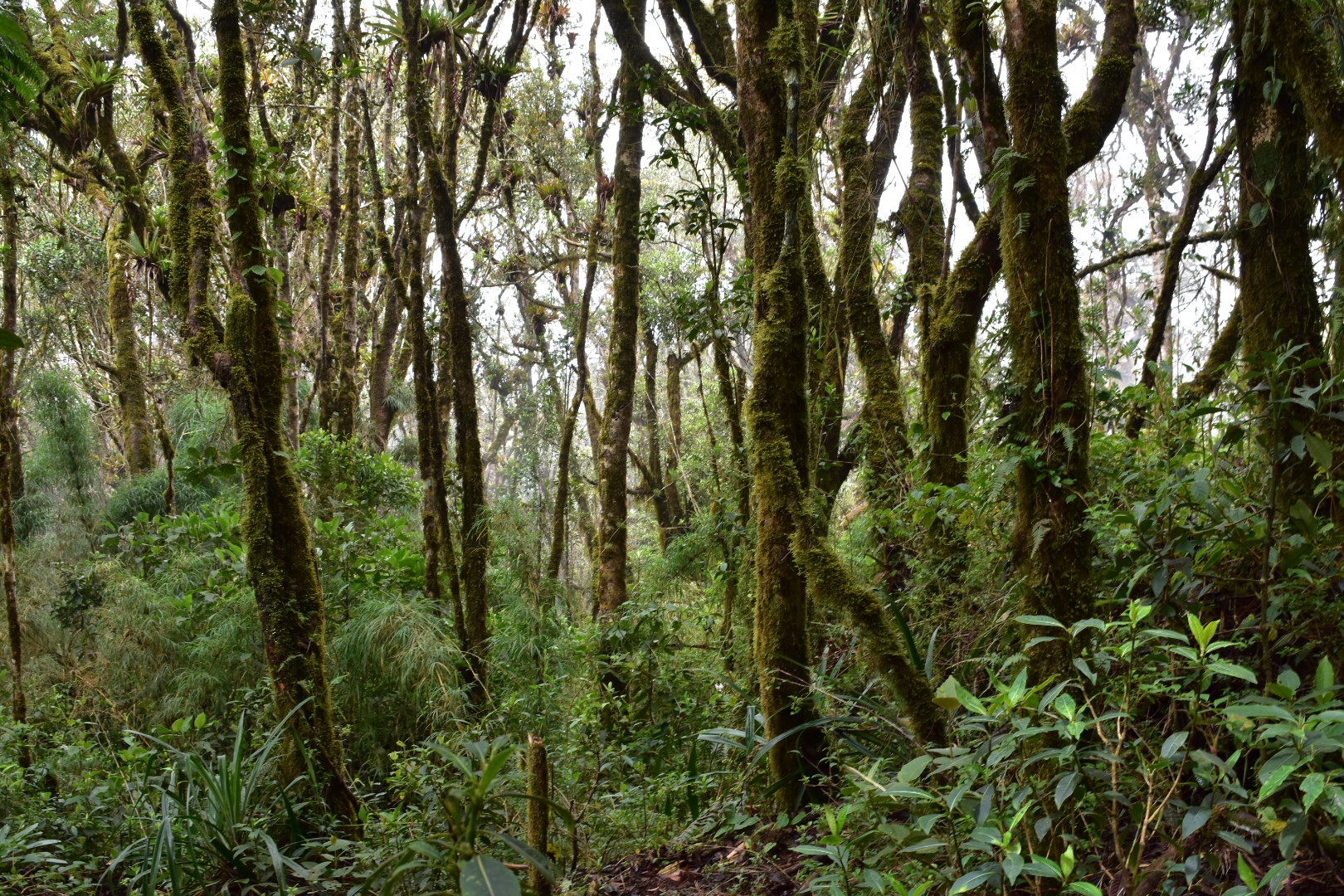
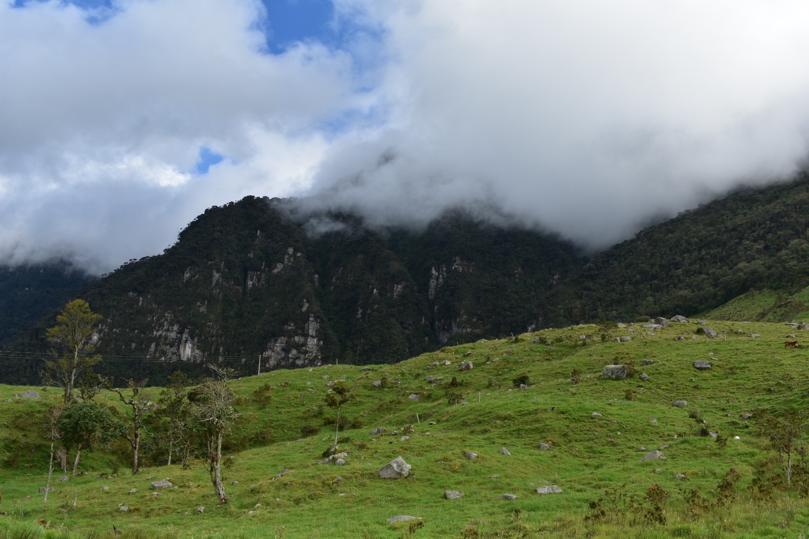
Follow this road and you will have to cross a couple of streams. It pretty muddy in places so you might want to weigh up footwear choices, we chose sandals. Do not attempt this in flip flops. After walking for a kilometre or more the path will split and the signs will point you towards the waterfront where you will end up on a deserted rocky beach. There are actually a couple of beaches along this path that might be worth your attention if you want a private experience as we did not see anyone around. Although I don’t think any of them are safe for swimming although the current was particularly strong on this day.

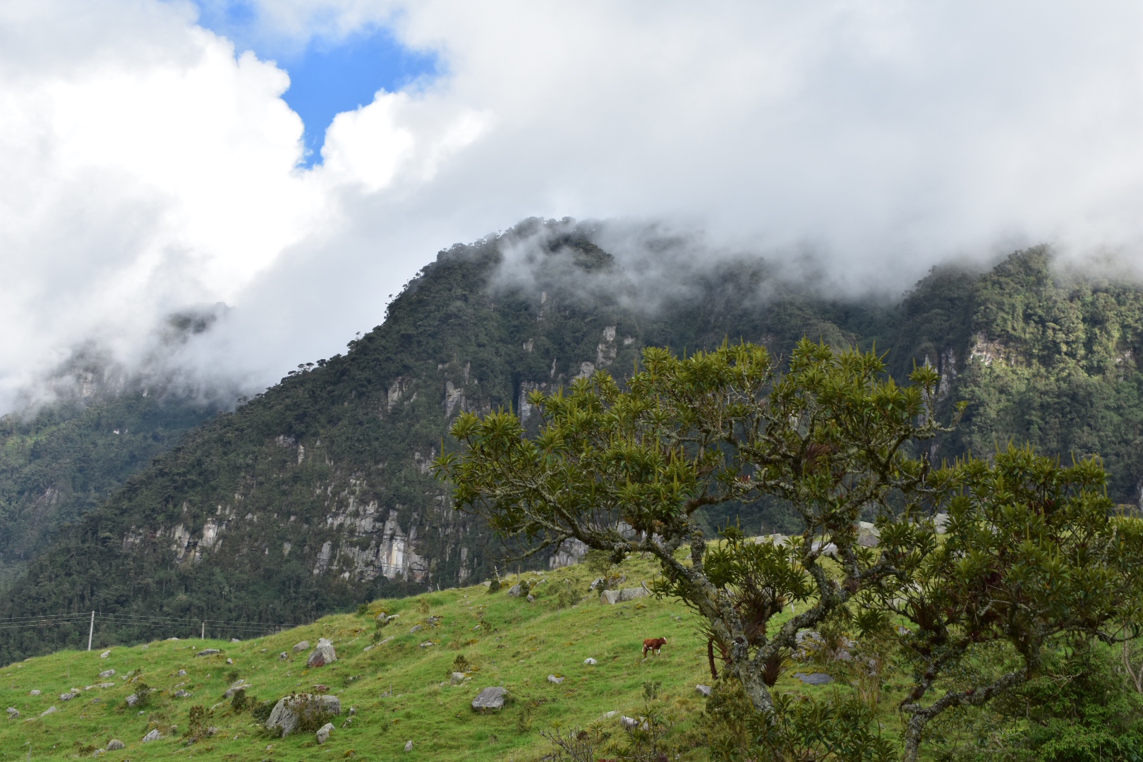
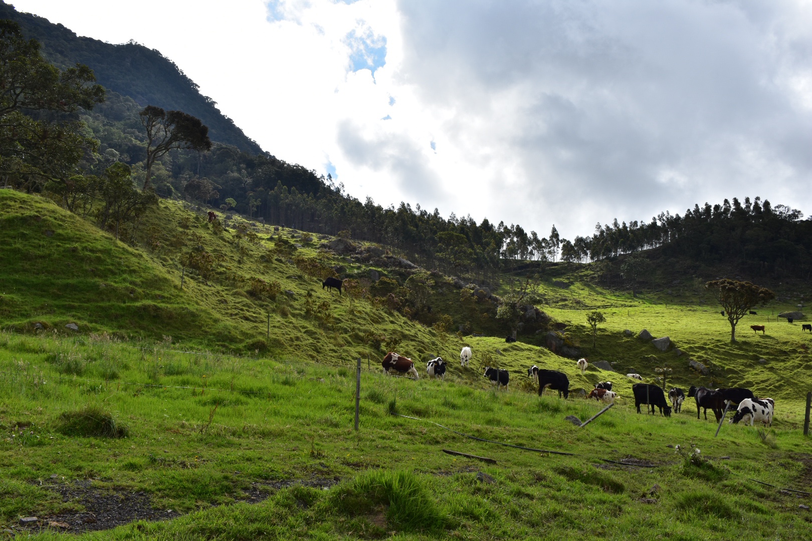
After winding its way around the first beach and back into the jungle we came out in this clearing with some beautiful palms and some cattle. You have to walk through another stream before you cross into the farm.

Just as you pass by the farm there is the first tricky section of the path. It gets pretty close to the sea and then you head up a steam slippery path before heading back down again to another beach.

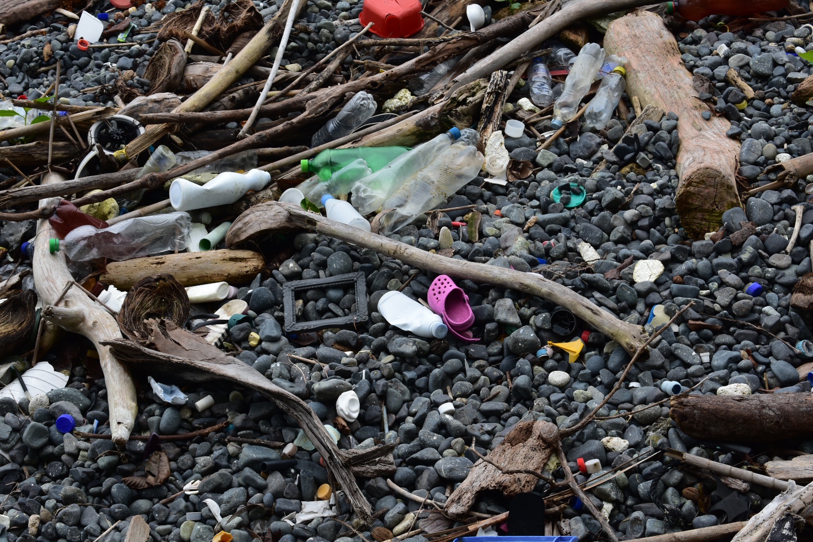
This one sadly is covered in plastic, I didn’t take too many photos but I wanted to demonstrate the consequences of where our plastic waste ends up.

Once you cross this beach there is a small steep climb to the path and then another steep climb up and down again and this time you end up on rocks with the sea metres away. The part across the rocks is a little dangerous if you fall but be careful and have a strong footing and you will be fine.

There is one more steep climb, possibly the steepest, up from the rocks and then back down again to a final bay. You should see some hostels in this area and you will pass along the bay to enter the jungle again. For us the path was really muddy so both going up and down were difficult, especially the down. In places there were wet and broken ropes to assist you. I didn’t trust them much but the did offer some support. The last challenge were some steps which the path washed away either side but after the we arrived at the beach. The trek took us a little over two hours as we were wearing sandals and it was slippery. Its around 4km in total and I’d only advise doing it if you have some experience hiking. As the woman at the hostel told us, most people walk there and take the boat back. I had no intention of walking back along that path so we took the boat.

The bay itself is picturesque but on that day there was no beach to relax on. There were a lot of tourists eating lunch but they soon left on their tours. Otherwise there are a fair few hostels and bars. We crossed the bay and when I realised we were walking further I called a stop and we returned to a bar which was in the process of being built. The owner sold us some warm cokes and water and Angela managed to book a passage back with his boat. He gave us a lot of information and explained that the weather had affected the bay today. He didn’t have any change for the drinks so we went to another place to buy lunch. They didn’t have any change either – It seems no one does here so bring small bills. 

Lunch was typical Colombian fair, fried fish, rice and plantain preceded by a soup for $20000 so we shared a plate. Our ride back was soon ready and we headed to the beach and boarded the small fishing boat. They had life jackets but I was unable to untie one so just trusted as we approached the open sea. We paid $10000 each for the ride back on a bumpy but fun journey. Again the captain was experienced and knew how to hit the waves and we were soon back in CapurganĂ  .

We returned to the hotel and the rain began. When it eased off we went to explore the town. Apparently downtown is where the plaza is so we headed there, where there was a lot of life, and at that point the rain started to pour down. I’m not sure I’ve seen rain that strong before and it saw no sign of letting up. We jumped into a bar and ordered some drinks while it passed. After an hour it had died down a little. We were two blocks from when we wanted to end up, a pizza restaurant and hostel called Resturante Gecko. The owner is Italian but we have since been told the kitchen staff are not. We managed to get there and despite the restaurant not being full were turned away. Instead we headed to the main street and found another restaurant. Its eye catching and looks nice but the food was nothing to write home about. Afterwards it started to rain again so we headed back to the hostel for an early night.

Day 3

The rain woke me in the night and it seemed to continue pretty much until dawn. We lost both power and water on this night, however, we awoke to sunshine which was exciting. I decided to take advantage and get a few shots of the hostel while we were getting ready to leave.

There were two cats at the hostel, this one who had a broken leg but was very friendly and seemed to sleep in the room next to us during the rain and another very cute one which was a lot more timid.

We walked back via the docks and grabbed some empandas for breakfast, around $1500 each. It was only around 8:30 by this point so we decided to walk along the sea front to find some coffee. The early morning was pretty spectacular but it was already HOT.

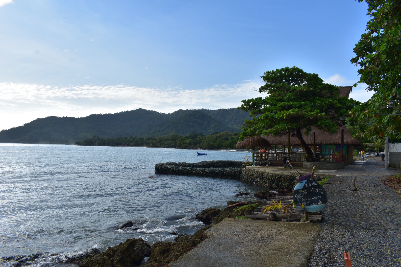
We stopped at a place called Pacha Mama for coffee, they seemed to do breakfasts for $6000 and we wanted to come back as the coffee was decent but we kept arriving before the place opened. You can recognise is by the cat pained on the wall outside.
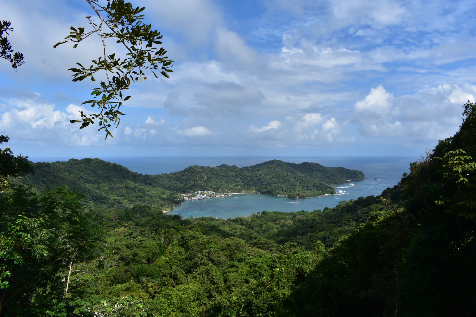
Hike to Sapzurro

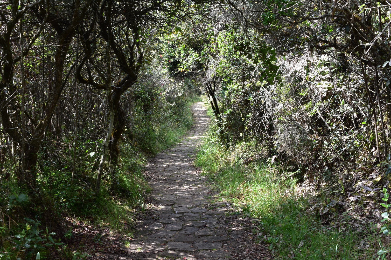
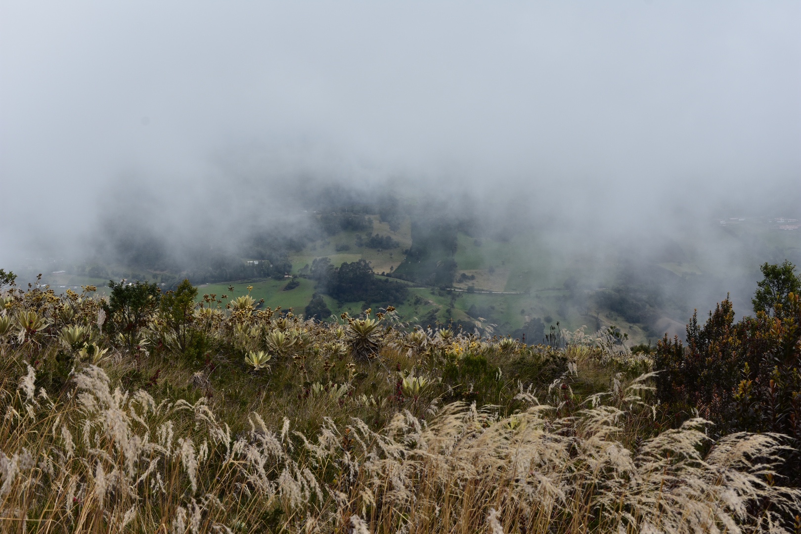
That morning we hiking to Sapzurro. The the hike begins in the main plaza which you can see below. It is possible to go by boat and we were told the tours all tend to leave around 9:30 am by the docks. We opted to hike as we thought it would be free, but it seems that contrary to all the blogs and guide books there is now a $10000 charge to use the path. In some respects its understandable as they have put in new walkways, watch towers and bridges to make the muddy route much safer and easier to hike, but at the same time I think passage on a boat is around the same price. Still I’d recommend the hike.

It is again 4km and it should take you around 1.5 hours, but it took us closer to 2 hours as we were walking in sandals and the path was really slippery from the rain the night before. While I’d recommend hiking shoes I think its fine without, you will just move a lot slower and be careful. Its nothing like the path to Aguacate, just make sure you wear more than flipflops.

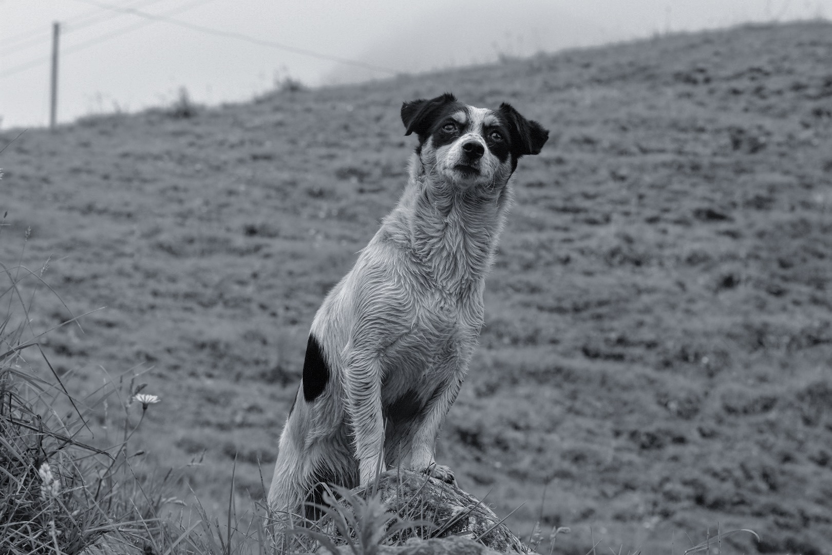
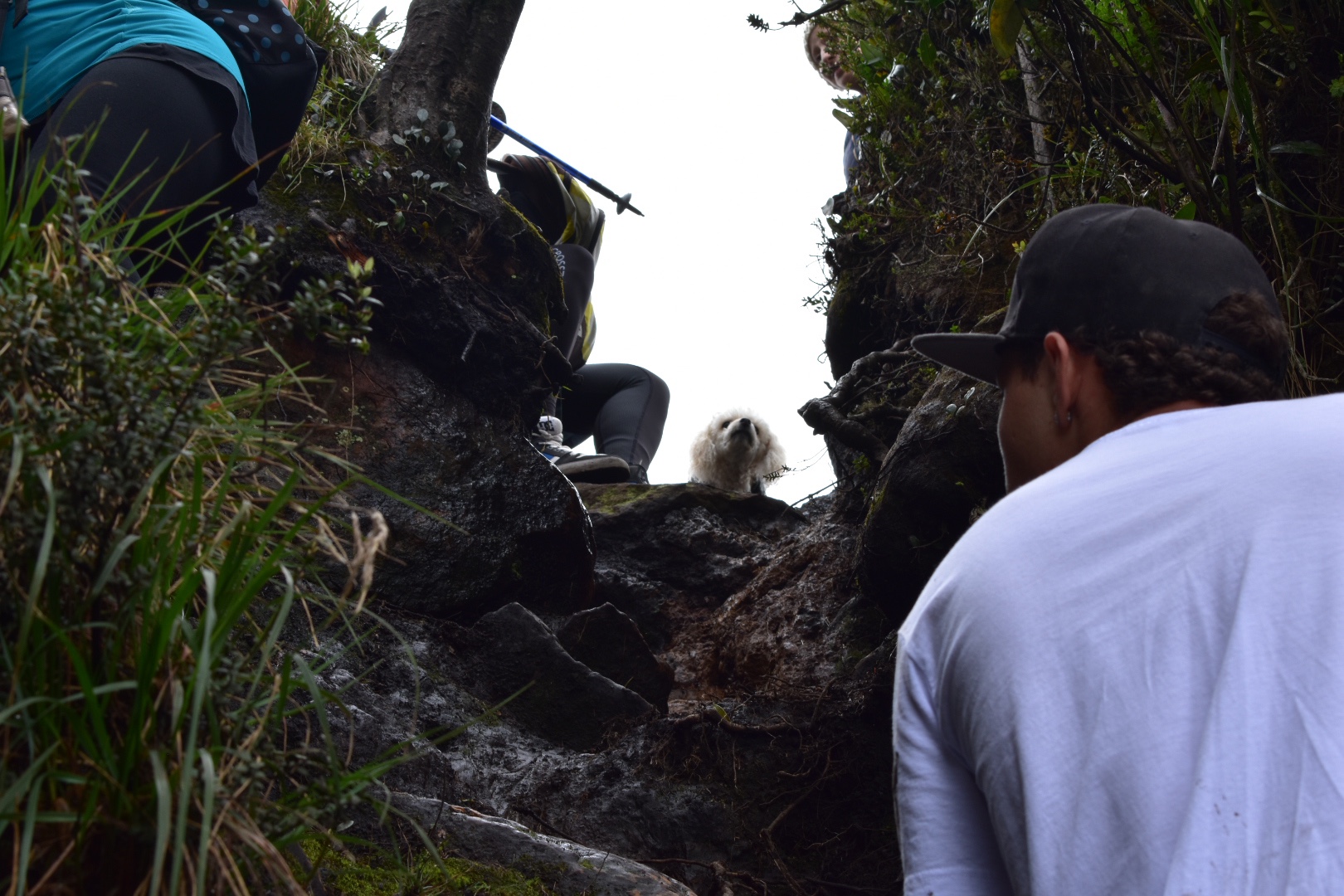
Before we set off I spotted a dog chilling on the runway.

Once you are at the main plaza of the town, take the western exit, so the airport is to your left, and then take the first left and then right, which will take you to the road that leads to the trail head. From here its all really clear as there is only path. Take a look on Maps.me, just in case there are streets that exist that are not on the map but I don’t recall any turns. The photo below is the route leading to the trail.

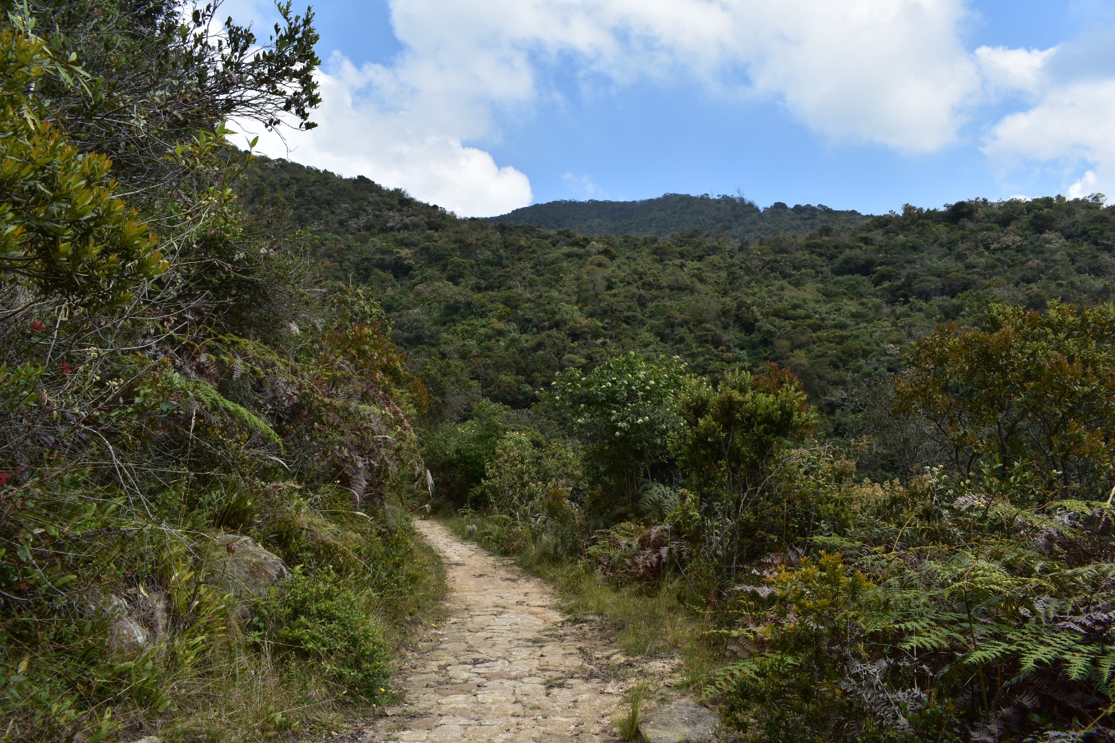
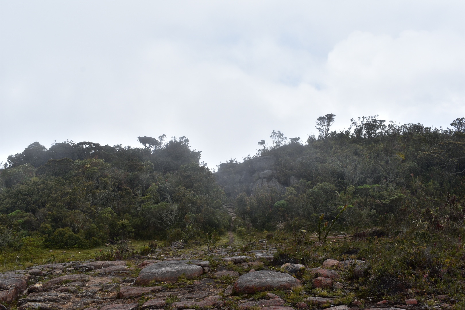
This is the entrance to the trail and soon after you will pay the entrance fee. The path is clear and you need to hike up over the hill and back down again. So the first part is largely up and the send part is mostly down. And you can see below the state of most of the path. Another bonus for hiking is that you can see the wildlife. On the hike to Aguacate we saw an Iguana and today we saw a few monkeys in the distance. 

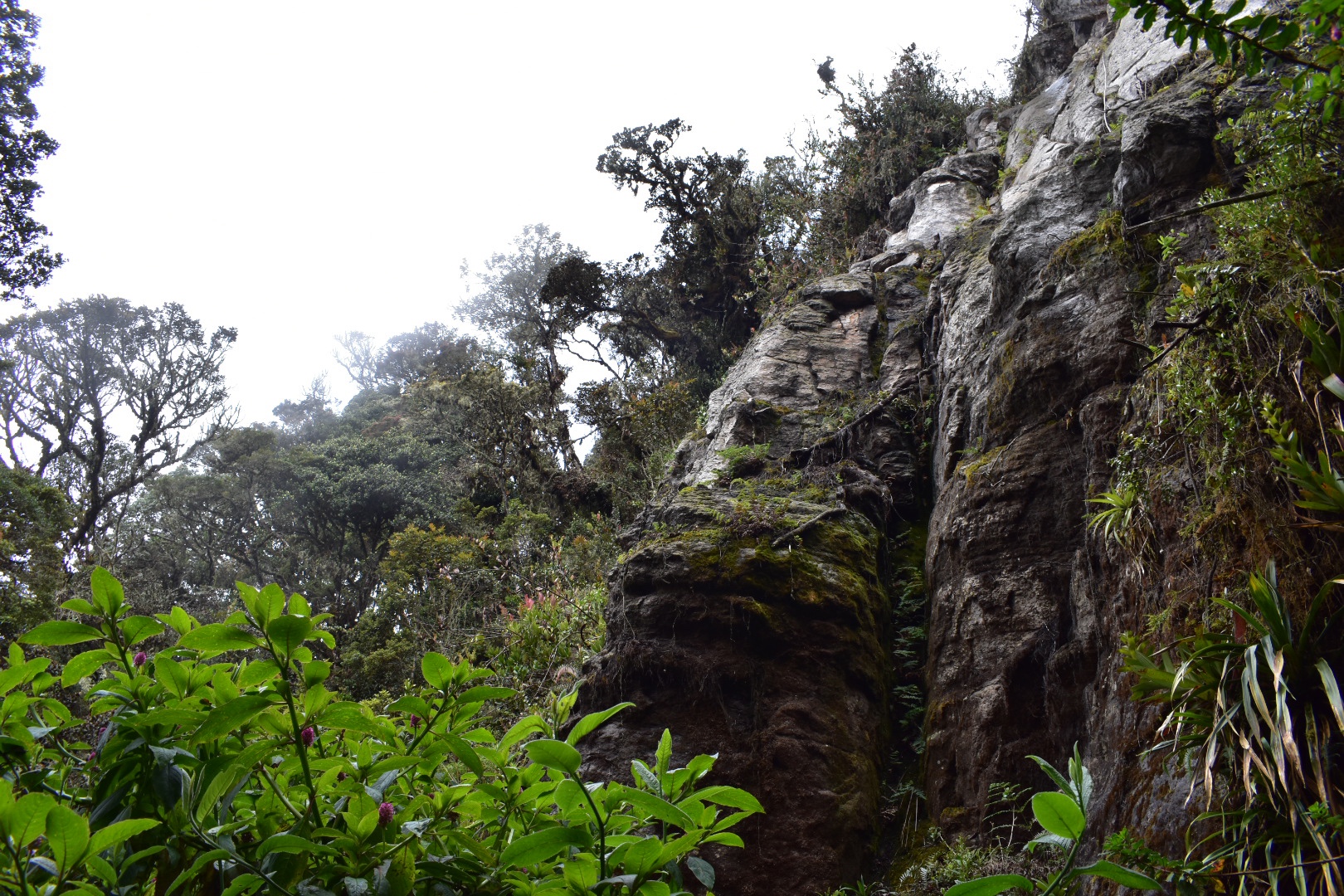
And here is one of the new bridges that has been constructed. Before you would have to have made the river crossing.

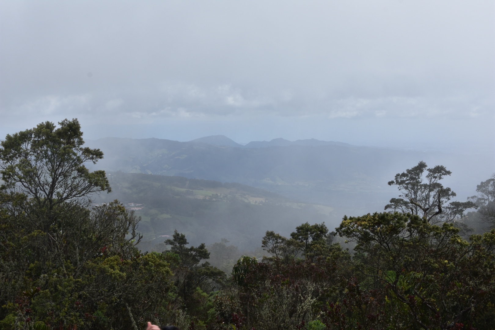
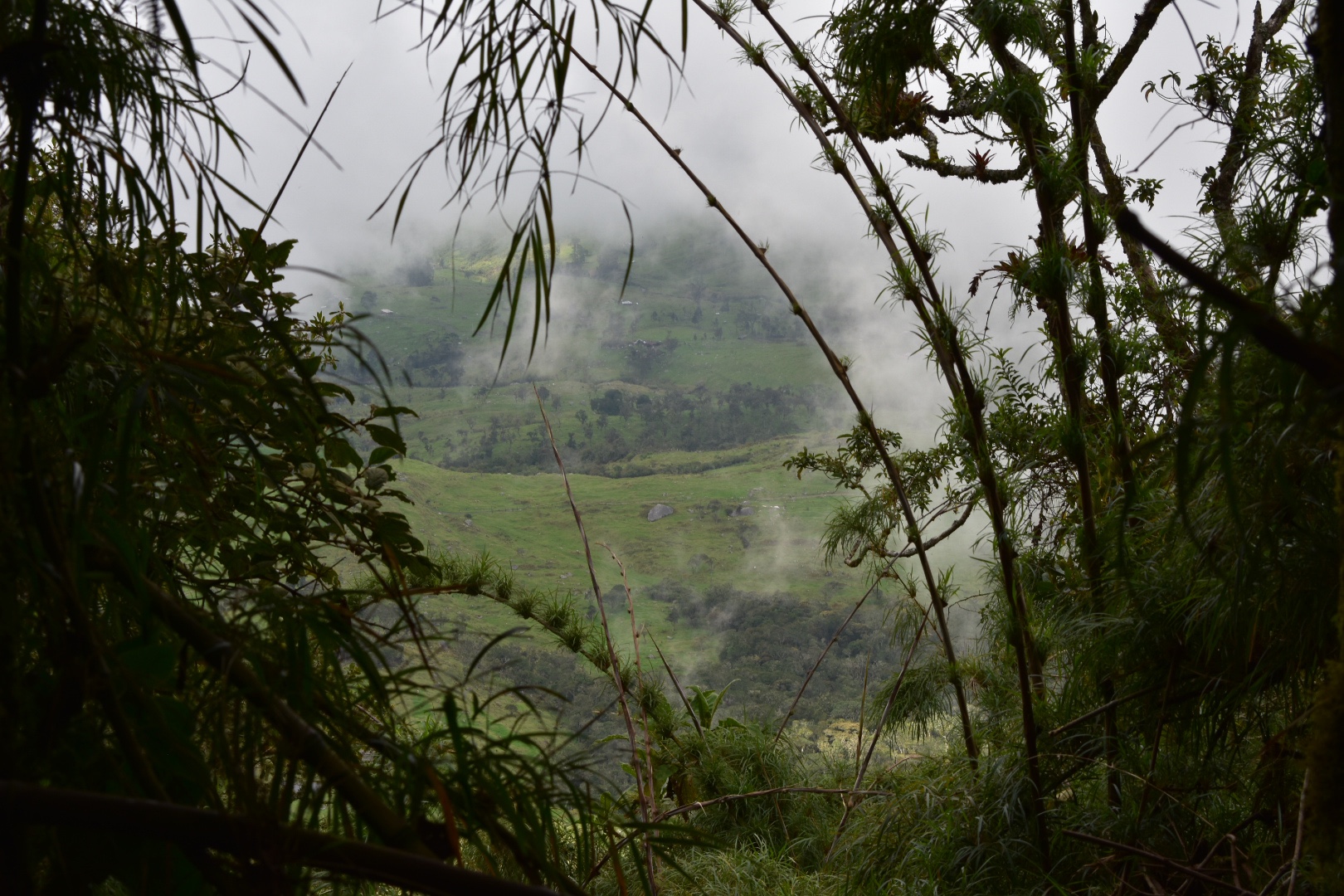
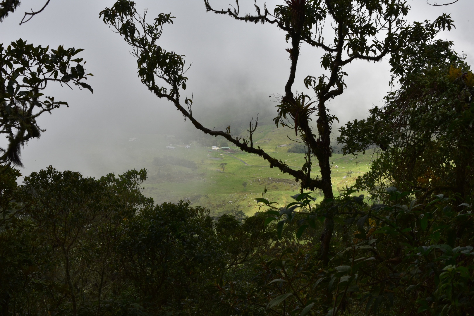
The path is plotted out with benches and places to rest. You come across a house before the midway pointwhere people are selling refreshments – I think this might be the place where you used yo have to pay a small toll noted in some guide books and from here there is the first set of steps going up. Which is goes as the path gets steep here and I don’t know if we would have make it without the steps. Soon afterwards there is another set of steps heading up and then you come out on the top of the hill with the views of both Sapzurro and CapurganĂ . Make sure you head up the tower for a better view. From here it is another 2 km, but this time all downhill to get to the town.

I met a Spanish lady at the top of the tower and we saw a couple of other people on the path but otherwise it was completly deserted.

There is nothing extreme on this part of the path and we could hear reguetton blasting out from the town. Otherwise just keep an eye out for all the ants. You don’t really want them biting you for treading on their line, but if you step over them you will be fine. There is another set of steps on this side which takes you down a particularly steep part and after that you are pretty much at the end of the path.

When you are near the town you will see a sign for a path to Cascada La Diana. It was a 6 minute walk so we decided to visit, which ended up in us seeing a lot more ants. It was a pretty diversion, you wont miss anything by not going as there is nowhere really to relax when you arrive.

And after returning to the main path and walking for a few more minutes we came out on the beautiful bay that Sapzurro sits on. Here the sky was blue, the water warm and crystal clear. The tide however was high and this was one of the two beaches on the map. We decided to head into the town and see what we could find.  

The town itself is pretty spectacular but there wasn’t many people around. I had read that there are seafood restaurants but nothing seemed open. You can stay here, as the Spanish girl was but I’m not sure I wold recommend it as a base. Instead on her recommendations we decided to walk on to Panama. But certainly if you want to relax in a tiny peaceful village it would be worth your time. You can get boats to here from CapurganĂ  for around $10000..

Hiking to Panama – La Miel

Sapzurro is the last outpost on the Caribbean in Colombia before you arrive in Panama. I had read that the beach at was the most spectacular in the area. The Spanish girl confirmed this and she said it was only another 15 minutes walk from the town. We decided to keep moving. In Sapzurro, La Miel is signposted from the seafront. Look for one of the paths leading in land, again clearly marked on Maps.me, and then just follow this. After about 400 metres there are steps leading up, and you have to head up over another hill into the next bay. Before you decide to make this journey make sure that you have ID. I’ve been told that you don’t need a passport as they do not stamp you in and out but you do need ID. There was no one on the border when we made the crossing, so we just proceeded. Again make sure you have plenty of small notes or you might become stuck as again people did not seem to have much change.

It probably too us a little longer than 15 minutes to reach the top and the steps are much better on the Colombian side then on the Panama side, so be careful going down. The steps can be slippery and there are no hand rails. Upon reaching La Miel take a right, its all clearly signposted, and you will have to pay $2000 entry fee to the beach per person. The town is a lot poorer on this side of the border and you will notice a few changes. There are shops and some restaurants on the beach, but the prices are much higher than in Colombia but its a great opportunity to try some local beer in Panama and to sit, relax and swim on a beautiful beach.

By the time we arrived the beach was pretty busy and bustling, and we knew that we had come to the right place. I needed liquid at this point as I was so hot and we ordered a range of drinks and then some lunch and relaxed for the afternoon. Lunch was pretty typical fair for around $20000. There isn’t really anywhere else to go from the beach and actually when we explored a little we found the beach behind the trees littered with plastic.

Around 4pm we decided it was time to leave and not wanting to hike back along the path we hitched a ride with a boat that was delivering beer bottles and collecting the empty’s. Angela did ask around for a boat back but no one seemed too sure and the captain was happy to take us for $20000 per person, which was probably excessive but with no other transportation back I was happy to pay. The journey was actually much longer this time and the sea more calm.

We were dropped at the pier in CapurganĂ  and headed back to the hostel where we were greeted by the worlds biggest dog. Luckily he didn’t know the enormity of his powers as his jaws could have bitten off my head in one bite and kept running away from the cat who was attacking him.

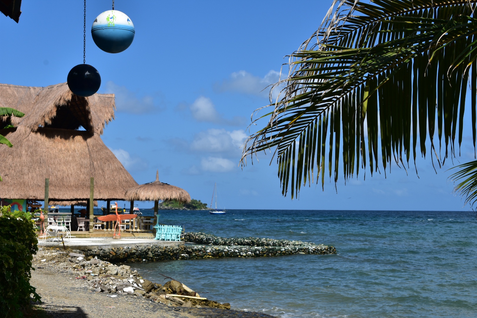
That night we tried to go to Josefina’s, a highly rated local seafood restaurant, but the place seemed to be closed and instead stopped by the busy restaurant by the pier and had a decent pizza. Our poor server seemed to struggle with our order of two pizzas and coke (which we of course snuck rum into) but everything came out good and the pizza was delicious.

Day 4

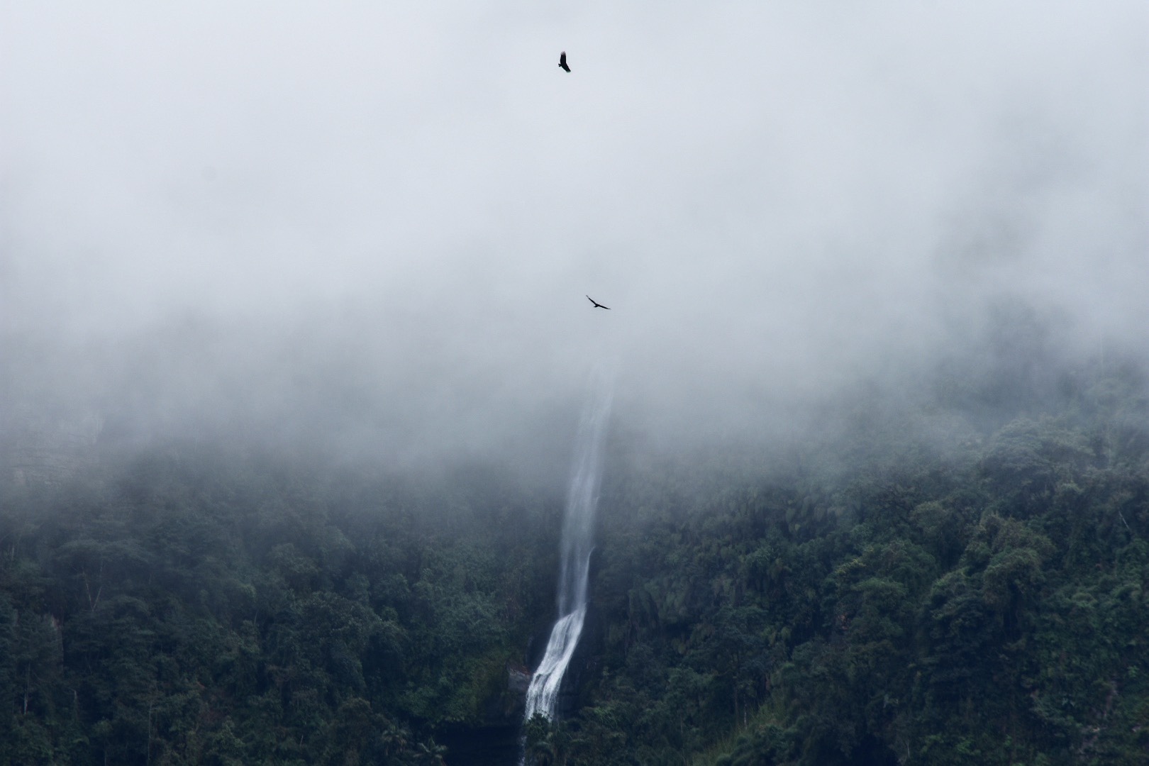
It was another hot night, this time not helped by the lack of rain. There was another power cut over night so the fan stopped working but we had a plan to deal with the heat. Today we were going to bath in the pool by the El Cielo Waterfall. We woke up early on this Sunday morning only to find the town deserted as people ensured their hangovers although a select few were still up drinking from the night before, I guess you can tell we are no longer party people. Again from the main plaza, the opposite side from the airport, is a road with a few clothes shops amongst others we stopped at a place for breakfast and watched the world wake-up. This is when we realised this street was much cheaper then the others closer to the docks. We had a quick traditional breakfast complete with eggs, rice, plantain cheese and some very sweet bread for $8000 each. After we grabbed some supplies and headed to the waterfall.

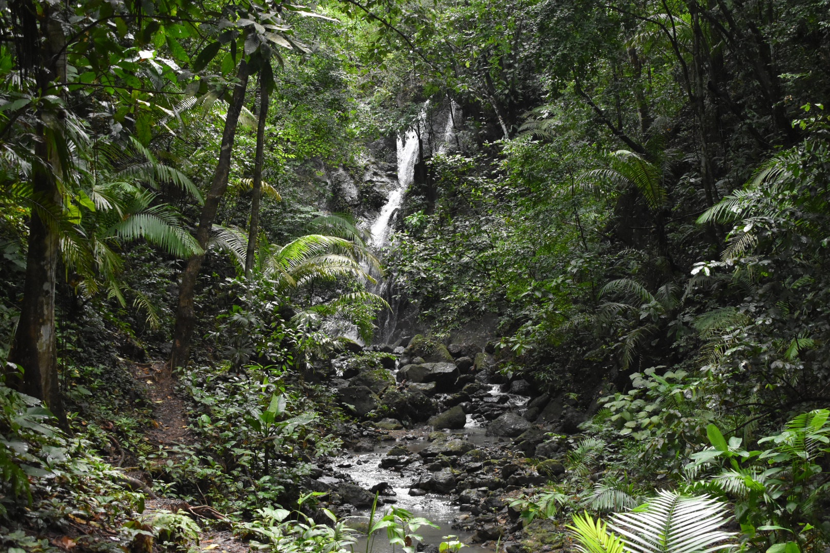
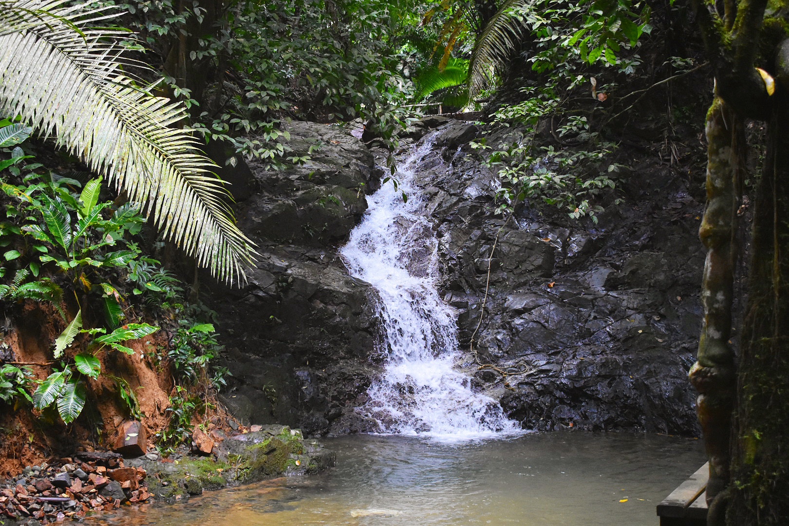
Hike to El Cielo Waterfall

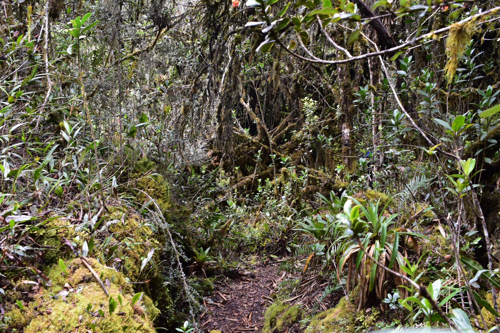
This is a really beautiful and relaxing jungle walk that will take you though a part of the town most tourists don’t see, through 13 streams, or the same stream 13 times, and you will have the opportunity to see monkeys, birds and other wildlife. Once you are out of the town it becomes really quiet and as the distance is only about 2 kilometres the trip should take you around 45 minutes. I actually would recommend this trip straight off the boat as you can cool down in the streams and its also a good bet on a hot cloudy day as in the jungle you don’t get to see much sun anyway.

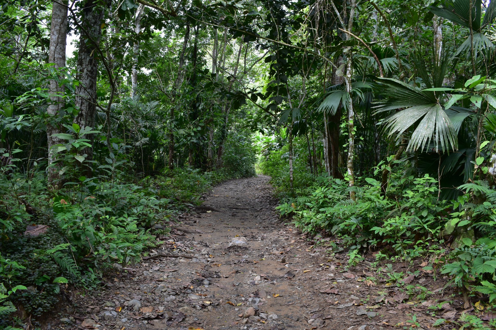
Start your trip in the main plaza and take either road that leads alongside the airport – they meet up in the end, we took the left route. When you get to the the end of the airport follow either road until you see a sign for El Cielo. Also make sure you enjoy the airstrip walk as you will see people and animals walking along and crossing the run way. Although there are only 3 flights a week I would not recommend taking the risk. 

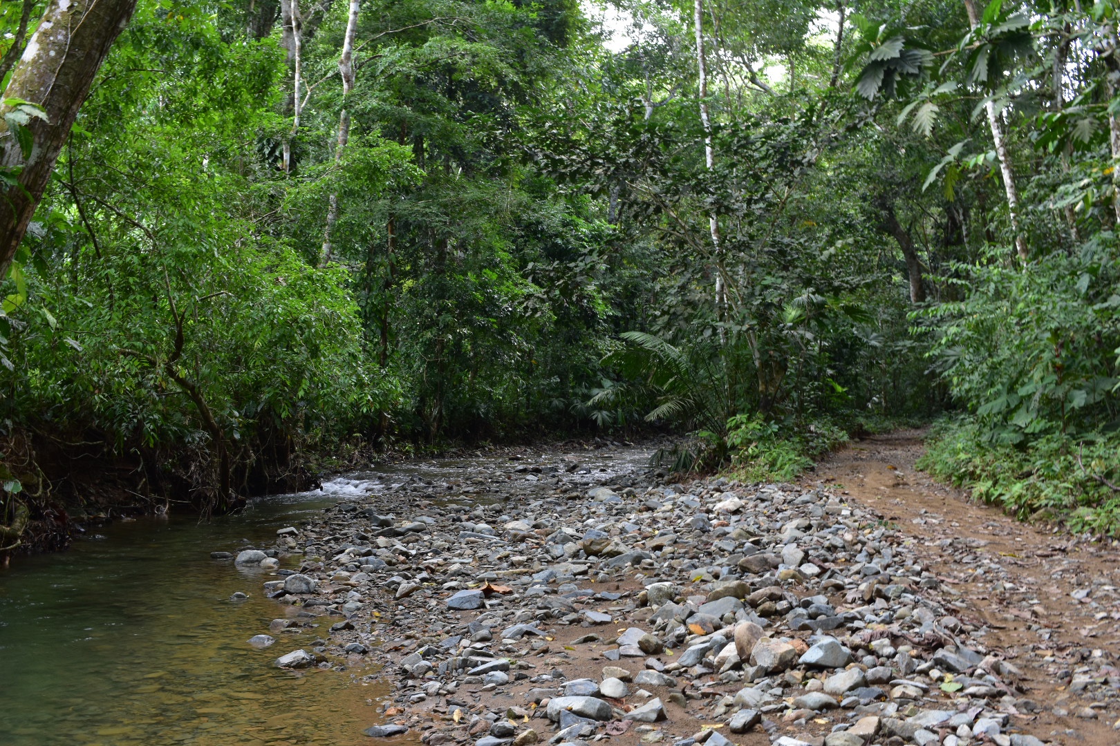
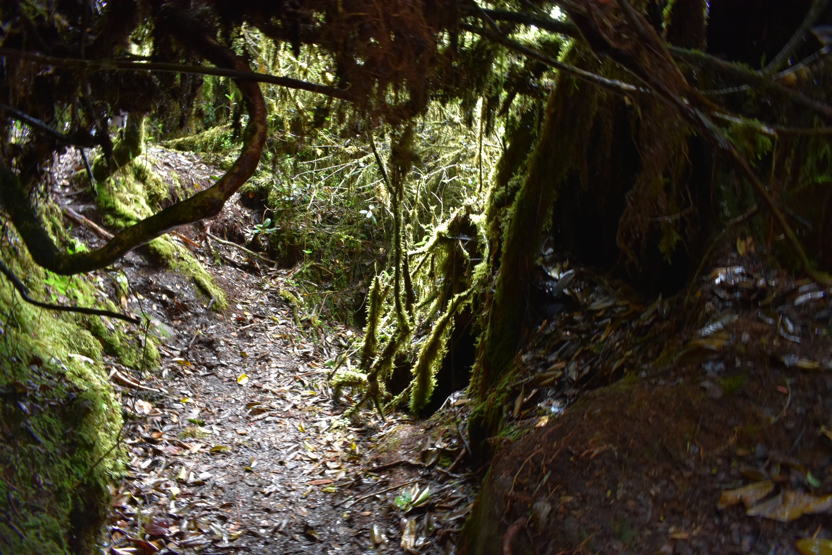
Follow the road the sign directs you along and after a few hundred metres you will see a steam with a half finished bridge, or maybe it will be completed by the time you arrive. We waded as that was what everyone else was doing. Soon after you will see more houses appear and a whole new section of the village. There are a couple more bars and shops you will pass but all you need to do is to stay on this road. Then you will leave the village and pass back into the jungle where the path winds its way along and sometimes separates a little and joins back together. This does seem to be the main road through so I expect you will see other people, but just keep straight.

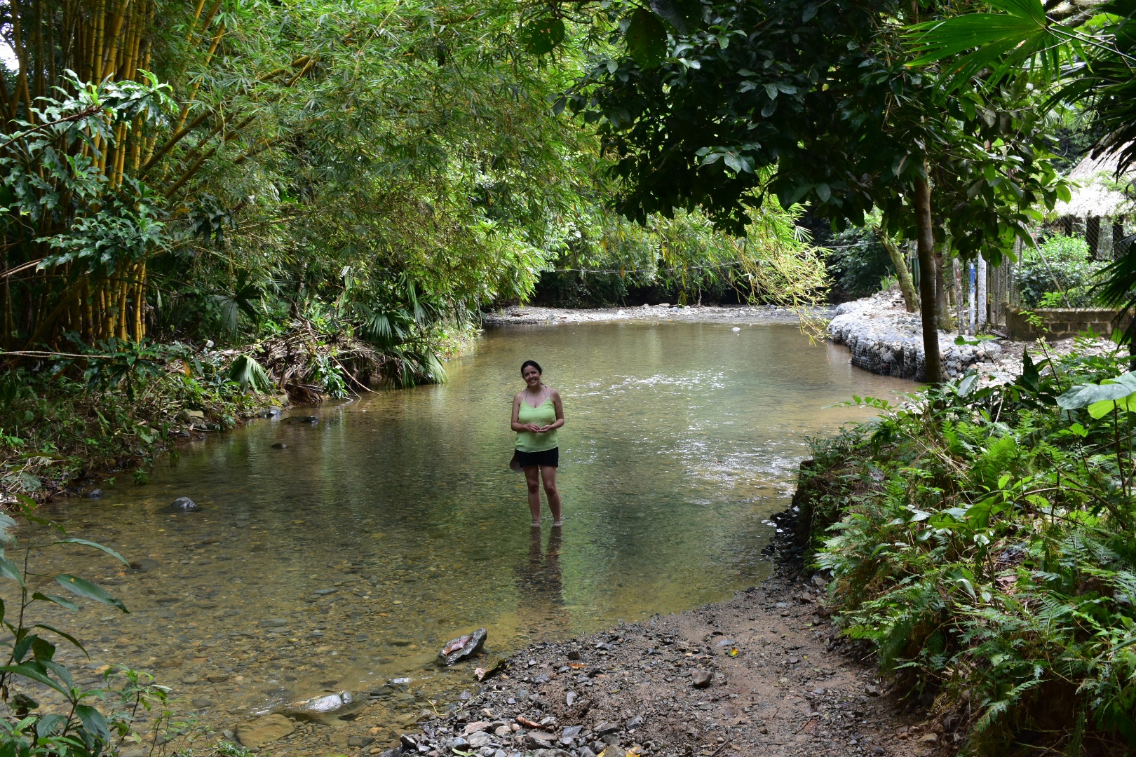
Eventually you will come to the first crossing. Straight ahead is some property so you have to turn right and walk up the steam a little. Here is where two streams meet but follow the river to the other-side and there is a small sign pointing you in the right direction. The photo below, with Angela, is taken after we crossed but should give you an idea.

And the rest of the path looks like this.

Around this sign is a place where you can buy some refreshments if you wish and you will see houses and families along the route.

Once you have made the first crossing the rest come thick and fast but I was enjoying the cool water each time we had the opportunity to dip our feet in. On this walk, I can’t really call it a hike, the sandals were really coming into their own.

You will cross a large part of the stream and then walk up the bank a little before you see the sign below. You are close now but don’t cross. Stay on the left of the bank and then you will see another sign for El Cielo.

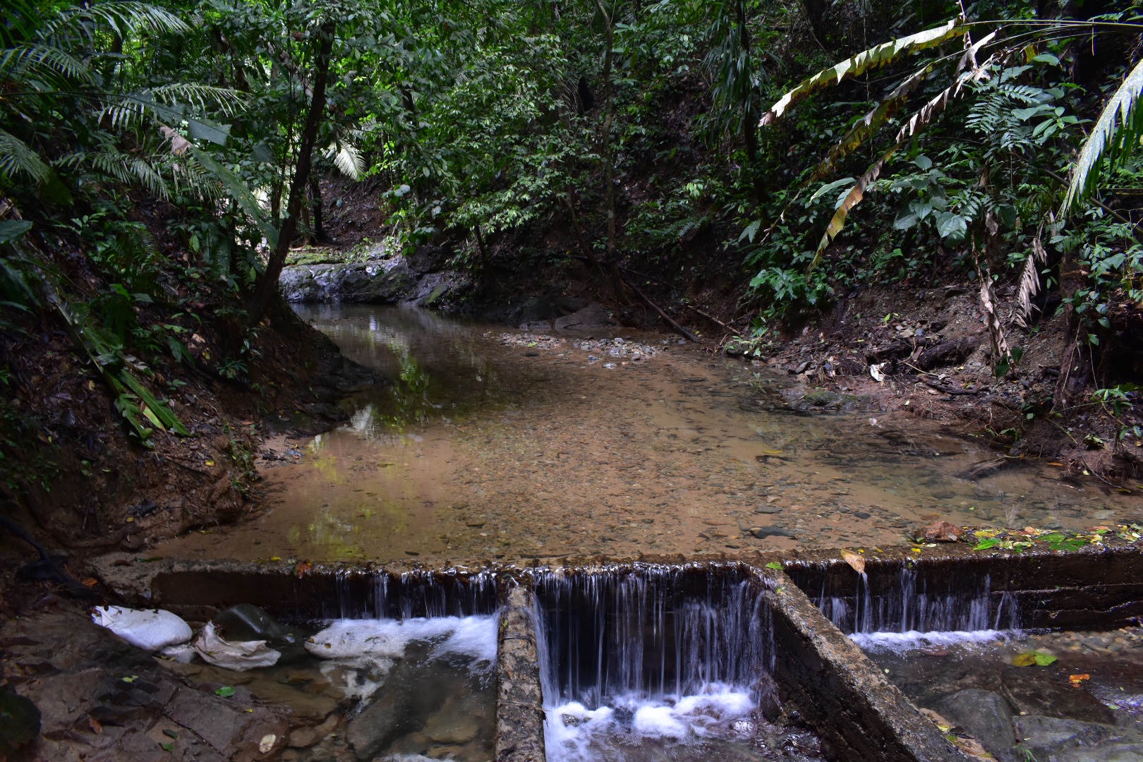
And after a few more crossings you will arrive. There is a hostel, if you wanted to bring your things this far but we did see a couple of moto-taxis so maybe you can hitch a ride in one of them, and restaurant and again be careful as no change. The entrance fee is currently was $5000.

Once you are inside there is a bathroom and a few places to get changed and then you can head for the waterfall. There are a few routes you can take. We walked around most of them so you don’t have to. One way is a raft you can use to putt yourself across the stream but to be honest you are more likely to end up in the water. Once couple tried as we were leaving and soon gave up. There is a place called the jacuzzi, which is sitting the the “rapids” of a stream and there is also a path to a mirador. We started up this route but stopped as it didn’t look short and I’m not sure you will be able to see much but feel free to explore.

We headed straight to the pool and it was great. We were the only people here and it was perfect to take a relaxing dip and cool off. There is some decking and chairs and to be honest we could have happily stayed here all afternoon. The water is refreshingly cold and I event think you could cool off a few cans in the water if you wanted.

There is a path that leads up and behind the waterfall. Not climbing up using the rope i the photo above, you can by all means try but I wouldn’t recommend. At the top you can see more of the rives and paddle if you want. A rope barrier suggests that you shouldn’t go any further.

After we had cooled off, we decided to head back to take advantage of the weather and to hit the beach close to CapurganĂ . We just followed the same path back and again it took us around an hour walking at a very relaxed pace. As you can see the sky turned blue and I took some photos of the town in the sunshine.

We changed and headed to Josefina’s to get some lunch on the sea front. Again the restaurant was closed. The guy in the shop next door just told us that it had not opened for the last few days. We thought we would cut our losses and just grabbed lunch at the restaurant from the night before which was offering a pretty tasty menu del dia for $12000 per person. We ate and relaxed next to the dock.

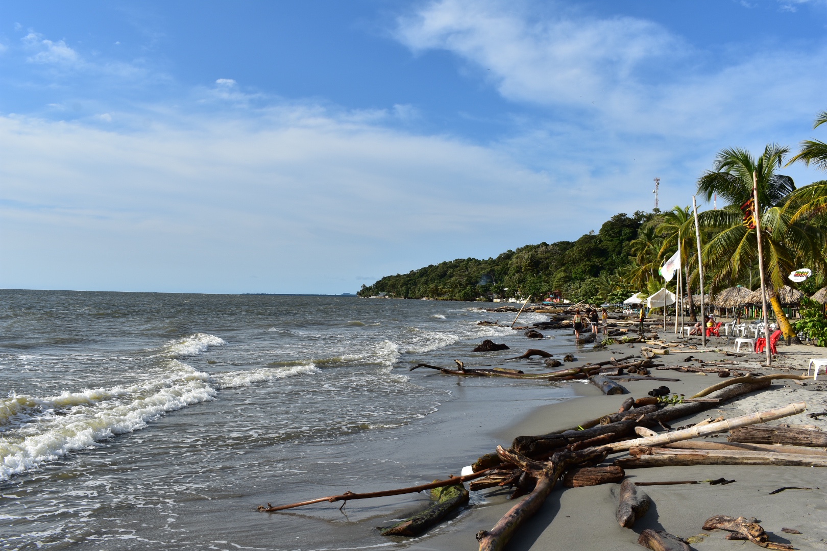
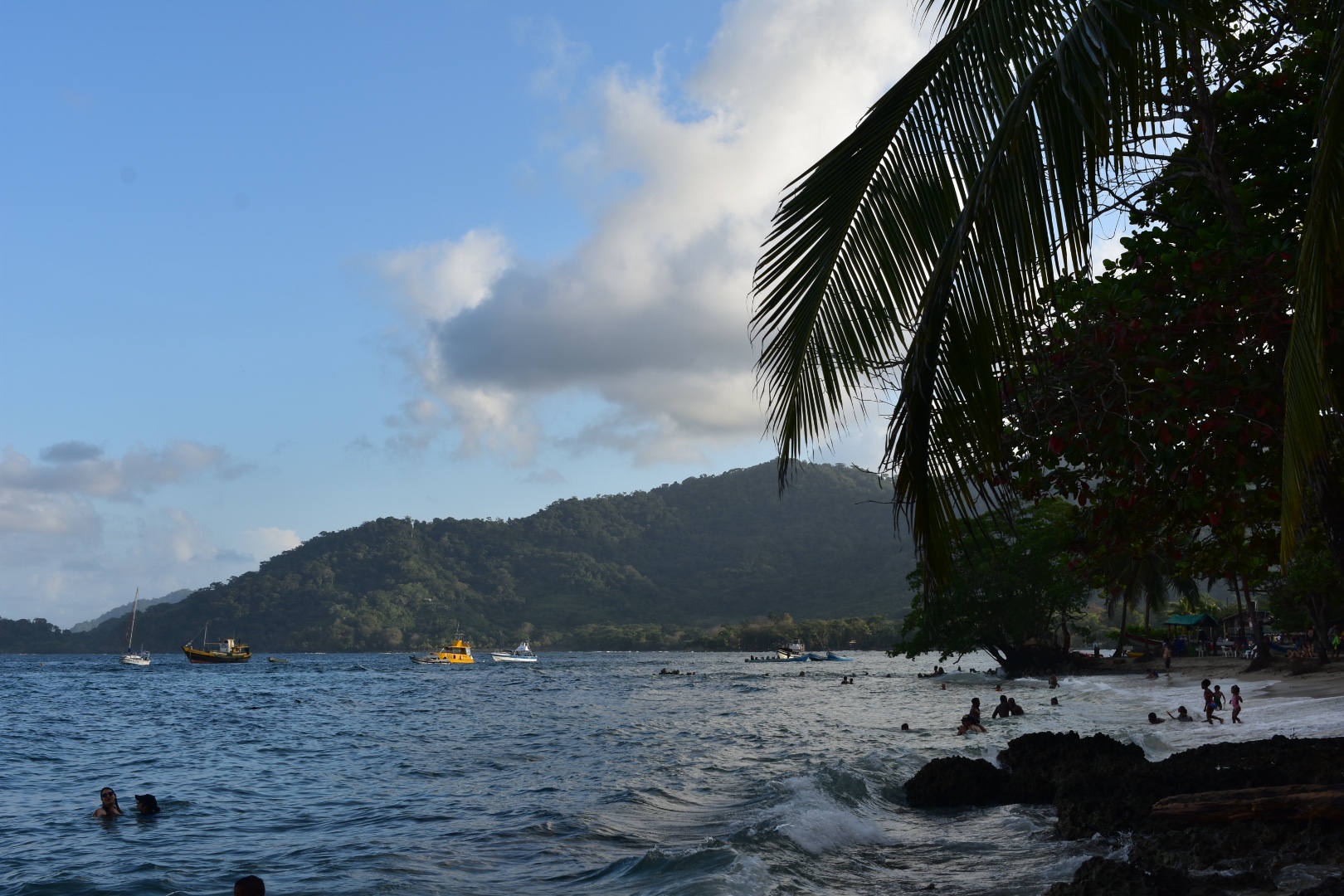
After lunch brought some beers and before heading to the beach near the town. From the dock turn right, you will cross a bridge and walk past the small market then you are pretty much there. There are restaurants and huts on the left selling food, drinks and playing music and from here you can just sit and relax wherever you want. I really enjoyed this beach, it was busy, but not crowded, people were having fun in the water and relaxing and I think because it was a Sunday and no one was working there was more of a local vibe too.

We sat drinking the last of the rum and then sank beers until the sun set. They are not too badly priced from the beach stores. On the way back to the hotel we were given a flyer for an Italian restaurant,  Entre Continentes, which has to be the best pizza restaurant in town. We were initially sceptical as when we had walked past the night before there were three guys sitting outside and no customers. But it turns out one of the is Italian and cooks perfect pizzas. After two failed attempts to eat at Gecko Cafe Bar I would honestly advise you to avoid that and just head to Entre Continentes. From the dock head up the main road through the town, it will take you back to the sea front. Walk around the bay and it will be on your right in maybe 200 metres.

When we were eating there was another power cut so we had a few more beers and called it an early night once again.

Day 5

For us the last day was just about returning to Bogotá. Our flight was at 6:30pm and the boat left at 10am which in theory should have allowed us plenty of time to get to the airport. We had an early breakfast, checked out and went to the ferry office which is towards to the left of the dock and waited to board. 

The water was much calmer today but I noticed something weird was going on when we stayed close to the land and didn’t head out to the sea. Then we stopped in another cove, to pick up people from Pinorroa, which you can hike to form Caprugana – its 10km. Angela mentioned that she heard we were also due to pick up passengers form another location and as we sailed south we hugged the coast. I was worried about time but there was nothing that I could do. We stopped in a village called Trigana, which was stunning and I’d recommend investigating if you can. Once the new passengers were onboard we headed to NecoclĂ­ on a much smoother crossing and arrived around 12pm.

We stopped for lunch and spent a little long faffing around before buying bus tickets for the 1:30pm bus back to MonterĂ­a. We were told that it would take 2.5 hours again but I was still worried about the 3.5 hour journey we had on the way out. This driver was much faster and arrived back in MonterĂ­a at 4pm. There was another women on the bus with the same tickets as us which made me relax more, but then she got off before the main terminal. There must be busses to the airport from the town but we didn’t have time to find out. Instead we jumped straight in a taxi and it cost us $25000 from the bus terminal. We arrived in plenty of time only to find out our flight was delayed. But still we made it back to Bogota and lived to tell the tale.

8321feb2-0f06-4040-a83a-21a488ffe4c4

How to get to Capurganá

There are no roads to Capurganá so you have two choices, boat or a flight.

Boat

Option 1 NecoclĂ­: Boats depart from NecoclĂ­ at 8am every day, the crossing takes 1.5 hours and costs $75000 each way. You will need to be at dock at 7am to ensure you have a ticket (although these can be limited in high season Dec-Jan and you can buy from the office the day before). The dock is located on Calle 46, and is marked on Maps.me. The main office is in the building opposite, but in the morning buy the tickets from the pier

You can take a night bus from Medellin (9.5 hours) or Cartagena (9 hours) and arrive in time or the boats or spend a night in the town, as we did. If coming from Bogotá there are cheap flights to Montería, and then a bus to Necoclí takes 2.5 hours and costs $30000.

The return boat costs the same and leaves at 10am each day. If you are travelling in high season Dec – Jan book your return leg when you arrive on the island.

Option 2 Turbo: Turbo is closer to Medellin and I would only consider it an option if that is your destination or starting point. Its a longer crossing at 2.5 hours and I’ve read a much less confortable boat. It seems the NecoclĂ­ crossing is newer and now the preferred route. Also consider that Turbo is not the nicest or safest town to spend a night in.

Air

There are daily flights from Medellin to a town near Capurganá called AcandĂ­ with the ADA Airline. Flights one way cost between $140000 – $340000. From here you will need to take a boat to Capurganá, a further $20000. Its also recommended that you hire a donkey to take your baggage to the dock.

Alternatively it is possible to charter a plane to fly directly to Capurganá from Medellin. I have seen a couple of blogs say it is possible but I can’t find out how. I guess a good place to start is to ask hostels in Medellin.

a6730110-b6ce-4248-ad64-fee72753c893

General advice

Just a few pointers from our experience of visiting Capurganá:

  1. There are no ATM’s in Capurganá or in the surrounding area so make sure you bring enough cash for the duration of your stay. Outside of the main town people often did not have change so bring as many small bills as you can.
  2. The crossing by boat can be rough and wet. If it is there is a high change that you will get wet so prepare by bringing dry bags (a must for me on any journey). Failing that buy some bin liners although I prefer dry bags as they can be reused.
  3. Currently power cuts in the town are frequent, we experienced one each night we were there. If you can find a hostel with a generator, you will thank me afterwards, as it can be really difficult to sleep in the heat without a fan. I don’t have a list but ask when you book.
  4. A five minute walk into the town will take you to the main plaza. As much as you can try to shop in this area and not on the main paved street. You will find water, drinks, beer and supplies at less than half the price as the main street. 2 litres of water was $4000 compared to $8000.
  5. High season is December – January and it is really busy over the Christmas period. If you are travelling during these times make sure that you book ahead.
  6. It is possible to stay in several different locations outside of Capurganá, there are moto-taxis, horses and boats that can take you to more remote locations if that is your thing. We found Capurganá well located for our three days and served as a good well stocked base, but some people comment they find the tiny town noisy.

d1705038-9626-4b19-8c73-56ac4832cf66

Things to do

One of the great things about Capurganá is the amount of activities. If you want to just sit on a beach, fine! There is one next to the town or you can take boat tours of the beaches with guides or hitch a ride with a local. For the more active there are options to hike to many of locations and then relax afterwards. You can go diving, or scuba diving, or even just seek solitude in the jungle at a remote hostel. The choices are endless.

e1e2683c-1fb5-49c3-a429-1d9d0ea7e33b

El Cielo

I would recommend this as the first thing to do after getting off the boat. Its a shirt hike and you can buy lunch at the end, providing you have change. Its 2km 45 minute walk, involves 13 stream crossings is there perfect place to relax and unwind. Head to the main plaza, close to the airport and then follow either road south west away from the plaza. At the far end of an airport you will see a sign pointing you to the falls, follow the road through the first stream and then village. About 10 minutes walk after the village you will cross the second stream and from here they come pretty thick and fast. At the end you will find a hostel and its $5000 to enter, you could always sneak in drinks and there is a decking to relax on as well as a few paths to explore.
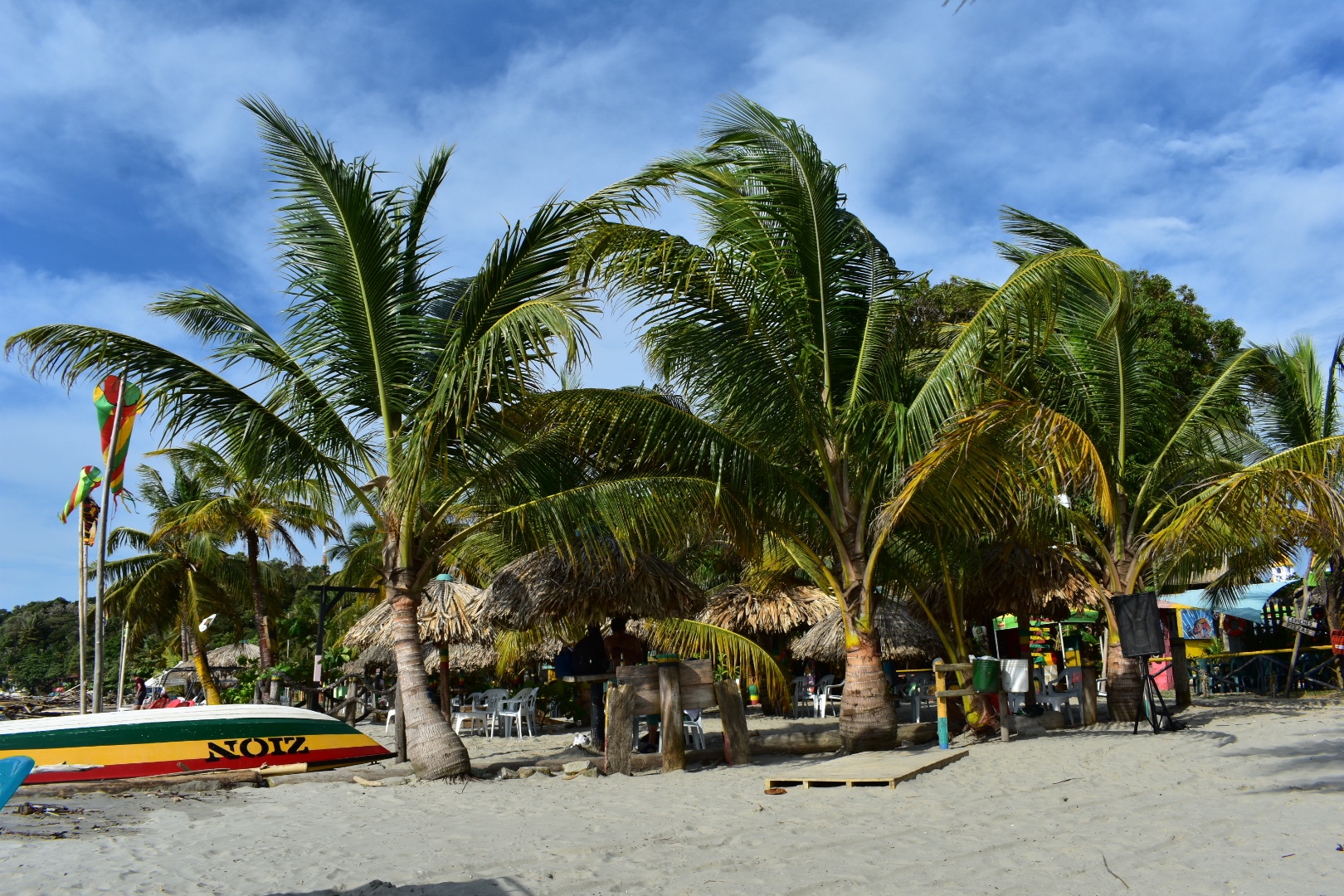
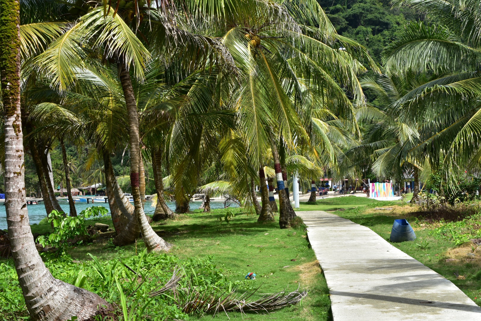
6a29ae53-9402-4fb1-8111-b04275cd695c

Capurganá Beach

The beach close to Capurganá is a perfect spot to relax and watch the sunset. There are a range of bars selling drinks and snacks and I’d recommend spending a few hours there are returning from El Cielo, or you can just spend a lazy day or afternoon. Take a right after you leave the docks, cross the bridge, walk past the market and fishing boats and after about 5 minutes you will see the beach right in front of you.

Coquitos

Close to Capurganá is Coquitos, where a local has created three pools, two freshwater and one saltwater where you can swim. From Capurganá keep following the coast north and after about 30 minutes walk you will arrive. The entrance is $5000 and you can buy cool drinks and plantain chips. 

ea9bf2e4-0374-4f64-b35d-795fb9f3c2c8

Walk to Sapzurro

There is a 4km path that leads to Sapzurro from Capurganá. The journey takes about 1.5 hours and will take you into the jungle where you may see monkeys and iguanas. At the top of the hill there is a lookout giving you a panoramic view of both towns. There is a fee of $10000 to use the path, which is the same as taking a boat, but the payoff is worth the price. Head to the main plaza and take the exit to the north west, on the side of the airport. Take the first left and then the first right, but check on maps.me and that will lead you to the start of the path.

There are a few beaches in Sapzurro, Cabo TiburĂłn is worth a visit and is a 15 minute walk out of the town around the peninsula, the oposite side from which you arrive. Stay and eat in one of the many seafood restaurants and you can even stay in one of the towns hostels.

77948ba6-3aec-4657-aa92-aeb624114ed5

Walk to Panama

Once you are in Sapzurro  it is a short walk over the hill to La Miel and the best beach in the area. You can do this as a separate trip or combine with the above trip to Sapzurro. Make sure you take ID to get past the border checkpoint. The steps up are much better on the Colombian side so be careful going down in Panama. When you reach the town turn right, the beach is signposted and you will have to pay $2000 to enter. There are lots of restaurants and stores at the beach selling food, drinks and snacks and its a beautiful place to spend the day or the afternoon swimming in the warm Caribbean on a sandy beach. You can take a boat back to Capurganá for $20000.

Walk to El Aguacate

There is a seafront path all the way to El Aguacate, 4km and 1.5 hours at a good pace, it actually goes all the way down to Pinorra, 10km, which is another beautiful town with a beach but I think it would be a challenging hike. The hike to El Aguacate is more challenging than others in the area as it involves some steep climbs and scrambling over rocks, but it will give you the chance to see lots of deserted beaches which you would potentially relax on. When you arrive you will be treated to a beautiful bay you can swim in which is surrounded by hostels and bars. Its the perfect place to get away for a while. Remember to bring small notes and if you don’t fancy the hike you can take a boat each way for $10000.

Diving and Snorkelling

There are many places in the area to get closer to the marine life. You can go snorkelling off any beach in the area, its easy to hire a mask in town, try the main street in Capurganá. If you want to go diving then again there are many places that you can try. I’d recommend starting at Dive and Green, which is where we stayed as they have a training pool and look pretty professional. 

1c01c10a-bba0-4e39-ac40-b2434bbd4dbd

Where to eat

You are not spoilt for choice for places to eat in Capurganá but there are some good eats to be found.

For breakfast head to the main plaza and there is a street the opposite side to the airport that has a few shops, including clothes shops, that has a few restaurants serving up a decent breakfast for $8000. Look out for El Arca de Noé, we went there a couple of times as its basic but the plantains were great.

Also search for Pacha Mama, on the seafront the opposite side of town to the main beach, it has the cat on the outside in the photo above. They do great coffee and breakfasts starting at $6000. We didn’t get to try but if the food is as good as the coffee I’d recommend.

For the best pizzas and Italian in town head to Entre Continentes, and don’t be put off if its quiet. The chef is Italian and the food is perfect to match.

Josefina’s seems to be a popular sea food restaurant, just across the bridge from the pier. Sadly it was closed when we tried to visit and I’ve been told its pricey but definitely worth a try.

The restaurant by the pier is generally bustling and serves decent food, try the pizzas, and they do a decent menu del dĂ­a which is a good option if you find yourself in town for lunch.

Enjoy the natural wonders of the high Andean Cloud Forest at Cuchilla El Tablazo, Bogotá

Cuchilla El Tabazo is considered the jewel in the crown of the Western Bogotà Savannah. Rising to 3500 metres high it serves as a natural wall the height of the cliff stops the clouds from the warmer climates in the regions below surrounding the palmero and forest in fog. This creates a mysterious landscape that is completly unique to this region. The wind currents that the birds use to glide reveal the beautiful landscape for miles and miles. From here you can hike down to Supatá, a small town set at 1800 metres where the temperature is tropical and you can wash back a beer before taking the bus back to Bogotà. Descending 1700 meters over the course of 14km, you will see the vegetation change feel the temperature rising. This hike is a truly one off experience where you can walk down from the dense cloud forests into the local dairy farms situated in the picturesque lush green valleys far below. 

If you enjoy this hike and are looking to explore others then check out Parque Natural Chicaque set in a beautiful cloud forest and surrounded in mist. Or you can visit Parque EcolĂłgico Matarredonda, a stunning palmro right on BogotĂ ’s doorstep.

Information

74ac33fb-db4c-4017-8c84-5fa231444bb1

Our Experience

We had been toying with the idea of hiking with a groups since I arrived in Colombia. Organised tours, on the whole tend to be expensive here and can be a little hard to find. We found out later that many are organised in WhatsApp groups – once you have an invite all is good but getting invited into one can be a challenge. We tended to hike solo, which is something I would always recommend, but sometimes its not possible and sometimes its good to be sociable and spend time with other people. Angela somehow managed to get us invited to a group and their next hike was to Chichilla El Tablazo costing $5000 each for the guide plus transport.

This hike wasn’t on my list and is relatively unknown, at least on Google, but when I found out it involved hiking from a ridge of 3500 metres down to 1800 metres over a distance of 14km. I really like hikes with dramatic changes in altitude as you pass through so many different landscapes. We had also done our fair share of uphill hikes –Mirador Aguadora,  Farallones de Sutatausa and Cerro QuininĂ­ to name a few – and I wanted to try something different.

It turned out that the group was largely a group of friends who go hiking regularly and the guide organises the trips for fun. Which is nice as he could easily charge $80,000 or more per person just for the hike. If you are interested contact Felipe (Spanish only) on +57 311 882 6358 and he can add you to the group.

Angela had instructions to turn up at Portal de la 80, so named because it is located on calle 80 on the western edge of Bogotá, for 7am, but we were told that we had until 7:30am to arrive. Being British I was there at 7am taking an Uber direct to the station. When we arrived we approached a couple of groups and Felipe was currently nowhere to be found. So we waited around tentatively until another woman approached us also looking for Felipe, I guess our clothes gave us away, and together we saw a slowly expanding group of people where at least some of them looked ready to hike. As stressed at 7:30 am we headed for the bus, at which point the group had grown pretty larger – I counted 23 plus two small dogs. 

The first destination was Subachoque ($5400). Take the bus from the calle 80 outside the terminal – you will see the busses stop and the ticket collects will get out to get you on. Somehow we were all able to fit on board and most managed to grab seats but a few in the group were left to stand. It took us just over an hour to arrive at the town and we were told we had 30 minutes to grab some breakfast.

There were a lot of cyclists on this route and I think this town is one place they stop to eat food and take a break. There are several food places around the main plaza serving up Colombian breakfasts, so if you haven’t brought any food this is likely to be the last place you will be able to get something (on our hike there were people selling snacks form the back of their car up on the mountain but this is not guaranteed). We always bring lunch and breakfast, just in case, and normally eat more on the road.

After our 30 minutes were up we headed to the main church, Iglisia de Subchoque, on the north-eastern side of the plaza and then headed up Via El Plantano to the top of the cliffs. There is a bus stop marked around the corner on maps.me but the bus doesn’t seem to pass that stop. If in doubt ask the locals and you want to look for the bus which says Laguna de Arce – I didn’t actually get a chance to see the sign on the front but that is the last stop. Its due to leave at around 9am and there seems to be a regular service. 

From the drop-off by the laguna it was a 2km walk to the top. Make sure you walk on the right of the road as there are cyclists coming down the gravel road really fast. One person in our group nearly managed to come close to causing an accident but luckily the rider had good breaks and reactions. The hike started off easy but the altitude did kick in pretty quickly. Angela started to feel a little sick and said I looked pale. There was no blue sky in sight and we were at times walking amongst the clouds. I knew I was definitely back hiking with Angela and she had brought the clouds with her that day. 

  1.  

After around 40 minutes you will see the radar towers. They were covered in clouds when we arrived but Felipe had told us that last time he was here the sky had been clear. I can only imagine the full view which I could glimpse through the clouds. The reason the towers are here is due to several planes that have crashed into the mountains. On clear days you can spot some of the wreckage but there was nothing to see today.

Just ahead of the towers take a right and walk along the top of the cliff edge. Here the you can get spectacular views over the edge of the cliff. Just don’t stroll to close unless you want to join the planes.

And you get an idea of the views through the clouds. We stayed around on the top for around 40 minutes, enough time for the clouds to clear a little for photographs.

The clouds were blown around by the wind clearing a little at times. Its actually fascinating to see the clouds moving so quickly across the landscape, revealing the world through small holes in the cloud and quickly covering them up again.

Felipe motioned that it was time to move on and we followed him back to the car park.  Here there were some people selling coffee, aperas and drinks from the back of their car. If you do want anything then this is your last chance to stock up. So do take advantage. Otherwise its a long wait until you arrive in Supatá. Some of the group were much slower and it took them a while to catch-up so I took advantage and took more photos.

We walked past the towers and then followed the trail along the top of the ridge, around the fences of radar complex and a very aggressive dog. The trail was really wet and muddy and it was easy to slip. I was immediately happy about my waterproof boots and not having to skirt around puddles.

If you are hiking solo then make sure you have maps me and follow the path down from the mirador. We took a detour from the path, which I will come to later, but don’t. Stay on it. When you leave the forest make sure you follow the main road – Maps.me offers lots of shortcuts but I didn’t actually see them on the hike and I guess if you follow them you will end up walking across farmers fields. Instead stick to the main road. One key area you need to watch out for is a farm with a house. I think its the first farm you will come to, and there will be photos later on. There were several dogs and there is a T junction. Take the right path, its longer but it will take you to your destination.

Eventually the path will take a right and into the bushes where there is a very steep descent. Its more of a climb than anything and is the height of 1.5 stories. Although we were near to the front it was initially hard to see why everyone was moving so slowly during this part. When I did reach the front of the line I could see that the path dropped vertically and it was necessary to climb down.

When it was my turn to go down a guy in the shell suit pushed past. I didn’t understand the what he has said but Angela told me to just let him go. He had said “let me go first I need to help” which turned out to be a curse as halfway down he took a fall and plummeted to the path below – luckily he didn’t get much further or we would have never seen him again. He was wearing white trainers with zero grip and I started my descent just in time to see him tumble down, which was pretty scary. It looked like a bad fall, and I hasted to get to the bottom without pancaking and thus falling myself. Another guy wanted to go first so I let him and he quickly reached the bottom and started dealing with the situation.

As you can see in the photo below it was a steep climb, essentially it involved climbing down clinging on to branches and roots. But if you go slowly and carefully and have decent boots you should be fairly safe. He was okay but had hurt his foot but didn’t have any broken bones or a concussion. Instead of turning back as he had been advised he insisted that he could continue but in front of us was about 14 kilometres of trekking and less then a kilometre and a climb were people with cars who could have taken him to safety. He would live to regret the decision – as would all of us.

At this point the some in the group who felt more confident with climbing formed a human chain to help everyone else down safety. It was slow going and took a long time to get everyone down, including the two dogs, but it was worth it. 

Straight after this point was another slightly challenging climb. It wasn’t anywhere near as high but there is a rock you have to cross and to the left is a steep drop down the mountain. There is a bit of a tricky climb down and if you do see some wood to step on then just be careful as it wasn’t as study as it had appeared.

After this the next one hundred metres or so is fairly steep down into the forest it levels out and the path treks through the forest. But for the next few kilometres you will be heading down through the trees.

Very soon you will appear in a clearing which after the steepest  part of the hike completed you can relax here for a time. We stopped to regroup and you could see the clouds moving around here as they did above. Its a nice place to relax for a time.

Once we had regrouped we headed back into the forest and everything is down for the next few hours. Just continue to follow the path on maps.me. We made slow progress for a time and I wondered why we kept stopping. The longer we kept walking the longer we were waiting and eventually I realised it was the guy with the hurt foot. Most people didn’t realise the distance we still has to travel as especially when you are on a forest trail you go so much slower and the scenery changes so quickly you don’t realise that the distance is much shorter. The views however were spectacular and it was beautiful to walk through the forest in the mist. 

We hadn’t gone particularly far and were already far behind schedule when all the hungry people stopped for lunch. It was already about 12pm by this stage and I was left wondering where all the time had gone. I couldn’t believe it when I found out that some people hadn’t brought food with them. I don’t know what they were thinking but I suppose they thought there would be somewhere to stop.

After lunch we continued down and progress was even slower. The guy was obviously in a lot of pain but for each 20 minutes that we walked we had to then wait a further 30 minutes for the last of the group to catch-up. I calculated by the time we exited the forest we had lost over 2 hours just waiting. But it was fascinating to see the foliage change. This is one reason I like hiking in mountains over other terrain, especially when you deal in large changes in altitude, as everything changes so quickly.

Eventually the forest started to thin out and we could see the beginning of the Savannah but there was still a long way to go down. Also looking at my map I could see that we had left the trail. Don’t do this as the main trail down is better. Felipe  took the decision to take what he thought was a more direct route out of the mountain. In the end it didn’t help us and we had to cross a few barbed wire fences. Always trust your guide and he did his best to support the injured member of our party.

When we left the forest the sky had turned blue, well mostly blue. We took the direct path down to those buildings, climbing over a couple of fences and walking through fields. I was beginning to worry as the guy with the foot was in a lot of pain. I suggested to Angela that we should give him some pain killers.

We were then in the grasslands and still had a long way to go. It was now around 3pm and our last bus from the town of Supatá left at 5pm and I knew we had at least 7km to go. In the end it turned out we needed to walk much much further.

As we walked I was finally able to see the cliffs and for a time the sky cleared giving us some beautiful views and allowing us to see all of the mountains around. I took a lot of photos.

We began to walk across fields and the land became flatter. The sun was creating beautiful patterns through the clouds and bathing trees, cliffs and and rocks in sunlight highlighting their beauty. 

We waited by a dairy farm for him to catch-up, everyone sat around and then started taking group photos. I was desperate to keep going knowing how much further we had to walk and how long we had already waited. We headed off at speed following the first road we had seen since descending from the ridge to the nearest farm to ask for help. 

The sun was really opening the clouds up and while we were waiting for the other to catch-up I took advantage and snapped a lot of photos.

Everyone sped along on the hike, most people were now realising the distance that we still had to cover. the temperature was beginning to drop and people were hungry. The landscape was stunning and I was very happy to enjoy it emerging as we reached the crest of every hill. 

The cliffs were now completly out of the clouds at times and we were able to enjoy them from afar. 

We soon reached the farm but for now no one was home. We waited for everyone to catch up and it took a long time for the guy with the painful foot to join. In the meantime he was lucky as the farmers returned while we were waiting and Felipe bargained passage for the guy on a moto.

As soon as this was sorted Felipe gave us the lowdown and told us which road to follow all the way to the town. We all knew the bus would have left by the time we had arrived so we needed to find another way back to BogotĂ . With the sun setting as still a long way to go time was of the essence! It was 4:10 pm and according to the map it was 6.5 km which is over an hours walk. Although it was more like 8 km by the end. We all walked off at speed to the town.

The final part of the journey was long and challenging. We had also run out of water by this point and I wished that I had brought my water filer with us. It wasn’t helped by the fact that we had to rush half of the hike in a few hours when we were tired. Then to top everything off it started to rain. I was thankful for the waterproof coat and trousers we had brought – Angela’s were a new addition. For a time it felt like we were hiking in a cloud but then we came out below it. It was all downhill which made it easier and walking along the road meant we made really good timer. There were a lot of large puddles crossing the entire road and a couple of streams to traverse.

The road was largely stones which makes it more challenging to walk but we kept up a fast pace. Soon the faster members were out of sight and had raced ahead on the road as it twisted downwards around fields and mountains. Occasionally there were switchbacks and I was more concerned about the half of the group that ended up behind us. Although later on I realised some of the better walkers had stayed behind to support the slower.

I knew that we would not reach the town before dark and was worried about the light – we only had our phones as I hadn’t anticipated needing a torch. This might be something that I pack in future as there have been a couple of times where I’ve worried about the night drawing in. 

There wasn’t much in the way of houses or shops or passing traffic. About a third of the way into the journey the guy with the foot passed us on a motorbike waving and smiling to everyone. He didn’t seem to grasp that we were all in this situation because of his stupidity. Eventually I realised that the road we were on took us along the longest path on Maps.me. As I said above there are shorter paths but I didn’t see any obvious ones while walking. Then again we just wanted to get to the end of the road as we were pretty much alone by this point.

With about 1.5km to go it turned dark enough to require the torch so I used my phone as a light, and then a lot of motorbikes appeared leaving town. The closer we got the more houses appeared and then I realised we needed to take a left turn to get into the town. If you stay on the road it will take you out again.

There was no one waiting for us and we caught up with a few others at this stage, so as a group we headed for the Plaza and found Felipe and the rest of the group. It was just after 6pm. If you do arrive before the last bus for Bogotá has left then you catch it from here. I’m not quite sure where but ask around.

I went to get some water and crisps and while I did some transport had been arranged. It was for half the group and Angela volunteered to wait for the others. It turned out that the guy who hurt his foot was supposed to help arrange transport when he arrived in town but instead he sat in the plaza and did nothing, turning his phone off leaving Felipe in the dark. A nice way to pay everyone back.

The second half of the group arrived around 20 minutes later and we were soon in the back of a pickup transport to the main road. It was a long quie trip back in the pickup. We were cramped in and all tired so we sat recovering with our own thoughts for company. IT took us as far as the main road to BogotĂ  where we disembarked and paid the driver. He stayed with us and helped to flag a bus which took us the rest of the distance back t Portal 80. It went further but at this stage we jumped out and took and Uber back to the house. It was around 9:30pm at this stage and I didn’t want to mess around on the Transmileno.

I ordered Burger King as soon as we were in the taxi and it arrived just afer we did. We ate hungrily and sank some beers before we turned in and had a well earned rest.

>How to Hike Cuchilla El Tablazo Solo

You need to take two busses from Bogotá to arrive at the beginning of the trail, assuming that you are going downhill. You can hike starting in Supatá which is worth considering but you will be adding on 9km to the hike and the vast majority will be uphill.

Go to Portal 80 on Calle 80 and from here take a bus to Subachoque $5400, a small town, you can take the bus from the main road. From here you need to get to Laguna del Arce $5000. Its a 9km walk or you can take a bus from the plaza. There is one that leaves close to 9am and I believe that there is a regular service. I would not aim to leave any later than 9am as its a long hike. 

When you are dropped off by the laguna take the road to the left, uphill, until you reach the radio towers at the top. From here you can get an amazing view from the top. Fro the car park walk right and away from the towers, which is basically walking along a path which takes you parallel, to the road you have just walked along. When you are finished head back to the car park at the top. Follow the road to the end and then walk around the remaining complex. At this point you should be on the trail that leads to Supatá. From here allow 6 hours to reach the town.

At Supatá head to the main Palza, its not on the map but you can’t miss it as you can see the church. From here you will be able to take a bus direct to Bogotá $10000 and will take at least 2 hours. 

In total the busses will cost you around $20000 per person. There are no entry fees on the trail.

Equipment to take

Once you start the hike there is nowhere to buy supplies and with this being close to BogotĂ  make sure that you prepare for any eventuality. Bring the right equipment and make sure you have enough food and water. This is a long and relatively challenging hike..

      1. Gortex hiking boots, if you don’t bring anything else make sure you wear decent shoes. Boots are better as they offer ankle protection.
      2. Waterproof jacket
      3. Waterproof trousers (you could live without these on most day hikes but once you have them you won’t want to hike without them)
      4. Dry bag or packback cover (I take both)
      5. Cell phone
      6. Cell phone battery
      7. Charger cable
      8. Sunglasses
      9. Sun Cream
      10. Painkillers 
      11. Blister plasters (better if you have a small first aid kit)
      12. Hand soap
      13. Tissues
      14. Water filer
      15. Sun hat
      16. Food (make sure you bring high calorie and this is also your change to binge on sugar – you are going to burn in)
      17. Water 3 litres minimum

Clothes

Again make sure you take decent clothes. I might go a little over the top as I brought all my equipment for Patagonia but you can’t go wrong with the following. I don’t always bring all the layers listed below but the layers will keep you warm.

      1. Base layer
      2. Jumper
      3. Fleece
      4. Down Jacket
      5. Hiking trousers
      6. Hiking underwear (trust me it stops the chafing)
      7. Hiking socks


If you enjoy this hike and are looking to explore others then check out Parque Natural Chicaque set in a beautiful cloud forest and surrounded in mist. Or you can visit Parque EcolĂłgico Matarredonda, a stunning palmro right on BogotĂ ’s doorstep.


Take the short hike up to the Mirador Aguadora on a weekend morning, Usaquen, Bogotá

One of the many many paths leading up into the mountains surrounding Bogotá  is the Mirador Aguadora hike. This short hike is perfect for a Sunday Morning excursion and definitely one for the kids and when you reach the top you can see panoramic views of the city. Its a great little hike, especially if you have just arrived and want to get used to the altitude or if you are looking for something not to strenuous and want to avoid the crowds at Montserrat. And the best thing about the hike is that its absolutely free! Starting in Usaquen amongst the market and restaurants means you can finish off with a well deserved, beer, ice cream or pizza, whatever takes your fancy. For those looking for a slightly longer hike then this one is easily combined with the Camino del Indio, which follows straight on when you reach the top.

There are many stunning hikes up to the Cerros surrounding Bogota which start in the city itself. Read my post about the 4 different hikes that form part of Quebrada la Vija, including one that takes you up to the closest Palmero direct from Chapinero Or escape the city on a sunny afternoon and take the short walk up to Guadalupe.

Information

Our Experience

This was our third attempt at the hike as on the two previous times we had been unlucky as the path was closed for maintenance. However that is a good thing as it shows that the path is well maintained. Angela and I went for the final attempt on a Sunday and you need to go early as the last admittance to the path is from 6am – 12pm everyday. We also decided to take Lorenzo along, who is five, but he misses out on most of our treks as he is still to young but seems to be a fan of the mountains. He had a great time and the path is perfectly safe for children. Towards the top it gets pretty steep but he was perfectly find holding my hand at this point.

Typically with a lot of places in Bogota the train head is actually on private land, a members club called Aguadora, which means you have to pass through security in order to get there, and you can see the gates below.

The first part of the hike is along the road to the club but you soon leave the city behind and are surrounded by the tranquile lush forest.

After a few bends the road bares off to the right and the trail starts. The first part is a dirt track where you will also find a lot of cyclists. We started later in the day as Lorenzo has a football lesson first thing and there were a lot of people coming back down.

I was complaining that all the people were ruining my photos but Angela suggested I should include them in some shots to show that other people used the trail. So here is a guy bravely cycling up the path.

The path winds its way through the trees steadily going uphill and soon comes out into the open and you can see the mountains surrounding you and the city far below. I climbed up a bank to get a better view before we continued onwards and upwards.

Around halfway to the top there is a small water processing plant and this is where the road ends and the cyclists have to complete their journeys. Those on foot can cross the bridge and continue up the train and from this point onwards it becomes progressively steeper.

There are a lot of benches along the way so do take advantage of them if you need a break. There is no point becoming tired but I’d recommend having lunch with a view, if you brought food, and waiting until the very top.

It took us around 90 minutes to reach the top, and that was with a very energetic 5 year old. We did stop to take a log of photos and to rest so if you allow 2 hours it should be more than enough to reach the Mirador. Here there are some benches where you can sit down to enjoy the view.

We decided to turn right and walk a little further stopping in the clearing which has a view of Embalse de San Rafael and had lunch.

When you reach the ridge you can continue the hike by taking a left or right. If you go right then you will soon see the clearing as we did and then the path heads up to the top of the next mountain. Lots of people were hiking up and down this path, which follows the pipes, and if you look at Maps.me you will see the route continues and then there is a further route back down to Usaquen.

Despite being keen to climb up we felt it was a little dangerous for Lorenzo as it is steep and also we didn’t want to use up all his energy before the end of the hike. Instead we took a few photos of the surrounding area, headed back to the Mirador and headed left as I wanted to explore where the path went.

Going left from the Mirador takes you to a quite road and the entrance to some exclusive apartments. Straight across is another access road that takes you down and we walked a little way to get the views of the lake. If you wanted to go all the way down you need you turn left and follow the paths on Maps.me, although I’ve not tested these and the paths on the map are not always accessible, but it does show a route. Do let me know if you try this, I would if I had more time.

The whole area is beautiful and it makes a nice short hike close to the city which is great, even if you don’t climb to the very top. And there are a lot of routes to take once you get up here for the more adventurous. Just keep checking on Maps.me.

How to Hike to Mirador Aguadora

The entrance to the hike is via the access road to the Club La Aguadora, on Calle 119. First head to the Plaza de Usaquen and then take calle 119, the north size of the plaza (look for Mister Ribs) and turn right. After one block cross the road and from here just go straight until you reach the security gate. This is where the trail begins.

If you are taking a bus you want to reach Avenida Carrera 7 and calle 119. There are many busses that pass this part of town. If you are not sure then Moveit has all the Bogota bus routs as does Google Maps.

Once you start the hike it can take around 90 minutes to 2 hours to reach the top and a similar time to come back down depending on how fast you walk. There is no charge an the cost of travel is as little as $2400 for a Transmileno ticket.

How to combine with the Camino del Indio hike

Its possible to combine this hike with Camino del Indio and I would actually really recommend as when you reach the top of the ridge you are already at the Camino del Indio. Its a further 12km to La Calera, all downhill and will take you another 2.5 hours form this point giving you beautiful panoramic views of the lake, but trust me the hard-work is already done. .

When you reach the mirador at the top, rest for as long as you wish and then turn left, this will take you down to the road. From here take a left and you will be at the Camino del Indio trail that leads into the forest, which has the fence on the right. From here just walk all the way to La Calera.

dsc_0580

Equipment to take

There is no food or water available once you leave Usaquen, but in all fairness Aguadora in itself is a couple of hours walk. Most people on the hike were wearing normal sports clothes and trainers but as I have the equipment and like to be prepared this is what I would always bring. Do take water as a minimum precaution.

  1. Gortex hiking boots
  2. Waterproof jacket
  3. Waterproof trousers
  4. Dry bag or backpack cover (I take both)
  5. Cell phone
  6. Cell phone battery
  7. Charger cable
  8. Sunglasses
  9. Sun Cream
  10. Painkillers
  11. Blister plasters (better if you have a small first aid kit)
  12. Hand soap
  13. Tissues
  14. Water filer
  15. Sun hat
  16. Food – you can never have too much and you will need it on this hike so pack appropriately.
  17. Water 1 litre minimum

Clothes

The hike is not high altitude and I found we brought too many layers getting warm quickly. Having said that is can always get cold in the eastern hills so its best to come prepared.

  1. Base layer
  2. Fleece
  3. Hiking trousers
  4. Hiking underwear
  5. Hiking socks

There are many stunning hikes up to the Cerros surrounding Bogota which start in the city itself. Read my post about the 4 different hikes that form part of Quebrada la Vija, including one that takes you up to the closest Palmero direct from Chapinero Or escape the city on a sunny afternoon and take the short walk up to Guadalupe.

Have an Adventure Weekend, Hiking, Climbing and Cycling in Suesca, Bogotá

Situated on the northern edge of the BogotĂ  Savannah, an hour outside of BogotĂ , is Suesca. Famous for the Rocas de Suesca (Suesca Rocks) it’s a mecca for the outdoor activities. For the adventitious there are 500 plus climbing routes across the rocks, plenty of hiking trails, and many cycling routes. For those who require less of an adrenaline rush can take time to relax by Lake Suesca or eat in one of the many restaurants. Hiking along the ridge line along the top of the cliffs provide views of the surrounding area for miles around. The scenery is breathtaking. Or follow the railway and recreate the scenes from the movies.

The town is well set up for outdoor sports and you can hire climbing equipment and guides from many places in the town. Visit Cañon de la Lechuza (Owl Canyon), Laguna de Suesca (Suesca Lagoon) and hike to Santa Rosita and for lunch. Its the perfect place to escape for a day or even longer. There are options for staying overnight either in the campsites situated at the bottom of the cliffs or in one of the many hotels.

If you enjoy hikes in the lush green mountains that surround BogotĂ  then mountains that try read my guides to Cuchilla El Tablazo, a downhill hike which starts overlooking lush green valleys from a palmero covered cliff at 3500 metres ends in a warm town at 1800 metres far below. Or head up to the rocky Farallones de Satausa where you can also go bouldering when you make your way along the ridge line.

5eeed405-5503-4cd0-ab8f-003e9f333c58

Information

  1. Our Experience
  2. How to get to Suesca
  3. Equipment to Take

d67e2a6b-060b-4623-96dc-de0cf4930256

Our Experience

On one of the many holiday Mondays in Colombia I decided to visit Suesca. It was my first solo hike since returning to Colombia, which was actually quite nerve racking. Despite having hiked solo in more remote places this many, many times the year before I was out of practice. But my Spanish is better now and so is my planning. Angela was not well, which was a shame as the weather was beautiful, so I left her at home to enjoy some solitude and took an Uber to the North Terminal.

While in the taxi I realised that this is how we should have started all of the hikes. Getting across BogotĂ  is difficult, slow and not much fun. On so many occasions it had easily added 1-2 hours to the journey, just to get to the bus terminal to leave the city. Uber is cost effective enough that you are not really saving much in cost vs the time of taking public transport. This time it was it was really easy! The cycle paths had not opened and being a holiday there was much less traffic than usual. I arrived at the station just before 7am, brought a tickets, snacks and was on a bus by around 7:15 am. Initially I headed into the main building and was directed around to the far end of the terminal. When facing the terminal there are a set of more local busses that leave from the bottom right corner, there is a huge sign which details the destinations of the busses. I grabbed some water and walked around the complex and waited in line for my bus.

Tell the driver that you want to go to Rocas de Suesca and you will be dropped you off just before you reach the river, outside of the town itself. You do not want to go all the way into the town or you will have to walk back outside of the town. A single trip is $7600. Assuming you are dropped in the correct place, it will be on the same side of the road in which you leave the bus, then there is a short walk to the train tracks and you will see the views in the photos below.

dsc_0064dsc_0480

Despite the sign above telling you that its dangerous to walk along the tracks I decided to head off in that direction. This is a working railway but its only used for cargo trains. I don’t know how often they run and being a holiday I felt fairly confident I’d be safe. I didn’t see or hear any trains pass on the day that I hiked. The only way to access the bottom of the cliffs is along the railway line so there are plenty of people taking the route along the lines. But just take into consideration that a train could pass you at any stage during the hike. I didn’t see any areas where it would not be possible to stand back and let the train pass and you should hear it coming from a long distance but again, just be careful.

There is also a path that leads straight across the railway and up into the hills, this is where I ended up when I returned. I wanted to follow the train track and recreate scenes from the movies I watched as a child. In hindsight stones are not the best for hiking on but there are well trodden paths along the sides of the track and you can also walk along the sleepers. So after taking some photos I immediately headed to the left to follow the tracks.

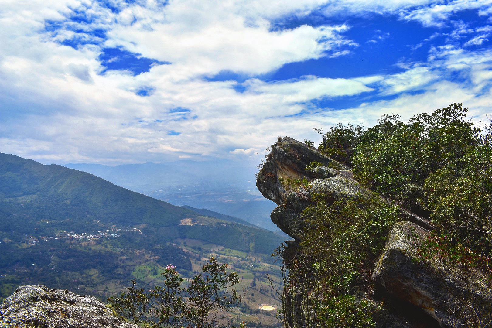
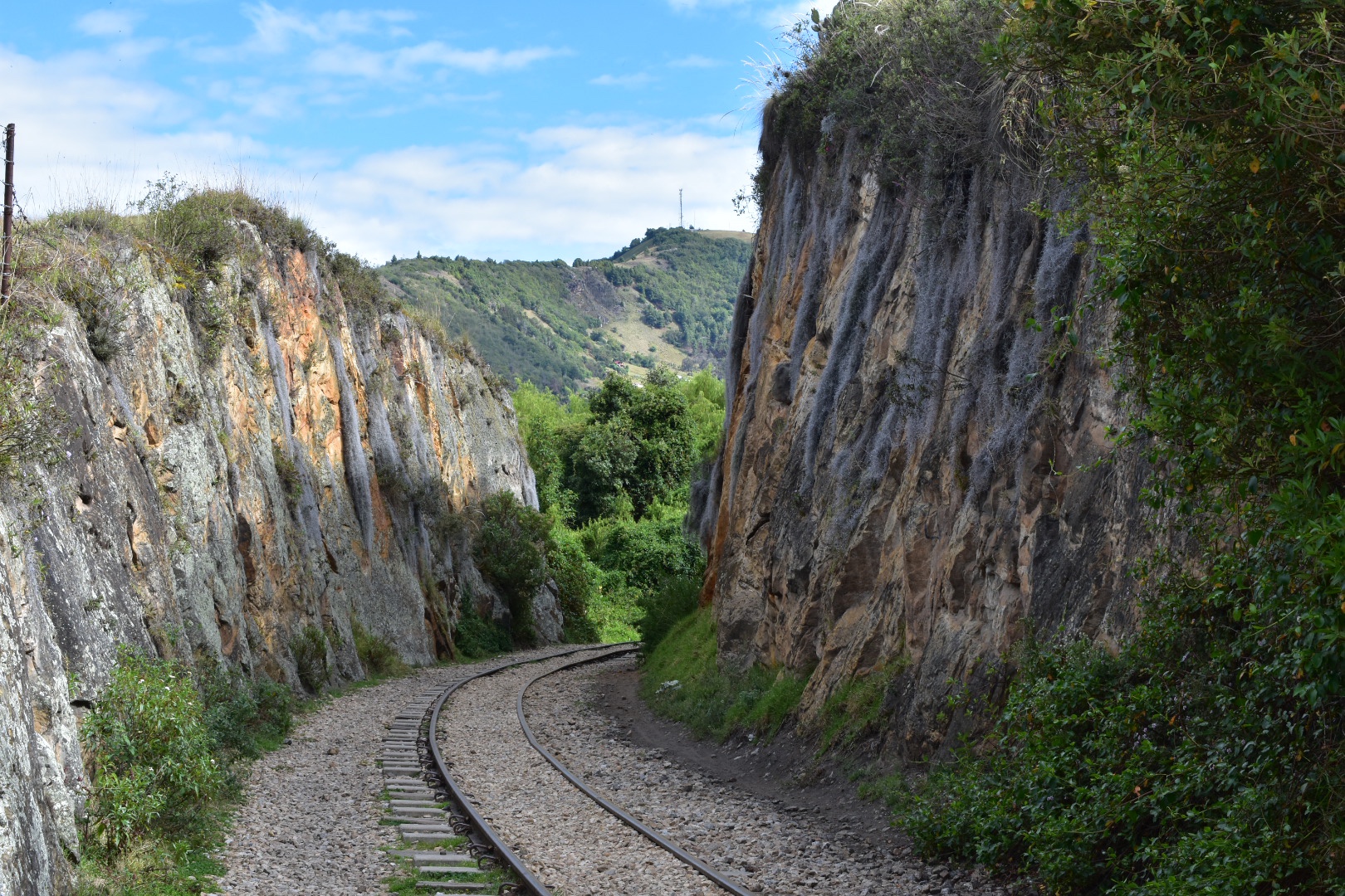
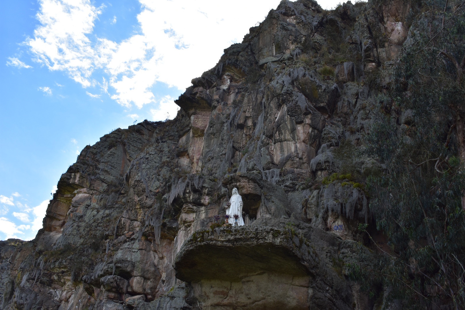
After curving around to the right the track levelled out and I could see the cliffs and very soon saw climbers making their way up the rocks. I also spotted a Virgin Mary which I’m hoping is not a tribute to anyone who has died.

I was lucky to be able to hike on a beautiful day and it had only taken me an hour to arrive so I started early around 8:30am. The initial leg of my trip was just over 5km and I wanted to go to Cañón de la Lechuza, a mirador on maps.me which is you can find by just following the tracks and if you wanted to go further then just under 1 more kilometer takes you to the town of Santa Rosita. I decided not to walk that far, but you will see it in the photos below. There you could have lunch as there are some restaurants, bakeries and hotels if you wanted to stay. But this whole hike is easily done in 3-4 hours. I was on a but by 12pm and I stopped a lot to take photos.

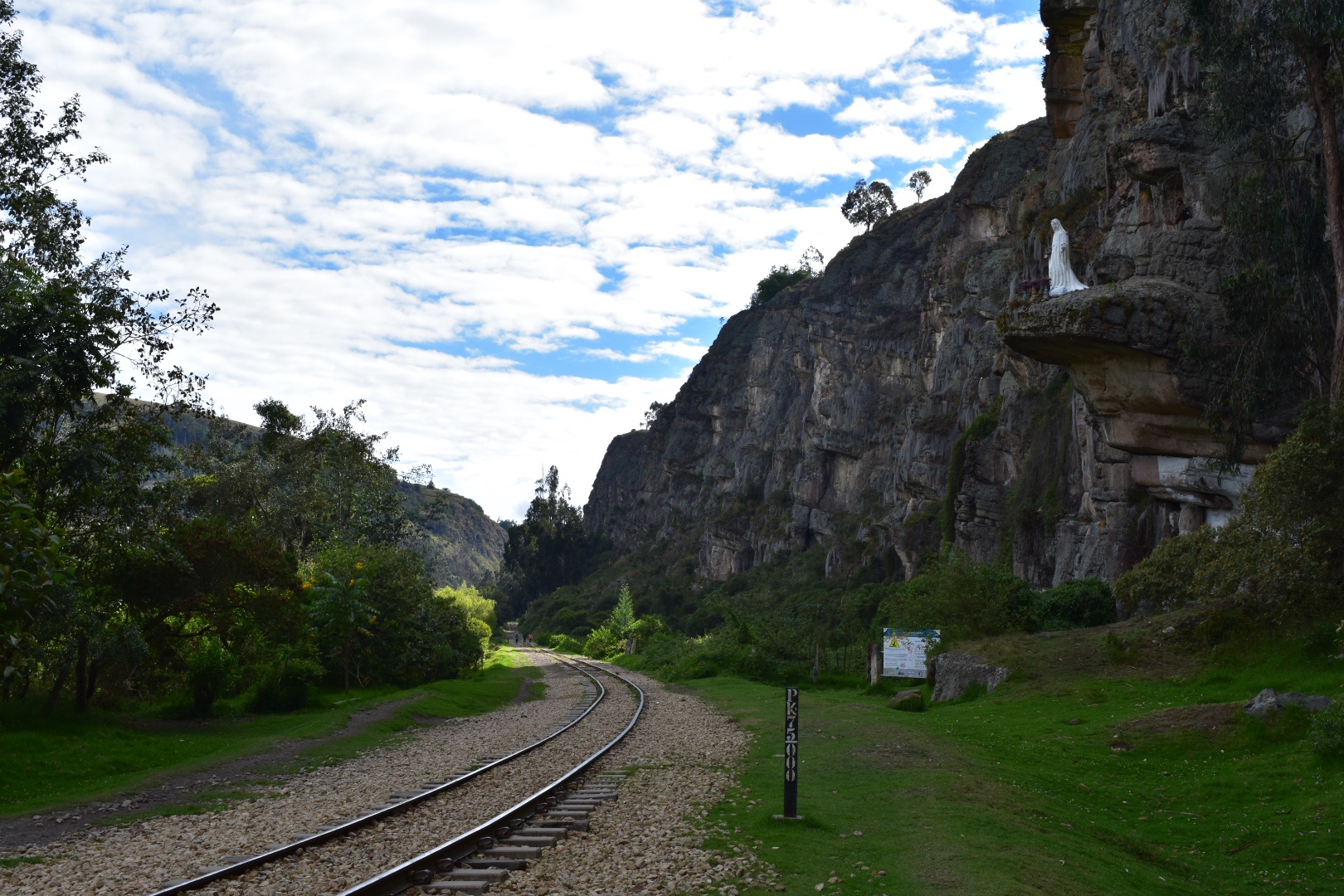
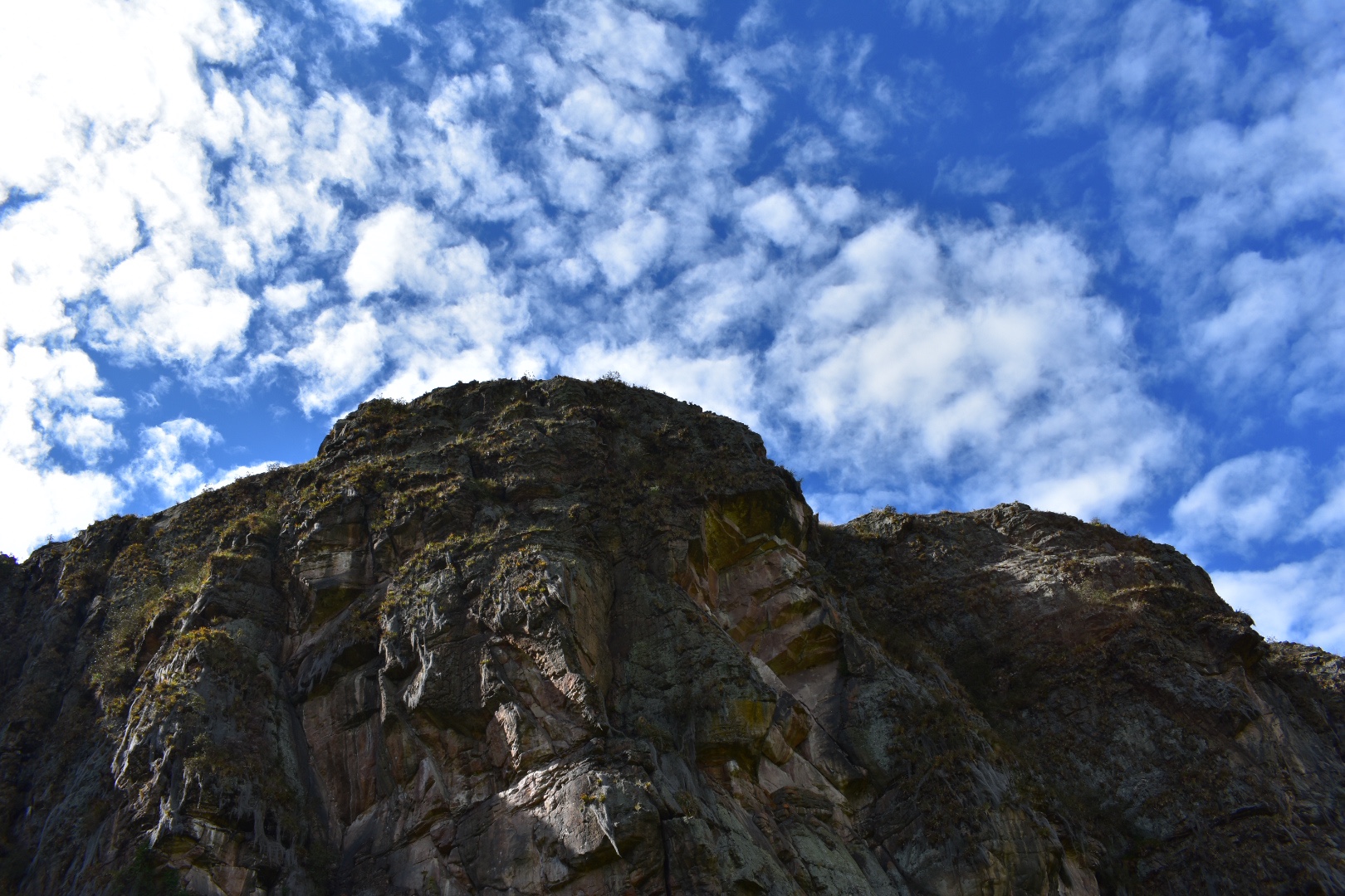
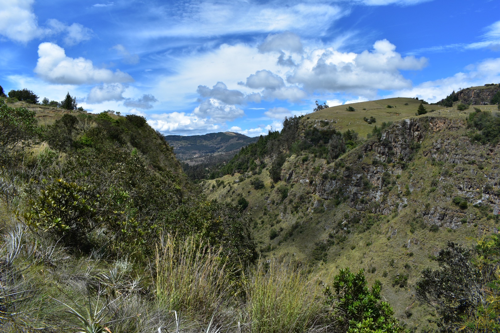
I really enjoyed the rugged terrain and the foliage growing out of the rocks. The photos don’t really do it justice but some of it seemed like giant spiderwebs.

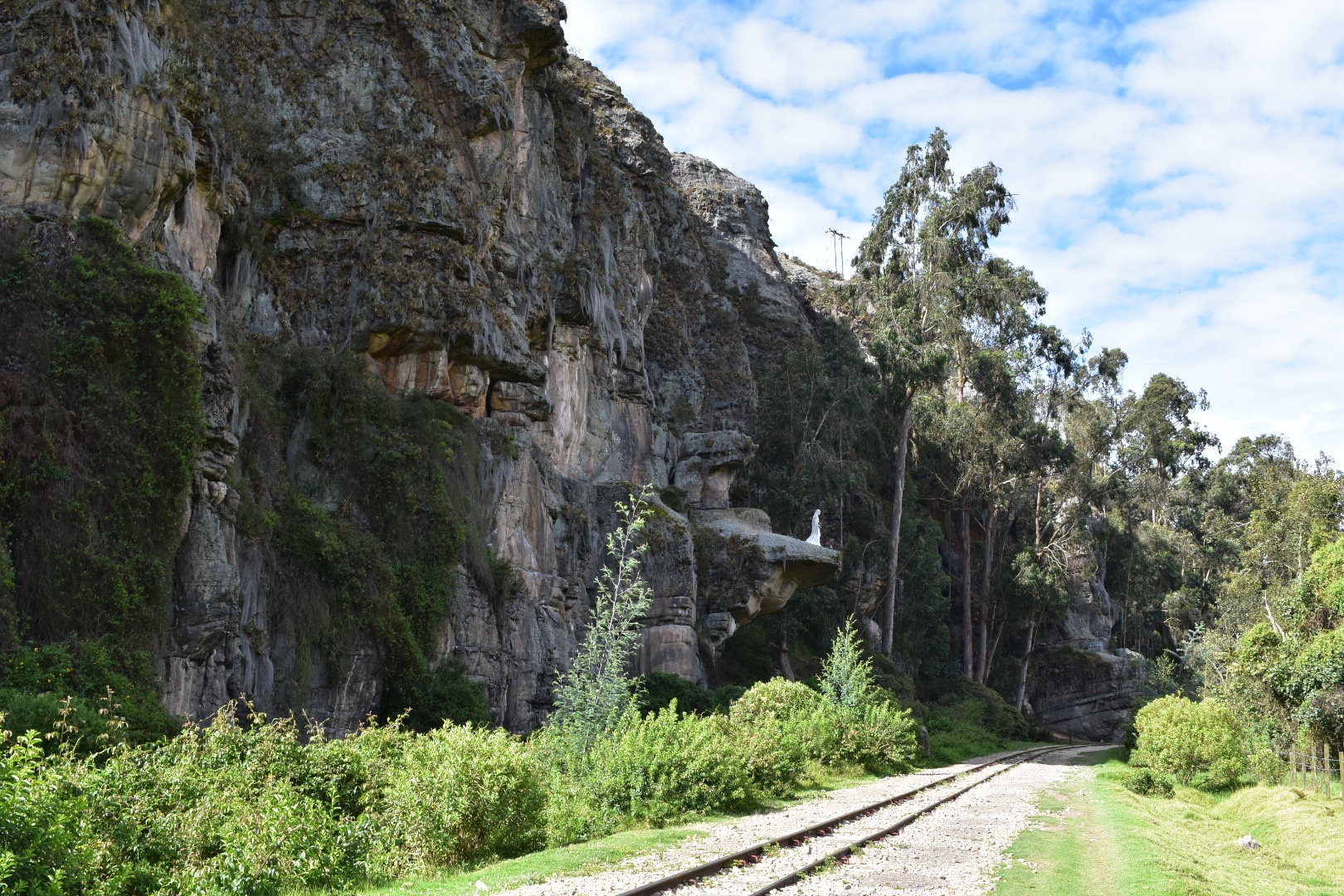
I soon came across a camp site where plenty of families had decided to spend the night. I also got the impression that any of the climbers were using it as a base because there were a lot of people in climbing gear walking to and from the camp. Although as I went further up the tracks I didn’t see so many people.

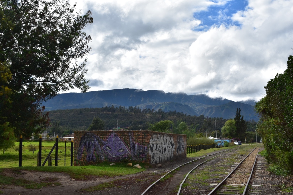
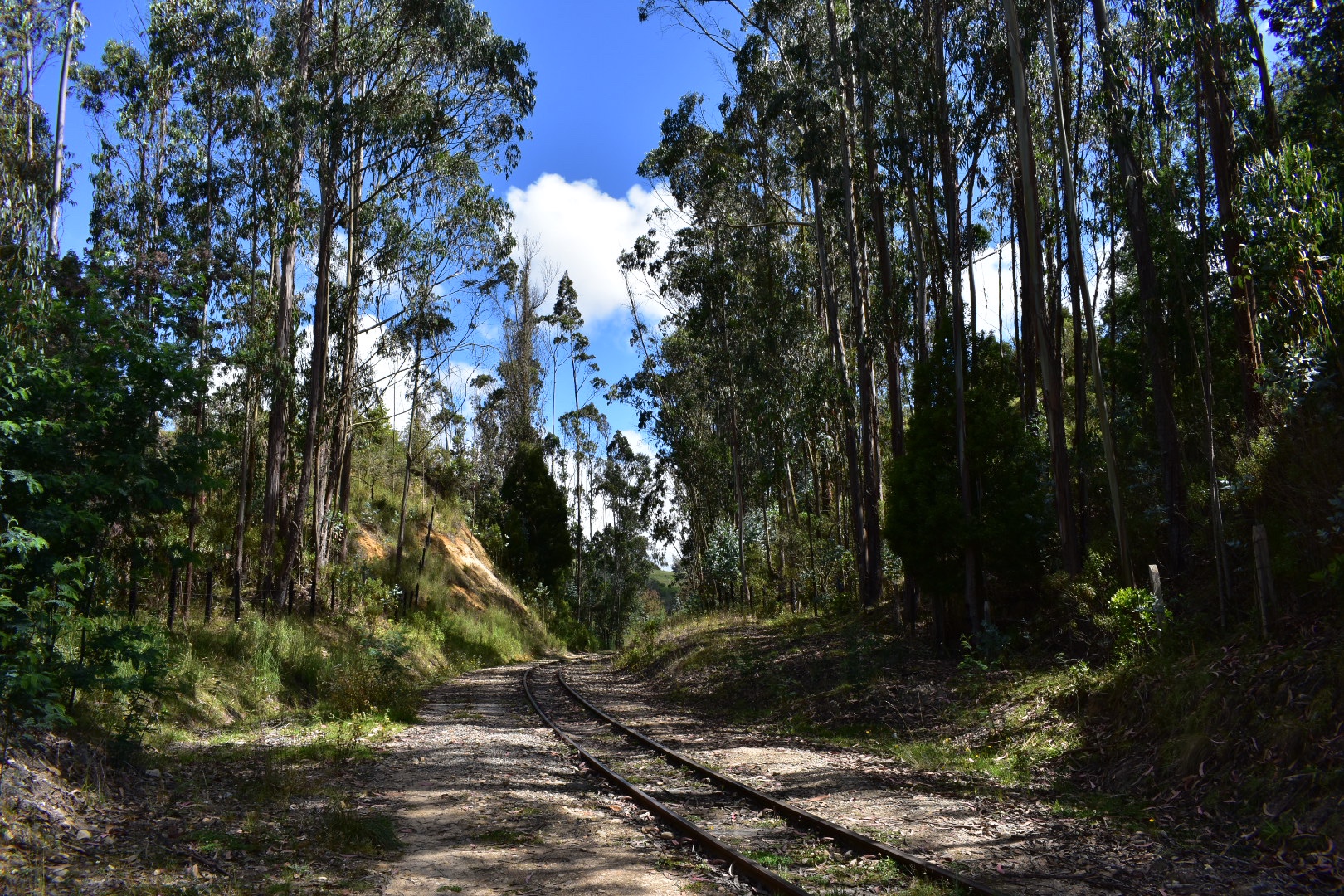
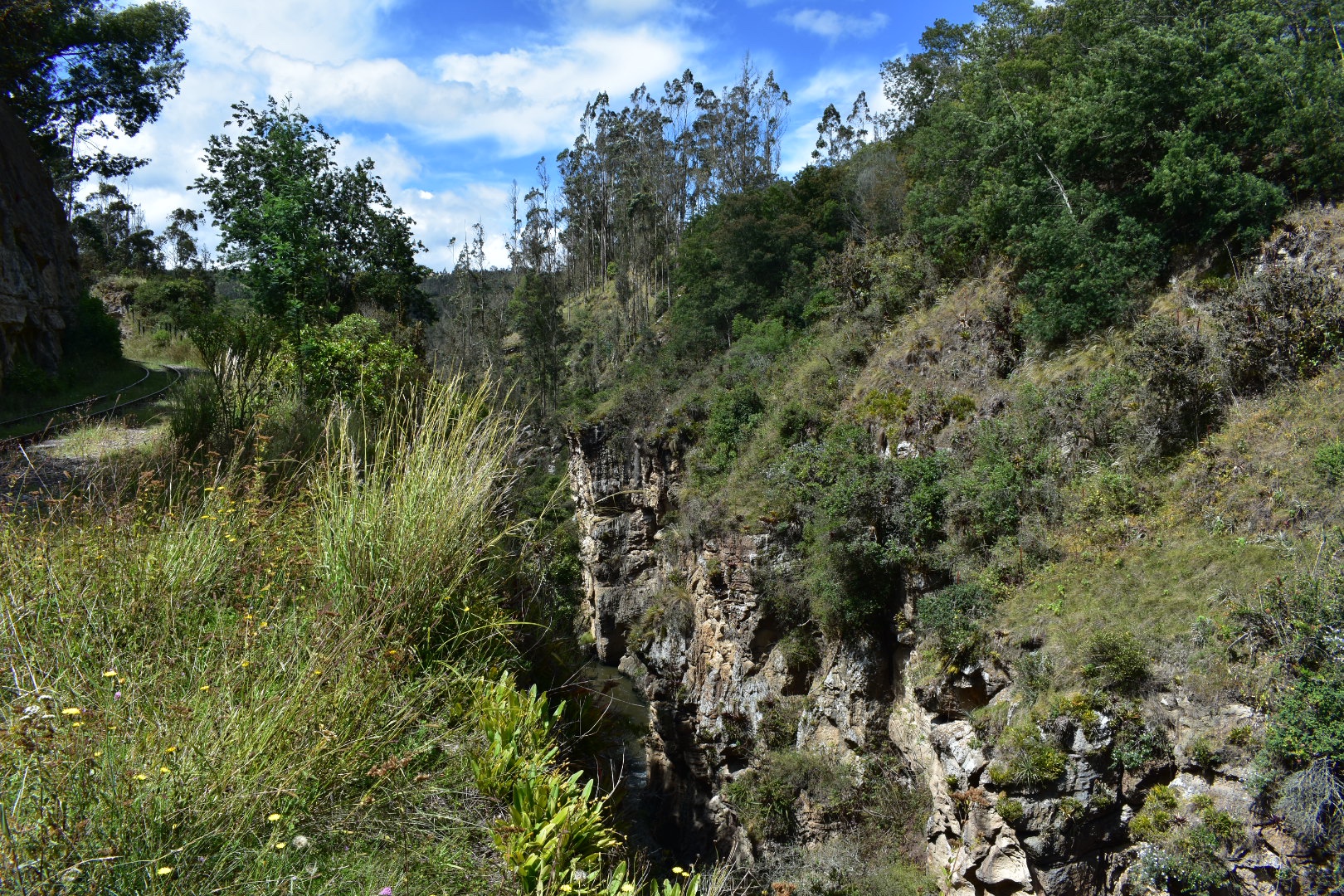
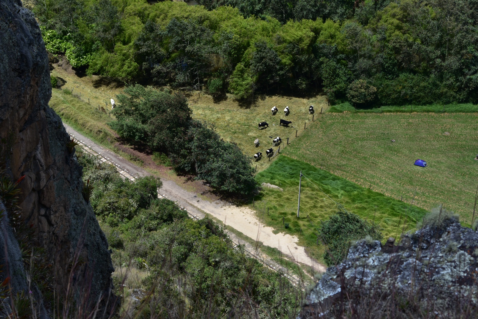
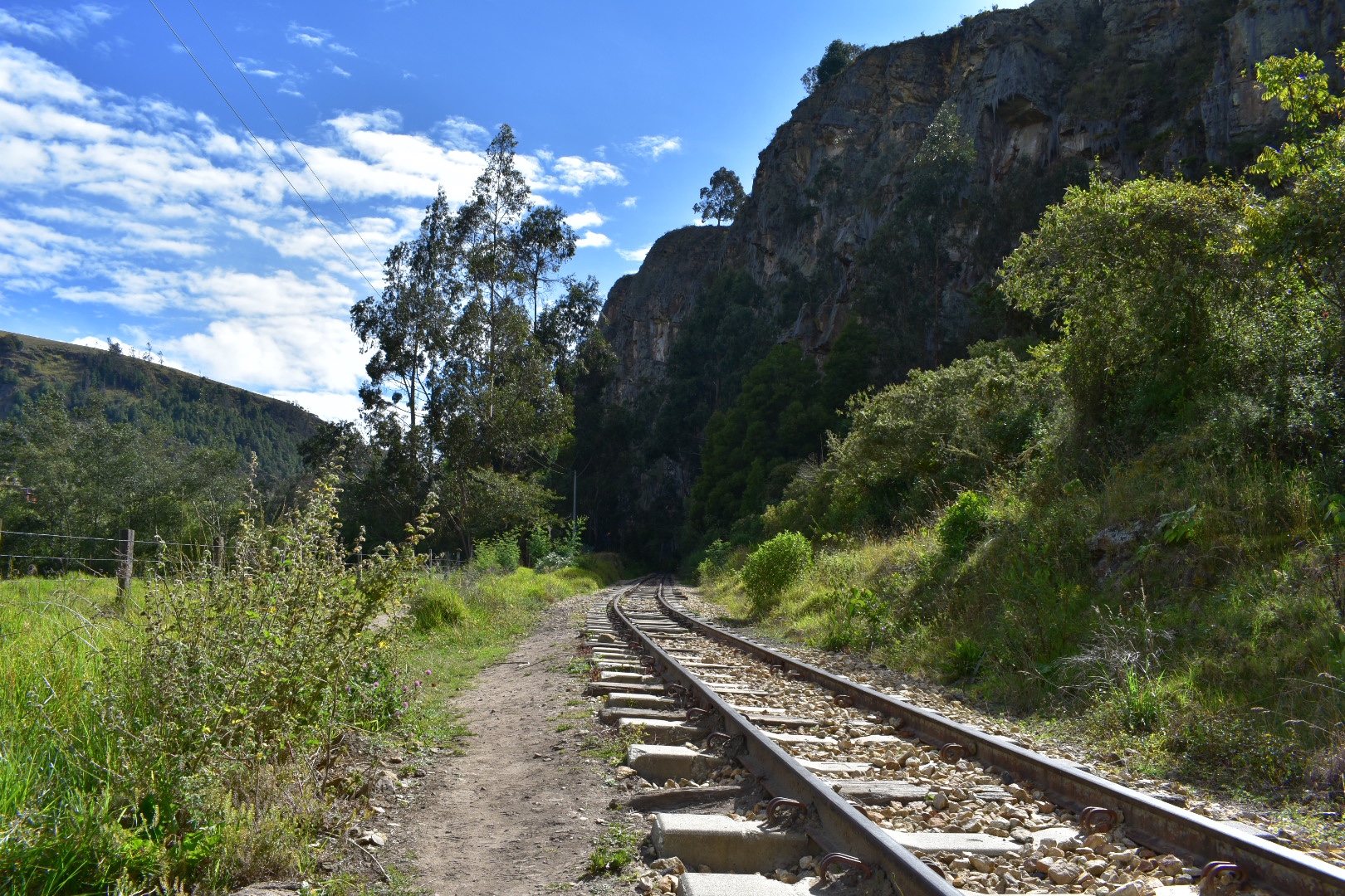
The mountains close in as you travel further along the train line forming a canyon with the river right at the bottom it provided some beautiful views and sounds.

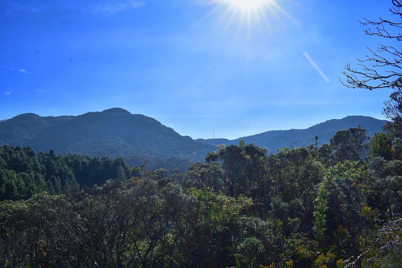
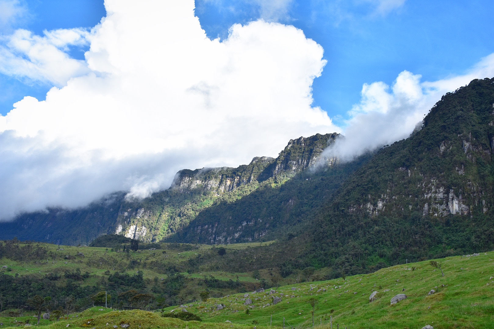
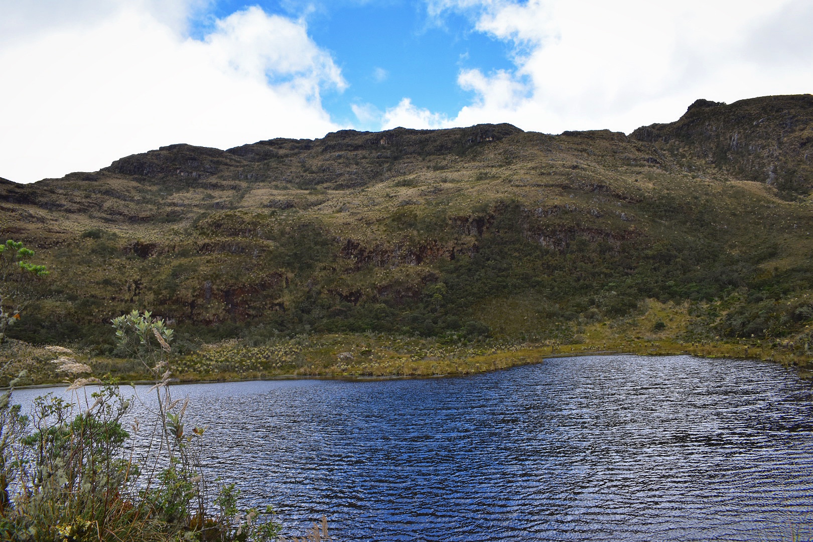
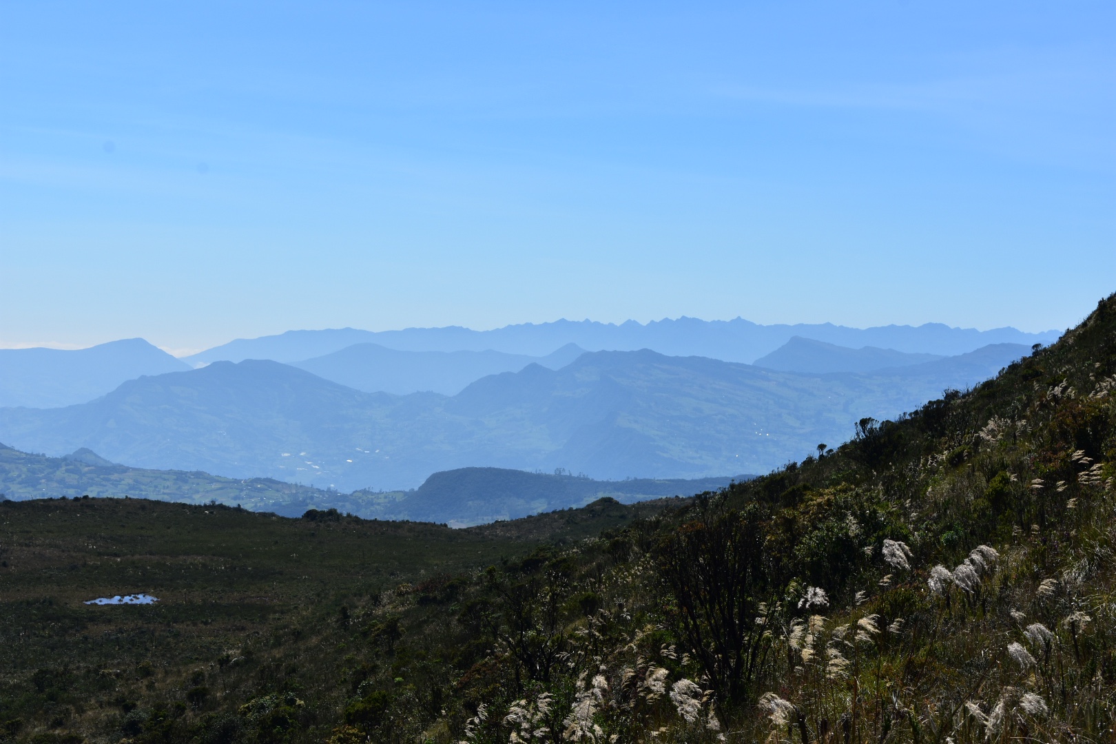
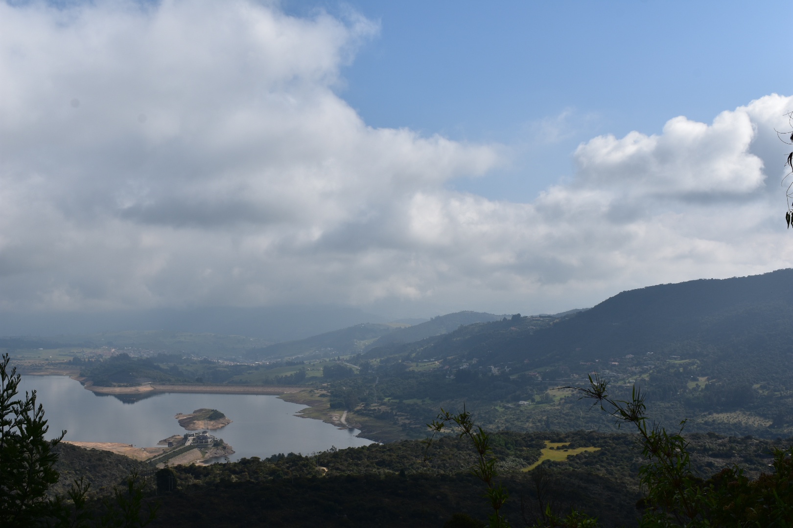
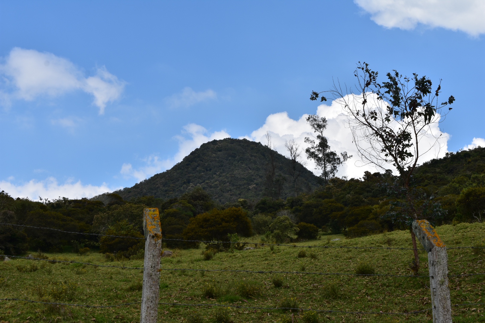
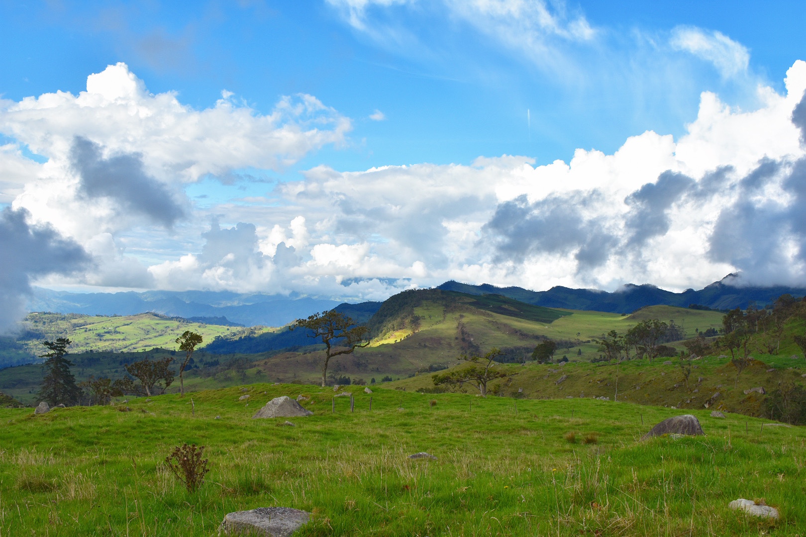
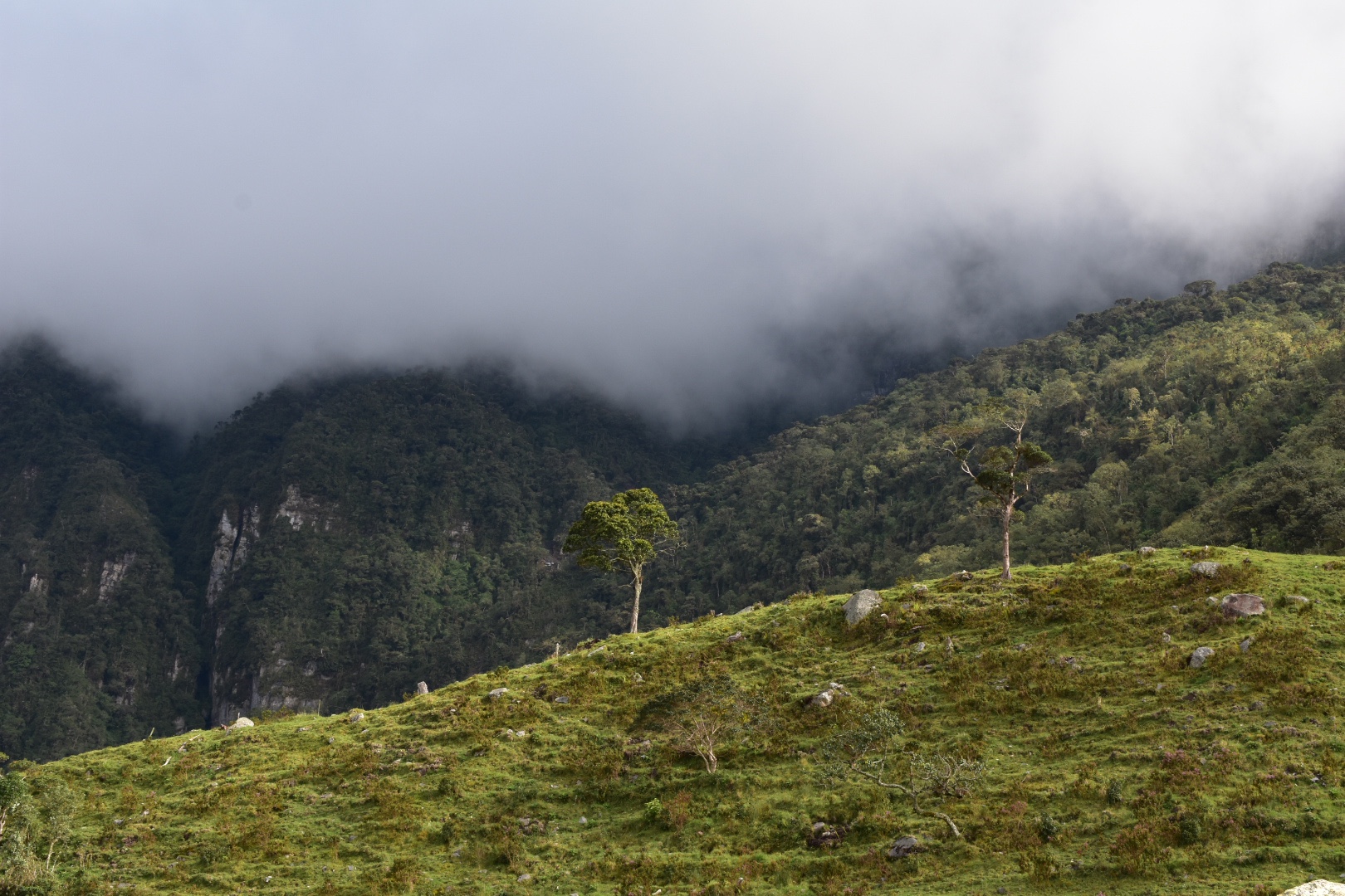
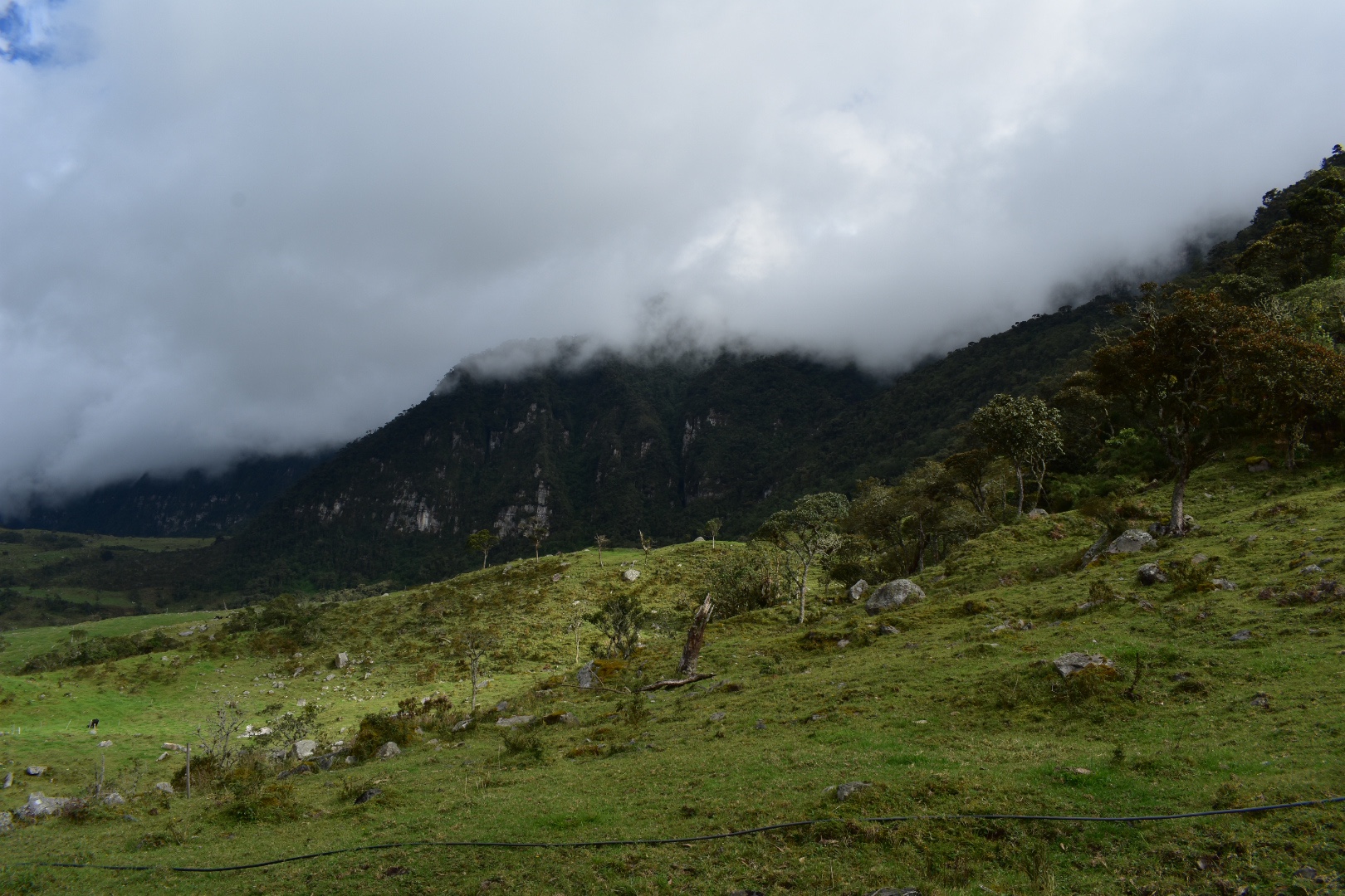
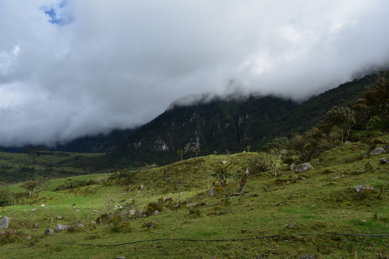
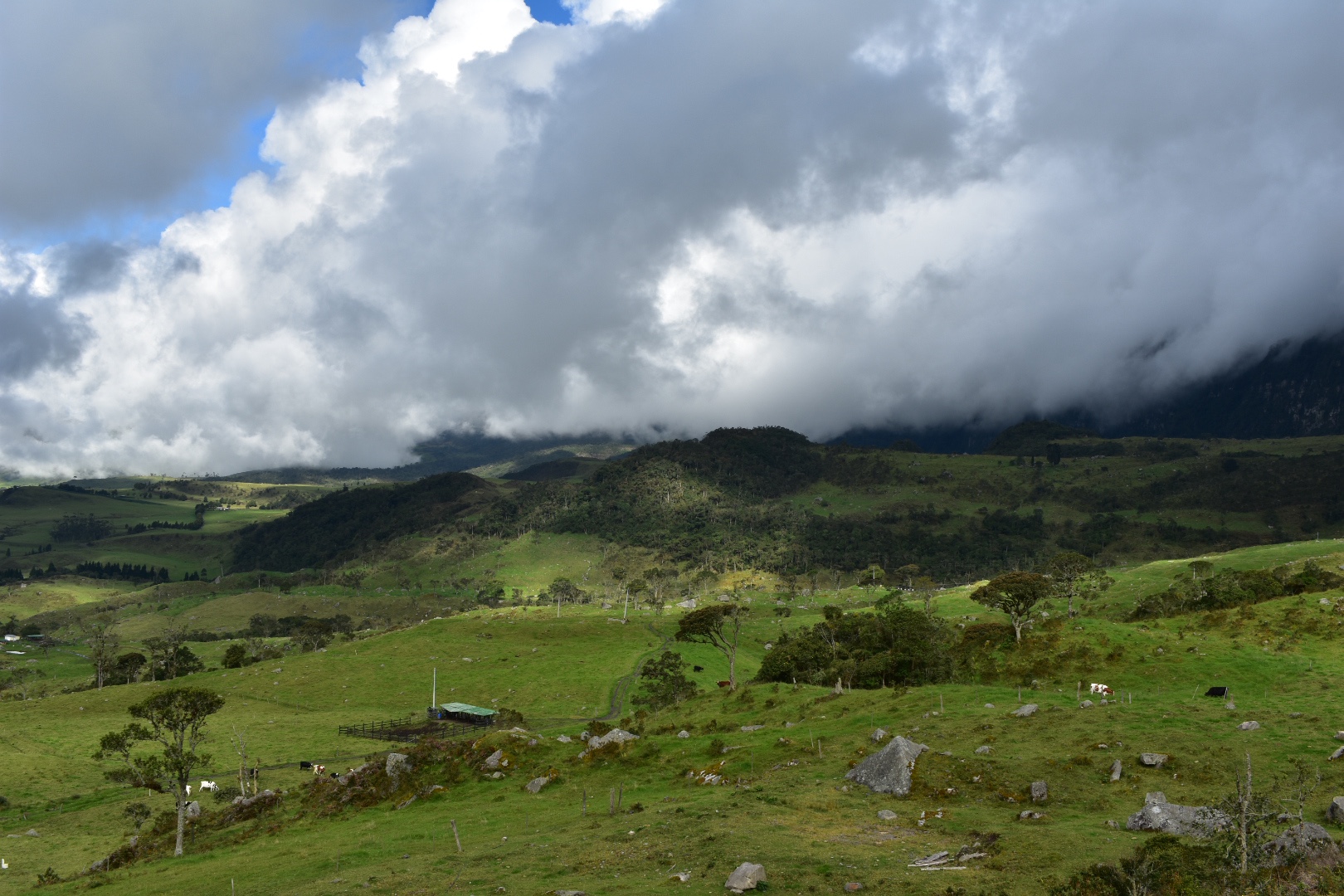
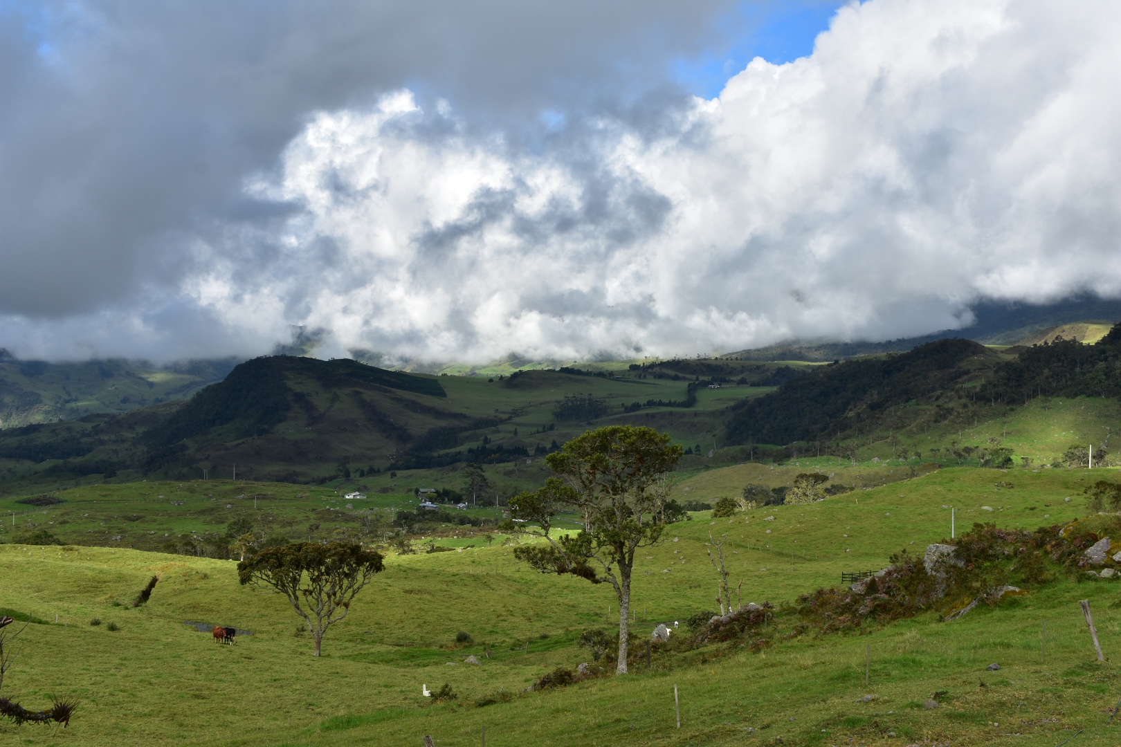
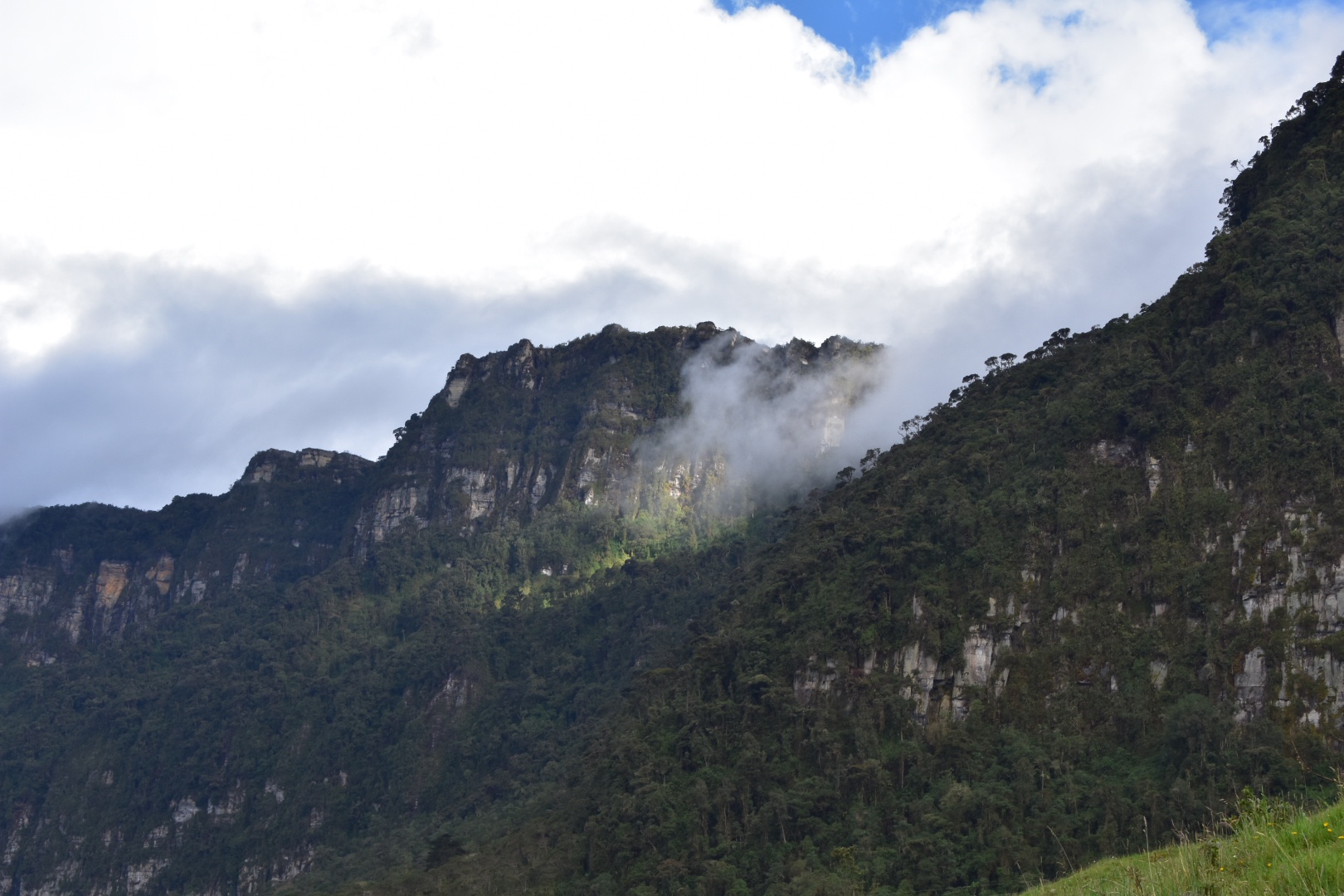
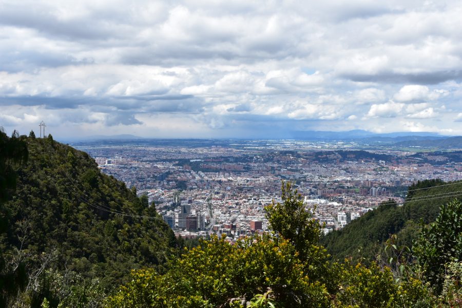
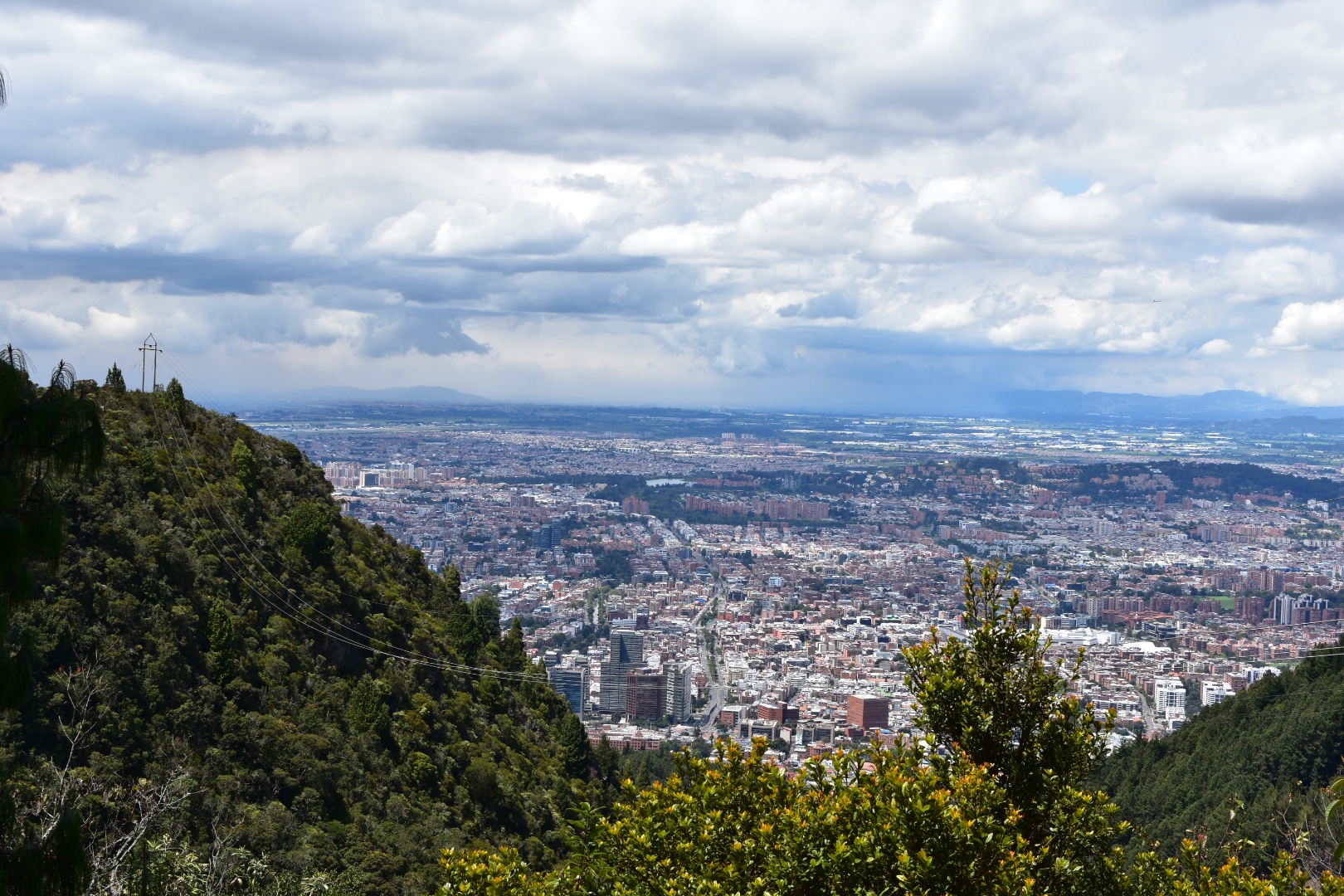
The surrounding trees and rocks were beautiful. Everything was so lush and green, I assume it was because I was here on a rare sunny day in the middle of rainy season, but the trees gave me the impression that it was autumn so the colours were particularly spectacular. Being close to the equator Colombia doesn’t really have seasons but the climate changes so much from place to place. The Bogota Savannah is around 2600 metres in altitude and you only have to travel 90 minutes and drop to 1500 to find the weather mush more tropical or head another way and go up to 4000 meters to find yourself in the middle of a Palermo where it is cold and wet. Its one reason I love mountainous regions.

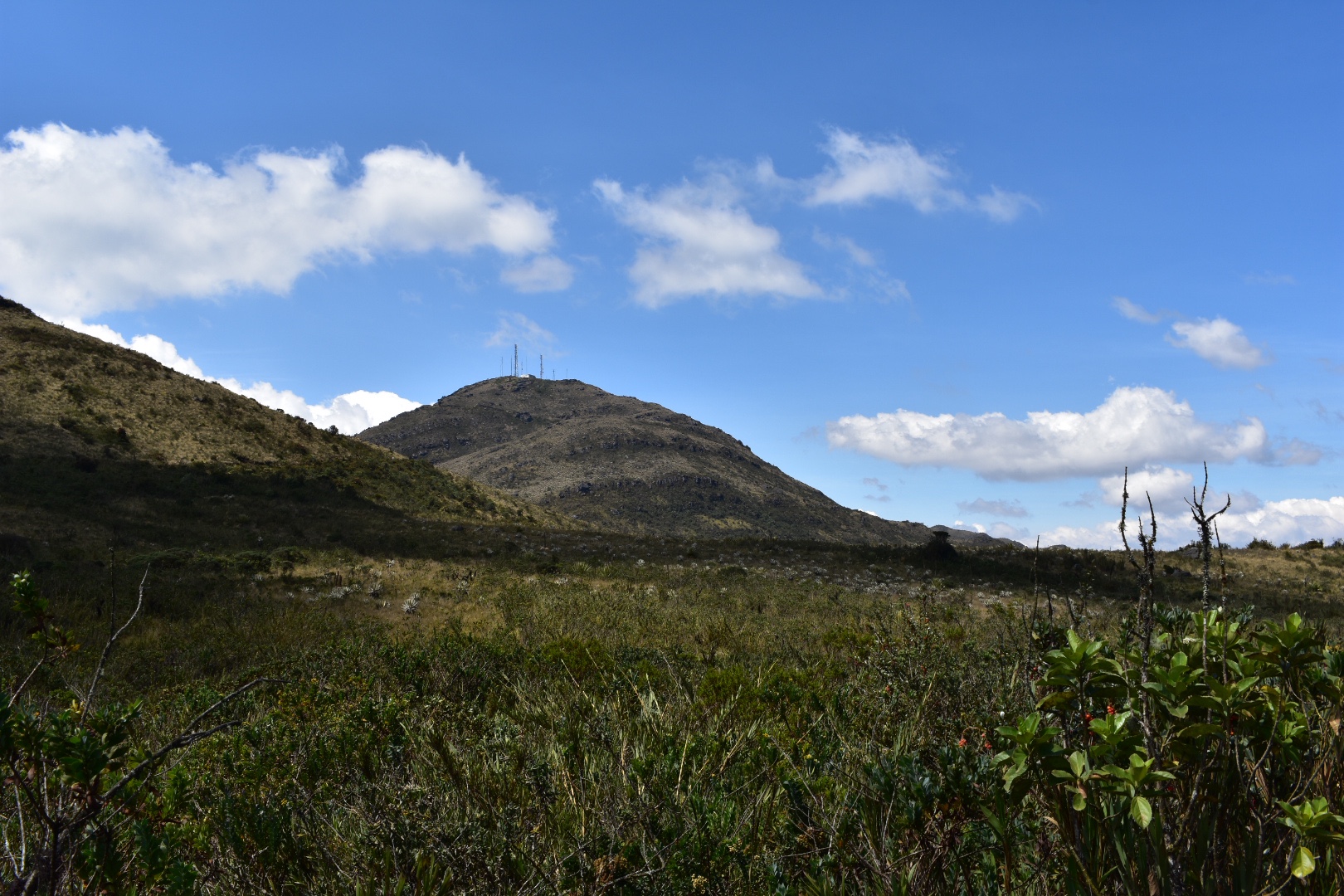
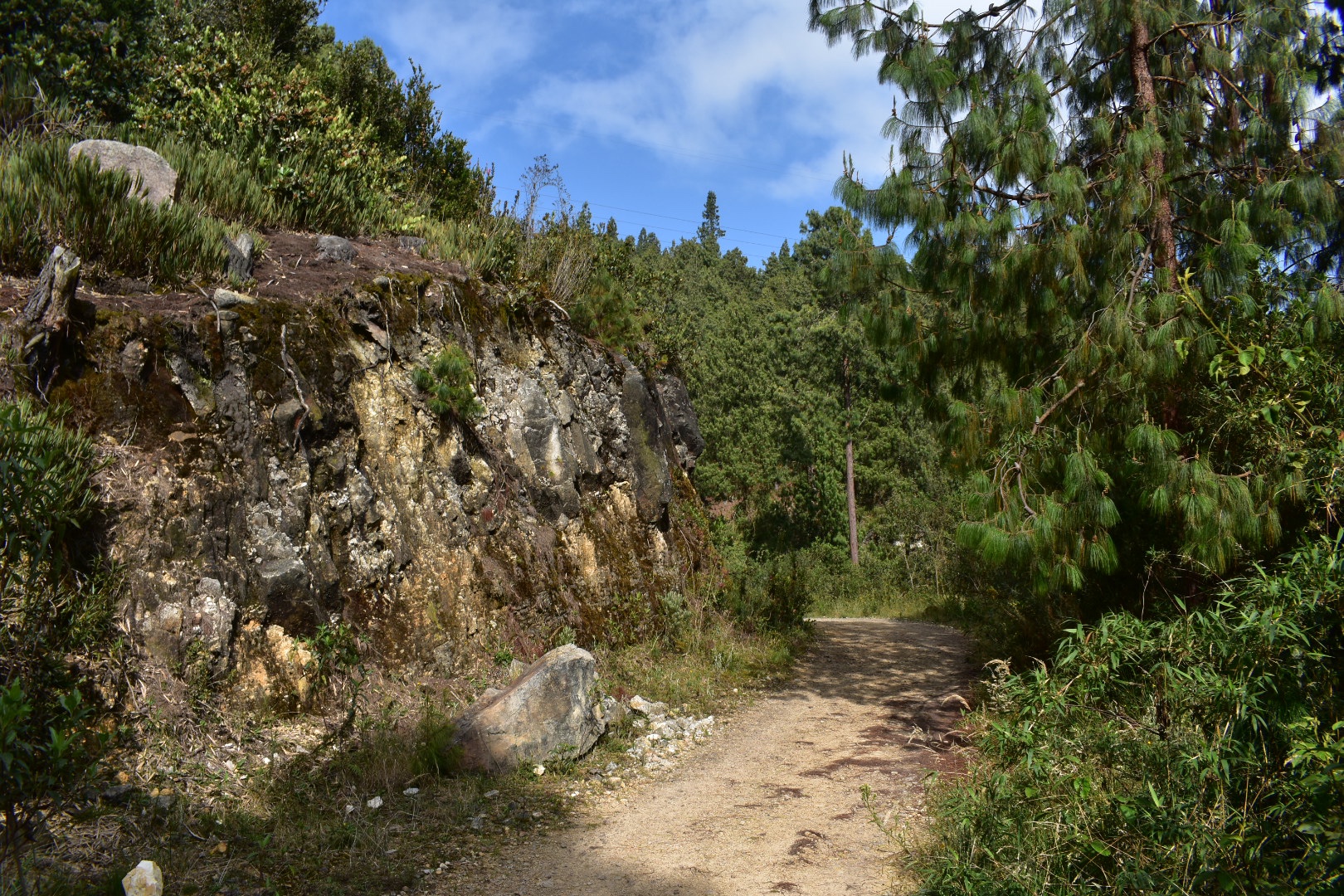
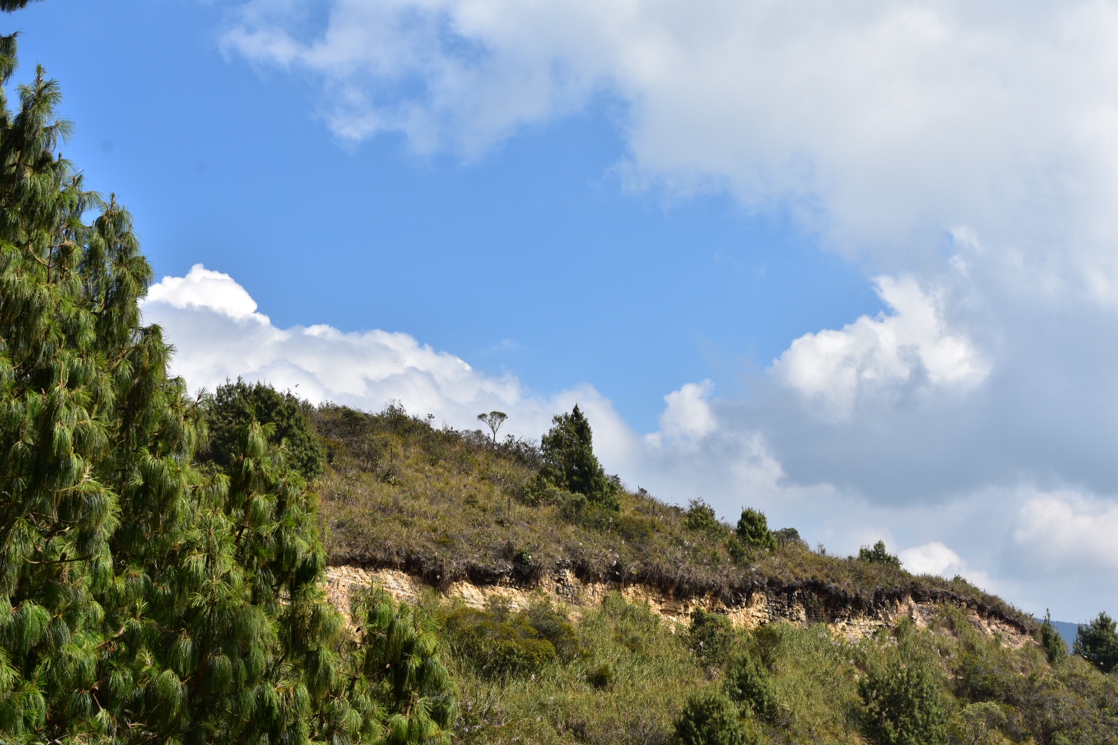
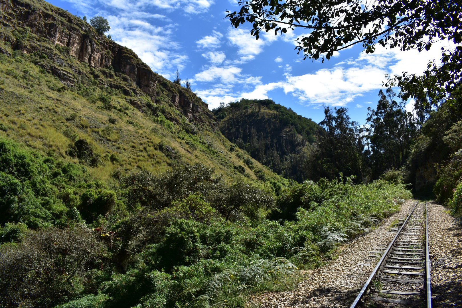
After I came out of the rocks above the train line goes around in a huge circle, after seeing the landscape I can only assume that they were not given permission to build on someones land. Also take note of the photo above as this is the beginning of the path where you head up to hike along the top of the cliffs.

I continued to follow the tracks and then they took a turn to the right and I was surrounded by trees again and started seeing some properties. I thought there might be a way to meet the main road here but alas the properties were in the way. But soon I reached the mirador.

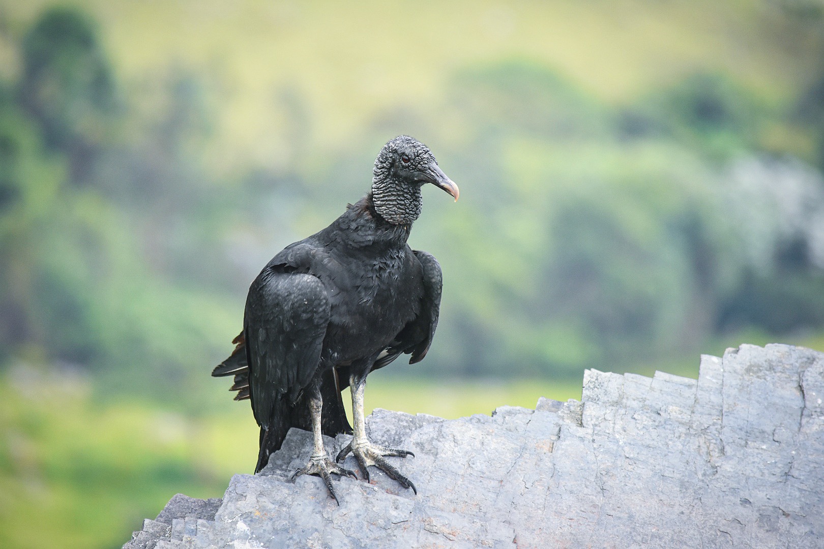
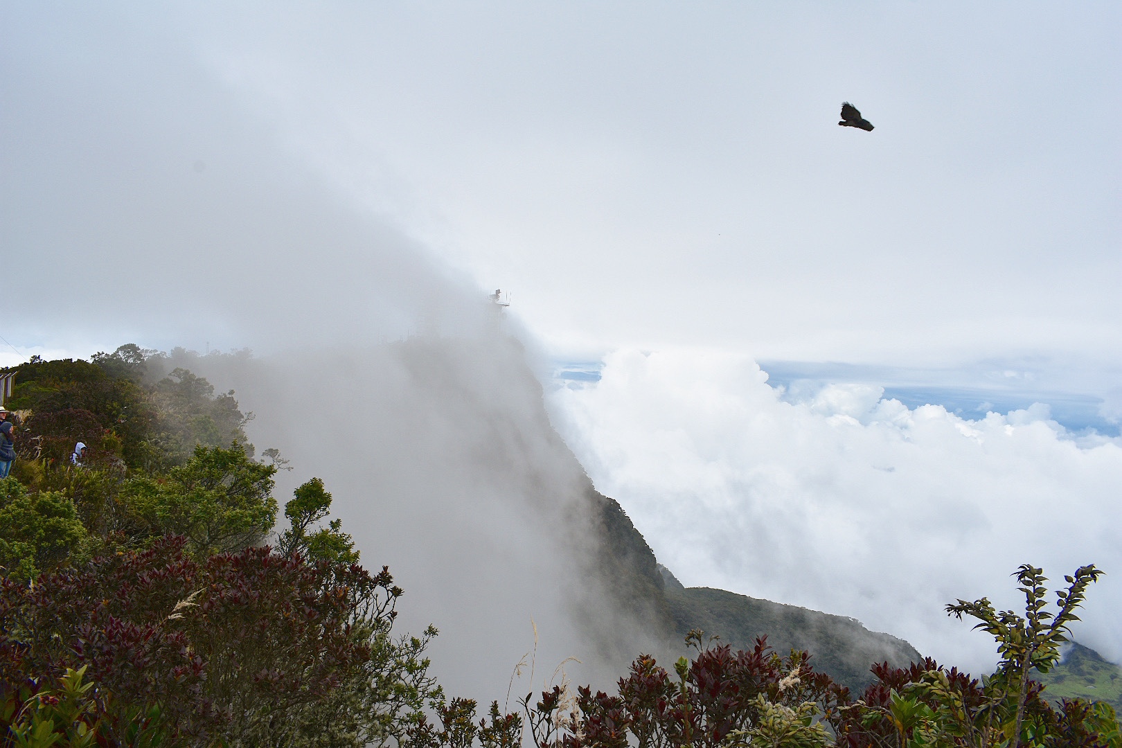
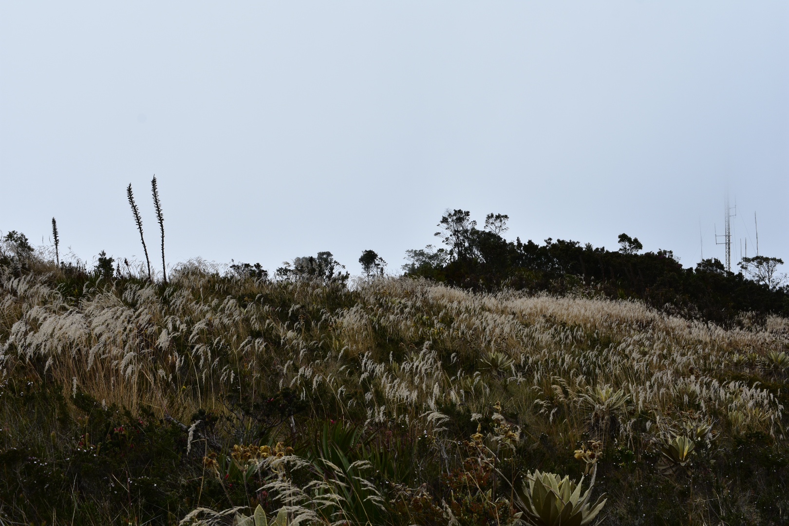
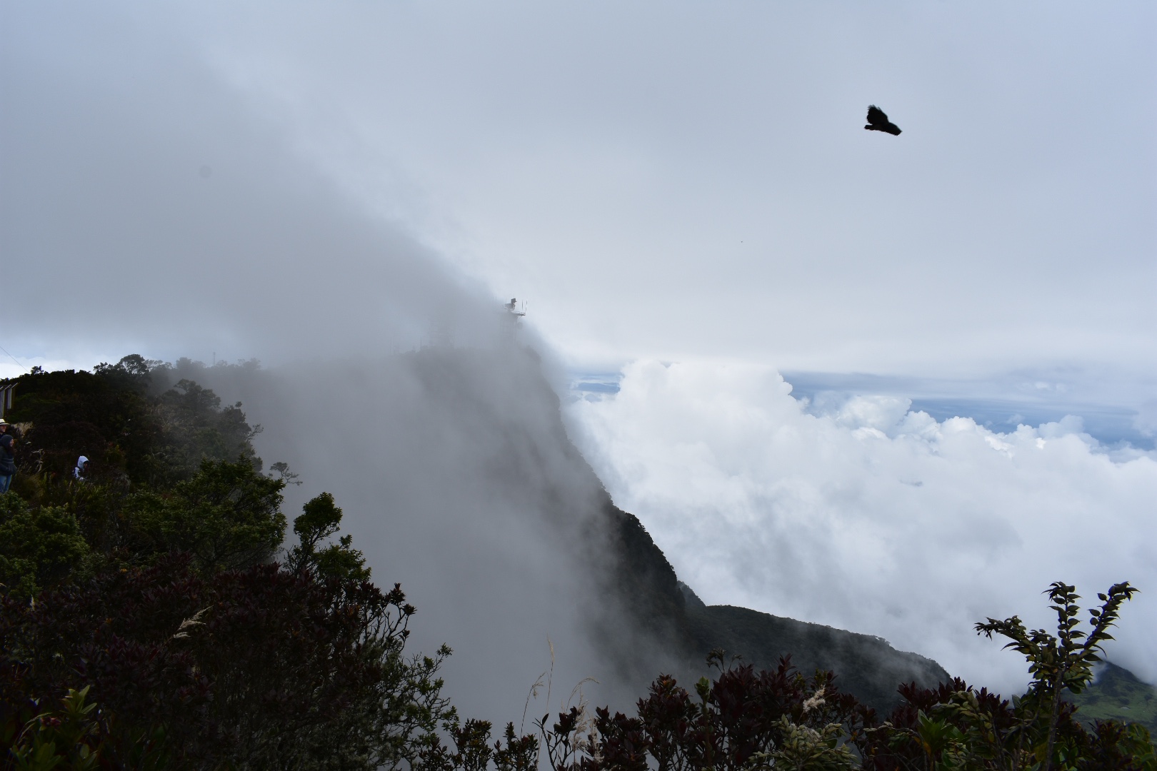
It was around 10am when I arrived at the mirador and I saw some flowers which I took a some closeups. And very quickly got upclose and personal with a vulture, who I didn’t see until the last second as I was concentrating on sitting down to rest and eat my crisps.

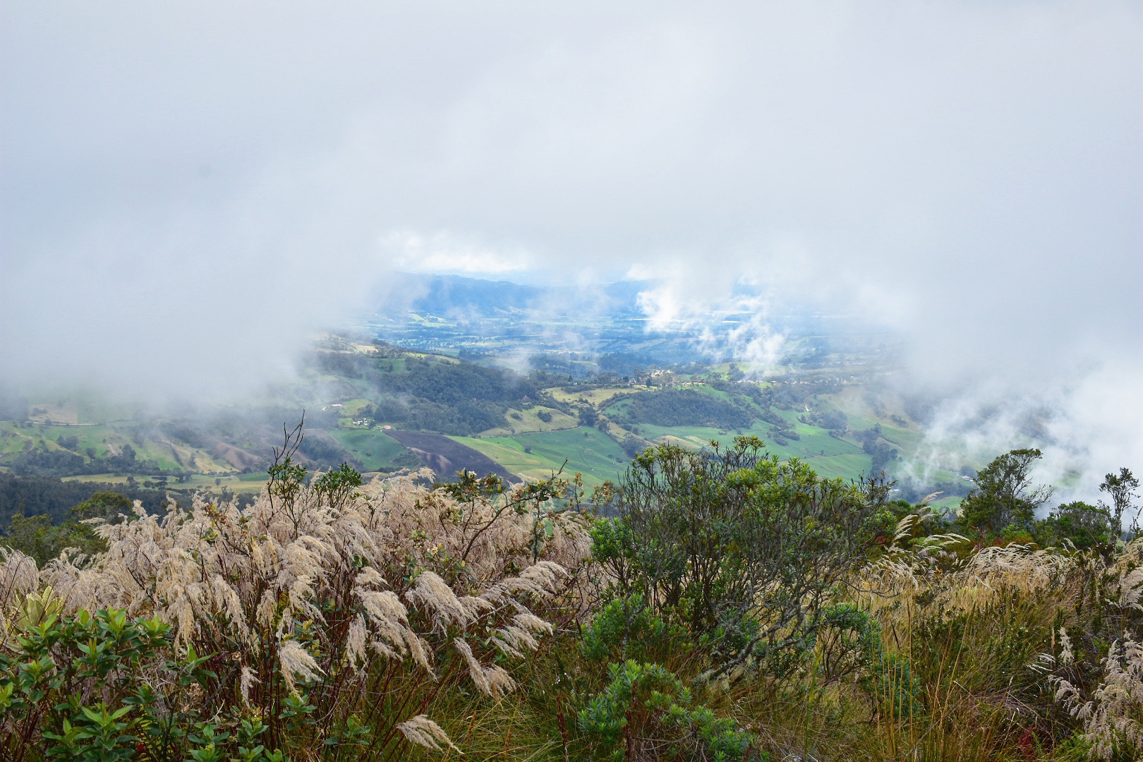
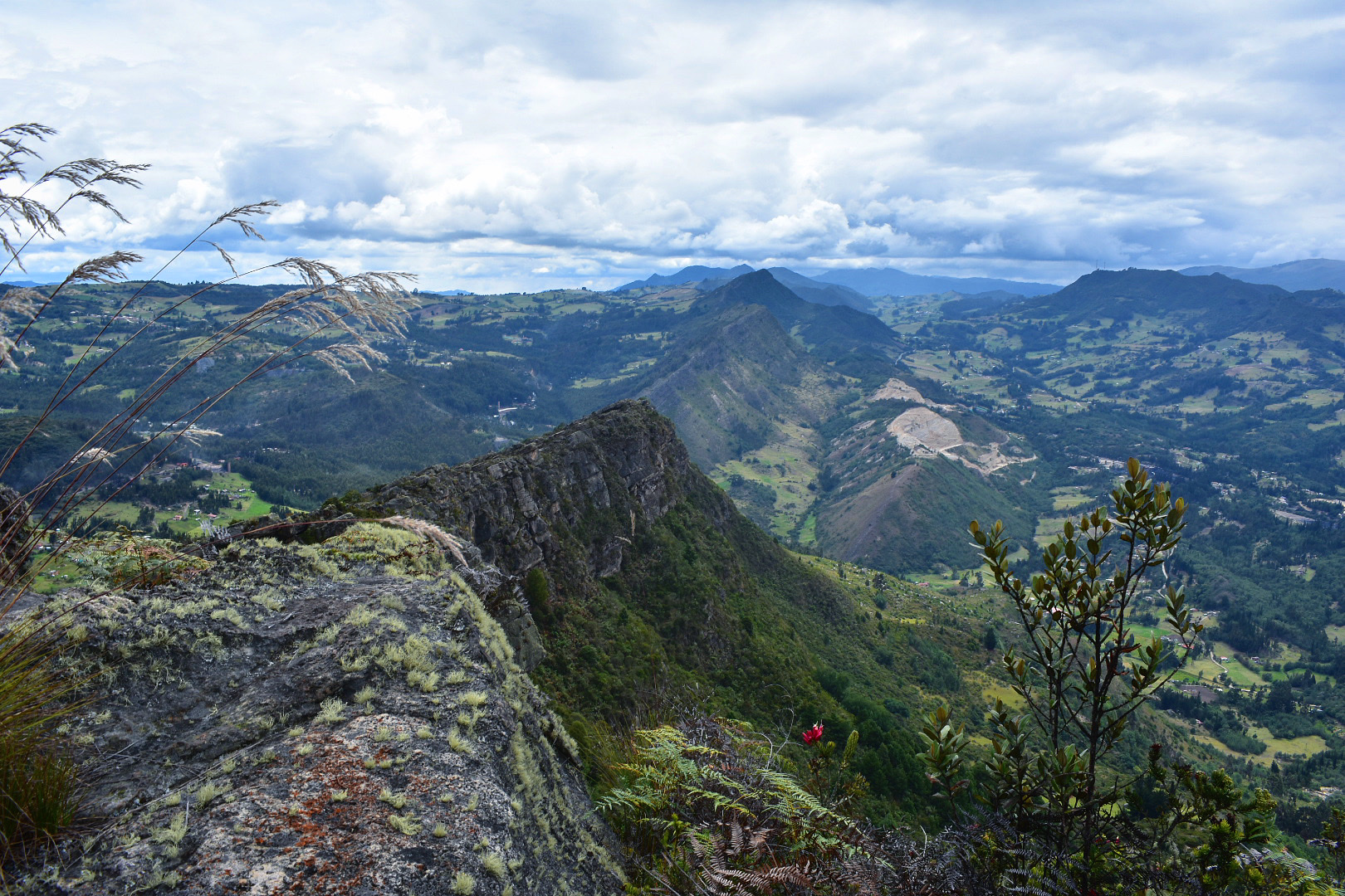
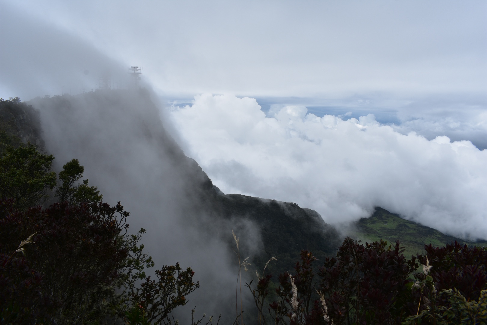
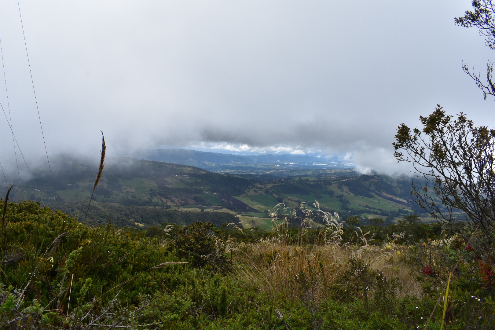
This was my intended endpoint but as views go I was a little disappointed. I sat and rested while a couple of groups passed me and then tried to take some photos. I had read that the canyon was a place you could view owls, hence the name, but its really difficult to get a decent view without half hanging off the edge and that was something I really didn’t want to do. I have seen videos of people kayaking along so maybe if that’s of interest its something you can opt for. I really wasn’t happy with my photos, which you can see below, but I wanted to take some to illustrate. But don’t let this put you off the hike as its beautiful, I just wanted to be realistic about the “mirador”. From here you can either continue to Santa Rosita.

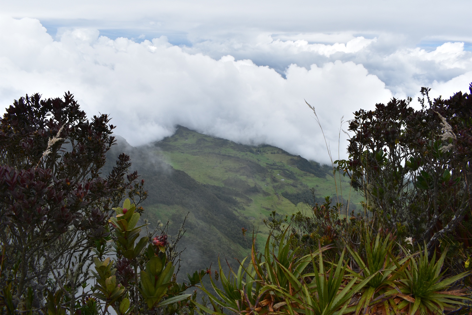
I wanted to see the town and continued to the point below. I decided that i didn’t want to add an extra two kilometres to my journey but I think it would be a nice place to stop on the outward journey.

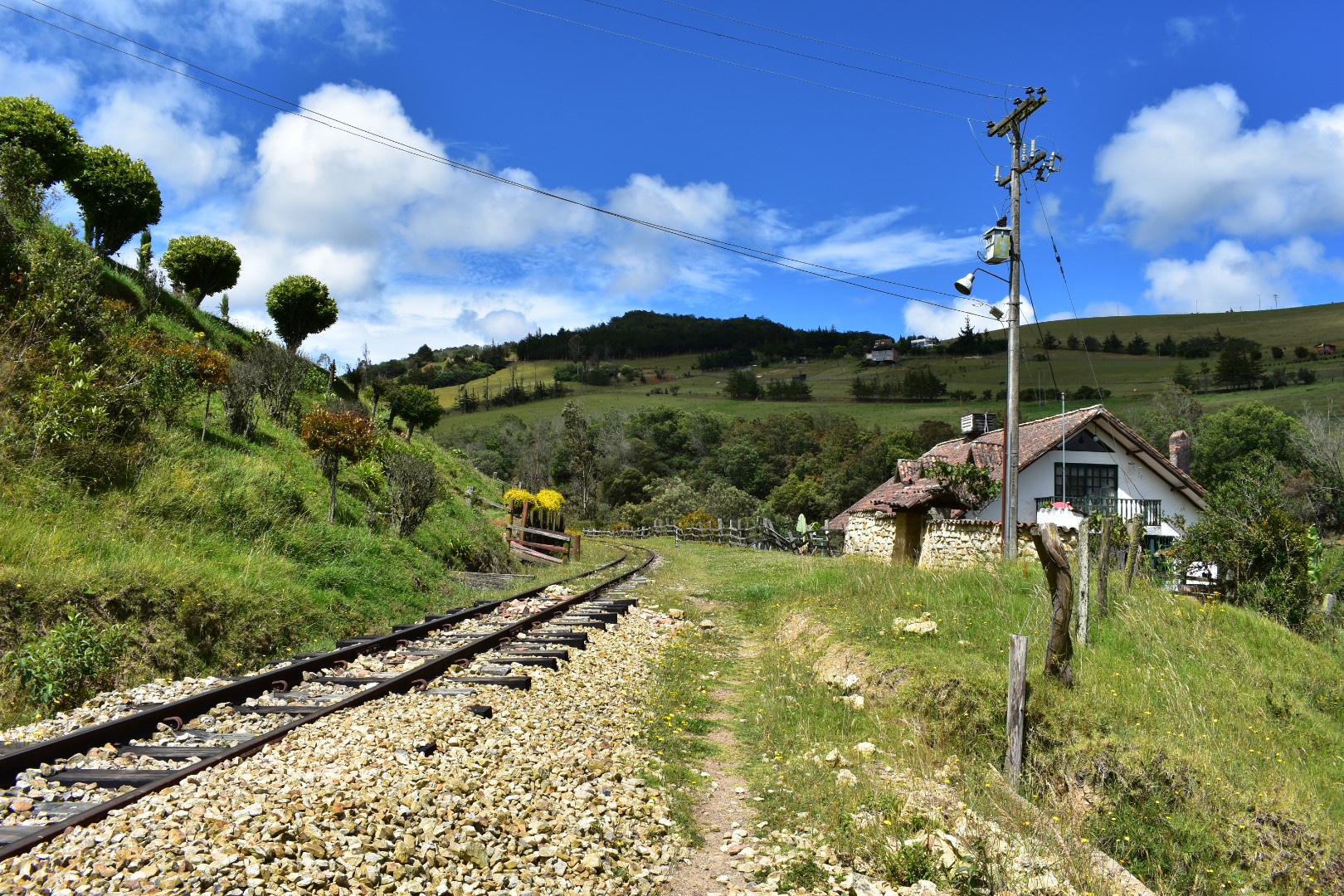
I retraced my steps along the track a little faster this time as I wanted to find the path that would take me along the top of the cliffs.

And soon I found it. I was about to head up when I saw a security guard with a very excited puppy, who ran up to me and wanted to play. I decided to ask for some directions and accidentally trod on the puppy’s tail as he lay down in front of me. Luckily the security guard took it with good grace and set me on the right trail.

I wouldn’t say it is particularly steep but there is definitely a good amount of up at this stage and I passed straight into the trees, passing a fair few hikers.

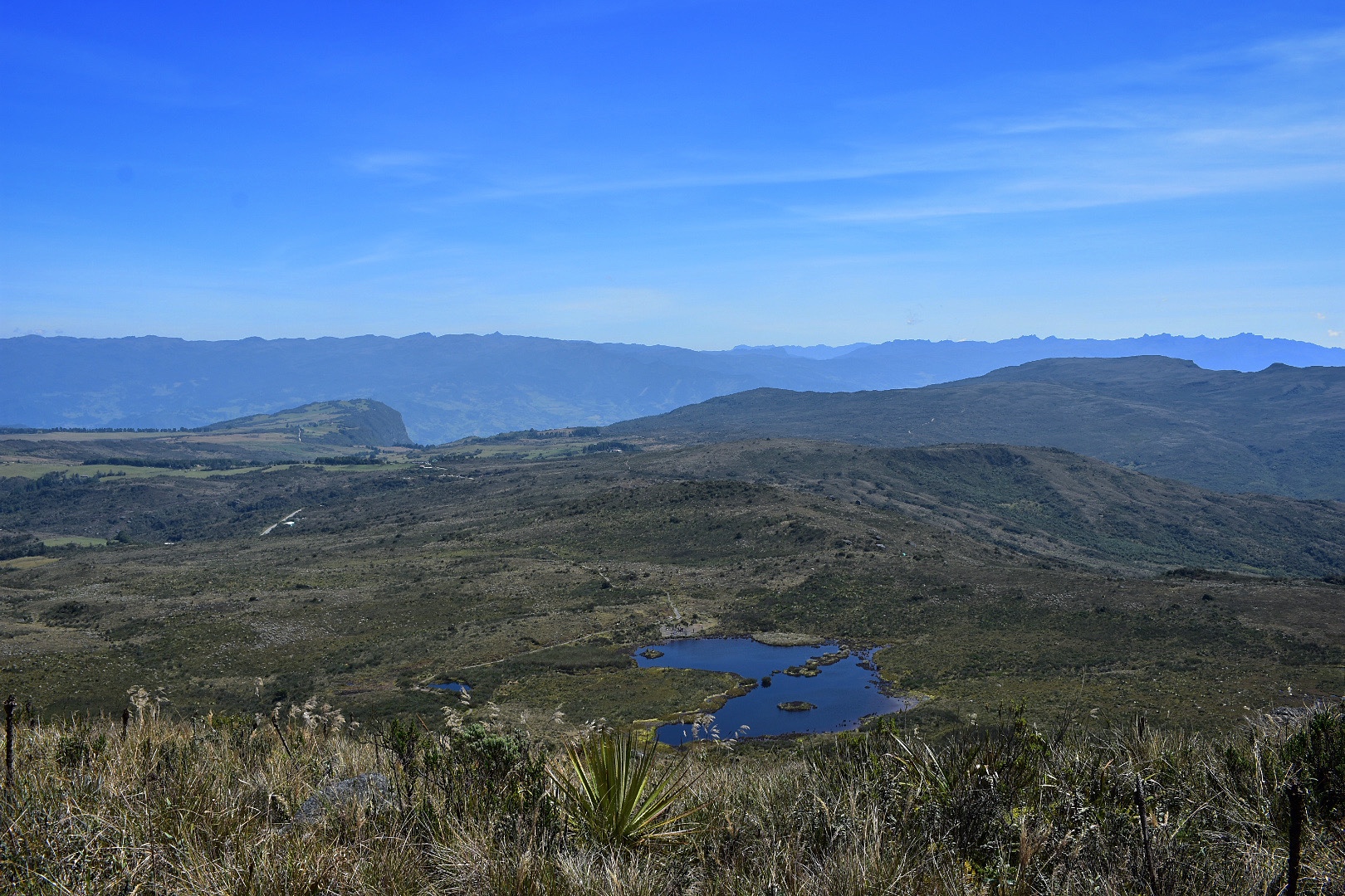
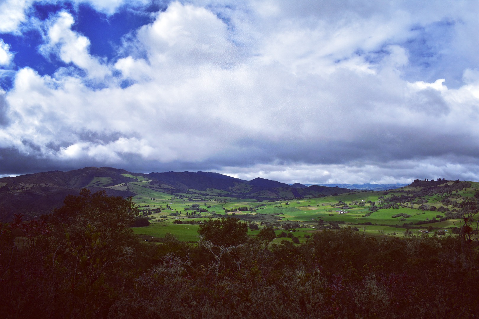
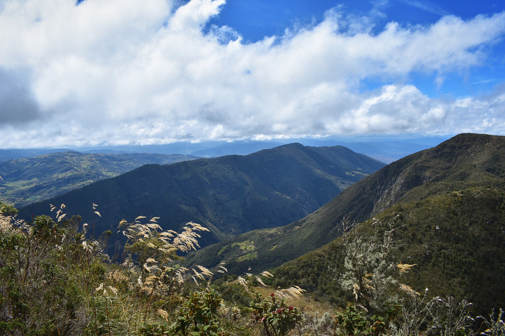
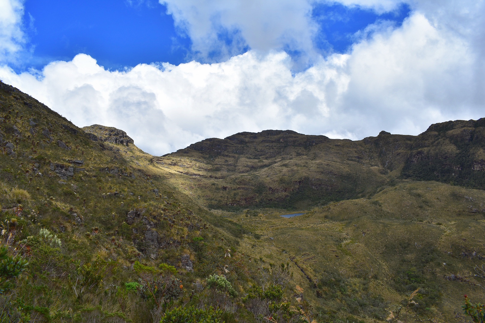
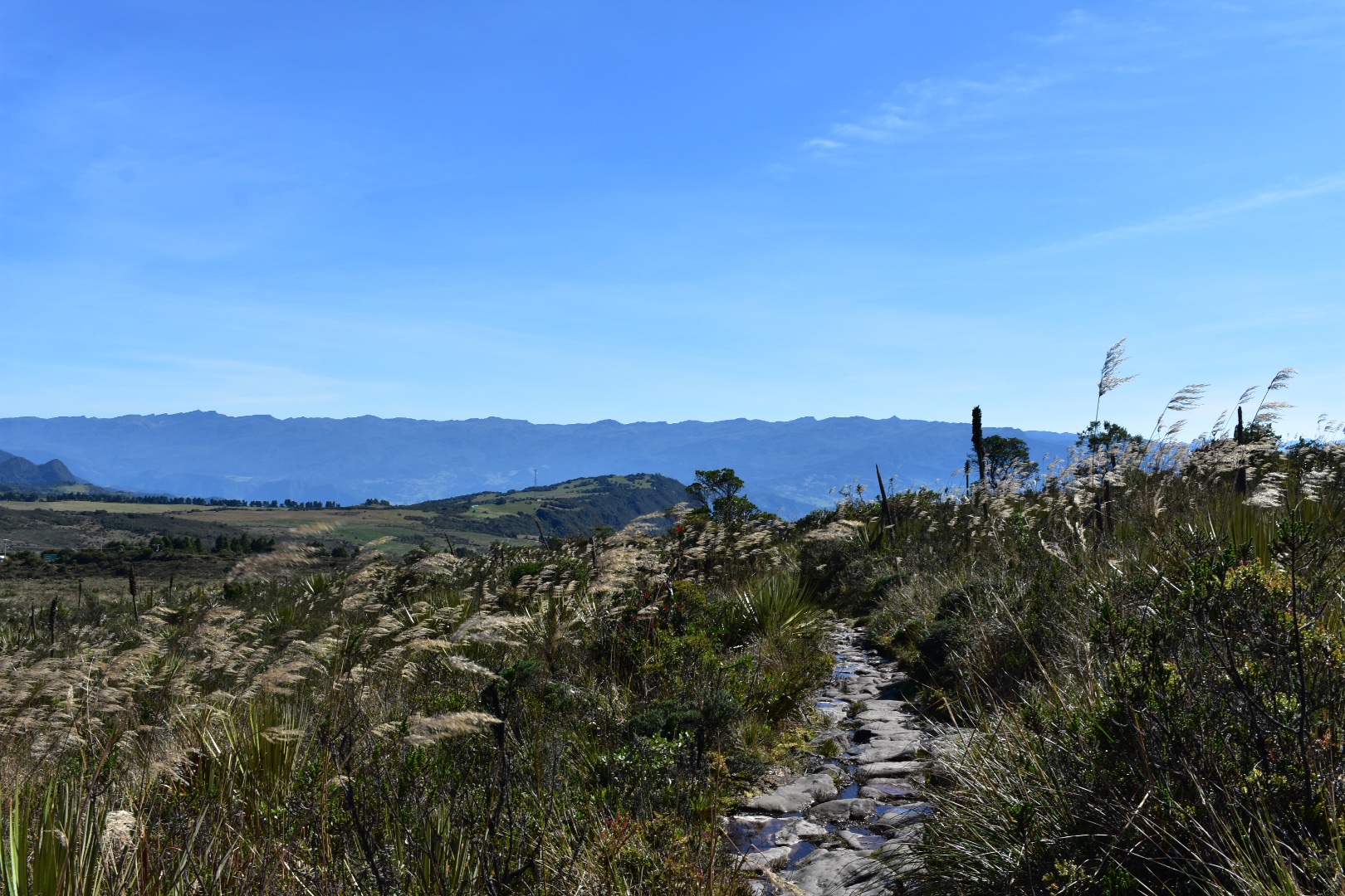
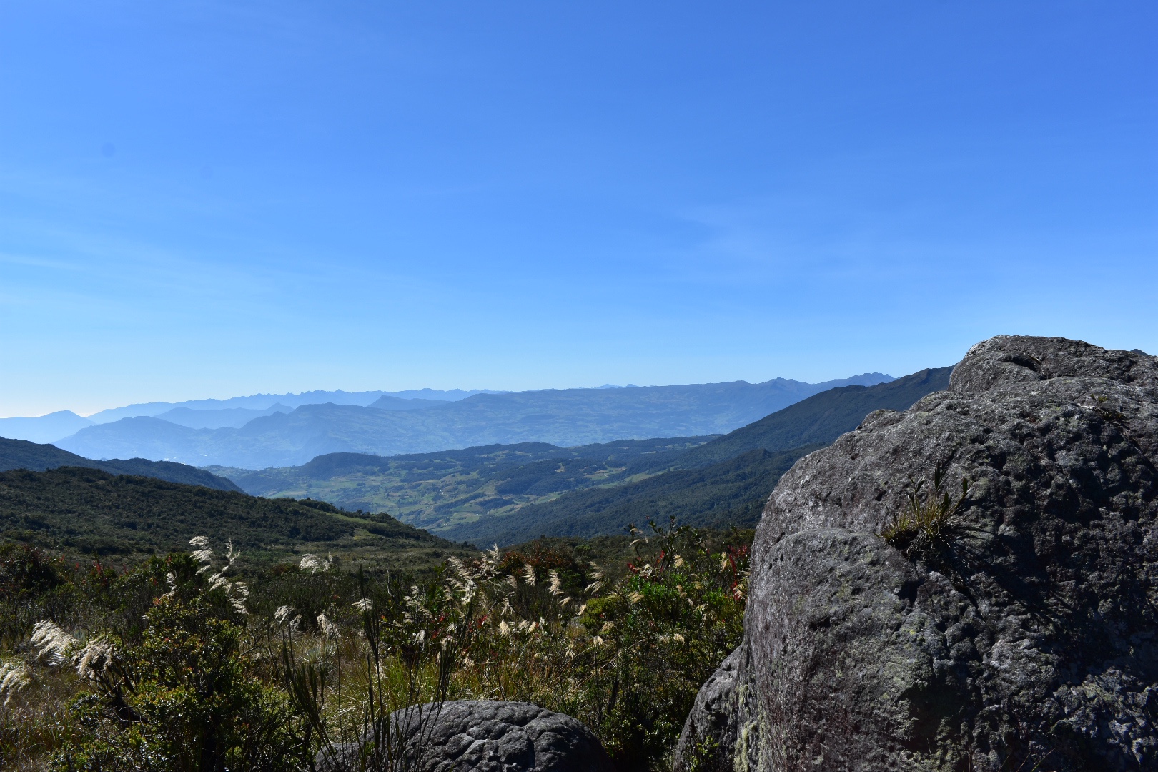
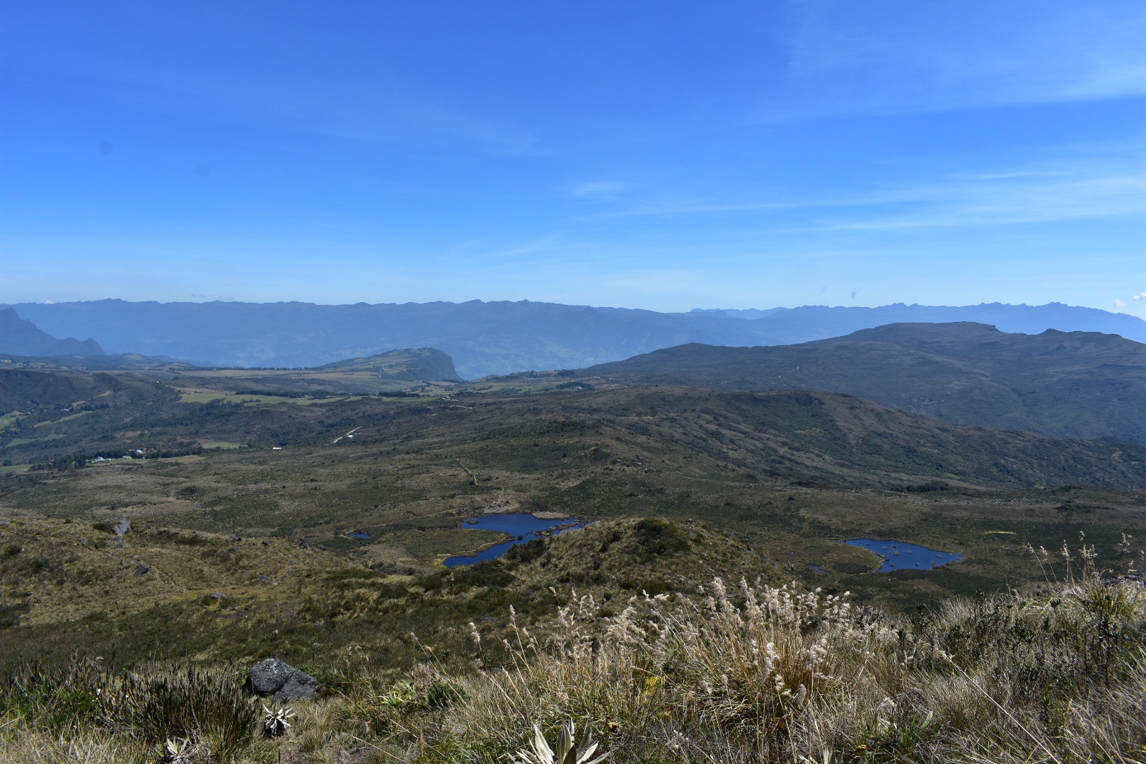
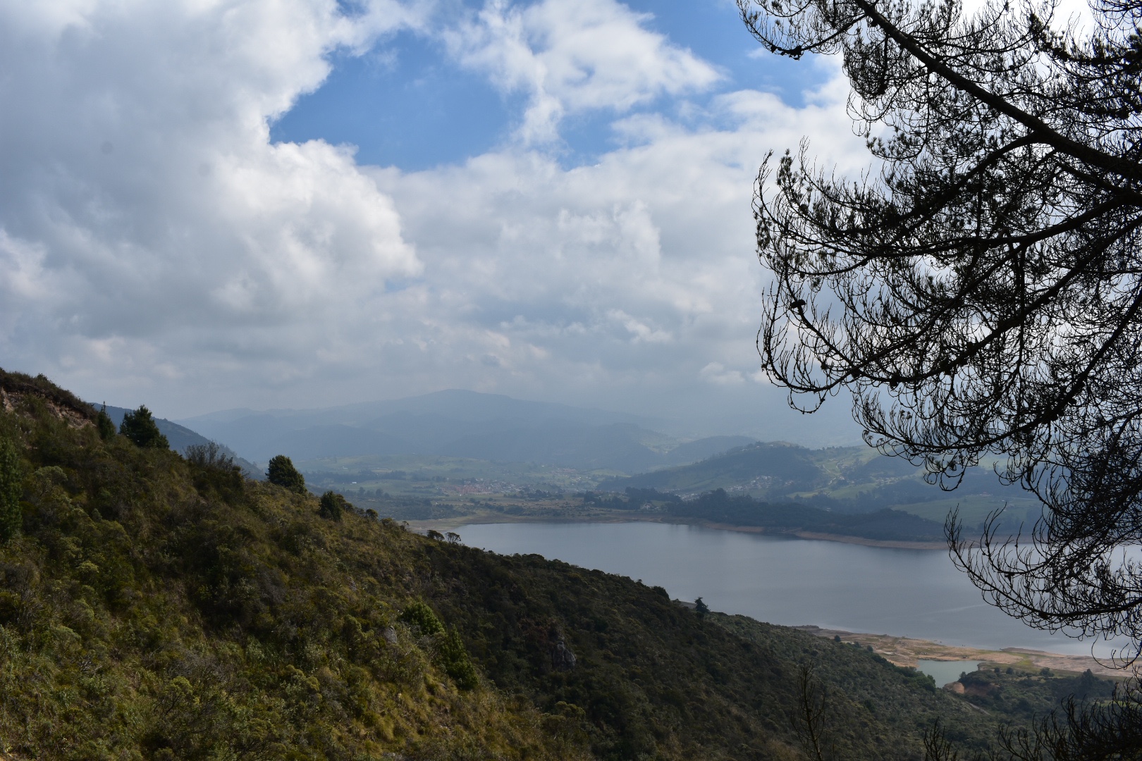
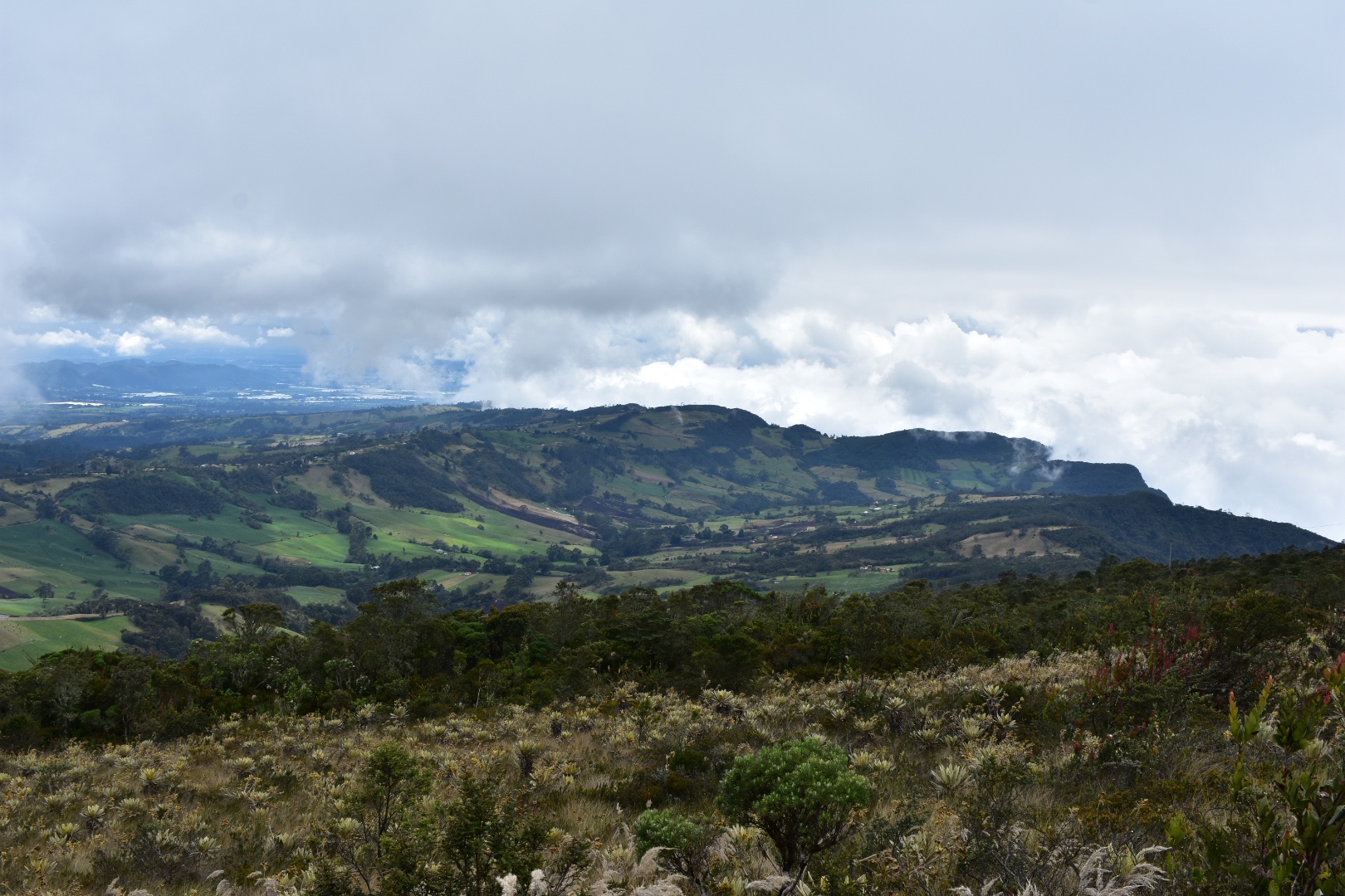
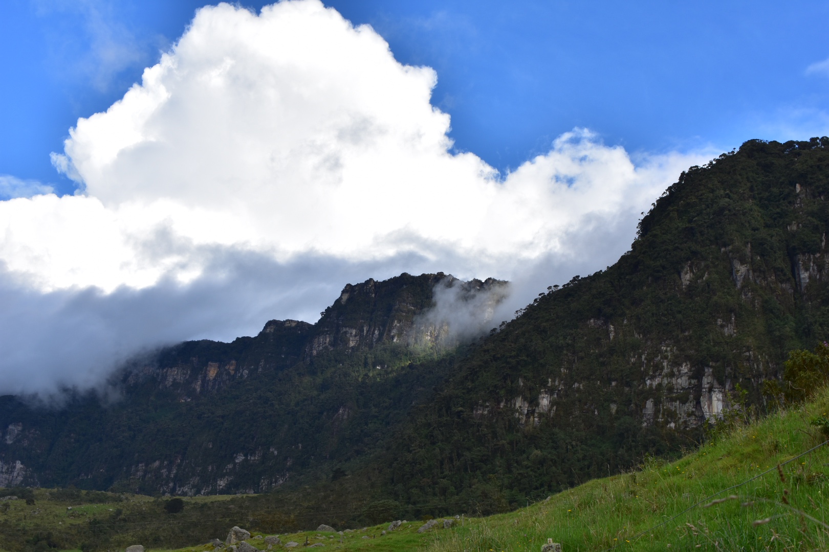
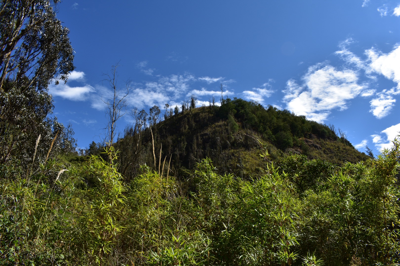
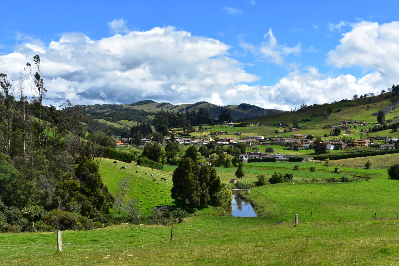
You come out into a meadow and from here you can see views of all the surrounding mountains as well as a panoramic view of the canyon.

When you reach this point you will want to take the path to the right, following the side of the canyon. The security guard overtook me on his bike and I found that there was a path leading down but it had a fallen tree across it. The tree was easily crossed but there was another large group coming form the path that came from the left. I thought I had gone the wrong way so took the path to the left and soon realised I wasn’t on the correct path according to Maps.me, but also I wasn’t too far away from it. Luckily the security guard and the dog came back and he informed me that I was going in the wrong direction. So I retracted my steps and headed back to the path going down, but I was quite happy as this is the direction I had originally wanted to travel.

Here is the tree blocking the path.

As the path led down I was treated to some great views and got closer and closer to the canyon itself. Soon I was able to see the places where climbers had reached the top and had left the bolts in the rocks.

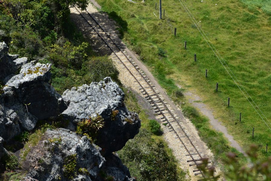
I then got to see the train tracks from above which is something I was particularly excited about.

And in the photos below you can see the town of Suesca and the camp site. The trip back is again around 5km and its not a hard route to follow. The path is often pretty wide and all you have to do is stay along the edge of the cliff.

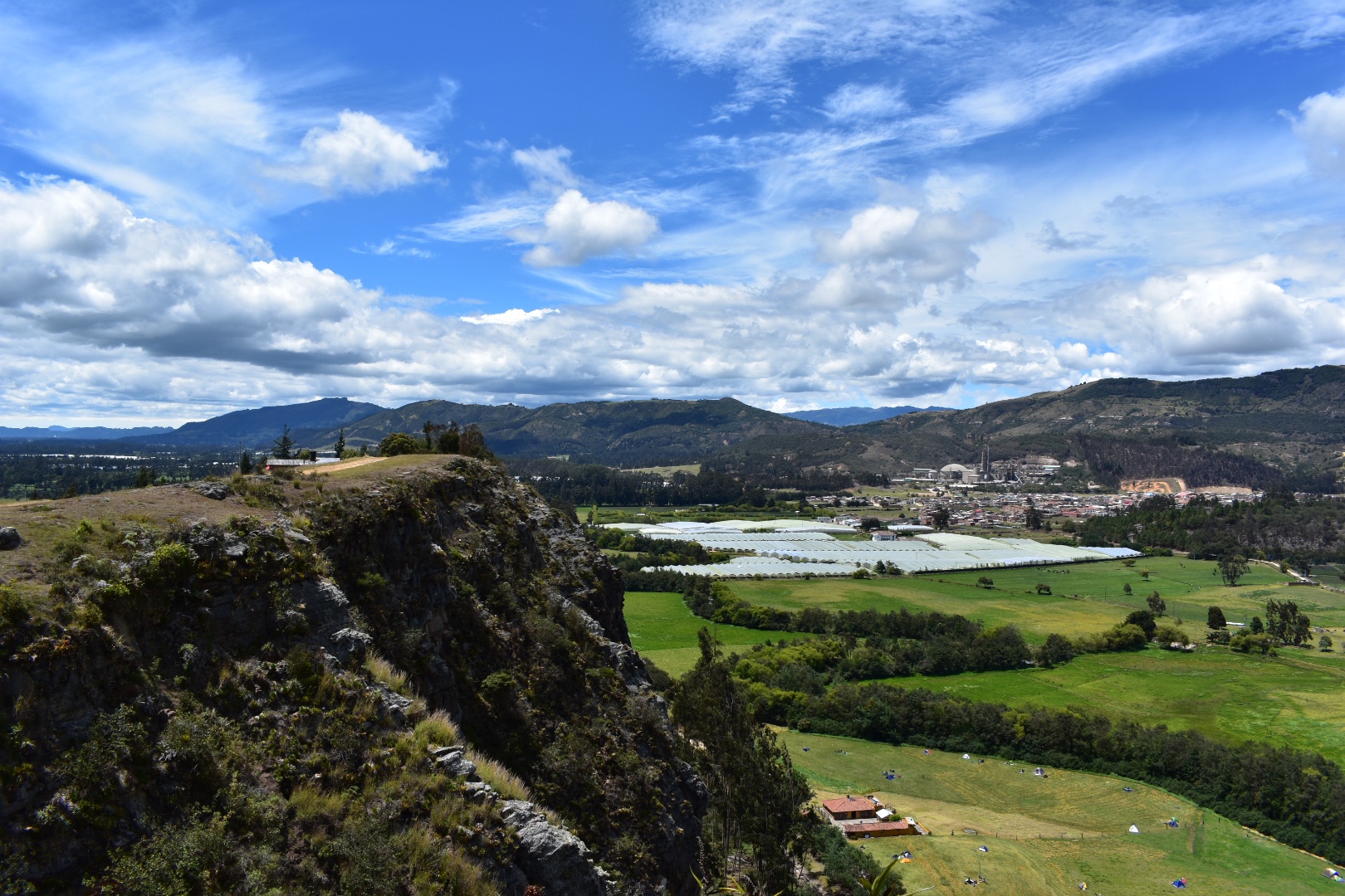
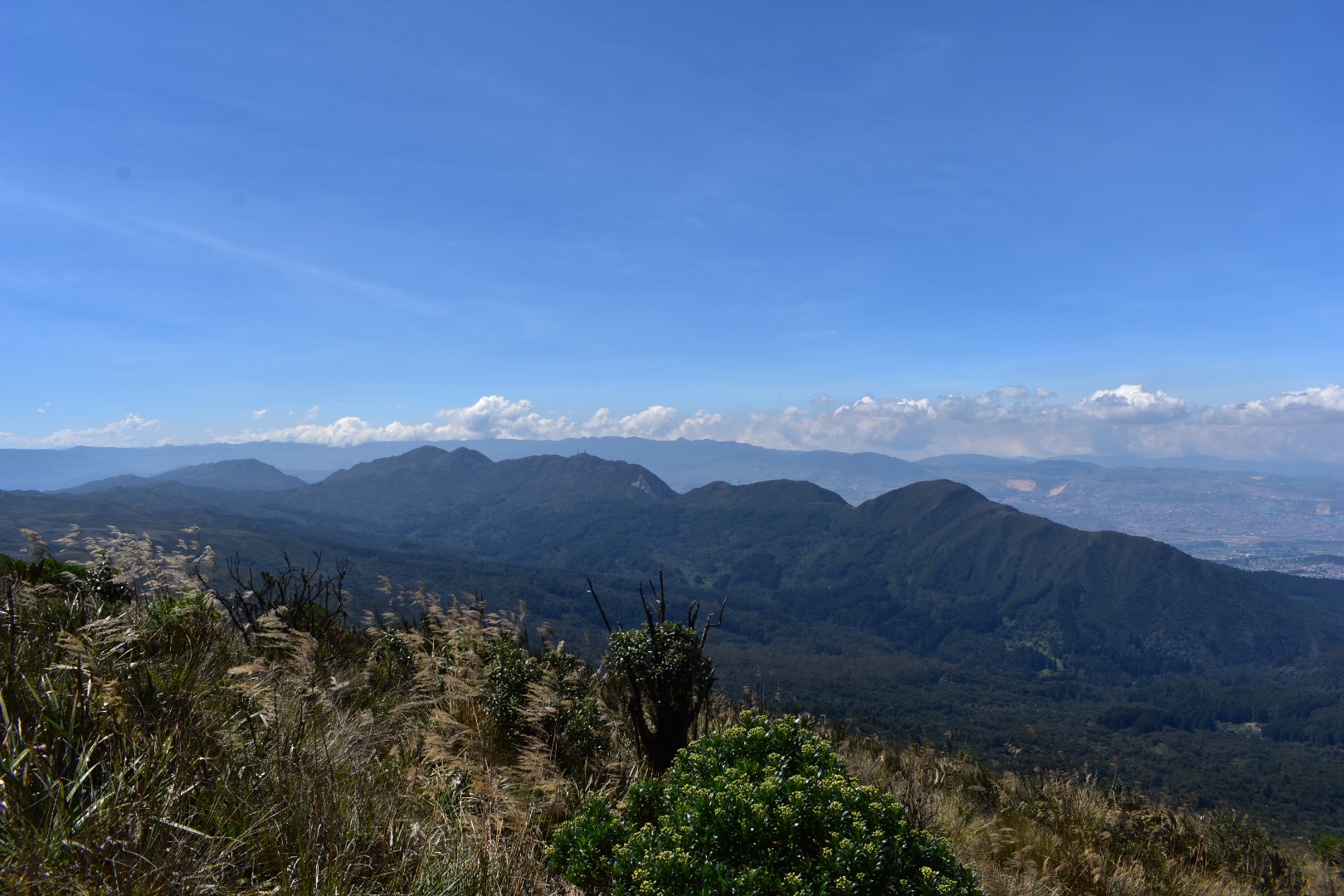
After a while you will start seeing properties and ar which will take other routes down to the main road, but make sure you stay to the right following the main route.

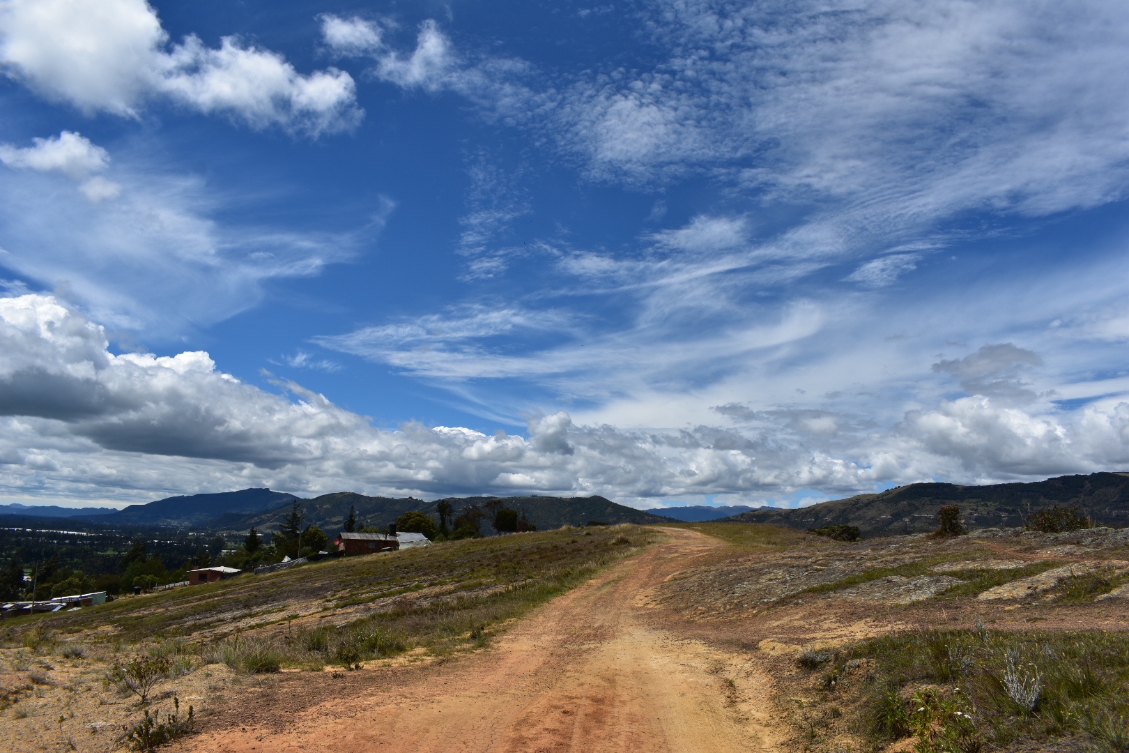
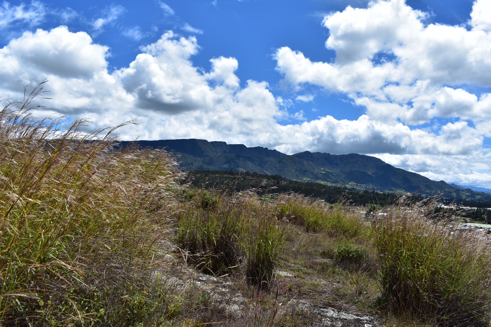
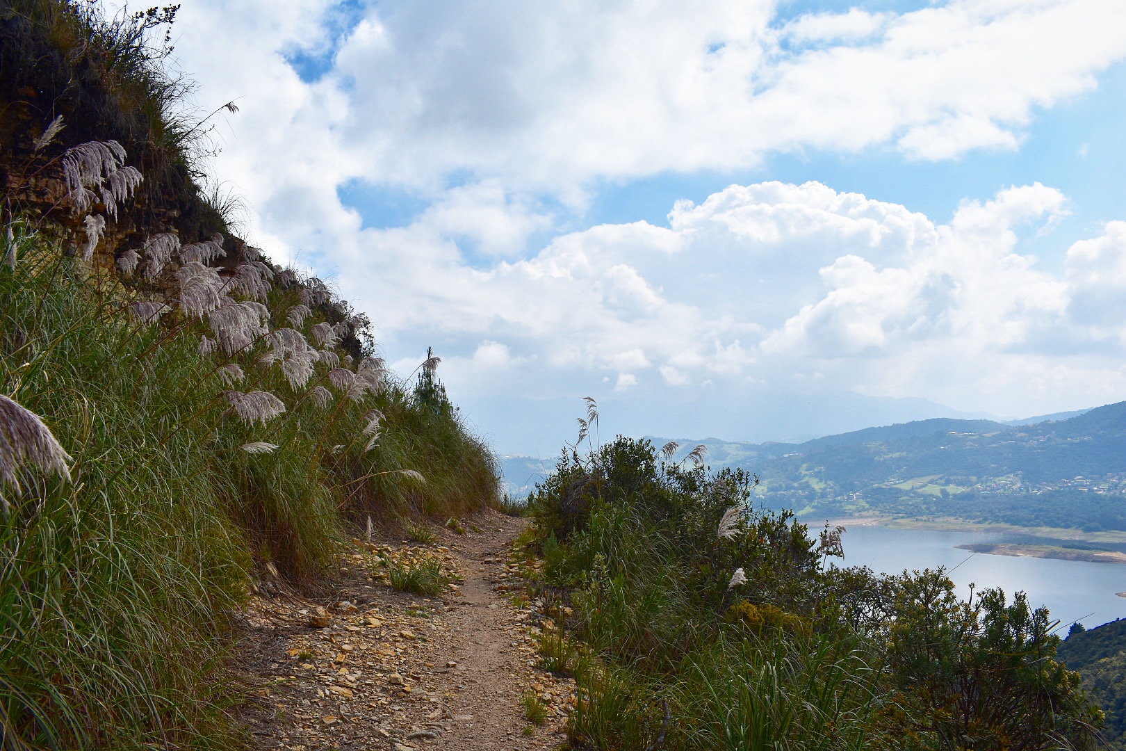
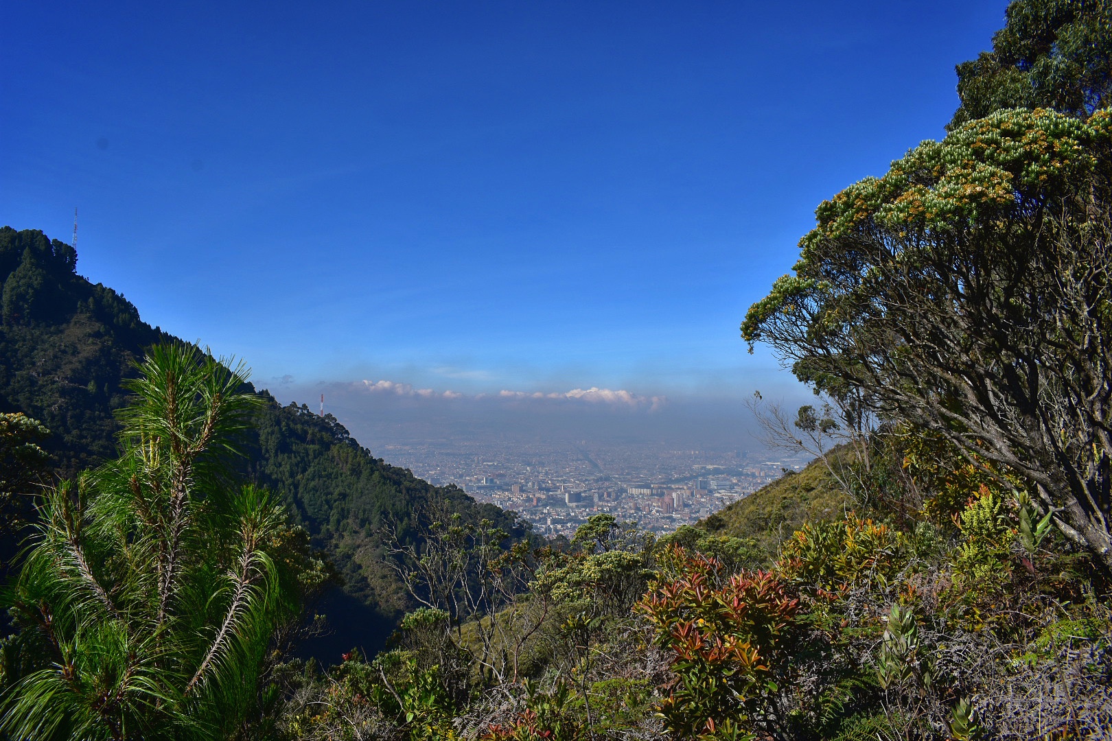
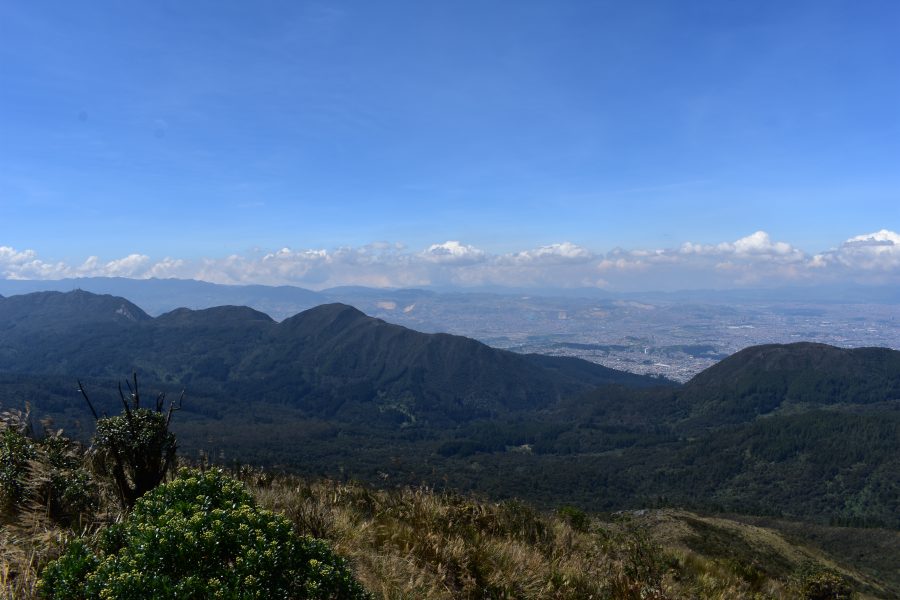
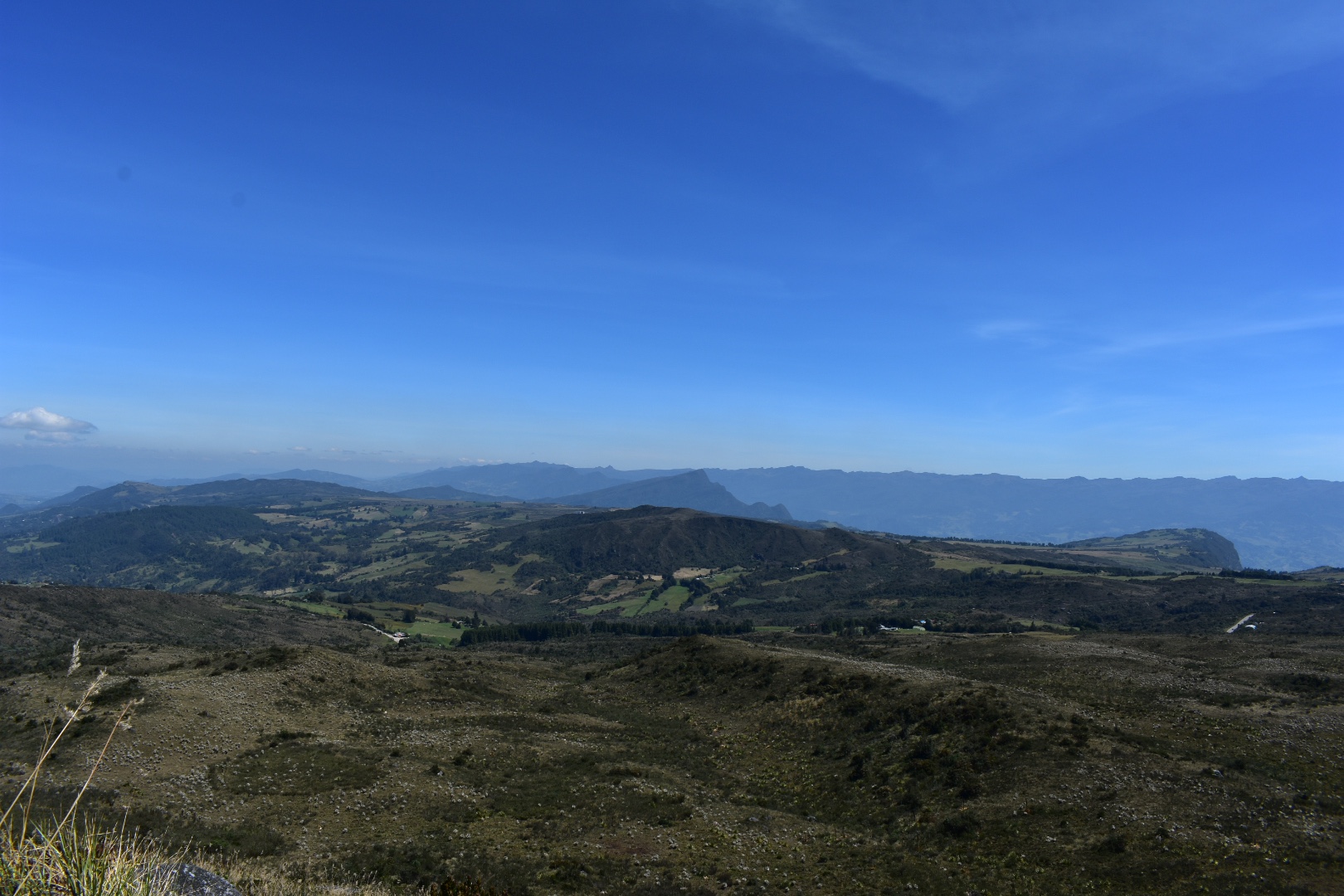
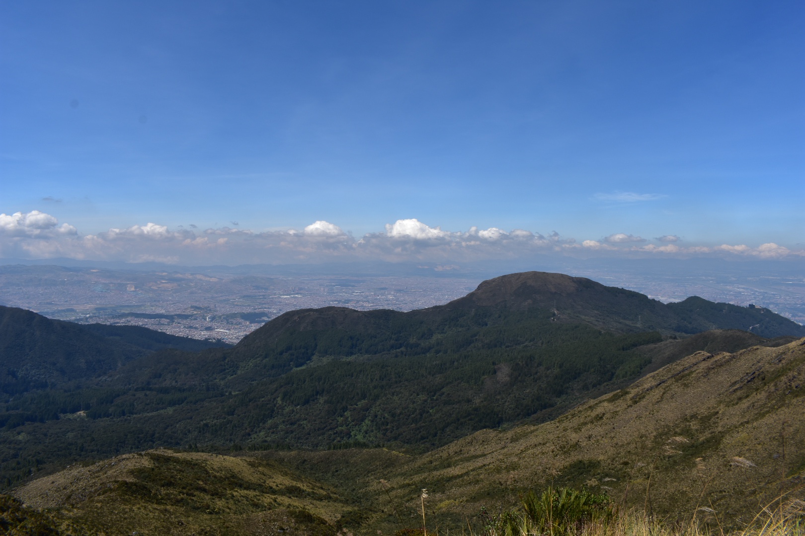
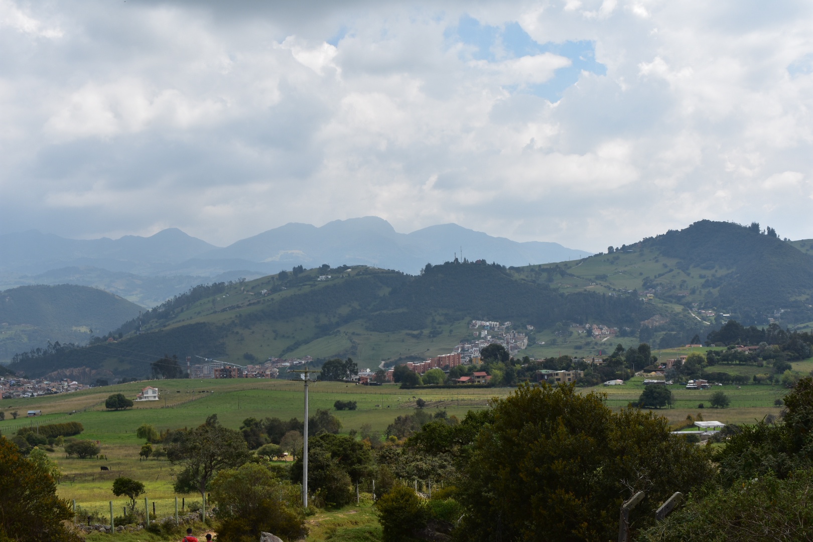
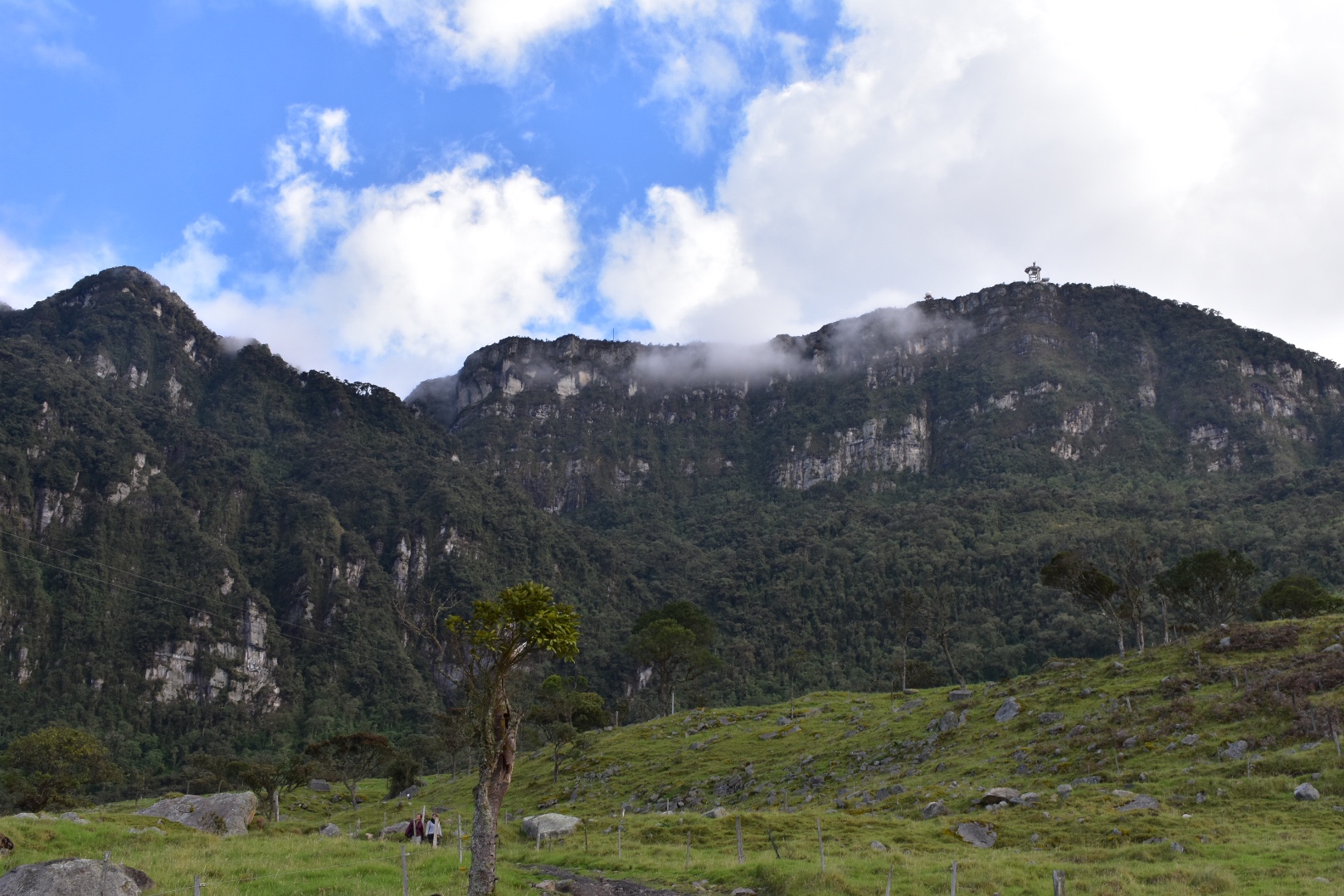
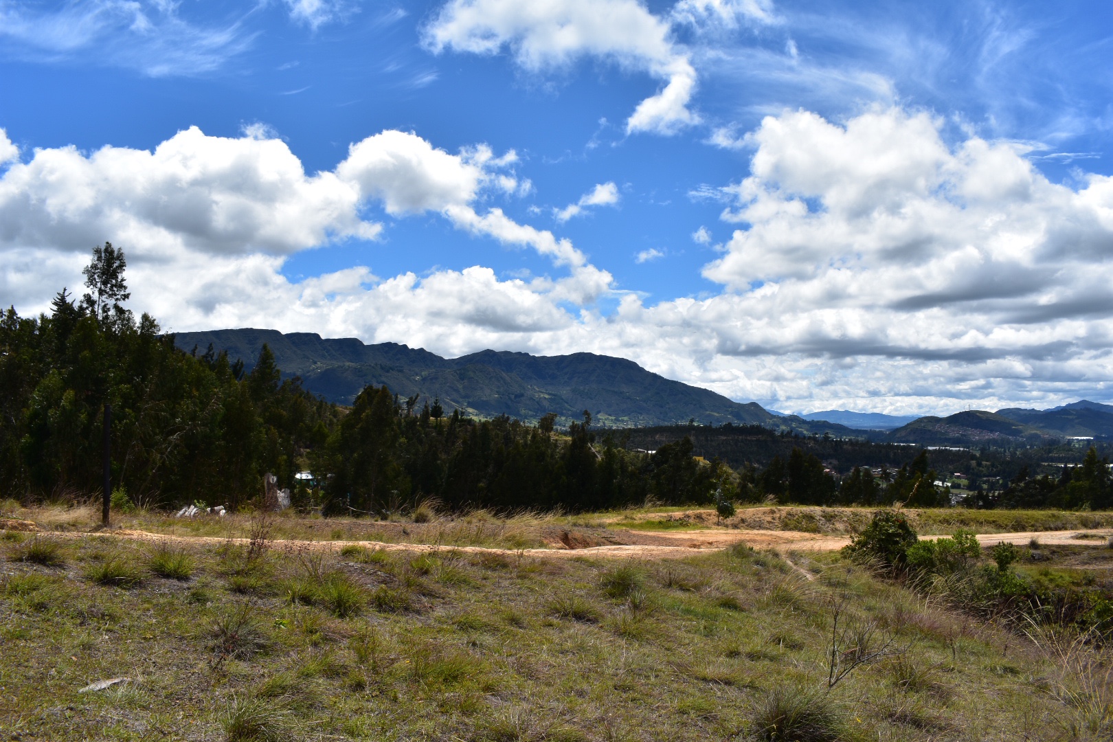
Then I got to see some of the larger mountains surrounding the wider Bogota area.

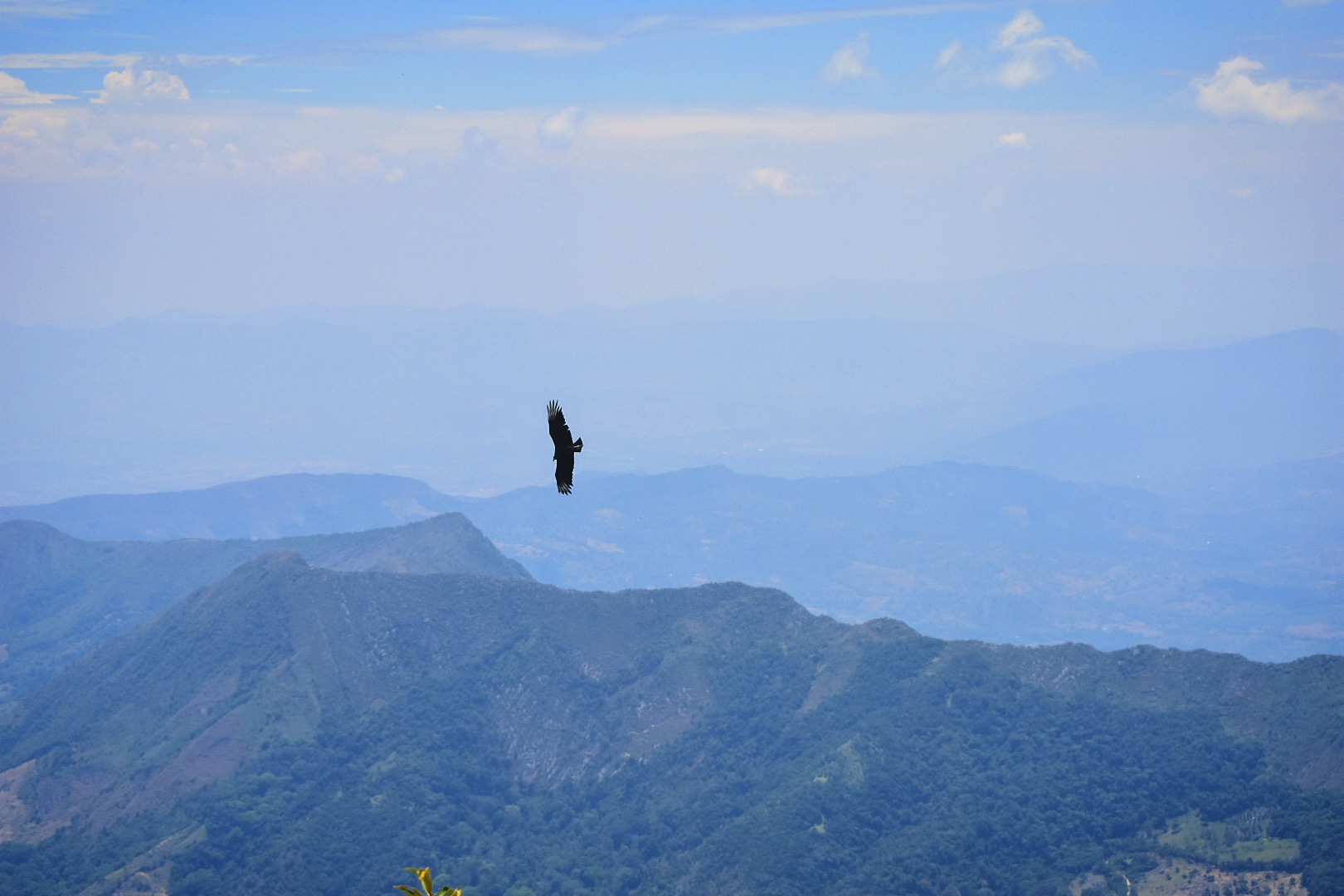
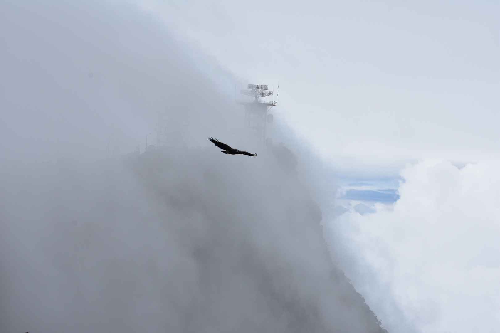
As you can see the path above turns to rock. As I was busy taking photographs near the end of the hike I disturbed two vultures and was able to quickly switch lenses to photograph them.

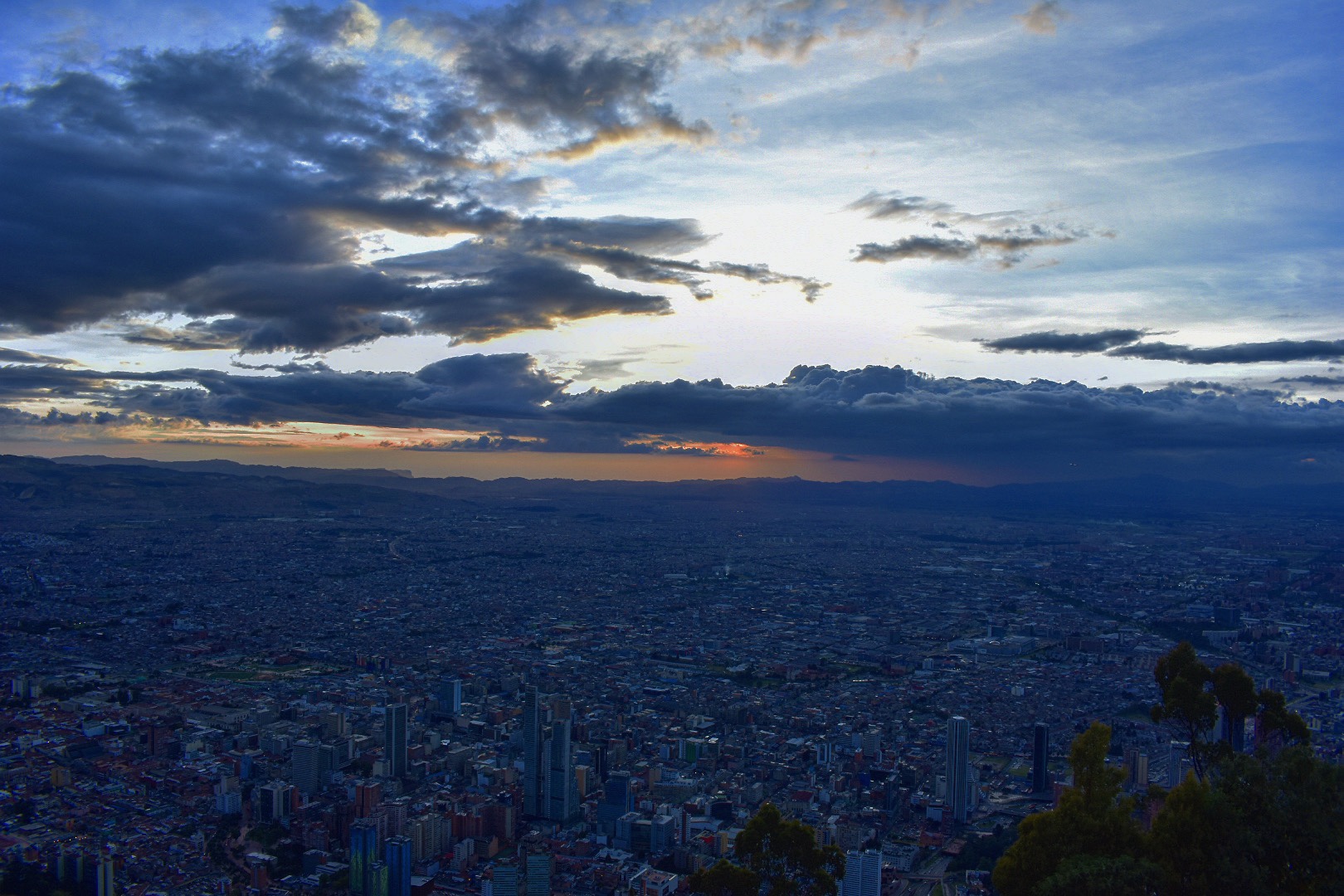
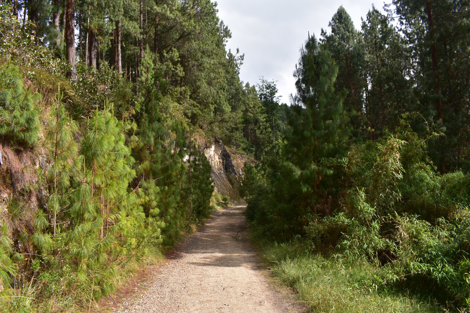
And then it was time to head back down to the tracks where I had started. This part of the trail is pretty steep but nothing too crazy. There were a lot of local people walking towards me back to their houses. I arrived back into town around midday and decided to treat myself to a Colombiana. You can of course stop here for lunch as it is fairly touristy and there are a lot of restaurants – it all depends on how much you want to push yourself. When you are ready to head back to Bogota, cross the road and flag down a red and black bus. The return journey costs the same. I wasn’t waiting too long for a bus to arrive so they will be fairly frequent. I was back at home by around 1pm which was a record for our trips.

How to Arrive at Suesca

Its a very easy journey to Suecsa and takes around 1 hour when you are on the bus. You can either take the bus form Bogota’s main terminal or from Terminal Norte. My advice would be to go to Terminal Norte on the Transmilenio or take a taxi/Uber to the terminal. At the terminal do not go towards the main building, but instead head to the right and you will see signs for a lot of towns including Suesca listed on a sign. Follow the path around the bus park and you will see lines with one being for Suesca.

Wait here for the bus to arrive and get on. A one way ticket is $7600 and make sure you tell the driver that you want to go to Rocas de Suesca, which is outside the main town. They should drop you at the right place but look for Vamonos Pal Monte, restaurant, just before the river on the map below and that’s where you want to get off the bus. From here walk to the train line and to follow the tracks turn left, or to go up along the ridge go straight ahead. There are no entrance fees. Or otherwise just explore at your leisure. There are plenty of trains on maps.me and if you ask around in town then you will find out about all the activities that you can explore.

Rocas

Equipment to take

This equipment list is aimed at those who are going to hike for a day. If you are camping or are planning on climbing then you will need to bring more equipment or hire it from one of the shops on the main street. Make sure you bring enough water and food. The route that I hiked was fairly short and I was back in a few hours. There are shops on the main road and again in any of the towns that you visit but its always best to be prepared, especially when it comes to water.

  1. Dry bag or packback cover (I take both)
  2. Cell phone
  3. Cell phone battery
  4. Charger cable
  5. Sunglasses
  6. Sun Cream
  7. Painkillers
  8. Blister plasters (better if you have a small first aid kit)
  9. Hand soap
  10. Tissues
  11. Water filer
  12. Sun hat
  13. Food
  14. Water 2 litres minimum

Clothes

It was a warm day when I hiked but this is my standard equipment which I would recommend. Remember you are on the BogotĂ  Savannah where it rains a lot and the weather can change quickly.

  1. Gortex hiking boots
  2. Waterproof jacket
  3. Waterproof trousers
  4. Base layer
  5. Jumper
  6. Fleece
  7. Down Jacket
  8. Hiking trousers
  9. Hiking underwear
  10. Hiking socks

If you enjoy hikes in the lush green mountains that surround BogotĂ  then mountains that try read my guides to Cuchilla El Tablazo, a downhill hike which starts overlooking lush green valleys from a palmero covered cliff at 3500 metres ends in a warm town at 1800 metres far below. Or head up to the rocky Farallones de Satausa where you can also go bouldering when you make your way along the ridge line.

Page 1 of 12

Powered by WordPress & Theme by Anders Norén