Parque Ecológico Matarredonda is a páramo situated right on Bogotá’s doorstep. Less than an hours travel by bus you are transported into a different world far away from the pollution and noise of the bustling metropolis. The park is very accessible with well marked and maintained trails taking you through the unique páramo landscape, around blue lagoons and up mountain peaks of 3600 metres. The weather will also change your experience, expect anything from clear blue skies to deep rolling fog, meaning repeat visits are a must. Once you are dropped off by the bus you can grab a hot chocolate to warm you up before the hike and after you hike stop for lunch in the small restaurant close to the entrance.
Read my guides to the La Chorrera waterfall, Latin America’s sixth highest waterfall, and Cerro de Guadalupe, that provides panoramic views of Bogotá which are both located on the same road.
Once inside the park there are two main walks you can easily explore without a guide, one to a beautiful blue laguna, and afterwards you can climb the cerro where you might be lucky enough to see Bogotá. The second is to another lake and a waterfall where you can cool off and swim in the very cold water. Both hikes are flat and each one can be completed in half a day.

Information

Our Experience
The day after the hiking Quebrada la Vija I woke everyone up early to go to Parque Matarredonda. This was another hike that had been in my sights for some time and with the clear blue skies we experienced in Bogotá for the first 10 days of January 2020, which is unprecedented, I wanted to squeeze in one last hike before we left Colombia for Buenos Aires. In the end it was a perfect choice as it wasn’t too challenging for Lorenzo and we had a stunning day and landscape to explore.
We took an Uber to the bus station on Calle 6, Prarda de Bus Intermunicipal Transoriente, in Bogota. You can also take a Transmileno to Tercer Mileno, which is on Avenida Caracas one block away. Leave by the south entrance and cross the road walking directly to the terminal. You will be safe here as you will see the heavily guarded police station and also you are fine in the terminal. I would not advice exploring this area any further as it is a little notorious.
It was a Sunday and we had taken the bus from here previously on a Friday and Saturday with relative ease. Despite it being around 7am the station was full of people heading to the Inglesa in Choachi, which is the final destination of the bus you want to take. You will also see a lot of people heading to the Inglesa at the top Cerro de Guadalupe when you are on the bus. We managed to get passage on one of thebusses leaving taking the last seats next to the driver. Ask the driver to be drop you at Matarredonda, tickets are $4000 each.
The road is narrow, with twists and turns around the mountains. On Sundays, as well as the increased bus traffic, it seems that cyclists, joggers and people walking to the Churches like to dice with death on the road. As our bus and numerous other vehicles were overtaking cyclists riding double on a single lane road with oncoming traffic I was waiting for someone to be hurt or killed. My heart was in my mouth on every corner. Ordinarily, for Colombia, this is a fairly safe road and it wasn’t us on the bus I was fearful for, as the cyclists seems to have no care or knowledge of personal space. My advice would be just to avoid this road on a Sunday.
After around an hour we were dropped off in the car park which is right on the main road. We headed to the restaurant to pay the $8000 entrance fee. This is one place you don’t need bring food as the restaurant serves a wide variety, including hot breakfast and lunch. We stopped to eat our pre-prepared breakfast and brought some hot chocolate and took advantage of the flushing toilets before heading out. We started walking around 9am and I was really excited as the skies were perfectly clear and, as you can see in the photos, there was no one else around as you can see.


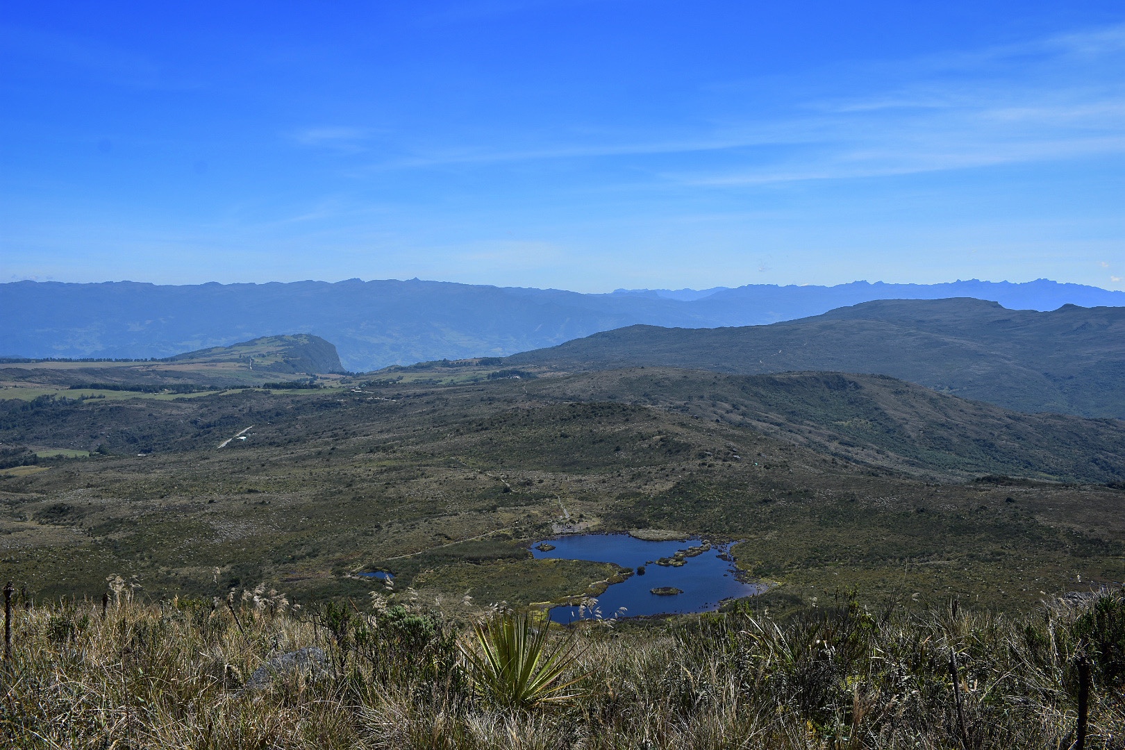
There are many hikes in the park, but most of them require a guide to be booked in advance. Luckily there are two which are easily completed in a day. Both should take around 2 hours, but it didn’t quite work out like that for us. You can go to the waterfall, we saw lots of families heading in that direction later on, which is the path that leads away form Bogotá or you can head to Laguna del Verjon, in the opposite direction. I wanted to go here as I had read there was a mirador from which you could see Bogotá on a clear day and I wanted to see if today it would be possible, so we headed to the lake.


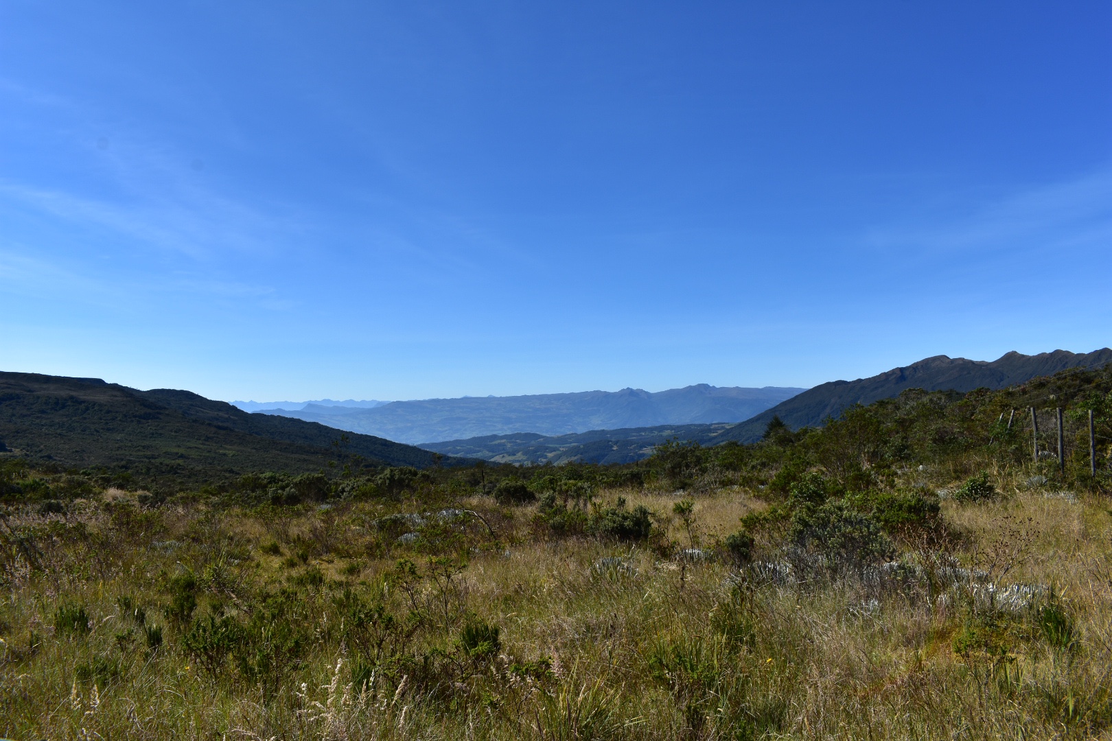
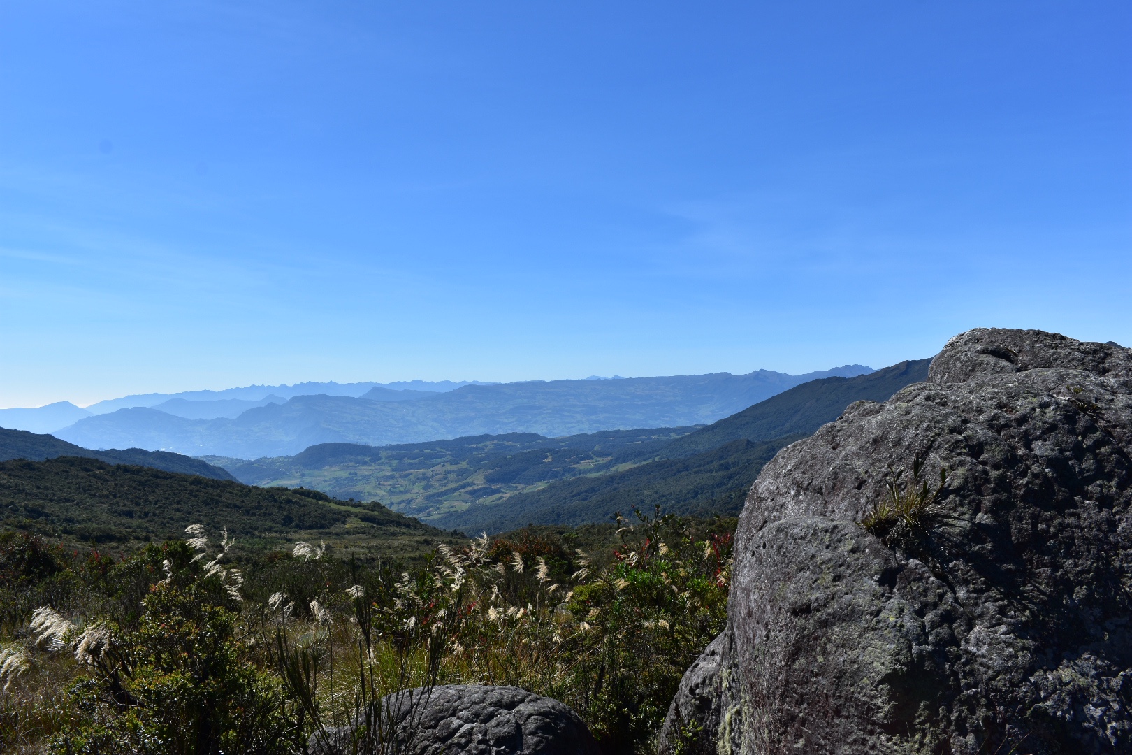
The vast open landscapes were stunning and I felt particularly special as normally much of this would be covered in cloud. A distinctive feature of páramo is that it is wet most of the time but for the past few days there had been no clouds.
We began walking and Lorenzo started mimicking me taking pictures with his invisible camera. We played some games as we hiked slowly allowing Lorenzo to enjoy the surroundings.
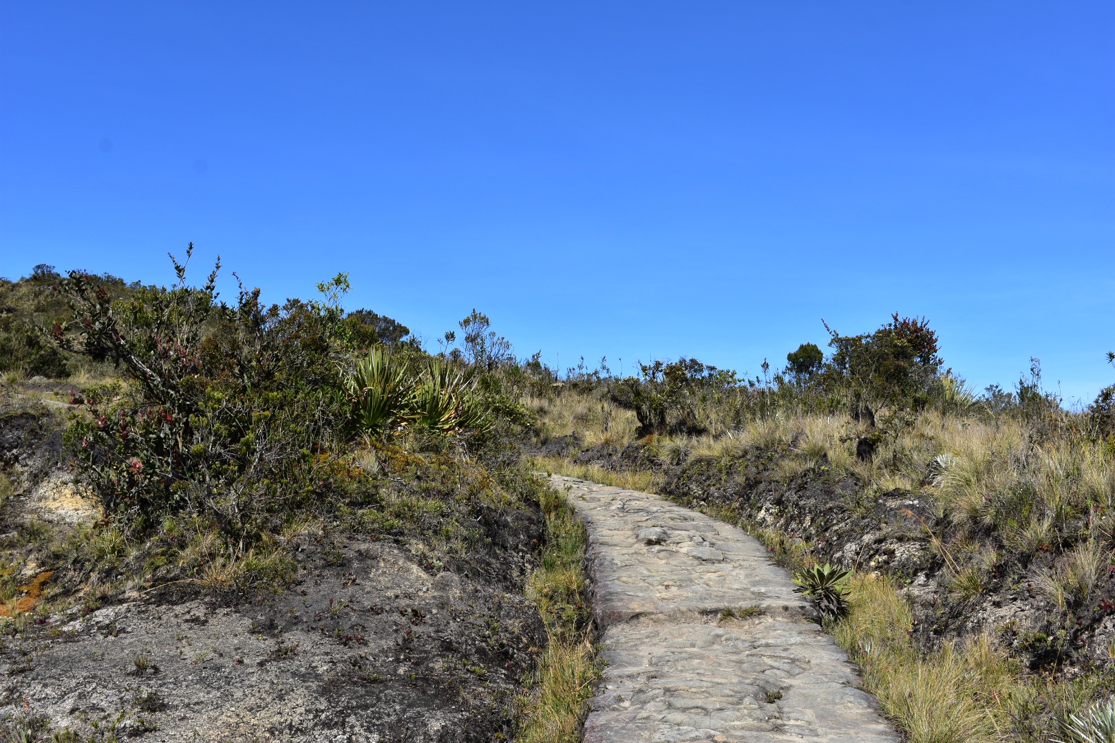
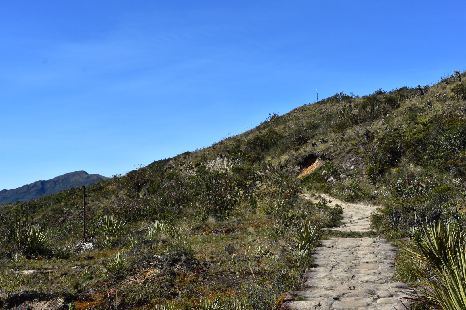
The paths are well maintained and start off as the gravel trail above and then soon turn into stones. This makes it harder to hike but as this is often wet I understand the reasoning.

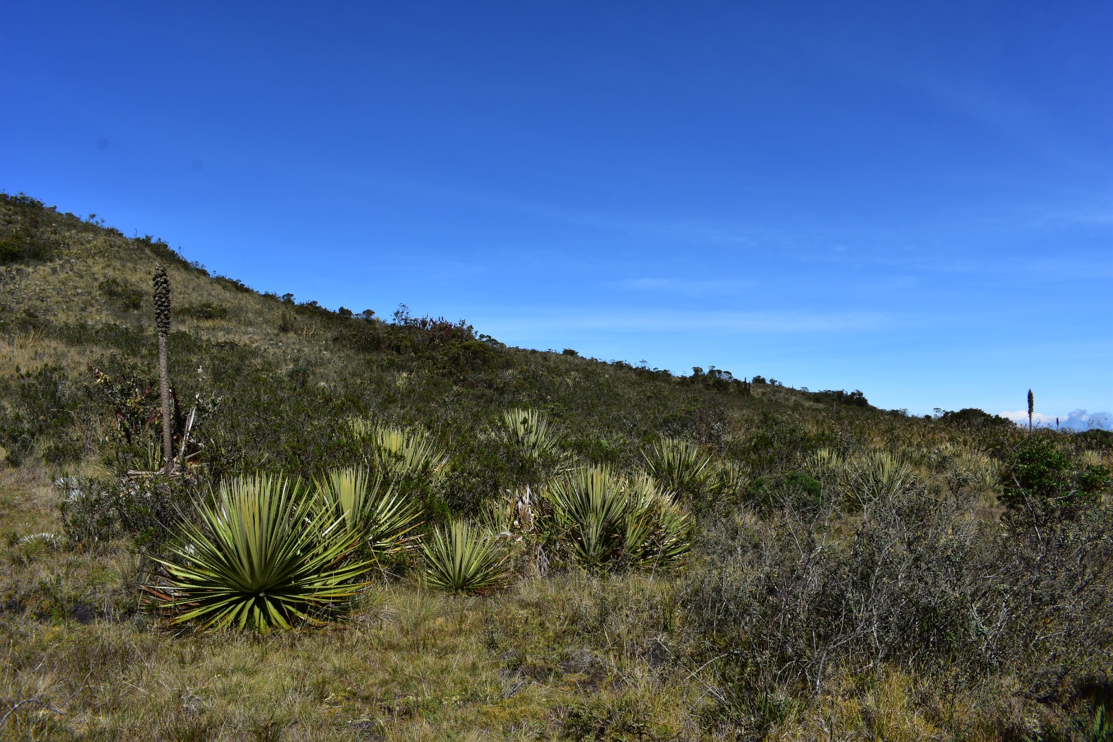
I particularly love this landscape, especially with the mountains in the distance. The plants almost seem not of this world and it a huge contrast to the green cerros surrounding Bogotá.


Lorenzo’s little legs don’t allow him to walk as fast as adults, although he does try, and a 2km hike is more like a 4km hike for him. He enjoyed exploring, looking at the plants and asking questions. Soon the other walkers caught up with us and went ahead and we were left alone again to explore.


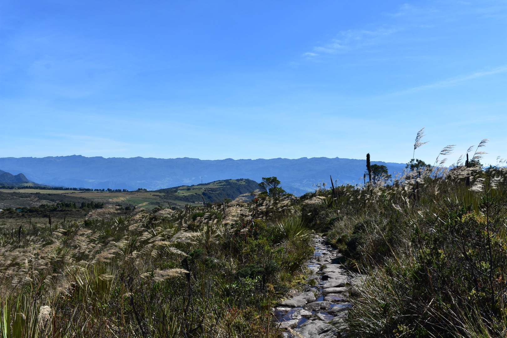

There were puddles and tiny streams crossing the path in places so I can only imagine how wet this can get when there is a lot of rain.


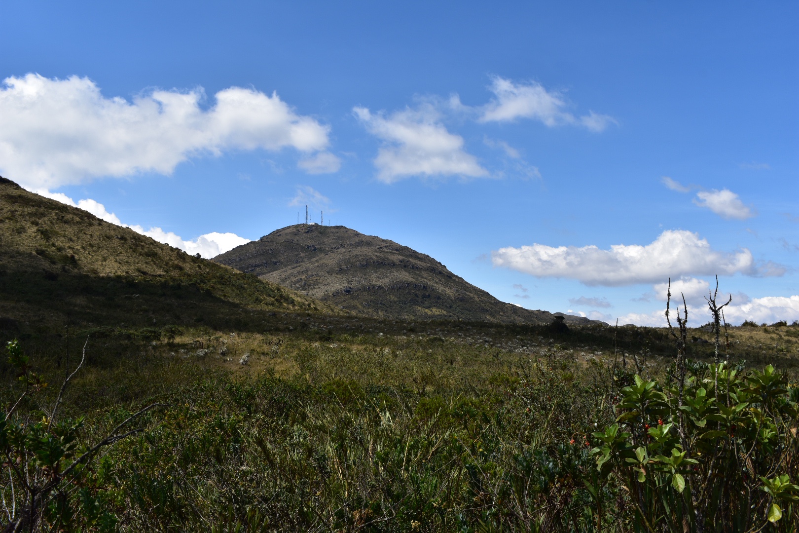
As we got closer to the lake the cerros became much larger.


Okay maybe it was me taking a lot of photos taking up all the time as Lorenzo kept running to catch-up with Angela.


Close to the lake we saw this cross.


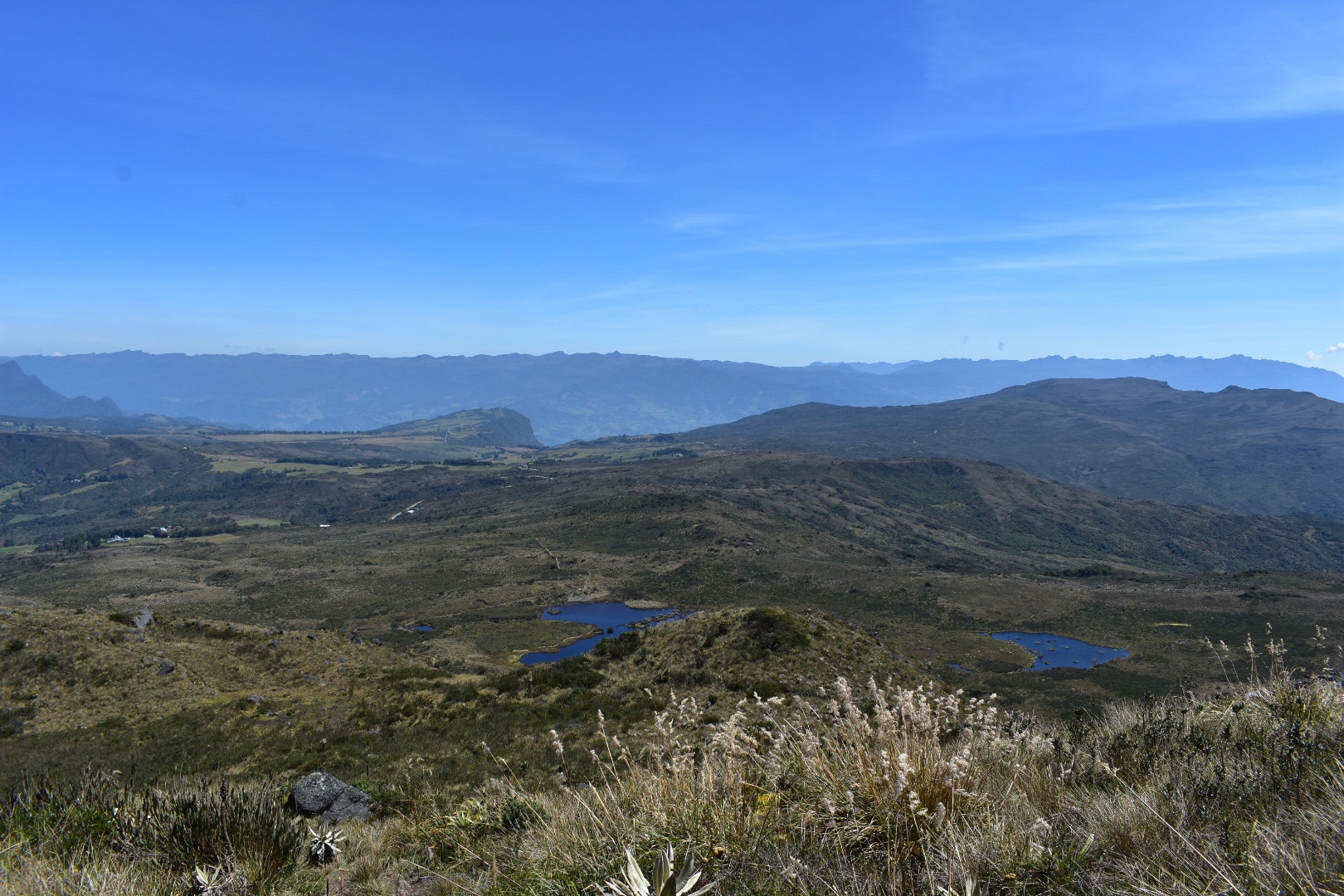
And soon after we reached the lake. It has taken us around 90 minutes to reach this point and all the other hikers were here already. Although upon our arrival they left as a group and continued. We decided to sit by the lake and enjoy the view.


I saw the other group on one of the cerros and I quickly looked at my map. They had reached their destination pretty quickly and I knew it was close so I said to Angela I wanted to take a look, thinking I would be around 20 minutes. Angela was feeling tired still from all the packing so stayed by the lake. Lorenzo decided to come with me as he thought the lake would be boring, so off we went to climb up the cerro.
The path takes you past the lake before turning right and starting slowly gradually goes uphill to the right of the ridge-line.


From here the path continues around to the other side of the ridge but you need to take a sharp left at the sign pointing to the mirador. From here the path becomes increasingly steep. It was fine on the day we were climbing but I can imagine it is much more challenging in wet conditions.


As is typical when climbing mountains each time you think you get to a point that might be the top you then quickly realise it was a false summit that there is still more to climb. I was keen to reach the top of the ridge where I had seen the others and when we reached that point I realised there was a mirador close to us. Lorenzo was enjoying the climbing and each time we reached one point he wanted to go to the next one, so we kept on walking.


This was one of the last false summits, I could see the other hikers going up and I nearly stopped when we became a little lost in the small peat bog at the bottom, imagine that on a wet day.

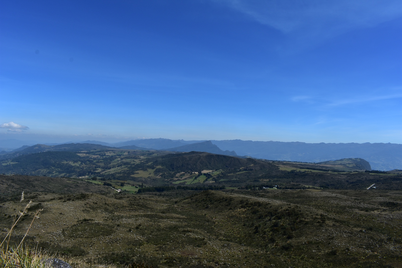
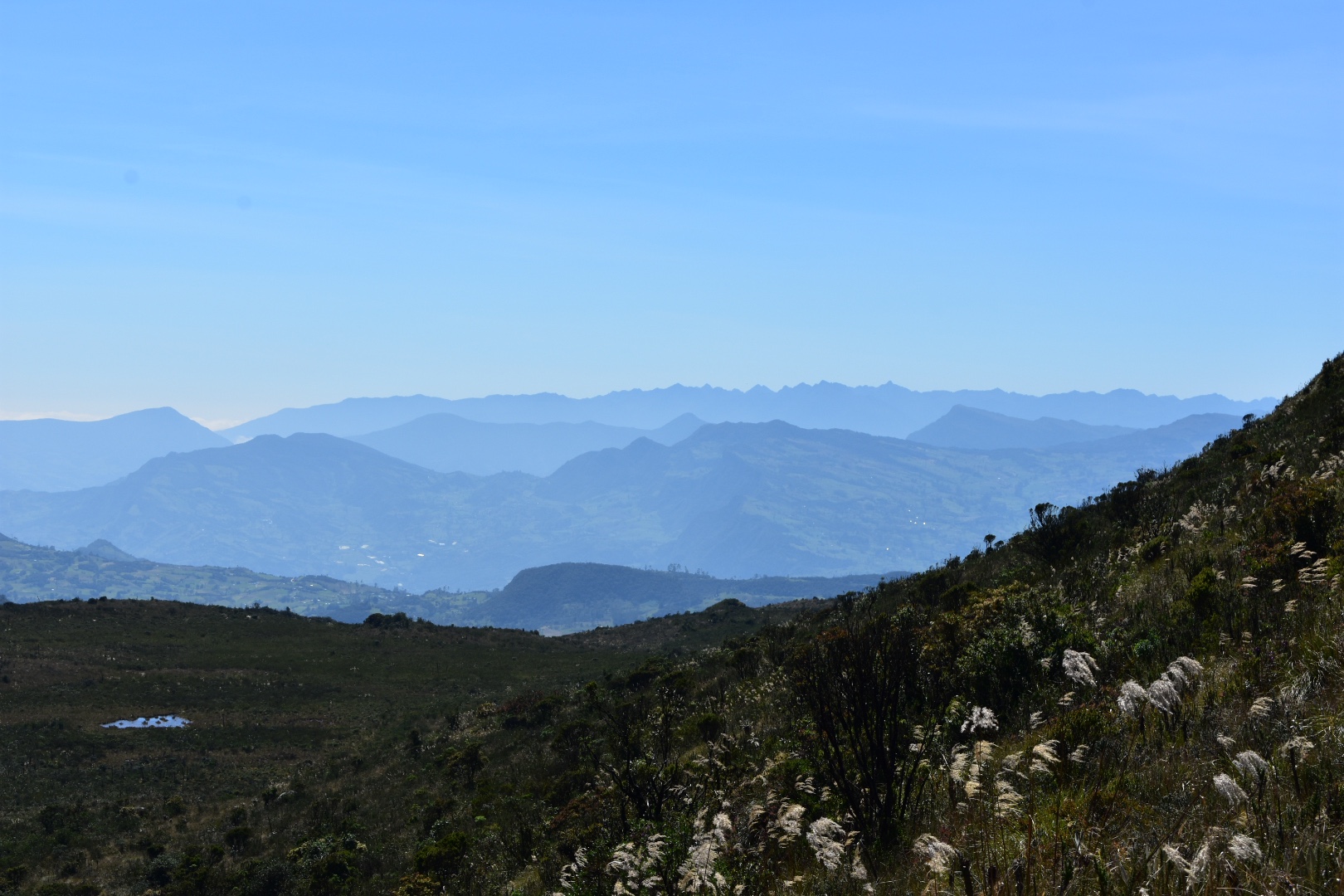
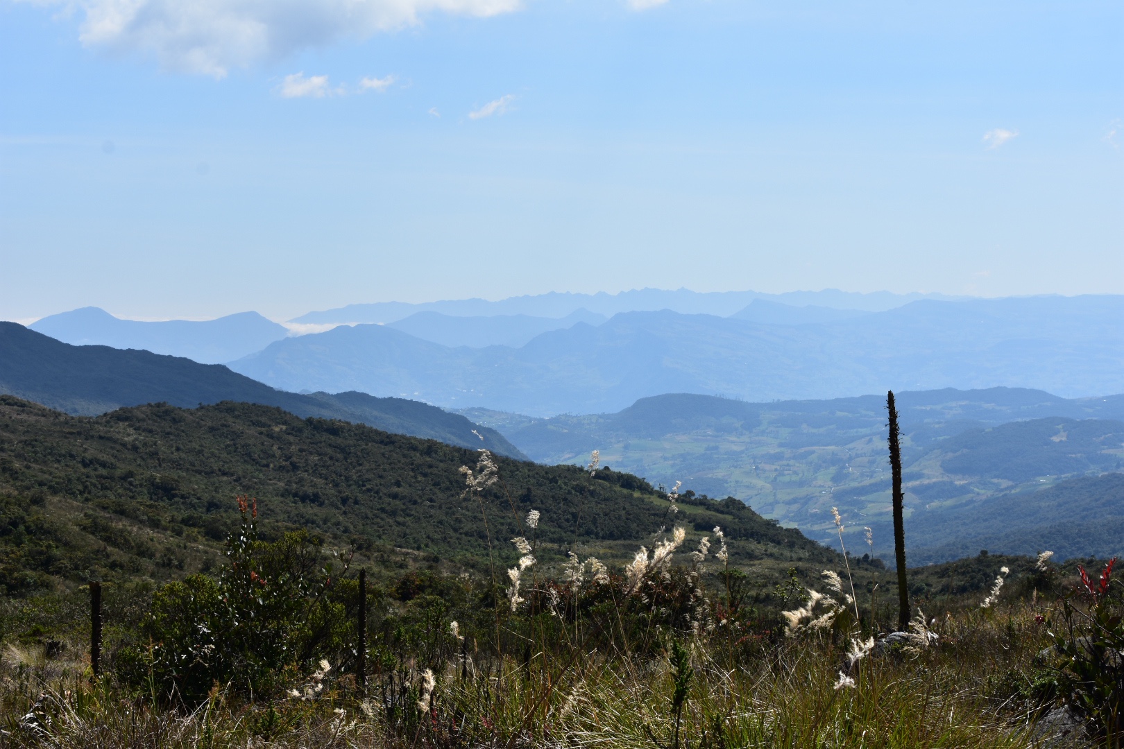
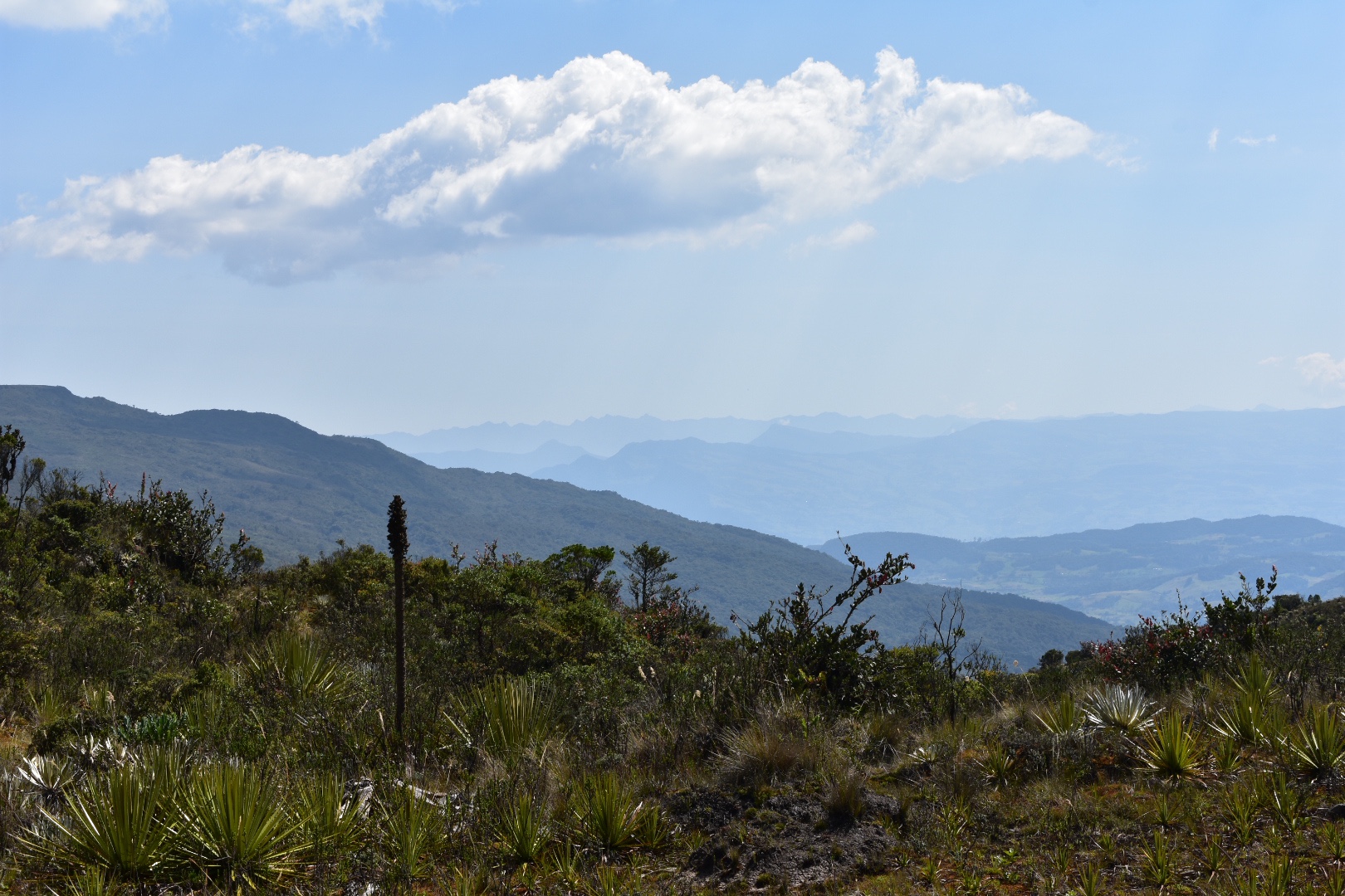
And the views made the challenge completly worth while.


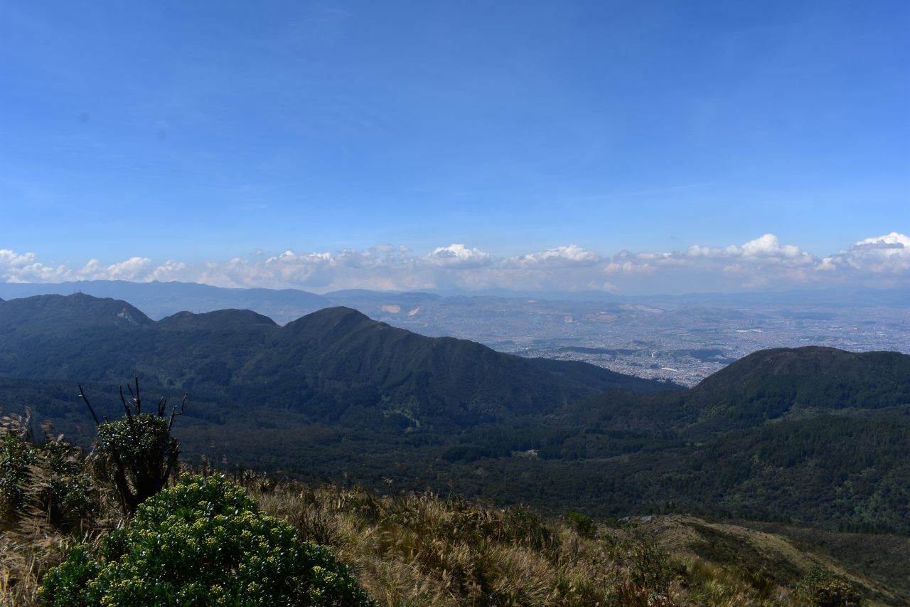
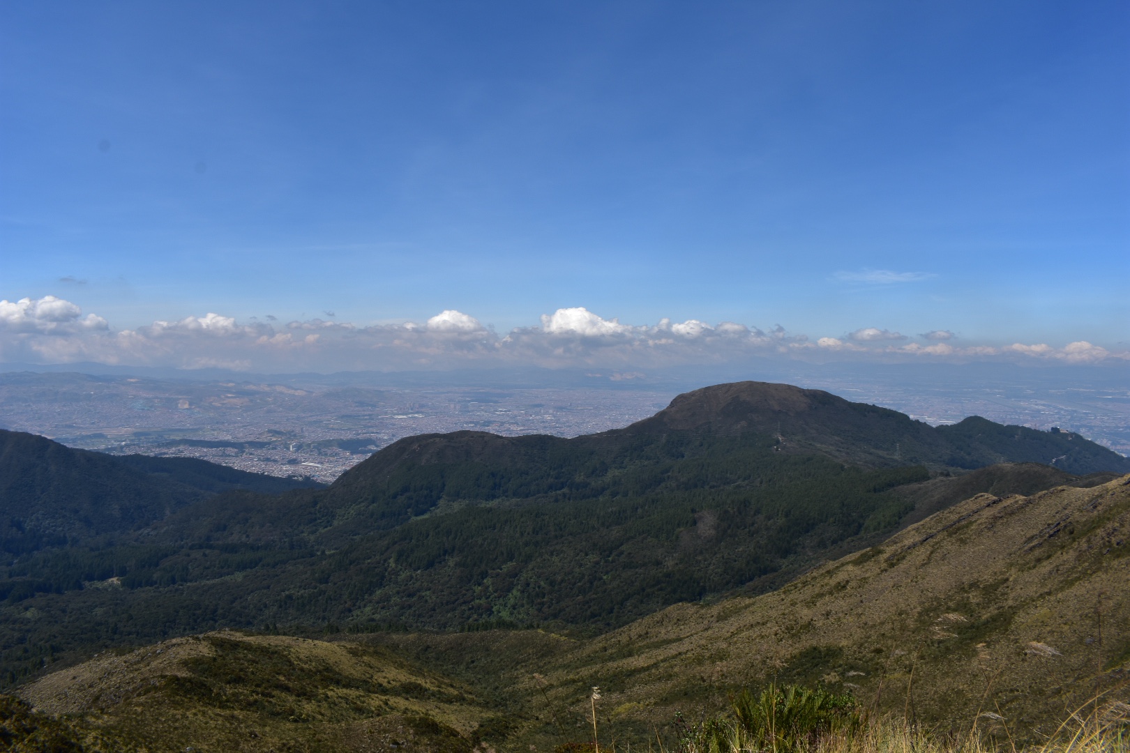
From here we could also see Bogota. The Church in the photos below is Monserrate.
As we approached the top it became windy in places and I had to keep taking Lorenzo’s hat so it didn’t blow away. The path was narrow with some big drops, which and made me a little worried, but Lorenzo is pretty sensible and held my hand. I realised later that it might not have been the wisest thing to do to take a 5 year old up to the top of a 3600 metre mountain, but in my defence neither of us realised it at the time. He was loving the views and I feel he is sensible enough to follow my instructions.
The views kept getting better the higher we climbed. As we reached the summit I realised that we have been gone for around an hour, having left Angela at the lake. We also didn’t have any food and I only took a little water as I had thought it would only be a short journey. After taking a few minutes to admire the view we started back down. In my haste I forgot to take any photos of Lorenzo at the top which was something I regret as I feel it is a major achievement for him.
From here we could also see Bogota. The Church in the photos below is Monserrate.


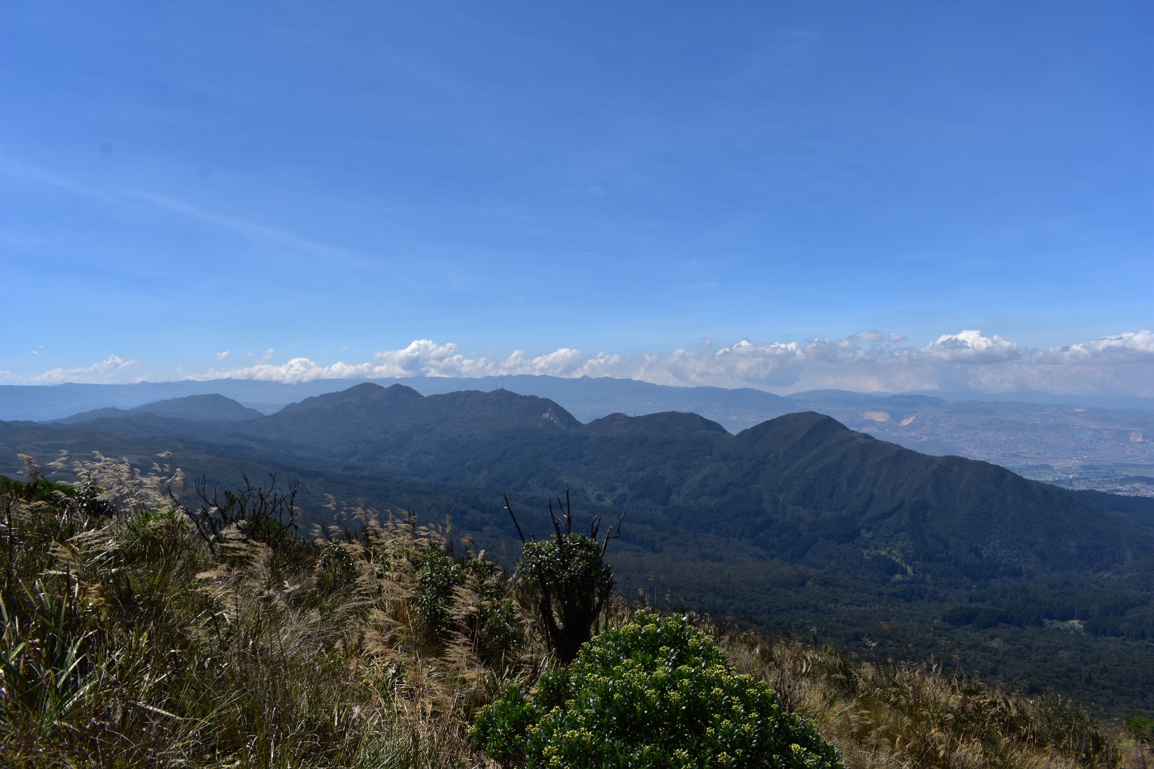
And more photos from the top.


Going down was slow, it was steep and I kept holding back Lorenzo as he wanted to go faster. I ended up sliding a couple of times but he was fine. At one point we took a wrong turn and somehow left the path, walking down what must have been a small stream when it rained. When we got to the path there was a small drop, easy enough for me to climb down, but not Lorenzo. Luckily for me a couple of other hikers had followed us so between us we helped each other down.
Returning to the lake Angela was relaxed, although she had a headache having being in the sun with no shade to hide in. The climb to the cerro had taken us about two hours in total. We replenished out water and had lunch enjoying the view by the lake.

Afterwards the clouds started to arrive, but the day was still really bright. We were all suffering from tiredness and a little from the altitude as we walked back to the entrance.
It had been my intention to go to the waterfall after the lake as it wasn’t too far but the climb had taken Lorenzo’s energy and he couldn’t walk any further. To be fair we were all a little tired but I think I could have pushed on the the waterfall. Instead we decided to head to the restaurant and rested, before we crossed the road and flagged down a bus that was heading to Bogotá. This time the roads were much clearer and the journey was faster. Once back at the main terminal we took an Uber back home.
How to arrive at Parque Ecológico Matarredonda
Getting to the Park is really simple. Go to the bus station on Calle 6, Prarda de Bus Intermunicipal Transoriente, in Bogotá. Take a taxi or the Transmileno to Tercer Mileno, which is on Avenida Caracas one block away. Leave by the south entrance and cross the road walking directly to the terminal. You will be safe here as you will see the heavily guarded police station. I would not advice exploring this area any further as it is a little notorious.
Once at the station book a ticket on a bus heading to Choachi, but tell them you are going to Parque Matarredonda, $4000 one way, and you will be dropped at the park gates. The bus journey takes around an hour. Coming back you can just cross the road and flag down another bus heading to Bogotá. We didn’t wait long and one bus passed us that was already full.
My advice would be not to go on a Sunday as the road and the busses are busy. The park is open from 8am – 4pm daily and it costs $8000 to enter. There is a restaurant selling full breakfast and lunch options as well as drinks and snacks. My advice would to bring food, just in case, and to make sure that you have enough water for the trip.
There are two main hiking trails:
- Cascada del Abuela – this walk will take you around 40 minutes and is the steeper of the two trails. Turn left when you enter the park and follow the signs. We didn’t try this due to time but I saw lots of families going there. You can swim in the water, but I think its really cold, but do bring swimming costumes if you want to try. Ther are paths marked on the map up to the cerros but I’m not sure if you are permitted to go further without a guide but the trails are clearly marked on Maps.me.
- Laguna del Verjón – this is the tail we took which is described in more detail above. Turn right when you enter the park and the walk to the lake should take around one hour each way. You are not permitted to swim in the lake. The walk is on a well maintained path and is flat, so you don’t worry about getting lost. If you continue after the lake it is possible to climb to the mirador, Alto los Tunjos, as we did, but I was following a group with a guide, and I wouldn’t recommend doing in bad conditions or if you do not have much experience.
If you want more information especially regarding guides try the following contact details: Call 3178657320 or Email vjmatarredonda@gmail.com.
There is a lot to explore in the park and I think a couple of repeat visits are needed to see everything.
Equipment to take
There is a well stocked restaurant but I would always advice to bring some food and all of your water just in case it is not open. Once you enter the park there are no facilities to buy anything outside of the restaurant. This is a high altitude hike in a páramo, which is normally wet and cold, so unless you are in a heatwave, which we were be prepared for the rain and cold:
- Gortex hiking boots
- Waterproof jacket
- Waterproof trousers
- Dry bag or packback cover (I take both)
- Cell phone
- Cell phone battery
- Charger cable
- Sunglasses
- Sun Cream
- Painkillers
- Blister plasters (better if you have a small first aid kit)
- Hand soap
- Tissues
- Water filer
- Sun hat
- Food – you can never have too much and you will need it on this hike so pack appropriately.
- Water 2 litres minimum
Clothes
- Base layer
- Fleece
- Down Jacket
- Hiking trousers
- Hiking underwear
- Hiking socks
If you like páramo hike then read the guides to Laguna de Iquaque a high altitude lake near Villa de Lleva or Cucilla El Tablaza a 20km downhill hike starting in the páramo west of Bogotá.

4 Pingbacks