Exploring Latin America 🇦🇷 🇧🇴 🇨🇱 🇨🇴 🇪🇨 🇲🇽 🇵🇪 🇺🇾

Category: Colombia Page 2 of 3

Tren Touristico Bogota, to Nemocon and the Minas de Sal

dc8cf56a-a136-46b6-a6b0-2989dac4511d

I decided I wanted to take the train in Bogota as soon as I realised it existed. Living close to Carrera 9 we hear the trains pass our several times a day and also don’t need to invest in an alarm as there is an especially excited driver who loves to press the horn at around 6am in the morning.

I don’t normally talk about my life outside of hiking on the blog but Angela and I have a 5 year old, Lorenzo, who is as excited about the trains as I am and with Angela showing little to no interest in the trip I decided to make it a boys day out and invited Jorge, Angela’s father. You can buy tickets direct from the Tren Touristico de la Sabana website or in person at the stations in Usaquen or Sabana. Being close to Usaquen, I decided to pop down and buy the tickets saving paying the administration fee. The tickets themselves are not cheap and I’ll detail all the information at the end.

The day finally arrived and for the first time on a trip out we had blue skys! Lorenzo was particularly excited and happily posed. The train was scheduled to leave at 9am on the Sunday and we were early to see the train arrive.

The train stops in the station for 10 minutes so there was time to get some obligatory photos before we boarded. 

We were on the front carriage and ended up sitting right behind the driver, which was great in this case as unlike any other train I’ve ever been on there was glass between the passengers and the driver cabin meaning that we could see out of the front of the train.

And soon we were off. As this was a Sunday one side of Carrera 9 is a cycle path until 2pm so that’s why there are all the bikes on the street. I’ve never seen Bogota from this perspective and soon realised that although the train is slower than cars it doesn’t have to stop at traffic lights. Instead there is an army of people stopping traffic in various forms and the constant beeping of the trains horn warns the people, who do not always heed it with purpose, to get out of the way. Thankfully on this journey at least no one came close to being hit.

Throughout the journey there are people selling drinks and snacks, including beers. I didn’t feel 9 am was the right time to grab a beer. Also there was the opportunity to by tickets to the mines on the train, I think you can even buy them from the ticket office. Jorge was buying the tickets and it was only possible to pay by cash on the train, which we later realised was a mistake – if you can make sure you buy the tickets for the Salt Mines on the train or before you depart.

The train follows Carrera 9 to the end and then past buildings in the suburbs. There are lots of houses built really close to the track in this area, it is a poorer neighbourhood and you can see how people live. This is juxtaposed alongside a lot of high-rises of the rapidly expanding city. 

Soon you are out of Bogota and surrounded by the green fields of the Savannah and the mountains. 

We seemed to be building up a rapport with the drivers, as Lorenzo was happily chatting with the woman across the isle, which would pay us dividends later in the afternoon. The drivers invited Lorenzo into the cabin to help drive the train. I was hoping they would invite me next but sadly no invitation followed.

The journey is around 2 and a half hours and there is plenty to see.

One of my favourite aspects of the journey was the variety of ways the traffic is stopped for the train. As I mentioned above in the city there are special crossings with barriers that are operated by someone close by. Outside initially I noticed there was someone on a motorbike rushing ahead of the train to each of he crossings, they stopped the traffic and sped off to the next position before the train arrived. Further on there was police who blocked off the larger roads.

At Zipaquira we were joined by this small train which went ahead of us. At each road the two guys hanging on to the back would jump off, stop the traffic and jump back on again, all while the yellow train kept moving. 

And there were more mountain scenes. Lots of animals can be spotted from the train, especially cows which seem to be Lorenzo’s favourite animal to spot.

The train arrived in Nemocon at the scheduled time of 11am and when we got off the train the local school band was playing. We were led through the town by the one of the guides to the Mina de Sal – there didn’t seem to be anything official about this and if you wanted to do something else then you by all means can – the ticket does not include entry to the mines and the train stops for around 3.5 hours, which seems like a long time. 

The mines are the other side of the town which is really picturesque and definitely set up as a tourist attraction based on the number of restaurants available. If you came on your own time its a nice way to spend a day relaxing.  

Then we reached the entrance and those with tickets went straight in and those without lined up at the ticket desk. We wasted away a good 15 minutes and then missed the preceding tour having to wait for the next one.

I’ll warn you now that the tour is not short. At this stage I wasn’t really paying attention to the time and after a shortish wait we were invited into the museum part of the tour. This covered a lot especially geology, how the andes were formed and all the ancient animals that could be found in the area. It’s all in Spanish so if that is something you are still not to grips with, like me, then you can read one of the few signs in English. I wouldn’t have a problem with it but it was so long and I could see the Spanish speakers becoming agitated. 

Then we were given our hair nets and hats and sent down into the mine. Its important to note that this is still a working mine. The areas that you see are just for tourists but worker access other areas.

You go down several set of steps and are told to be careful and then begins the longest tour of a mine in history. I joke, I do think this is a fun day out with some spectacular views but the tour is overly long. The second chamber is great, especially with the light reflections on the water.

You and your friend can pay to have some whacky photos taken. We decided not to take up the opportunity but I enjoyed taking photos of proceedings.

The three of us went a little rogue and started following at our own pace, I’m sure to the annoyance of the guide but finally I was able to fulfil my long term plans and send Lorenzo down a mine – sadly he was costing money and not making any. But baby steps. 

I really loved the markings and textures of the rocks.

And of course the tunnels. I’m also a big fan of tunnels. 

Its also important to note that this mine was used for the setting of The 33, a movie about the Chilean miners trapped in 2010.

And of course being in South American there was a dog in the mine!

We were able to leave the mine just after 1:30pm which didn’t give us much time for lunch. We squandered precious time looking for a restaurant before settling on one that was close to the mine. This is why I suggest you buy the tickets in advance, just to give you time to have some food and explore the town afterwards rather than rush like crazy as we did. In about half an hour we ordered, had piles of food delivered, had a take away arranged for the food we couldn’t eat. Then to top it all off there was a problem with the bill that needed fixing, Lorenzo wanted a balloon so the waitress fetched that rather than sorting the bill and we managed to eave the restaurant with about 2 minutes to spare before the train left, with a 10 minute journey to get there.

I put him on my shoulders and ran and we arrived about 10 minutes late. Somehow the train was still in the station waiting for us, but I think it was only because the woman at the front had asked the driver to wait and they of course had remembered Lorenzo – if we had been sat anywhere else they would have left. And I know that as pretty much as soon as we sat down the train pulled out of the station. I wondered if we had messed up the timings for the crossings.

The journey back was largely the same taking around 2.5 hours. I was exhausted after the stress of getting the train and running but it was a fun journey. We grabbed a few more photos of the train before it left the station when we arrived back in Bogota. All in all it was a good day, a little expensive for Colombia but trains here are few and far between so if you want to take one this is the perfect opportunity.

And here is us together after disembarking.

Train Information

For the most recent information do check the Tren Touristico de la Sabana website, which is also in English. Currently trains go to two destinations Nemocon, only on Sundays for the Minas de Sal, and Zipaquira, for the Salt Cathedral on weekends and holidays.

Tickets can be purchased online or at the stations in Usaquen or Sabana stations. Check the departure times as these are subject to change and make sure you get back to your station on time. I would advise you to buy tickets for the attractions at the same time as your tickets or in advance on the train so you do not waste time on the day. Only cash payments are accepted on the train.

The train does sell drinks and snacks including sandwiches, but not hot food. I would advise that you bring your own as it will be cheaper.

Prices

Nemocon: Adults – $72000, Children and Seniors – $65000

Zipaquira: Adults – $60000, Children and Seniors – $54000

Entrance to the Mina de Sal:  Adults – $29000, Children and Seniors – $20000

Entrance to the Salt Cathedral and transportation: Adults – $64000, Children and Seniors – $54000

Embrace Adventure and Climb up to the Farallones de Sutatausa, Bogotá

The Farallones de Sutatausa are a stunning rock formation that form the back drop of Sutatausa, a small mining town 90 minutes north of Bogotà. Sacred to the local indigenous peoples the 3000 metre peak is one place that you can see the Bogotá Savannah and surrounding valleys at the same time. As you climb to the top the views of the surrounding landscape unfolding below are phenomenal. The views combined with the unique rock structure and plant foliage make this a must visit destination.

The cliffs are a mecca for bouldering and the many hiking trails that wind their way up through the forest to the top of the cliffs offer a range in challenges. Once at the top there are plenty more options for bouldering as you scramble across the rocks along the entire ridge line. This is one experience that is not for the fainthearted so do make sure you have a level of experience before you attempt this hike. 

The town is another weekend getaway akin to Suesca and Villa de leyva where you can visit for a day or spend the weekend enjoying the surrounding form the lush green valley floor. There are many beautiful hotels, hostels and camping spots all secluded in the valley with options to hike, climb, cycle or just relax. We hitched a life from a family who were returning home from a family birthday party. It is entirely possible to enjoy the cliffs from afar, but whatever level of adventure you decide is right then you are in for a a fun time.

If you enjoy hikes in the lush green mountains that surround Bogotà then mountains that try read my guides to Cuchilla El Tablazo, a downhill hike which starts overlooking lush green valleys from a palmero covered cliff at 3500 metres ends in a warm town at 1800 metres far below. Or head to Suesca where you can also go bouldering and spend a weekend enjoying hiking, camping or relaxing in restaurants.

d0eb46b1-20cd-4b60-a4de-1f7260f505ee

Information

  1. Our Experience
  2. How to arrive at Farallones de Sutatausa
  3. Equipment to take

Our Experience

I was really excited to go to the Farallones de Sutatausa ever since read about the hike and saw photos of the views in another blog. There wasn’t much information in English, or Spanish for that matter, so I did my best to piece together the information and we had a fun, and at times scary adventure, but lived to tell the tale. 

We set off to Terminal Norte early and had luck with a bus arriving pretty quickly. We needed to get a bus to Sutatausa, the final destination is Ubate. We were charged $12500 pesos as I had only told Angela the final bus destination, which we will come back to later. Do make sure you tell the bus driver that you want to get off at the Farallones de Sutatausa and you will be dropped off about 5 minutes south of the town, which is where the main trail starts. Despite having not told the driver of the location we were fairly confident that we would be able to get to the location as I had placed a pin in my map where I believed the tail started – we would later learn, several kilometres into the hike, that I had marked the wrong location. This was because I was transposing the map information from Google Maps to Maps.me and not having zoomed out enough on both to check. But back to the adventure.

If you get a direct bus to Satatuasa then the journey is around 90 minutes, the bus we flagged back to Bogota seemed to want to stop at every village and hamlet on the way resulting in a much longer journey. When we reached the town I surprised our driver by asking to be dropped off. Instead of heading straight up to the hike we decided to check out the town and I wanted to see if there was some tourist information to ask questions as this had been helpful for the Pionono Park hike and another blog had suggested that you can start the hike from the side of the church.

dsc_0531

We arrived around 8:30am and the town was deserted. Later we found out that most the people that live in the town work in mines and they start early. There are a few shops along the main road but not so much further into town, at least not open, although if you follow the instructions below you will not come into the town. Make sure that you do bring what you need for the trip ahead of time. We didn’t have enough water with us, I had lost a bottle that week, and I was fairly confident there was a shop closer to the cliffs. We, however, didn’t find the shop but that is because we were looking in the wrong location.

The tourist information was closed, so we took a left and headed the 2km to where I have put the pin in the map. That was where we made another mistake as the route to the cliffs and the first point we had missed is accessed by taking a right from the church, as the blog had told me, and following the signs. We never saw any signs to the cliffs on any part of the journey. My advice would be go to to the location I flag below as I’m not sure the path from the Church is the best one to take.

It was a few kilometres to where I believed the trail started and we made good progress along the road with Angela leading. I was excited to be hiking even if I had seen a completly blue sky slip behind the clouds. This is Bogotà after all. The road was a bumpy dirt track and a few cars and motorbikes passed us but very easy to walk on and pretty quiet.

We soon reached the pin I had placed in the map and expected the shop to be located. I still hadn’t realised that we were in the wrong place as there was a trail on the map which led up and we were right in track. There was no sign of the shop but I guessed it was either further ahead or no longer here.

We had a choice of turning right, which would have been a very long way around but would have instead taken us to the correct trail or turning left and follow the trail that I thought would take us to the top of the cliffs and then walk the 2-3 kilometres along the ridge line before descending on the south side. I think all in all I had guessed it would be around a 15 kilometre hike, which is not without the realm of reason, especially as it was still before 10am. Maps.me was behaving a little strangely but trails were marked on the map so I didn’t see any reason not to proceed, so we followed the road to the left and headed down into the valley below.

All the time we were walking down we were in good spirits, even though we knew we would have to go back up again. We walked past a couple of locals and for some reason I pushed Angela to ask for directions. They told us that there was a path up to the cliffs but this wasn’t the normal way for people to come. I may well have realised the mistake by now. The path that maps.me wanted us to follow disappeared across private land and we were told that landowner didn’t let people pass. But the man had pointed to a house in the distance and said that the owner did let people cross his land but to be careful as there was a dog.

We continued along the road which had turned into a very small track at this stage. Upon finding the house we decided to find the owner and ask for permission. I was a little concerned as we seemed to have to walk into the property and there had been a lot of barky dogs, who were not friendly as the other dogs had been at Pionono Park or Cerro Quininí. As we approached the hose we spotted a man working outside who was not friendly at all and did nothing when the vicious dog came to attack us. Luckily Angela didn’t panic and we walked away without incident. We followed the trail a little further to where is appeared as if it would join with the direction that Maps.me wanted us to head but we were blocked by another property. Again it seemed people were home but there were more dogs around and I didn’t want a repeat of what had just transpired so disappointed we retraced our steps. I definitely knew we were in the wrong place by this point, but we had been told there was a path up and up we wanted to go. After a few hundred metres we stopped at a place where Angel had picked up a pigs leg before and exactly at this spot there was a path that headed off in the direction we had been told to take. Although it wasn’t on the map and we were far form the actual trail head we decided to follow and see where it would take us rather than turn back.

The trail ran for a few hundred meters around the property we had just been forced off by the dog. It narrowed passing around a few more properties before ending in what appeared to be the back garden of a farm house. We passed through and found a road which I was temped to follow but sitting the other side of the house were two people who directed us up a path which they said led to the top. Happy we had come luck we eagerly began our steep ascent.

The path leading up to the top was steep from the beginning and was tough work but we made good progress and in good condition, to begin with. I was happy to finally be heading upwards after having walked down into the valley. We soon cam across a small barb wire fence that was a tiny bit tricky to cross, but thought nothing of it as there was nowhere else to go. Inside the field the path was not always clear and we took a could of wrong turns before finding the crossing out on the other side. We went up one more steep bank and found ourselves with a view across the valley. The path here had been washed away in many places but resulted in more rather than less to walk on. It was clear that we were not on the traditional path up.

Soon after passed behind a water pumping station that supplied water to the valley, which the first man had told us about but made it sound as if it were 5 minutes away, not an hour as hit had been. After a few more turns the path opened up into a meadow where we took a short break and saw a mother and her young children pass. We continued up and the path kept splitting into several directions and saw more locals who helped in directing up upwards. After more twists and turns in the trees we arrived on the top of a crest and could see these beautiful mountains.

We took some more directions form the lovely people in this farm house who seemed to think that we were a little strange for coming this way but told us we were on the right path and then we started to climb up again.

The image below gives you some idea of where we were headed and it became much steeper after this point. It didn’t feel too bad going up and there was nothing too challenging, most paths at the top of mountains are a little sketchy and you just have to go slowly and take your time. It didn’t feel like a long time and we kept on moving upwards. Soon we came to a cross roads with another trail, which when I looked at my map, was the trail the map had suggested we take. The one that had previously cut across private land. I felt pretty happy that we were back on the right track and so close to the top.

After a little more climbing the path levelled out and we arrived at the top. There was a lot of thick foliage, so we climbed a little higher and  found some rocks to sit down on and eat lunch. For me the hard part was done, it really wasn’t, but in my mind all we had to do was walk along the ridge line and then come back down the other side – it was only a few kilometres away.

The view up there was a beautiful and sadly was obscured when it started raining, the wind struck up and it became really cold. We ate quickly, donned waterproofs and decided to follow the ridge to the path that led down. As I said it was 2-3 kilometres away.

We toyed with visiting another cerro close by but I rejected that and also the idea of heading back down the way we had come. So instead we started to pick out a path around the rocks and bushes which was initially a little tricky to find on the map. At the beginning there seemed to be a trail to follow but we kept hitting dead end and we were either above or below the path. But it was fine as we were quite easily following the ridge line. Soon after the path seems to lead ups off the cliff face, there was something really sketchy going down or a way to go up, which we started to follow but after a while that would have required climbing equipment. I stopped to take some photos before picking our way around on some quite tricky rocks.

This is the view to the other-side of the mountain, it didn’t look at steep and there was no obvious path down but you can see there are houses there and keep this in mind as we will come back to it later.

Around the other side I found that we were far below the trial so I headed back up to where is should be using the GPS but I didn’t find anything obvious. The map kept telling me that we were above or below the right line. Luckily the rain had stopped before we went too far and we found ourselves coming to dead ends where there were deep drops and having to retrace our steps to find a way around. As we continued picking our way across the ridge and found some more beautiful views.

After a while of slowly working our way across the top we reached a series of  trenches/gullys that we had to climb down into and then out of again. Some were a lot deeper than others and mostly it was fine but it was long and hard work. At this stage the sun started to come out and we had also ran out of water by this stage. I was really thirsty, tired and dehydrated. And the problem is when you get to that stage is that you start to get tired, and when you get tired you make mistakes.

We pushed on, rejecting the idea of going back as it would not have been any easier and then it was a long way back to the village, going up and down and up and down and then we got to this view, which caused us to have a moment of reflection as we realised we would at the very least need to get to the end you can see in the middle before we stared to go down. I looked at the map as I thought we had been making good progress and realised I had zoomed in a lot. So much so that we had only made it about a third of the distance along the ridge. There were two more peaks on the map which were around the same distance away that we had just come and then the path continued in the same direction for the same distance yet again before turning back to town. We didn’t know when the path would start to go down but it was now about 2pm and at our current speed it would have taken us around 2 more hours to get to the peaks and then who knows the rest. It gets dark in Colombia by around 6pm so I started to panic a little.

We looked at walking down the less steep side of the mountain, I didn’t know if that was even possible as you never know what obstacles you will come across but even if it was posible, and we could see a road it was a long long way to get us back to the road we would take to Bogota. I noticed a route on the map leading down but the path stopped a third of the way. We decided to head to the path and make a decision as to what to do.

After more climbing we arrived at the path, it was overgrown, covered in leaves and was a series of vertical drops, that led down over the side of the cliff before it disappeared out of view. I didn’t want to go. My instincts were to go back the way we had came or to continue but I don’t know if that would have been the correct choice. Sadly it was made for me as Angela decided to take a look and started heading down. At that point I nearly cried, and you can tell by my hiking that I’ve been up a fair few mountains now. The last time I felt this scared was in Bolivia when I hiked Pico Austria and we ended up walking on snow. It was so slippy that if I had slipped there was a long way for me to keep falling. That time I was with a guide. This time it was just us.

I had no choice but to follow as you shouldn’t split up on mountains. Luckily the rocks seemed stable, but honestly, one wrong move and we would have been flying down to the ground below. There were lot of dry leaves which could have made us slip but my biggest fear was that the path ended on the map. Did that mean it would end halfway down the cliff and we would have to go back up again? So the fist few giant steps down were difficult but soon after we were surrounded on three sides by mountain. Then we came out of the trees to a steep part where the path took a right angle and flattened out. Angela went painfully slowly and when I got there I understood. There weren’t really any handholds, imagine a bumpy slide and at the other end would have been your last drop. I got to the right angle, on my arse, and then proceeded to twist my body and slowly inch my way down. The path was no wider than my body so I was sitting on the edge of the cliff. I did not take any photos and had absolutely no urges to do so. All my concentration was placed on not falling.

After that we were surrounded by trees again but it was still steep and there was still the opportunity to go flying, but I at least had the guts to stand up for a while. Until the path left the trees and we had about 30 centimetres between the cliff face and the edge. I sat on my ass and manoeuvred along slowly grabbing on to all the plants I could for support, which is not generally advised as plants can come lose and the support is then gone. I can’t really describe how scary this part was but it happened twice and each time I inched along. After the second we entered back into the trees and found switchbacks and the path going became a lot less steep. I breathed a long sigh of relief and I think this is the closest I’ve come to falling off the side of the mountain. I’m not trying to make this too dramatic as I’m describing it how I remember the path.

My throat was so dry I was in pain and Angela’s legs were shaking so much she could barely stand but we had made it to relative safety. Typically the clouds broke up at this point and the sun  came out to play and there was still a long way to go down.

Looking at the photos above and below I can’t really believe that we had just come down from there.

We kept walking following the path as it twisted around rocks ad small rises until we came to some deserted farms, except for some rowdy dogs who wanted to give chase and walked through them until we reached the road. It was at this point I realised that we still had a 5 km walk back to town. I was so tired and dehydrated and desperate to find a shop but there was nothing.

Here are the views from where we reached the farms.

We ended up walking along the main road, which I guessed was the one that we would have walked along if we had taken the right by the church, but the problem was none of the roads quite connected on the map and at this stage neither of us wanted to retrace our steps so we kept following the long road rather than attempting to take any shortcuts. We didn’t see any signs, either leading to the cliffs or the town so just kept walking. I was hoping for a car so we could ask for a ride but all we saw were a couple of motorbikes going in the wrong direction.

After about 2.5 kilometres, which is the longest 2.5 km I’ve walked in my life. My throat was burning and I had to force myself to keep moving forward. My throat was on fire, so let this be a lesson to take enough water! Eventually a car overtook us but we didn’t stop it. Luckily we came across it a short while later and the driver was on the road. At the same time a lorry pulled up behind us as it wanted to get by. Angela alerted the driver and at the same time saved us both by asking for a lift to the town. We were dropped at the main road and I found the first shop and brought the biggest bottle of water i could. We sat there for 20 minutes before Angela suggested we wait on the road for a bus. One came past pretty soon and after we were able to get a seat we both sat back and pondered about how we were still alive. Because honestly at the top I really wondered if we were going to make it. It had been an interesting day, we had had a lot of fun and some scares, having lived to tell the tale. But I was also a little sad that we hadn’t experienced the correct hiking path but we had experience something truly unique. I would advise that you follow the instructions below rather than try to follow our steps.

How to arrive at Farallones de Sutatsusa

Firstly go to the North Terminal in Bogota, you can get there by using the Transmileno or take a taxi or Uber. When you arrive at the station head to the main building. There are lots of little parts tot he station with busses going to different places. You want to get a bus to Ubate, but say Sutatsusa and it should be around $10000 and takes around 90 minutes to arrive once you are on the bus. Make sure that you tell the driver that you want to got to the Farallones de Sutatsusa he should drop you on the correct road which is before the town. If not try and get off near the road that leads toward the pin on the map.

Sutatausa Map

There are several paths up form the shop but you can ask there for advice and this will take you to the top.

If you go too far and end up in town, walk to the church on the main plaza, you can see it from across the town. From here take the path to the RIGHT of the church and you should see signs to point you in the right direction. Ask at the town if you are unsure and it should take around two hours to reach the top from here.

As we did make a little bit of a mess of this one you can also follow the wikilock guides – many people have walked along this route so it should be easy to find.

Equipment to take

There is a serious hike and once you start there are no places to purchase food or water so make sure you have everything you need. The trek across the rocks along the ridge is tiring and you will need to take extra water for this part. Also the weather is changeable and can be cold so again before you attempt this one make sure that you bring the right equipment:

  1. Gortex hiking boots
  2. Waterproof jacket
  3. Waterproof trousers
  4. Dry bag or packback cover (I take both)
  5. Cell phone
  6. Cell phone battery
  7. Charger cable
  8. Sunglasses
  9. Sun Cream
  10. Painkillers
  11. Blister plasters (better if you have a small first aid kit)
  12. Hand soap
  13. Tissues
  14. Water filer
  15. Sun hat
  16. Food – you can never have too much and you will need it on this hike so pack appropriately.
  17. Water 3 litres minimum

Clothes

This is a high altitude hike which can get cold and also can often be wet so be prepared for the cold.

  1. Base layer
  2. Jumper
  3. Fleece
  4. Down Jacket
  5. Hiking trousers
  6. Hiking underwear
  7. Hiking socks


If you enjoy hikes in the lush green mountains that surround Bogotà then mountains that try read my guides to Cuchilla El Tablazo, a downhill hike which starts overlooking lush green valleys from a palmero covered cliff at 3500 metres ends in a warm town at 1800 metres far below. Or head to Suesca where you can also go bouldering and spend a weekend enjoying hiking, camping or relaxing in restaurants.

Escape the City for an Afternoon and take a Short Hike to Cerró de Guadalupe, Bogotá

The stunning Cerró de Guadalupe stands out in Bogotà’s skyline where the statue of the Virgin of Guadalupe, built by sculptor Gustavo Arcila Uribe in 1946 and the accompanying chapel are visible from vantage points across the city. Situated in the eastern hills across from Cerró de Monserrate, Bogotá’s premier tourist attraction, which also offers great views of the statue. Cerró de Guadalupe is much less popular, but arguably the more beautiful cousin, and is well worth a trip. The views of the Bogotà Savannah are  stunning, with a better angle to see more of the city and being less popular means that you can have the peak to yourself and enjoy a tranquil respite from the metropolis.

The trip is a little more challenging than Monserrate. Public transport all the way to the top is only available on Sundays, which I recommend you avoid as then it will be packed with church goers. You can get a flavour how busy the route becomes on Sunday’s by reading the Parque Ecológial Matarredonda post, as we took a bus that passed the entrance. The entrance is a short bus ride form Calle 6 and then a 2km walk to the top, which is a long a road so its not as steep as it sounds. If you visit on a weekday you might not see another soul.

There are many stunning hikes up to the Cerros surrounding Bogota which start in the city itself. Read my post about hiking to Mirador Aguadora from Usaquen, which can be combined with a slightly longer Camino del Indio with Emblase San Rafel as a backdrop. Alternatively you can choose from 4 different hikes that from part of Quebrada la Vija, including one that takes you up to the closest Palmero direct from Chapinero.

Information

  1. Our Experience
  2. How to get to Cerro de Guadalpue

Our Experience

I had located Cerró de Guadalupe on the map when we were returning from the El Chorro Waterfall hike, not really realising what it was at the time. We had driven past the access road on the way to the waterfall and I pulled out my map to see where the rad led. After popping in the pin in the map and some research I realised that it was the same mountain as the statue so this hike was added to the growing list. One Friday we decided to hike up to the Mirador Aguadora from Usaquen but when we arrived we were told by security that the path was closed for maintenance. Not really wanting to give up as we were ready for a hike Angela suggested we attempted this climb instead. So we jumped on a long bus ride across the city and instead headed up to Cerro de Guadalupe.

The bus leaves from Calle 6 south of downtown so we headed to Tercer Mileno, Carrera 14 and Calle 6, right next to Parque Tercer Milenio. From there head out the south entrance to the main bus terminal on calle 6. I would recommend taking an Uber or a Taxi as the area os not the safest, although you will be fine between the Transmilenio and Bus Terminal. From the terminal you need to get on the bus to Choachi but tell them you want to get off at Cerró de Guadalupe, which is about half an hour into the journey. It’s around $4000 each way and you will get dropped off by the driver on the side of the main road on the access road that leads to the top of the mountain.As soon as you are off the bus you will be able to breath in the pine smelling fresh air.

From here just follow the road until the top and you can’t get lost as there are no turn offs. We began the walk already surrounded by the trees that cover the eastern hills of Bogotà. The whole 2km hike is uphill, with several respites, and we set off at a nice easy pace as we knew the hike was pretty short. You will be walking along a road, with cars, although you can hear them from a distance and there are no parts where they can not easily pass you. We didn’t see any other hikers but on this Friday afternoon we did meet some workmen fixing the road. Well they had stopped for lunch at the time.

It was nice and quiet and when you do reach the top there is a small car park and some tourist shops and restaurants. Most were closed and we bypassed those that were open. Although you are not far from the city I’d make sure you bring food and water. After all its the perfect place to stop and enjoy lunch.

When you reach the top be prepared for the views to take your breath away.

The 50 ft Virgin statue is more impressive close up.

And you can see Cerro de Monseratte opposite, and you can be smug knowing that you can look down on and have a better view of the city than the toruisits on the other cerro.

These will be your views while you are at the top. Take you time to enjoy the experience.

And a quick look at the surrounding mountains.

There are not a lot of things to do at the top but its really worth the trip for an afternoon – I would advise you not to come here for the sunset. I’m not sure how late the busses run but as with most of Bogota this area was known for muggings and I’ve read that it is much safer than it was, but always be careful. We didn’t see anything to make us scared. Just be wary of your valuables.

Afterwards it was just a case of retracing our steps back down the road. The 2km passes pretty quickly when you are walking downhill. Cross the main road and flag down one of the busses heading back to Bogota.We were waiting for 15-20 minutes and it shouldn’t take you too long. Again when you arrive at the bus station on Calle 6 either book and Uber or walk directly to the Transmileno station.

How to arrive at Cerró de Guadalupe

You need to go to the TansMilenio station Tercer Mileno, Carrera 14 and Calle 6, right next to Parque Tercer Milenio. Make sure that you either take and Uber, Taxi or Transmileno. If you take the bus then leave by the south entrance and walk directly to the bus terminal. I’ve been told to keep out of certain areas of the city and this is one. That said the next bus stop you need to reach from the Transmilenio is one block away and there is a police station on the way so it’s safe, just don’t stray.

The Bus station you want to reach is on Calle 6 and on Maps.me (which I really recommend you downloading) it’s marked with two names, La Estaanzuela and Transoroente. To find it, take the south entrance from the station and head to the right, west, away from the mountains. If you don’t find it within one block you have gone too far.

From here you will need to take a bus to Choachi, $4000, and ask to be dropped at the road for Cerró de Guadalupe. Busses are pretty regular and from where you are dropped its a 2km walk to the top. When you are ready walk back down and flag one of the busses heading back to Bogota.

Equipment to Take

This is a short hike so you don’t need to be overly pre-paired. I always wear hiking gear but its not necessary on this trip. As the hike is in Bogotà take some warm clothing and its best to have waterproofs on hand in the event of rain.

The walk up is more of a walk than a hike, but I’d advise wearing sensible shoes and taking a bottle of water. There are no toilets on the walk and limite places to stock up on supplies, once you leave the bus terminal at Calle 6. Although you are only a short distance from the city I would advise that you bring everything food and dink wise for an afternoon excursion

There are many stunning hikes up to the Cerros surrounding Bogota which start in the city itself. Read my post about hiking to Mirador Aguadora from Usaquen, which can be combined with a slightly longer Camino del Indio with Emblase San Rafel as a backdrop. Alternatively you can choose from 4 different hikes that from part of Quebrada la Vija, including one that takes you up to the closest Palmero direct from Chapinero.

Experience the Sunset Behind the Andes from Cerró de Monserrate with Panoramic Views of Bogotá

Perhaps the number one destination for panoramic views of  downtown Bogotá, for both tourists and locals alike, is Cerró de Monserrate. Famous for its church, where on Sundays legions of parishioners make their way up, via cable car, train and hiking, for the weekly service, the Cerro provides a little sanctuary from the bustling city below. Travel up in the evening to enjoy the sun set over the Andes and see the skyline come alive with lights or take an early morning hike and reward yourself with a deserved Agua de Panela when you arrive.

The cerro was considered sacred by the indigenous Minca population, long before colonisation, as the sun rises directly behind the mountain during the solstice. This focal point was not lost and the Brotherhood of Vera Cruz built a shrine here which became the location of the city’s first cathedral.

At the top you will find a number of markets, shops and cafes and is considered one of the foremost tourist attractions in Bogota, so make sure its included on you itinerary. From the top you can see another white church and a giant statue of the virgin on the neighbouring Cerró de Guadalupe which offers even more spectacular views of the city. Its for those who want to avoid the crowds and who want more adventure as the route is slightly more tricky.

There are many stunning hikes up to the Cerros surrounding Bogota which start in the city itself. Read my post about hiking to Mirador Aguadora from Usaquen, which can be combined with a slightly longer Camino del Indio with Emblase San Rafel as a backdrop. Alternatively you can choose from 4 different hikes that from part of Quebrada la Vija, including one that takes you up to the closest Palmero direct from Chapinero.

Information

  1. Our Experience
  2. How to arrive

Our Experience

The first day that Angela and I had met, in my stopover in Bogotá, back in 2018, she pointed out the church on the mountain top. At the time we were walking around the downtown are and a 2km hike with an elevation of 500 metres felt easy. Flash forward 9 months having returned to London for 4 months and I was in much worse shape. I kept telling Angela that we would run up there the day I arrived back. She laughed, and was right to, she always is. After having landed at 4am with serious jet lag I spent the first weekend being spaced out and adjusting to my new surroundings. Instead we decided to go the following Saturday.

If you’ve been following my hikes in Bogotá you might be wondering why I’m posting this out of sequence. The truth is that on the day we hiked there was so much rain we were actually hiking in a cloud. Taking photographs of anything but grey was problematic so I sat on this one until a sunnier day when we returned in the evening, this time taking the Teleferico, saw the views that are the reason people flock to this site and armed with a new set of photos I could now write up the story.

Hiking

On the day of the hike we woke up to a grey skies, something I would become accustomed to over time. We took a Transmileno to Parque de Los Periodis on the Transmilenio and from there walked up the the trail head, located near the Teleférico on Carrera 1. Downtown is considered a little dangerous so there is good reason to take a taxi or Uber to the trail head if you want. We had also read a lot of information online about the not being safe but I think like lots of places in South America, especially where tourists are concerned things are getting safer. We hiked on a Saturday morning and there was a police presence which is helping to keep the path safe. Its open from 6am-4pm but you you won’t be allowed to start the hike after 1pm. I would advise going early.

During the walk up from the bus station the rain started, slow at first but really quickly turning into a down pour. As we started hiking up the trail it already felt as if we were in a cloud. The higher we went the more dense it became and the views from the top were grey. The climb is around 2km in total and although there are lots of people panting and taking there time there should be no reason why you can’t reach the top even if you are unfit. There are lots of steps so if you have mobility problems maybe give this a miss, but we took Lorenzo who was 4 at the time and there were lots of pensioners giving it there all.

There are lost of places on the route to buy drinks, use the bathroom and rest. It’s steep in places but unless you have a serious knee problem, I think you will be fine. Take your time, rest and enjoy the view. We found it a little tough that day as I hadn’t acclimatised to the altitude properly yet.

By the time we reached the top we were soaking wet and desperate for a view of the city. Sadly everything was surrounded in deep cloud and the rain started to get really heavy. We dashed into a small cafe we found close to the church and had some snacks before heading down in the train. There is a market here and a bunch of eateries I would probably avoid on the other side of the market but it’s a perfect place to spend a few hours and enjoy the view…assuming there is one! But its a good places to spend a sunny afternoon or an evening watching the sun set.

Teleférico

We returned a few months later to watch the sun set. The weather in Bogotá had changed and after over a week of beautiful sunny evenings on the Friday we found the time to return. I was excited as thought it would be an amazing place to see the sunset and I was not disappointed. We rode up on the Teleférico, which is $21,000 for a round trip and much quicker than hiking, also if you go in the evening hiking is not permitted. Make sure you get here with plenty of time to spare as it can get busy close to the sun set and it will get cold on the top when the sun has gone so make sure you dress appropriately.  As you ascend you will be treated to a panoramic view of the city, so its well worth a little jostling with the other passengers for a better spot. There are two cars which leave at the same time, crossing over in the middle, which means it takes some time between each trip and you might be in the line for some time. We had to wait for nearly an hour before we could ride back down after the sun set.

As soon as you exit at the top you are greeted with a view of the Church. You can go in and look but this time there was a service taking place and we were presented with much more distracting views.

Bogota just stretches out in front of you and actually this is just the south of the city. You can’t see a lot of the north from here as the view is blocked by the mountains.

This is the view of the Church on Cerro de Guadalupe, which is well worth a visit and you can read about in the separate blog post.

If you walk past the Church you will come across a market that sells everything you would usually find in a tourist hot-spot. If you keep going through the market and out the other side and you will find a lot of small restaurants restaurants and we would not recommend that you . Angela didn’t trust them as it was late and they all had a lot of food out. Angela asked me what I thought they were going to do with the left over food. The answer was, cook it tomorrow. And we had no idea if they had cooked it the day before.

If you walk past the restaurants then you will come out on a side of the hill that gringos don’t normally find. I have been told that it is possible to buy chicha here (at your own risk) but sadly on this day the seller was nowhere to be found. What you can find are more stunning views of the surrounding mountains and the city.

We headed back to the main spot to watch the sunset and it was beautiful through the clouds, watching the sky turn read as it dropped behind the mountains. As the sky became darker it started to get really cold. Bogota is not the warmest place on earth at the best of times especially at night, but its much colder up on the hills so make sure you dress appropriately.

I couldn’t resist getting some closeups of the clouds. When I zoomed in with my long lens I felt like I was flying through the clouds.

After taking a lot of shots of the city it became too dark to take more photos. We waited until the sun had fully set and the city lights had turned on. The transition was beautiful and I was really happy to have experienced it. We took the Teleferico back down, but there was a long line of people, some of them very cold. Angela was happy that she could understand conversations in 4 languages which kept her occupied while we waited for an hour to get back down. When we did reach the bottom we ordered and Uber as this is an area you don’t want to walk around in the dark. Do make sure you take a taxi on to your next destination.

How to get to Cerro de Monseratte

There are three options you can take depending on the time you want to visit. You can hike the 2km path up (not as hard as it sounds) or take the Teleferico or Funciular.

If you are in Downtown you can just walk up to where Carrera 1 meets Carrera 3, or the closest Transmileno stop is Universidads. When you exit the station walk towards and then cross Parque Germania. Follow the small stream up the hill along Calle 22 and you will come out by the station and entrance to the hike. I would just suggest taking a taxi or an Uber form your hotel as the cost is so low and they will drop you off in the correct spot.

If you do want to hike the route is open 6am –  4pm but the latest you can start the hike up is at 1pm. The path has been flagged as dangerous and there is a police present, at least at the weekends, but I’ve been told it is much safer and you can hike all week. Just be aware of your valuables when hiking. It shouldn’t take much longer than two hours, which was our time with a 4 year old in tow and although its steep in places it shouldn’t be too challenging. There are plenty of places to stop and rest along the way and some great views.

If you decide to take the transport its $21000 for a return ticket and $12000 for a single. Just consider that there are long queues at peak times, especially weekends and we had to wait for an hour to get back down after sunset. But you can’t walk at this time.

Equipment to Take

If you are taking the Teleferico or Funciular then take some warm clothing, especially if you are going up to watch the sun set. It also rains a lot in Bogota and often with little warning so it would be a good idea to be prepared.

The walk up is more of a walk than a hike, but I’d advise wearing sensible shoes and taking a bottle of water. There are plenty of places on the walk and at the top to stock up on supplies and you are only a short distance from the city so if you do get hurry then you can always head back down again.

There are many stunning hikes up to the Cerros surrounding Bogota which start in the city itself. Read my post about hiking to Mirador Aguadora from Usaquen, which can be combined with a slightly longer Camino del Indio with Emblase San Rafel as a backdrop. Alternatively you can choose from 4 different hikes that from part of Quebrada la Vija, including one that takes you up to the closest Palmero direct from Chapinero.

Escape the city and spend the weekned visiting Cerro Quininí, Tibacuy, just outside of Bogotá

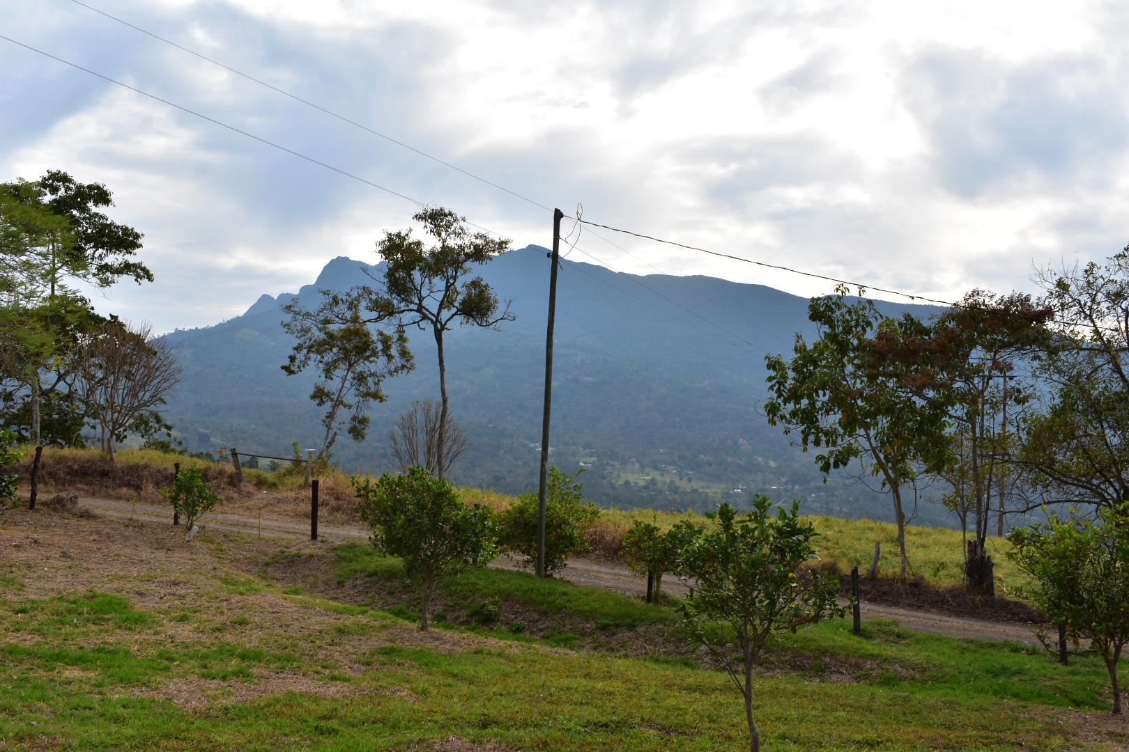
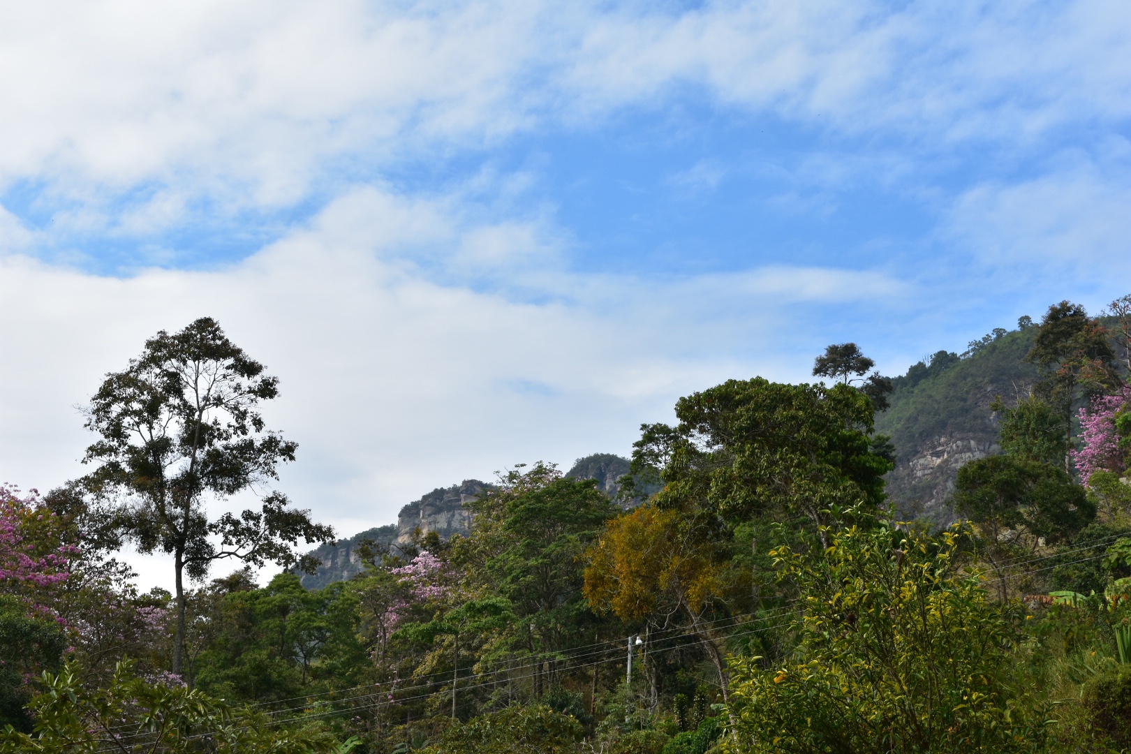
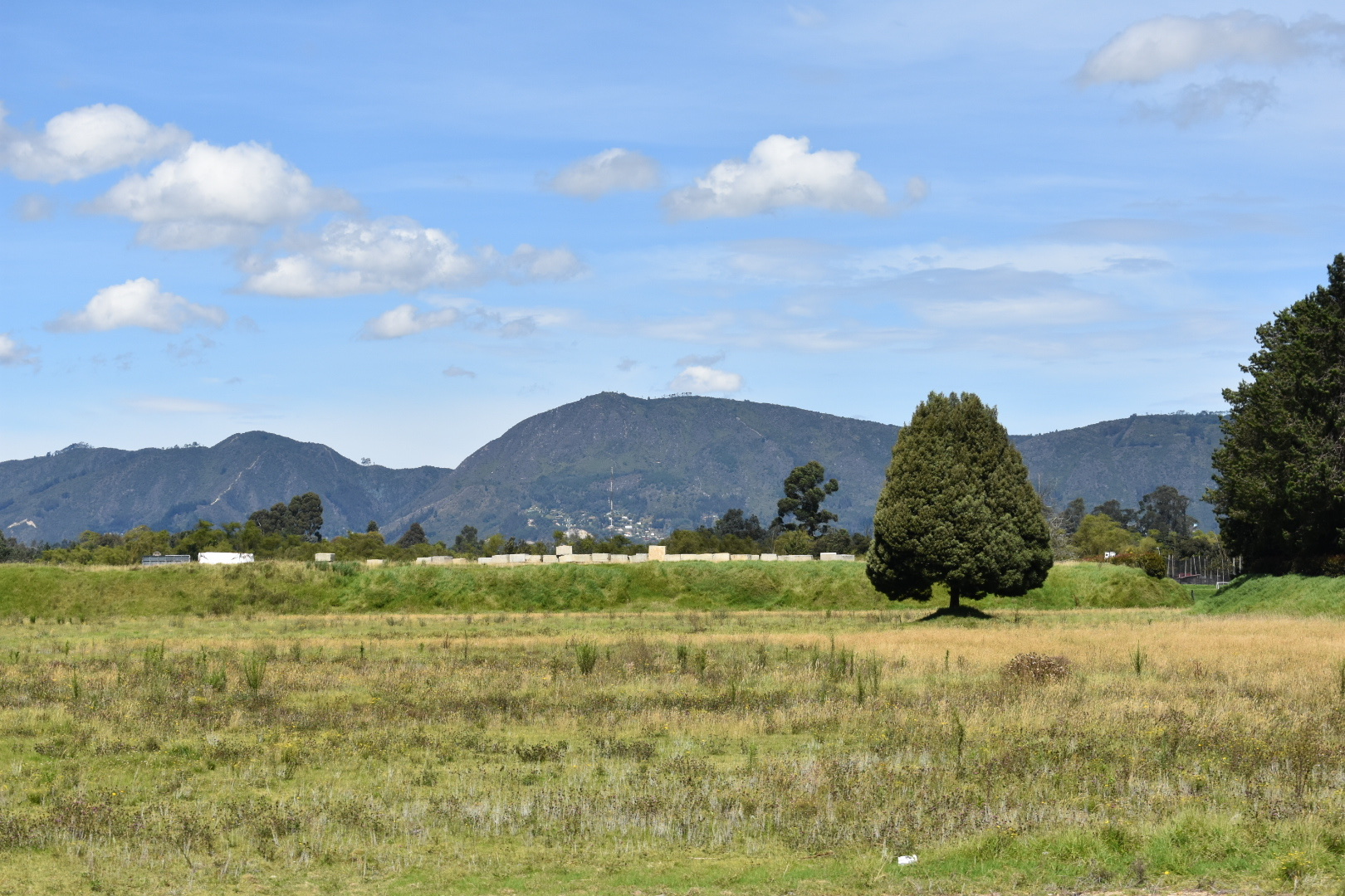
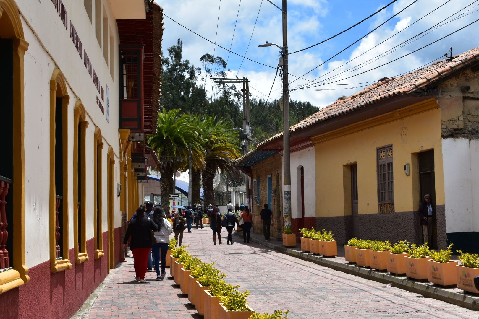
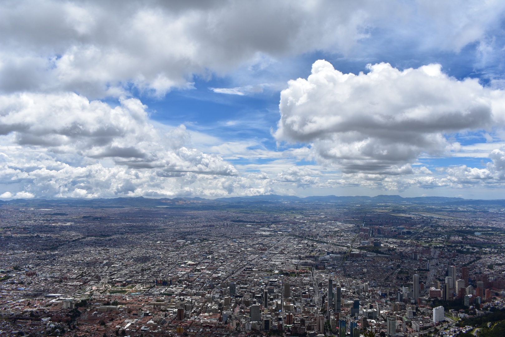
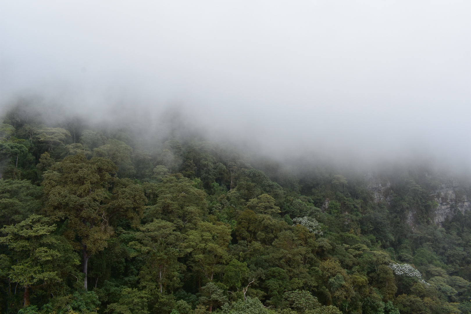
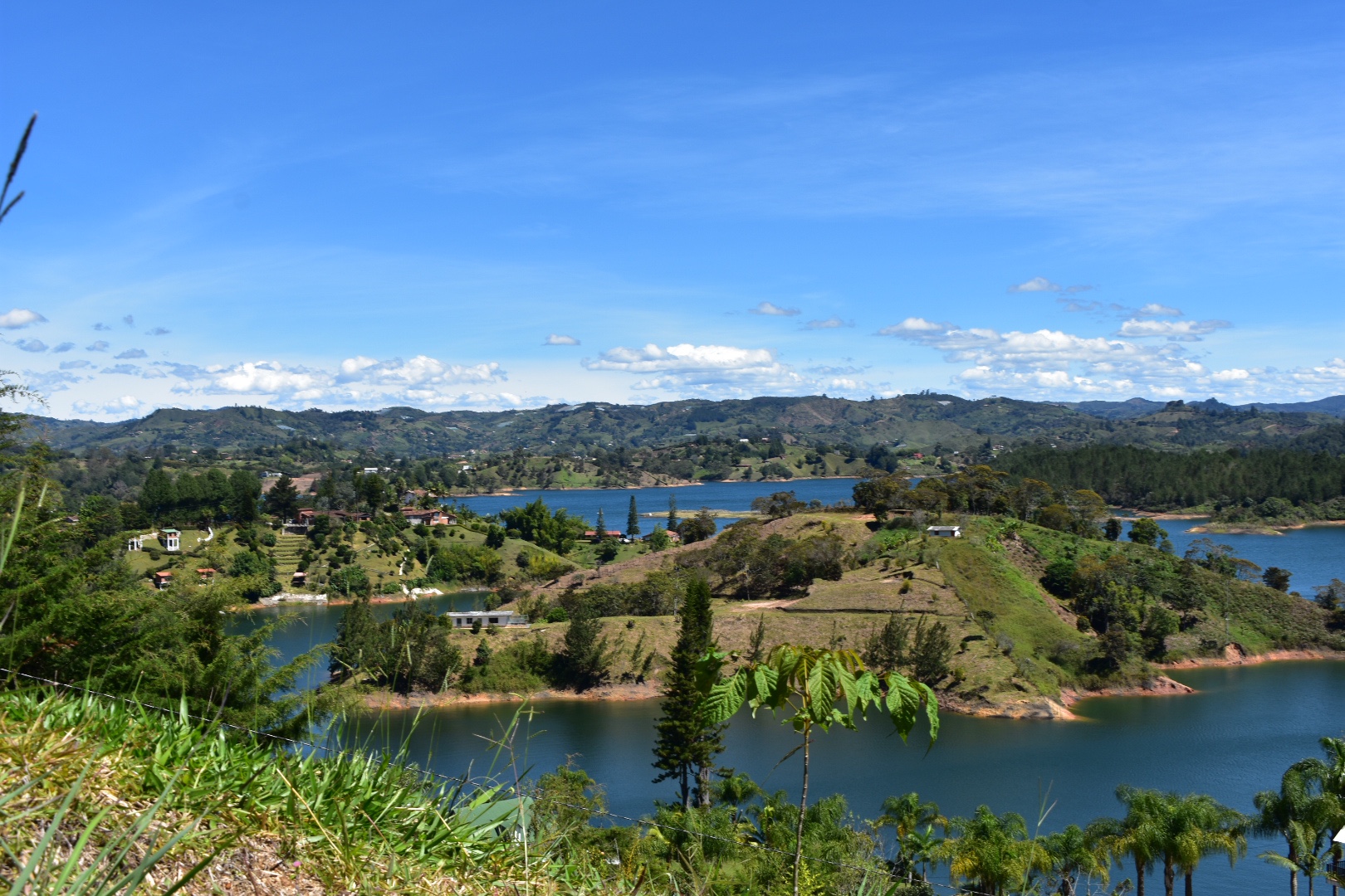
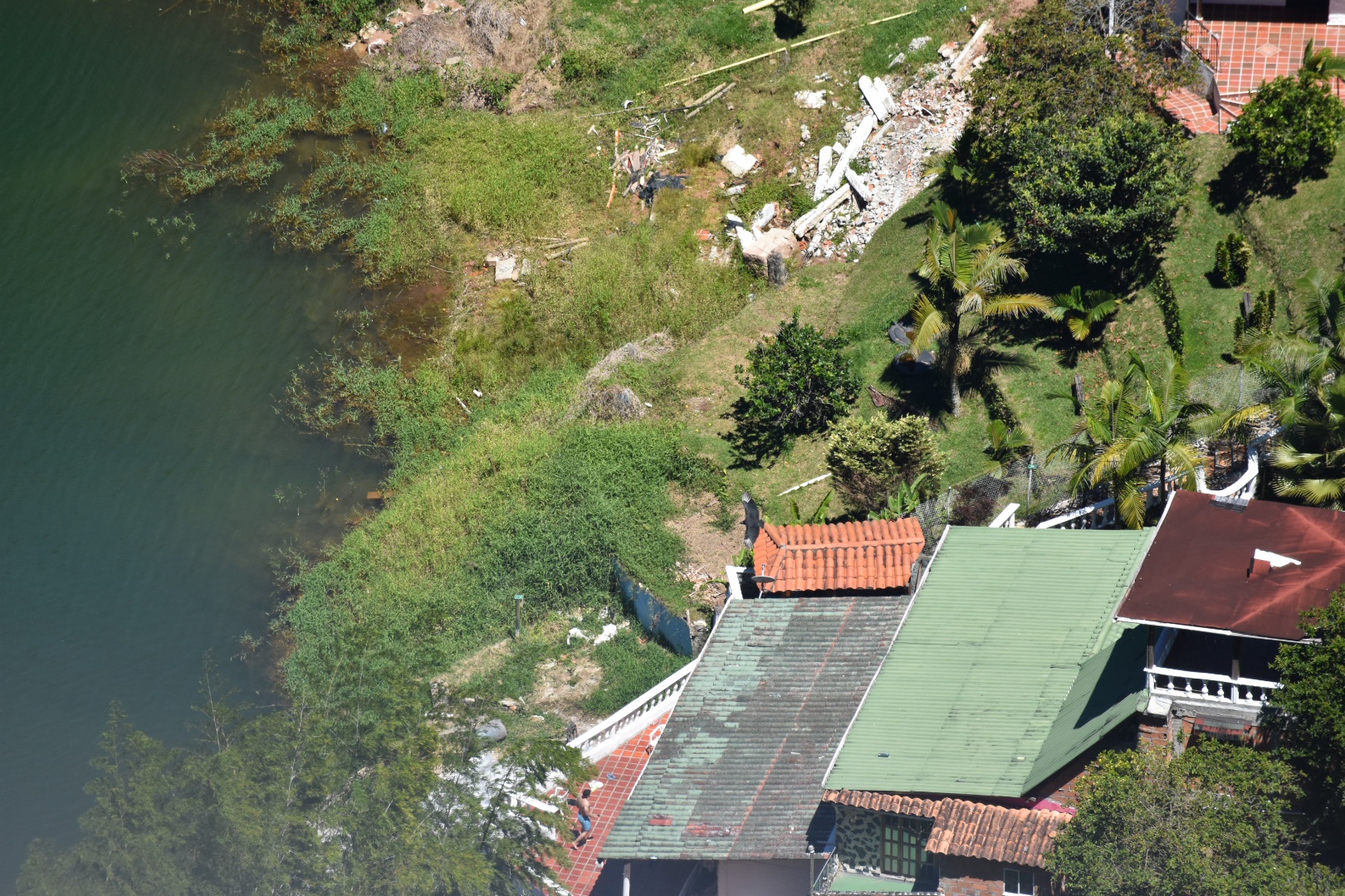
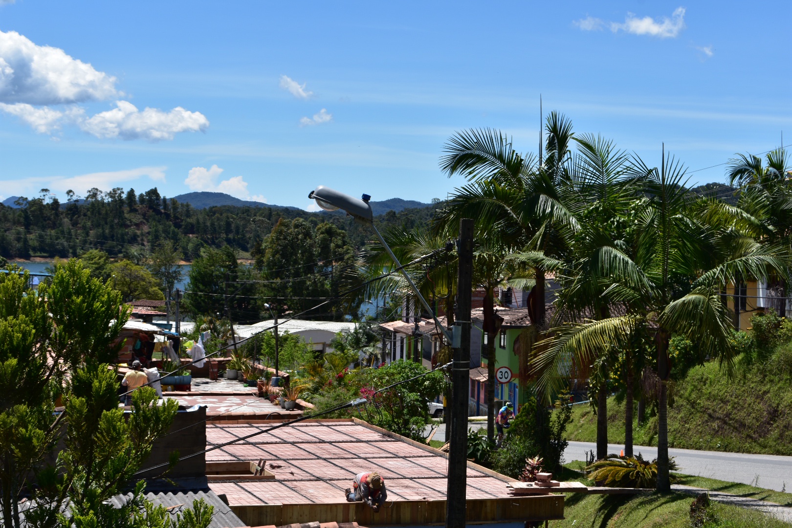
Cerro Quininí is located in a natural park situated high in the Colombian Andes. Surrounded by green mountains from horizon to horizon you can see birds of prey hunting in the warm coffee growing region. Located a only two hours drive from Bogotá you will be amazed how much the landscape and climate change in the short distance as the constant cold is replaced with warm and sunny days, with enough cloud cover to keep you protected when hiking. The small towns in the region make this the perfect weekend getaway from the bustle, cold and pollution of Bogotá. You can come and stay on one of the many coffee farms or in one of the small towns and enjoy playing Tejo with the locals.

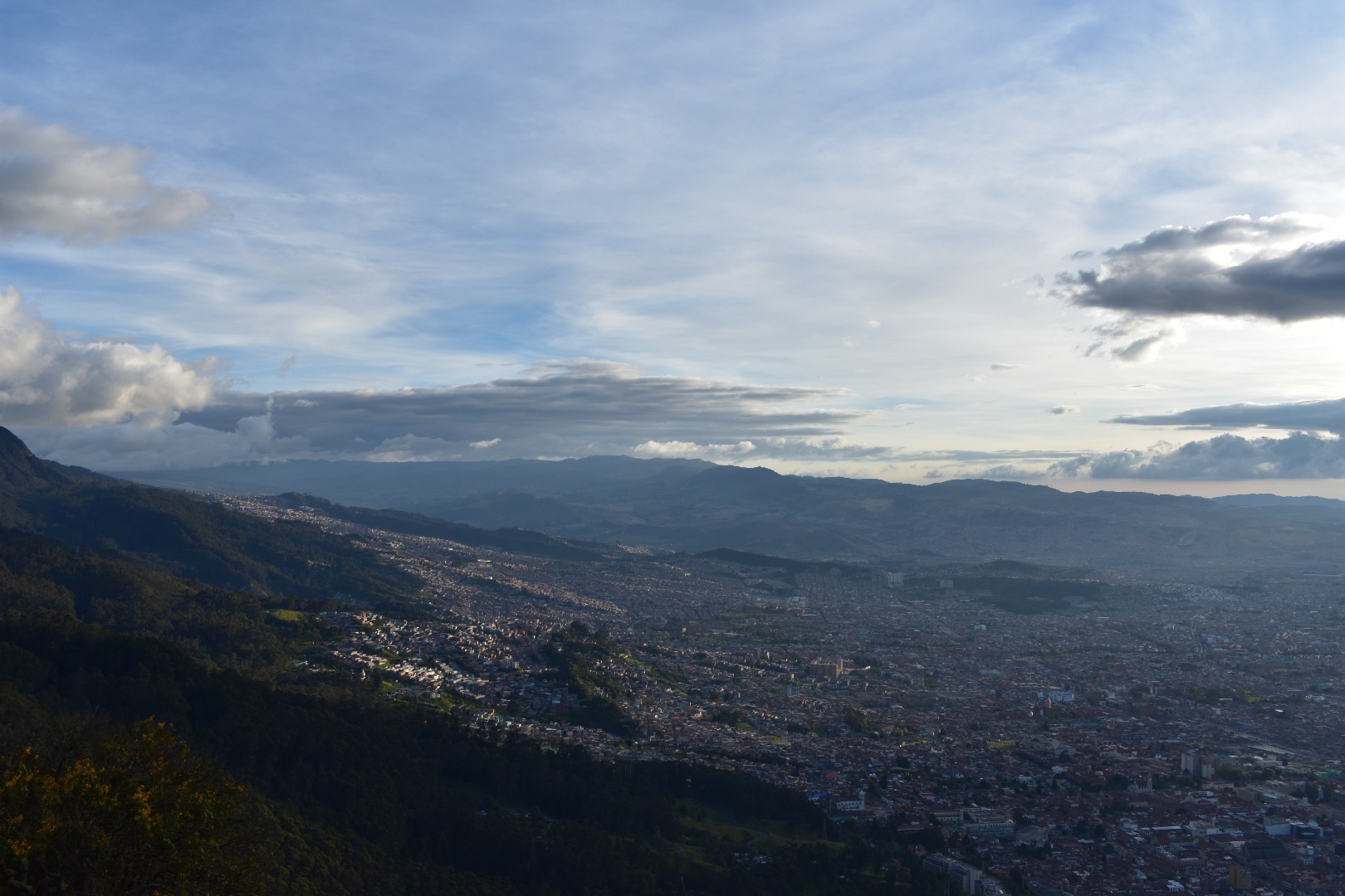
When we took the long bus journey back to Bogotá from Pereira I was looking out of the window scouting for locations to hike. I remember being excited when I spotted Cerro Quininí due to its proximity to Bogotá and the trails on Maps.me. After some research I found some stunning photos of the park, especially the overhanging rock. I found a blog which gave very sketchy details about how to arrive (which I can no longer locate). Armed with very little knowledge a phone booking at a family run hotel near the trail head and a strong will to arrive we decided to try and see how far we could get. But as always we seemed to find the right people to help us along and with a little luck we found our way to the top.

If you are interested in other weekend hikes away from Bogotá then read my guide to Laguna de Iguaque, a high altitude hike to a sacred lake close to Villa de Leyva a UNESCO heritage town full of delicious restaurants. Or a little further afield is Capurgana, a tropical paradise on the border with Panama where there are many different jungle hiking trails or you can just relax on pristine beaches.

Information

  1. Our Experience
  2. How to arrive at Cerro Quininí
  3. Equipment to take

Our Experience

With a holiday weekend coming up and the location being a few hours outside of Bogotá we opted to make this an overnight trip. You could easily extend for the weekend if you find the right spot as the relaxing towns and the warm temperatures make it the perfect getaway. And it will save you having to rush back to the city after the hike as happened with us. In hindsight it was good that we did set out this timescale as it took us more than 2 hours to arrive at the bus station to leave a very wet Bogotá.

There was only one hotel, a few towns far, available on Booking.com, which was expensive, but we found a few hotels on Google Maps near the trail head. As the primary reason for going was to hike it made perfect sense to us to stay near the trial. We called the Hacienda de Vuelta, which I would highly reccomend, and were quoted $60000 for the night for both of us.

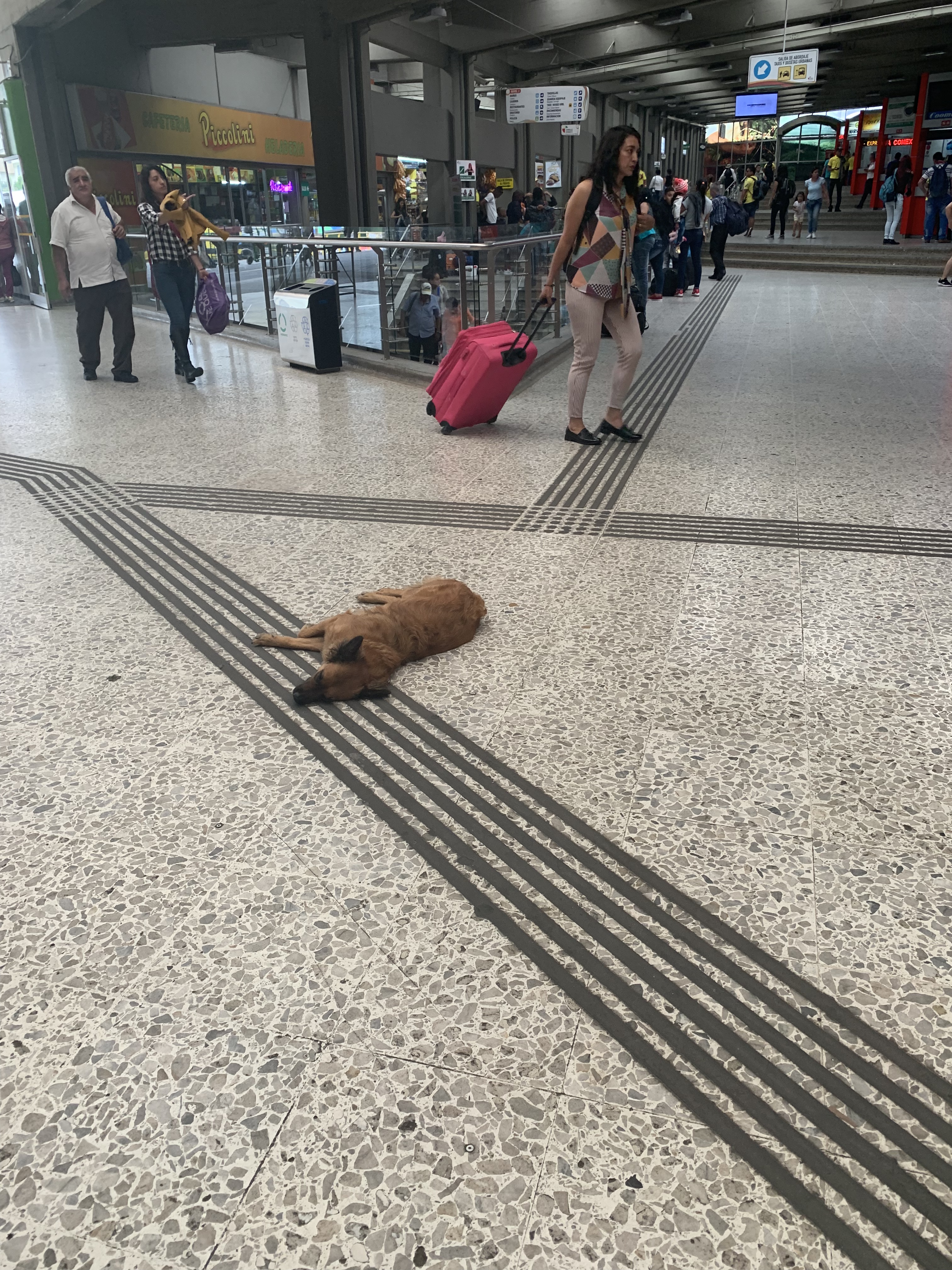
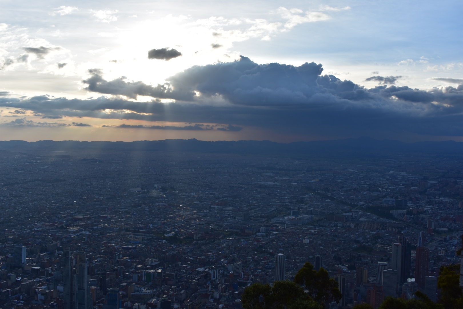
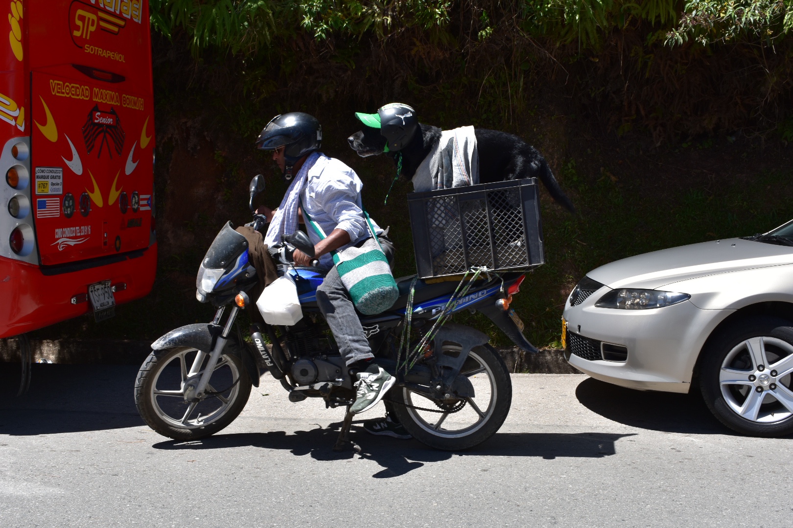
The most difficult part in the journey for us was leaving the city. Angela had to work so we agreed to meet at the Tansmileno Estación near where she worked at 1:30pm. Our aim was to get to the Terminal de Transporte Del Sur in Bogotá, which is close to Estación Bosa. I was following Angela and and she was following me and we accidentally ended up at the end of the line. We were told to flag a bus from the main road, and stupidly attempted, crossing a three lane highway to get to the main highway. Rammed with traffic it was impossible to find the bus we needed. It wasn’t a god day to flag a bus anyways as all the seats were already taken so we decided to run back across the busy highway and return to the correct Transmileno station, Estación Bosa, and take a bus from the terminal.

When you arrive to head to the north side of the road and turn right and the main terminal is 4-5 blocks along staying on the main road. You will soon see the station on your left. As we left the Transmileno station it started to rain and by the time we reached the terminal we were already wet.

There is no bus to Tibacuy and we were offered the chance to be dropped off on the main road, Highway Panamericana, by getting a bus to Fusagasugá. We brought tickets as we wanted to see how far we could get and just hoped there would be onward travel when we arrived. We were already tired and disheartened by this point as it had taken over two hours since I left the house to reach this point. So I really stocked up on well needed snacks and we arrived at the very full bus to claim out seats just before it left at around 3:30pm.

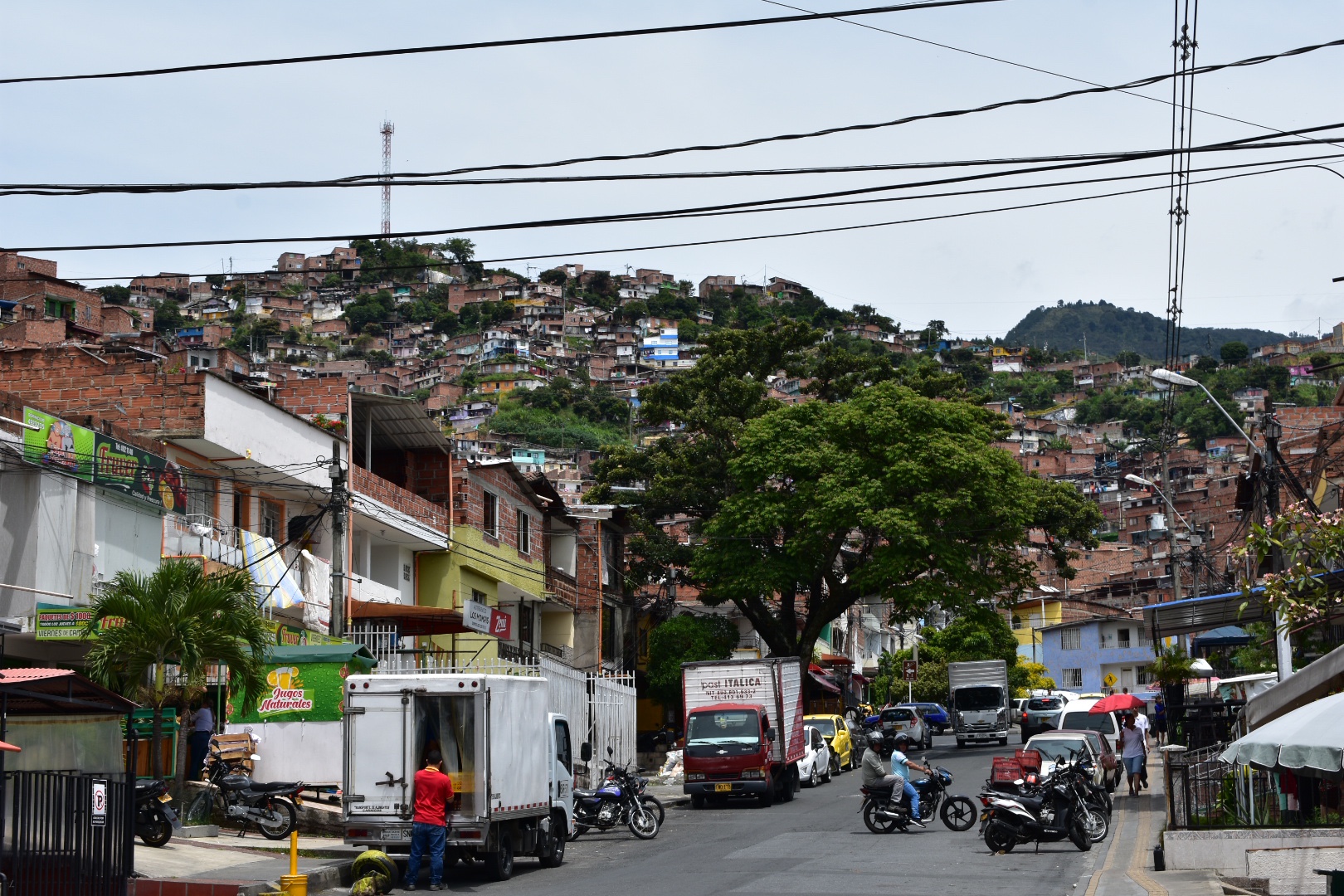
The two hour journey was one of the busiest and sketchiest busses I’ve been on. The local busses are really not as fun as the long distance. We had been told to get off at the highway but I reasoned the best place to get another bus would be at the terminal. Besides I’d rather be at a terminal than standing beside a highway not really sure what I was looking for. When we arrived Angela asked the driver where we could get connecting transport and we were told to go back to the highway. Don’t do that as we have done the painful work for you. We asked again at the main terminal we were told that there were collectivos that went to Tibacuy but they didn’t always pull into the bus station. So the best thing was to head into town. Although for some reason no one knew where in town to go. We took a local bus marked Centro and lots of people all piled on. I kept checking our location on the maps and after we seemed to reach the city centre Angela asked the bus driver who told us to get off and pointed us to walk back down the main road we had just came.

This information didn’t sit right with me as it meant we were heading back out of town and all the traffic was going into the town so we reasoned we should at least cross the road. We did and another passer by told us that the busses only came once and hour, so we waited on the road looking for destinations in the window of passing busses. It was at least 5:30 by this point and starting to get dark so we walked a few blocks north and Angela asked a few more people and we spotted a road where a lot of busses were coming from. We waited here but saw no busses coming for our destination but we waited and looked for what felt like a really long time. If felt as if the rain was going to start again any minute so I was desperate to find the right bus and on the verge of giving up when two guys came to join us. I spoke to them in my best Spanish and I found out they were waiting for the same bus, but they soon they left without saying anything and walked off towards the town. Knowing the bus came down the road I asked in a shop where is started and was given directions but told it would pass. I don’t always like waiting and wanted to be on the move and we headed off in the direction that the others had waled and on the next block stopped as we found a really dirty market square. I asked again and was told the bus left from the other side of the square.

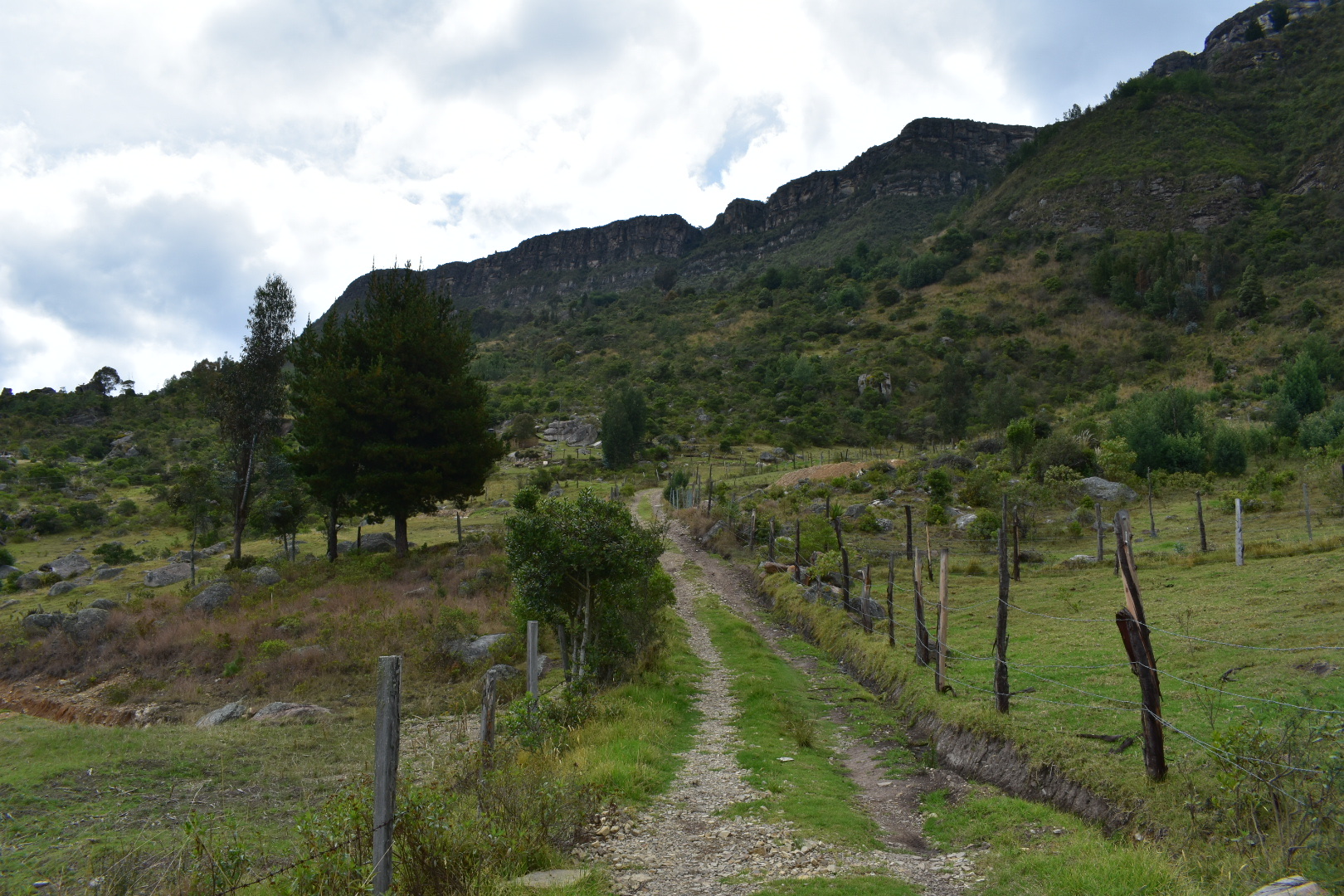
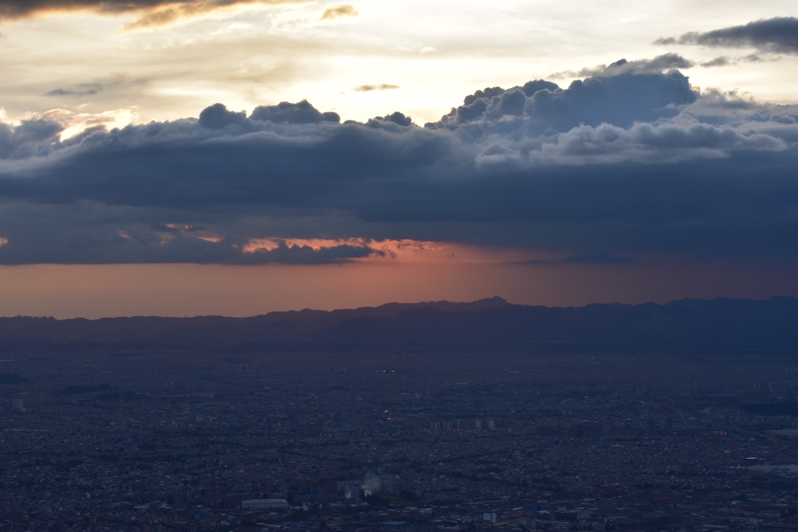
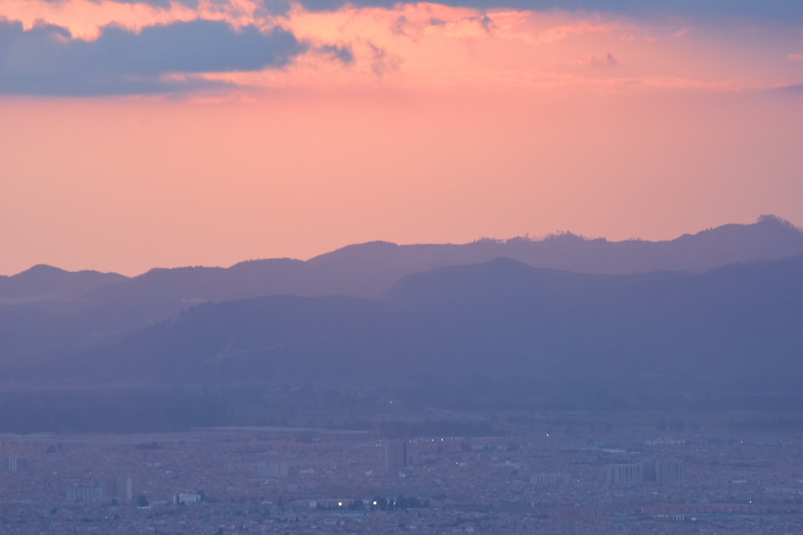
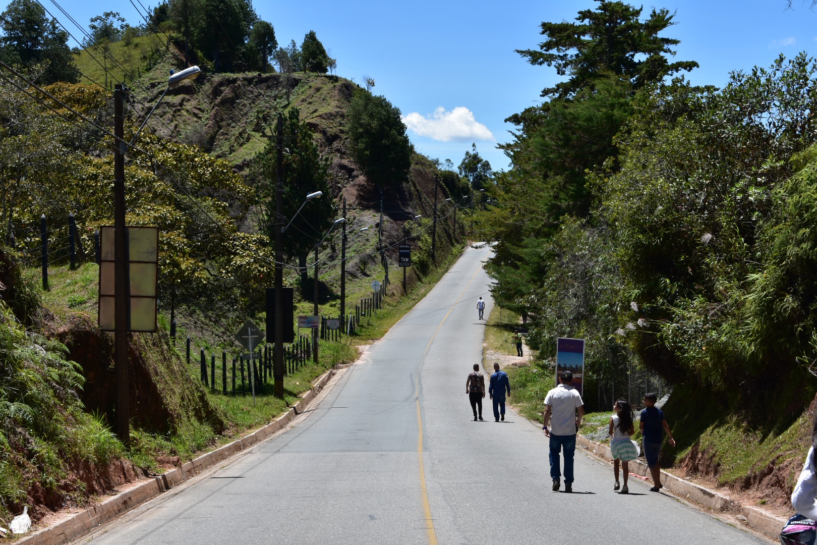
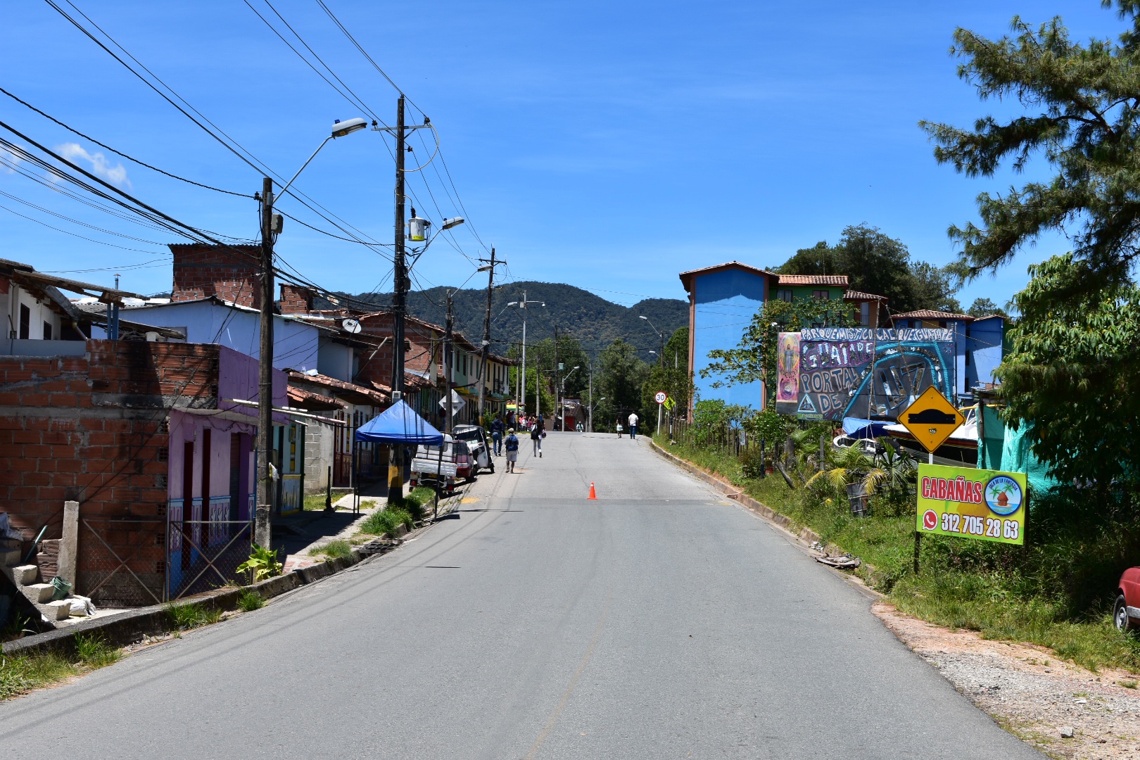
We crossed the square and went down Carrera 11 and just on the left was a full collectivo-which is why I say it’s best to come here rather than flag on the street as the bus did not stop for anyone else. There was no space left! We grabbed the last two seats and were soon again on our way. It was around 6:30 pm by this stage and it’s a good hour and a half journey to the final stop. The collectivo headed back toward highway Pan Americana, drove back towards Bogotá for a time and took a left towards Tibacuy. It first winds it’s way down into the valley and then back up again the other side. The road is bumpy but you get some great views during the day, but for us it was pitch black and we just dealt with being jostled around crammed into a small bus. The collectivo stopped in various small towns and villages until we were the last passengers. And then we were dropped at the trail head. There are a couple of food stalls and a bar so if you want to stop and rest up you can.

As it was already dark we decided to head up the trail to the hotel, drop our stuff and return here for a well earned beer. I was so happy that we had arrived and knowing the hotel was a short walk up the path made me really excited. The excitement dissipated walking in the dark takes much longer than it does in daylight. I was wearing a jumper and jeans and it was much hotter, darker and longer walk than we expected. We only had our phones for light – I really needed to pack a head torch but as we were generally doing day trips I never considered it necessary. After being barked at by every dog in the all of the houses we passed was not much fun. We arrived to a very warm welcome but feeling a little broken and exhausted. Luckily the hospitality we were shown turned this all around really quickly.

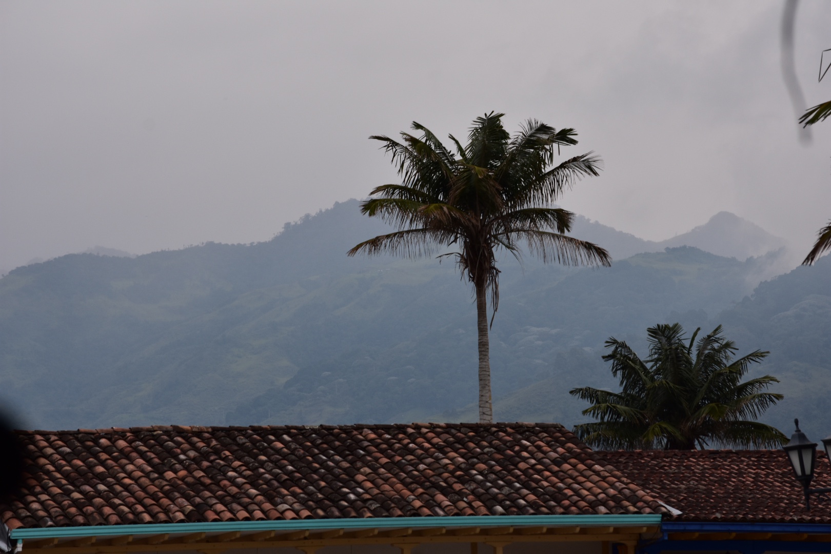
We were shown to our lodgings which was in a building with a tonne of rooms and we were the only occupants. I purchased some really cold beer, and sank one almost immediately, and water from our hosts and we opted to stay here for dinner rather than heading back down the trail to where we were dropped off. There were four dogs who joined us for dinner and we were treated to a hearty chicken, rice and plantain. It was simple but delicious. We sunk a few more beers and then headed to bed exhausted. But the bed was one of the most comfortable I’ve ever slept on.

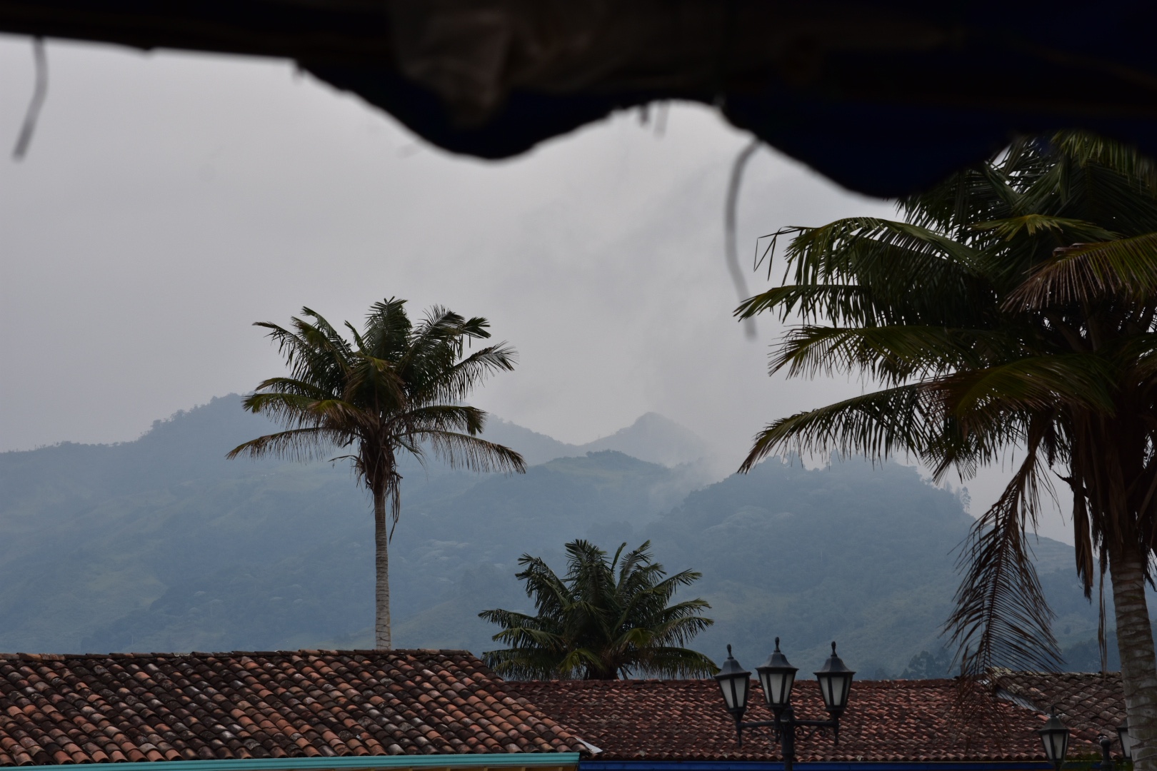
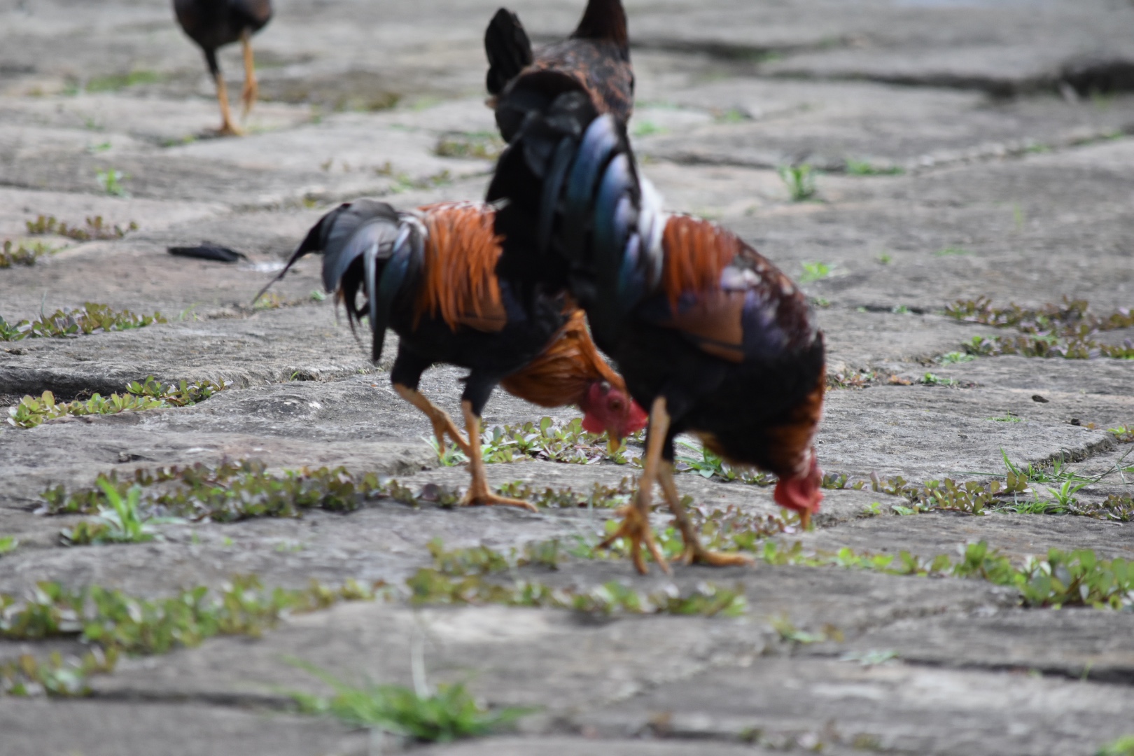
We awoke the next day and found ourselves in a paradise. I had asked for breakfast at 7am as the sun was still rising and there were so many animals around, including the cockerels who had kept me awake for a portion of the night I decided to photograph the animals.

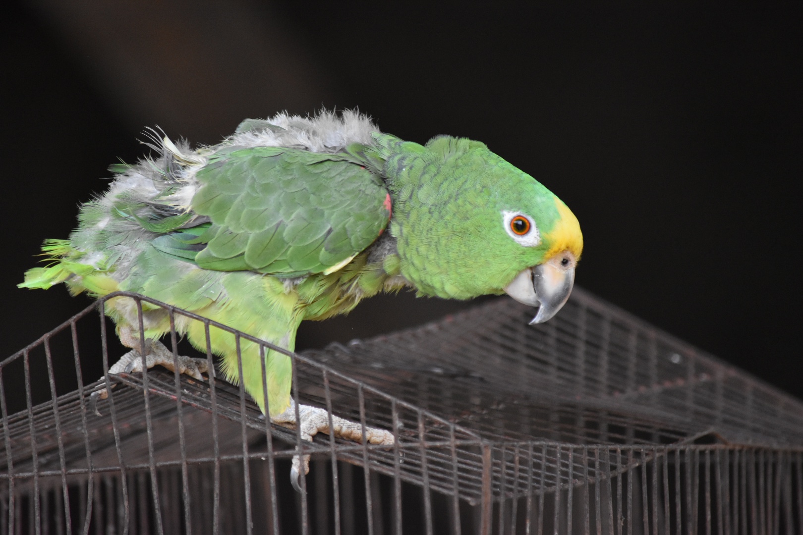
There was a parrot who was singing La Cucaracha and climbing around his cage.

The four dogs who watched us eat every meal were posing in the sunlight.

Even the cockerels were on form, posing, eating grain and chasing each other around.

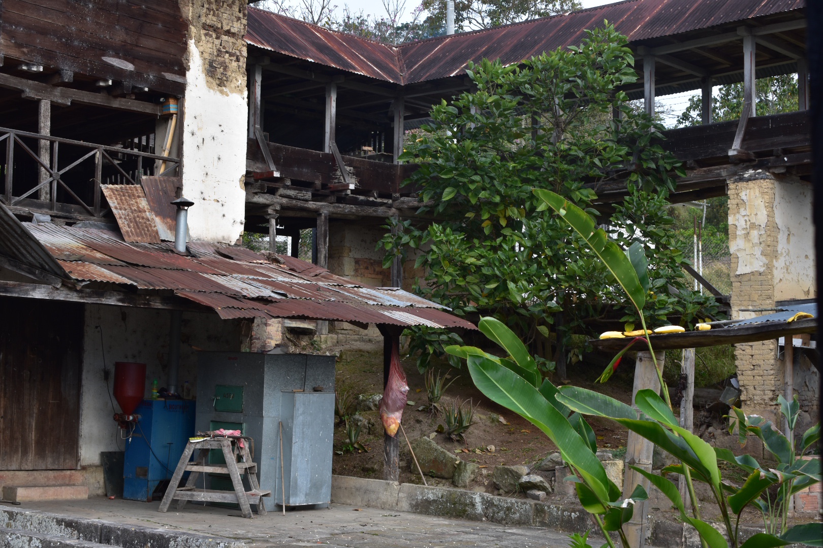
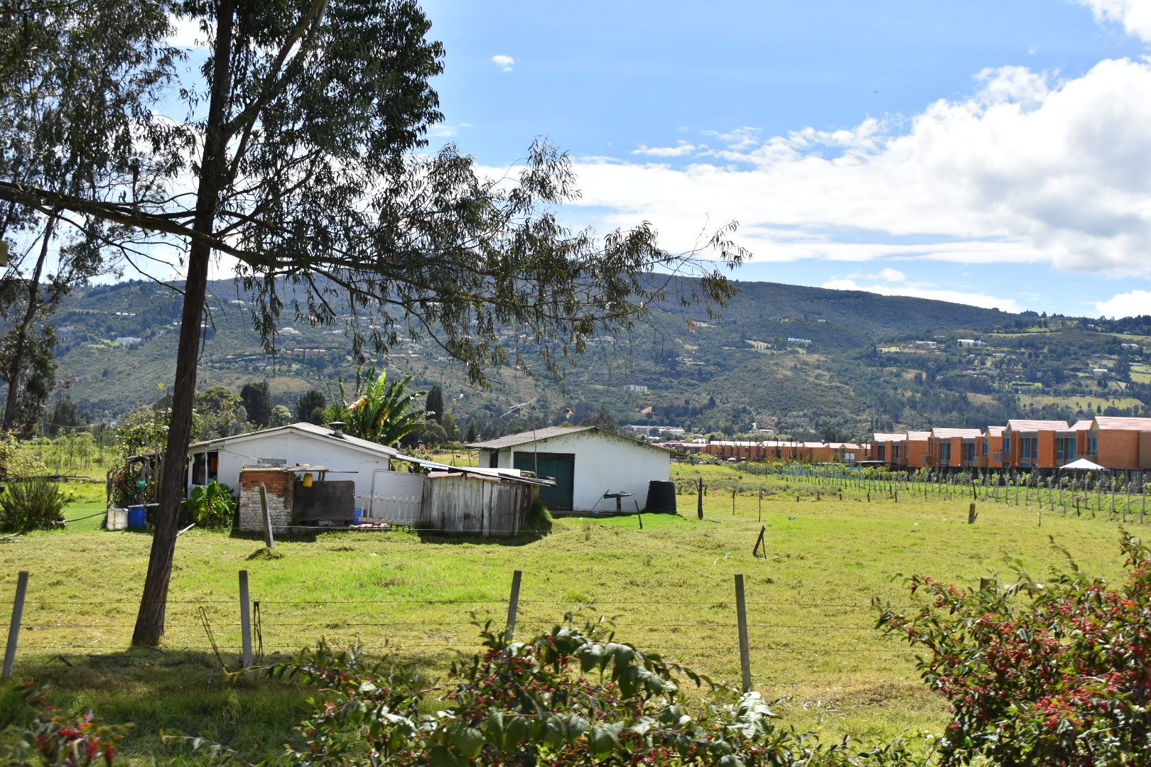
The hotel where we were staying was also a coffee farm and this giant barn used to be used for drying coffee beans. Now it’s all done in a small metal container and the farm doesn’t need to employ so many staff.

This is the container in the picture below.

Just as we started breakfast the owner placed some bananas on a bird table. I didn’t really think much of it until these colourful birds started appearing. I grabbed my camera which was already on hand and snapped away.

And then when I was excited to have seen all the birds a hummingbird fluttered by. They move stupidly fast and I was lucky I had my camera ready to go.

After breakfast we explored the gardens in the day light a little and I went back to finish prepping the bags for the hike. Angel played on the swing and found an orange growing in the garden.

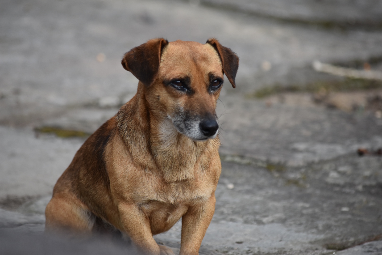
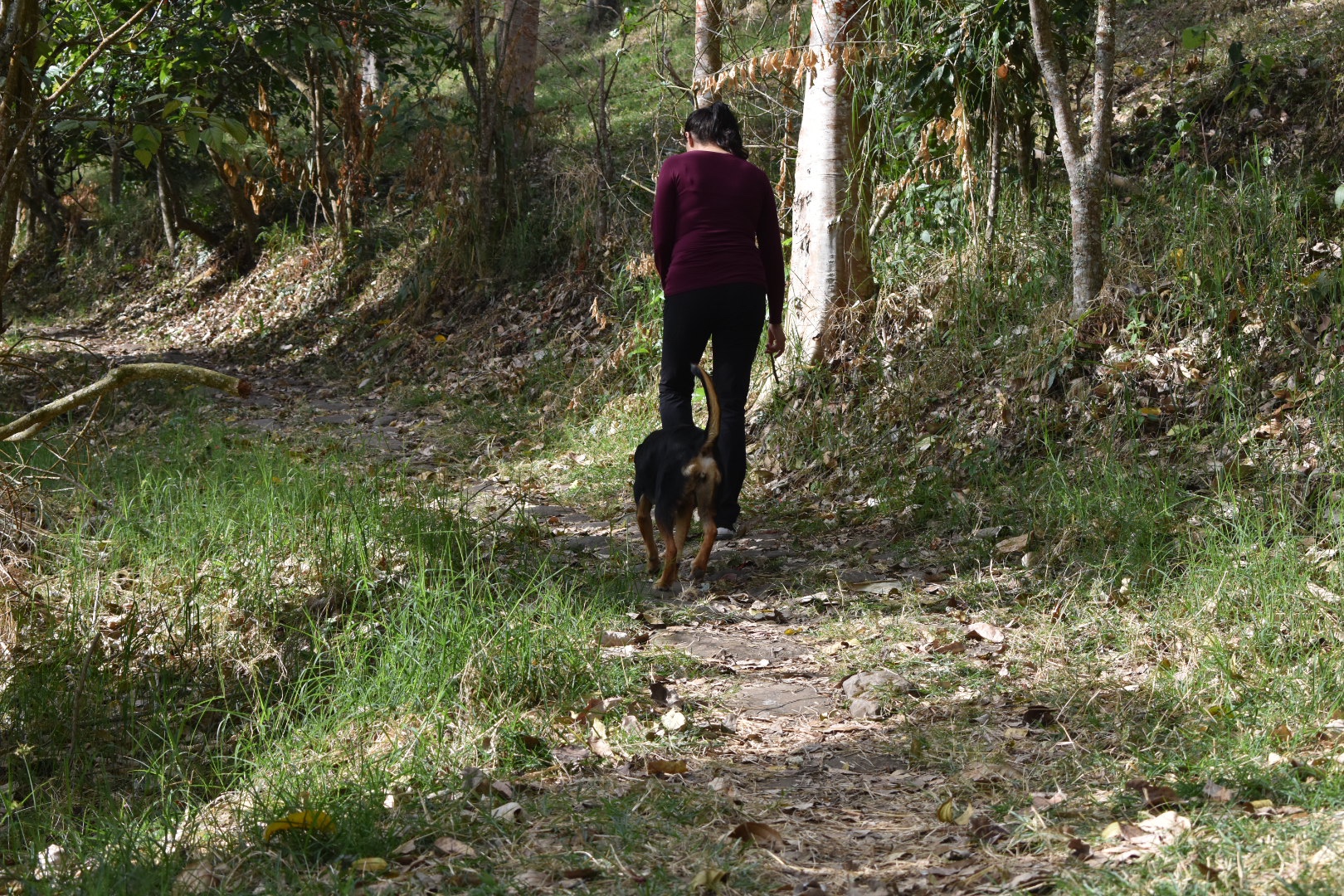
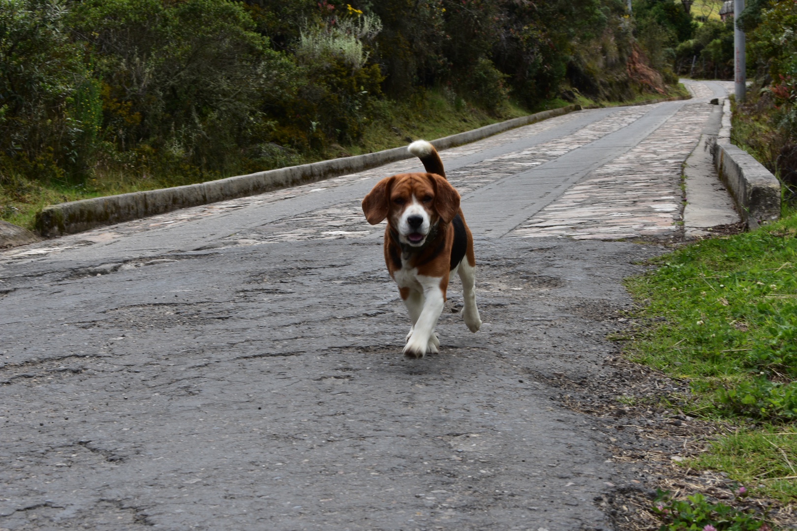
But then we were off and it was around 8am. The sun was still rising giving us beautiful views and it was already hot, looking like we were going to get a great day, despite the clouds in the sky. We turned right out of the hostel and followed the path up to the mountains. I don’t remember how soon it was after we left but we were very quickly joined by a four legged companion. I named her Winston, before we later realised he was in fact a she. For some reason I assume all dogs are boys and all cats are girls, which is not how life works.

It’s not the first time we’ve been joined by a dog but it was the first time we had such an eager complaining who stayed with us until the bitter end. When we returned we saw her run back into the neighbouring property so I can only assume she waits for hikers to walk up the mountain in the morning and takes herself for a walk. She definitely had fun!

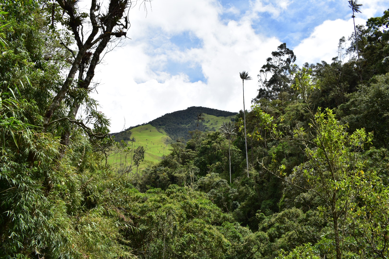
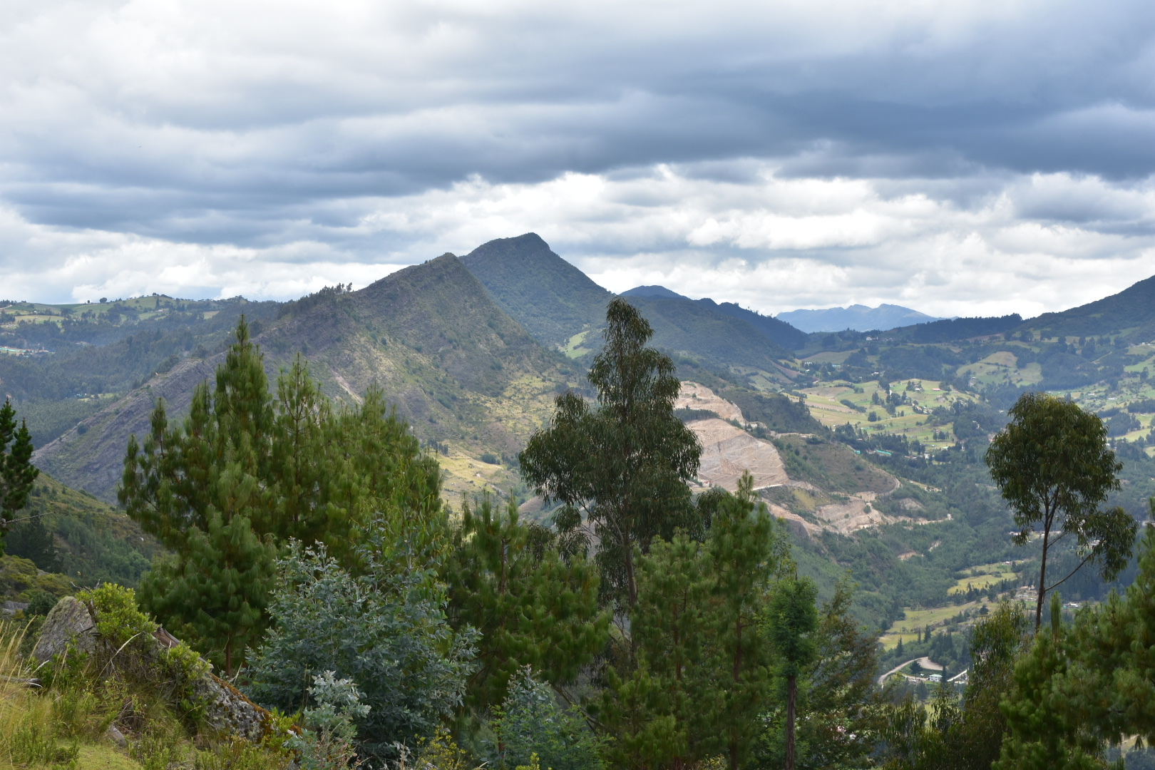
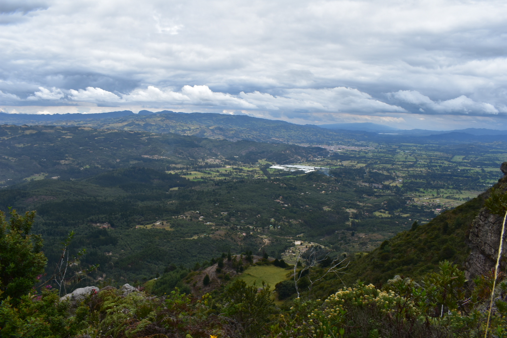
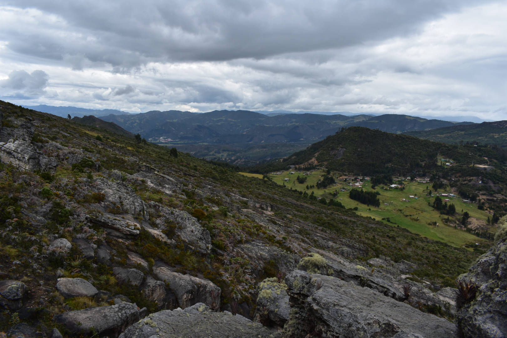
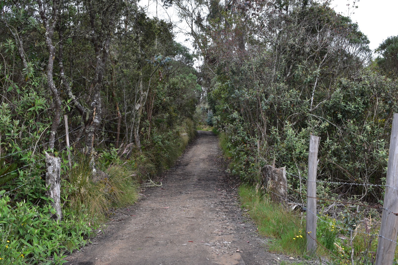
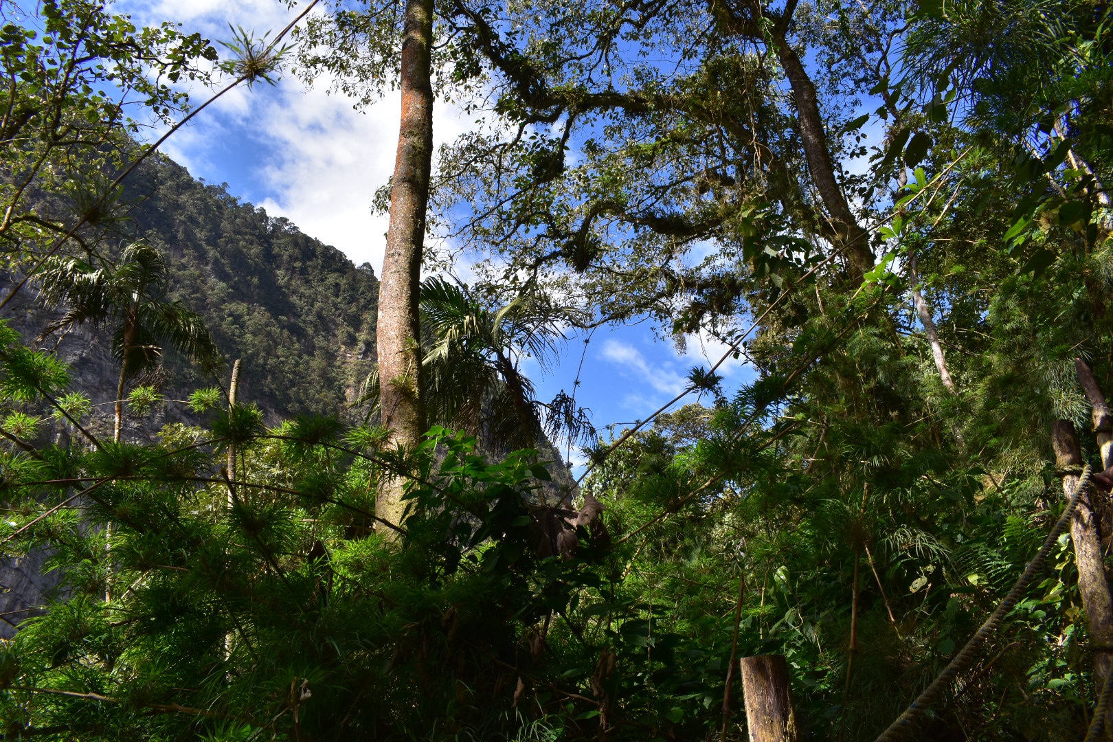
At the beginning of the hike the path ascends rapidly via switchbacks before steadying for a while as you hit meadows. Here are some of our views from beginning of the trail

The path is leafy and surrounded by trees. Here you can see Winston looking after Angela as we made our ascent.

The path takes on a number of switchbacks taking you steadily higher and providing better views. You walk past a number of properties and small holdings, many of which have happy dogs, before walking through a few coffee plantations.

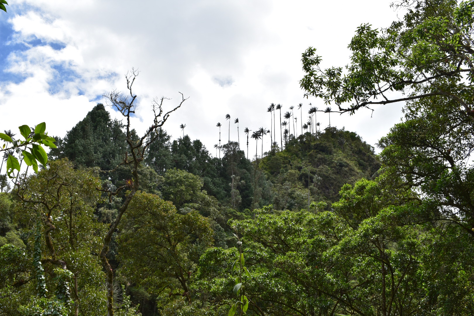
Once you pass around the side of the meadows and the path weaves past the farm houses, with some very barky dogs, and the coffee farms we entered enter some dense forest. It’s here where the path gets really steep. There are a number of switchbacks taking you up to the top of the mountain. All in all the trail is not stupidly long, but it is steep. Winston kept running off into the trees chasing birds and I assume ghosts as I had no idea what she was after.

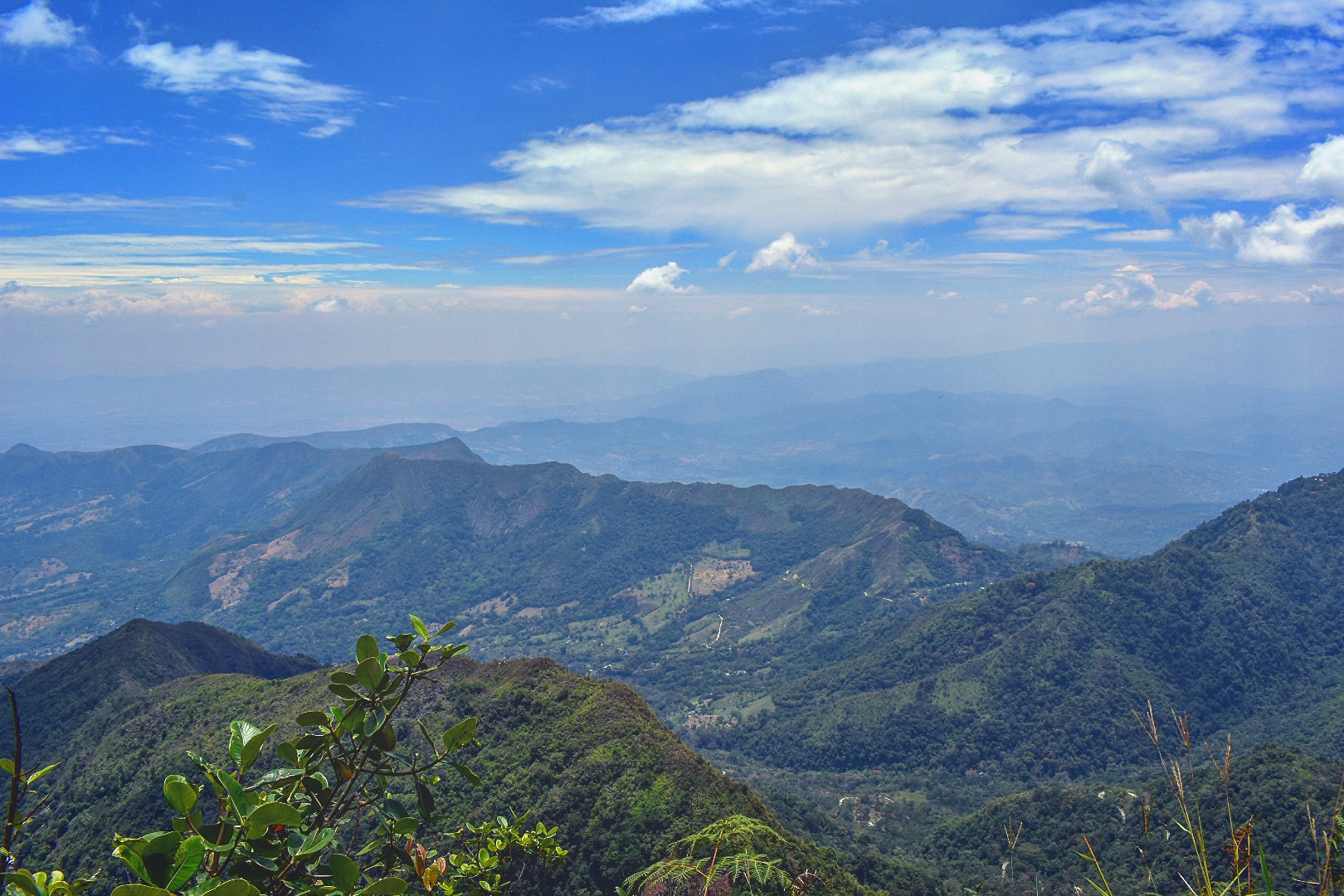
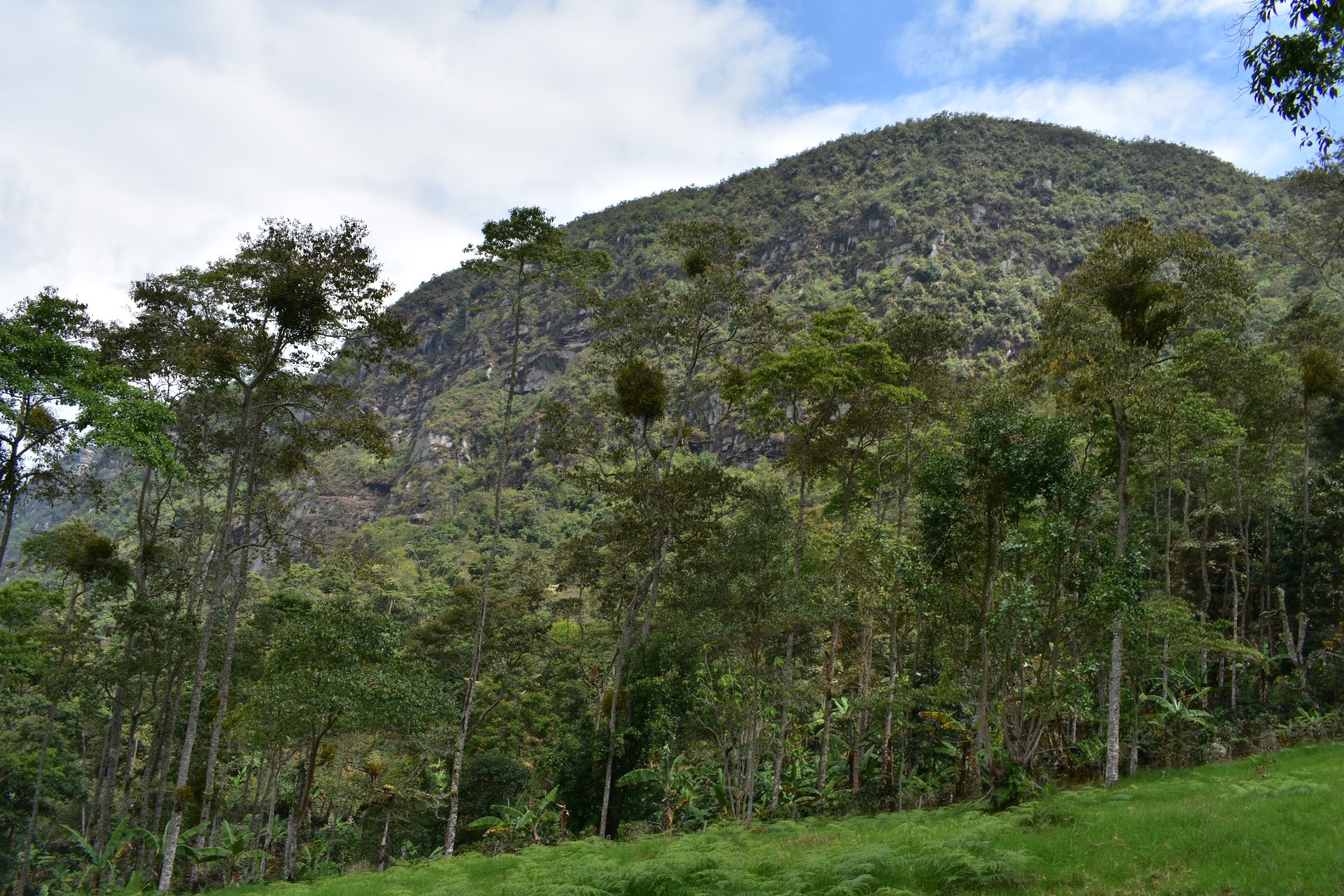
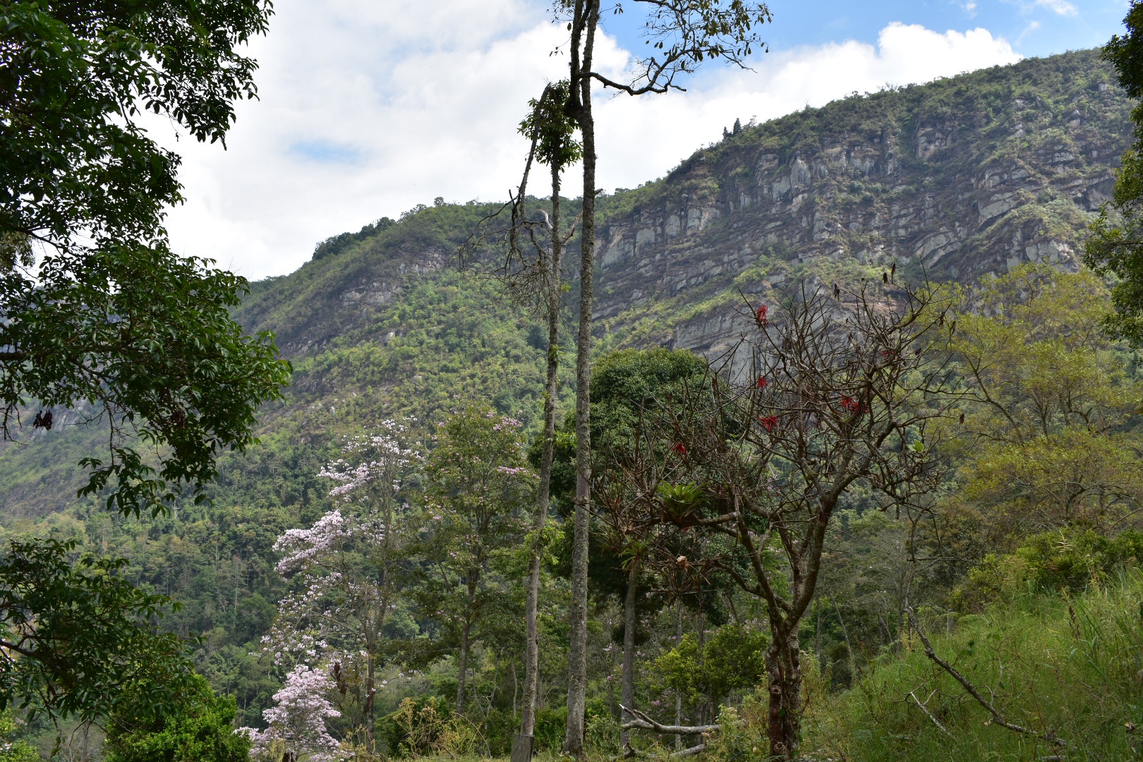
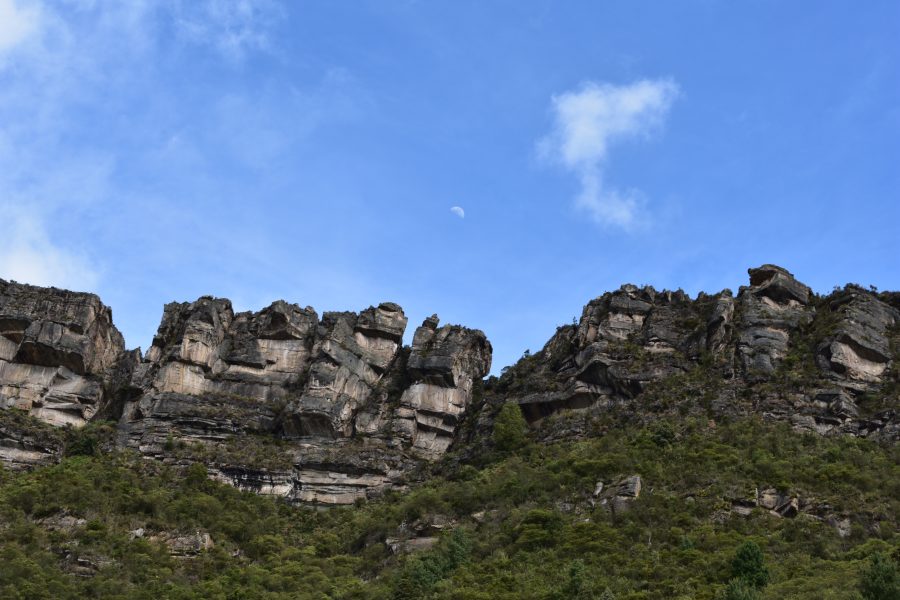
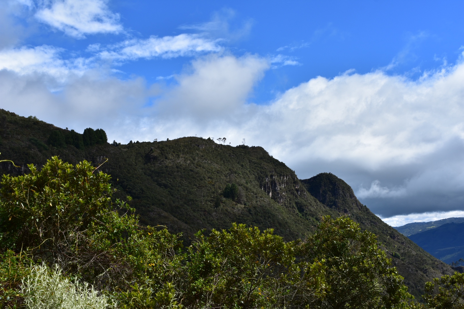
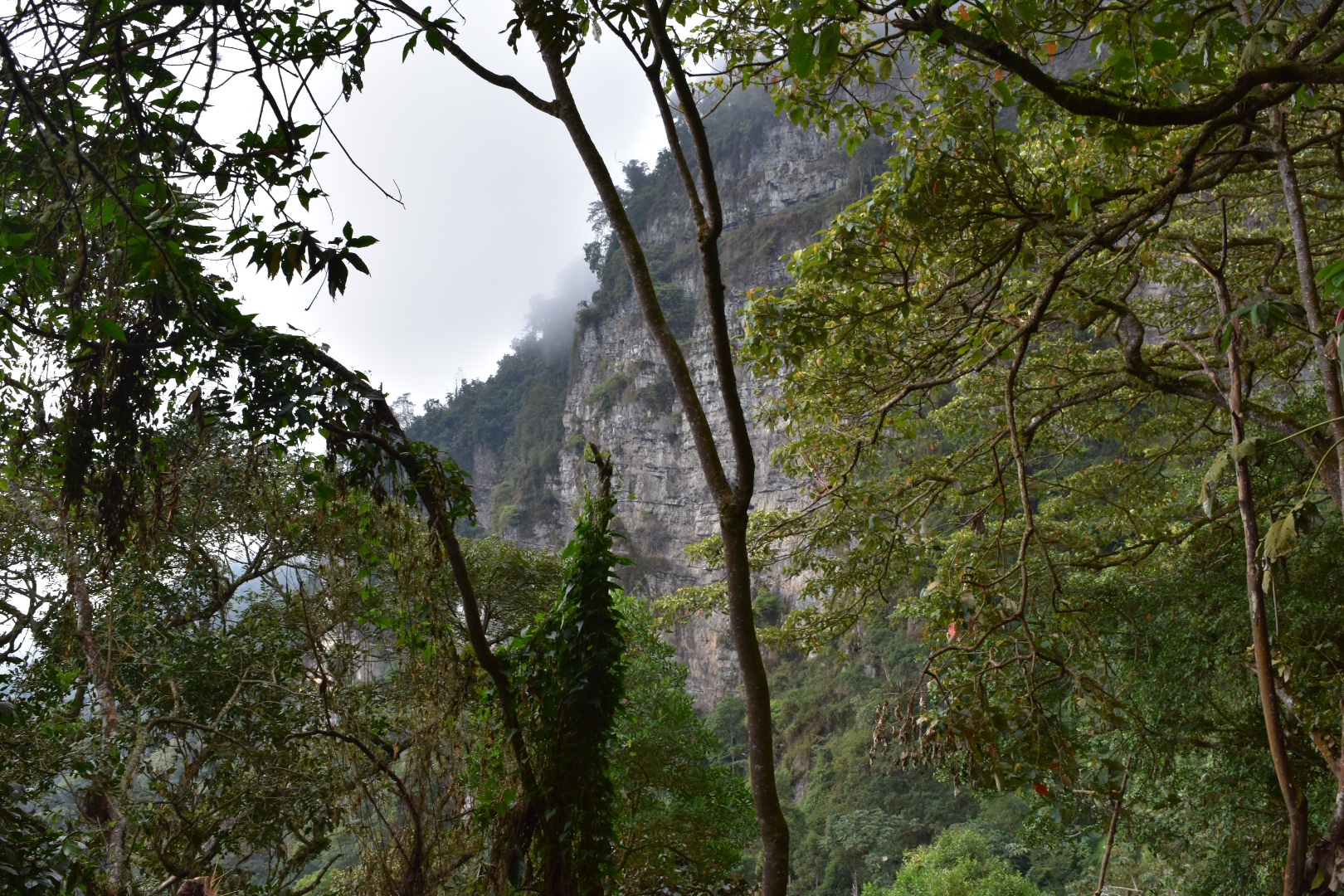
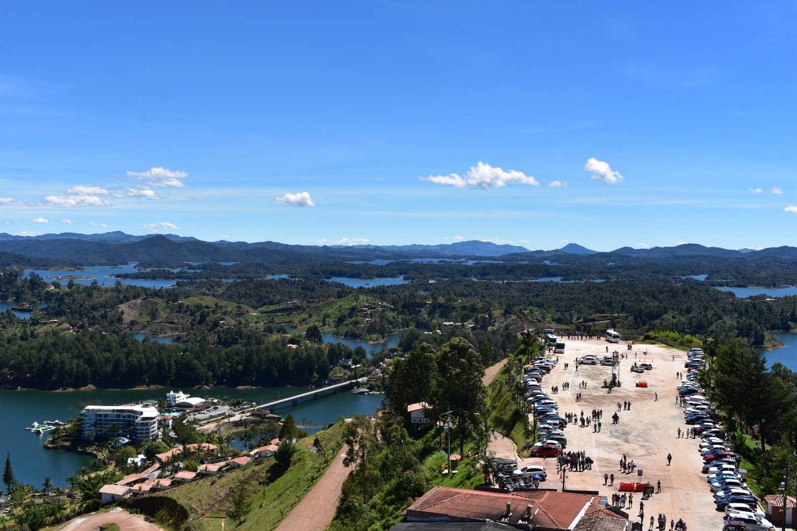
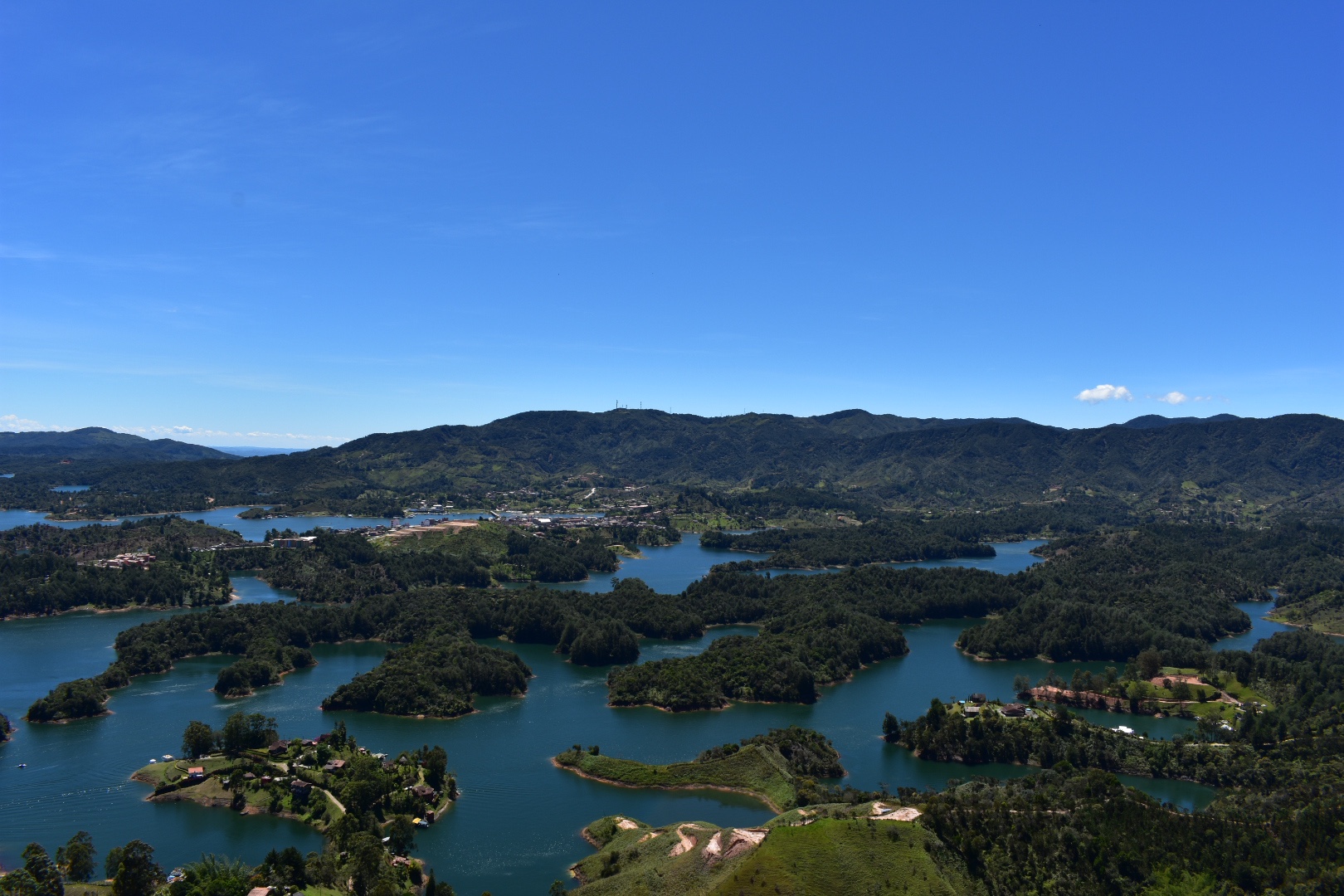
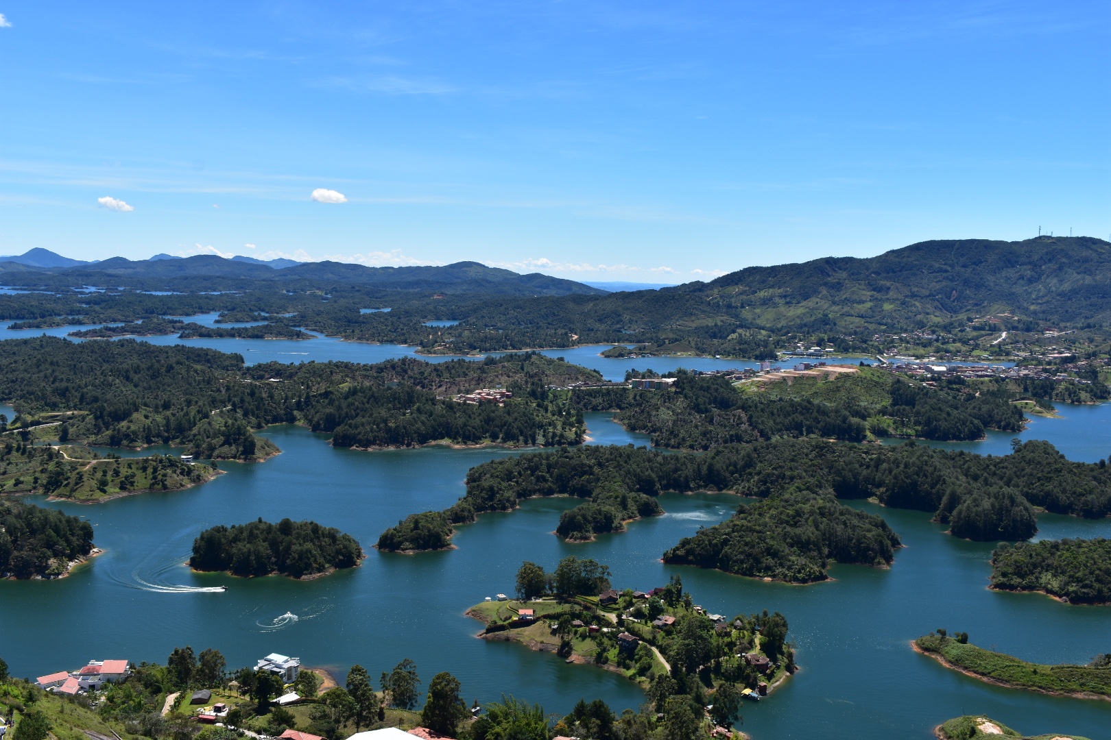
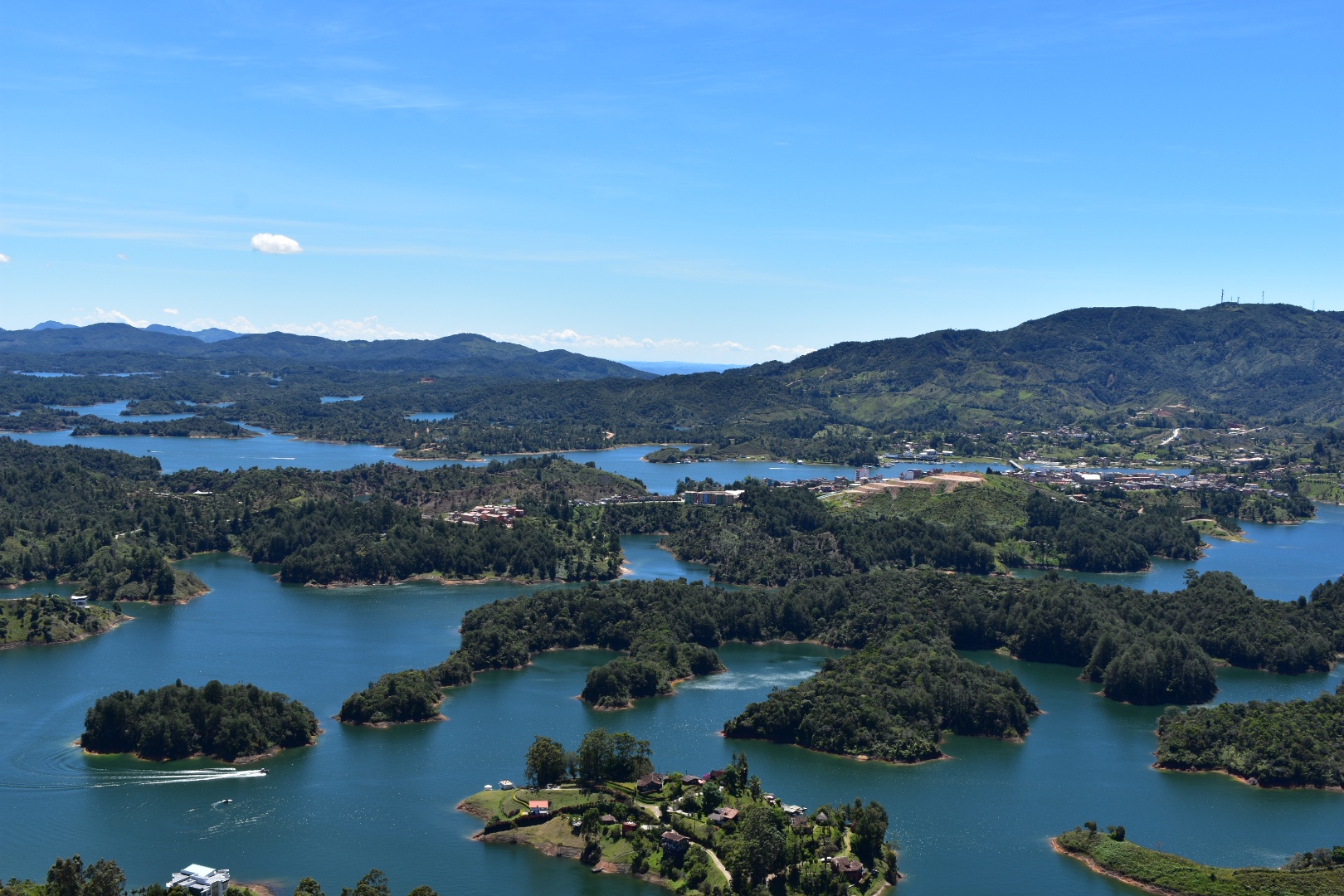
Sooner than we though we arrived at the top where the path opens up on to a gravel road and from here is a few hundred metres to the park entrance. You soon realise why you came all this way.

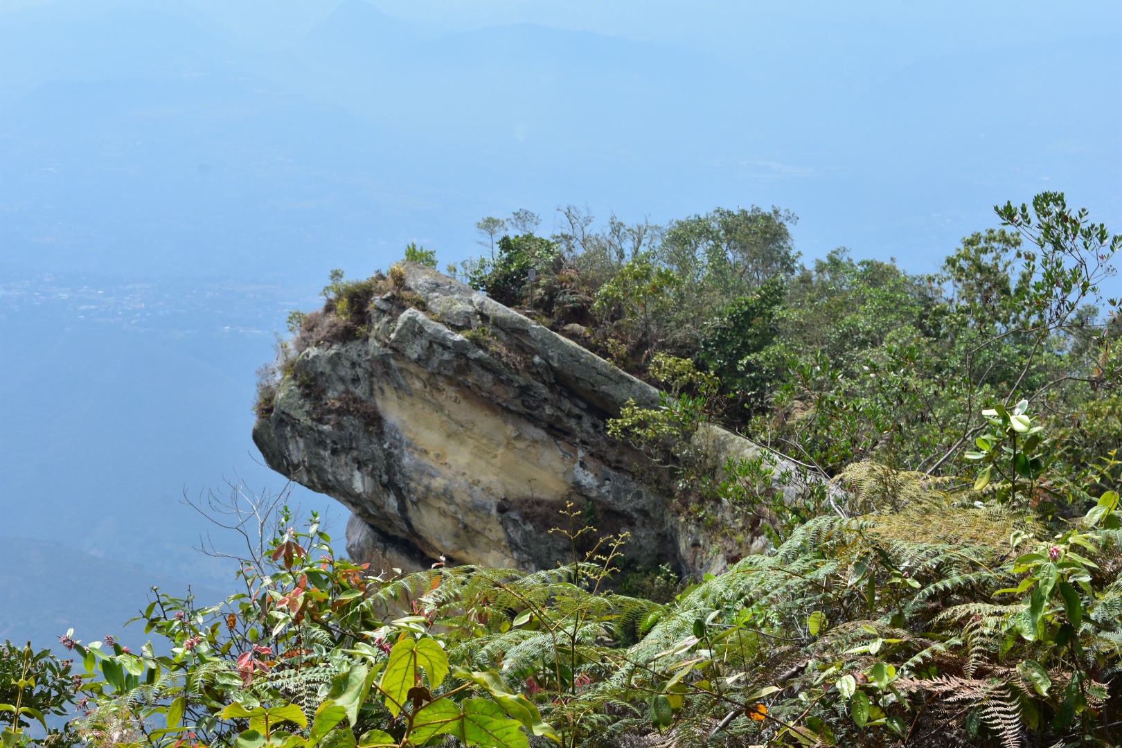
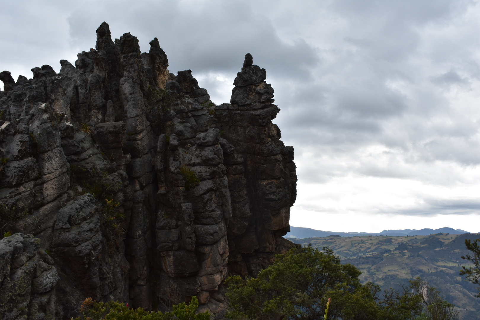
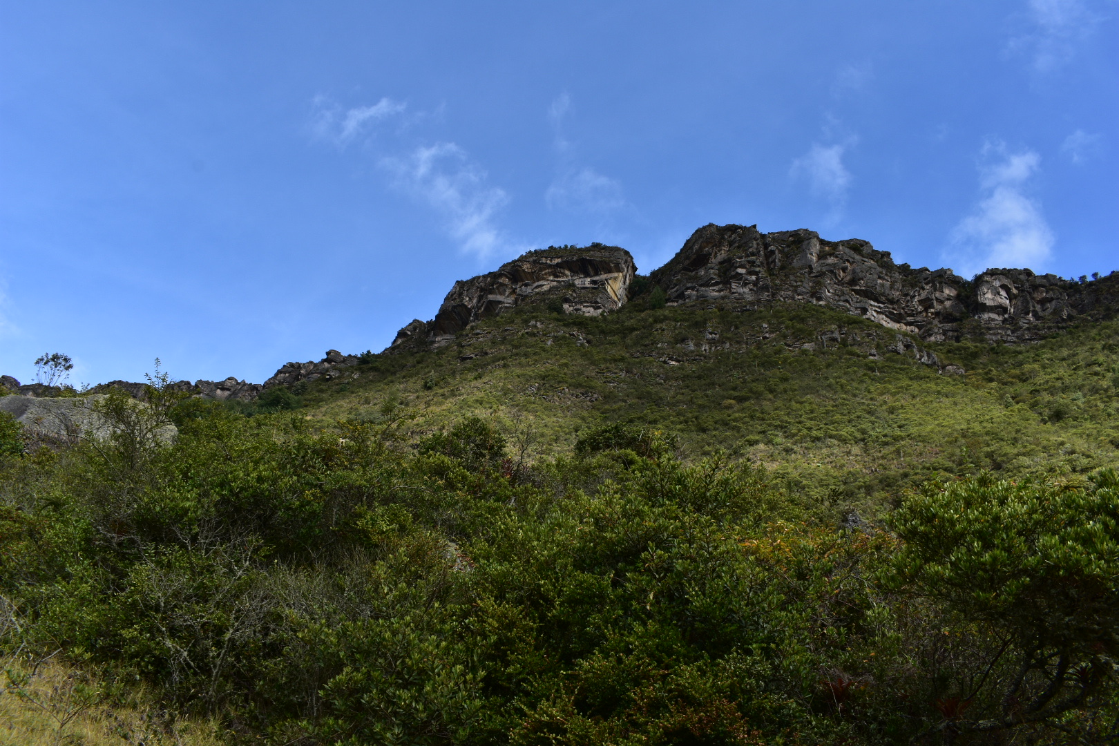
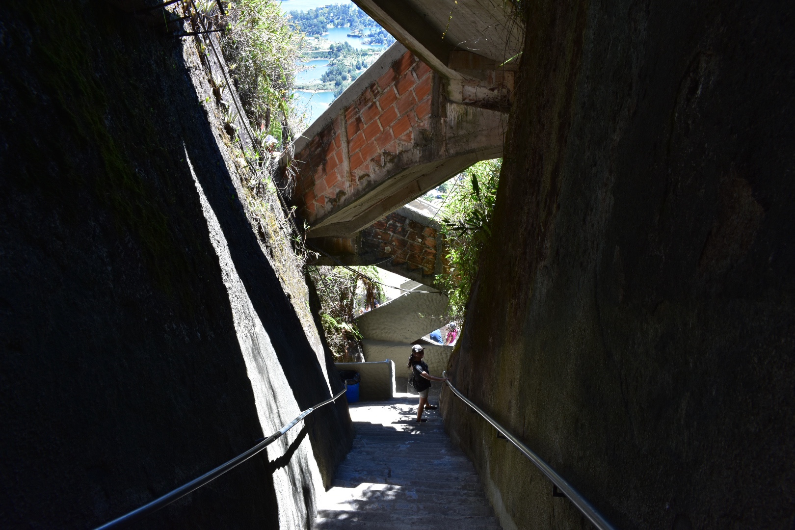
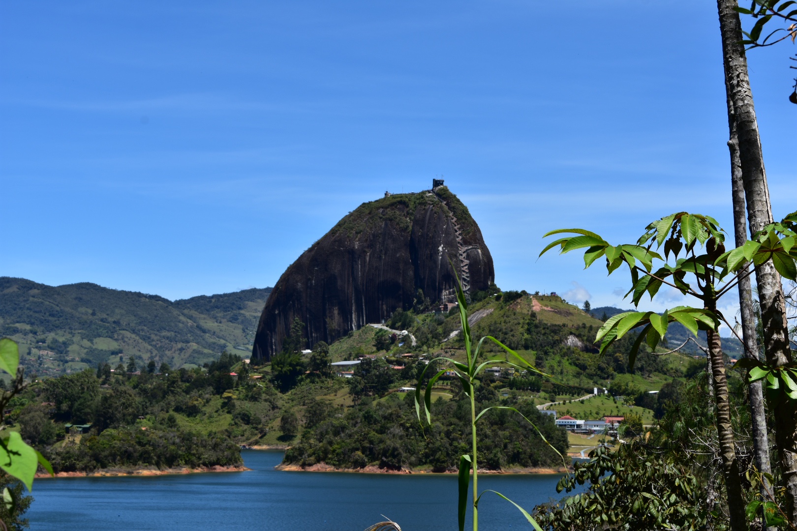
Currently entrance to the park stands at $10,000. It was around 9am by the time we arrived and the park was just opening up. We paid our fee to the señoría and headed in. We were given a warning not to stand or sit on the edge of the overhanging rock, which you might have seen in the Instagram photos. There is a crack in it and they are waiting for engineers or whoever accesses cracks in rocks to determine if it’s safe. I for one decided to avoid as I don’t like the idea of dying just to get a better photo, but also I don’t want my legacy to be the cause of deaths of others in an avalanche which also resulted in destroying a local landmark. But that’s just me…

It seems that there are organised tours should want a guide but this park is completly accessible by yourself.

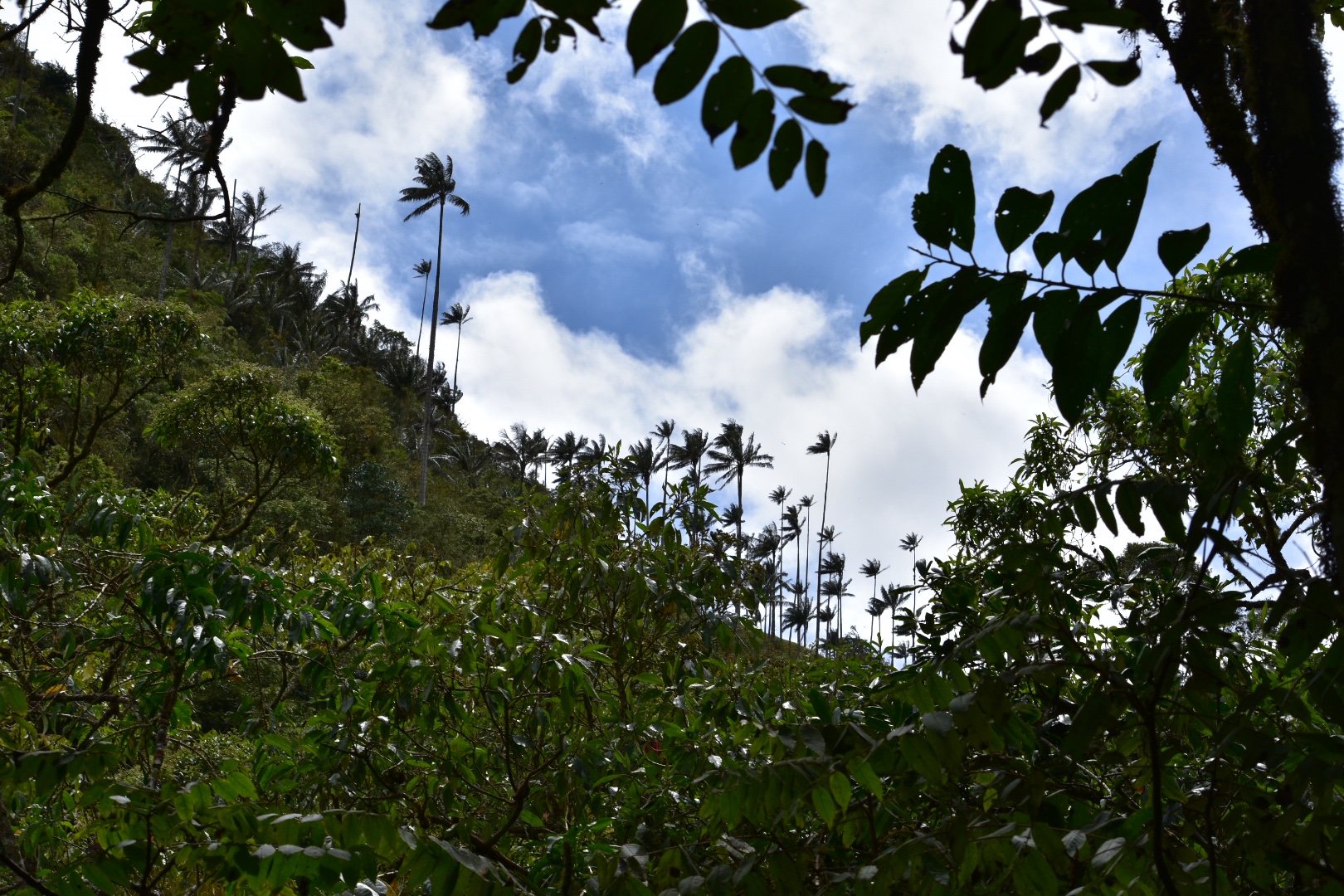
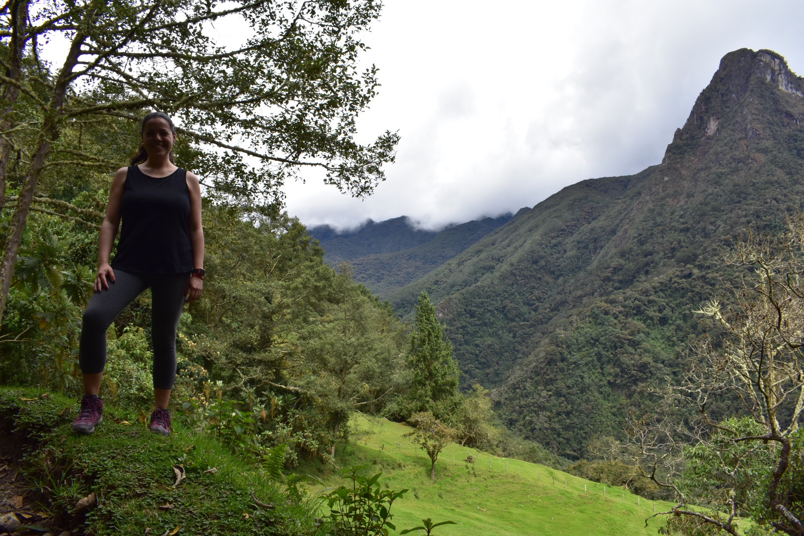
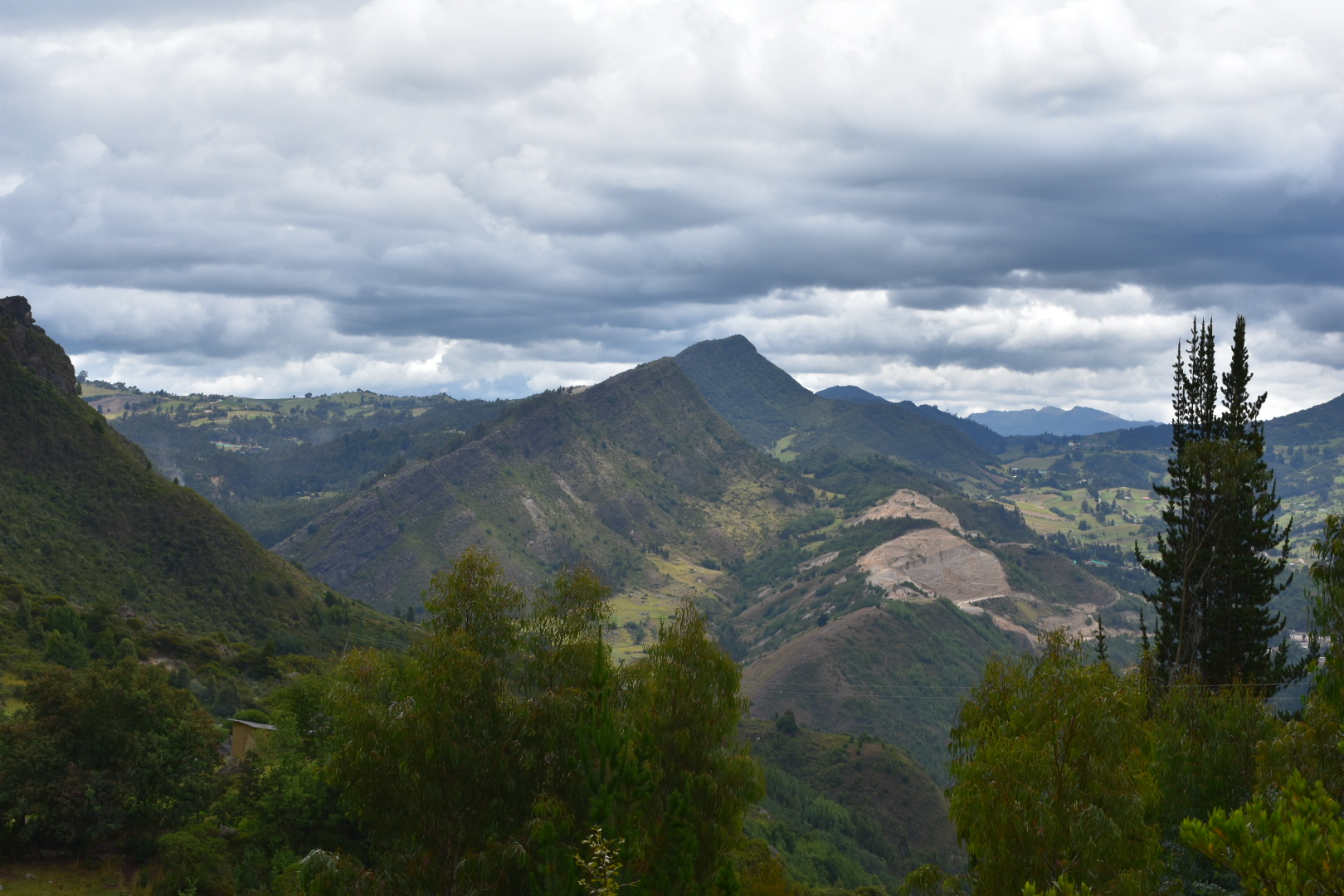
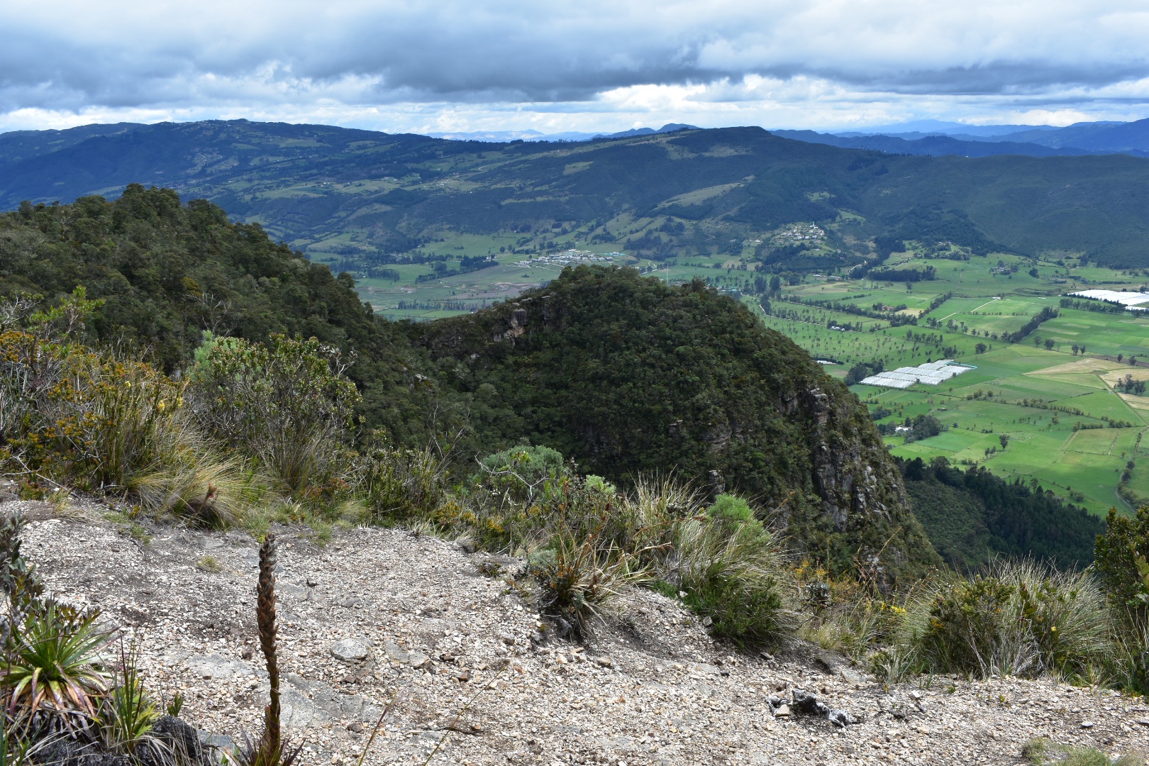
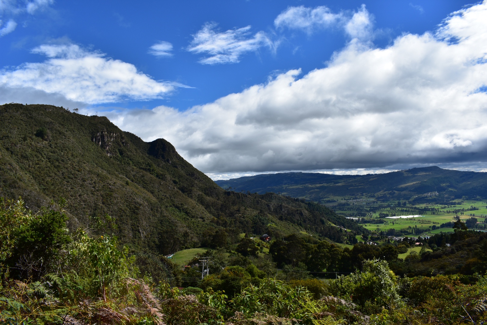
There is one main path that leads into the park, so we followed before taking a small detour to walk along the ridge looking out over the valley. The photo below is actually the other side.

Winston was fearless and posed on any rocks she could find in order to get a better profile pic.

Angela tried to get some shots with Winston but it seems Winston is not interested in sharing her social media presence.

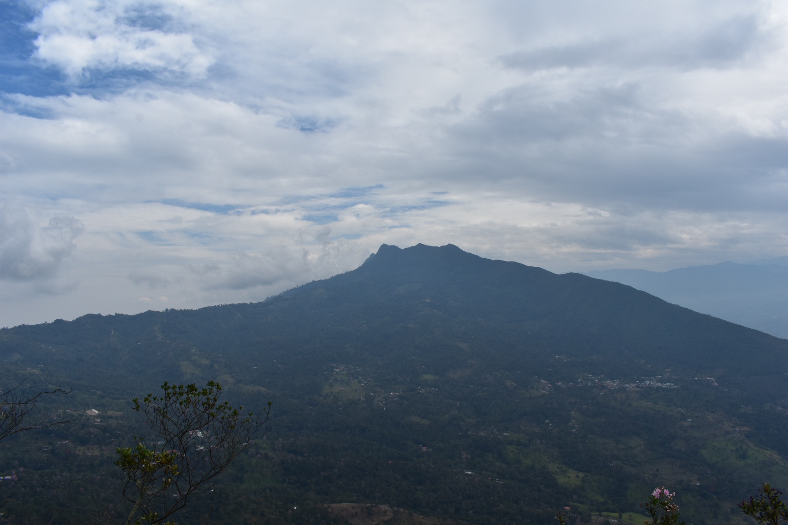
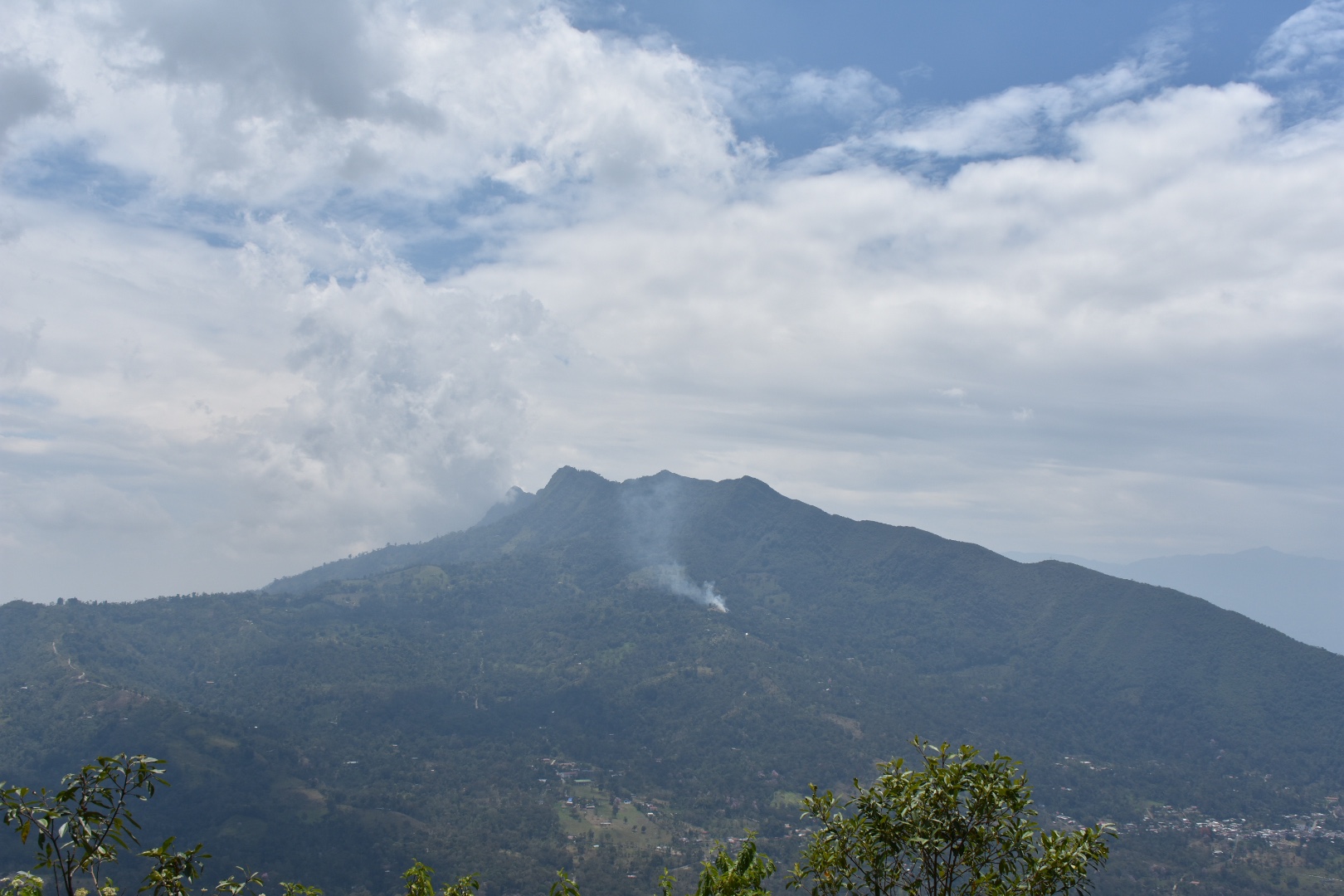
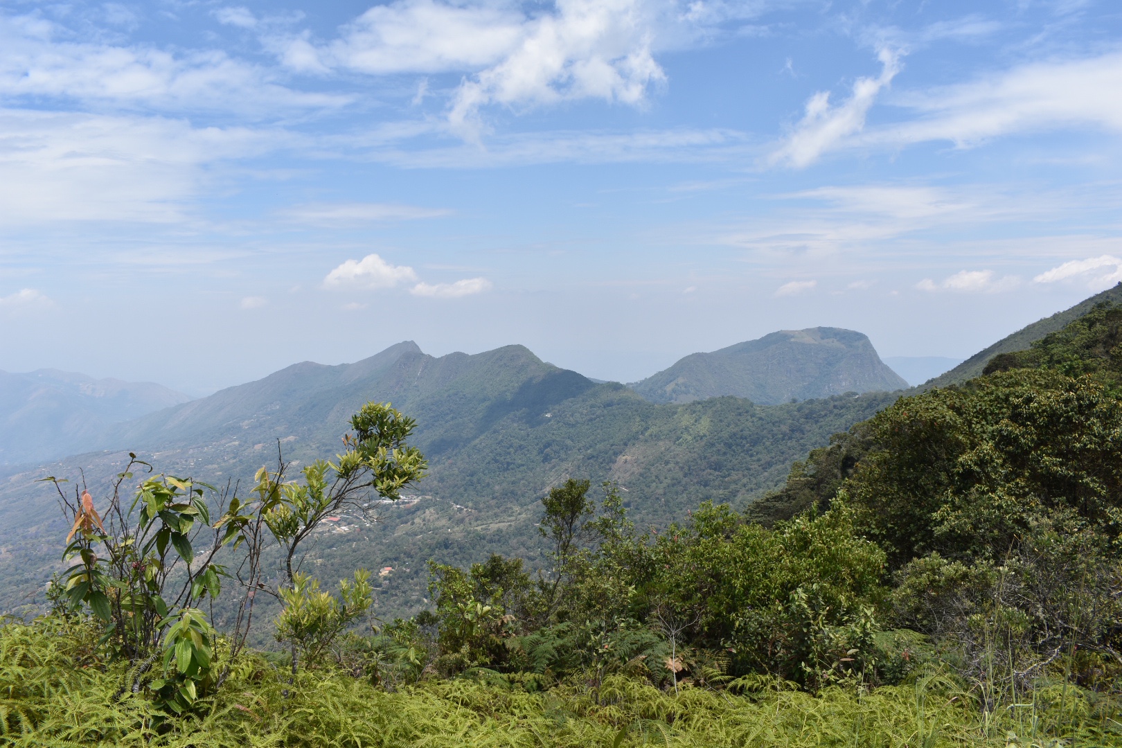
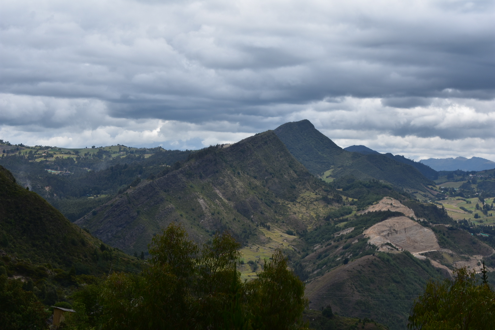
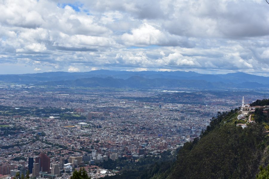
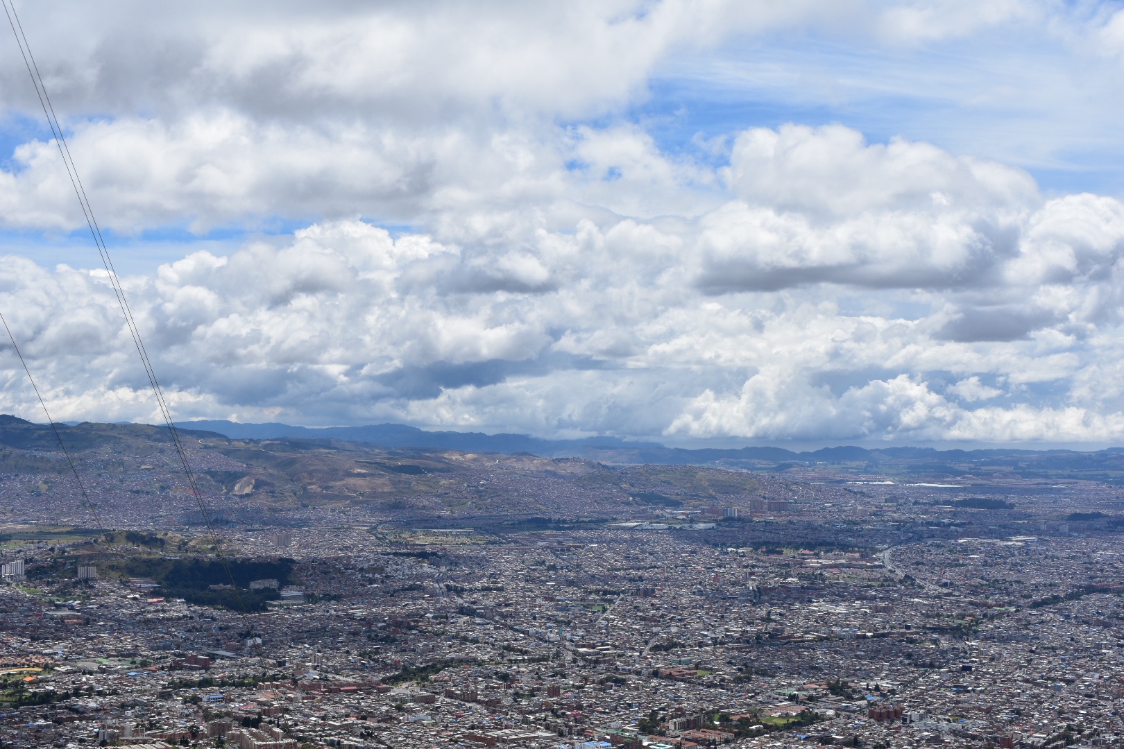
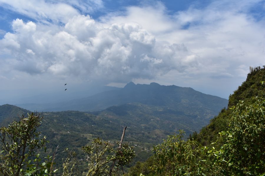
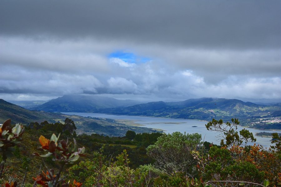
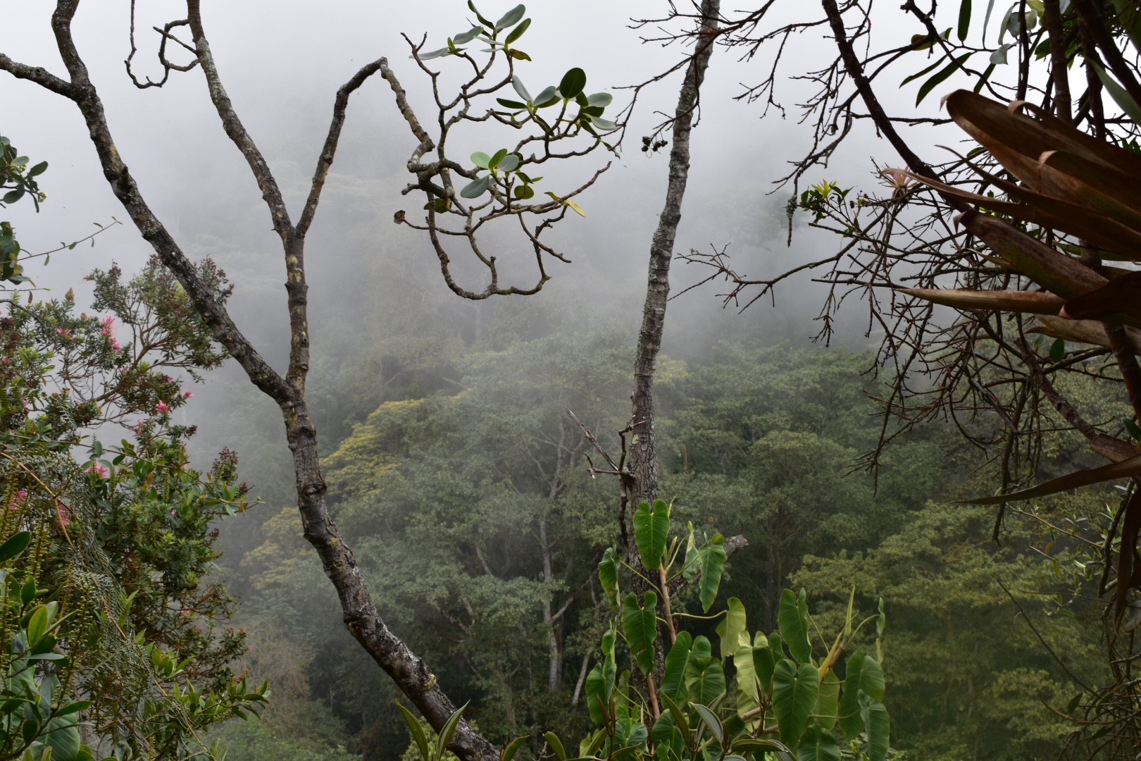
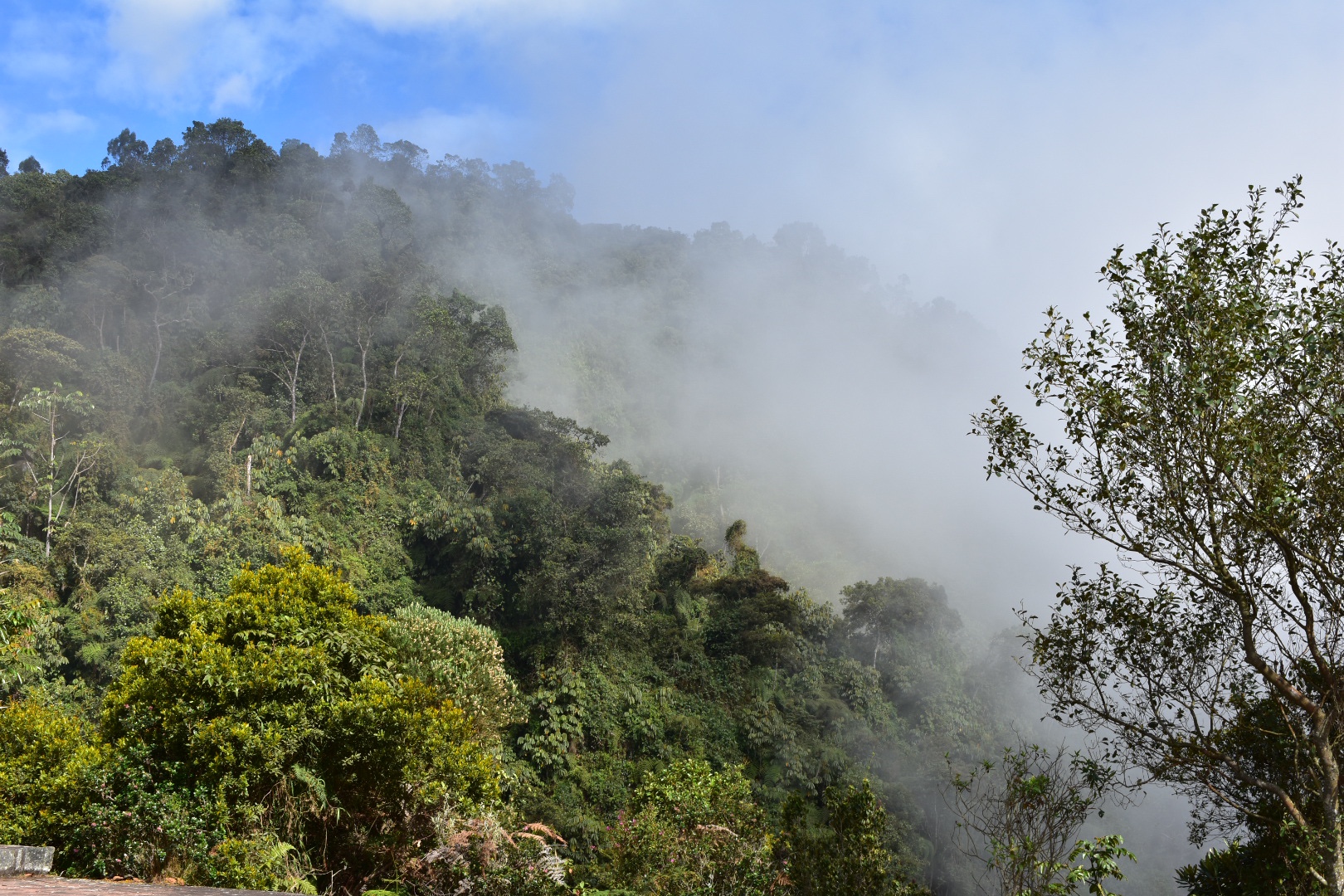
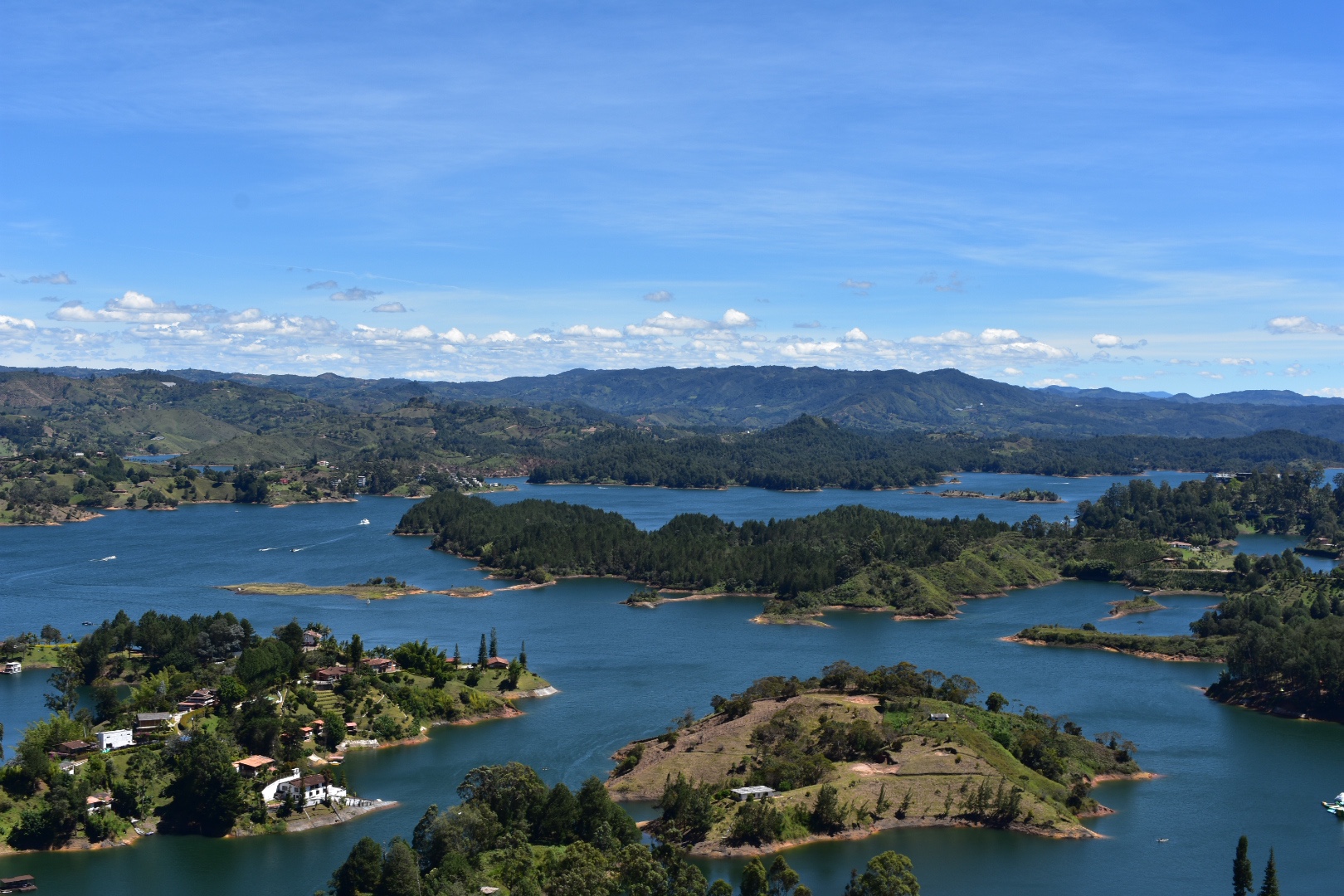
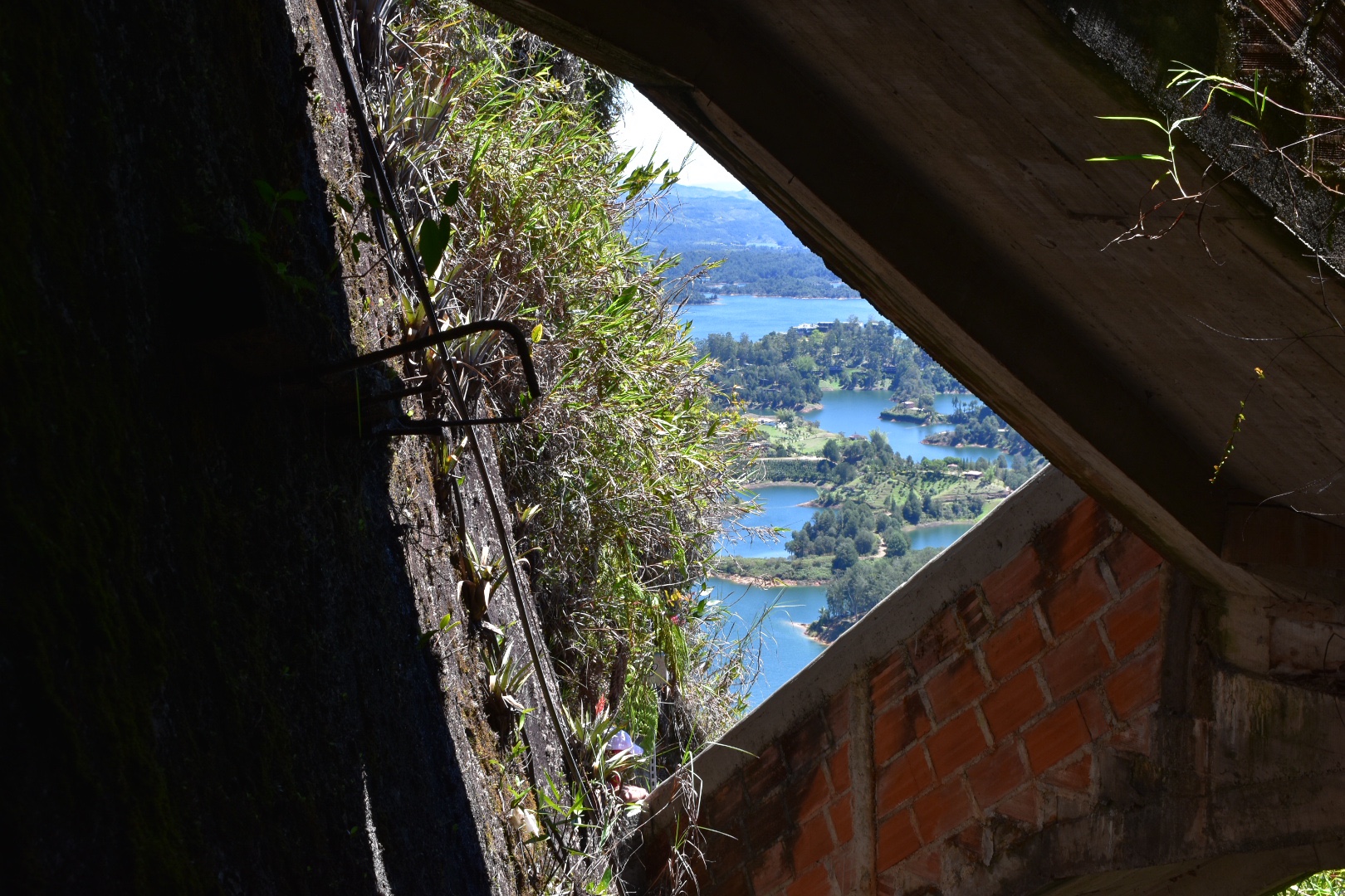
We walked along the ridge for a time, stopping at the different locations. This mountain was considered sacred by the local indigenous peoples and there are a few places where you can stop and see rock paintings and the sacred sights. The path goes up and down a little but nothing significant in comparison to what you have walked on the way up. We reached the famous rock, Cara del Indio and stopped for some food. We had lunch booked at the hotel for when e arrived back but snacks are always necessary and this time I shared with Winston still feeling guilty after Pionono Park. It took maybe an hour to reach this point, but we didn’t push ourselves. The sun looked like it was clearing the cloud away and the mountains in the horizon were covered in a lot of haze-I can’t tell if it was pollution or not, so we decided to wait it out a little and see what happened.

Angela didn’t sit on the cracked rock.

Winston on the other hand had no such fear.

I spotted a lizard which I’d previously chased around the Tataco Desert. I mean I don’t think it was the exact same one.

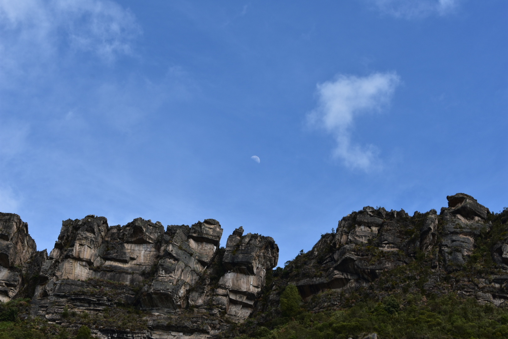
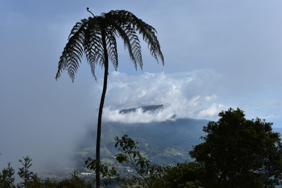
And the clouds did clear a little so I took a lot of rock photos.

We spotted a fire on the mountain across the valley.

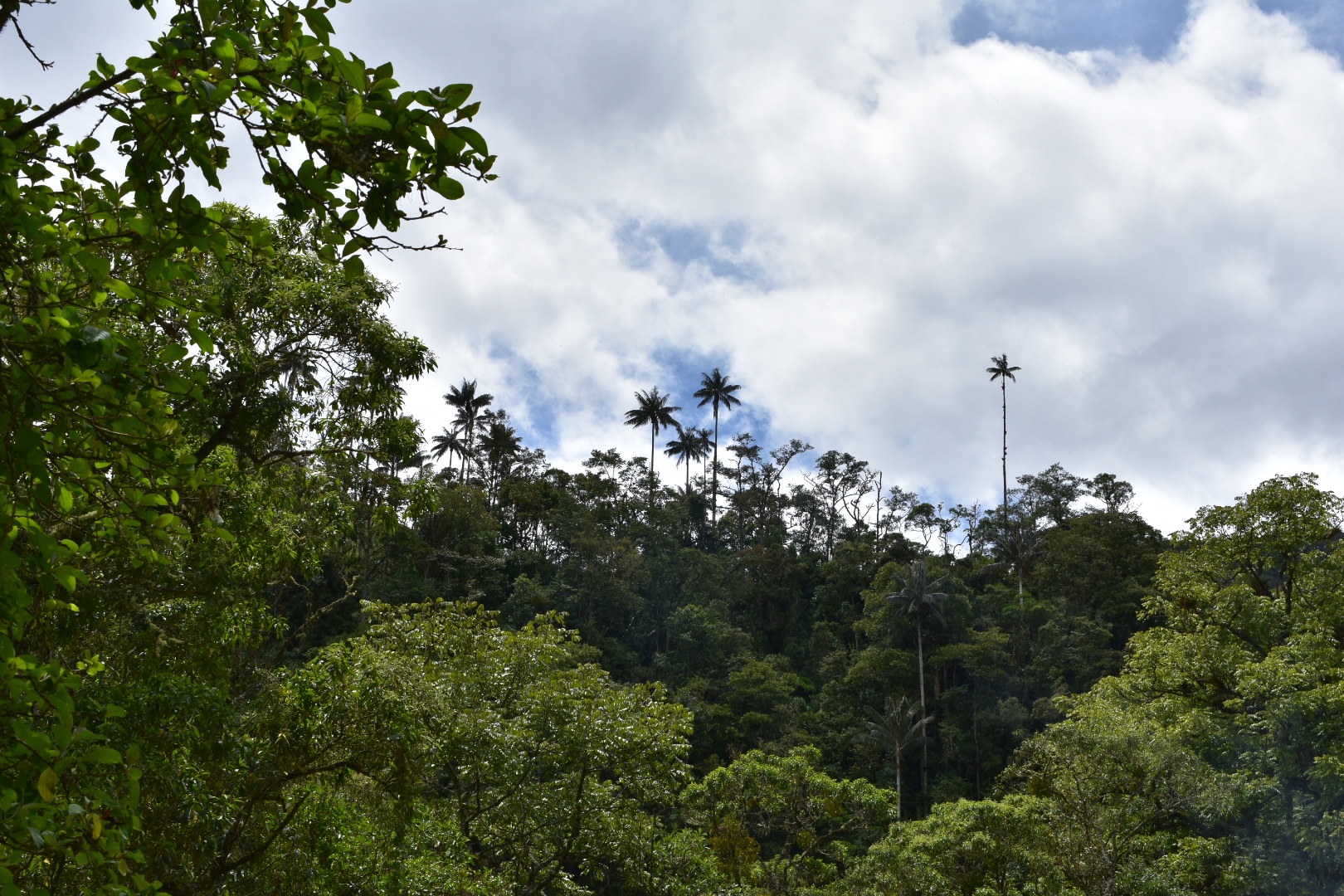
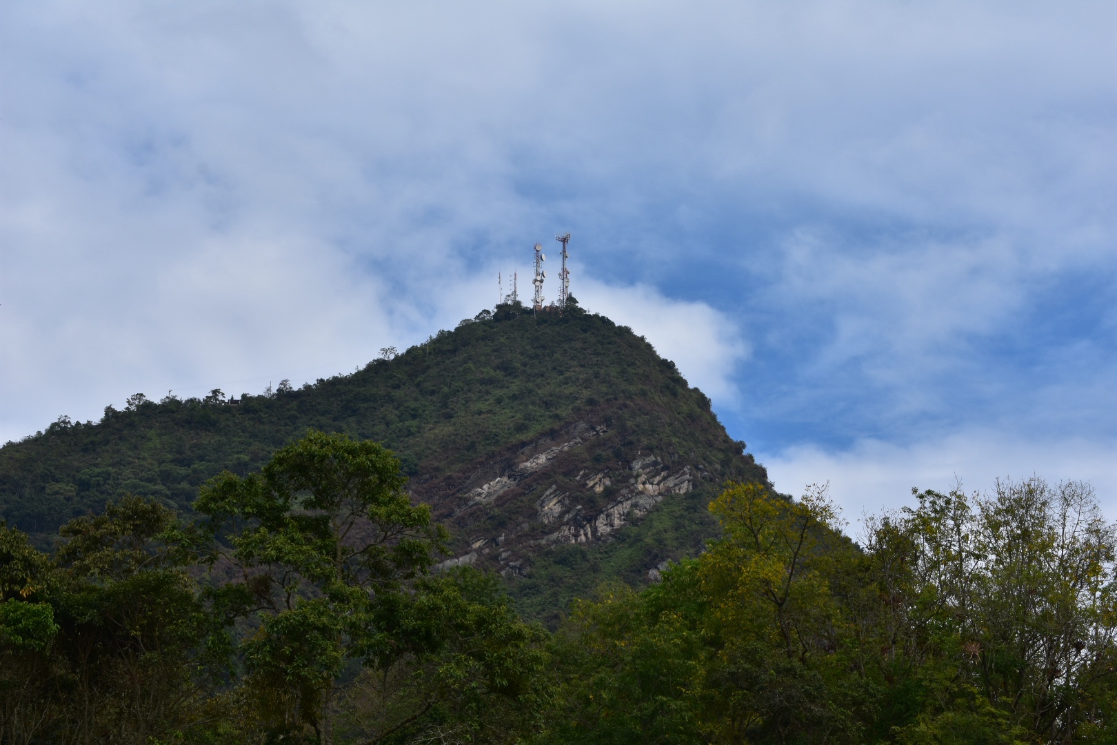
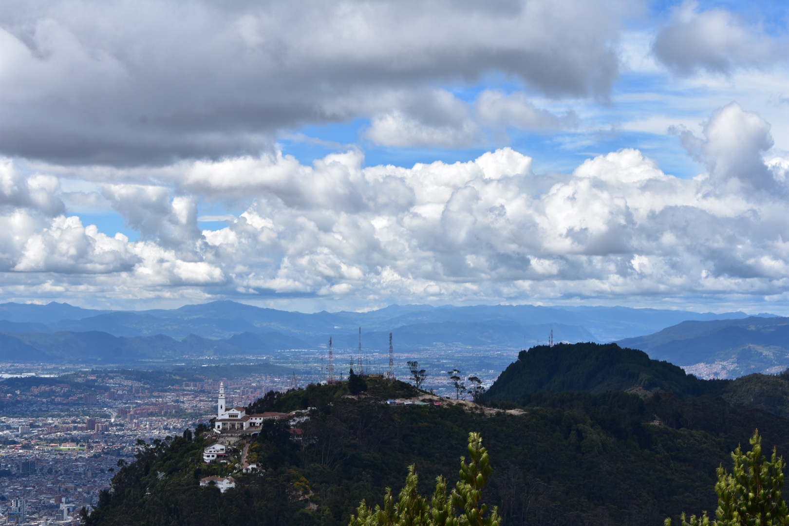
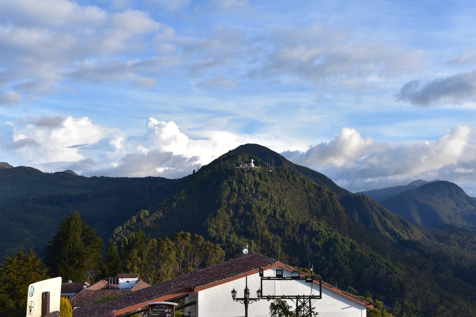
And then decided to head back to the entrance taking a different route. It was largely in the tree cover and we didn’t see much. There was a path that seemed to lead down into the next valley but as we needed to get back today we decided not to pursue that both but instead I wanted to head up to the other cerro accessible on the ridge.

This is the one with all the mobile phone masts and there is a road leading to the top. This is free and not part of the park.

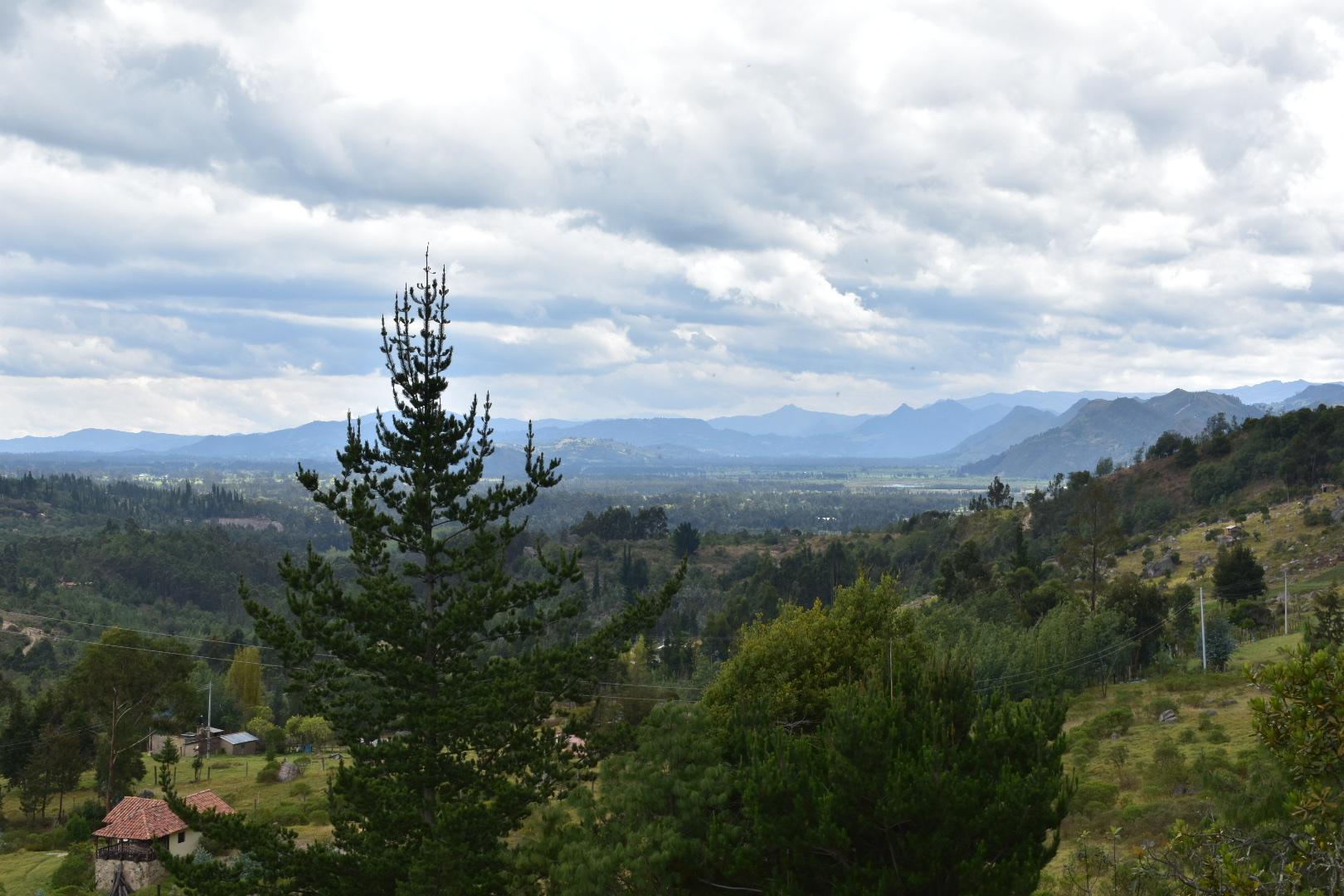
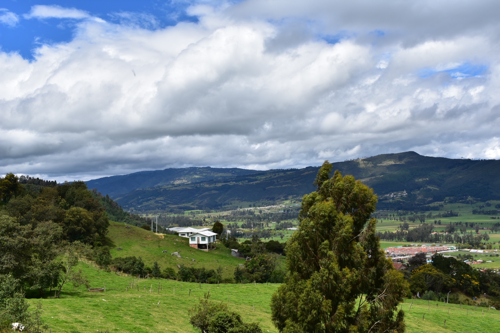
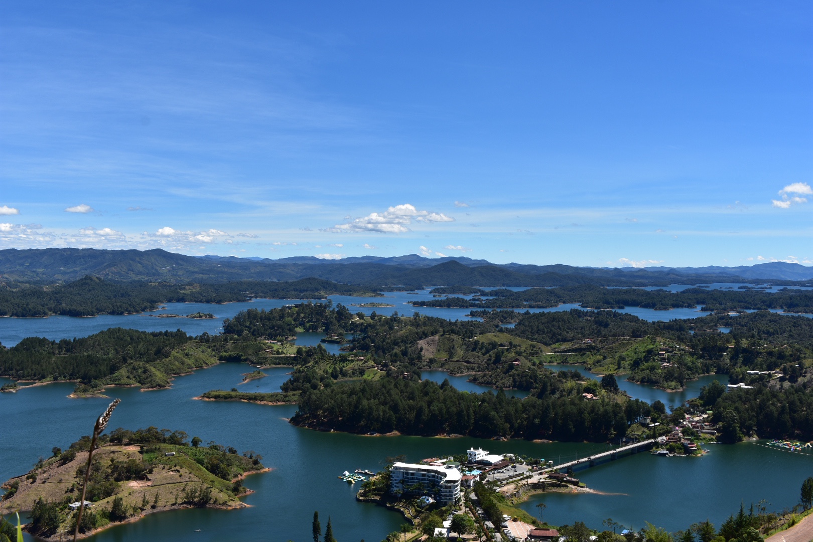
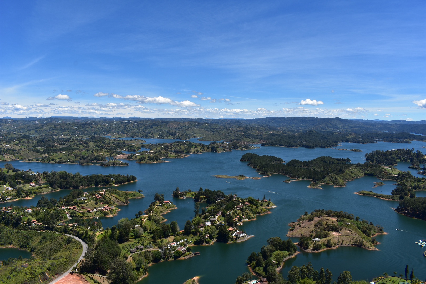
At the entrance we brought some more water and tried to give Winston a drink but it turns out that she won’t drink from the communal dog bowel and prefers mineral water. It was really warm not and she was panting a lot. We were worried about her but determined to push on. Here are some of the views form the entrance.

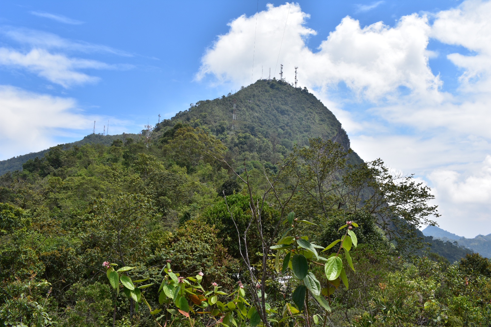
It’s a tough little walk up the steep road to the top. I guess it took us around another hour to reach the masts.

On the way up we met some workers who were chopping back the foliage. At one point two cyclists and a maintainer worker over took us. There were a lot of cyclists on this route and I have not idea how they made it up this high – it was tough enough walking, let alone peddling a bike.

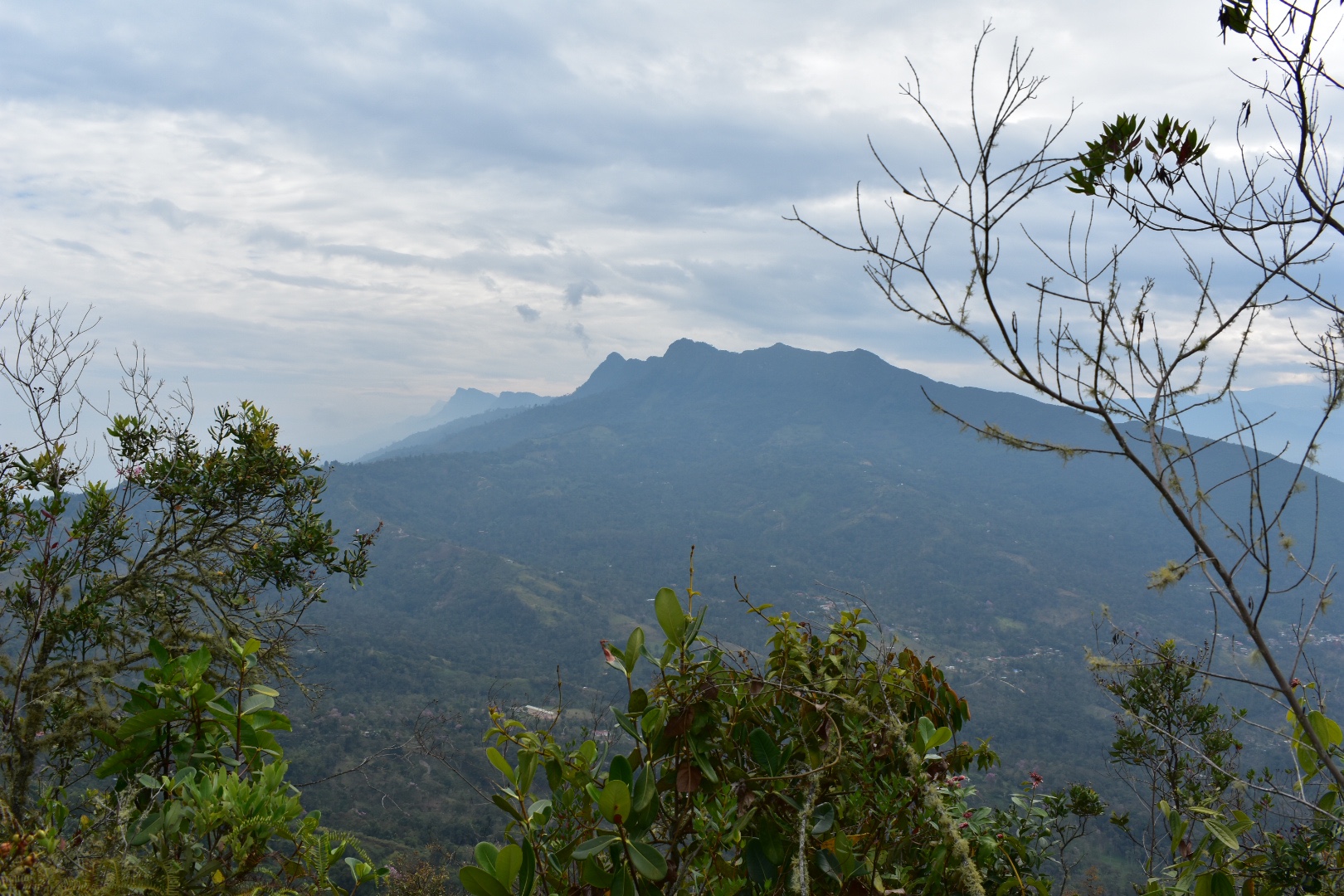
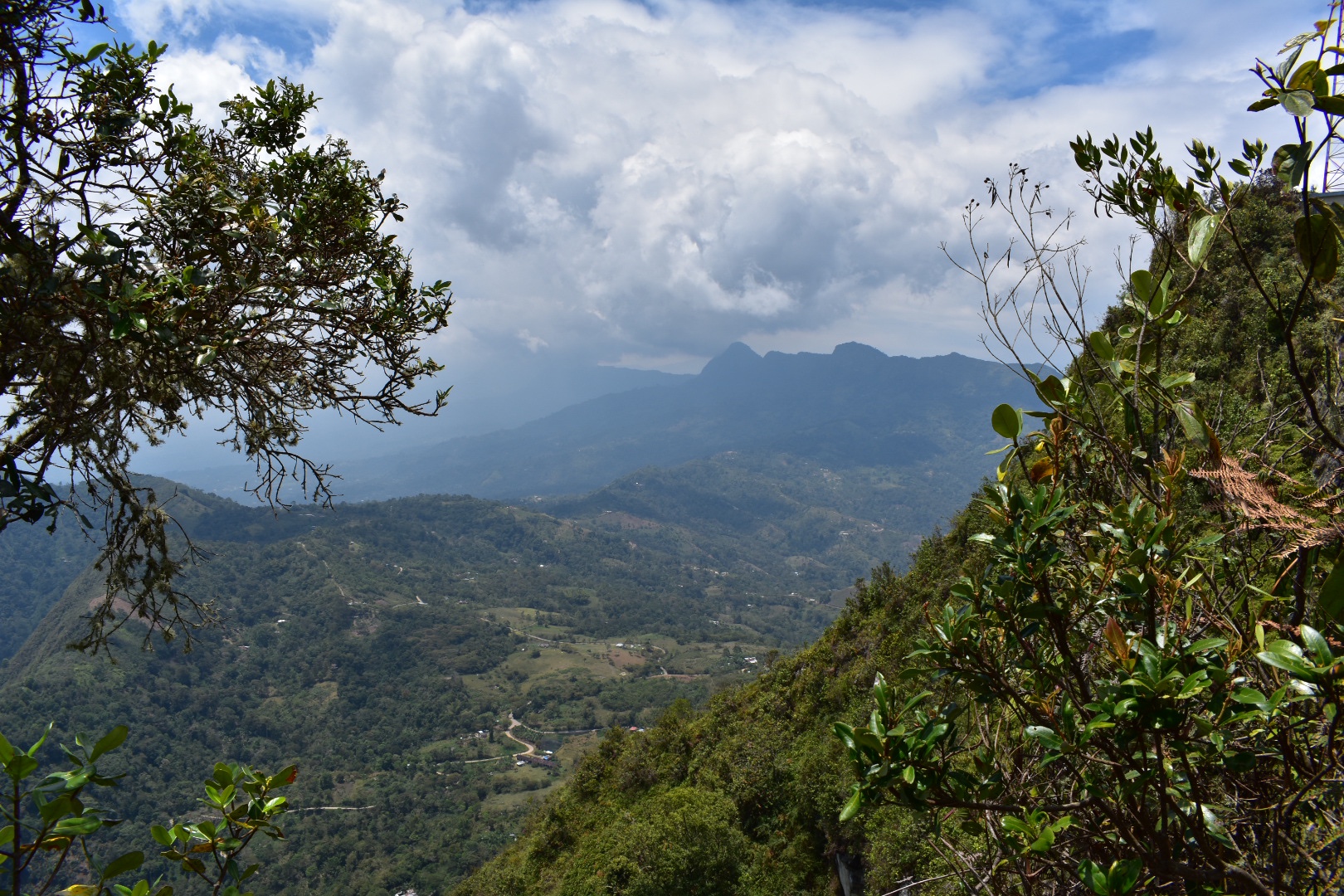
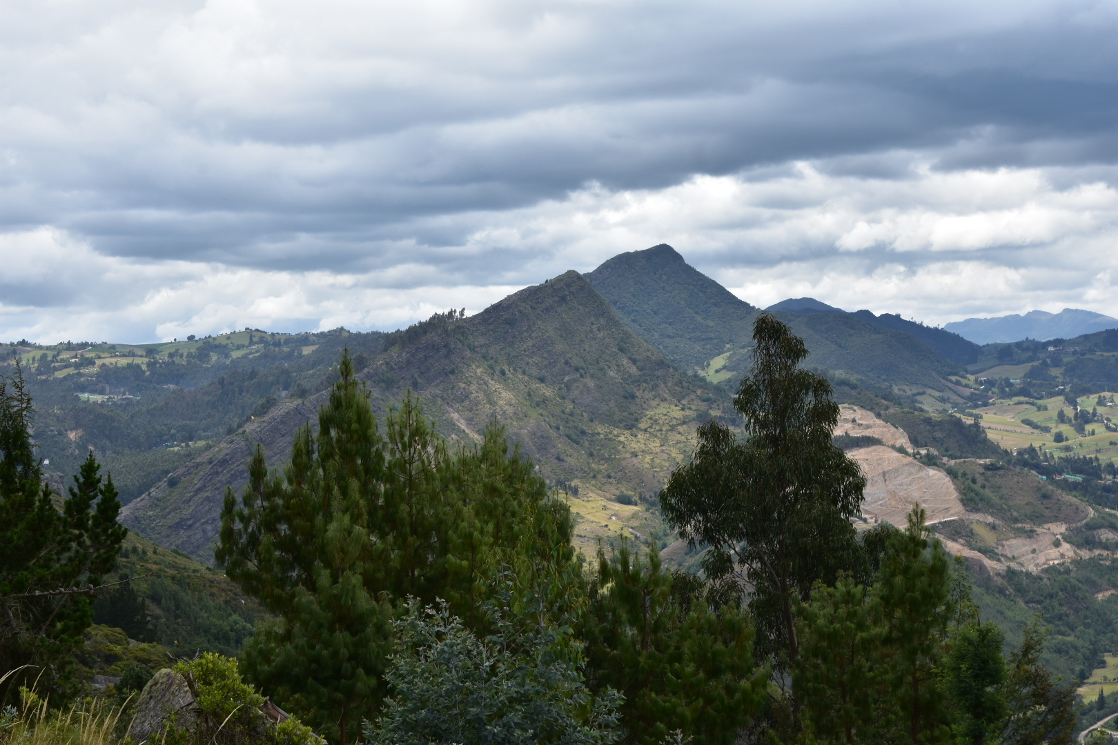
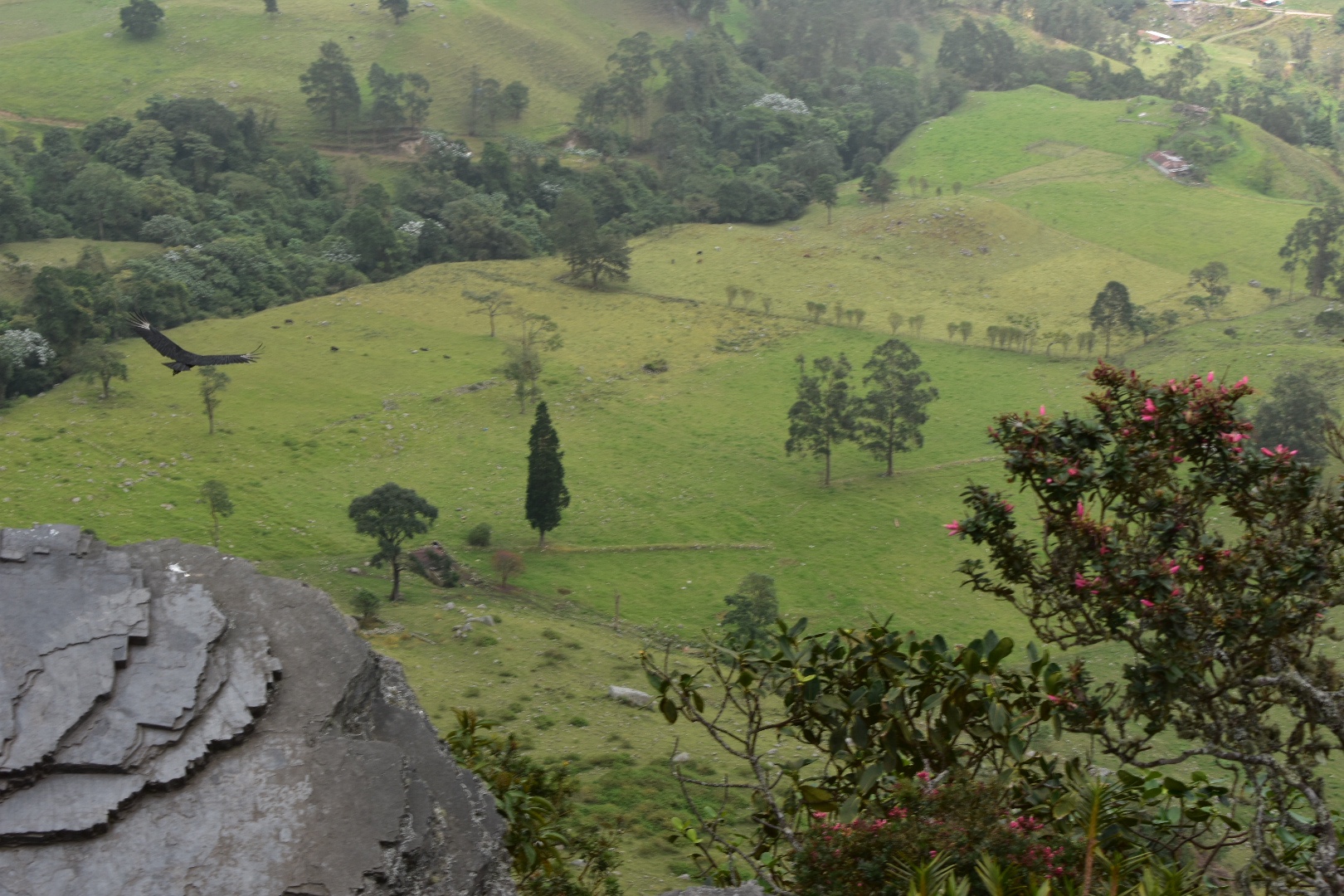
When we reached the end of the path we found a compound for the masts blocked the road. And looking at the map the top of the mountain was up a path to the right that we had neglected to take. One of the guys who was cycling came back out from a path that led around the side of the compound. He hadn’t found anything but Angela asked the worker if there was a mirador and he said yes. So we followed the path to the left of the compound. If you decide to do this you won’t be disappointed but just be careful as the path weaves up and down and there are some big drops next to the narrow path. But then you reach the lookout point.

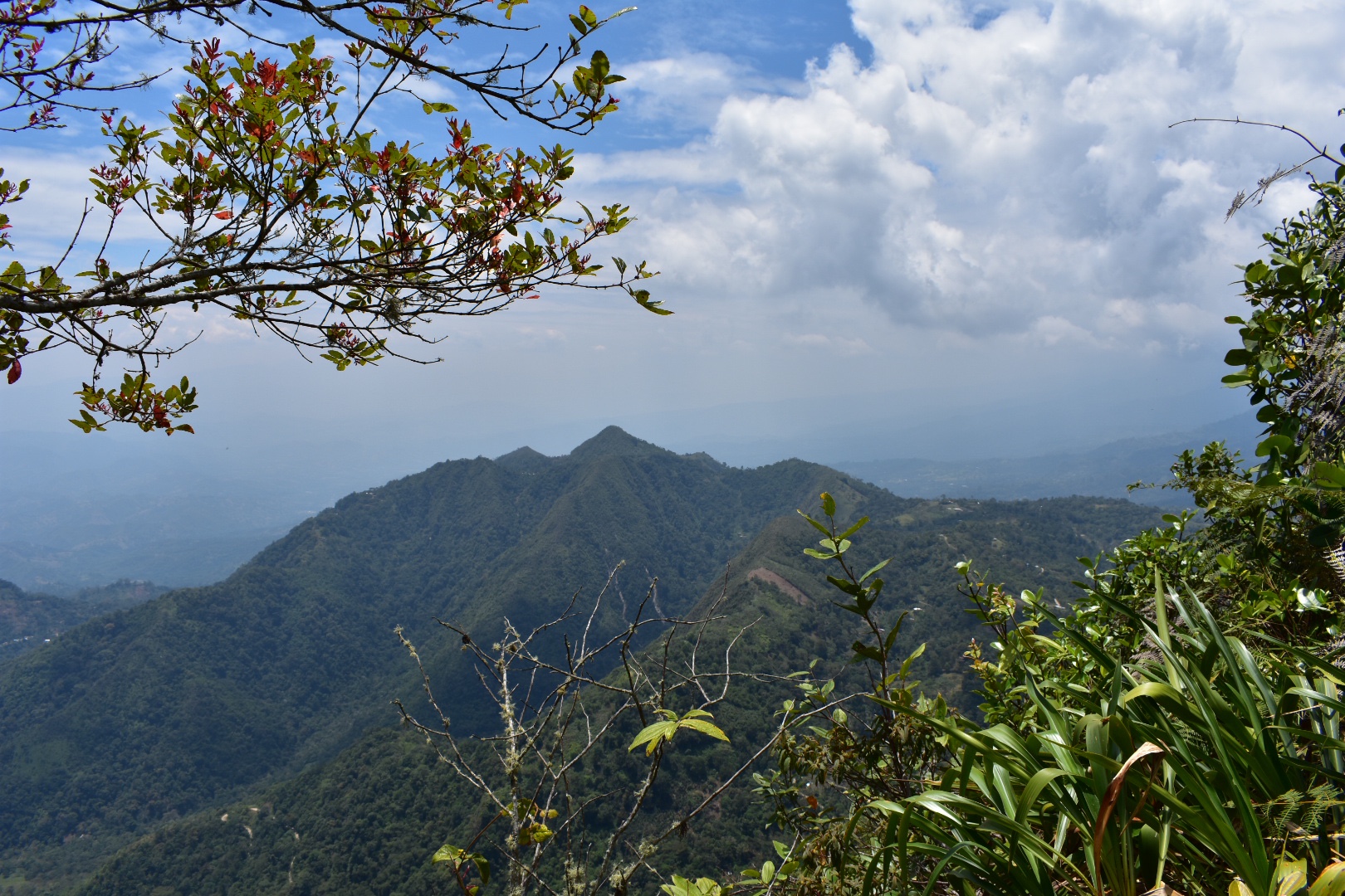
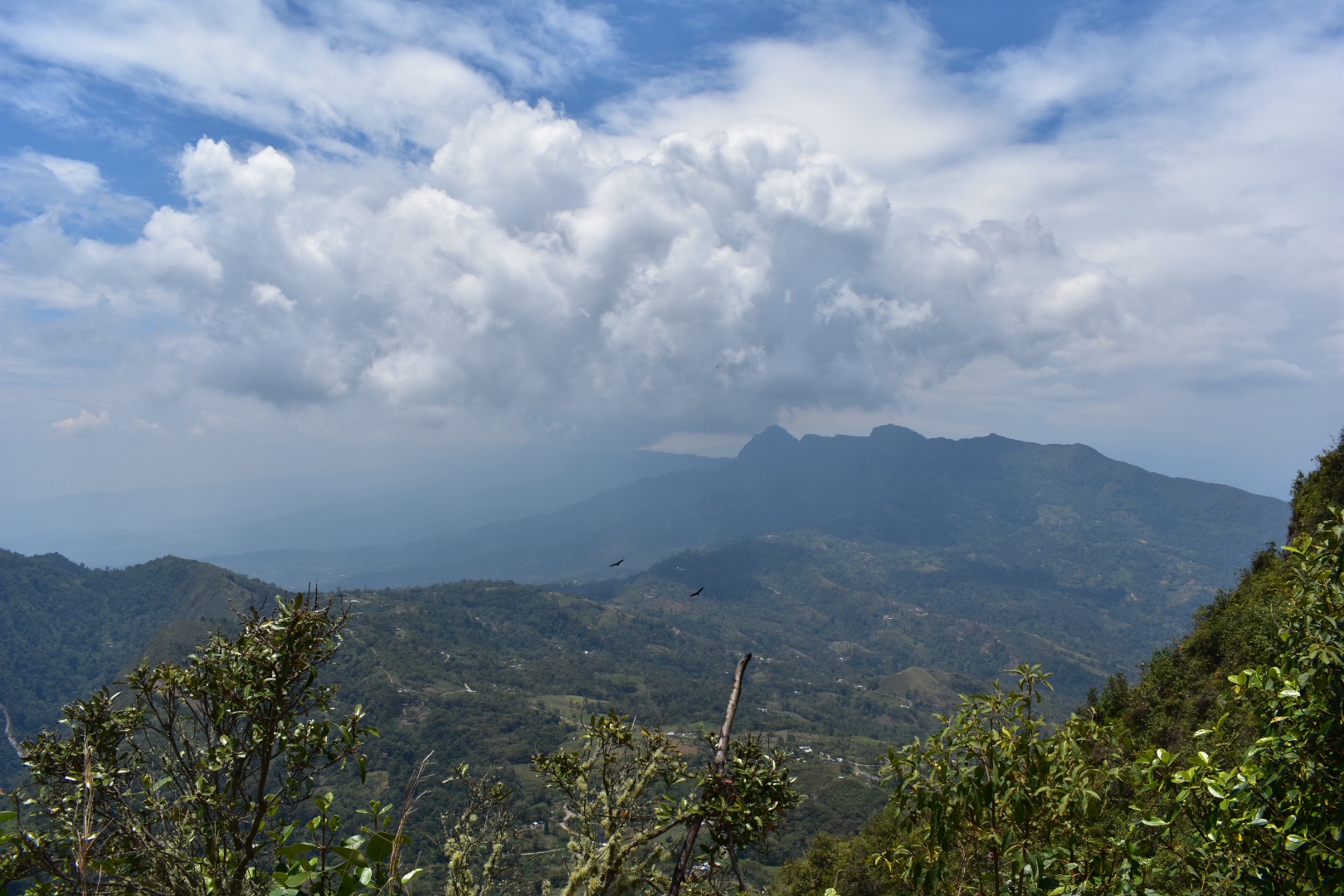
And it’s all rather stunning.

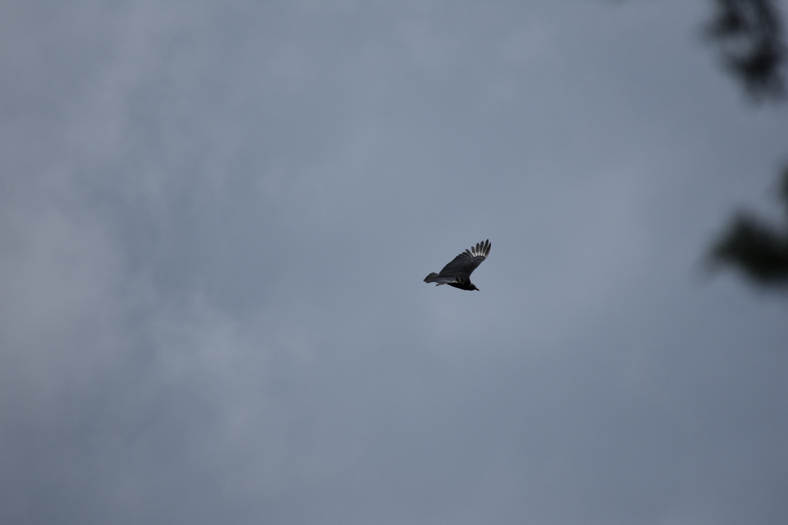
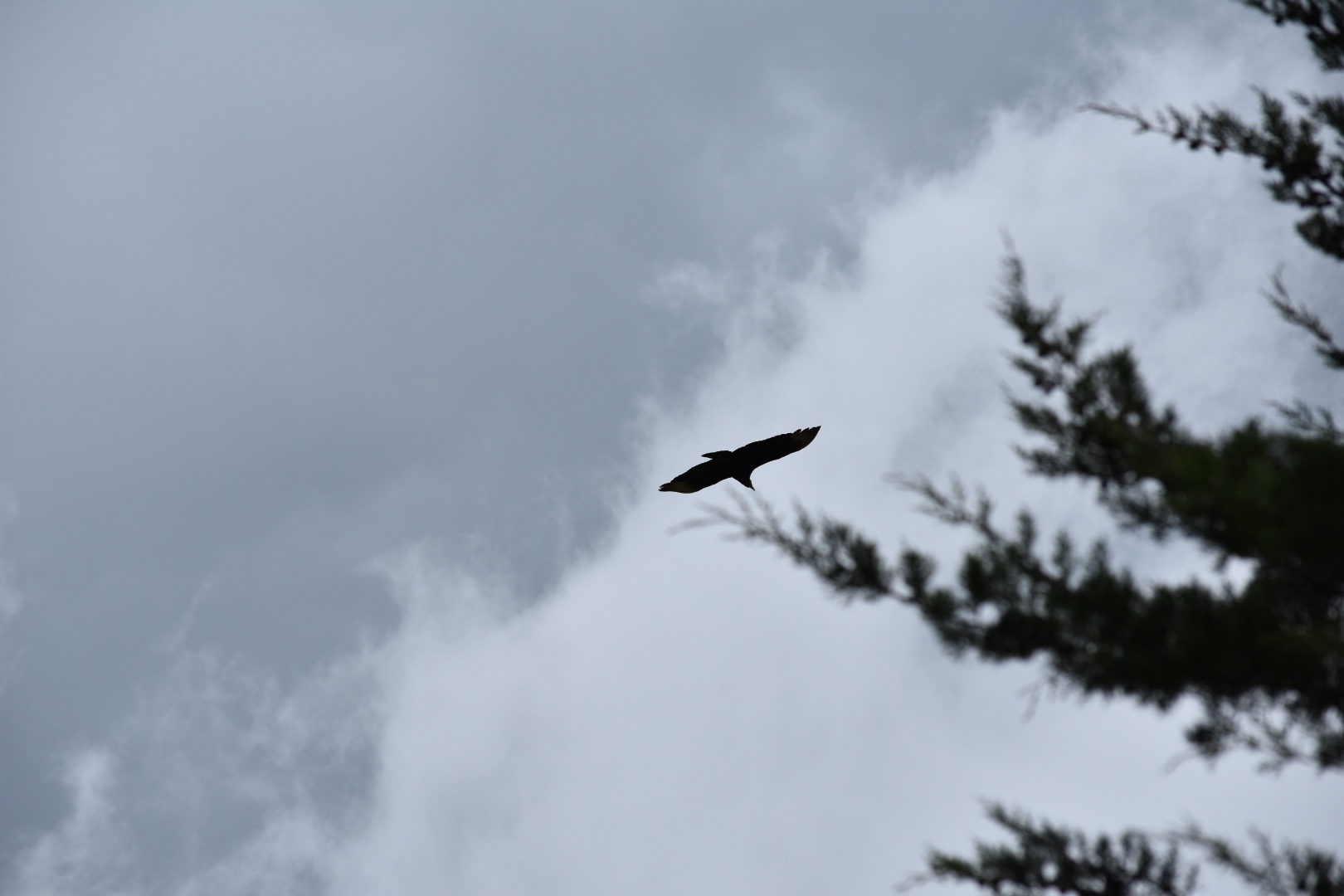
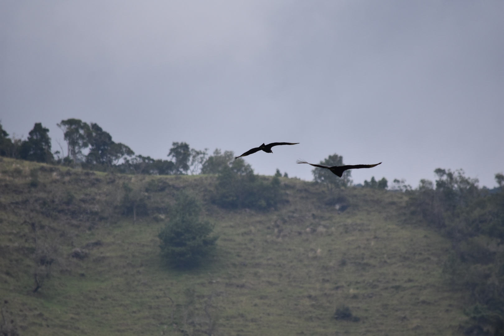
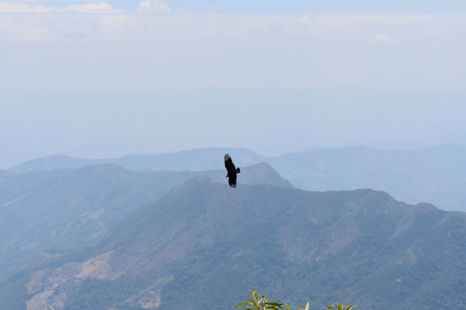
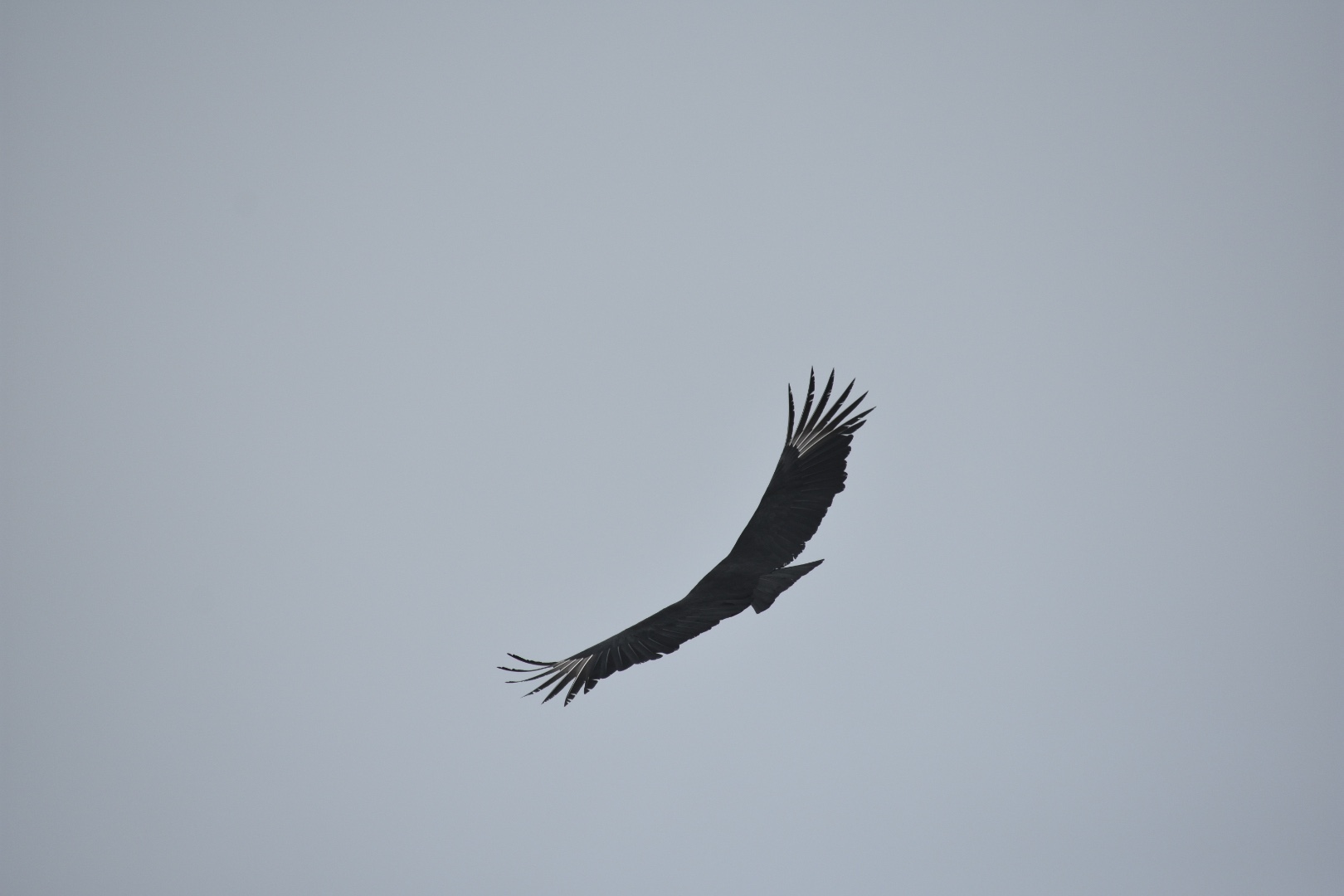
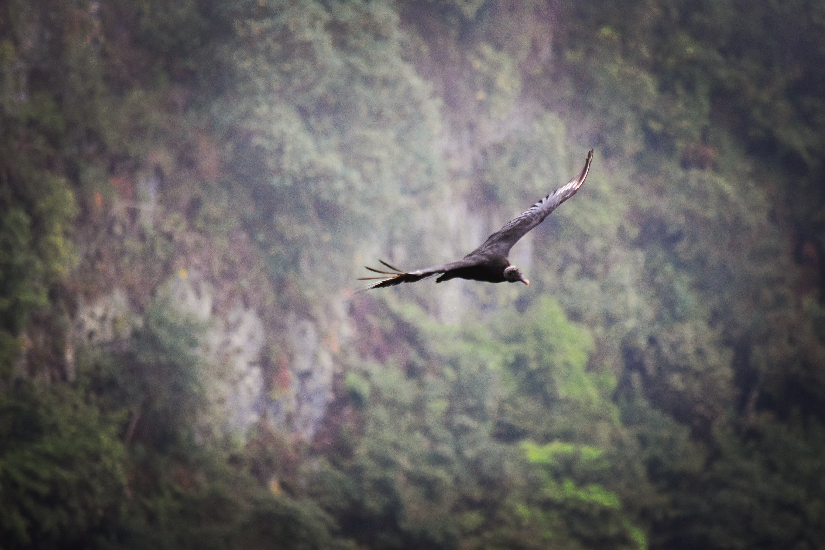
And if you are lucky you might see some birds.

We rested for a time but rarely for our hikes we didn’t bring lunch as it was waiting for us back at the hostel. But you could easily spend a decent amount of time here and its a great place to stop for lunch. We instead decided to head back. It took a good hour or more and in total I think we arrived back at the hostel around 1pm.

Going back down was much faster but it is tougher on the knees. Just make sure you take your time as it can be slippery in places.

Winston ran away without even saying goodbye and we headed back to pack and have lunch. We were treated to soup sancocho de gallina which thrilled Angela as she had been looking for a soup on a hike since we were walking around Minca. We knew that the Minibuses go back to the main town every 20 minutes so we were in no huge rush. We took our time to rest over lunch, I had a coke to re-energise and we walked slowly back to the trail head enjoying the sunshine. When we arrived there was a bar full of locals enjoying Águila and a game of techo. We grabbed a seat and debated a beer but rejected the idea and a collective soon pulled up. We grabbed a seat and enjoyed the long ride back in the day time where it was possible to see the surrounding mountains. On the return journey you can ask to be dropped at the bus terminal. Within seconds we were on a bus to Bogotá which nearly left without me as I was buy more crisps. Not quite sure why I’m not losing weight with all this hiking…

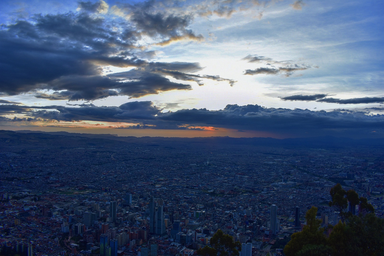
The bus journey is two hours back to Bogotá and drops you at the same main terminal where you departed. We asked to be dropped by the last Transmilenio station so we could get a head start.

How to get to Cerro Quininí

The main bus station in the south is called Terminal de Sur. The closest Transmileno stop is Estación Bosa. It depends on where you start in the city as to which bus to take to arrive but head to this location. When you leave the bus station take the north exit and turn right, the bus terminal is around 5-6 blocks and will be on your left.

When you arrive ask to get on a bus to Fusagasugá $12000, taking 2 hours. You can jump off on Highway Pan America but my advice is to go to the terminal, take get a bus to Centro and head to the main market and on Carrera 11 there is the collective to Cumaca, $8000, taking a good 90 minutes. On the way back get them to drop you at the main terminal. Read above for more detailed instructions and you might have luck flagging one down from the main road outside of the bus terminal as ours passed both times, but I think the office is the best place.

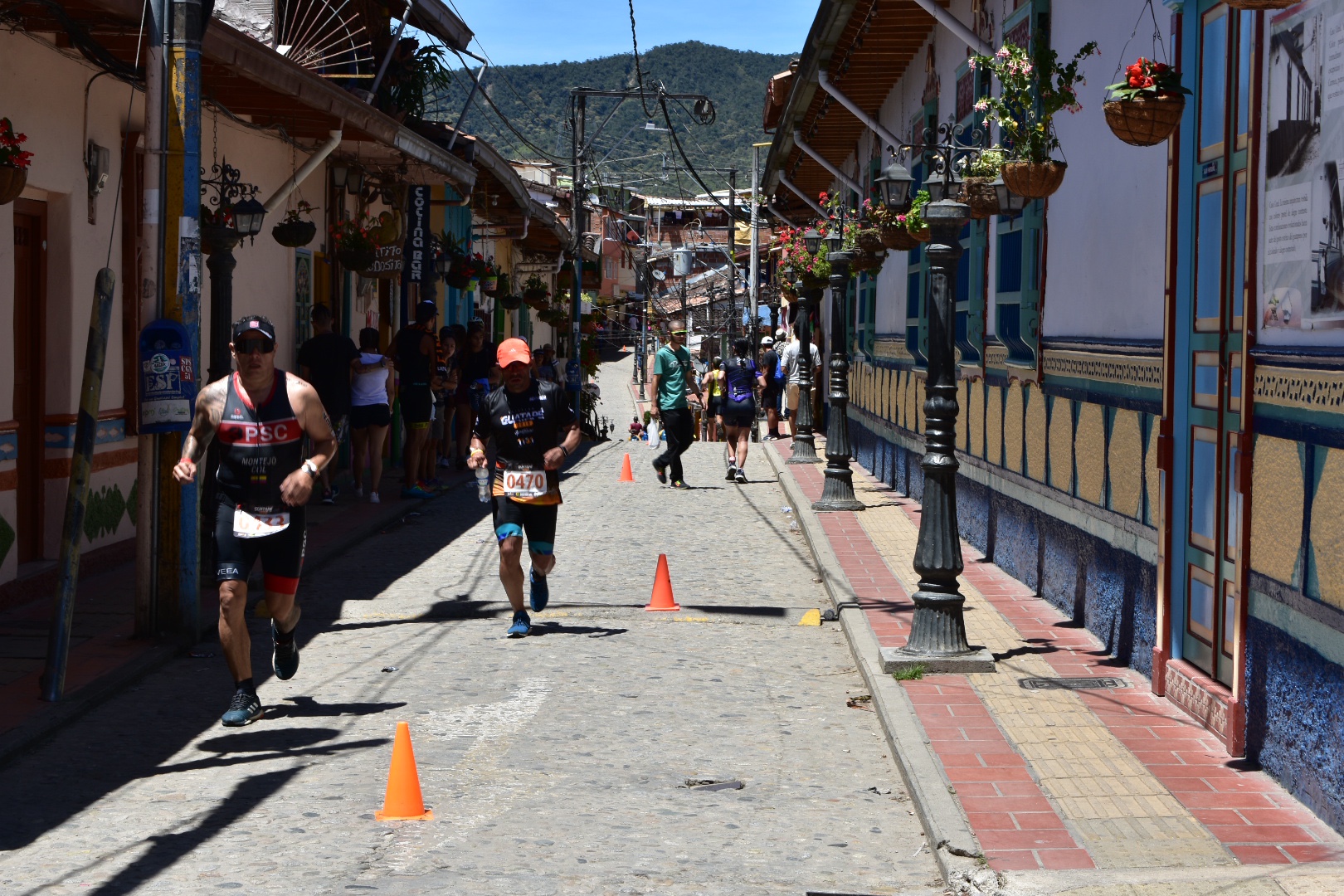
There are a few small towns along the way and the collectivo go every 20 minutes from around 6am until 8pm, so if you decide to stop in one of the local towns, which seemed quite fun, you can easily get to the trail head.

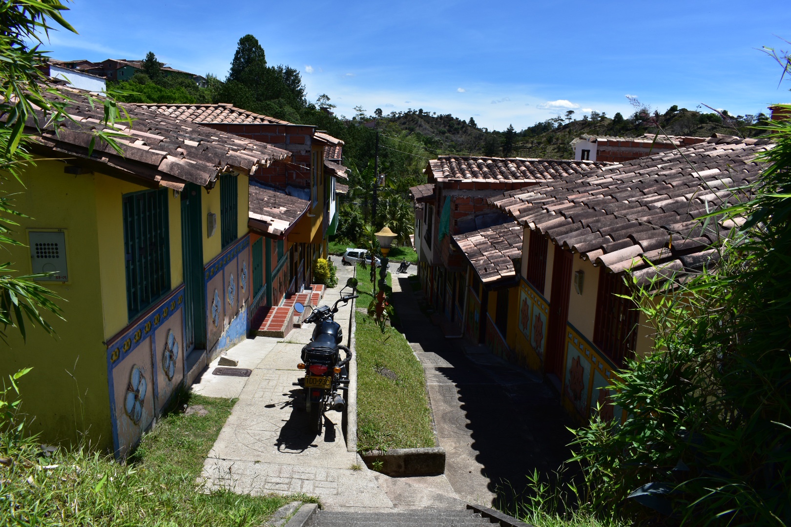
We decided to stay at Hacienda de Vuelta which worked out at $90000 for the night for both of us including 3 meals each and a good few beers which is a bargain. It’s at the beginning of the trail so a good place to start the hike and beautiful. If you stay at the same hotel as us or close by then that would be my recommendation, although there are plenty of places to stay in the other towns along route and they were pretty lively on a Friday night. You will just need to get a taxi or wait for the collectivo to take you to the trail head. If you do opt for this then remember to bring supplies. There is a small shop at the entrance selling sweets and drinks but not much else

If you are interested in booking a guide, I don’t think you need one to access the park but I’ve read a few posts that says its worthwhile to understand the history of the location you can try this local company. I only saw a sign advertised at the entrance so I can’t vouch for them.

Entrance to the park is $10000, and the second cerro with the phone mast is free. Take the tail up as described on Maps.me. It start where the collectivo drops you off at Estación El Ocobo. If in doubt ask, but its really easy to follow when you have located the map on maps.me

Equipment to take

Even if you decide to spend the weekend in the area the hike will only take you one day, or more likely half a day as it did for us. The main thing is to bring plenty of water and some food but as the weather is generally hot you wont need too much in terms of warm clothing:

  1. Gortex hiking boots
  2. Waterproof jacket
  3. Dry bag or packback cover (I take both)
  4. Cell phone
  5. Cell phone battery
  6. Charger cable
  7. Sunglasses
  8. Sun Cream
  9. Painkillers
  10. Blister plasters (better if you have a small first aid kit)
  11. Hand soap
  12. Tissues
  13. Water filer
  14. Sun hat
  15. Food – enough for lunch and some snacks
  16. Water 2 litres minimum

Clothes

  1. Base layer
  2. Long sleeved light top
  3. Hiking trousers
  4. Hiking underwear
  5. Hiking socks

If you are interested in other weekend hikes away from Bogotá then read my guide to Laguna de Iguaque, a high altitude hike to a sacred lake close to Villa de Leyva a UNESCO heritage town full of delicious restaurants. Or a little further afield is Capurgana, a tropical paradise on the border with Panama where there are many different jungle hiking trails or you can just relax on pristine beaches.

Enjoy the Stunning Tranquil Views Hiking Around Pionono Park, Bogotá

Located just 45 minutes north of Bogotá, Pionono Park is a peaceful mountain paradise located above the small town of Sopó, which is home to Colombia’s favourite dairy, Alpina. After hiking up to the park, or taking transport to the entrance, you will experience the beautiful panoramic views of Guatavita on one side and the Valle de Sopó on the other. You can relax in The Cabana Alpina enjoying freshly prepared deserts and sweet treats as a reward. The park itself is not too large, which makes it perfect for all abilities, and it will be a welcome relief for those who, like us, decided to walk up the steep road from the town.

Once inside the park you can easily walk around the park in a few hours, which makes this the perfect day trip. Camping is available if you decide to extend your stay and it makes a great place to bring children as the camping and park are all self contained. The park itself is one of the less frequented places so you might well have the park to yourself as we did, and its definitely one of those off the beaten track, which makes it all the more special.

If you are looking for other enjoyable hikes a little out of town then you can read about my hike along the train tracks in Suesca or have a weekend away hiking up to Cerro Quininí, take the famous Instagram shot and relax in one of the small green mountain towns knocking back beers with the locals afterwards.

Information

  1. Our Experience
  2. How to arrive at Pionono Park
  3. Equipment to take

Our Experience

I came across Pionono park as I had been trying to research for more information about Chingaza, which I have not managed to visit. Pionono sounded fun, challenging, was off the beaten track and more important easy to reach so I slotted it into the hiking schedule straight away.

The bus to Sopó, the town that sits below park, leaves from the north of Bogotá. We were told to head to Portal Norte which is not too far from our home and opted to leave a little later than usual. We took one of the local busses to the Transmilenio station and as soon as we became stuck in traffic I realised our mistake. It was here that I vowed to just take Ubers to the main bus terminals as the speed and extra cost, which is not huge, far outweighed the amount of time spend on busses crossing Bogotá.

There are now two main terminals in the north of the city and it seems that over the past couple of years the busses have been moving form Portal Note to the North Terminal, which we found out on arrival. The North Terminal is another 10 blocks north, so its not too far if you do end up at the wrong terminal. Angela wanted to walk the extra distance but as we walked past a Bicycle Taxi I suggested that we jump on board, I’m not sure the rider quite knew what he was in for with our extra weight. We joined another lady and the three of us were in for a fun and scary ride. Our rider did well and for $2000 each we were soon at the North Terminal. After scouting for busses in the main terminal we were told to go to the far side. From the main entrance go to the far right and you will see a sign for Sopó. Follow this path around the bus terminal and then there are three lines you can join. We were not waiting long before a bus pulled up and we were soon given cards to tap in and out, which was exciting as it reminded me of an Oyster card.

This bus didn’t have the man (yeah always seems to be a man) who collects the ticket money. In the UK we would call them a conductor but in Spanish a Conducer drives the bus and apparently this guy doesn’t have a job title. I’m really curious to find out how they advertise the jobs and establish the pay grade but I’m in Colombia so I don’t question these kind of things.

Sopó is a 45 minute trip north of Bogotá when you are on the bus. I tapped us both out when we reached the main plaza and the journey was $4700 each which is the cheapest so far. Ask the bus driver to drop you off along Carrera 4, otherwise it will head to the terminal the other side of town, and head to the main Plaza. Although I was following another blog I still wasn’t exactly sure where to go so we decided to stop and have a quick breakfast of scrambled eggs, juice, hot chocolate and pan which came to $11000 before speaking to the tourist information which is also on the main plaza. They thought we were crazy to walk but I had read the walk to the park was harder than the hike in the park and that was why we had come. To walk up a very steep hill. 5km up a very steep hill. I laughed when I was told it would take two hours to make the climb but right from the beginning there is a steep up. There isn’t really any respite until you reach the top so just bare that in mind if you are not the best at hiking. The hike again is along a road and cars do pass, as well as some crazy cyclists. Colombians are taking their cycling seriously after winning the Tour de France. But soon you get to see beautiful views.

The town is actually really pretty and if you don’t fancy the hike you can take taxis to the park and I could see myself spending a lazy Sunday afternoon hanging around, drinking cervezas.

There are lots of helpful signs along the route to keep you on track but more importantly to remind you how little progress you have made.

But still there are lots of views of the mountains.

We were soon overtaken by a fat panting dog. Not really something to keep your ego up. But also on that corner a moped with a passenger ground to a halt due to the steepness. The passenger jumped off and started running up the road, also overtaking us, while the rider waited for the engine to cool down, caught up with her and they continued. I suppose if you live up here you get pretty fit.

And more shots of farms and houses across the valley.

Around half way we made a friend, Martin, as I named him, and he kept us going. The three men in the distance also over took us and they carried some well worked on beer bellies. However Martin kept positive. He would race ahead and wait, pacing indicating that we should try and catch-up. Or on occasions he would run back to see why progress had stopped or slowed.

There were a fair few dogs en-route, many of whom did not take kindly to Martin. But they were cute none the less. Its a very steep punishing road that seems to go up and up and up. It all feels like it rolls into one but there are impressive views and it winds its way around wonderful houses. I highly recommend taking the challenge. Especially if you are a fan of dogs.

And then we reached the top of the ridge which meant we could see Embalse de Tomine on the other side. We had been closer to this lake on the Lake Guatavita hike. The clouds by this point had become vary dark and tried to rain on us but luck prevented them. I can only imagine this view on a clear day.

Sadly for Martin dogs are not permitted in the park so we ditched him at the gates while he was sniffing around. The people at the gate were asking whose dog he was and I don’t really know how to explain that “he’s not my dog”. After all this struggle I felt a pang of guilt leaving him but I knew the real reason he had followed us all this way was due to the tasty smells coming from my backpack. We never saw him again and Angela made me feel suitably great about this as to be fair I had thrown poor Martin under a bus but completly ignoring him at the gates. Hikers should always stick together.

Entrance to the park is $5500, which is great, and if you want to camp then it’s $27600 per person, which feels like a lot. in comparison. I’d suggest this is better served as a day trip as really most of the hiking is done on the way to the park.

We entered and headed down the trails to the first mirador.

It took around 20 minutes to reach the first mirador. We had passed the camp ground and BBQ section on the way. Today it was completly empty and there were not many people around. When we arrived we were able to see across the whole valley. The clouds has boxed in the sky but we had a slither of blue to help brighten up the horizon. The path that led further up to the cerro had been blocked off and I had read on another blog that is was no longer accessible. There was another path leading down into the bushes. We head voices and laughter coming from this direction but it didn’t feel like a park sanctioned path so we sat and ate our lunch while enjoying the view.

There are a few hiking trails in the park and we covered the circuits as shown on maps.me. They are not stupidly long so after a few hours we decided to head back to the town. This time it would be a very steep down, which presents a different set of problems. This time the views of the lake were punctured with a spot of blue which gave them an air of beauty.

Typically as we started heading down the sun decided to come out and clear the sky, although to be fair this seems to happen a lot around Bogotá around 3-4pm. Which is slightly annoying as it gets dark around 6:30pm each day so it doesn’t give you a lot of time.

The valley was beautiful in the sun and I was excited to see the views.

When we finally returned to town we stopped for a well earned rest, brought some cokes and then headed to the dairy, La Cabaña Alpina, which is on the edge of town, to buy some strawberries and cream. It’s worth a little visit, if only to see the amazing amount of plastic everything is covered in. But there are so many dairy products to buy. It’s literally a shop full of dairy products. It’s located near the roundabout where you entered the town adjacent to the main road. From here you can chill out for a while or wait at the bus stop on the main road for a bus back to Bogotá. The price is the same at $4700 and you can either be dropped off on the main road or go back to the terminal.

How to arrive at Pionono Park

The destination town is Sopó which is about 45 minutes north of the city. The bus leaves from Terminal Norte and you can get there by either taking a Transmilenio all the way to the terminal or taking a taxi/uber. With the amount of time the busses take to cross the city I would recommend the second option.

Once there don’t head into the terminal building. Instead from the main entrance look to the far right and you will see a path that takes you around where all the busses pull up at their various stations. It’s almost like there is a second parking lot behind the first and you will see several different lines for different busses. Make sure you get on the bus to Sopó which will cost you $4700 each way.

Once you arrive in Sopó jump out on Carrera 4 and head to the main plaza. There is a tourist information point here which can point you in the right direction. Otherwise head directly to Carrera 3 and just follow the road up the hill. You will soon see signs for the park as it’s well signposted.

Currently entrance to the park is $5500 per person and camping is $27600.

To return to Bogotá follow the same road back to the plaza and flag down a bus on the main road that leads to the roundabout. Its just the other side of the dairy. They will have a Bogotá sign in the front.

For more information do check out the parks website.

Equipment to take

There is no food or water available in the park or on the walk up after you leave the town itself so I would recommend stocking up for the day. Full on hiking clothing is not necessary as you will be on trails and roads but I’d always recommend the following:

  1. Gortex hiking boots
  2. Waterproof jacket
  3. Waterproof trousers
  4. Dry bag or backpack cover (I take both)
  5. Cell phone
  6. Cell phone battery
  7. Charger cable
  8. Sunglasses
  9. Sun Cream
  10. Painkillers
  11. Blister plasters (better if you have a small first aid kit)
  12. Hand soap
  13. Tissues
  14. Water filer
  15. Sun hat
  16. Food – you can never have too much and you will need it on this hike so pack appropriately.
  17. Water 2 litre minimum

Clothes

The hike is not high altitude and the sun was pretty warm on the hike. It did nearly nearly start raining at one point so do be prepaired.

  1. Base layer
  2. Fleece
  3. Hiking trousers
  4. Hiking underwear
  5. Hiking socks

If you are looking for other enjoyable hikes a little out of town then you can read about my hike along the train tracks in Suesca or have a weekend away hiking up to Cerro Quininí, take the famous Instagram shot and relax in one of the small green mountain towns knocking back beers with the locals afterwards.

How to hike at Parque Natural Chicaque, a stunning mountain cloud forest close to Bogotá

Parque Natural Chicaque is set in a high mountain cloud forest a stones throw away from Bogotá. The wind blows the clouds around the mountain tops allowing you to snatch glimpses of the valley below as you descend with an ever changing view. The lush green forest has so many unique plants you will feel as if you are in a jungle a world away from the smoggy capital and it is well worth a visit. The well marked paths are perfect for all ability hiking and the park is open for bird watching, camping and horse riding or you can ride in one of the jeeps to the hotel and relax.

If you enjoy cloud forests hikes and the lush green forest walks check out my guides to Cucilla El Tablaza a 20km downhill hike starting in the páramo west of Bogotá and Pionono Park just to the north of Bogota in Sopo where you can also visit Colombia’s favourite dairy.

Information

  1. Our Experience
  2. How to get to Parque Natural Chicaque
  3. Equipment to Take

Our Story

We set out around 6am to get to the southern part of the city Sorcha. It’s about an hour to ninety minutes on the Transmilenio. Following the instructions I’d found online we crossed the bridge and ended up in a hectic part of Soacha. I could see some local busses one block further but we realised it was the wrong place and headed back to the bridge. There are a lot of bicycletaxi there and we spotted the guy in the orange coat who would take us to the park. The busses are due to leave at 7, 8 and 9am but take that with a massive pinch of salt. He wrote down our names and said we had time to get some breakfast so we headed to a cafe that he pointed out to us.

I was worried about the time so opted for a coke and after I realised Angela was having something more substantial I opted for some scrambled eggs. One thing I do like here is that they make scrambled eggs with tomatoes and spring onions. After a good 20 minutes we headed back to the bridge and were directed to a minibus. Under the bridge the smell of urine was so strong that it made our eyes water. But we were soon sitting on the mini-bus and were joined by another guy. I had read that the busses will only go when full and we waited a good 40 minutes before we were ushered into another full minibus. I noticed that some of the people from the cafe were also on the bus. So there is absolutely no reason to rush. Then we were on our way.

If you take this route then the park is about a 30 minute drive out of the city. As we disembarked we paid for the journey and were asked about the return journey where we put down our names. Busses return at 3, 4 and 5 pm each weekend. There is a restaurant when you first get off the bus and you have to again give your details which are written in a book. The restaurant looks really good so if you can it’s worth trying the food. It’s also cheaper than the shop close to the park entrance.

The day at the top here was beautiful and sunny and I could see clouds coming out of the valley. We stopped at the information point where they have a model of the park, with the trails, there are a fair few loops in the park and you should easily be able to trek around all of them, at a push, if you are fit enough. Afterwards we headed to the park entrance, which is a yellow building, which also sells some snacks, so stock up now. It was $17000 each and once we were through there was one main path down into the valley. Initially the steps are well paved as you begin the long descent. It wasn’t long before we saw a group of people practising yoga in the mist, I wasn’t sure how they had managed to arrive so early but we passed and continued to descend down the steep hill and soon the track turned into the forest and became a dirt path.

There are plenty of clear signs posted along the route so it is difficult to get lost. Our intention was to hike down to the lake, stopping at various points along the way and then after visit the waterfall, which is the path that traverses the far side of the park.

We look a left and followed the switch backs down through the forest. We were surrounded by clouds and couldn’t see far at times. It wasn’t temperature was mild and the trees made beautiful patterns in the clouds. A groups made of much younger hikers quickly passed us as they continued into the park. Following the signs we took another left which led us away from the main road and onto a trail, which levelled off, before taking a right and leading us back down the hill. We saw a sign for the black cliffs so decided to follow.

After a short climb we ended up in a maze of rocks from which you can traverse and climb up to the look out point. Its not particularly treacherous and we saw some very small children had also been pulled up when we arrived at the top. There was a lot of cloud so I held off taking photos as I had a feeling it would clear, which it did…a little.

There were around 10 people there when we arrived and after they had left we took up a seat on a rock and noticed some birds circulating. I tried to shoot them as they passed, which was challenging, and then they landed on a rock nearby. We soon realised that we might have been sitting on their target rock but they seemed happy for us to be close.

I never had expected that I could get this close to the birds but they do say that this is a great place to do bird watching and now I can see why.

Another group of people arrived and the birds flew away we took that as our cue to leave, we had already eaten a lot of our snacks during this first stop and knew that we had a long way to go.

The photo below gives you a good illustration of why this is called a cloud forest.

And the clouds did start to disperse a little so we were given a better view of the valley.

After reconnecting with the path towards the lake we continued for a short time before the red route cliffs path led off to the right. This led us up and along a ridge line in the clouds. It was a fun diversion and we had to climb over rocks and through some bushes – this was not the most frequented path. It was really cloudy and we didn’t really get to see any views. The path was challenging in places, and didn’t seem frequented by man people, I think you could easily give this one a miss as there is not a lot to see unless you wanted an additional climb – it’s not the same as the black rocks where there is a decenlt look out location at the top.

It took us a decent amount of time to get up and then back down to the main path and when we did a sign pointed to the lake being further back to the left than it had been before we started on the red path, in the direction that we had come. By taking the red path we had circled around it somehow. Being tired and having a long way to go we decided to continue to the right and explore the rest of the park. but by the time we had reached the end of the path the lake was a lot further away then it had been at the beginning.

After a little more walking we found a clearing and stopped for lunch next to a boulder. A few people walked past and it was a pleasant place to stop. When we continued, we realised that we were not far from the lodge. We headed back into the forest and followed the path as it twisted through the trees and soon came out on another, much larger clearing, where you could see the cliffs surrounded by mist, and right in the middle was a giant lodge.  We decided to quit and have lunch and afterwards continued along the waterfall path. This soon led us into a clearing where there was a hotel and you could see the famous rocks.

As we got closer a dog came out to greet us. You can actually stay in the lodge, if you wanted to spend more time in the park. I don’t know the costs but it is a beautiful place to spend a few days. There is also transport from the park entrance to the lodge if you want to take it. We didn’t see it but we did hear it pass several times on our ascent. There were moments when we did wish it would stop and wait for us.

There were some cats around so I took the obligatory animal photos before we continued towards the waterfall.

To hike to the waterfall you will head back into the forest. You can approach this from two directions and the path takes you around in a 5km loop starting and finishing in the clearing by the lodge. We took the left path which look as through a campsite with several tents – the group that had passed us hours ago was sat here relaxing having set up their tents already! We waved and carried on.

The walk to the waterfall from here is fairly flat, with the path weaving through the forest and up and down, but there are no major climbs. On a clear day you can see the valley and surrounding cliffs in the distance.

we made slow progress as Angela’s feet had starting hurting. It was on this hike that we realised the boots she had purchased were definitely too small and would need replacing. There was nothing I could do to help at this point as we were the furthest point in the park away from the entrance and there was nothing that we could do other than to hike back.

We took a few moments to enjoy the waterfall and then realising that we only had 3 hours to make it back for the last bus we decided to leave at a quick pace. We actually made it back to the entrance in two so needn’t have walked so fast. Angela’s boots were now causing a lot of pain and I don’t honestly know how she did it but I encouraged her and as I’ve said many times in this blog, if you just put one foot in front of the other sooner or later you will arrive at your destination. The only other thing to mention is that to get out of the park from here it is all uphill. That’s not strictly true as again its fairly flay until you reach the lodge, a fair few up and down hills but nothing sustained.

Once we had arrived back at the clearing with the lodge the cloud had cleared a little and we could get a much better view of the cliffs.

It was then time to start the climb back up to the entrance. We followed the signs away form the clearing and along a path we had trodden earlier. Taking a left we started heading up. I wouldn’t say this is relentless but it is by far the hardest trek in this path. That’s because it just takes you up, and up and up and up. There are steps in places and the path is clear and well cut. Its mostly switchbacks through the forest and it crosses the road occasionally.

The sun started to break through the clouds and we could begin to see the magical views that had been obstructed all day. But we kept climbing. At one point we had to follow the road and a few hikers caught up with us. There was a park ranger waiting at the corner at a shelter and we could have waited here for the elusive transport but at this stage we felt so close that we should continue. There were times when we both regretted this decision but in the end felt better for it.

The weather kept improving and we started to see swathes of blue in the sky. This is perfectly normal for Bogotá as often on one side of the mountain you will have blue skies and it can be completly cloudy on the other.

And after a hard climb we reached the top, well nearly there were a few more stairs. But this time we could see across the entire valley. There were more steps to climb, Angel took to them right away as she wanted to be done, as I took a few shots of the view. Back at the top we could see a few of the groups we had encountered during the day eating empanadas near the entrance and we grabbed a well needed coke. We were an hour earlier than expected and managed to get passage on the 4pm bus as there was enough space. We were soon on our way back to Bogotá and were dropped off close to the Transmileno station, which just meant we had to get across town before we could take a well deserved rest.

How to get to the Chicaque Park

The park is close to Bogotá being a 30 minutes from the south of the city. There are shuttle busses on Saturdays and Sundays, so I’d suggest you take one of these as if you use public transport then you are dropped at the main road and have to walk the extra 3 kilometres to the main entrance.

Shuttle bus

Each Saturday and Sunday there’s are shuttle busses that leave close to Terreros/Hospital Transmilenio station. When you arrive at the station walk to the bridge and turn right. After you cross the road and walk down the circular ramp you will see lots of  bikes at the bottom waiting to give people a ride. In this area you should find someone wearing an orange coat who will take your name and give you an idea as to when the next shuttle will leave. Thy can also direct you to a cafe nearby if you need to get something to eat. The busses which leave at 7am, 8am and 9am and costs $6000 each way per person. In reality they leave when full and they return from the park at 3pm, 4pm and 5pm dropping you off at The Transmilenio station. For more information check out the parks website.

Entrance

The cost of entry to the park is $17000 per person. It is possible to camp, stay in the lodge or to stay in a tree house all of which sound like good options. Camping was around $30000 per person.

Before you get to the park there will be a model map of the park so do ask about which trails you can take. They are on maps.me but the trails seem to be a little out of date so make sure you follow the clear sings spread throughout the park to get to the various sections. You should easily be able to see several things in one day, including visiting the lake and waterfall. We saw a lot and also stopped for a long period several times to look at the views. But do listen to their advice and get them to help you plan out a day.

Equipment to take

There is a really good restaurant at the top adjacent to the car park and you can also buy snacks at the entrance. Once you enter the park there are no facilities to buy food, although I expect there is a good supply of food at the lodge. The altitude in the park is not too high and it is generally warm, just make sure you are prepared for the rain if you go during rainy season:

  1. Gortex hiking boots
  2. Waterproof jacket
  3. Waterproof trousers
  4. Dry bag or packback cover (I take both)
  5. Cell phone
  6. Cell phone battery
  7. Charger cable
  8. Sunglasses
  9. Sun Cream
  10. Painkillers
  11. Blister plasters (better if you have a small first aid kit)
  12. Hand soap
  13. Tissues
  14. Water filer
  15. Sun hat
  16. Food – bring a minimum of snacks as you might need the energy even if you can buy food.
  17. Water 2 litres minimum

Clothes

  1. Base layer
  2. Fleece
  3. Down Jacket
  4. Hiking trousers
  5. Hiking underwear
  6. Hiking socks

If you enjoy cloud forests hikes and the lush green forest walks check out my guides to Cucilla El Tablaza a 20km downhill hike starting in the páramo west of Bogotá and Pionono Park just to the north of Bogota in Sopo where you can also visit Colombia’s favourite dairy. 

Bogotá Graffiti Tour

For my first week in Bogotá I had planned on going to the Museo del Oro, several art galleries and two of the walking tours including the graffiti tour. As it happened real life kicked in and one thing led to another and I didn’t get my gentle introduction to Bogotá that I had planned. Instead the weeks passed as I wanted to have a good day to take photos and waiting for a good day in Bogotá in 2019 is impossible as the default is a strong sun but a sky blanketed in clouds.

But one Monday after having my contract extended and failing miserably at a final interview the week before I decided to take a break from job hunting and to tick off a few things on my list. It was a grey start and had rained in the morning but Angela had insisted I should go and the weather would change. I’m staying up in Créditos and it’s a good hour journey on the bus. I nearly didn’t go but luckily I pushed myself and I was rewarded with one of the most spectacular afternoons I’d seen in weeks.

I’m a big fan of walking tours in South America. Most decent sized towns have one and it’s a really good way to meet people, get to know the city and learn some history. It’s not exactly safe in Bogotá to walk around with your camera out so I also used it as a safe way to take photographs. Safety in numbers etc.

There are several tours and I opted for Bogotá Grafiti Tour, apparently the original, and Ana our guide, who is a street artist herself, was really knowledgeable telling us everything from the human cost of cocaine smuggling in Colombia to politics and the background of the artists. I’d really recommend and the group support a range of local projects and artists but I’ll let them explain when you take the tour. The whole tour was conducted in English, I guess if you are reading this then A Spanish tour will not be your preference, but I don’t know if there is one.

It starts everyday at 10am and 2pm in Parque de Los Periodis which is fairly central in downtown. You don’t need to book but you can via their website if you want. Based on my experience with the weather I’d aim for the afternoon and actually speaking to a couple of others on the tour it’s worth combining with one of the city tours in the morning-I’m yet to make it on one but I’ll confirm when I do. But first here are a few pieces of street art I found closer to home.

I arrived in the park and realised I’d been here before on my first 2019 hiking excursion in Bogotá. We passed it on the way up to Cerro de Monserrate, which I didn’t write about as the hike took place in a cloud. But you can see the church pictures below. I took advantage of the blue and snapped some photos.

The group was really large, possibly one of the largest tour groups I’ve been on. I think everyone noticed the weather and decided to take advantage. I’ve found smaller groups of 8-15 better as it tends to be easier to meet people. In the larger groups for some reason people seem reluctant to break away from those they know and talk.

You spend a decent amount of time in the plaza at the beginning of the tour.

Then it’s on to the grafiti and due to the size of the group and the small calles in the centre meant we blocked the pavement many times.

I’m a big fan of this skeleton picture.

I also like to capture the buildings when I can without getting people in the photos. This was a challenge today due to being in a huge city and a large tour group.

One of the things this tour focussed on is the styles of grafiti, where they came from, what they represent and how they are made. It’s quite interesting to learn.

Sadly the dinosaur was not on the tour but I got as close as I dared.

A few blocks further we came across an interesting street with some huge works of art. Each one has its own story. The below is of an indigenous women from the north.

And this one is in reference to a boy in Mexico who lives in a part autonomous state defending his community.

We later came across a dragon and I couldn’t quite get the light right.

This is one of my favourite art works and it’s pained by a female artist who wanted to bring attention to the sexist abuse female artists experience when working.

The tour ends at a park a few minutes walk from the centre, but don’t worry they walk you back. It’s interesting how they talk about how grafiti has changed the park for the better and made it safe again-a similar story in Medellin. After they take you to their shop and cafe where they try to sell you extras. I sadly had to tun as I was late to meet Angela so we could buy a WiFi extender-real life beckoned but know if you buy anything it’s supporting local causes and artists.

Medellín

After Salento, Medellín was another place firmly on the Gringo Trail that I had missed the first time around. Mostly because I was visiting places less visited, get me, including the Tatoca Desert, Cano Cristales and the white peaks at El Cucuy, which I would highly recommend. For some reason when Angela had first agreed to travel with me she had been less than enthusiastic when I told her this was my next destination. Instead that time we headed up to Santa Marta. I wasn’t 100% surprised as Medellín is the home of regauetton, cheap plastic surgery and beautiful women who are looking for a gringo – I should say I’ve learned from Colombians and I didn’t see any evidence of this when I was there. Well actually there was a lot of surgery. None of this really interested me too much. I wanted to head to Guatape, an artificial lake with a beautiful view and get some much needed sun so was delighted when Angela brought me tickets to go for my birthday.

We flew, which I’m trying to do less, but it’s 45 minutes vs 10 hours on the bus. I know. With ice sheets melting it’s better to save 9 hours than the planet but also the tickets were a present and it would also be rude of me to turn them down. Coming from the north of Bogotá we spent about 90 minutes on the bus to Bogotá airport. Remember you can access the city by TransMilenio from the airport, weirdly not the main bus terminal, but airport yes.

After trying to get a breakfast at McDonalds I have up when the line didn’t move and headed to Creps & Waffles which along with Home burgers is fast becoming one of my favourite places in the city. The domestic flights in Bogotá is a relatively small area and before I Kew it we were onboard, and high above the Andes before landing again on some strong wind which made the landing a little more fun.

We opted for the bus option from the airport to Medellín at $10000 per person. You can also take a taxi or a collectivo at twice the price and no idea how much a taxi would set you back but the busses are very regular and cheap so why wouldn’t you wait a few minutes. There are two locations that the busses drop you off in the city and neither is a bus terminal. The San Diego Mall and behind the Nutibara hotel in El Centro. For more information check out this blog.

Once we had arrived at the first mentioned stop we realised it was only around a half hour walk to our Air BnB so went on foot. Most Gringos stay in the south of the city where there are a tonne of hostels and it’s safe but we opted for the student district. We checked in a headed out for lunch. After a quick google we found a Mondongue Restaurant nearby. It’s worth going for some typical Colombian food. We had Chicharrón and you can see Angela was very happy!

It was now mid afternoon and hot. Really hot. With the sun beating down we decided to head to Plaza Botero. I don’t know if it was just because Angela knew the city and how dangerous it can be and projected that on me or if it was just the feeling of the Plaza but I didn’t feel at ease. I think much of the time when travelling I visited potentially dangerous places but didn’t feel it as I didn’t know the history. But when you are with someone who knows then you pick up on the feeling. Either was ignore the danger and you can take a metro right to the square whereas we took the bus and decided to walk. The plaza itself was bustling and pretty. The surrounding building which were quite obviously lap dancing bars are not so attractive.

You will have noticed the abstract bronze statues, which are mostly of cats, created and donated by Colombian artist Fernando Botero. He wanted to donate them to a poor part of the city so that tourists and outsiders would have to come to this place, mix and see what life is like for the locals – a more detailed history can be found here. It does make an interesting place to sit and watch the world go by, just watch your bag when you do although there are plenty of police around on a Saturday afternoon.

The plaza is also home to the Museo de Antioquia where you can find more statues and a lot of other work. The air con is a relief from the heat but its a fascinating building along with the art work held inside. I took a few photos but the art is best appreciated in person. Also there were a few live exhibits with a chorus singing a variety of songs using the acoustics of the building.

While I perused the exhibits Angela grabbed a beer as she had been here before and afterwards I joined her before we took an Uber back to the place we were staying. It was getting dark and as I had been showing off my camera all afternoon we thought lets be safe. 

That night was going to be our only chance to party so we took a bus down to calle 10 which is where all the tourists stay. To say this area is up and coming is a mis-representation and there are hundreds of bars and restaurants. We had been advised to go to Pizzaiolo which severed delicious wood-fired pizza. It wouldn’t have been out of place in London or New York and they have a slightly left field menus. We shared one to my disappointment but my stomachs relief and had shrimp which is unusual for me on a pizza but delicious. Its really all about the salsa and the cheese and this was great in both instances.

After we went on a walk around the bars. It was about 9pm so early by partying standards. Angela commented on how much the area had changed in the past two years and after a few passes we popped into a bar which felt fairly local. After a few beers we decided to go on to somewhere else and after rejecting the idea of popping into a few clubs we took a taxi back. We were both exhausted after the early start and had an early start the next day for Guatapé and more importantly we are both old so decided to reject two of the main things Medellin had to offer – dancing and drinking. 

Guatapé

Is a town two hours bus journey outside of Medellin perched on the edge of a man made lake created by a hydro-electric dam. I hunted for photos and the location of the dam but with little success. But look environmental damage is pretty and it brought me to the location so…yeahhhhhhh.

Anyways you ar not going to be able to take out the dam and it does help to provide Colombia with the 70% clean energy that the country utilises. The key point is the Piedra del Peñol which is a large rock over looking the lake and the town itself where you can take part in water sports and boat rides.

To get there you need to take the metro to Caribe and then follow the bridge into the main bus station – oh yes Medellin has an amazing metro system which you should check out. You can’t really miss the bus station but its on the west side of the train station.

Head down to the ground floor and go t counter 9 or 14 and book yourself on a bus to Guatapé. They leave every 30 minutes and it was $15000 each way. Busses leave form around 5am-6pm so make sure you don’t miss your connection back, especially at the weekends when locals descend on the town. For some reason Angela and I had trouble finding the bus but they leave on the ground floor behind the counters where you brought the ticket. There isn’t a ton of exciting food at the terminal but there is plenty at Guatapé so no need to bring lunch.

We woke early and headed to the bus station and I snapped these on the way tot the station. The journey is exciting as you leave the valley which hosts Medellin and you get a great view of the city.

Most people jump off the bus at Piedra del Peñol which is about a 10min bus journey outside of town. While it is worth mentioning this to the bus driver the stop is so popular that busses seem to stop here as a matter of course. We jumped out along with most of the other passengers and grabbed a coffee at one of the restaurants right at the bottom of the hill.

Then we started our climb, which to be fair although steep is not really anything compared to getting up into the mountains. But it was fun to see the view of the lake quickly change.

Yes we did climb those stairs but the initial climb is to the base of the stairs or the car park as of course people in cars always need to do less exercise than us who are taking public transport. Before you ascend further you have to buy tickets for $18000 per person, no reduction for locals, and there are a tonne of tourist shops and a sad looking fun fair. Don’t worry about buying supplies here as you can get everything you could possibly want at the top.

Either these cages are for transporting prisoners or supplies to the top. The jury is still out on my part.

And here is the car park that I spoke of earlier. It is a hard steep climb made more difficult by the heat. We started around 10am so it was getting hot but keep going one step at a time and you will get there. Just tell yourself each step up is one closer to the top…and one more you have to come down later but there is beer at the top! And the views are stunning. I’ll let the photos speak for themselves for a while.

And as I promised when you arrive there are a variety of stores you can get supplies. Everything form ice cream to beer and beyond. And toilets! Once you are ready head up a little further to the top and you get some spectacular views. You can probably see your house from here!

There were some vultures circling  far below.

And then is was time to go down. The stairs amused me, especially the signs and the fact the stair case became really narrow at points. But its probably just me that was having do much fun.

Afterwards we decided to head to Guatapé. Once you meet the main road then you can get a tuk tuk or flag a us to the town. Luckily for us this was the last drop off point until 3pm as the road was closed to traffic for a triathlon. But as the town was only another 3km we decided to walk and I say luckily as you will see everything that we got to see. I would highly recommend skipping the transport and taking a walk if you have time.

Above is where the bridge was closed to traffic and there was a little big of a line, including a dog on a motorbike. He was a very happy pup.

We were not alone in walking and it was a fun journey.

And my close up shots, this time of some grass.

What I particularly enjoyed was the different views of Piedra del Peñol.

As the road was closed there was no traffic but we saw a lot of people crossing this bridge and the natural thing to do is to cross it. It feels pretty dangerous and I assume the post is suggesting that people should not cross so do at your own risk. We decided to and realised it was completly needlessly but it was still fun.

There is another small colourful town town just before Guatapé which provided me with a wealth of photo opportunities.

Keep walking a few hundred meters and you will arrive in Guatapé proper and we headed directly for the Plaza.

Here suddenly we found ourselves in the middle of the race and had to work hard to avoid the runners. We took a walk around the town and decided to stop for lunch in one of the burger restaurants along the lake front. There are many many restaurants to choose from, most of which are serving the same Colombian food so either take a little time to research or just pick one. They all look as good as the others. 

After lunch we decided to grab some beers and site on the lakeside before heading back. Here I do have some advice as there is a supermarket where the beers are half the price as the bars and the shops around the square.

As it was particularly busy on this Sunday we decided to head back around 4pm and I’m glad we did as there was a little wait for a bus. As we left the station had become much busier. We arrived back around 7pm and headed back to our hosts place and grabbed a Rapi.

We were flying back around 8pm so needed to make the most of the day and decided to head to Parque Avri which is only accessible by cable car. Sadly for us it was not open on Mondays and we only realised after we had reached the end of the metro line. We decided to take the cable cars anyway to get a view of Medellin.

Once back down we hastily looked for other things to do and realised that it would be possible to join a tour of the fabled Comuna 13. We took a tour organised by Inside Medellin Tours, and our tour guide was Sergio who had grown up in the area and his local knowledge was great. He knew a lot of history and personal information but also more importantly was his commitment to helping those who lived in the area, supporting the local people and encouraging those on the tour to do the same. The tour starts at 10:20 each day, no need to book, just head to the San Javier metro station.

We phoned them from the metro and after I made us get off at the wrong station we made it there just as the tour was leaving.

Its a really good tour that gives you the opportunity to see another side of Medellin.

There are a few spots where you have to walk for a time to get to the next point but the graffiti gets better as you progress through the tour.

And then out of nowhere a set of sophisticated escalators appear form nowhere taking you up the mountain.

The last spot at the top gives panoramic views of the valley which you don’t get on any other tour.

And then the tour ended. We took the offer of joining Sergio for lunch and then headed back to the metro and back to the airport to return to Bogota and the cold.

Valle de Cocora, Salento and Pereira – and how arrive on bus from Bogotá

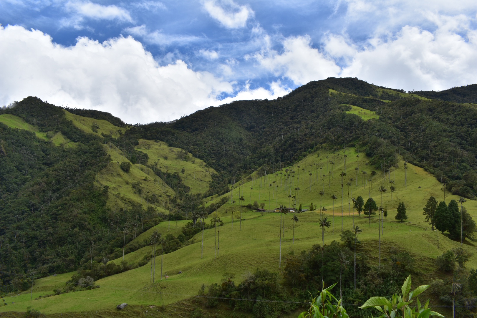
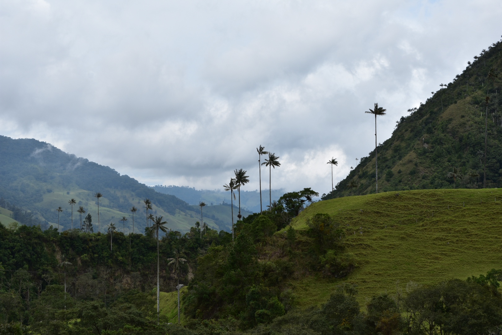
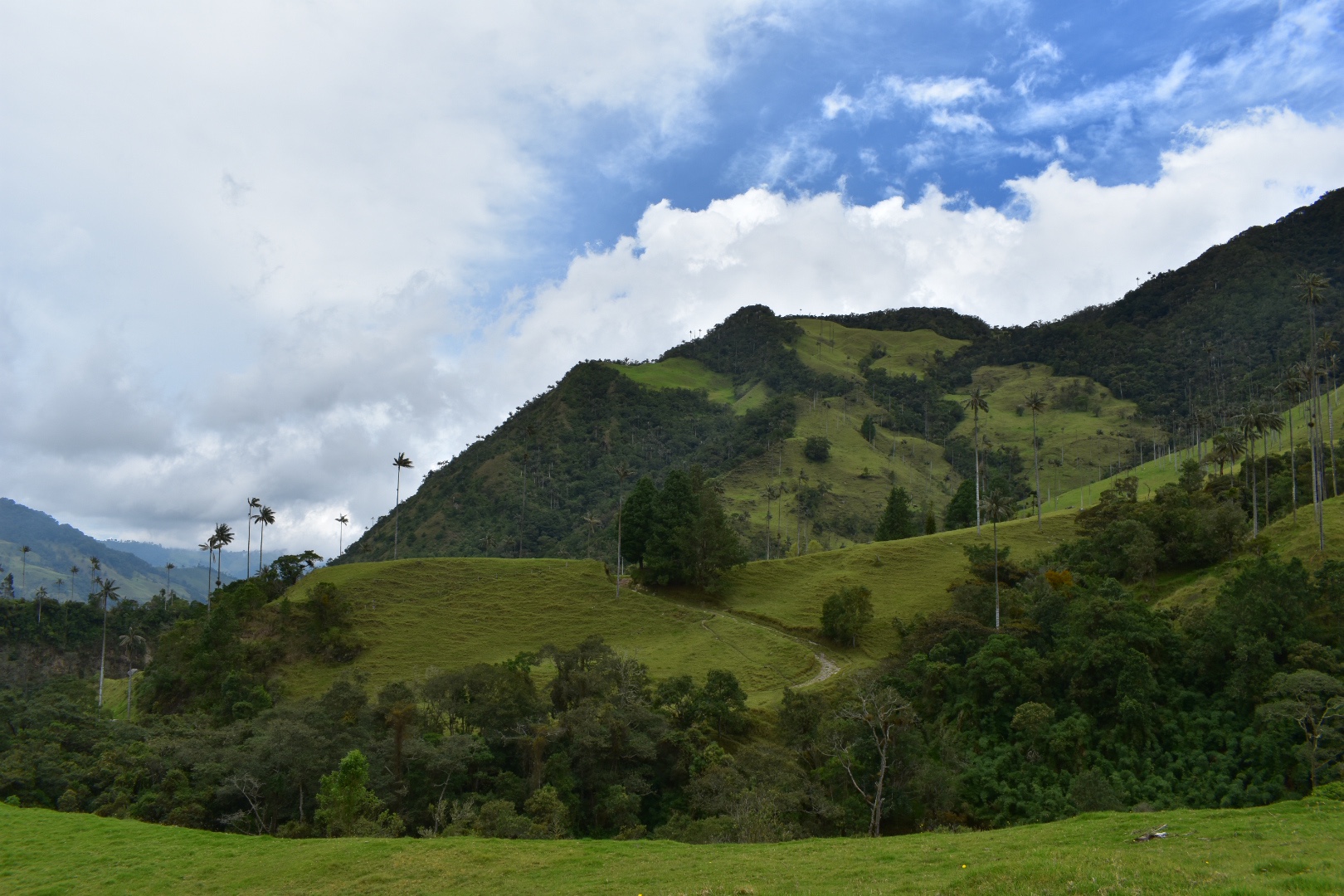
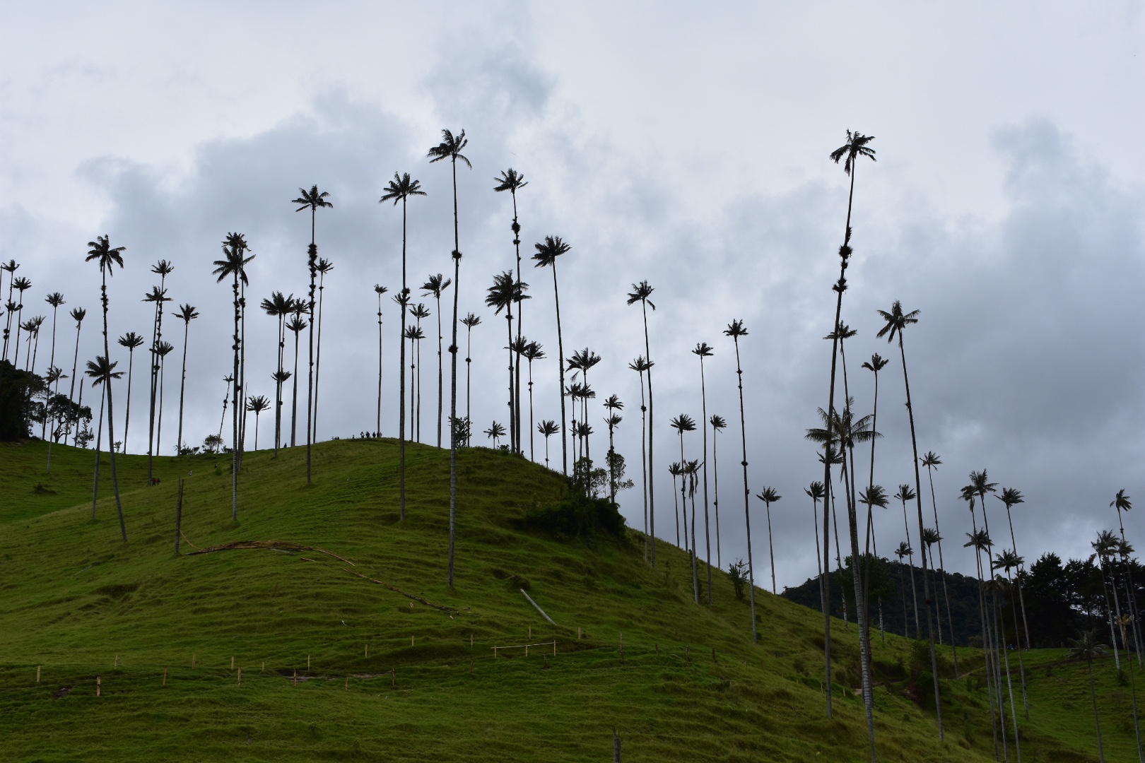
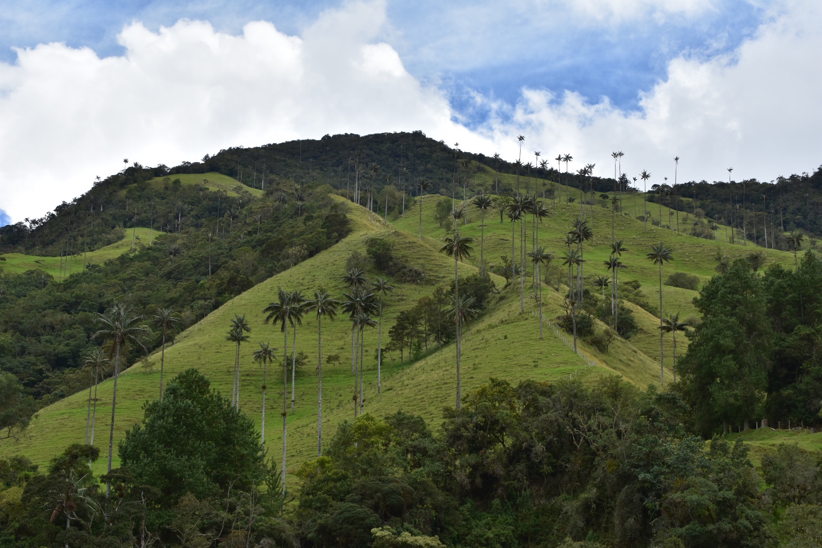
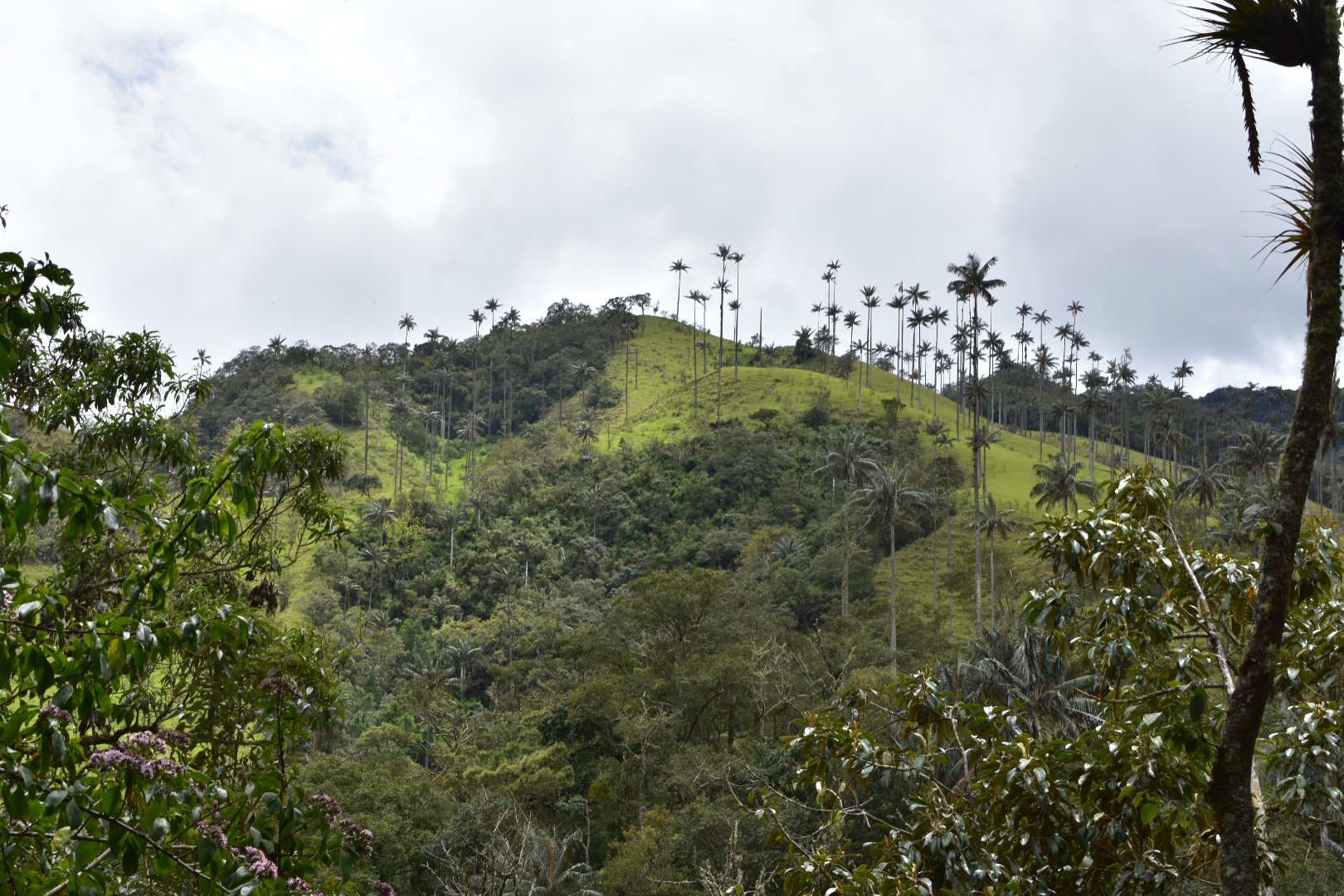
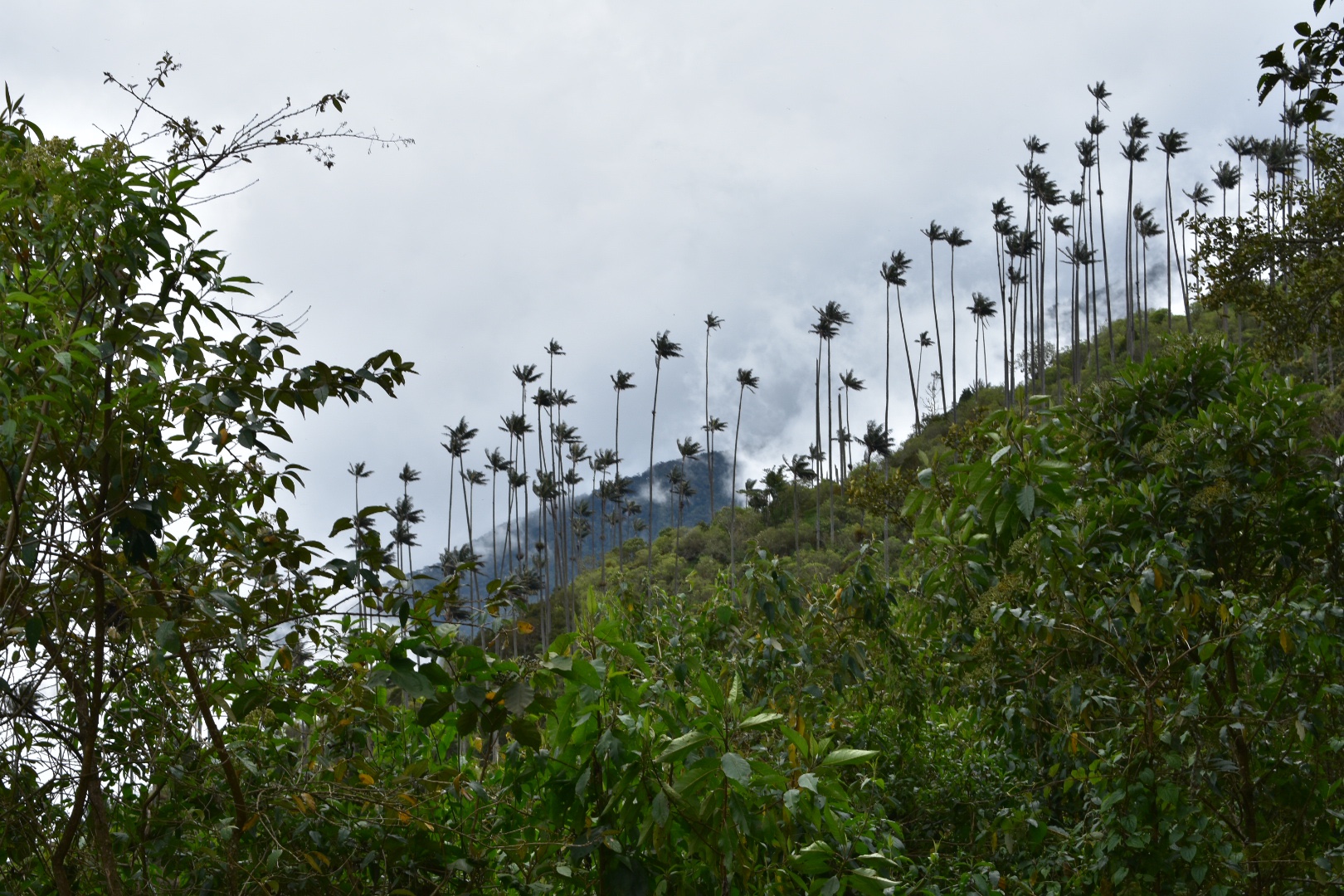
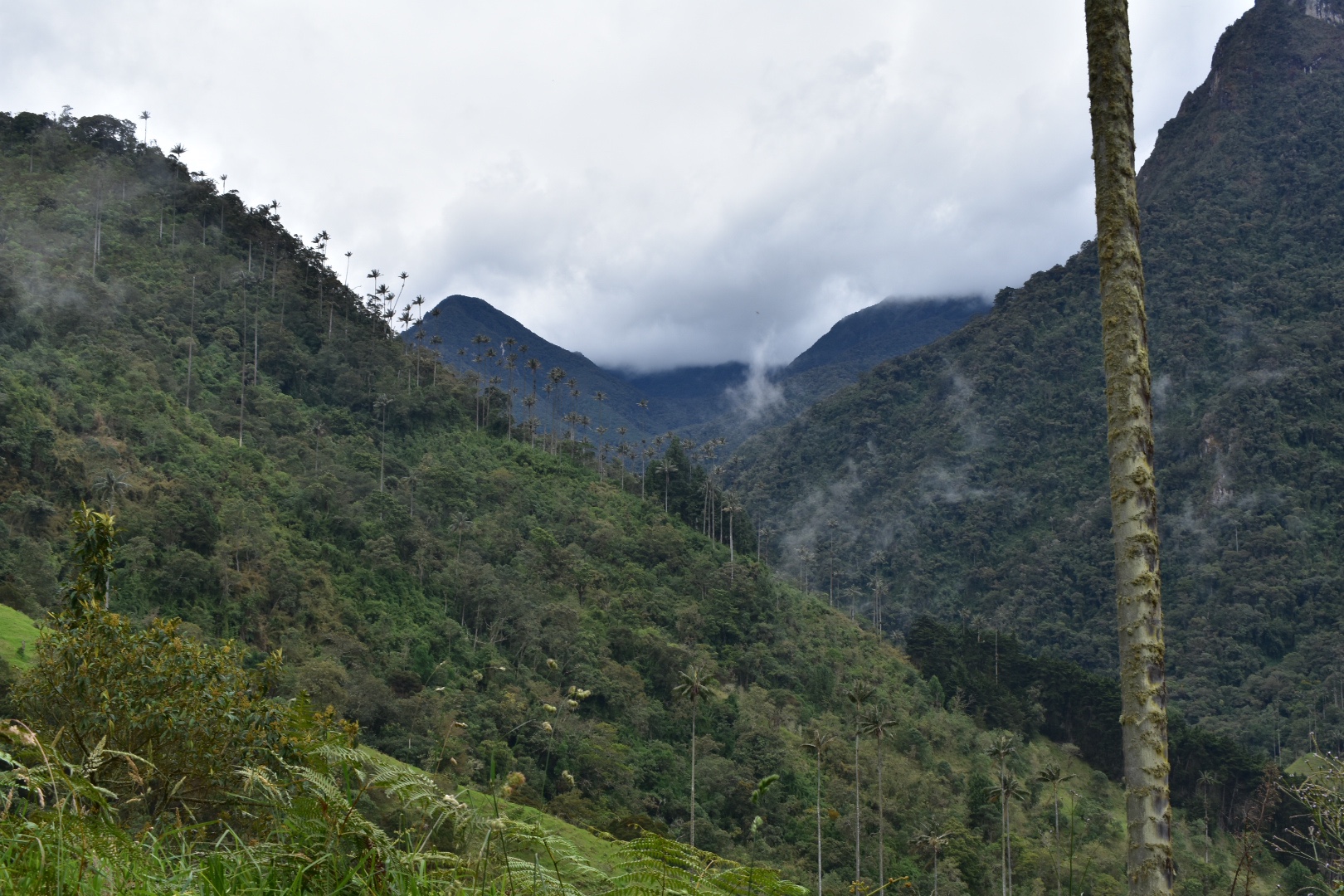
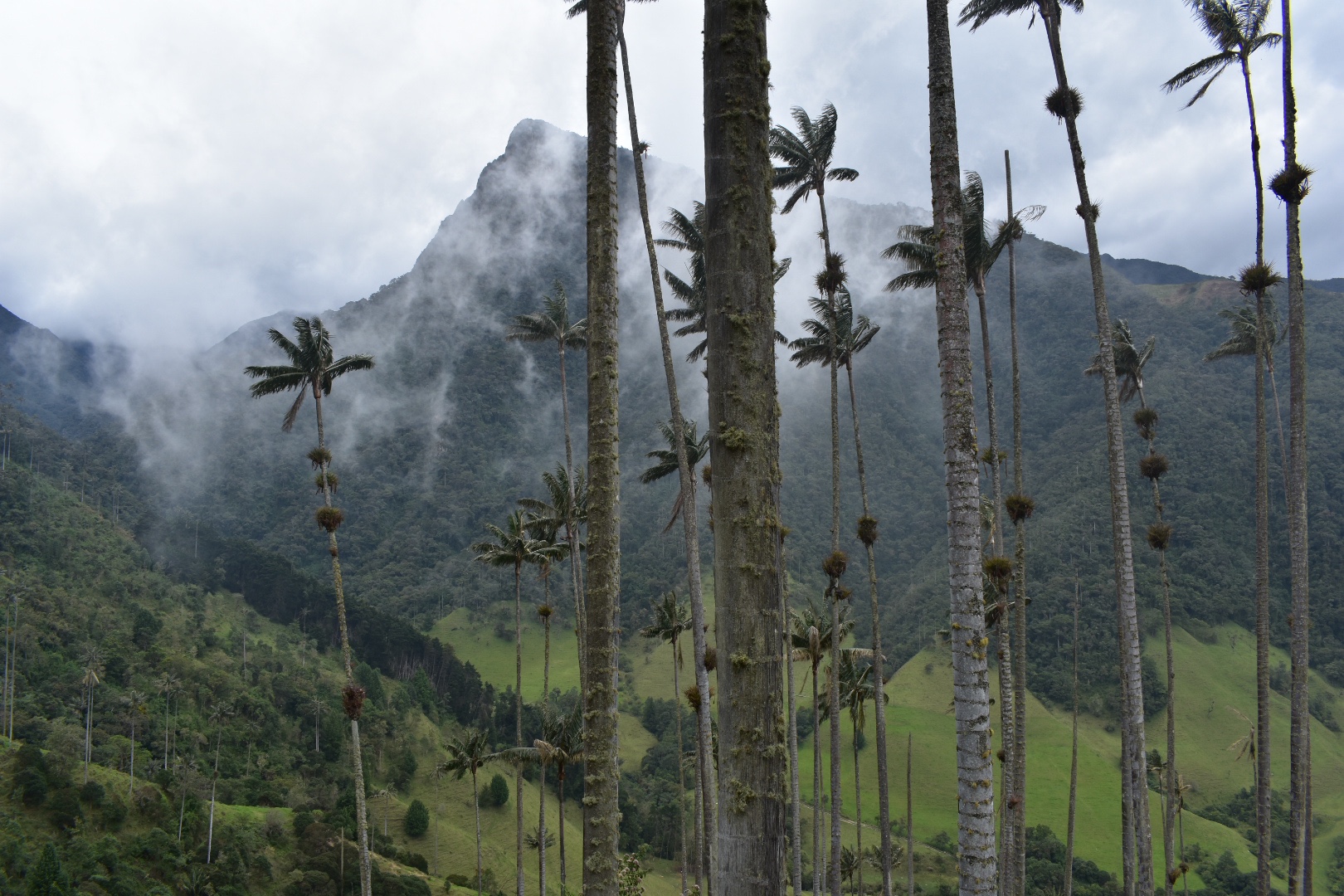
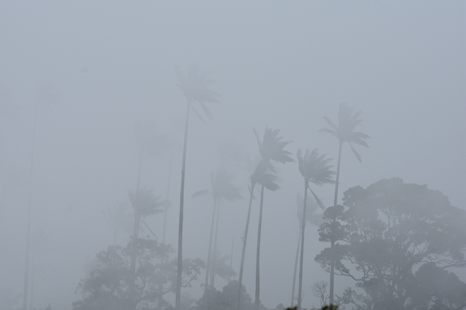
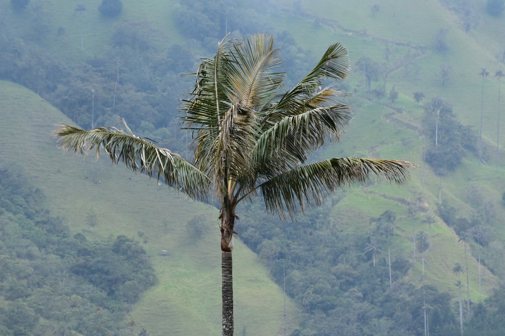
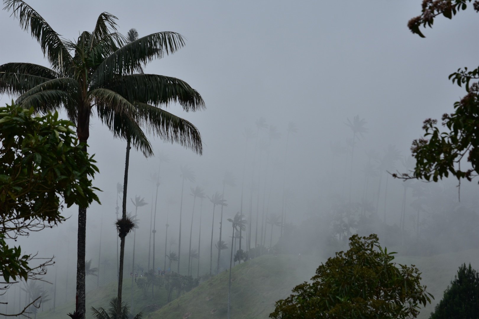
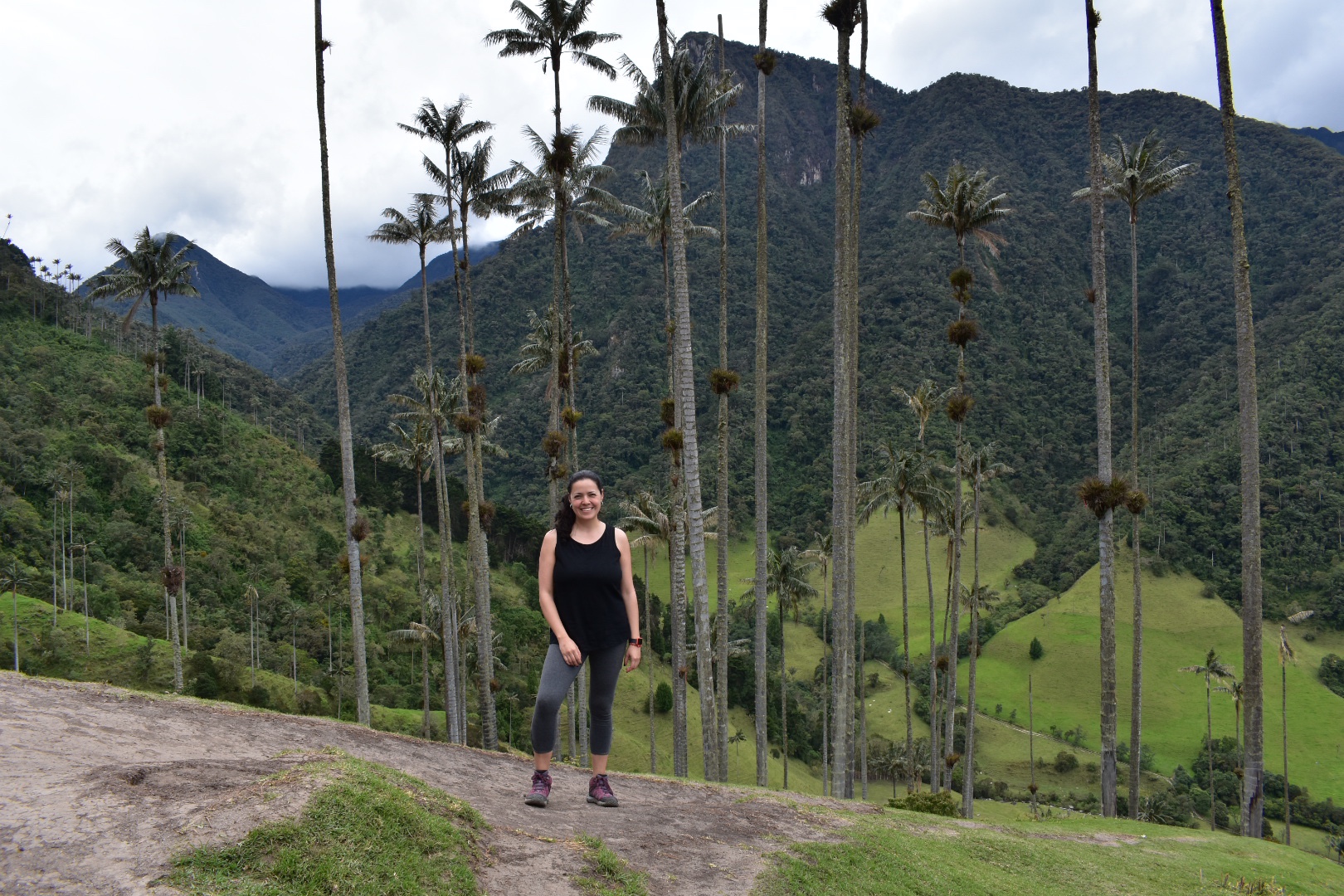
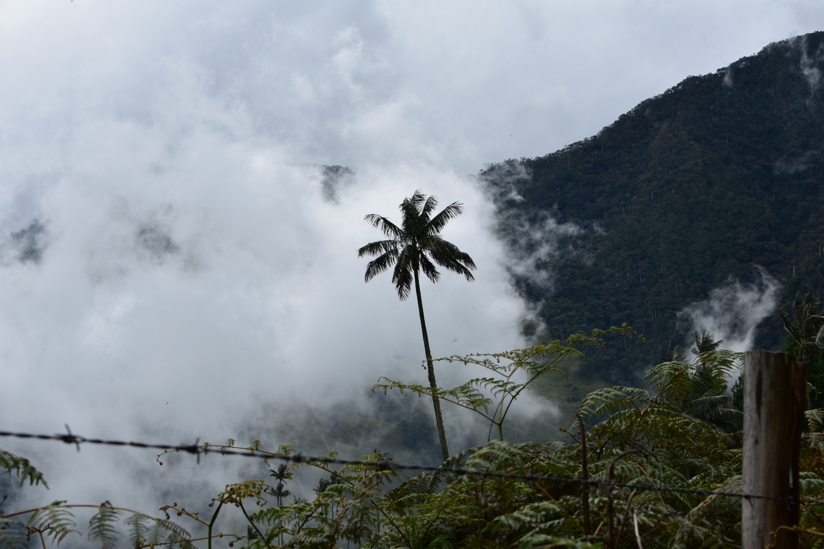
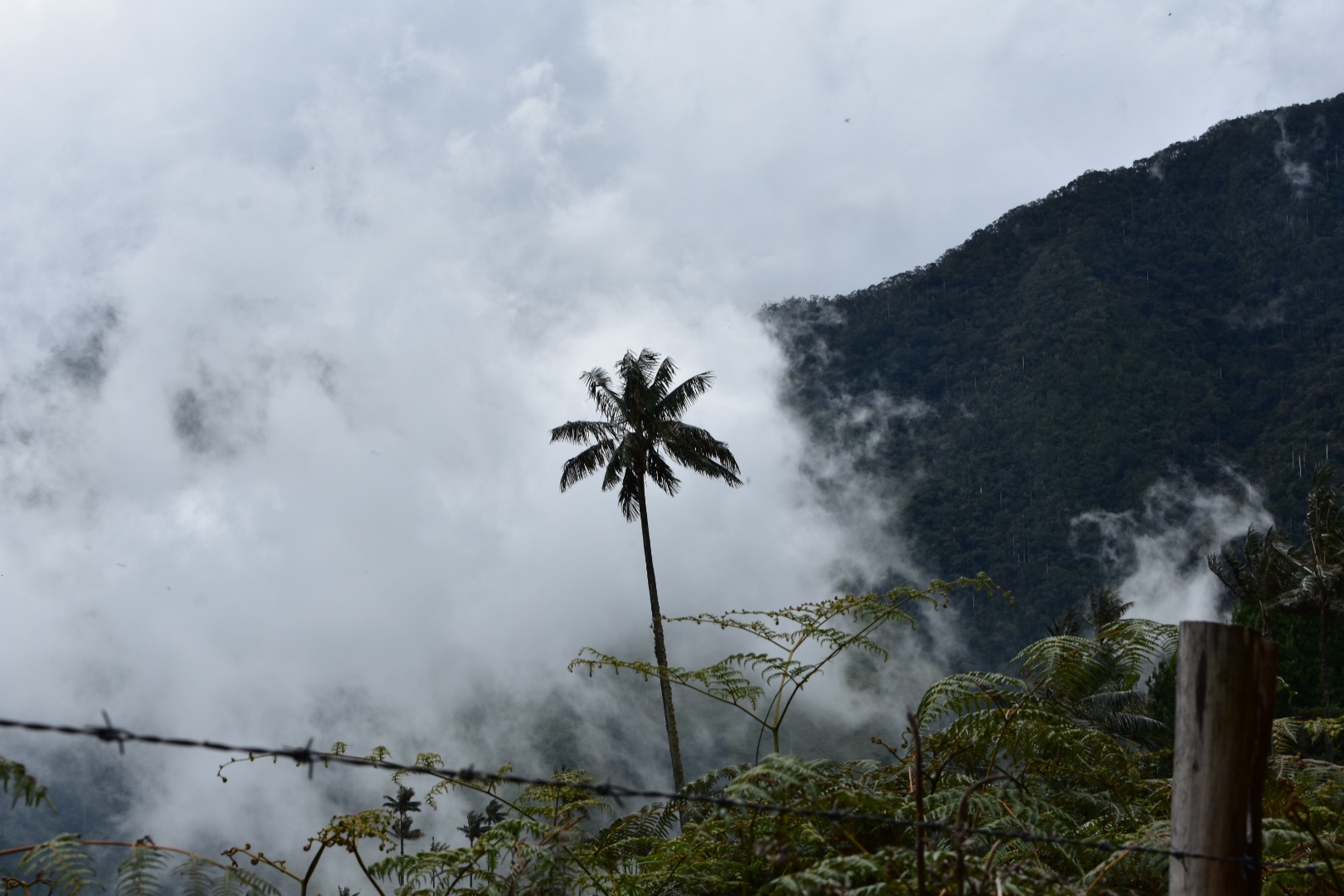
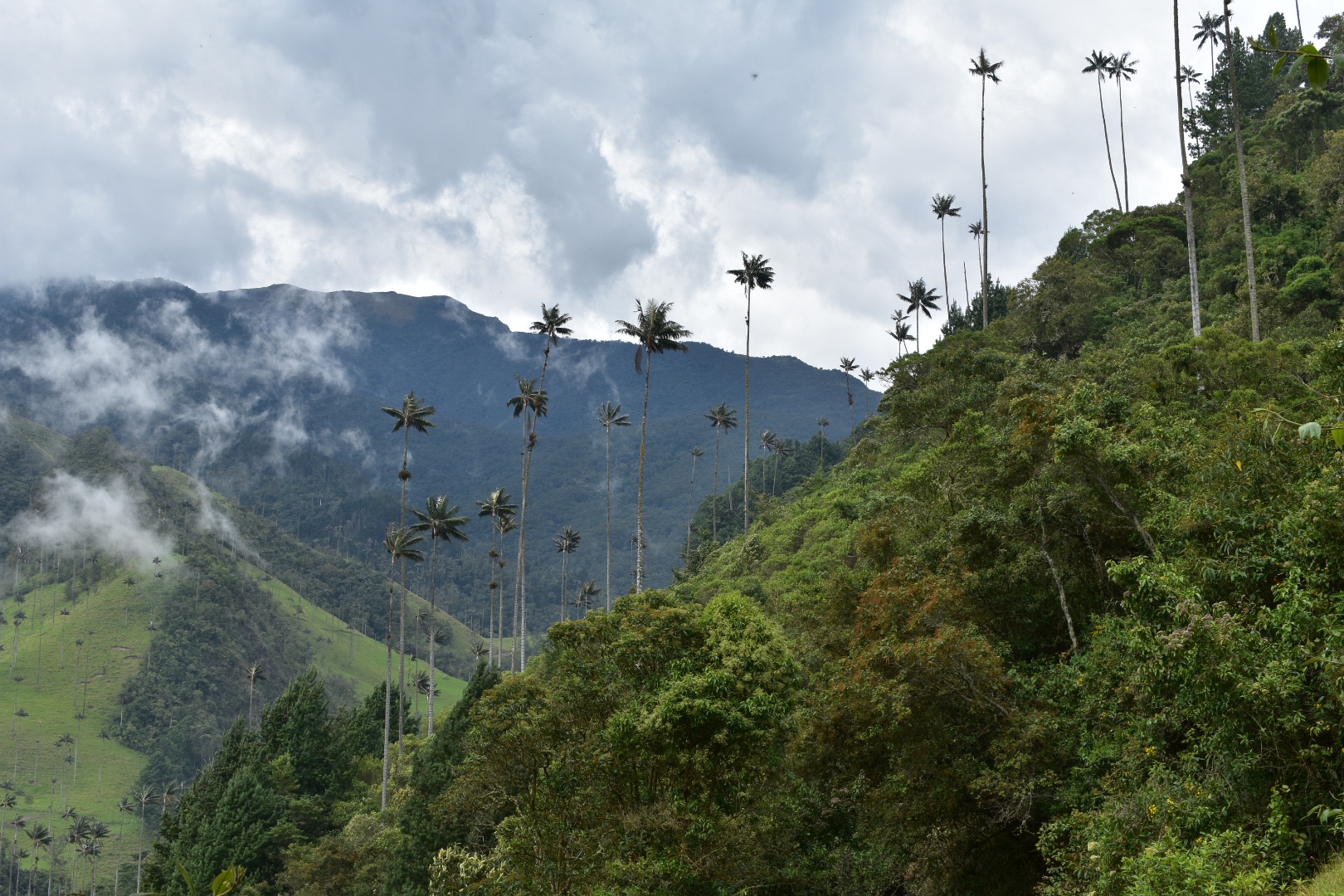
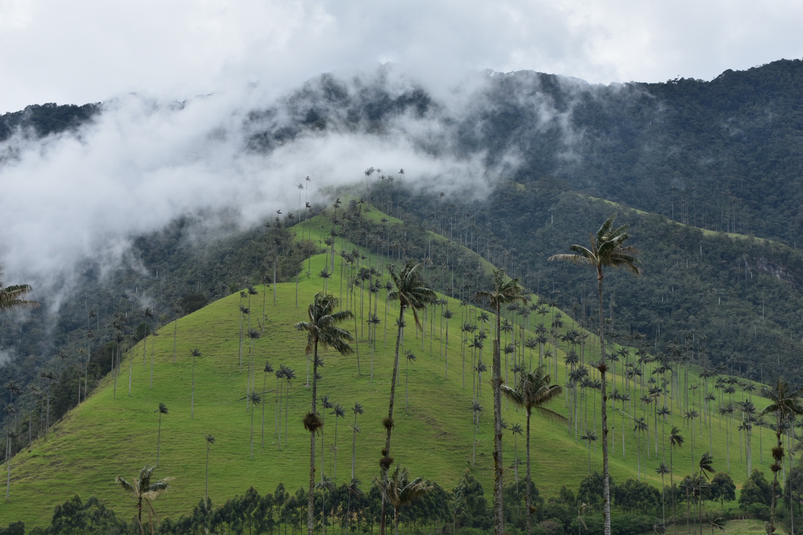
When I had travelled through Colombia at the end of 2018 one of the key places I had missed was Valle de Cocora and the worlds tallest Palm Trees. Instead I took in some more off the beaten track sights such as the Tatoca Desert, Cano Cristales and the white peaks at El Cucuy. So when I found out Colombia had lots of holiday weekends coming up I thought this was a great time to go.

To get to the Valle de Cocora you need to go via Salento which is the main tourist town and you can get to Salento from Medellin, Cali or Bogotá via Pereira or Armenia. We opted to stay on Pereira as Angela’s uncle had a place there for us to stay. For a full travel guide scroll to the bottom of the post. Otherwise stick around for the photos.

I wanted to travel by bus which I prefer for several reasons, less carbon footprint and you get to see the scenery. Avid blog fans will know I’m not a fan of night busses because I don’t personally sleep, you can’t see anything out of the windows and you can’t see the scenario change. Nothing disorientate me more then getting to you destination at 4am and then having to wait around in the hostel for the room to be ready. But sadly as the journey takes 9 hours and I’m no longer travelling for 10 months where the days no longer matter I had to suck it up and take the overnight bus as Angela suggested. We did compromise for the journey back as I wanted to see the mountains.

So we arrived at the main bus terminal at around 8am on the Thursday evening for our 8:30 bus which cost $53000. Most on this route were around $70000 but this time was cheaper for some reason. It took around 2 hours to leave the city due to traffic during which time these two guys came on board selling everything you would never think of and I ended up buying a LED camp light-don’t ask. Soon we were winding our way along mountain roads, but in the dark, and Angela and I soon fell asleep. A further problem with mountain roads is that they are really windy so you roll about a lot. It wasn’t the worst overnight bus I’ve taken and soon we were being woken in Pereina at 4am.

Tired and knowing there was no transport we jumped into a cab and arrived at Angela’s Uncles house. I was tasked with moving a cuckoo clock, which apparently didn’t work again and I locked it in the master bedroom. Best not for me to achieve tasks at 5am after being on a night bus. After I had failed miserably we went to sleep for a few more hours.

Having woken tired but hungry we decided to head into town and jumped on the first bus that passes our building. This took us towards the centre and after passing a mercado we decided to jump out and try some local food which meant a large breakfast for both of us was $10000. It was hot and we were tired so we grabbed some supplies and headed back to the apartment complex as it had a pool. What we didn’t realise is that the pool came with a no fun policy and we didn’t have the card to enter. Angela managed to talk our way in but we have to leave all the supplies outside. Despite being hot, and I was so happy to get some warmth after several weeks in Bogotá, the water was freezing.

I had to finish some work in the afternoon so after a few hours of work we decided to head to a mall to get some food. We found Frisby Chicken which is a Colombian version of KFC where the chicken tastes good and the prices are reasonable. The food court gave us panoramic views of the mountains and I started looking at all the ones I wanted to climb. Sadly for me on this trip it would be none.

We jumped on another random bus and headed into town managing to find the main plaza this time. After a little wondering and buying some hiking supplies for the next day we grabbed a taxi back to the apartment. I got to meet Angela’s fabulous Aunty for the first time who saved my evening by going out on her motorcycle to pick up a large pizza, which no one would deliver despite being close. We has an early night as had decided to head to Salento early in the morning.

For some strange reason upon reaching the bus terminal I decided to speak in Spanish for the day. It’s not been repeated yet but I managed to ask where the counter was. Busses leave for Salento on the hour starting around 5am with the last one leaving around 7pm. The same is true for the return journey. The tickets cost $8000 each, one way. The bus was about to leave so we headed to the platform and jumped in joined by a mix of Gringos and locals. This place is firmly on the trail.

If you want to head straight to the Cócora Valley then head to the main plaza where there are jeeps that will take you to the valley, 11km away. There are a handful of shops and restaurants in the valley but if you want to stock up this is the place to do it. Also bare in mind that the drivers in this region have a tendency to pile as much on to their keeps as they possibly can. This includes people. So you might be coerced into holding on to the back. It seems unfair that these passengers are charged the same and Angela had no interest in doing it. Colombia is not known for its road safety so if a Colombian won’t do it then there is no way I am going to!

The journey is not shout either, I’d guess around 30 minutes which is a long time to be hanging off the back of a moving car. But we arrived and there was a smattering of blue sky and straight away you can see the Palm Trees. When you get dropped off there are a few restaurants and shops which are expensive. My advice is to move on to the next lot which are a little cheaper.

I stopped to take a few photos and Angela had some tinto before we set off. There are a lot of people taking horse rides, mostly without helmets. I’d suggest you avoid these and follow my suggestion as it will really take you away from the rest of the tourists.

We started by following the main track with everyone else and were treaded to some great views of the valley.

Then there was a sign pointing to a “Parque”, which turns out to be private property and a charge of $4000 pesos to enter and climb the hill. Angela didn’t want to pay and although my preferred Maps.me route was this way there were other paths mapped out so we followed one down to the river.

When you get there don’t try and cross on the road, slip on the moss and nearly dive head first down a waterfall like I did, just because you are feeling cocky wearing waterproof boots. No look for the actual path and cross the river using the completely totally 100% safe bridges.

Following the track you will find a lot of people on horseback but when you reach the river and take the path then you will be away from everyone. The path is a 4km route over a mountain ridge and back down again into the valley but it was good fun and gets you away from the crowds.

We met some butterfly friends.

After about 1.5km the path splits. The main path goes left and towards a waterfall and maybe even Parque Nacional Natural Los Nevados. There is a much smaller more overgrown trail that leads to the right. We took that one.

Although we had met three people on the path they had turned back and we were now alone. I wouldn’t recommend hiking this by yourself as although it’s perfectly fine and the path is well trodden I’m not sure how often it was trodden.

The path is steep and fairly punishing, to which you can add the heat but it’s more that it’s a constant uphill with no flat parts.

But soon we reached the crest for a well earned break and from here it was all down hill as Angela painfully found out when she kept falling over.

We descended into the Cócora Valley and although it had turned a little grey we had some beautiful views.

As you get lower the path opens out to grassland and we soon rejoined the main track. We were unable to decide if we should turn right and pay the entrance fee or turn left and take a longer walk though the valley. Some hikers came down the road and I asked them where they had been. It seemed they had followed the path to the left that I wanted to take which was mostly in Cloud Forrest. So we decided to try and get in and see the famous views.

Despite being the quieter side of the park there were people ready to take our money and we continued our descent along the track. By the time we reached some of the photo spots the cloud had descended but it gave us some mysterious views.

And then we took some photos of ourselves, just to prove it was us.

And continues our journey down to the valley floor.

I really like here how you can see the cloud roll over the mountain.

We finally exited and had completed our loop so we headed back to the jeep drop off point with the hope of finding our way back. Some giant birds flew overhead so I did a photo shoot from the ground.

The jeeps leave as soon as they are full and we all piled in for the journey back. I’d booked the bus for 6pm which wasn’t too late so we had time for dinner. Angela wanted chicharrón so we found a local restaurant and I had pork covered in a sweet and sour esq salsa. It was huge and after a tiring hike we washed it all down with several beers before getting the bus back to Pereira. And before we go here are some shots of Salento.

We headed back and had the pregnant to ourselves but were tired and headed straight to bed.

The following day we decided to try and visit Filandia local town but the roads were closed due to a cycle race. Instead we chose to visit Santa Rosa de Cable, which sounds more beautiful than it actually was. I wouldn’t overly recommend taking the trip although the region is known for its chorizo and we had some good sausage. We couldn’t stay long as we were due to visit Angela’s aunt that afternoon in Vierbo. The bus had a fun gear stick warmer and it was nice enough but nothing spectacular to recommend to tourists-unless you want to see a small town set in a valley surrounded by huge mountains.

Back at the house we were treated to a traditional lunch of Sancocho and I conducted a photo shoot with some perritos before we headed back to Pereira.

Upon arrival Angel’s other uncle had arrived so we sunk some beers before heading to bed and getting the bus back to Bogota the next day. This time I had opted for a day bus which was 9 hours so I could see the mountains. The most interesting thing that I was was a half built and long deserted road that would replace the main highway. It was crazy to see how much work had been completed with miles of bridges and tunnels having been dug but look long since abandoned. Around lunch time we did stop off for an hour and had some delicious pollo, con papas, con arroz con fréjoles.

How to get to Valle de Cocora from Bogotá

Unfortunately there are no direct busses from Bogotá, so you need to travel to either Pereira or Armenia via Salento. There are more busses to Salento from Armenia.

You will need to get a bus from the main Southern Terminal in Bogotá, Terminal de Transporte Salitre. Busses leave frequently throughout the day and there is no need to book, you can just turn up. Expect to pay between $50-80,000 one way.

We went to Pereira and paid $50,000 booking in advance via Expreso Bolivariano. You could also try Fronteras, Flota Magdalena and Expreso Palmira. For Armenia you could try Expreso Palmira, Velotax and Fronteras. Both journeys take between 9-10 hours depending on traffic.

When you arrive in the terminal at Pereira busses leave for Salento every hour from 5am until 6pm. There is only one company that takes you there, Expresso Alcala, and the journey is around 45 minutes and costs $8000. The office is downstairs in the terminal near the main stairs leading to the upper floor.

From Armenia busses leave from 5:30am to 8pm every 20 minutes and the journey time is also around 45 minutes and the price is around $6000.

When you reach Salento the bus should drop you off near the centre of town. Head to the main plaza and you will find jeeps taking you to the valley for $4000 per person. They pile people into these jeeps and I’d advise that you skip hanging off the back as the journey is 20-25 minutes.

Page 2 of 3

Powered by WordPress & Theme by Anders Norén