Exploring Latin America πŸ‡¦πŸ‡· πŸ‡§πŸ‡΄ πŸ‡¨πŸ‡± πŸ‡¨πŸ‡΄ πŸ‡ͺπŸ‡¨ πŸ‡²πŸ‡½ πŸ‡΅πŸ‡ͺ πŸ‡ΊπŸ‡Ύ

Category: La Paz

Pico Austria, La Paz

I had been sent photos of the Pico Austria hike and after reading about it in the guide book I decided it was something that I needed to do. Again without really knowing anything and being a solo traveller I decided to book a guide. This is because the trail is 45km outside of La Paz and whist it is possible to take a taxi, I saw others doing the same, really you need a group to make it worthwhile.

I asked around for advice on travel agents and took a list from the guidebooks and headed into town on the Wednesday before the weekend I wanted to do the trek. The first one didn’t exist, the second one didn’t either but I found Inca Land Tours who were the closest agency to the address where the second travel agents were located. I went in and they said they they had a tour going on Sunday. I tried a couple of others for good measure and they were either more expensive/not running or a combination of the both. One agency gave me the number of another traveller and said we should work it out between ourselves. I messaged Inca the next day, they told me two other people were going and so I confirmed.

I had to be at their office for 7am. They normally pick up but I was staying in Jupapina which is to the south of the city. It meant I needed to be ready and in a taxi by 6:15. That all went smoothly and I arrived outside of their office before 7am. After waiting for 15minutes Simone arrived to let me in. I paid the 400bs and soon a driver and a guide arrived and I was put in the back of a minibus. We drove off and ten minutes later picked up my travel companion, a French lady, and we were off. She had booked the day before and was also told there were two other people going. I don’t know who these mysterious travellers were but they never showed.

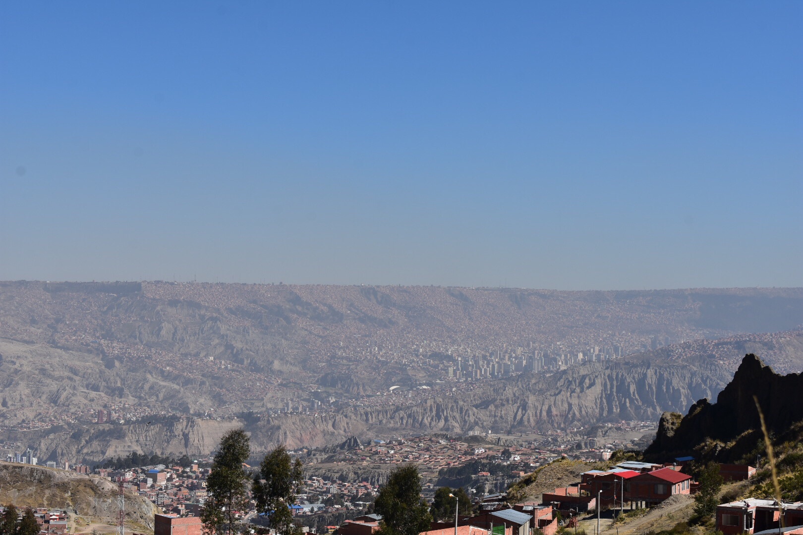
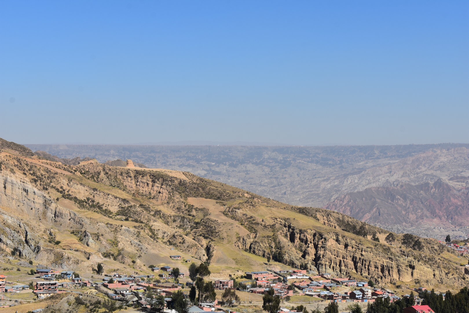
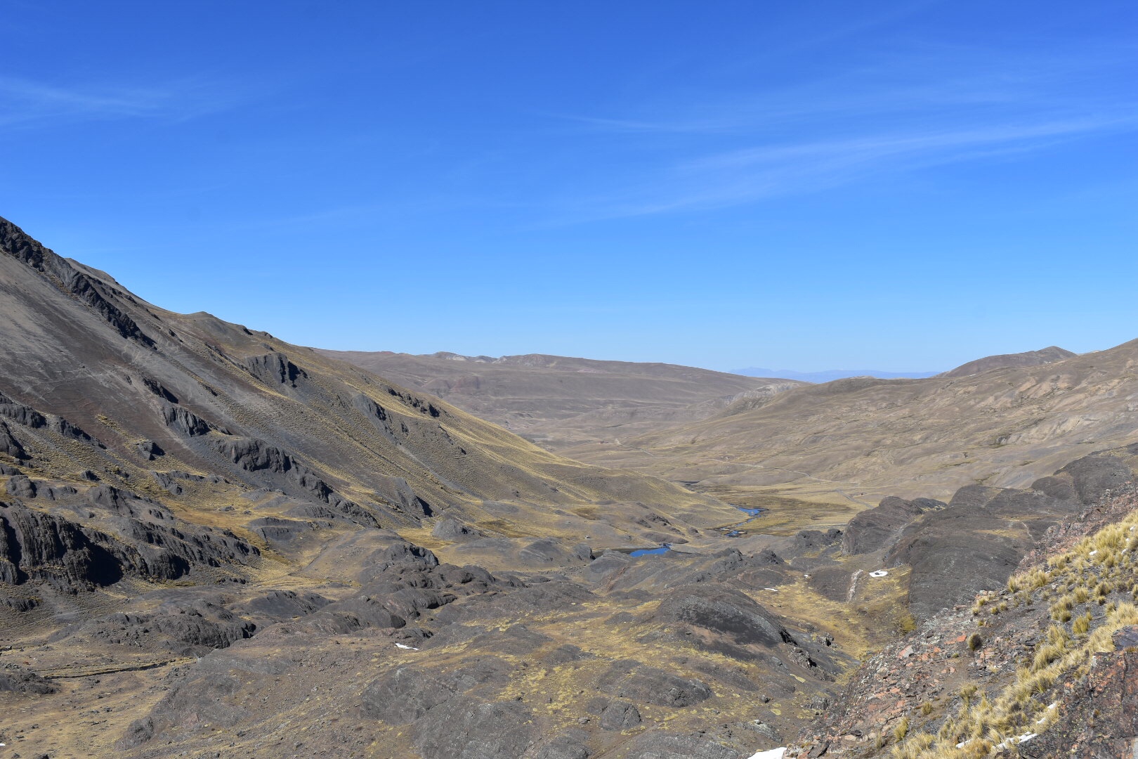
It took just under an hour to leave La Paz and soon after we arrived at a dirt track which we would follow for the second hour of the journey to the drop off point at 4400 metres. We got our, put on sun cream and all the other necesites and I quickly realised that I had overdressed and packed as it was not as cold as I thought and being dry season there was not a cloud in sight.

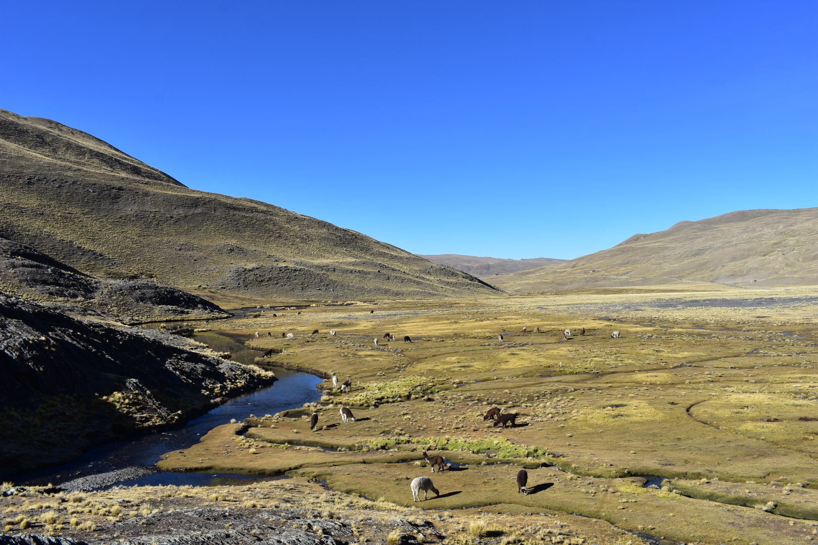
We started off in some llama fields and I quickly took some photos. I did end up lagging behind most of the way up as I stopped to take photos. There wasn’t much opportunity other than the viewpoints but I suppose we needed to get up and get back before dark. And if I’m honest I’m glad we weren’t driving back in the dark.

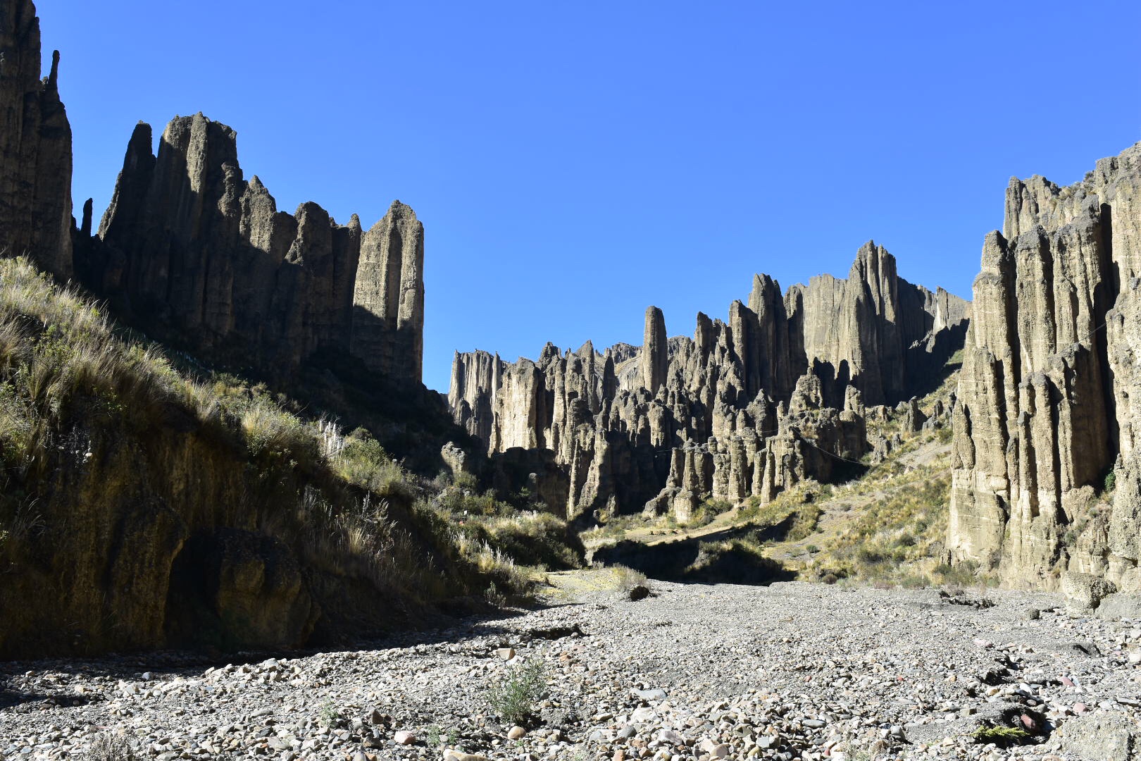
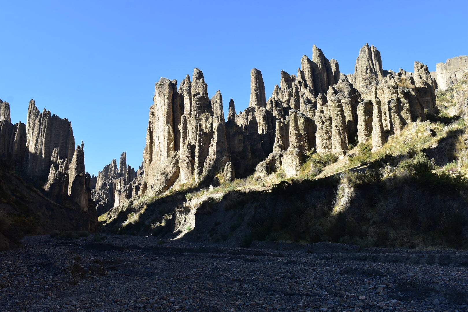
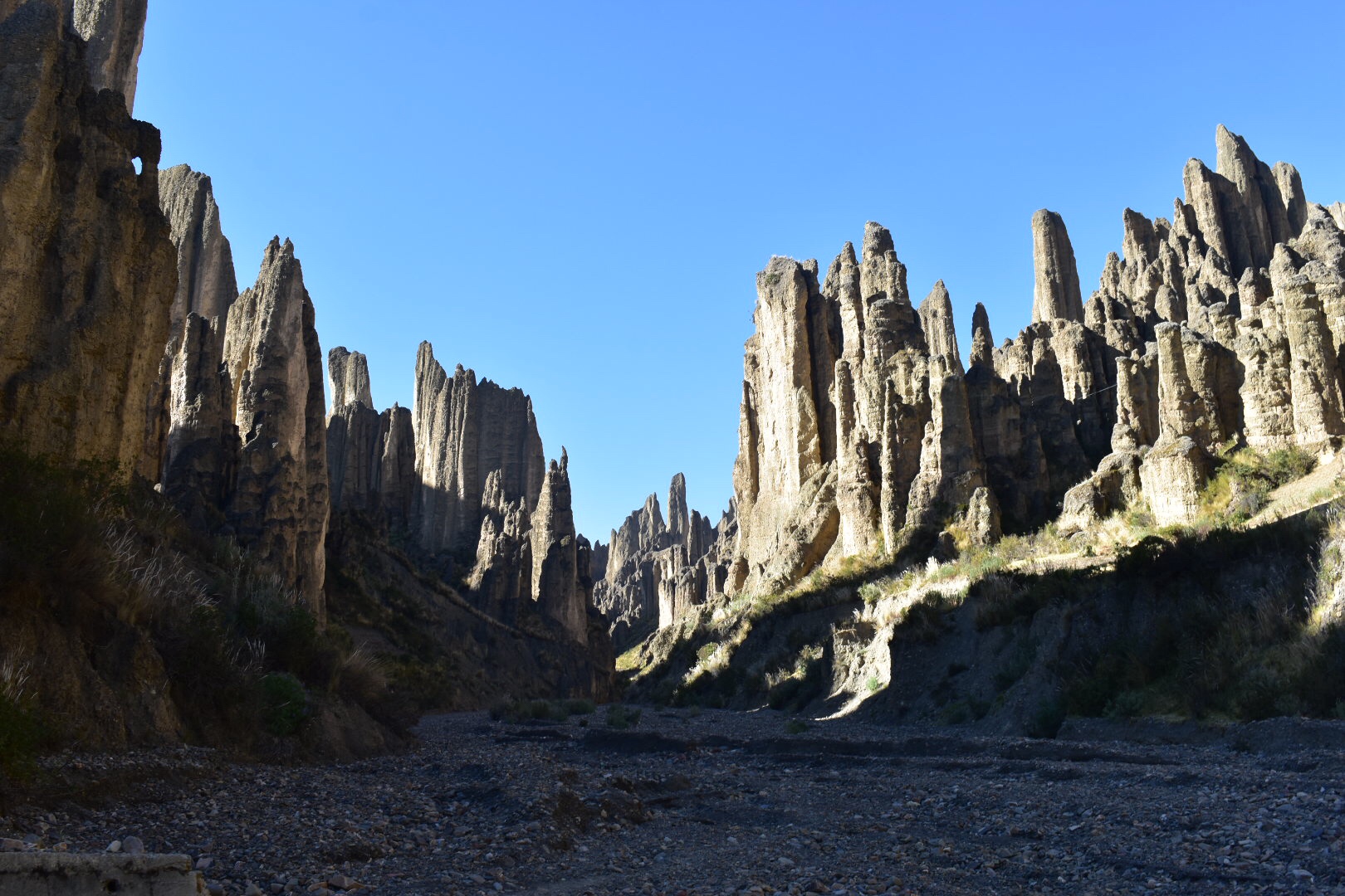
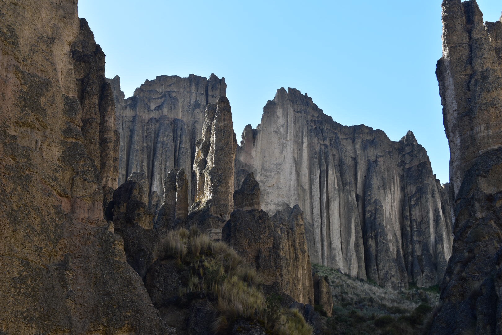
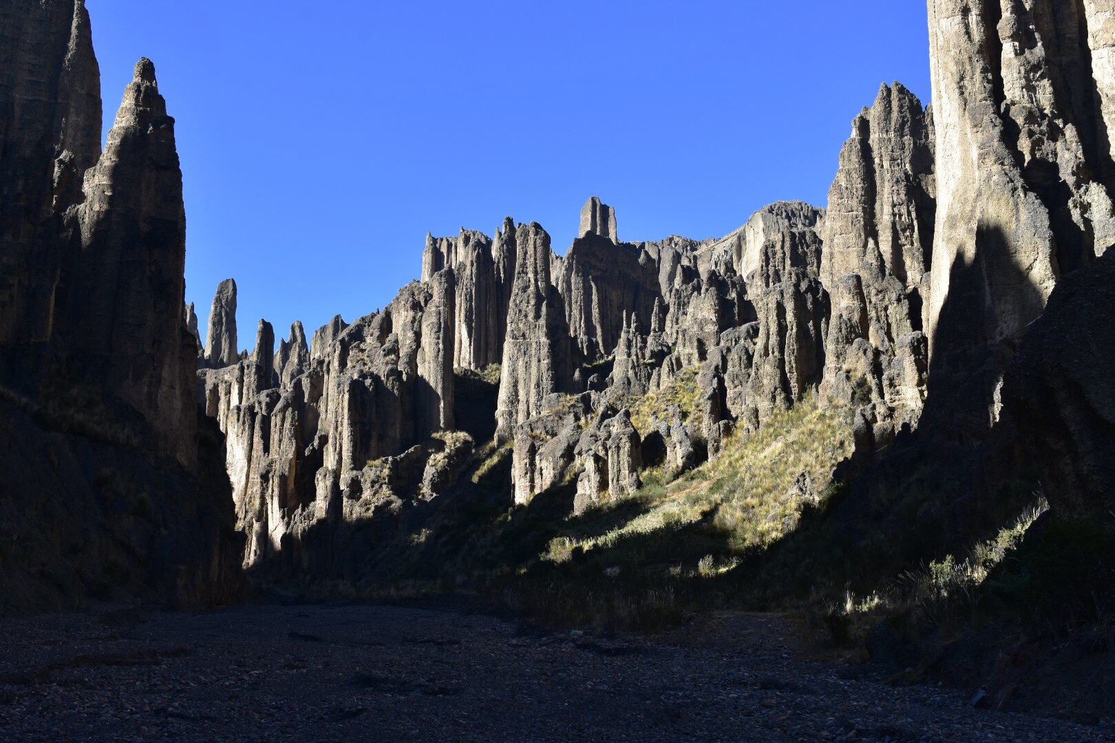
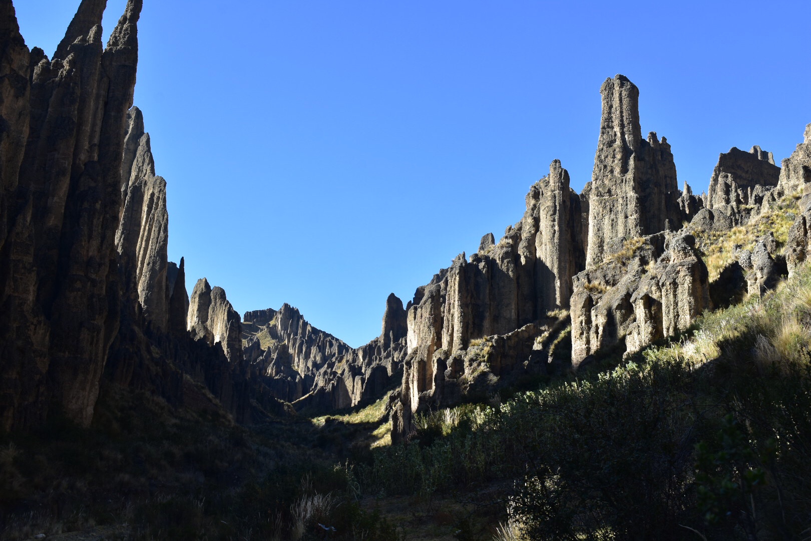
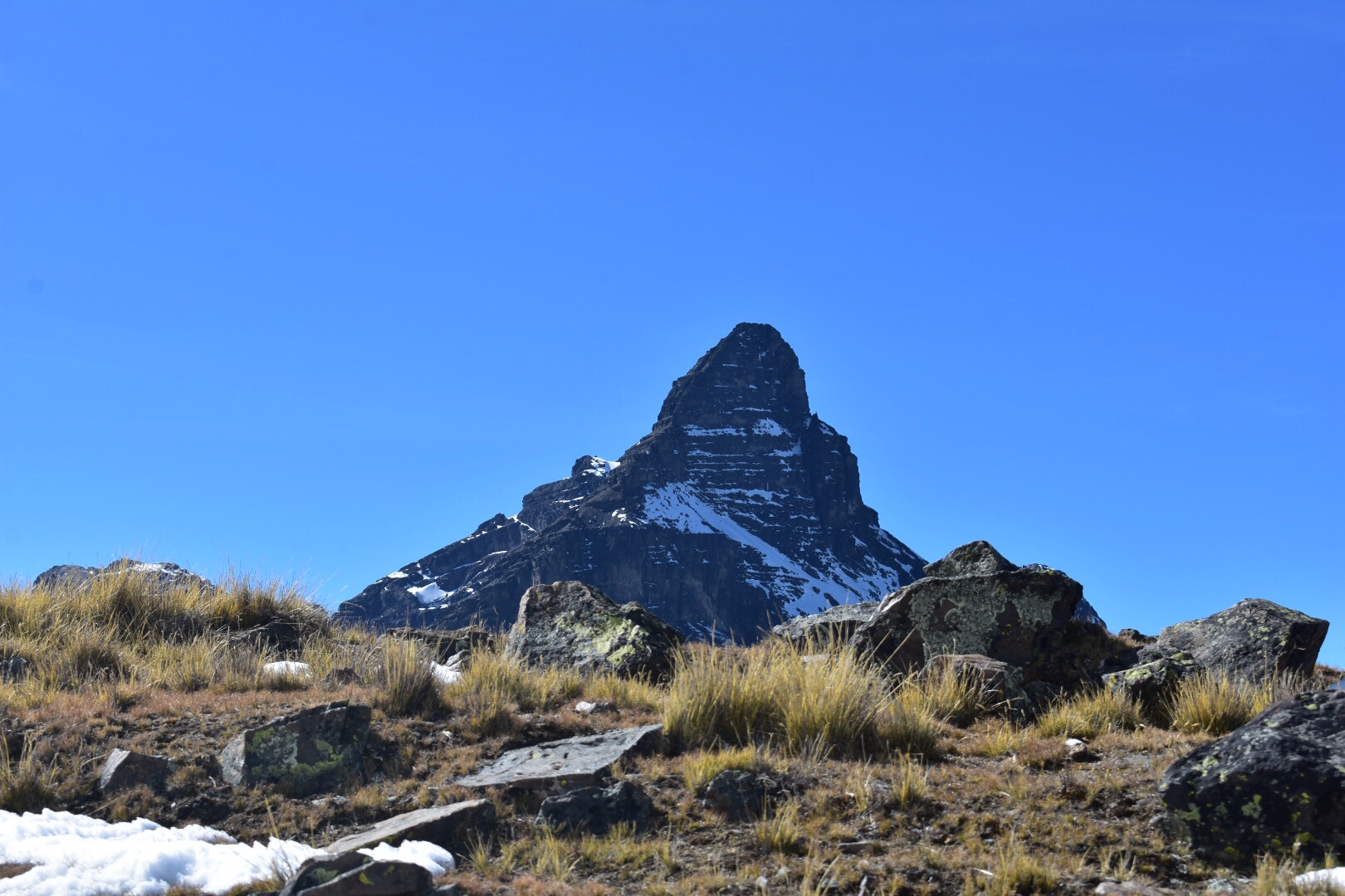
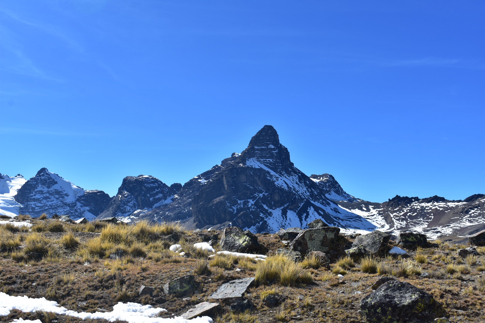
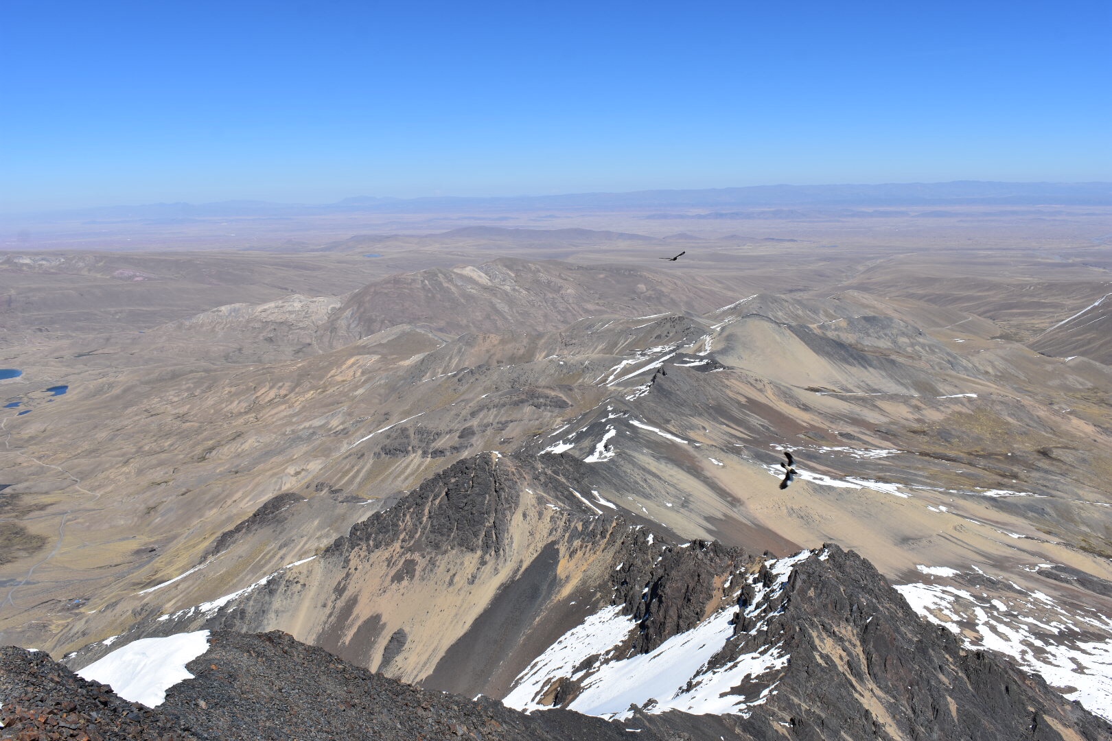
As we rounded the first big corner I got my first proper site of the mountain range.

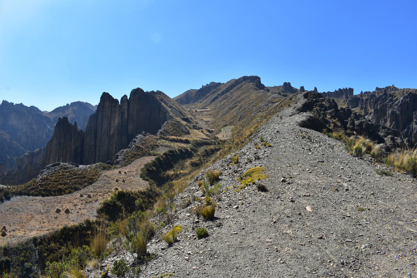
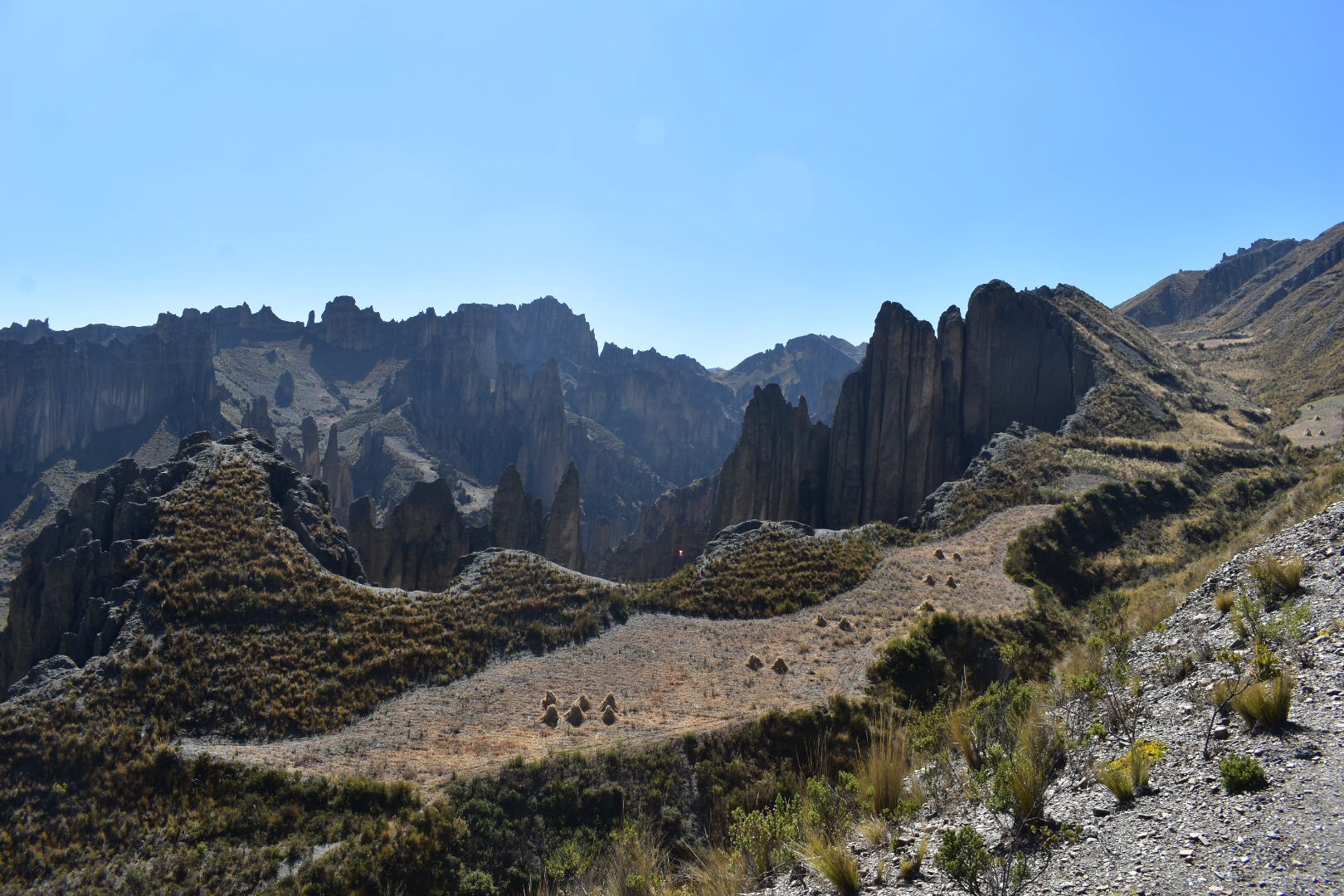
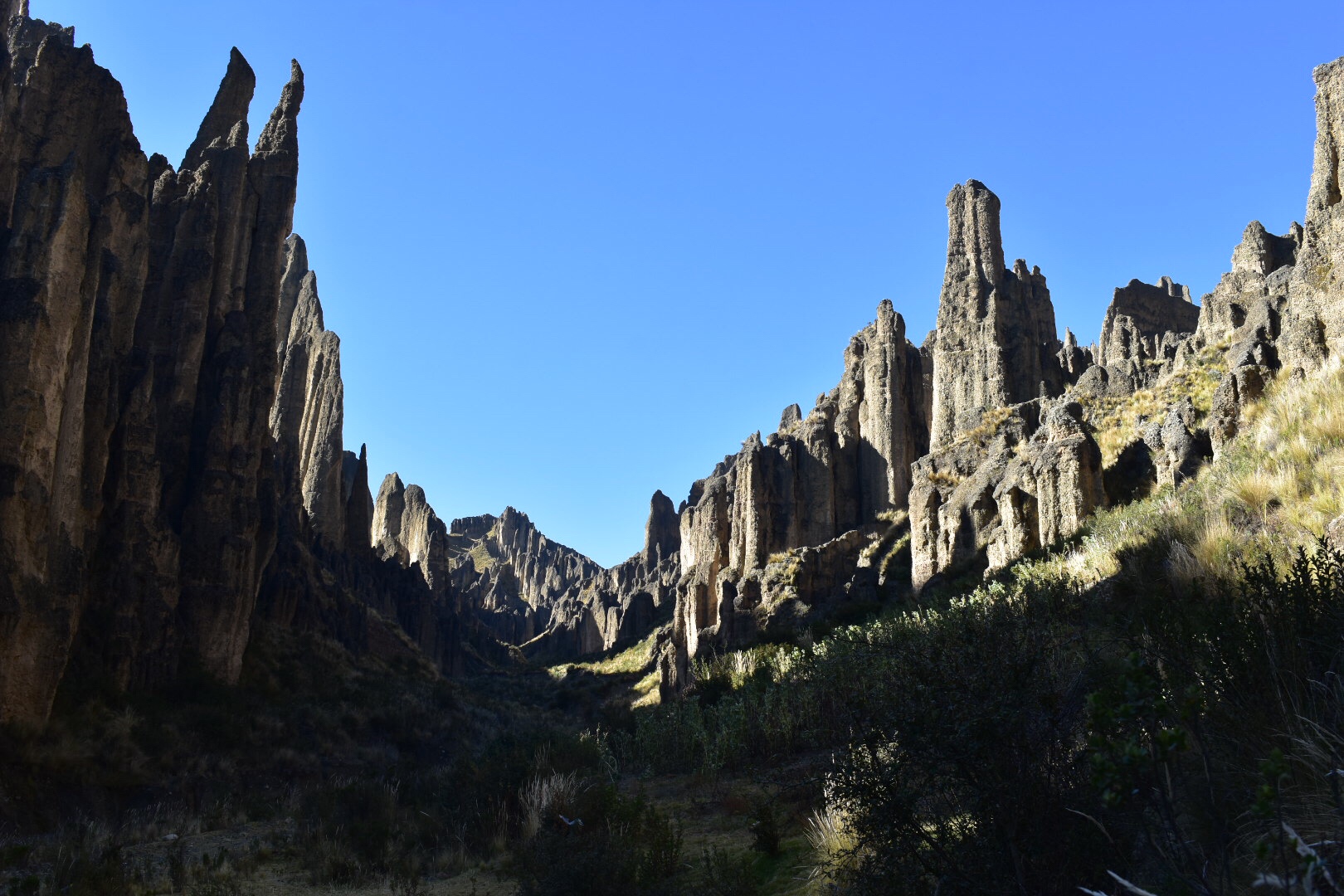
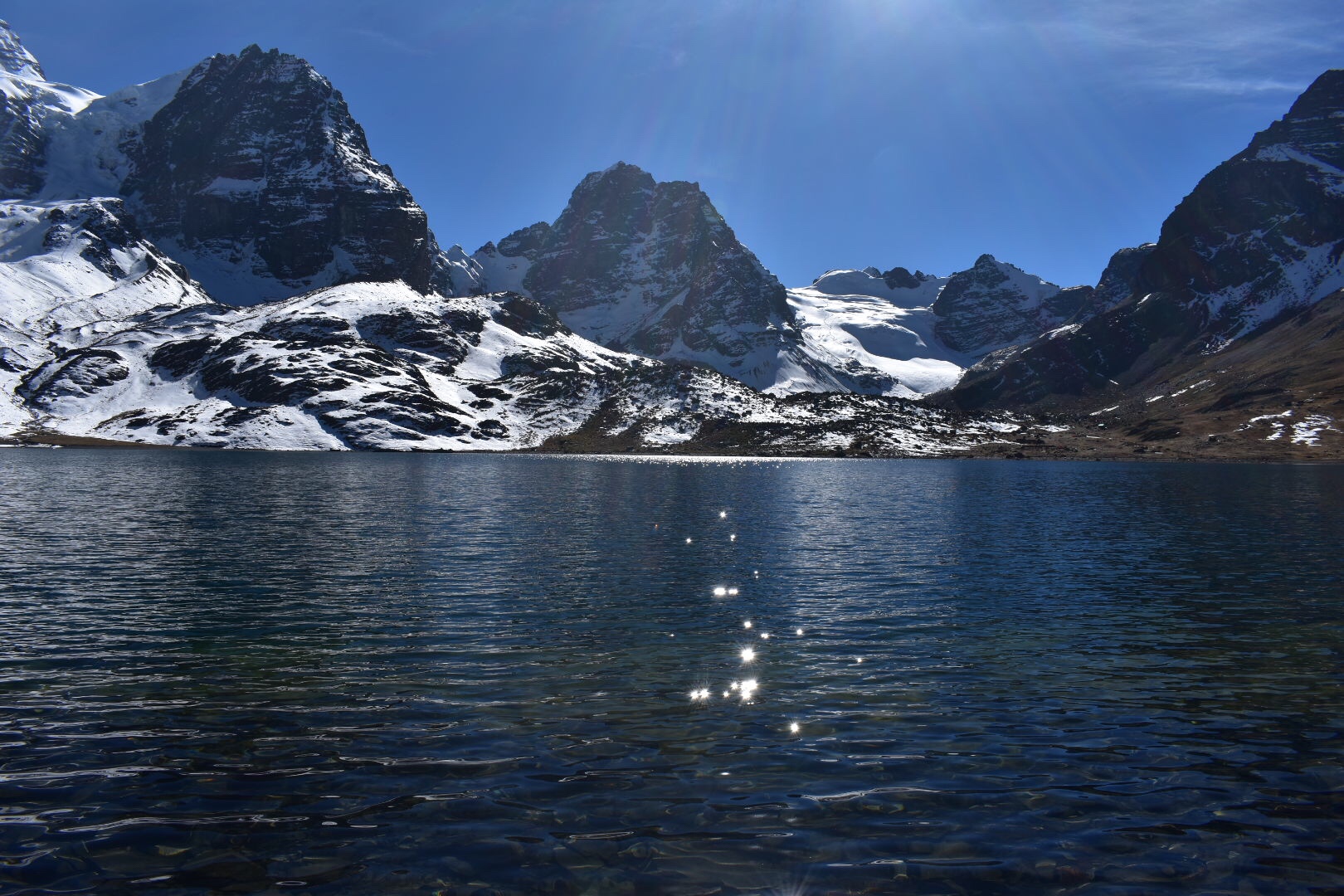
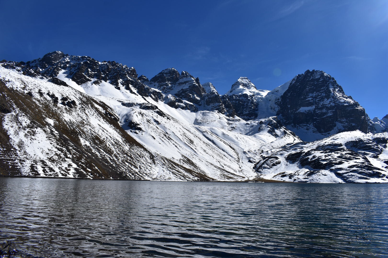
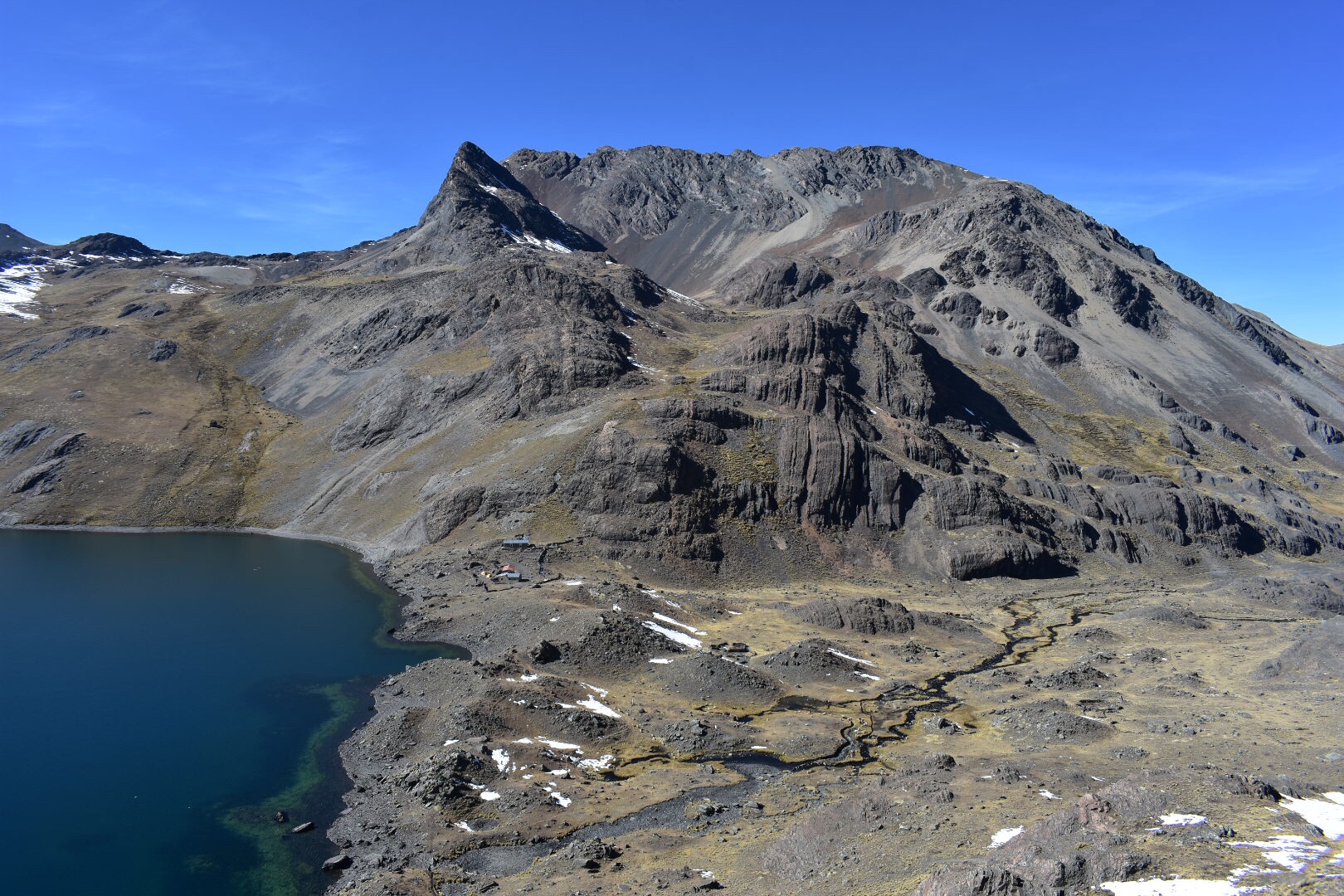
It wasn’t long before we reached the first lake, Laguna Khauan Khota, and we stopped to snap a few photos before moving swiftly on. Here we saw a couple of other hikers who didn’t take a tour guide. I would argue that you don’t need a guide for this trek but whatever you do done go alone. Again all the trails are clearly marked on Maps.me. We saw somewhere between 20-30 people on the trial all day. Most were on tours and while the path is relatively easy to follow there are some scary parts, well for me, as you will see below. I think I a group you will be fine as the guide didn’t really do anything to stop us from falling. That’s not a criticism as I don’t really see what he could have done although he did try and show us the best path to take. I think you could find your own way easy enough.

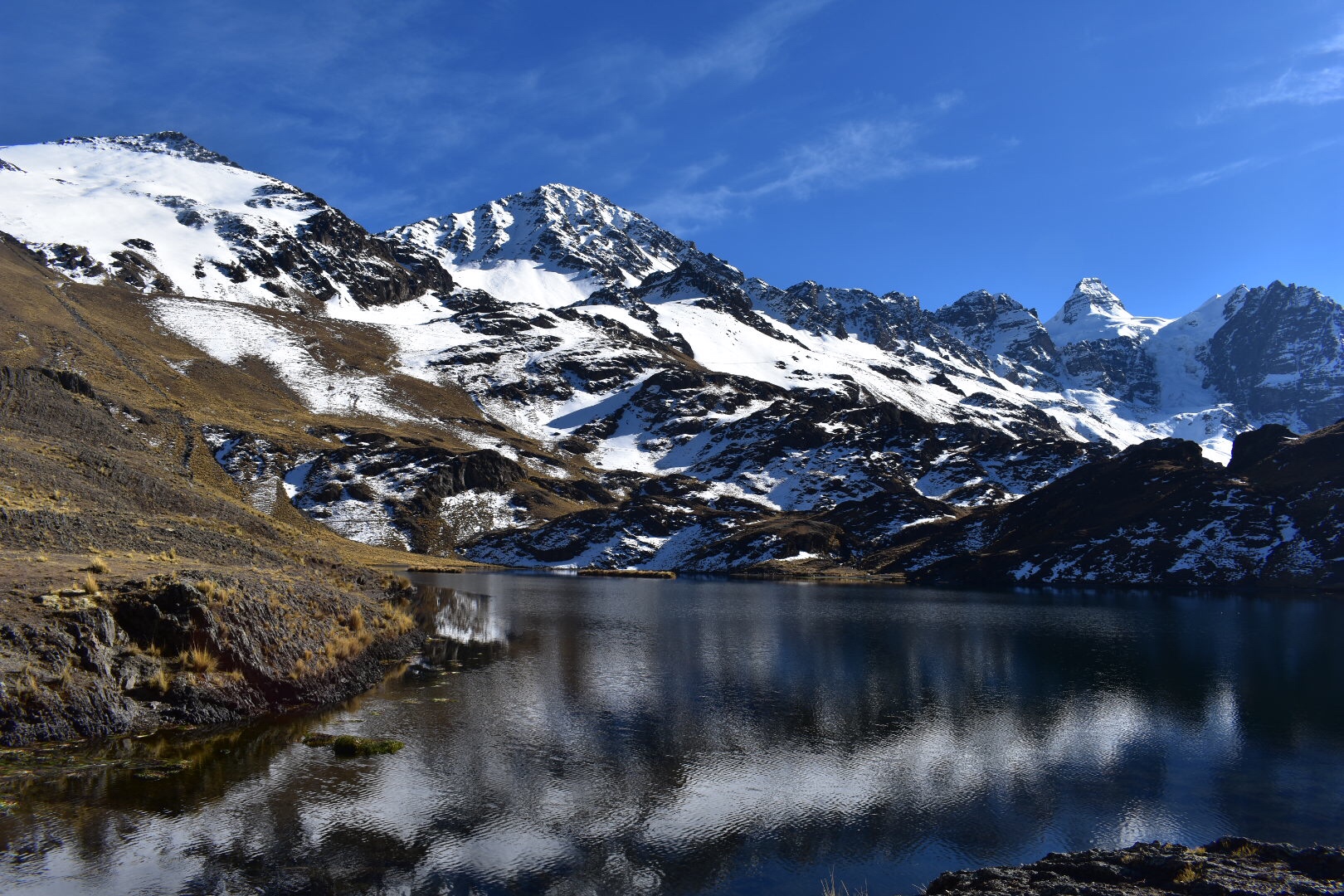
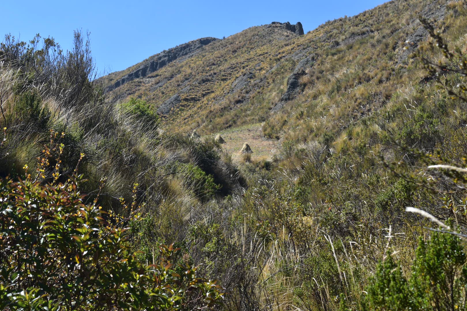
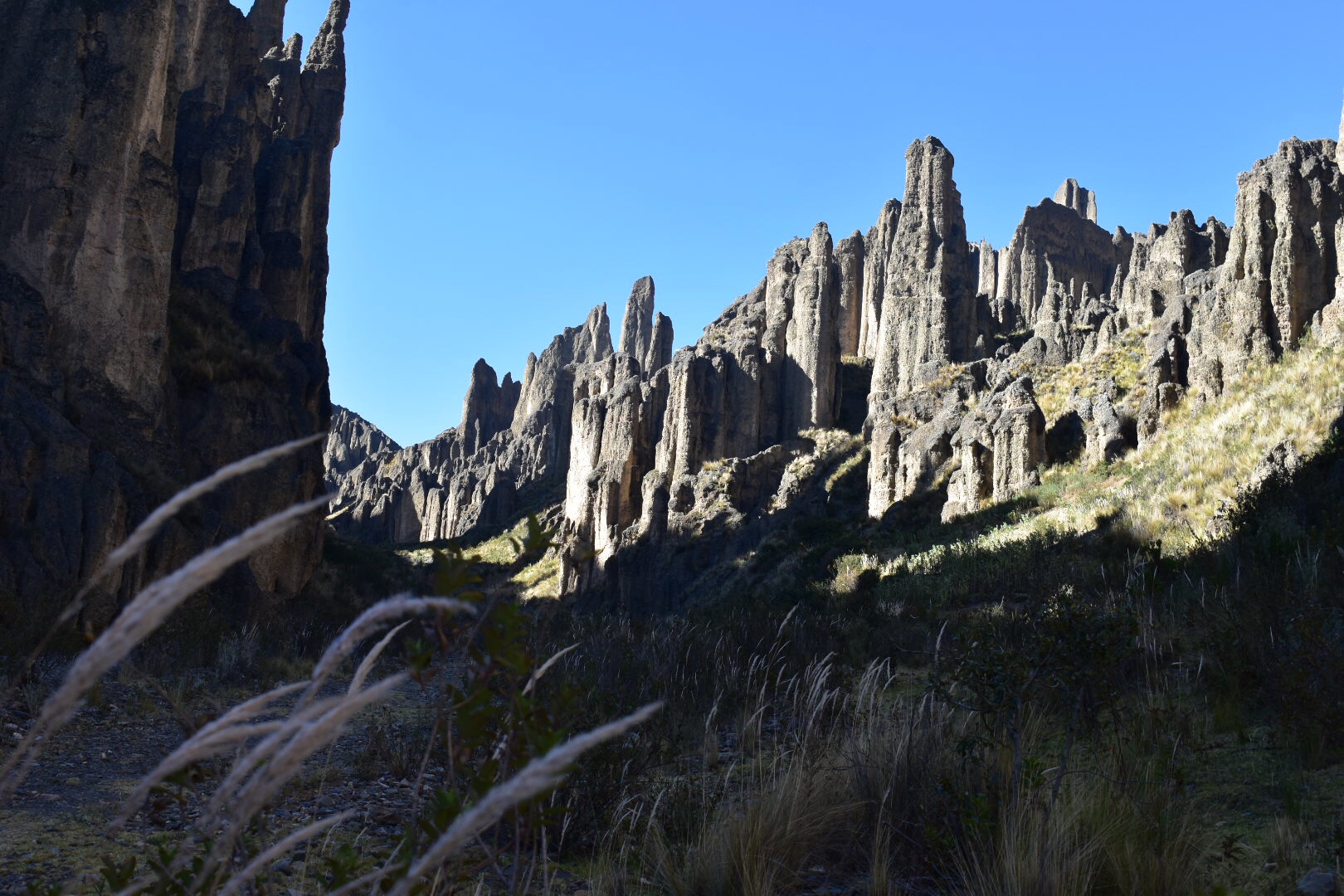
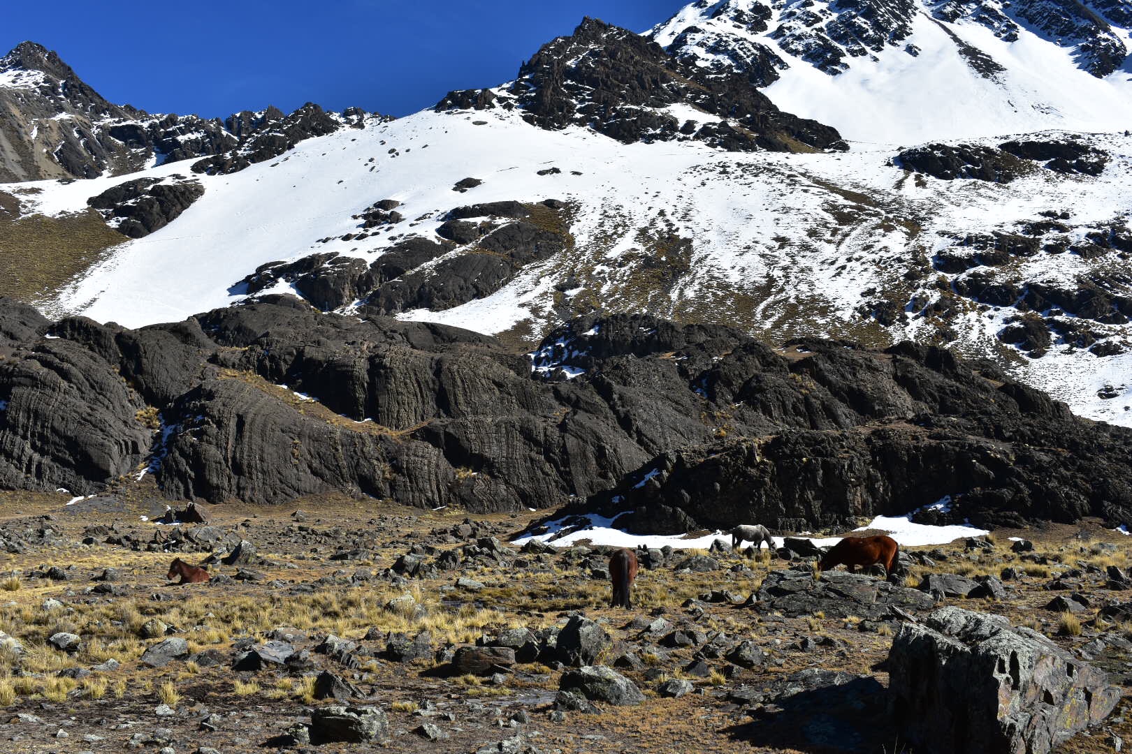
We walked around the first lake and the terrain remained reasonably flat. There were some horses and more llamas, i think you can find a lot of llamas all over this section of the trail and we got closer to the snow covered mountains.

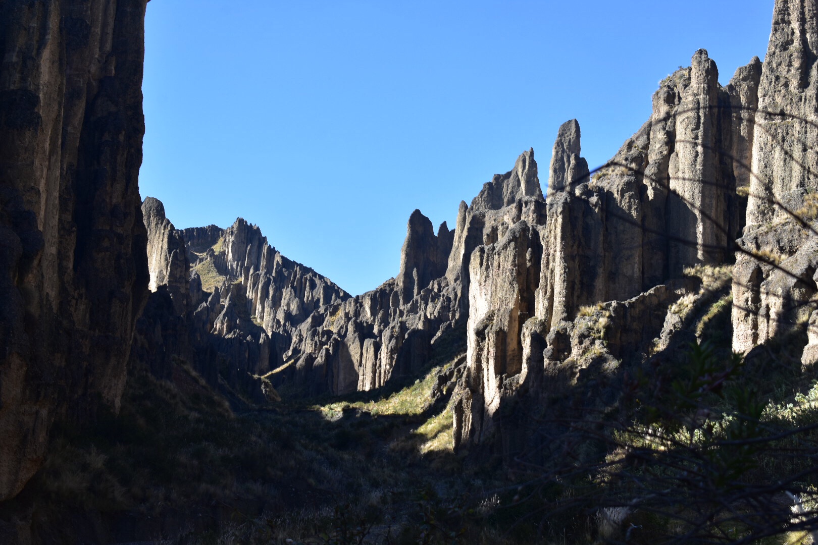
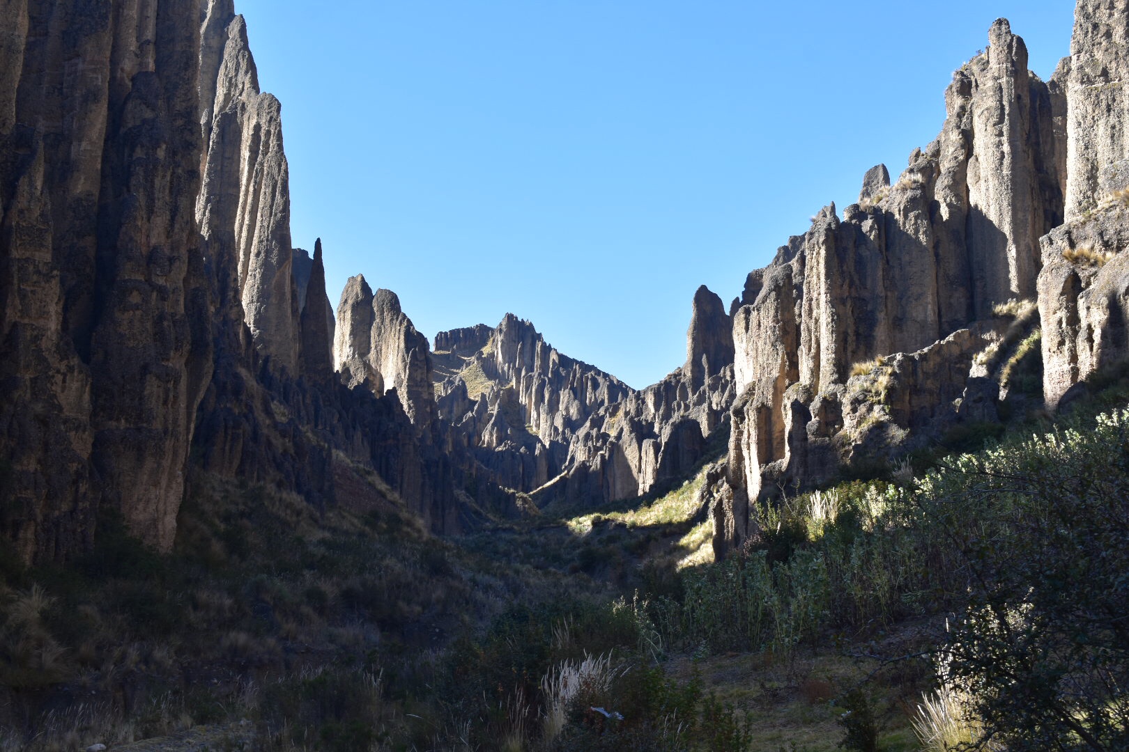
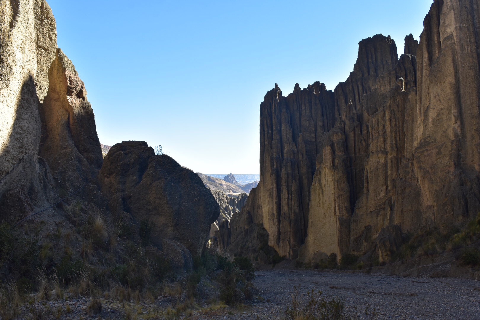
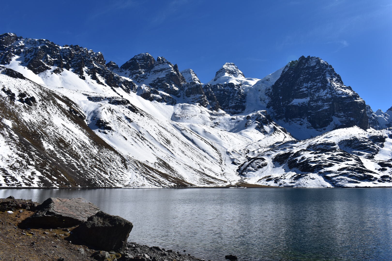
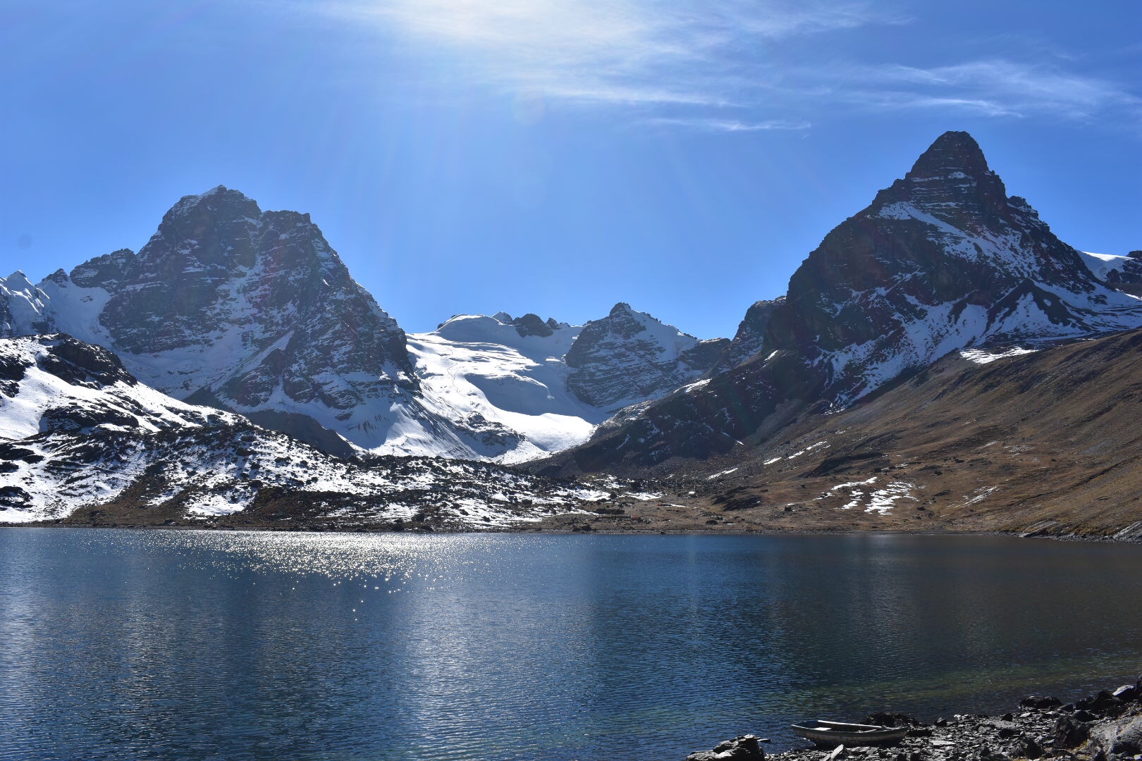
After another kilometre of hiking we arrived at Laguna Chair Khota. There is a Refugio here, I have no idea how you stay there or how much it costs but there were tents around and we saw people relaxing. The photos don’t really do this Laguna justice as it’s truly beautiful and I expect the sun rise/sun set here is something special! I also expect it’s freezing at night and once dark there is nothing to do. We did meet some people that did multi day treks in the area so this is something you could definitely explore if you wish.

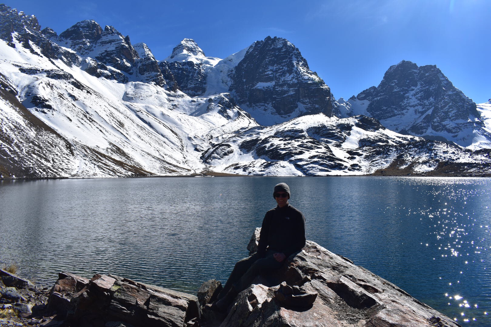
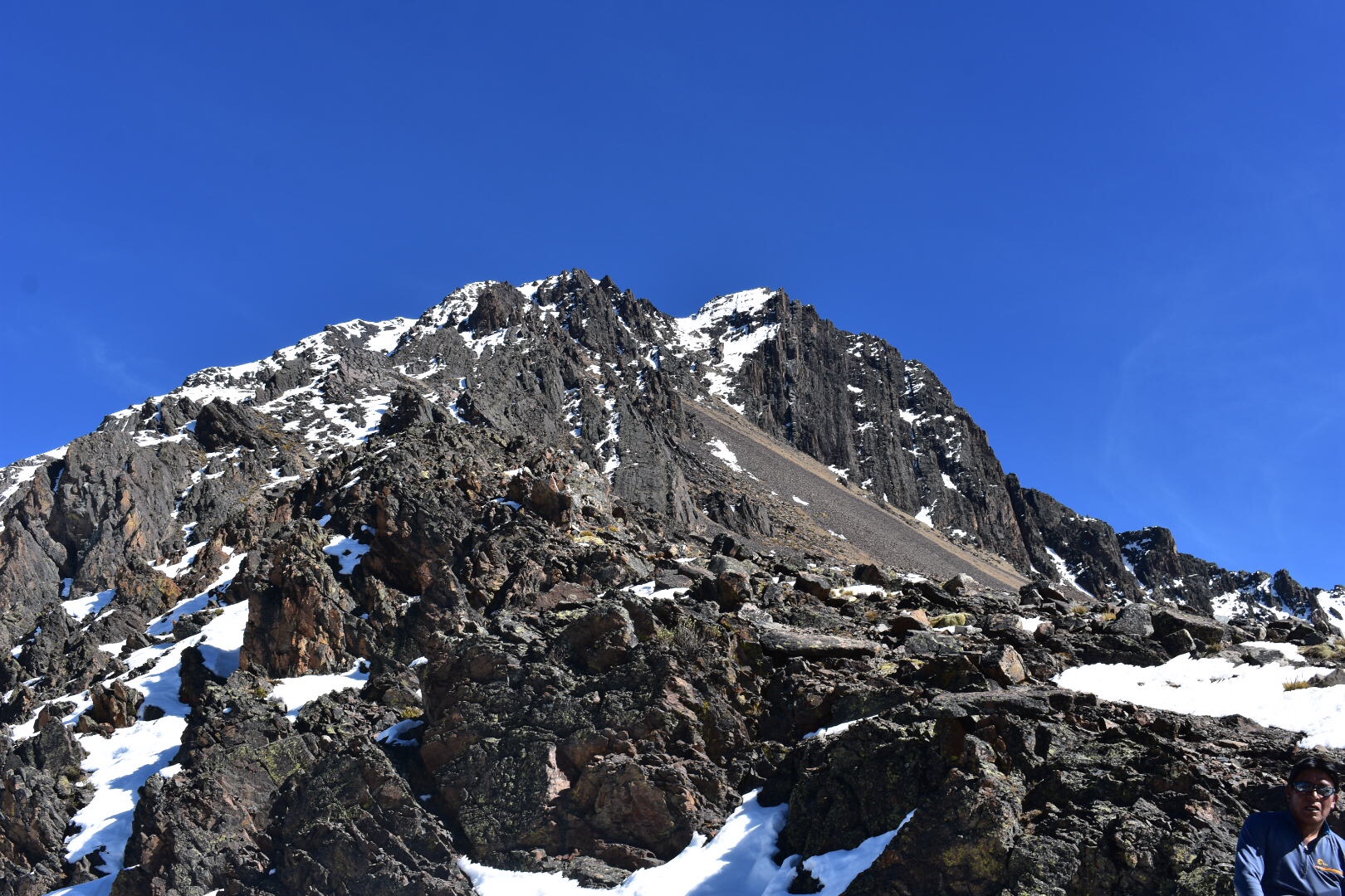
We followed the path around the lake to the left and very quickly it’s starts ascending up very steeply. From this point the path doesn’t really let up until you get to the pass. We walked slowly and I was out of breath the entire way. I kept stopping for photos, you are welcome, and then I had to play catch-up which left me even more out of breath.

Around a third of the way up we stopped for a short break and had a banana. I snapped some more pics and after this was the first lot of snow. Now I don’t know if crampons would help in this situation but as people do travel this path daily the footprints left by my predecessors were very icy and slippery. The path is maybe 30cm wide and if you did have a bad fall the wrong way you would easily be over the edge. I say this although every trail I’ve walked on has elements of this although this is the first with snow. Actually that’s a lie as Torres del Paine had snow and ice but there was a “safety rope”. Here there was nothing but spectacular views.

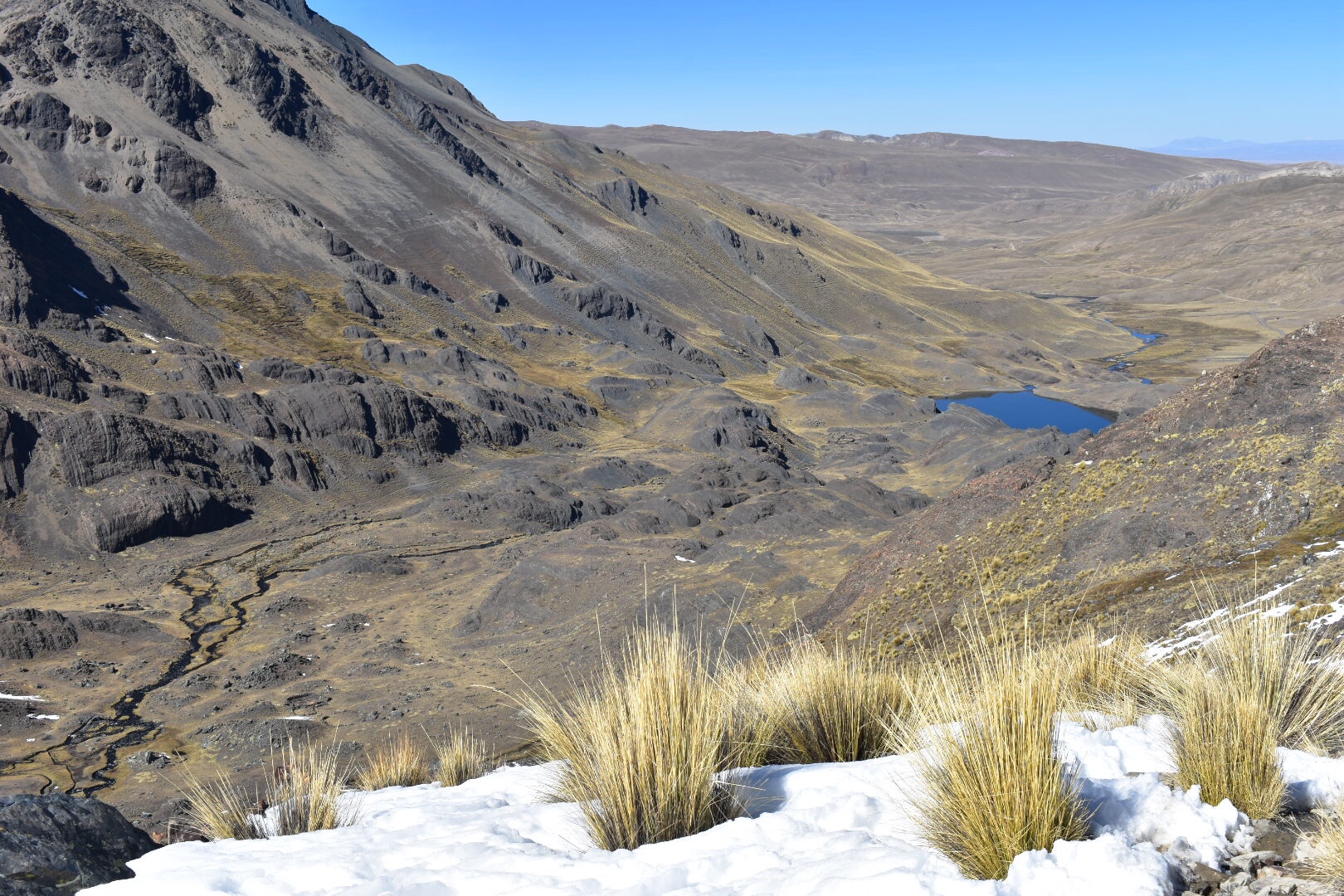
We climbed higher and higher and through another big patch of snow. I just kept taking pictures as everything became more beautiful. Looking down I really couldn’t believe that we had walked from all the way down there. It looked unreal!

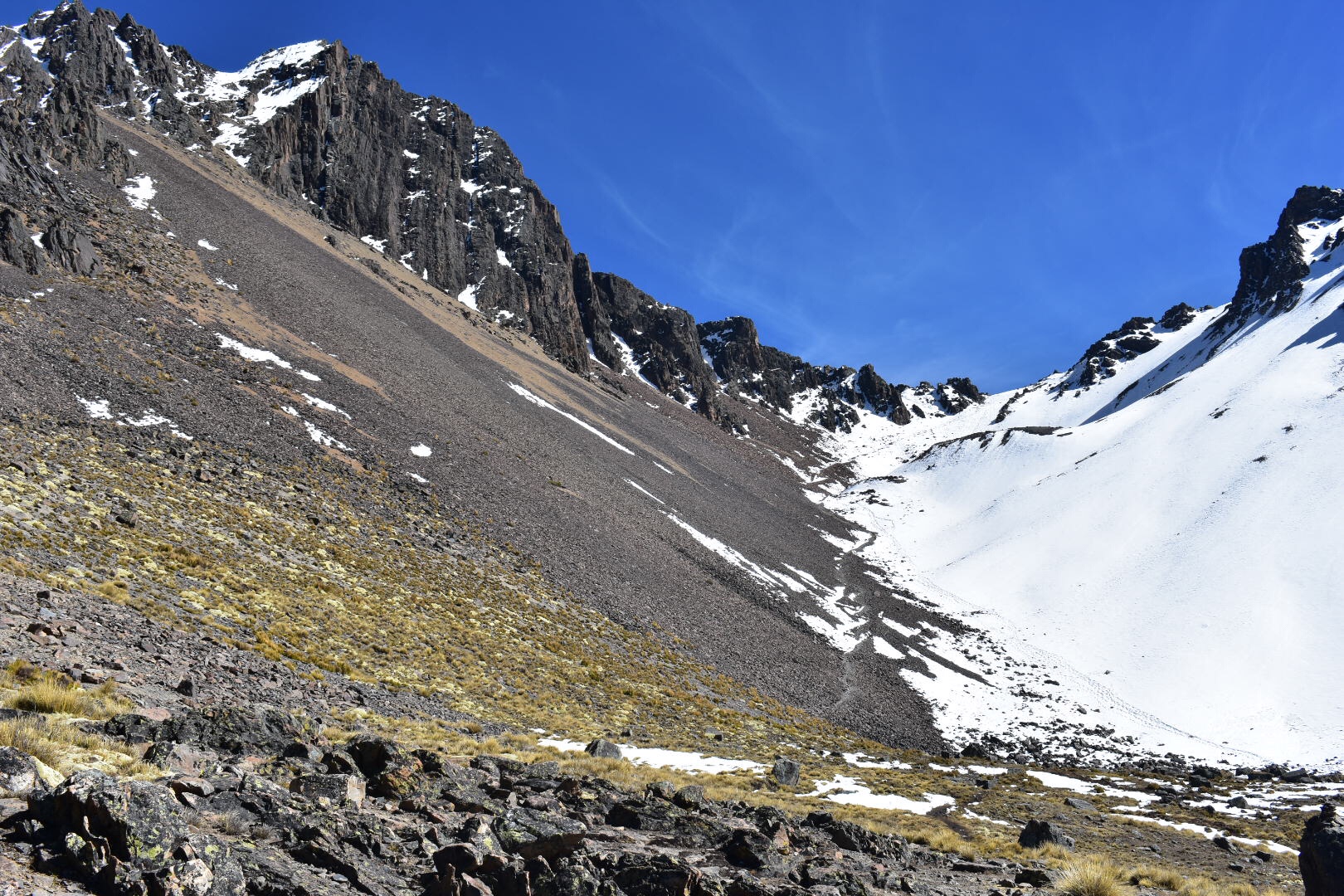
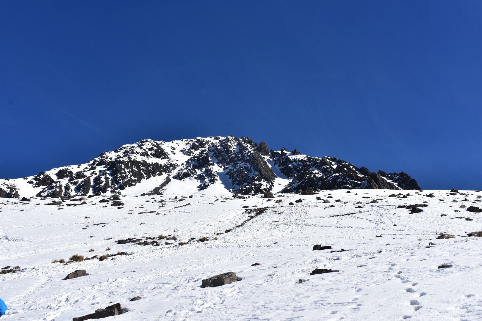
After more up and more levelling off you could begin to see the mountain pass. Look at the footsteps in the snow below. There was a lot more up and by this point we had reached 4900 metres which is higher than Mont Blanc in France. The trail to the pass was largely over small rocks but the last 200 metres or more was all snow. It’s was challenging getting up, I was exhausted and my lungs began to hurt as we pushed past 5000 metres. I was particularly scared on this section of snow. It was really slippery and I felt unbalanced by my camera which was swinging around in front of me but I didn’t dare stop and put it in my bag. Still for the love of pictures, again you are welcome.

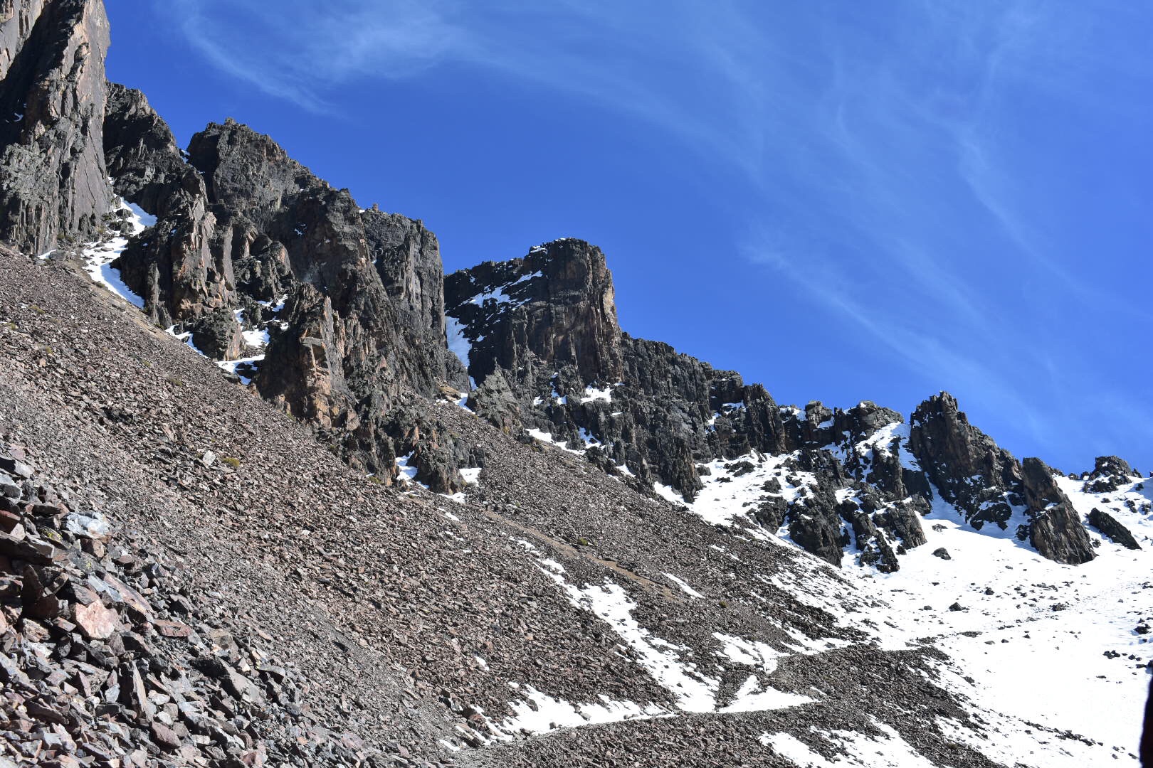
We reached the summit of the pass and took a well earned break. You can see photos of it above and below. In the two photos immediately below you can see that we still had someways to climb before we reached the summit. It was really difficult to walk now and each step was becoming a huge effort. We put our bags down and only took the essentials for the last part of the climb. I’m not sure that I would have made it if we hadn’t.

We stopped for a break near the summit and you can see Lake Titicaca in the background here.

And then after another hour of climbing up from the pass we reached the summit. I’ll let the views speak for themselves but I can see your house from here!

We headed back down to the pass to have lunch and this is where it went wrong for me. A headache hit and after I had eaten I felt as if I was going to be sick. This wasn’t helped by the thought that it was three hours to the bus, then two hours along bumpy potholed roads, which would make any council in England proud, and for me another hour at least back to Jupapina. That coupled with the idea of walking back through the snow but this time going down 45degrees along narrow ledges was not great.

Suffice to say I went slow and took things carefully. We all slipped a few times but nothing out of control but I kept feeling worse and worse thinking I would be sick at any point. Coupled with this i was exhausted by this stage. My bag was too heavy, there was not enough oxygen and I was forcing myself to move. I would have taken more photos as the sun changed the landscape but I felt I couldn’t hold is up anymore and I didn’t want to throw-up in my camera bag.

There was one really fun part as to make it easier to go down we were instructed to walk in the fresh snow which at times came up to my knees. We took giant leaps and it many we could go faster and when I fell it was backwards not down hill so this was safer (I think) than following the path.

We stopped at the bottom by the lake and I thought I’d never be able to move again but after this I started to feel better. We took a different route through the llama fields and eventually made it back to the bus. I colapses on the ground not being able to move for a few minutes and after a quick loo stop, there is not much in the way of facilities, I was on the bus and we were on our way back to La Paz. By the time we got back i was feeling much better but exhausted. However this hike was totally worth all the pain. Do it!

Valle de las Ánimas, La Paz

After reading about hikes in La Paz I was desperate to visit Valle de las Animas. I did find it difficult to find information about how to arrive but it was so close to the city and i could see the trails on maps.me. I asked around and one of the guys working at Colibri Camping had recently visited. If you’ve read and of my previous posts you will know that I’m staying in Jupapina which is to the south of the city.

So we went to Plaza Humbolt in Zona sur to catch the number 42 bus. I’ve since seen the bus in the centre of La Paz so you can catch it from there. Make sure it says ApaΕ„a on the front and then it’s up to you where to get off. I saw a trail on Maps.me that I wanted to follow so we hit that first but the bus also passes right by the valley entrance so read below and I’ll leave the decision to you.

I was joined by David and Pippa, who I’ll tell you more about in the Upclose Bolivia post when I write it, who are staying with me in the Verde House. We decided to trek the 3.5km trail that went along the top of the canyon and ended up at La Laguna de Animas. We started at the opposite end to arrive at the Laguna and then the plan was to take a bus to the Valley entrance. Sadly it didn’t go quite to plan so if you do decide to do this then maybe start at the Laguna and follow the path back. You might have more luck but I’m glad we did what we did.

The path rise steeply out of the village and right away there were some beautiful views of La Paz.

I was walking faster than the others and I don’t like to stop when going uphill as I lose too much momentum. I kept checking my location in maps.me and after a while realised that I was no longer on the path. I wanted to go back as Pippa had taken a different path but David felt we should forge ahead as the views were perfect. Pippa caught up with us and we decided to walk along the top of the ridge until it became obvious it wasn’t a path and Pippa and I stared suffering from vertigo. It was beautiful but we decided to retrace our steps.

We soon returned to the path that Pippa had taken in the first place and maps.me was much happier with this decision. After walking through a couple of fields with the Blair Witch style haystacks we were led down into a canyon. We followed this up and realised progress was slow as I realised we were hiking uphill at over 4000metres.

Soon the canyon levelled our and we found more haystacks so decided to have lunch while Pippa practices some yoga moves. It was also at this point where we lost the trail. The map said that we should go left but we couldn’t see a path. I thought I could see a way though the hills via a canyon but the route was increasingly overgrown and eventually reached a point where it was impassable. We decided instead to follow the fields up the hill and found the most beautiful views overlooking the Valle de las Animas.

It was also at this point where we lost the trail. The map said that we should go left but we couldn’t see a path. I thought I could see a way though the hills via a canyon but the route was increasingly overgrown and eventually reached a point where it was impassable. We decided instead to follow the fields up the hill and found the most beautiful views overlooking the Valle de las Animas.

After our progress was blocked yet again we decided to turn around and walk down to the valley itself. David took the lead and we followed him along a precarious path that consisted of sheer drops and ended up in someone’s back garden. My advice is to follow the path but it’s not always the most fun. We followed the road 1.5km to reach the valley entrance stopping for ice cream along the way. Going into the valley is tough as it’s all uphill, I hadn’t realised this and we were already tired from the trekking.

We walked in as far as we could but the sun began setting so we didn’t go too far. I would love to go back and check out more as the sceenary is beautiful. On the way back we could see the Devils Tooth framed in the valley. We walked to the road and jumped on the first minibus heading back to the city.

Muela del Diablo, La Paz

You can see the Muela del Diablo looking over La Paz from pretty much anywhere in zona sur of La Paz. I don’t think you can see it from the centre but it’s easy and accessible. It mean Devils Tooth but during my time here I’ve referred to it as Devils Finger, Devils Toe and Devils whatever else springs to mind.

I started my journey from Jupapina which is where I am staying to the south of the city. Actually you can see it from here and it’s one reason I was so desperate to get up there. From Jupapina you can take busses but I was advised to take a taxi for 90bs and sometimes it’s best to do what the people who know tell you to. You can get a bus to Pedregal and then walk up the hill to Chiaraque. They should gonfrom Plaza Humbolt in the south of the city or from the main road where all the busses go-just look for the signs on the minibuses. I’d advise you to get a Mallasa taxi from the rank in Plaza Humbolt. The starting town of the trek is not nice and has some vicious dogs.

Tell the taxi to take you up to the base but I would get out towards the top just before you reach Chiaraque as there are beautiful views of La Paz. I didn’t do this and I regret it. Then you can follow the road through the village and up to the tooth. I was dropped off close by and you can see that another set of hills blocks the views of the city although it is spectacular none the less.

When you reach the tooth you will find that without climbing equipment you can’t go very high. There is a path but watch out as it suddenly stops. But do go up as it’s worth it for the views.

I was there on June 21st and this is a public holiday as it is the New Year. There was a party going on as there seems to be a lot in La Paz, which is great fun. I watched the dancing for a while before setting off on my journey.

Now I suspect you are thinking what’s the point in going on a hike if you take a taxi all the way up. Well I ended walking 13 kilometres that day and essentially what I did was walk down. The tooth is closer to 4000 metres altitude so walking up is tough and this is a good hike to try if you want to go up some of the bigger mountains. There is a path that follows the ridge overlooking the valley of Mallasa and Jupapina and from the end you can get a bus back to the city. It’s all downhill and I didn’t see another person all day so I’d reccomend. From the tooth follow the road away from the village and you will see this.

As you walk further away the views get better.

And I also saw some hay piles which is a little Blair witch-I’ve since seen these in many places.

After about 30mins there will be a gate blocking your path. You can enter on the right and don’t worry it’s perfectly find for you to do so. The path again is on maps.me but it’s not 100% accurate so make sure you follow the most obvious path at all times. After about another hour you will come to another gate. Again go though and keep following.

Here are the views of the valley where I have been staying.

You can actually see my house in some. Keep following the path, some is overgrown, until you reach a wide flat area with some trees on the right. Then follow the cobble road, there are several roughed you can take, until you reach the bottom. Then walk to the main road and take any bus back to town. It took me about 3 hours at a slow pace and it’s not a technical trail! Enjoy.

Valle de la Luna, La Paz

The Valle del la Luna is just south of La Paz in Mallasa. There are minibuses that run from the centre of La Paz, just look for one that had Mallasa in the window and you can easily combine with a trip to the La Paz Zoo where I am volunteering (combined entrance is 25bs). Mallasa is where Bolivians come for the weekend so there are lots of restaurants catering to local tastes and the trip will give you a little insight into the are that you otherwise wouldn’t get.

I am staying in La Paz for just over five weeks and if I write one long post this is going to crash as with the other posts. I don’t like writing about a place until I leave as you can’t really tell where the experience will take you halfway through, but I have done several hikes each of which are independent and can be done as separate trips so I’ll be publishing these over the next week and then I’ll write about La Paz and Upclose Bolivia afterwards.

I seem to have most of Monday’s off with a Spanish lesson at 4pm so I wanted to make the most of my second Monday in the city. I decided to check out Valle de la Luna as I pass it on the bus when I travel into the city from Jupapina and I also noticed a couple of interesting viewpoints.

I jumped on a minibus (I’ll explain these more in another post) and headed to the entrance. There are two routes through the valley, one that takes 45mins and one that takes 15mins. You can easily do both. After paying the entrance fee of 15bs you get to walk through the gift shop before appearing in a really fascinating rock environment, that if you use your imagination looks a little like the moon.

I opted to start the 45min trek and as it was a Monday the park was pretty quiet. The weather was perfect and I was able to enjoy the landscape. Note that it is right in the middle of Mallasa so there is a town backdrop to the views. It’s also at high altitude, I’d guess around 3500 but so is most of La Paz so just take it easy. I found I was very quickly out of breath.

It’s a dessert landscape and in the background of the above shots you can see the Muela del Diablo in the background which I hiked a few days later.

As i mentioned there are a couple of view points you can visit. Check on maps.me but the first is a short 10 minute walk from the valley and it’s well worth a detour. Take a left as you leave the Valle de la Luna and follow the road until you get to the steps on the right. There is a sign that clearly marks the route. You go right to the top of the hill that gives panoramic views of the whole area.

After this the other view point is a little out of the way. I walked around and sadly it was barred when I tried to go so you might want to skip and head into Mallasa. Grab some lunch in one of the restaurants or head on down to the zoo and get some food in any of the restaurants near the entrance and enjoy your afternoon there.

I headed down the road and there is a “path” where you can readh a little out of town shopping area with a supermarket, pharmacy, take away pizza and a cage. I stopped here and treated myself to an Oreo milkshake and WIFI before heading back for my Spanish lesson in the afternoon.

Page 2 of 2

Powered by WordPress & Theme by Anders Norén