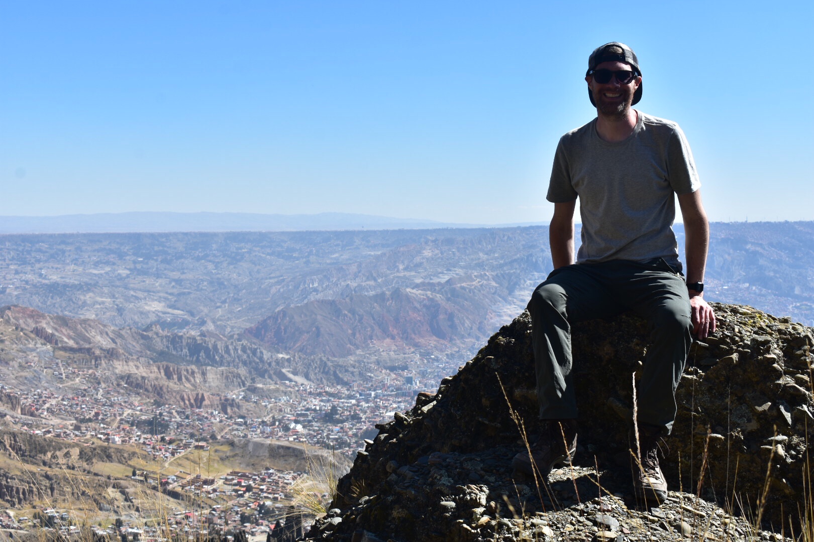
Exploring Latin America 🇦🇷 🇧🇴 🇨🇱 🇨🇴 🇪🇨 🇲🇽 🇵🇪 🇺🇾

Category: Bolivia

Valle de las Ánimas, La Paz

After reading about hikes in La Paz I was desperate to visit Valle de las Animas. I did find it difficult to find information about how to arrive but it was so close to the city and i could see the trails on maps.me. I asked around and one of the guys working at Colibri Camping had recently visited. If you’ve read and of my previous posts you will know that I’m staying in Jupapina which is to the south of the city.

So we went to Plaza Humbolt in Zona sur to catch the number 42 bus. I’ve since seen the bus in the centre of La Paz so you can catch it from there. Make sure it says Apańa on the front and then it’s up to you where to get off. I saw a trail on Maps.me that I wanted to follow so we hit that first but the bus also passes right by the valley entrance so read below and I’ll leave the decision to you.

I was joined by David and Pippa, who I’ll tell you more about in the Upclose Bolivia post when I write it, who are staying with me in the Verde House. We decided to trek the 3.5km trail that went along the top of the canyon and ended up at La Laguna de Animas. We started at the opposite end to arrive at the Laguna and then the plan was to take a bus to the Valley entrance. Sadly it didn’t go quite to plan so if you do decide to do this then maybe start at the Laguna and follow the path back. You might have more luck but I’m glad we did what we did.

The path rise steeply out of the village and right away there were some beautiful views of La Paz.

I was walking faster than the others and I don’t like to stop when going uphill as I lose too much momentum. I kept checking my location in maps.me and after a while realised that I was no longer on the path. I wanted to go back as Pippa had taken a different path but David felt we should forge ahead as the views were perfect. Pippa caught up with us and we decided to walk along the top of the ridge until it became obvious it wasn’t a path and Pippa and I stared suffering from vertigo. It was beautiful but we decided to retrace our steps.

We soon returned to the path that Pippa had taken in the first place and maps.me was much happier with this decision. After walking through a couple of fields with the Blair Witch style haystacks we were led down into a canyon. We followed this up and realised progress was slow as I realised we were hiking uphill at over 4000metres.

Soon the canyon levelled our and we found more haystacks so decided to have lunch while Pippa practices some yoga moves. It was also at this point where we lost the trail. The map said that we should go left but we couldn’t see a path. I thought I could see a way though the hills via a canyon but the route was increasingly overgrown and eventually reached a point where it was impassable. We decided instead to follow the fields up the hill and found the most beautiful views overlooking the Valle de las Animas.

It was also at this point where we lost the trail. The map said that we should go left but we couldn’t see a path. I thought I could see a way though the hills via a canyon but the route was increasingly overgrown and eventually reached a point where it was impassable. We decided instead to follow the fields up the hill and found the most beautiful views overlooking the Valle de las Animas.

After our progress was blocked yet again we decided to turn around and walk down to the valley itself. David took the lead and we followed him along a precarious path that consisted of sheer drops and ended up in someone’s back garden. My advice is to follow the path but it’s not always the most fun. We followed the road 1.5km to reach the valley entrance stopping for ice cream along the way. Going into the valley is tough as it’s all uphill, I hadn’t realised this and we were already tired from the trekking.

We walked in as far as we could but the sun began setting so we didn’t go too far. I would love to go back and check out more as the sceenary is beautiful. On the way back we could see the Devils Tooth framed in the valley. We walked to the road and jumped on the first minibus heading back to the city.

Muela del Diablo, La Paz

You can see the Muela del Diablo looking over La Paz from pretty much anywhere in zona sur of La Paz. I don’t think you can see it from the centre but it’s easy and accessible. It mean Devils Tooth but during my time here I’ve referred to it as Devils Finger, Devils Toe and Devils whatever else springs to mind.

I started my journey from Jupapina which is where I am staying to the south of the city. Actually you can see it from here and it’s one reason I was so desperate to get up there. From Jupapina you can take busses but I was advised to take a taxi for 90bs and sometimes it’s best to do what the people who know tell you to. You can get a bus to Pedregal and then walk up the hill to Chiaraque. They should gonfrom Plaza Humbolt in the south of the city or from the main road where all the busses go-just look for the signs on the minibuses. I’d advise you to get a Mallasa taxi from the rank in Plaza Humbolt. The starting town of the trek is not nice and has some vicious dogs.

Tell the taxi to take you up to the base but I would get out towards the top just before you reach Chiaraque as there are beautiful views of La Paz. I didn’t do this and I regret it. Then you can follow the road through the village and up to the tooth. I was dropped off close by and you can see that another set of hills blocks the views of the city although it is spectacular none the less.

When you reach the tooth you will find that without climbing equipment you can’t go very high. There is a path but watch out as it suddenly stops. But do go up as it’s worth it for the views.

I was there on June 21st and this is a public holiday as it is the New Year. There was a party going on as there seems to be a lot in La Paz, which is great fun. I watched the dancing for a while before setting off on my journey.

Now I suspect you are thinking what’s the point in going on a hike if you take a taxi all the way up. Well I ended walking 13 kilometres that day and essentially what I did was walk down. The tooth is closer to 4000 metres altitude so walking up is tough and this is a good hike to try if you want to go up some of the bigger mountains. There is a path that follows the ridge overlooking the valley of Mallasa and Jupapina and from the end you can get a bus back to the city. It’s all downhill and I didn’t see another person all day so I’d reccomend. From the tooth follow the road away from the village and you will see this.

As you walk further away the views get better.

And I also saw some hay piles which is a little Blair witch-I’ve since seen these in many places.

After about 30mins there will be a gate blocking your path. You can enter on the right and don’t worry it’s perfectly find for you to do so. The path again is on maps.me but it’s not 100% accurate so make sure you follow the most obvious path at all times. After about another hour you will come to another gate. Again go though and keep following.

Here are the views of the valley where I have been staying.

You can actually see my house in some. Keep following the path, some is overgrown, until you reach a wide flat area with some trees on the right. Then follow the cobble road, there are several roughed you can take, until you reach the bottom. Then walk to the main road and take any bus back to town. It took me about 3 hours at a slow pace and it’s not a technical trail! Enjoy.

Valle de la Luna, La Paz

The Valle del la Luna is just south of La Paz in Mallasa. There are minibuses that run from the centre of La Paz, just look for one that had Mallasa in the window and you can easily combine with a trip to the La Paz Zoo where I am volunteering (combined entrance is 25bs). Mallasa is where Bolivians come for the weekend so there are lots of restaurants catering to local tastes and the trip will give you a little insight into the are that you otherwise wouldn’t get.

I am staying in La Paz for just over five weeks and if I write one long post this is going to crash as with the other posts. I don’t like writing about a place until I leave as you can’t really tell where the experience will take you halfway through, but I have done several hikes each of which are independent and can be done as separate trips so I’ll be publishing these over the next week and then I’ll write about La Paz and Upclose Bolivia afterwards.

I seem to have most of Monday’s off with a Spanish lesson at 4pm so I wanted to make the most of my second Monday in the city. I decided to check out Valle de la Luna as I pass it on the bus when I travel into the city from Jupapina and I also noticed a couple of interesting viewpoints.

I jumped on a minibus (I’ll explain these more in another post) and headed to the entrance. There are two routes through the valley, one that takes 45mins and one that takes 15mins. You can easily do both. After paying the entrance fee of 15bs you get to walk through the gift shop before appearing in a really fascinating rock environment, that if you use your imagination looks a little like the moon.

I opted to start the 45min trek and as it was a Monday the park was pretty quiet. The weather was perfect and I was able to enjoy the landscape. Note that it is right in the middle of Mallasa so there is a town backdrop to the views. It’s also at high altitude, I’d guess around 3500 but so is most of La Paz so just take it easy. I found I was very quickly out of breath.

It’s a dessert landscape and in the background of the above shots you can see the Muela del Diablo in the background which I hiked a few days later.

As i mentioned there are a couple of view points you can visit. Check on maps.me but the first is a short 10 minute walk from the valley and it’s well worth a detour. Take a left as you leave the Valle de la Luna and follow the road until you get to the steps on the right. There is a sign that clearly marks the route. You go right to the top of the hill that gives panoramic views of the whole area.

After this the other view point is a little out of the way. I walked around and sadly it was barred when I tried to go so you might want to skip and head into Mallasa. Grab some lunch in one of the restaurants or head on down to the zoo and get some food in any of the restaurants near the entrance and enjoy your afternoon there.

I headed down the road and there is a “path” where you can readh a little out of town shopping area with a supermarket, pharmacy, take away pizza and a cage. I stopped here and treated myself to an Oreo milkshake and WIFI before heading back for my Spanish lesson in the afternoon.

Salar de Uyuni Tour

Day One

I had yet another early start and woke up at 6am to be collected around 6:30. The bus was half full off sleepy tourists as it raced around San Pedro. Benny, who i met on the Red Rocks tour a few days before, managed to grab the seat next to me and we headed up, literally at 4000 metres, to the border.

The Chilean side went smoothly, they kindly let me use the toilet and I noticed that they had a table tennis table. We then raced over to the Bolivian side and it was here that I realised I wasn’t in Kansas anymore. Now most people seem to travel South America from the north to the south. Either starting in Colombia, Central America or a multitude of other places. I started in the south and am travelling north, which I think and don’t quote me, is less common. So I’ve been told that Argentina and Chile are really well developed, which they are, but for me they are really different to Europe. However for those who have visited the poorer countries in the north they are very close to Europe, expensive and I think as a result many travellers don’t stay so long. I hadn’t really thought about this as I’ve been her a long time. It was only when I reached the Bolivian border that I realised things were going to be different from here on in…

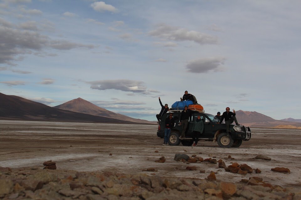
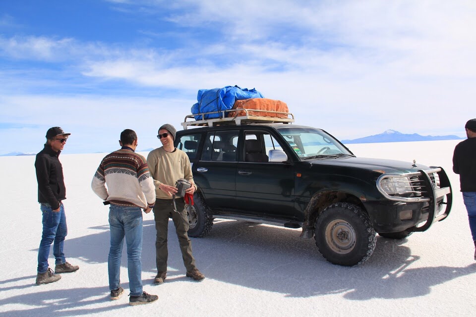
Benny has a little trouble with the border owing to him being a US citizen. He had triplicate paper work, the fee and everything else and still they needed a bribe. Whilst Benny stressed the rest of us ate breakfast and it was here that we met Melissa, Emma, Ruben and Niklas who were to be our friends for the rest of the tour. The company told us to divide into groups and we jumped into the Jeep’s with Simón, our driver and guide.

The breakfast was great along with all the food on the tour. We were never rushed and stopped for extra photos on request. I booked with White World Travel, going from San Pedro to Uyuni.

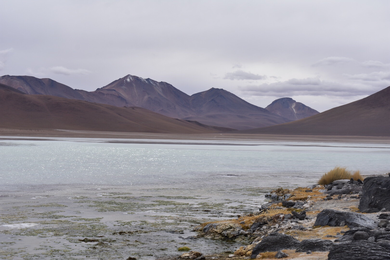
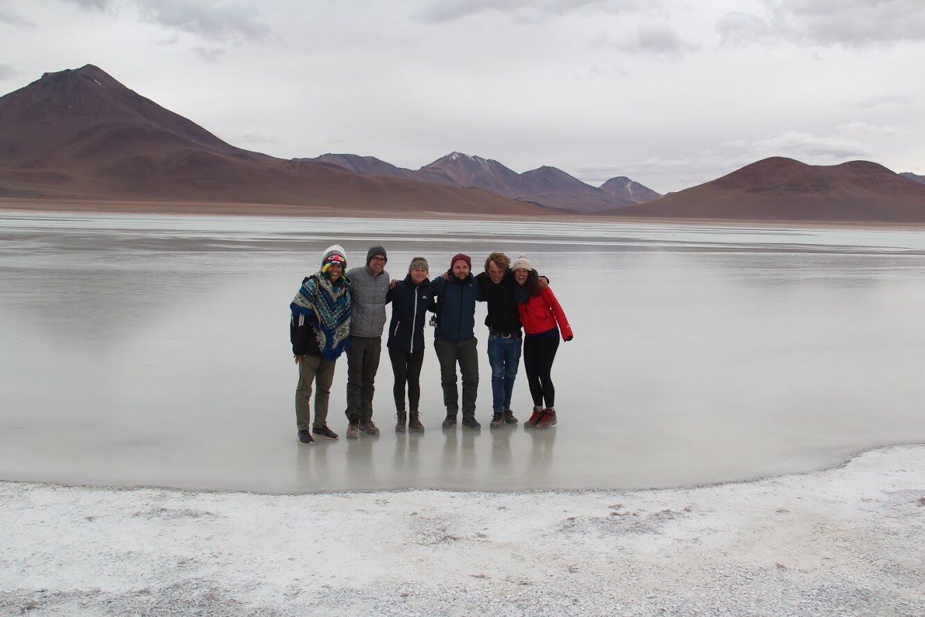
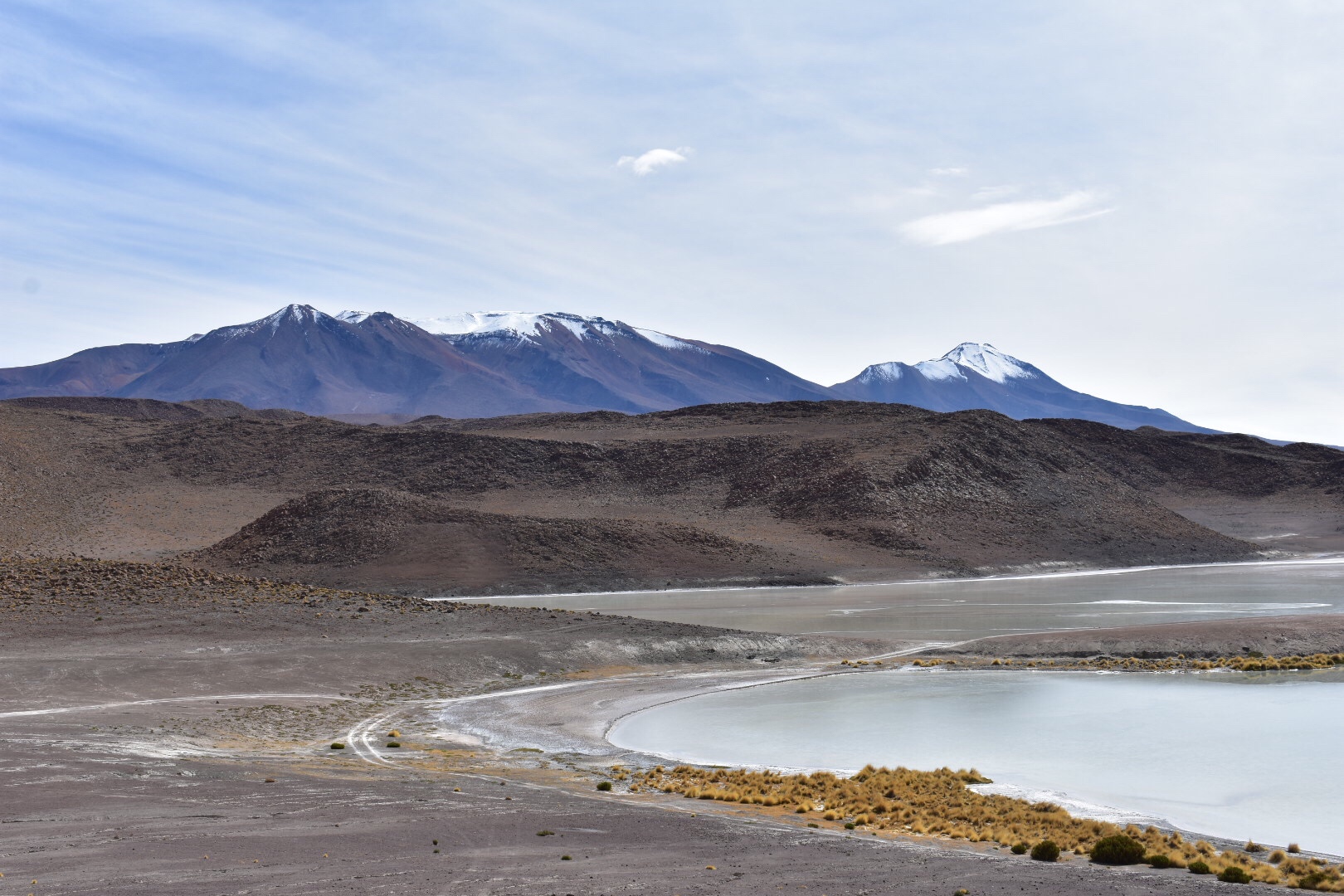
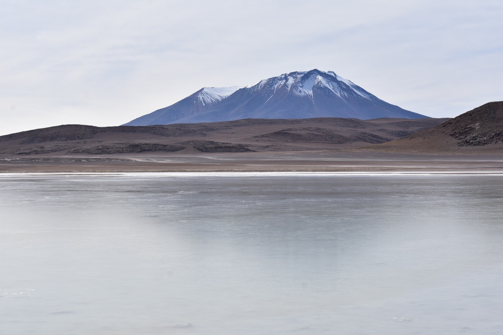
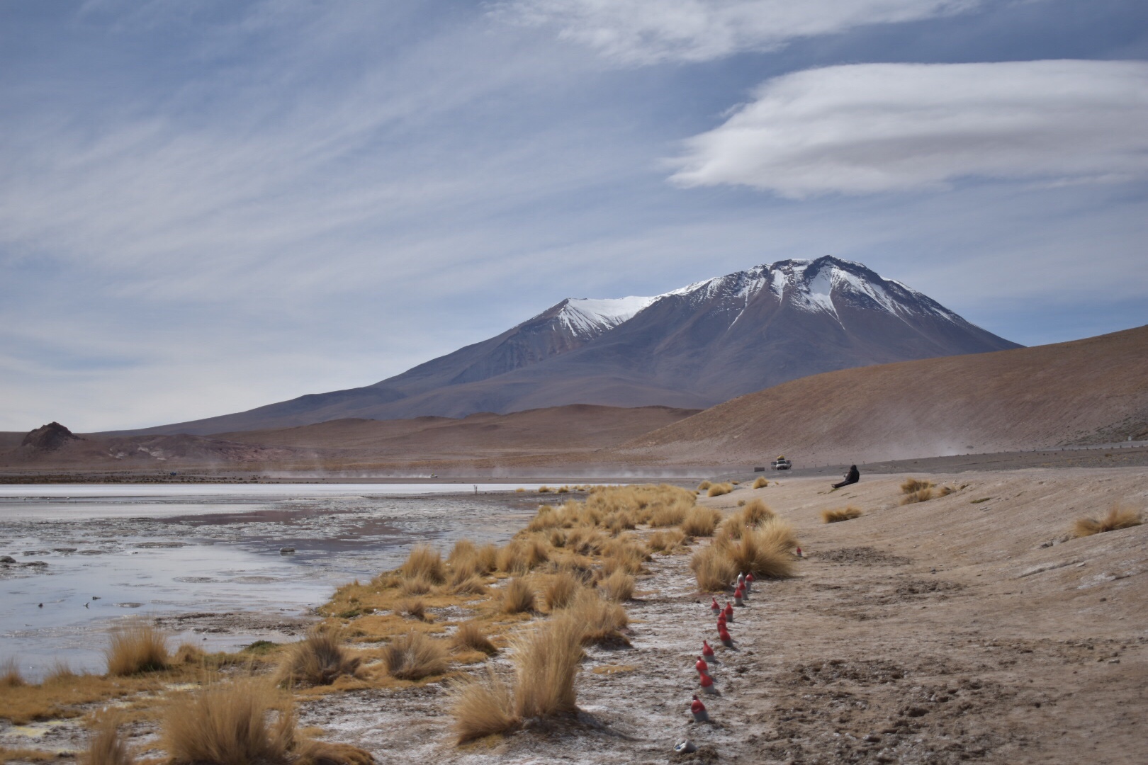
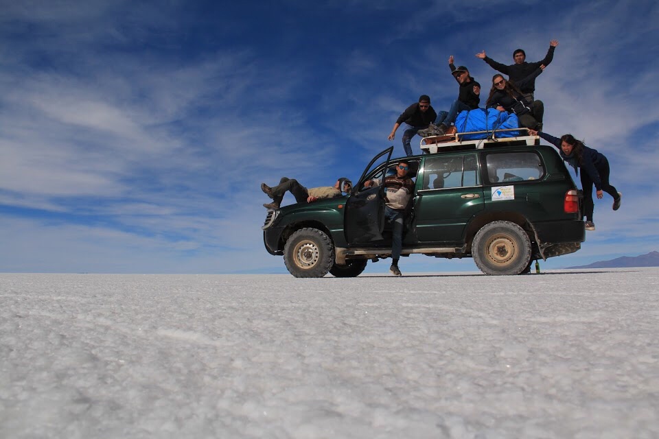
We were whisked away and soon arrived as Laguna Blanca. This was after a quick stop to buy tickets for the National Park. After an introduction in Spanish, I would end up knowing little about what we were to see over the next few days so don’t ask, we jumped out in the freezing cold to have a look and take photos. As you can see in the group shot below the lake is frozen! So yeah it was cold and this day was really grey so that didn’t help much.

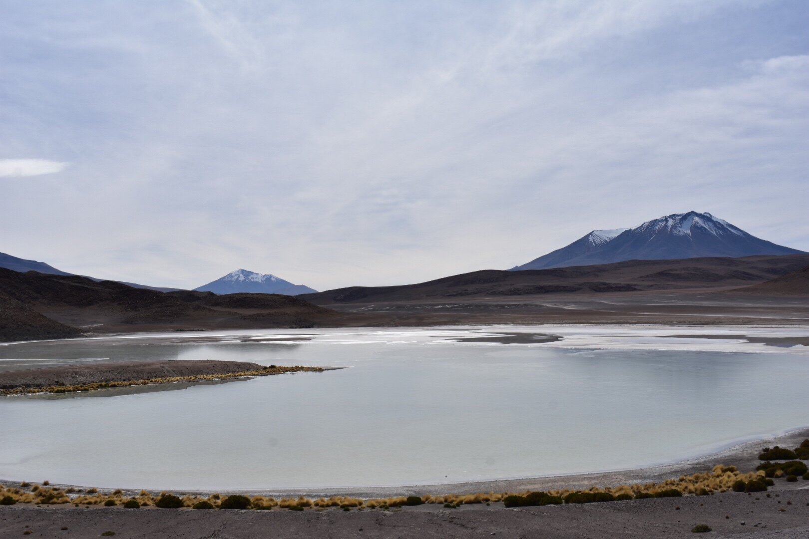
We then drove across to Laguna verde which didn’t really look very green to me owning to the cloud. We didn’t stay too long.

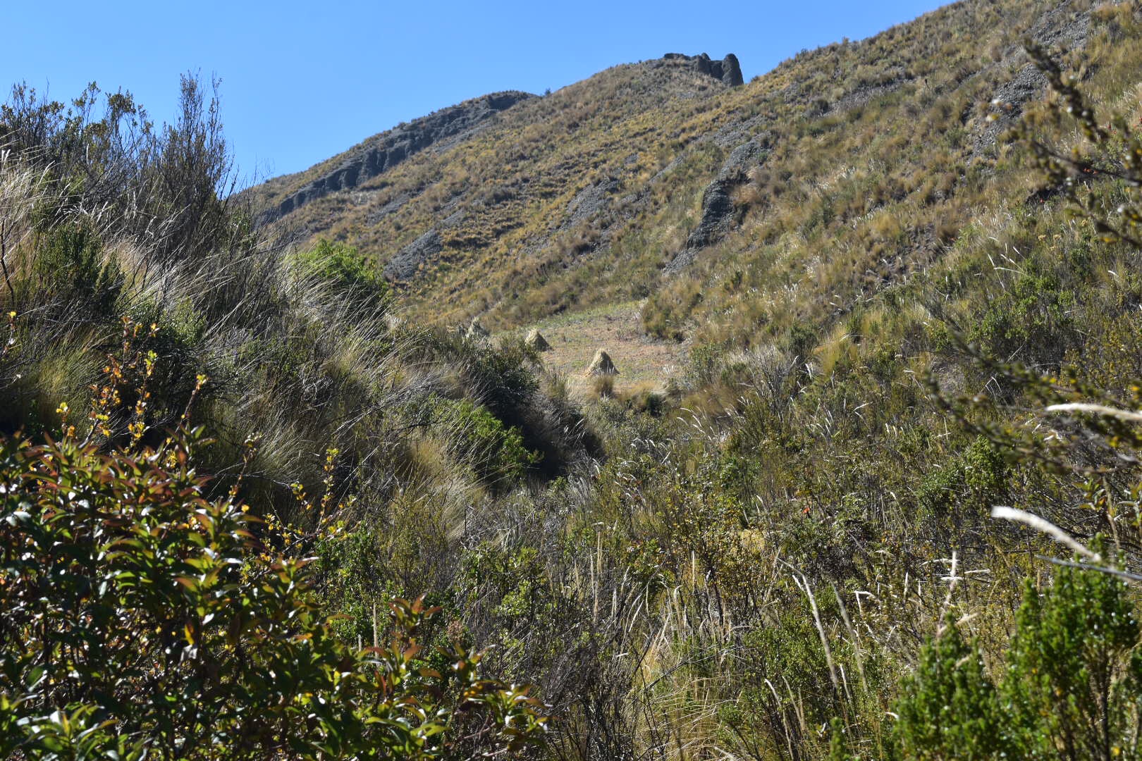
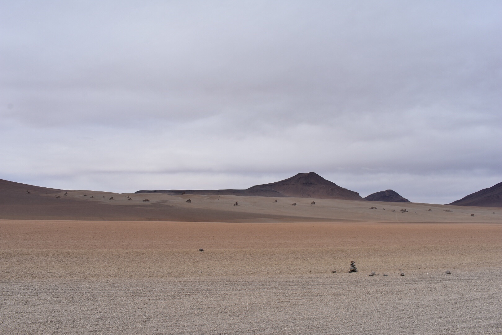
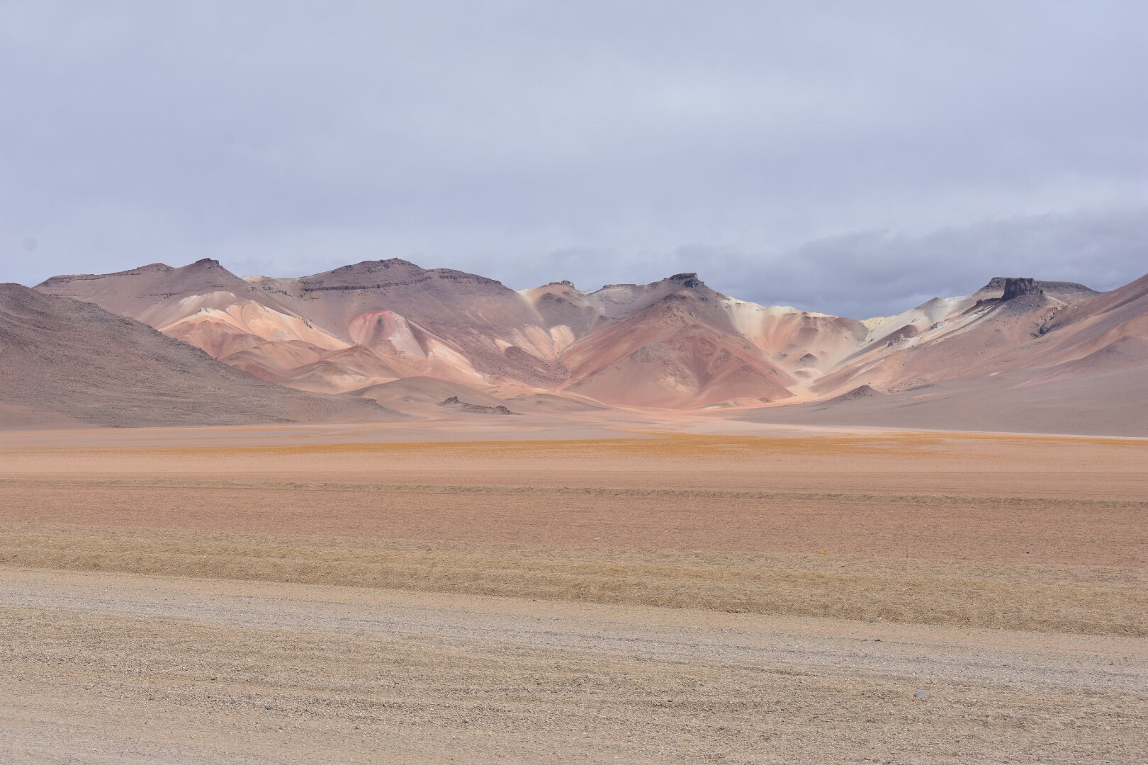
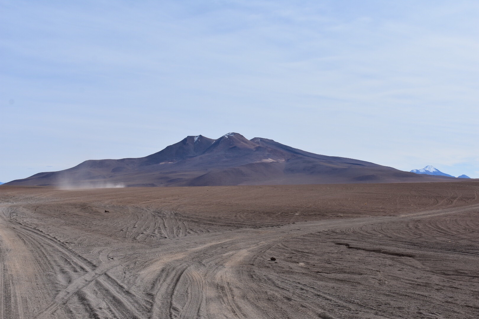
Then we stopped at this random place in the dessert. I don’t know why but I took photos.

Then we came to the hot springs. It was freezing and I very nearly didn’t go but after missing every other opportunity I figured that I should. So I stripped off to my trunks and very quickly jumped into the quieter of the two pools. After some time we changed pools and found the reason the other was busier is because it was hotter. I dreaded getting out but it’s wasn’t as bad as I thought. Mostly because my body was so warm from the pools. We were told to stay for only 20minutes and I’m not sure if I stayed too long but this is where the altitude started to hit me.

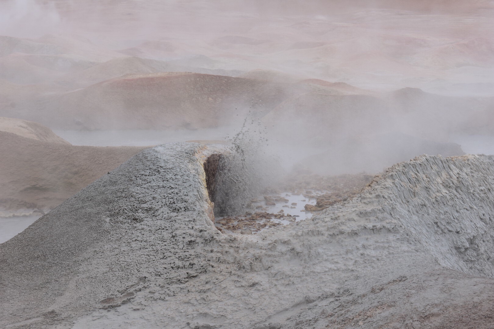
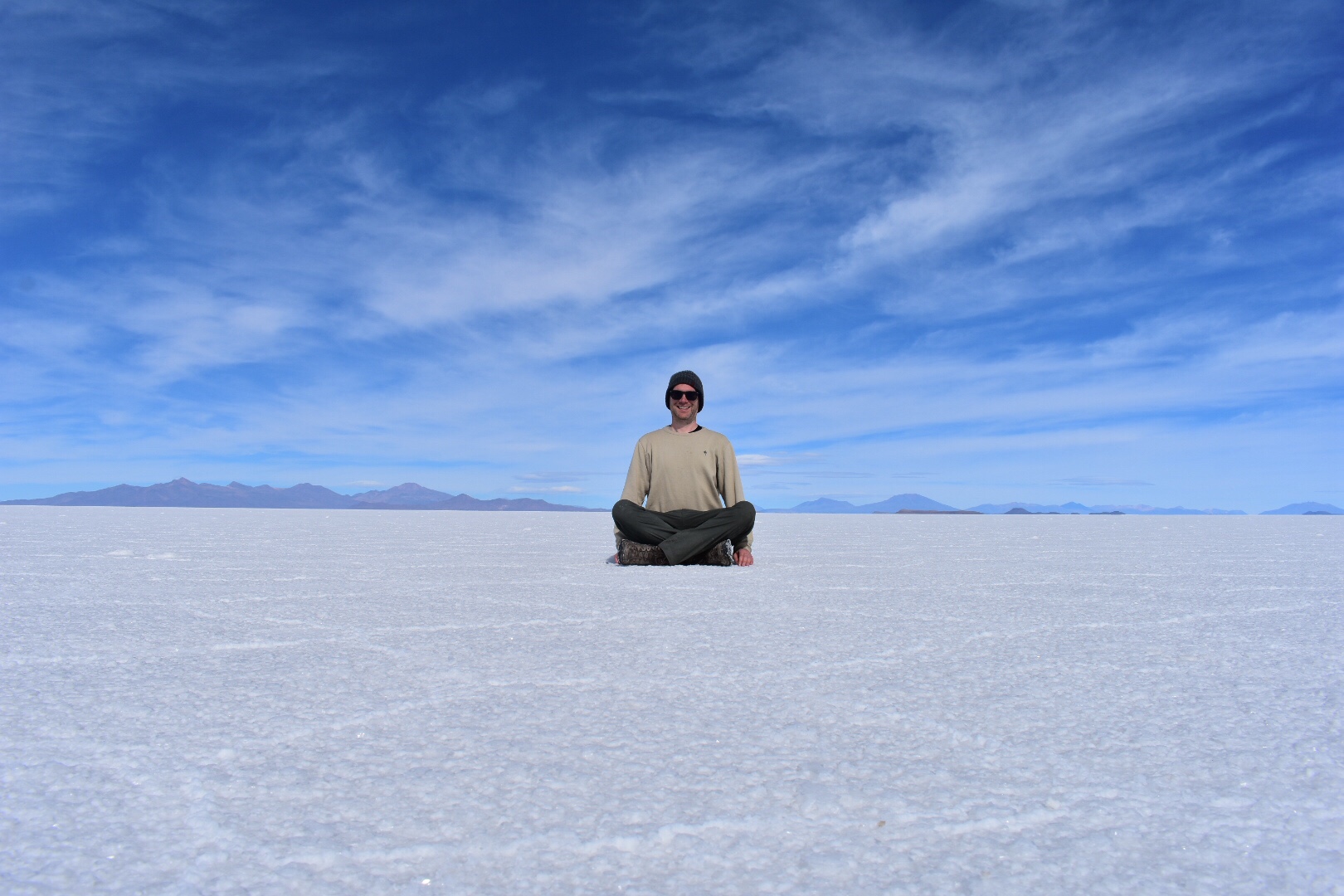
Next up was the thermals and these were at an altitude of nearly 5000 metres and there were still mountains towering above. Call me stupid but I never realised that flat land could be this high. I just assumed that it was mountains but no there is tonnes of flat as you can see from the pictures. I think I’ve said this before but London is 35 metres above sea level. So go outside and look up at the clouds and that is how high I was. Again I don’t know anything about the thermals but they stank and bubbles away so I took pictures as any good tourists would.

We stopped for lunch at our accommodations, which had no heating and was well above 4600 metres. On the first night we were in a 6 person dorm but with all the extra sleeping bags and blankets we were cozy and warm. Lunch was again delicious and I broke out the dice for the first time in months and everyone really got into Perudo which was nice.

I was still suffering quite badly so I made myself some tea from the random herbs I brought in San Pedro. It tastes gross but it did help and I drank a lot of water.

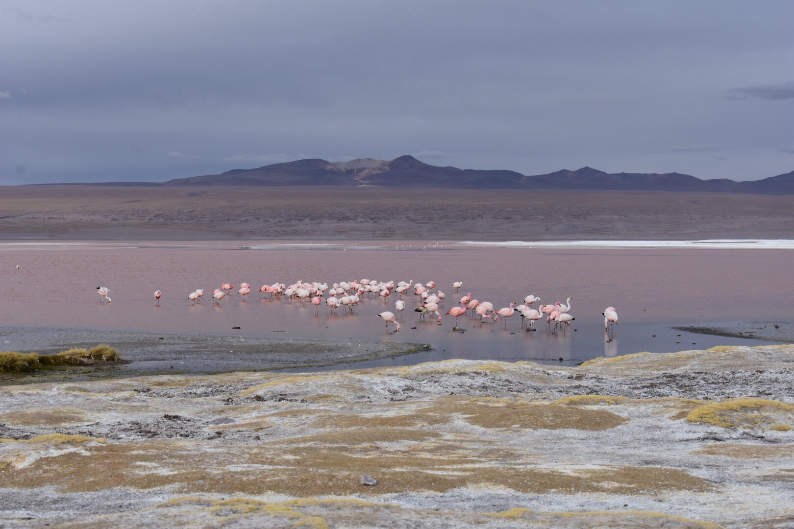
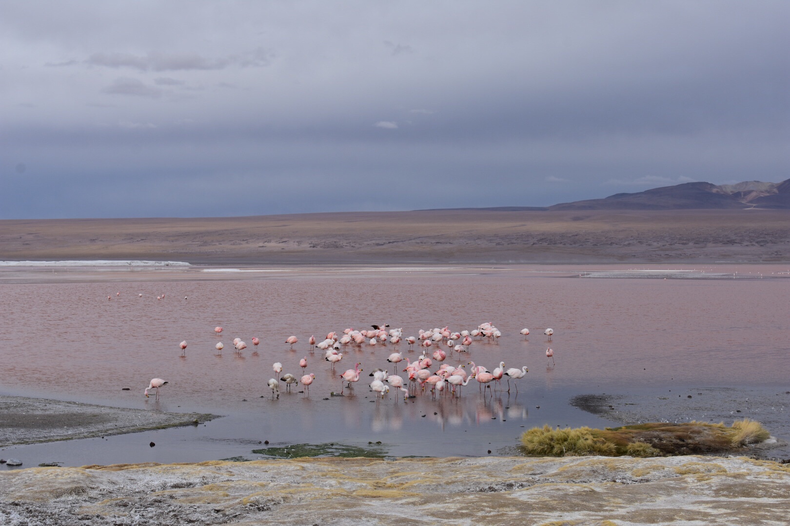
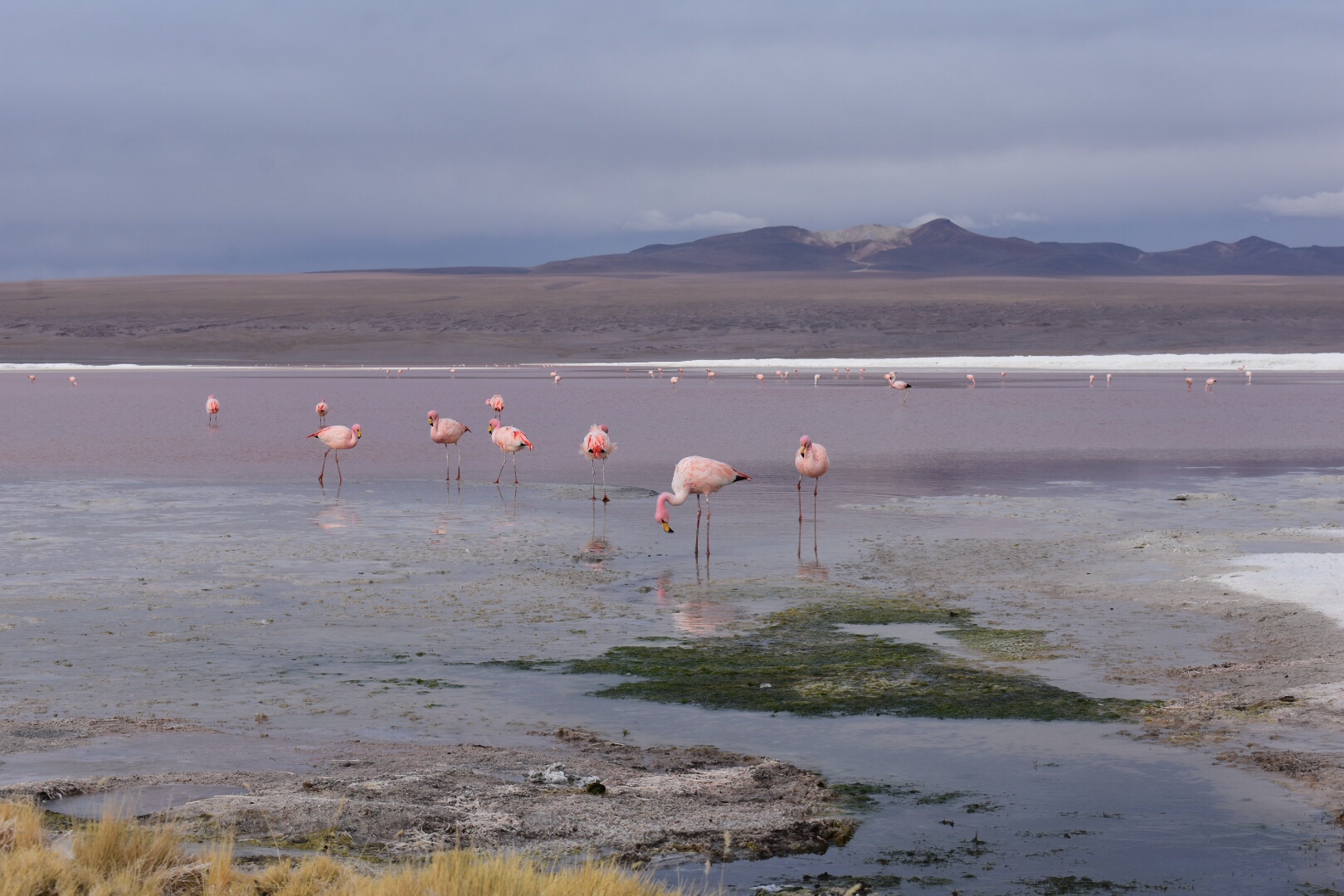
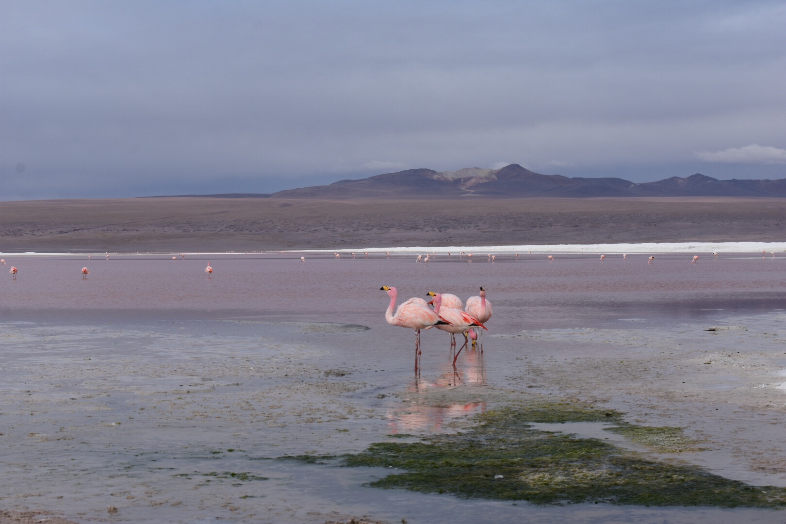
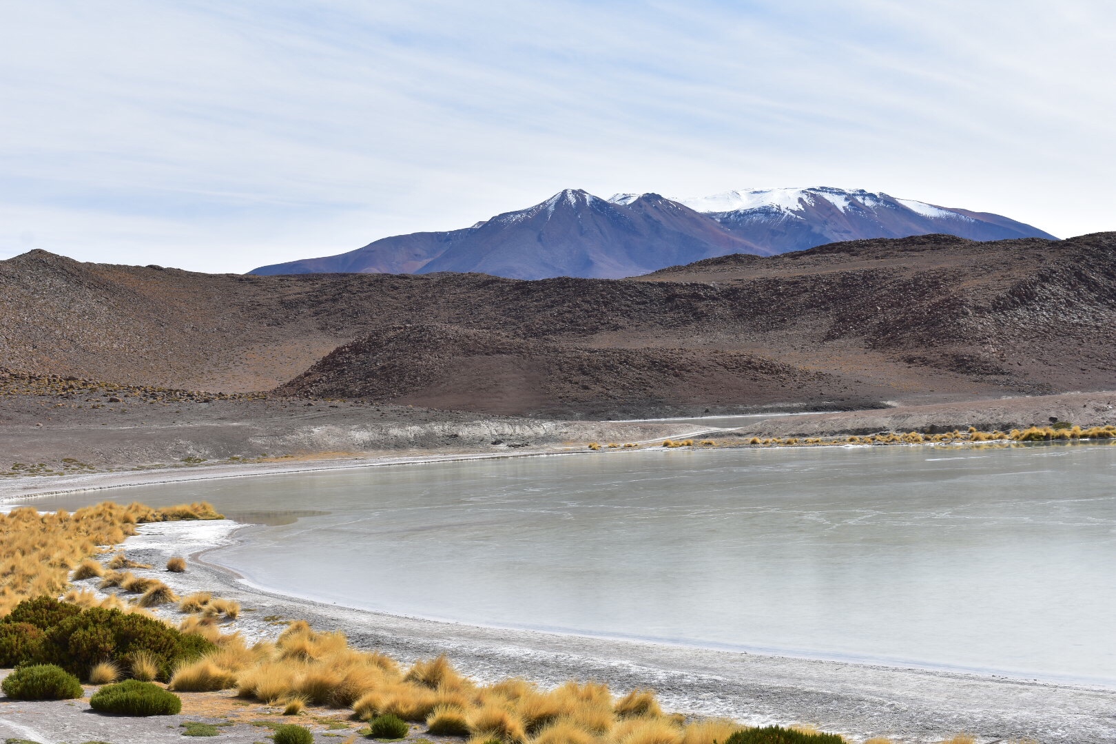
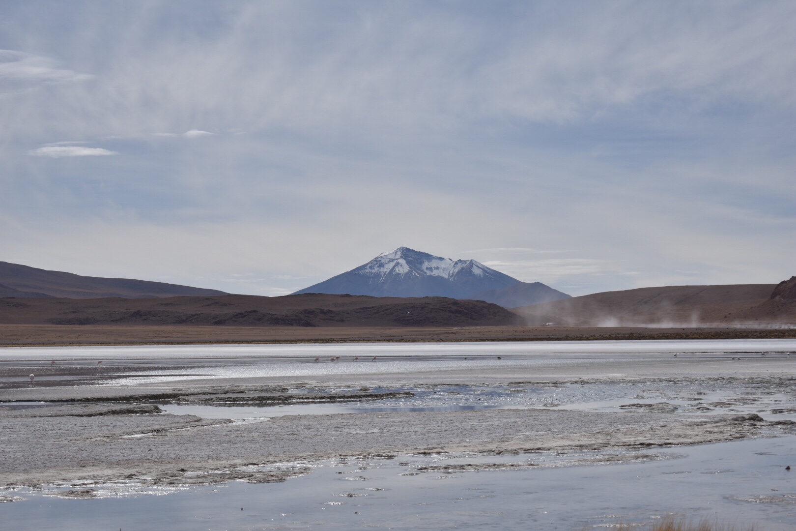
After lunch we headed to this red lake with flamingos. Again I don’t really know anything about t other than it was so cold. This time I was having trouble walking due to the altitude. If I walked any faster than a crawl I was left fighting for breath. Once I realised my limits it was okay and I felt like and old man hanging out at the back. Benny was kind enough to stay back with me to make sure I was okay.

After the lake we headed back to the accommodation had dinner and went to check out the local shops. There was a bar that we visited but all declined a drink due to the altitude and ended up in bed by 8pm after another game of Perudo.

Day Two

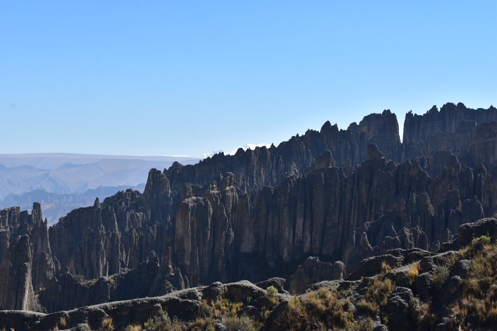
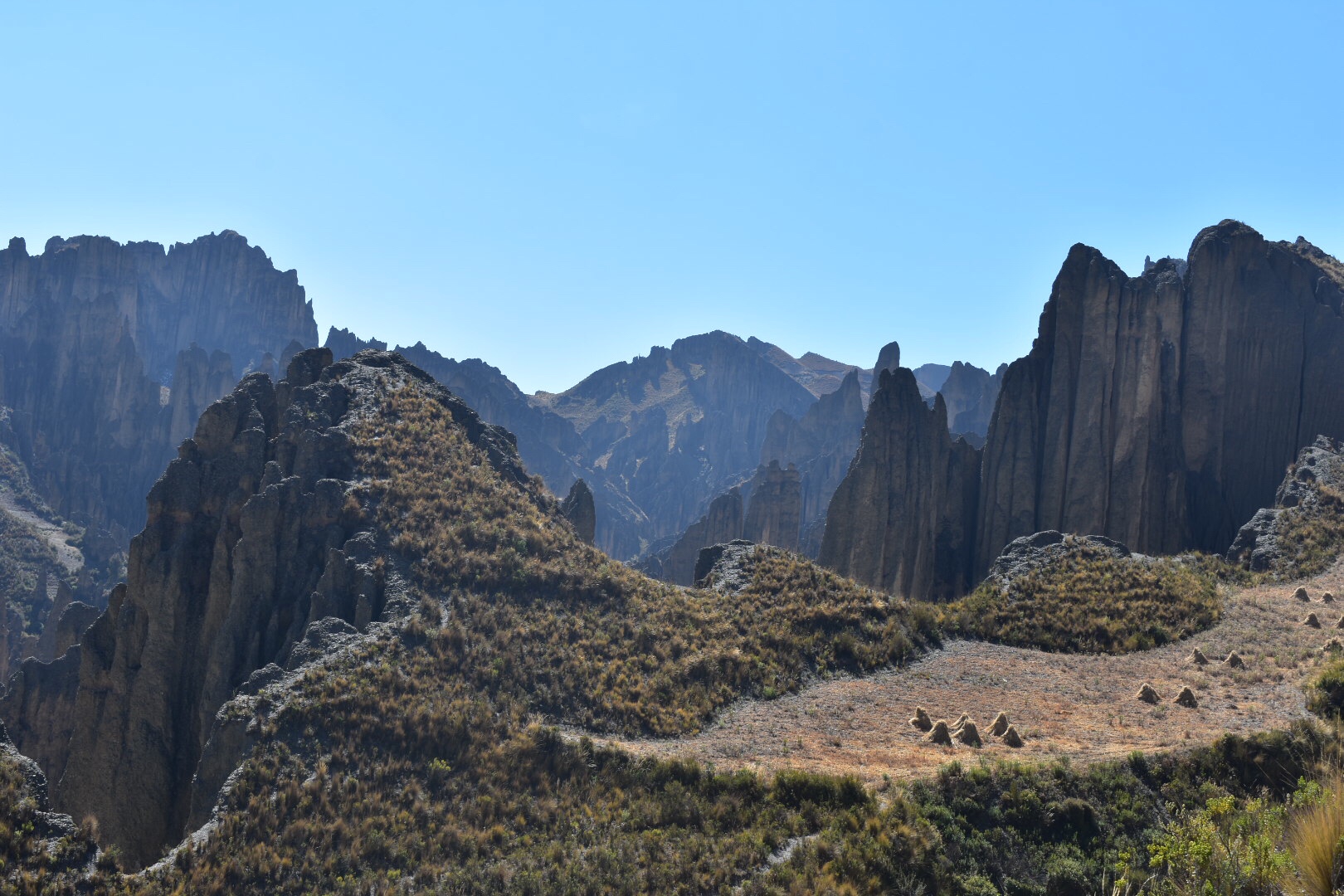
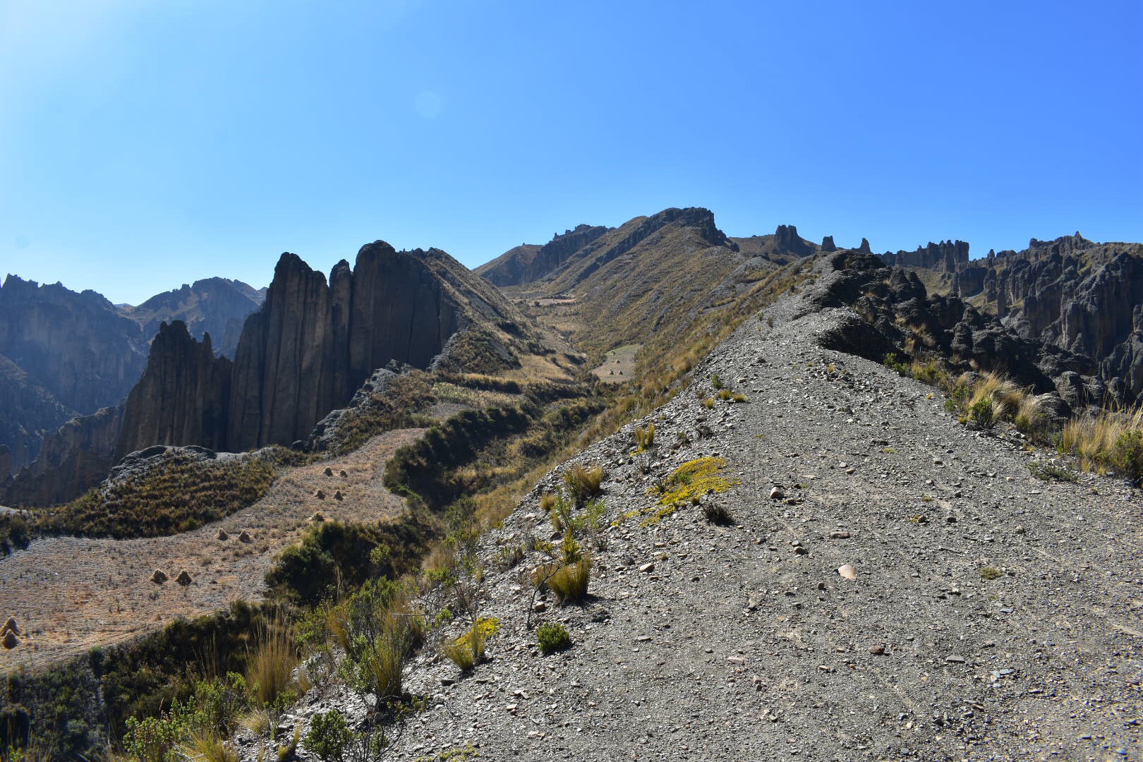
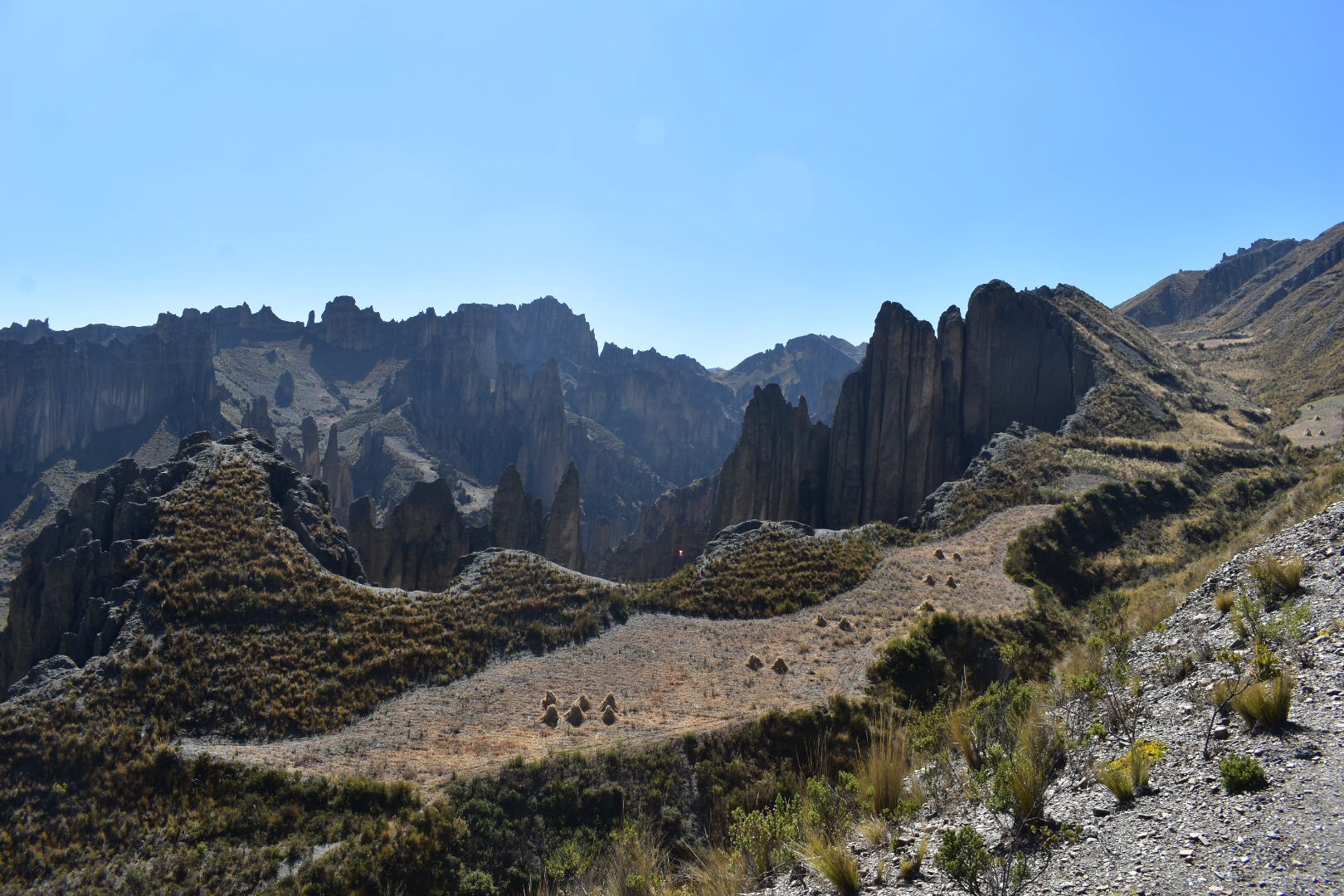
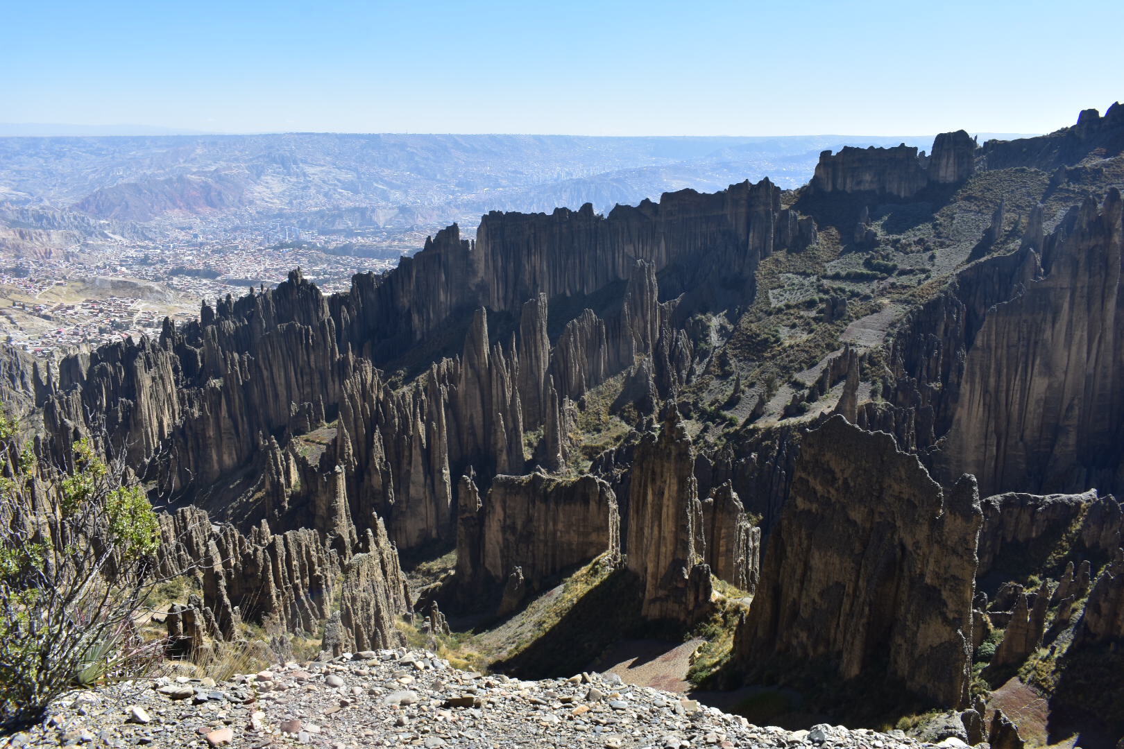
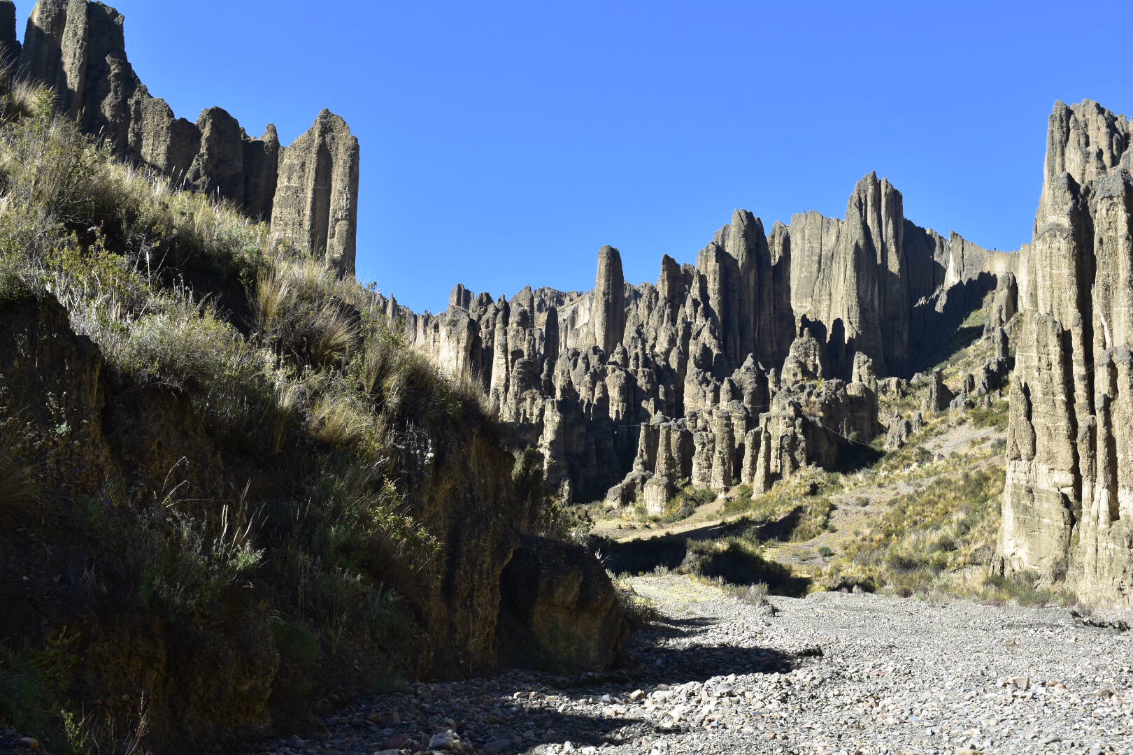
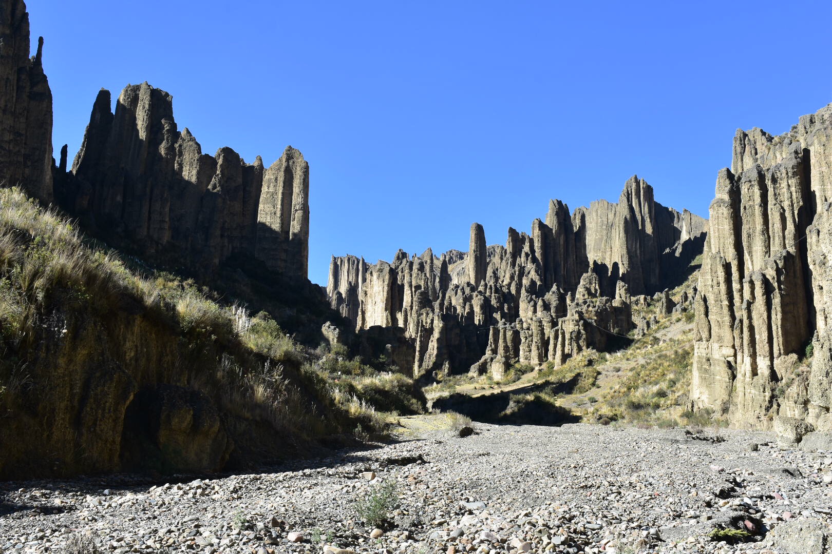
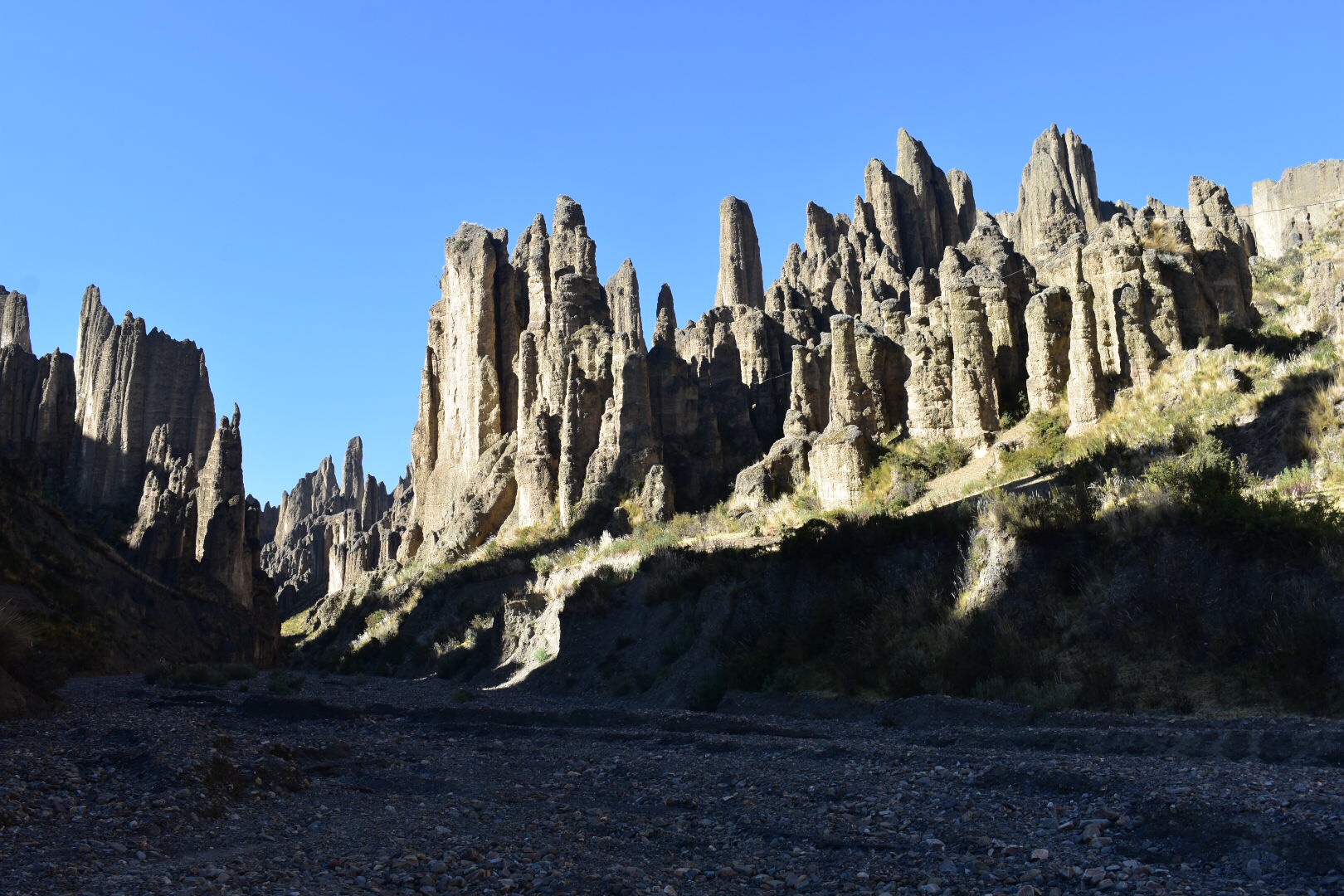
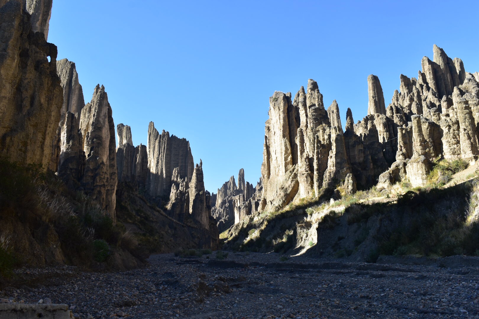
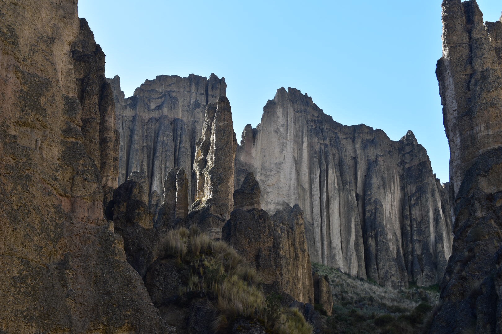
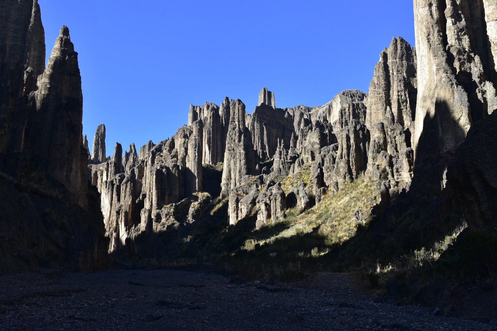
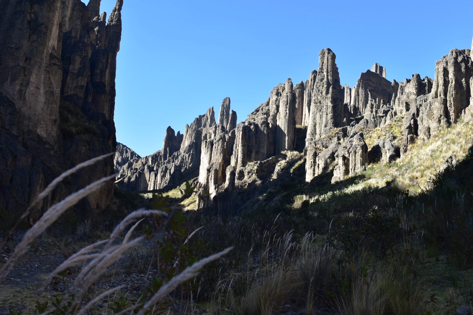
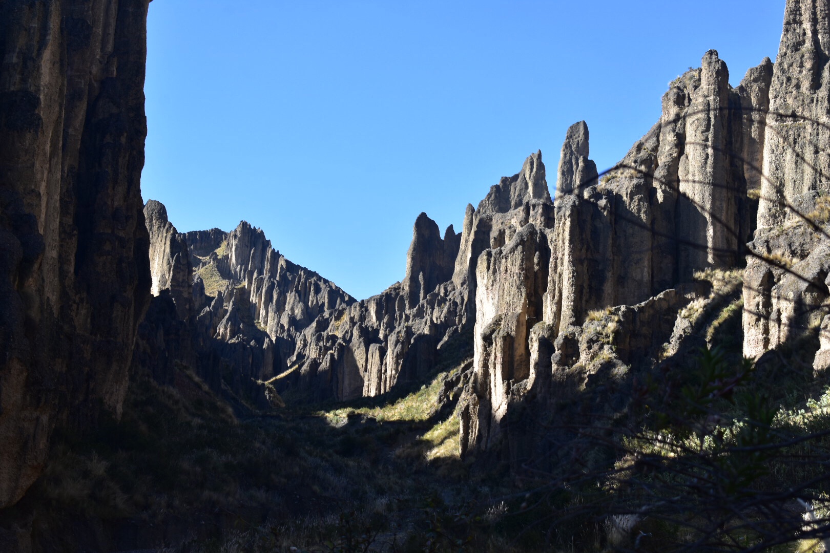
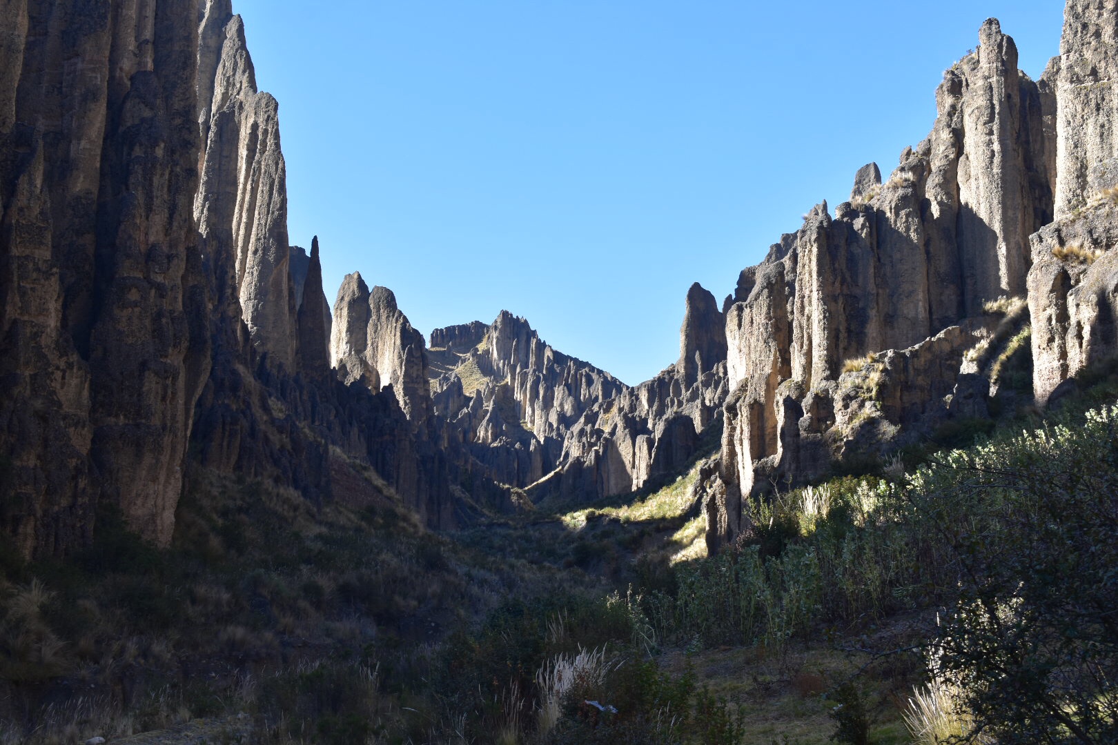
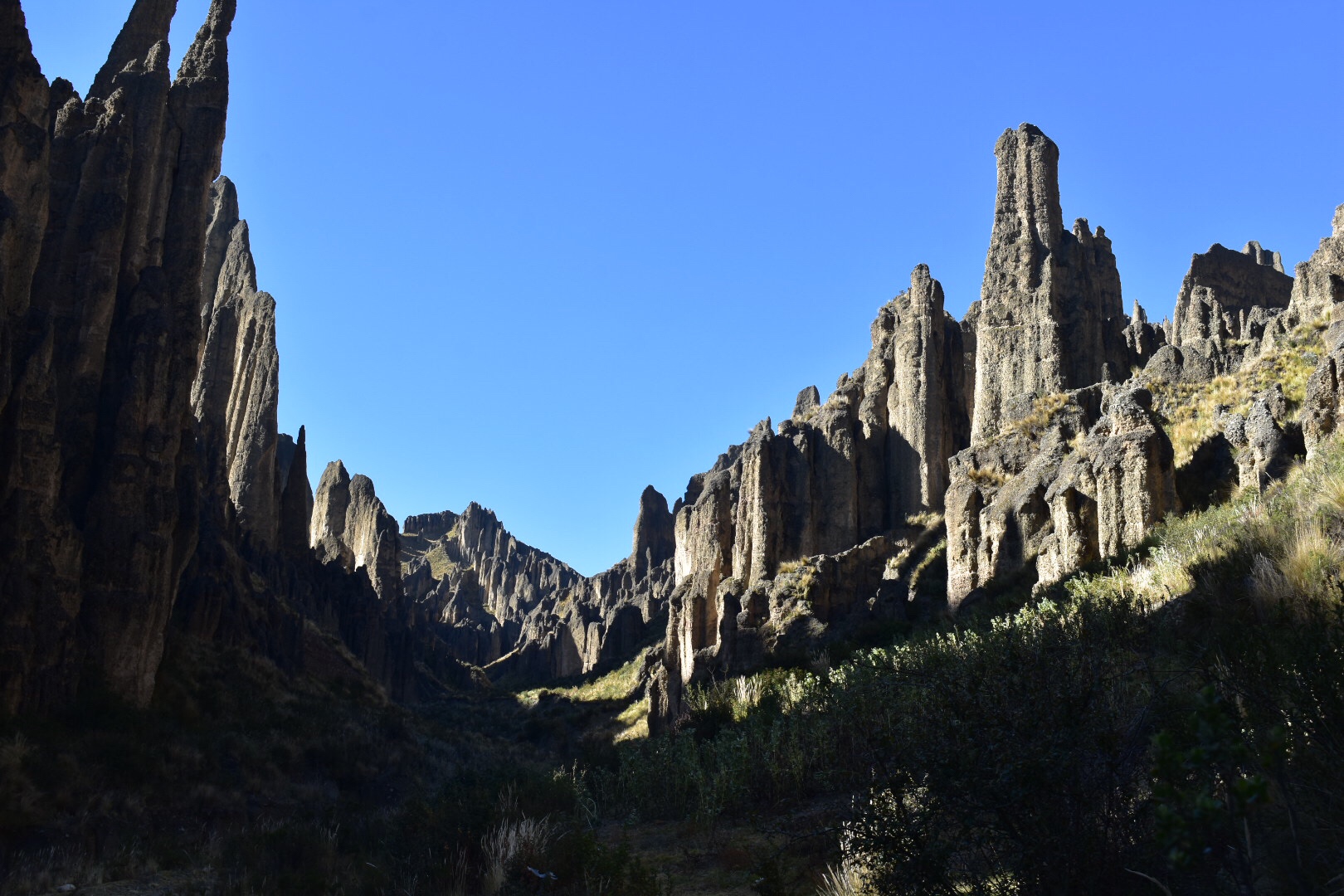
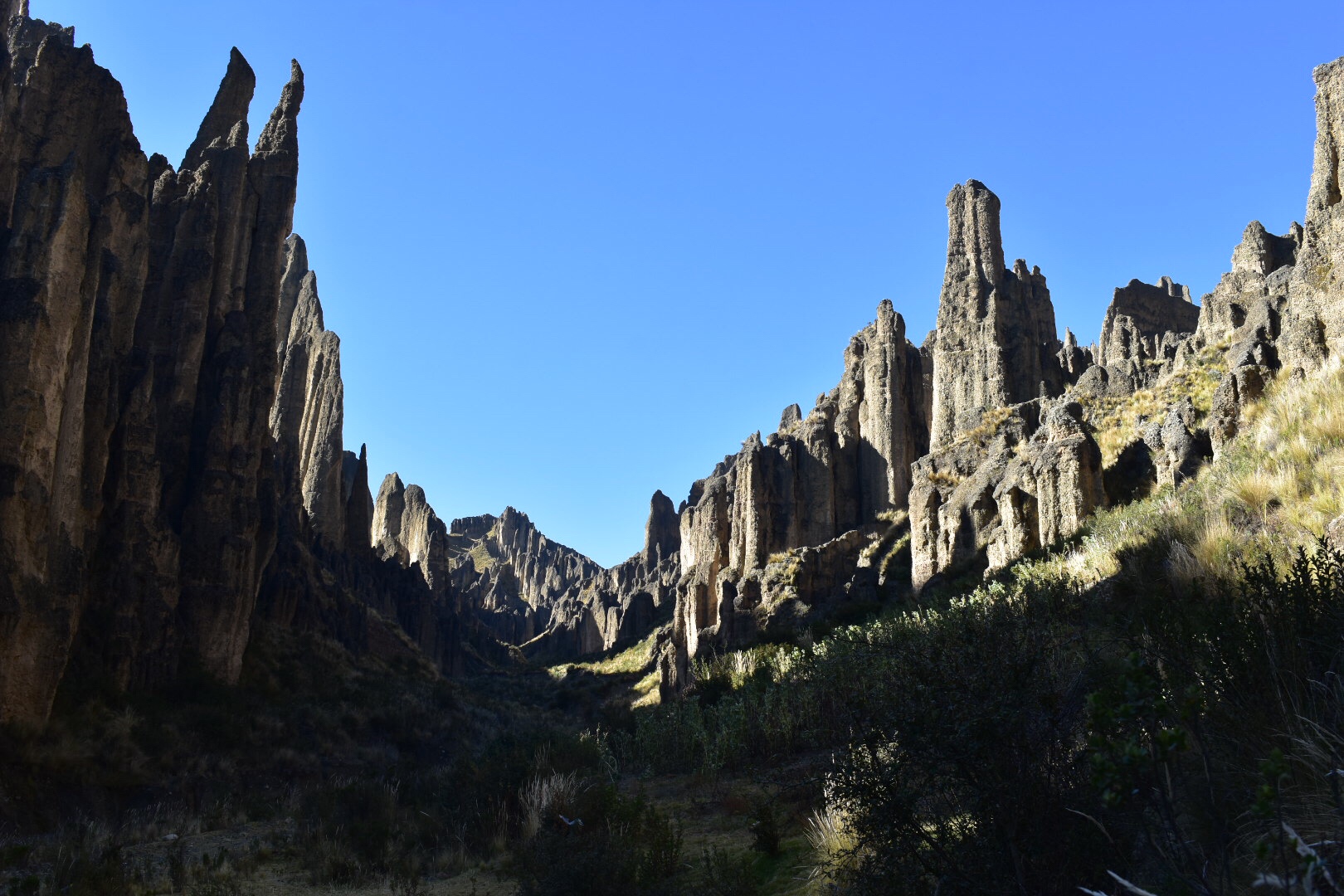
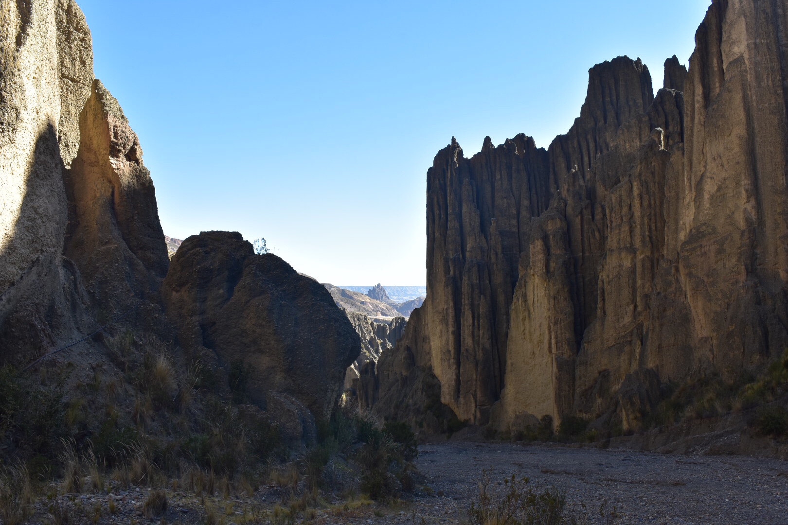
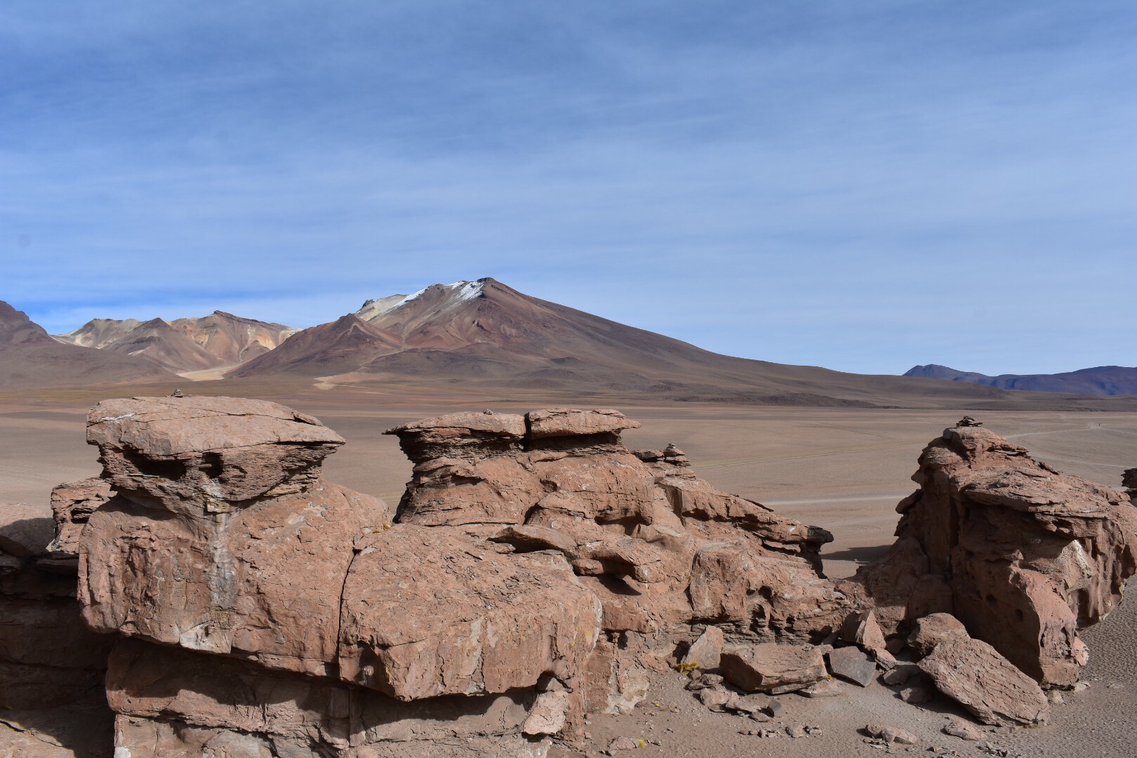
We had breakfast at the hotel and headed out early to some rock formations in the middle of the dessert. There was nothing to say we couldn’t climb on the rocks so we did. At one point Niklas and I tried to climb up one set and were blocked. Ruben and Benny scrambled straight up other formations and later Melanie was kind enough to take some photos of me posing.

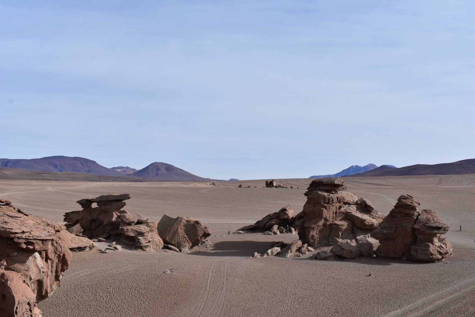
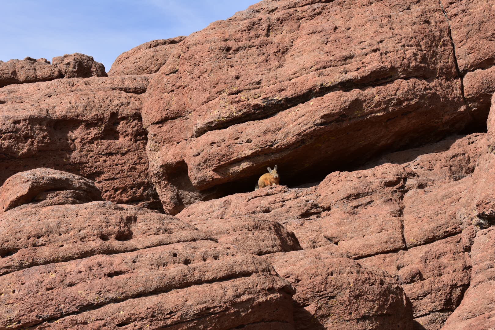
We moved on to another set of rocks which was home to some rabbits. Well kinda rabbits.

And then stopped in the middle of the desert. There was a great song on the raído and Simone turns it up so we had an impromptu disco. I have a video but I don’t know how to upload it here.

After another long drive and passing a load of cyclists who were doing the same tour as us, but on bikes, some people are just crazy!

We ended up at another salt lake, again I don’t remember the name, but Emma helped me take one of the best photos I’ve taken on the trip. I’ll let you decide which one.

We stopped by another lake for lunch.

And when we headed on we all thought that we could see a camel in the mountain. It turned out that that we were all seeing different camels but let me know if you can see one.

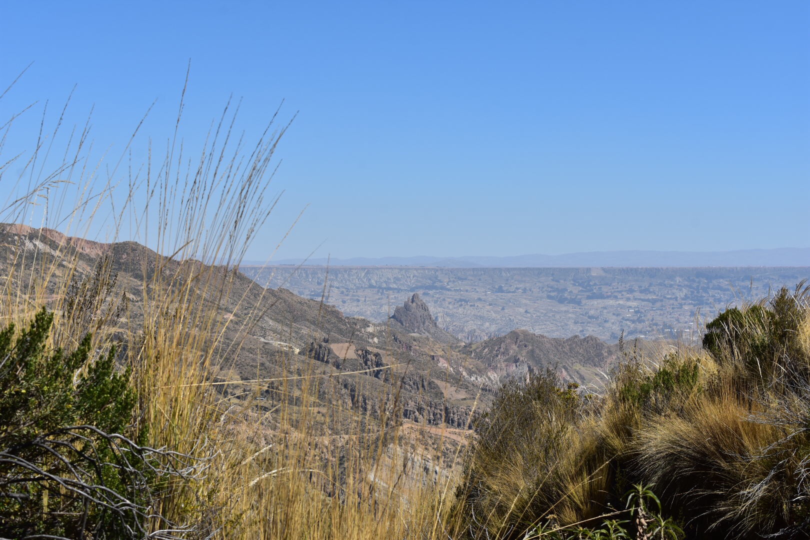
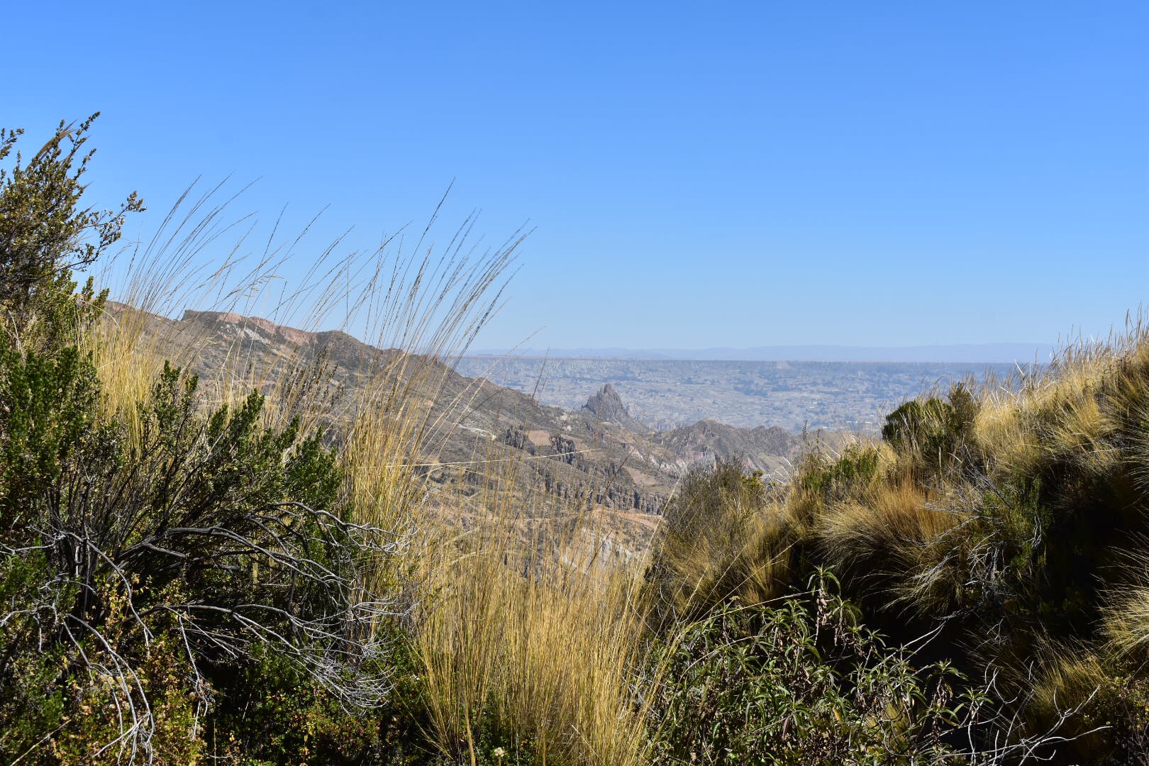
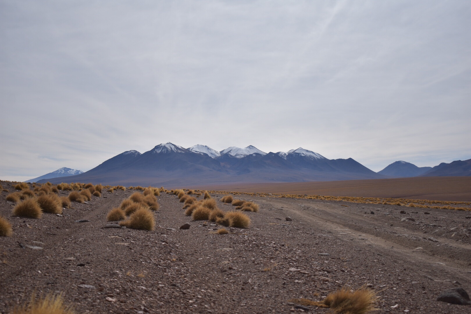
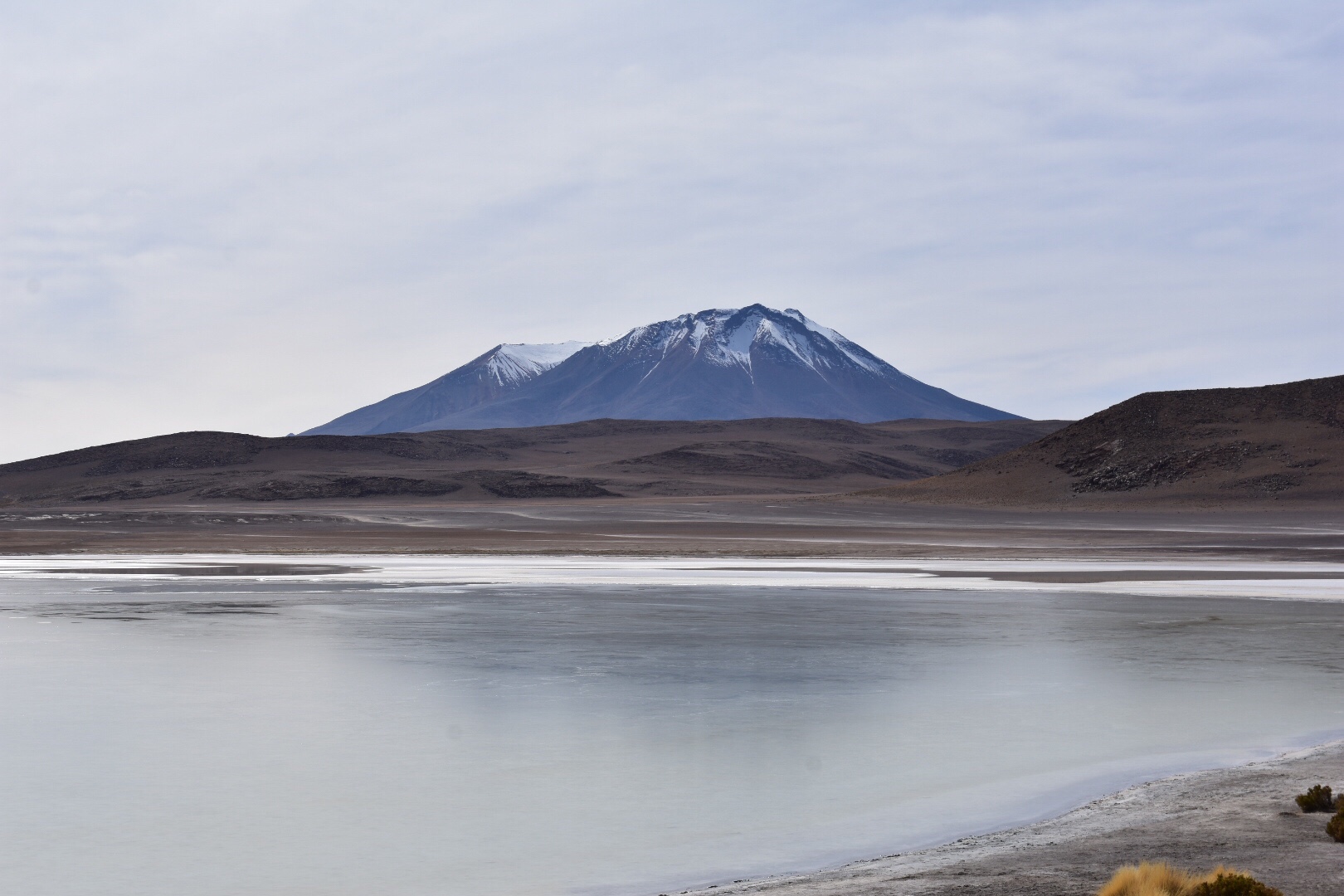
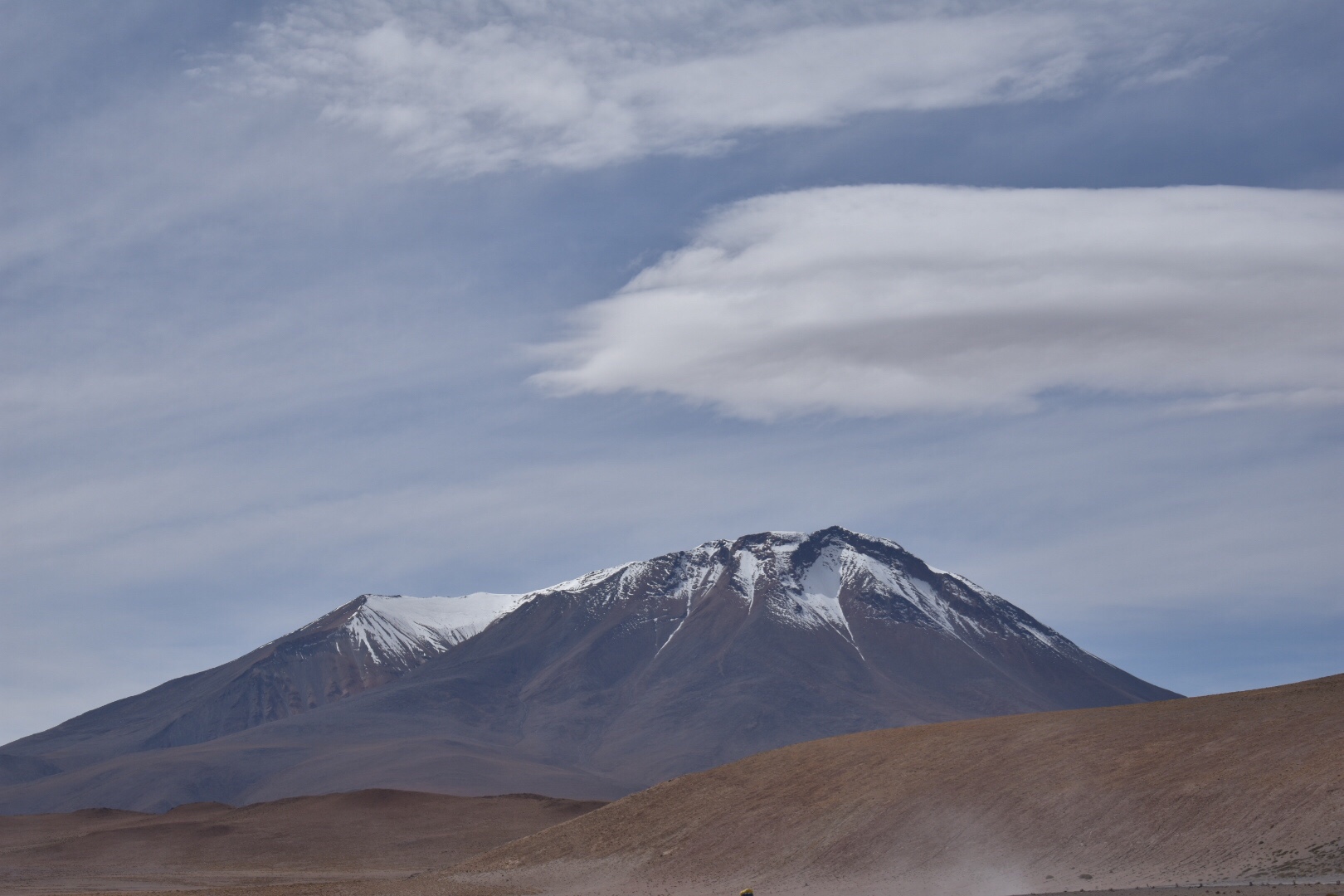
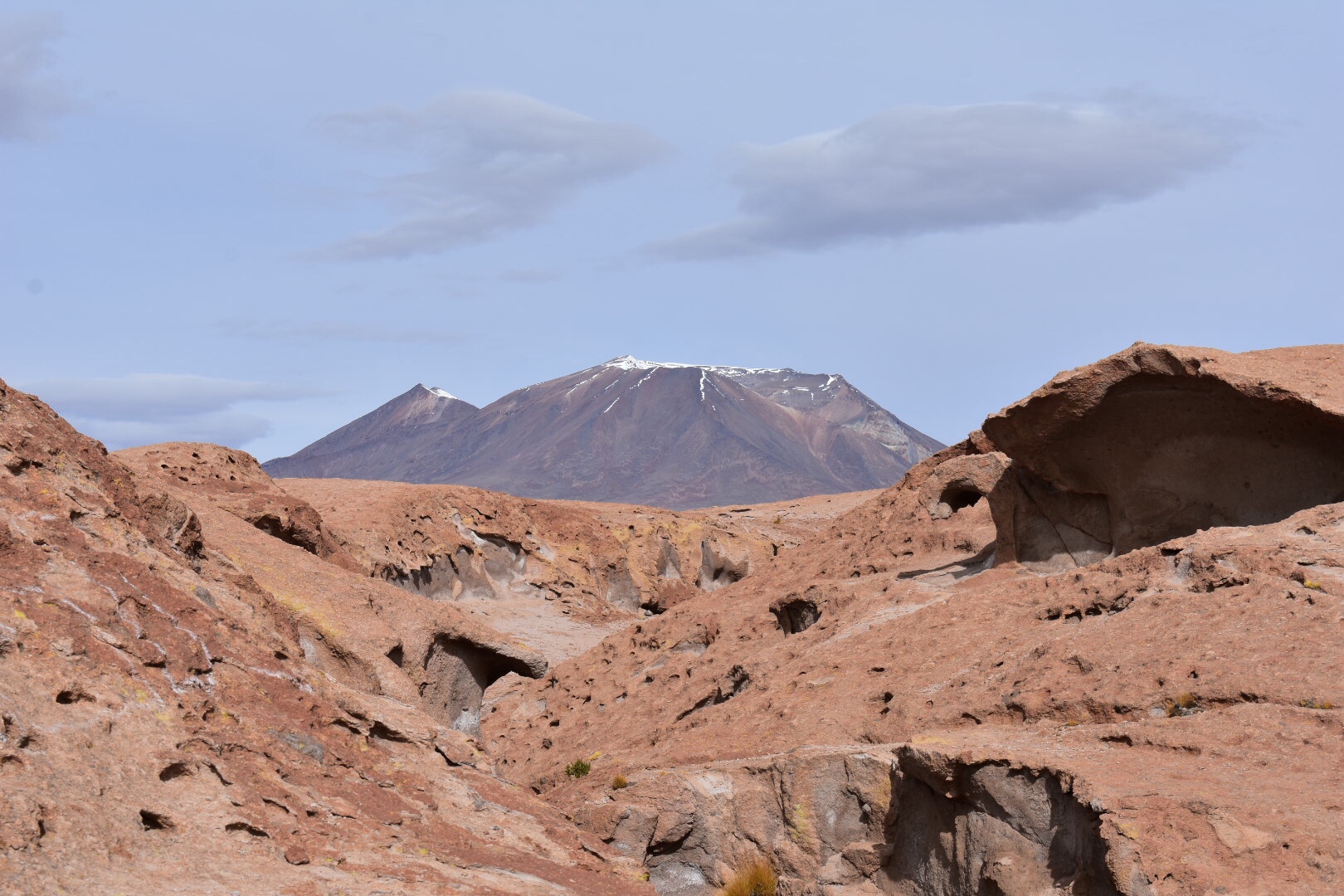
The next stop off was stop to see an active volcano. There was also a sign saying that we couldn’t do something but I still have no idea what.

After this stop I was able to ride shotgun and managed to snap some shots of the dust thrown up by the trucks.

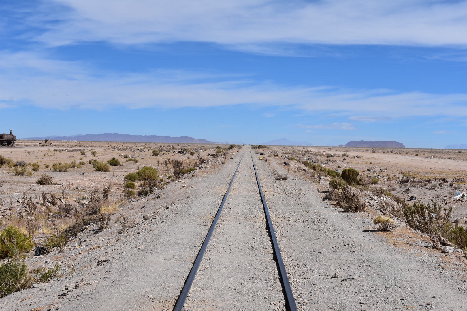
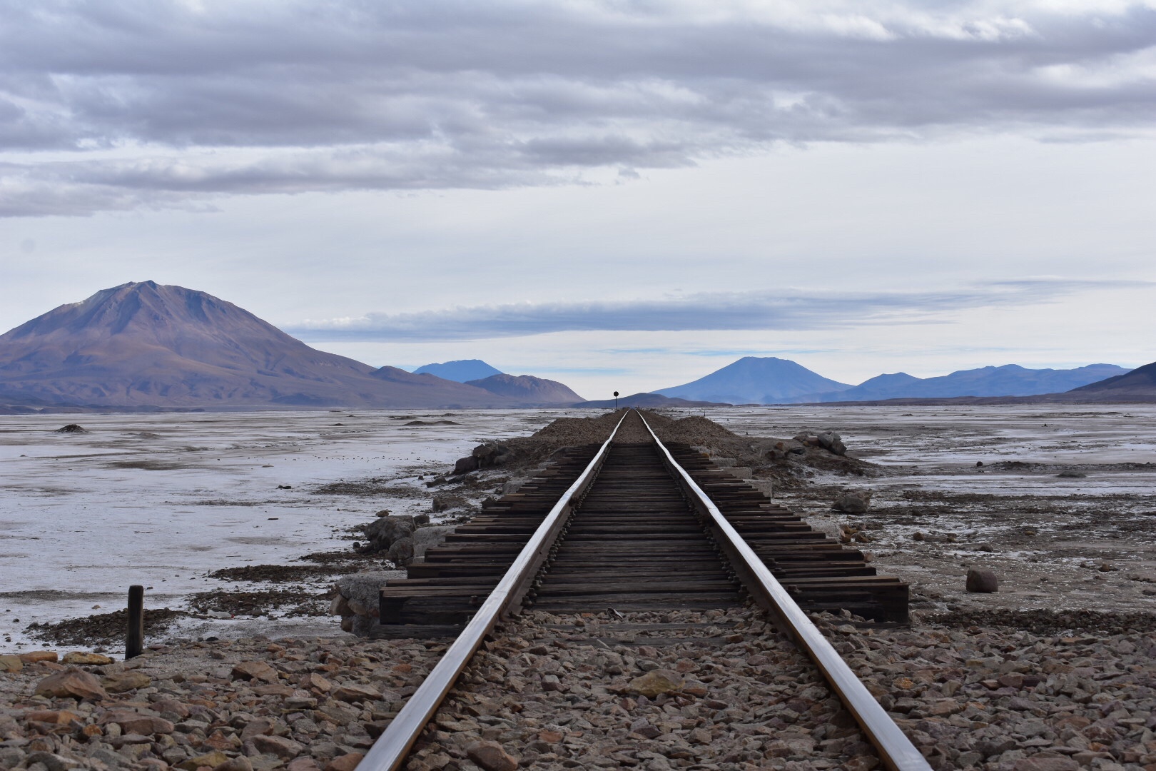
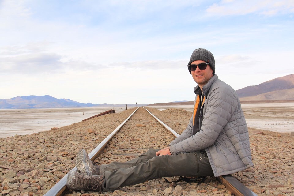
the final stop of the day was the train line. I managed to tick off another bucket list item by sitting on the tracks. Before you worry there are only two trains a week and it’s easy to see if any are coming. Melissa took some really nice group shots with her camera and We took Benny hostage for fun.

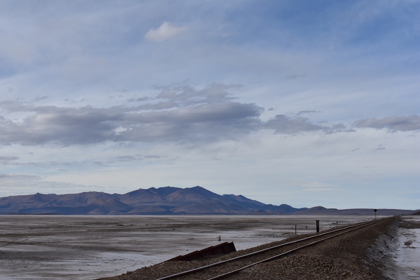
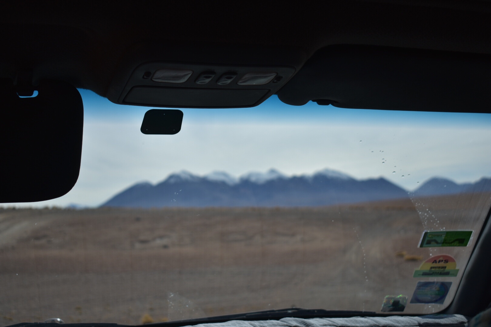
Again I rode upfront and took some. More shots. It’s really interesting to drive though this dessert as you can’t believe how far away the mountain are in the distance. We never seemed to reach them despite driving for miles and miles.

We arrived at our second hostel which had salt for carpets and had hot water-In one shower only. We convinced Simon to drive us to one of the shops to get some cactus beer and opted to get up at 5am to see the sunrise on the Salt Flats. But not before we drank the beer, played a few games of Perudo and were mobbed by the children.

Day Three

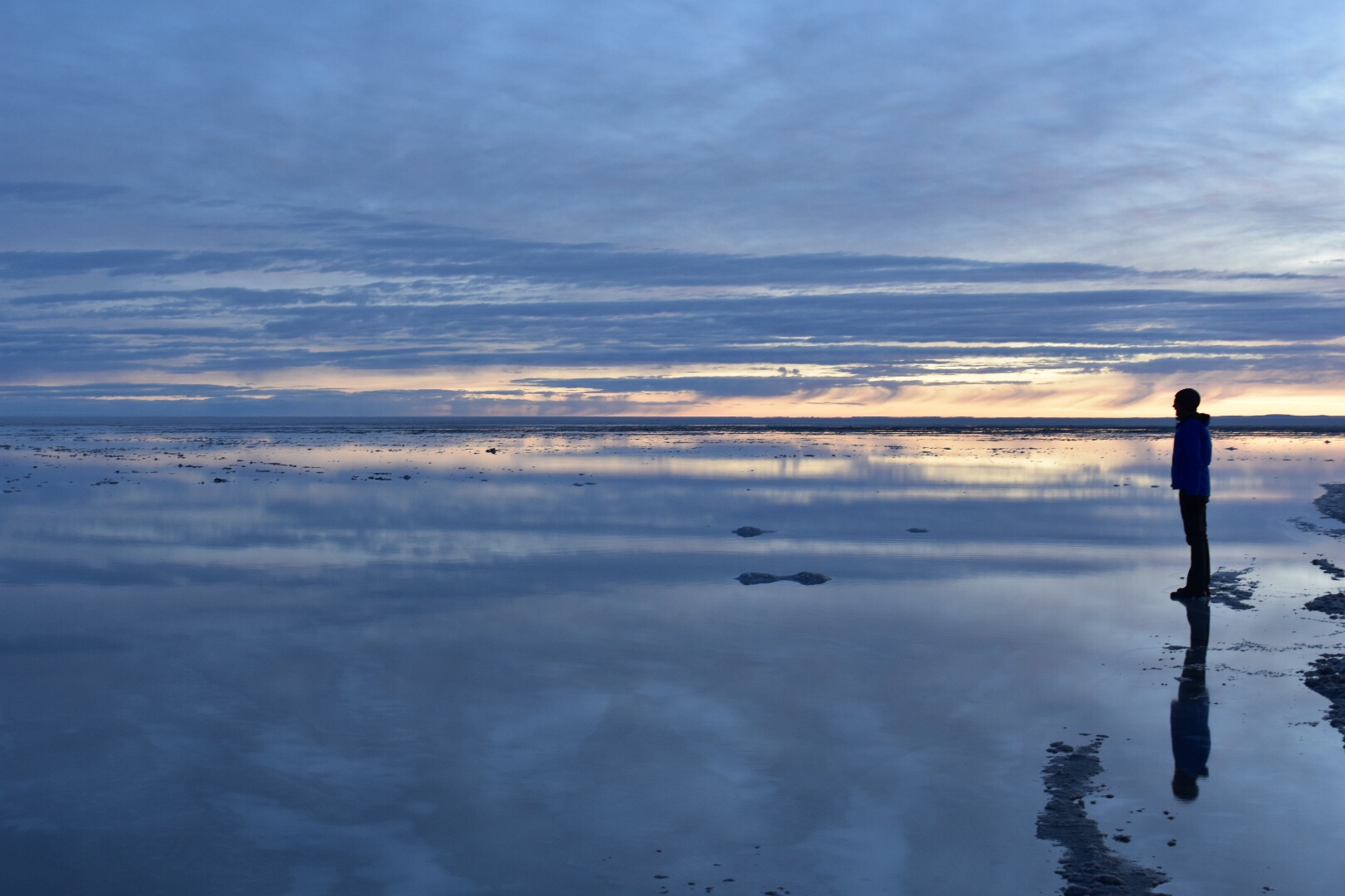
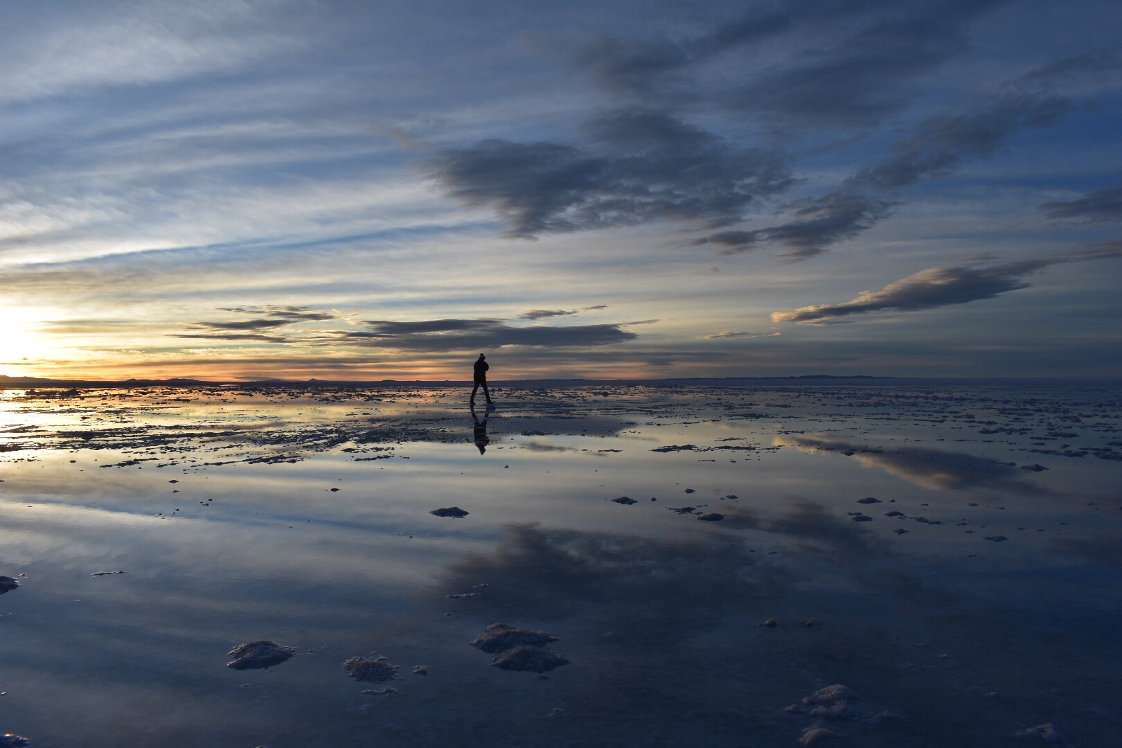
I had yet another early rise and it was getting ridiculous as to how many early morning a I had had in the past 12 days. It was absolutely freezing too. I ended up in the front seat which had become much less popular since the door on the passenger side had broken meaning I had to climb over everything but also I was able to get the warmth from the engine which was good. We set of in the dark and soon light started showing over the horizon. I snapped a couple of photos but the jerky ness of the car made it impossible to get anything in focus but I really like the first photo.

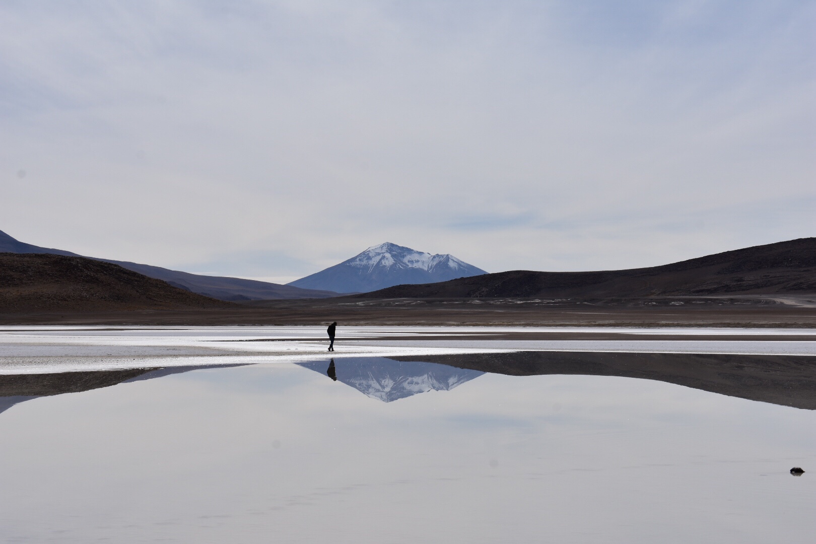
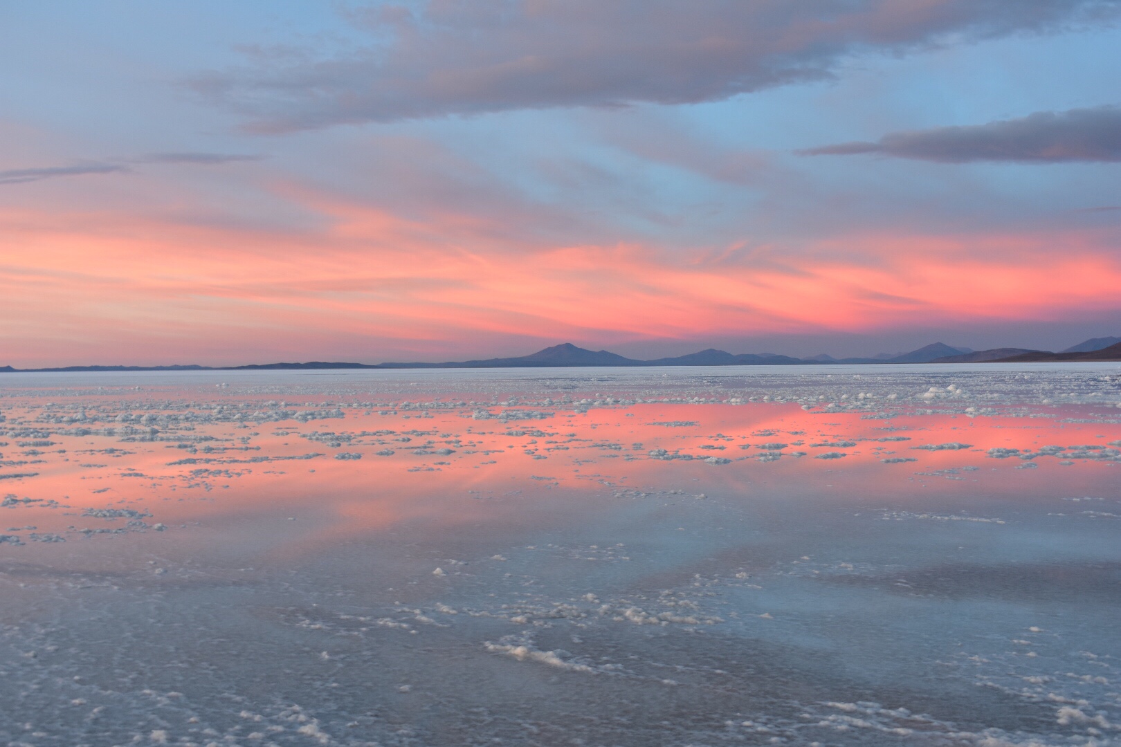
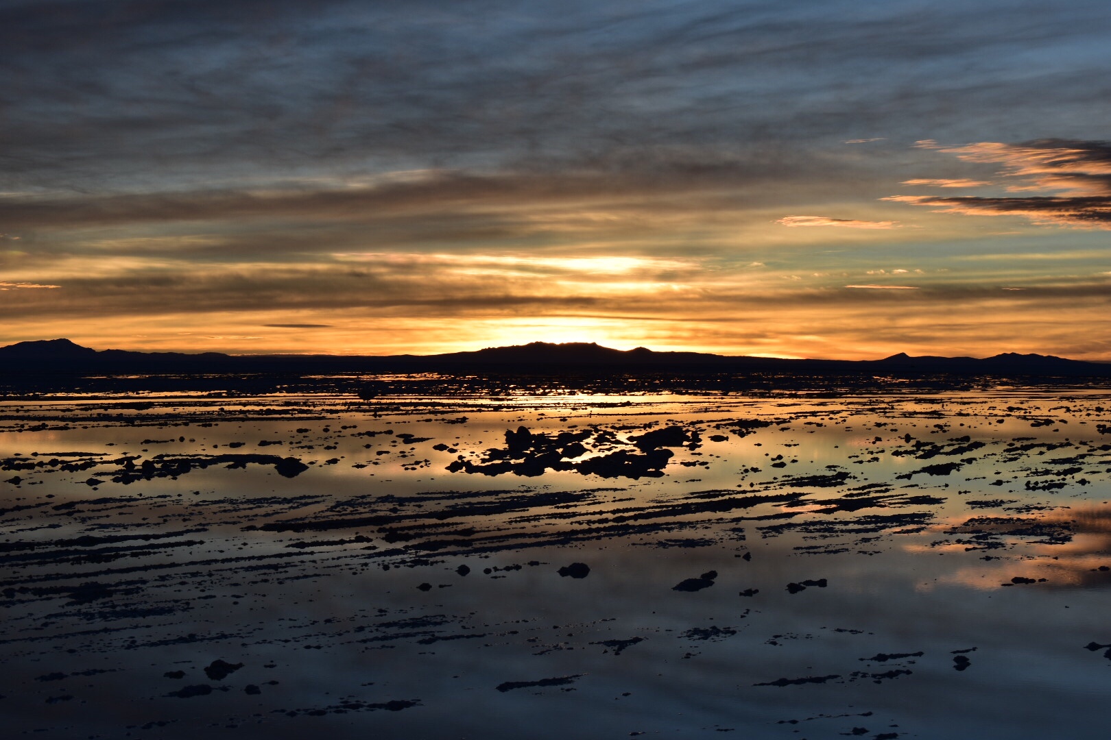
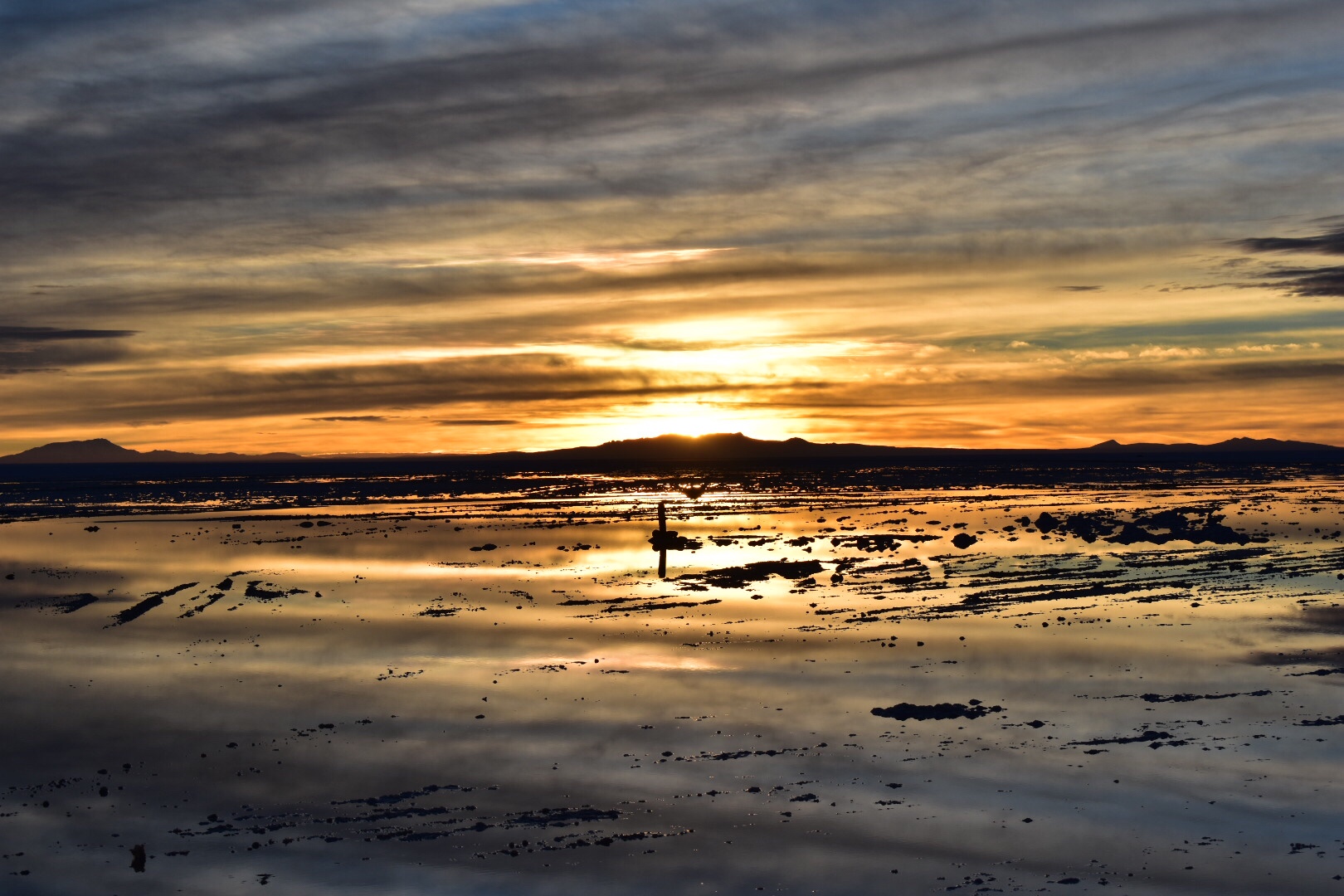
Soon we arrived at the Salar de Uyuni and this part was covers in a thin layer of water giving a beautiful reflection. I can’t tell you how cold it was here but it was completely worth it. I’ve never seen so many colours and the reflections with the clouds was just stunning. There are no filters on any of the shots below. It’s all completely natural.

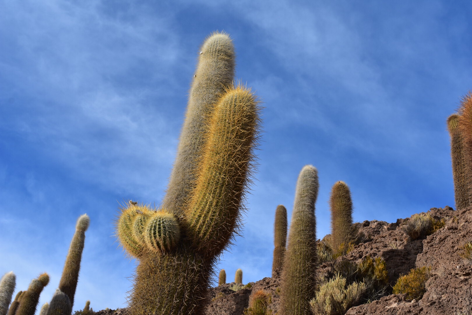
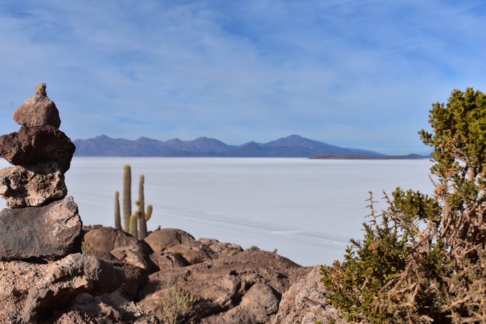
After we had watched the sun rise we were taken to an island in the lake where the re were lots of cactus growing. Just to give you an idea of scale the lake is 200 kilometres long. That’s further than from Portsmouth to London. And a depth of 140 metres. It’s huge.

We walked around the island in the middle of the Salt and returned to have breakfast in a beautiful setting.

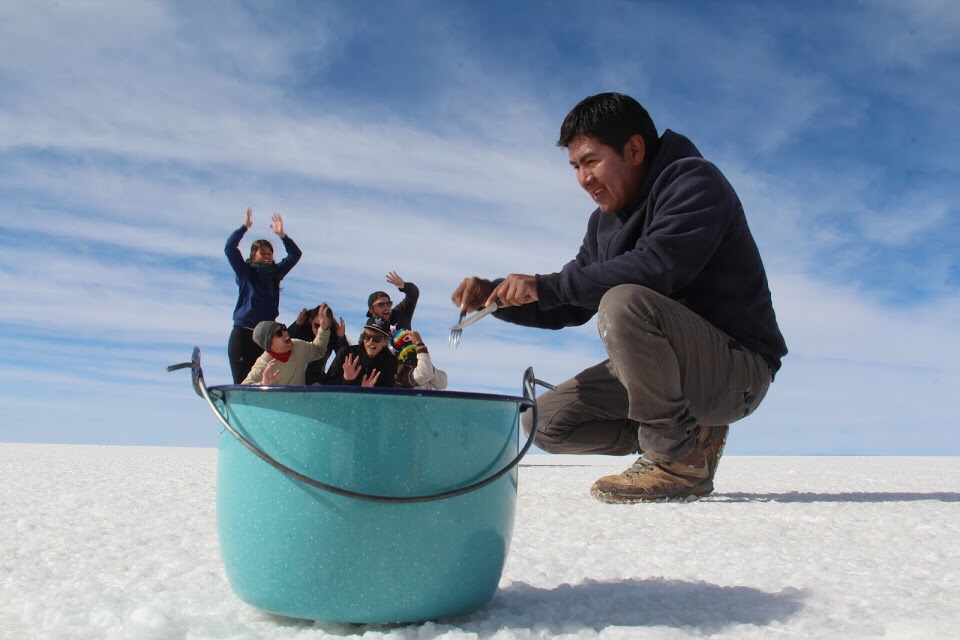
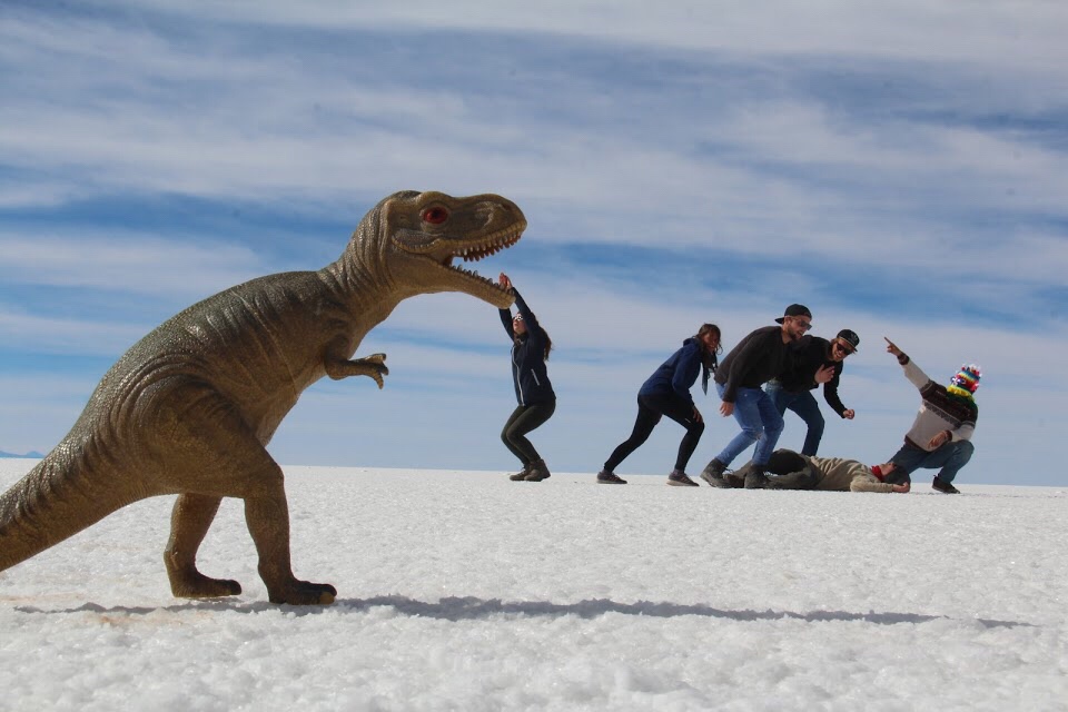
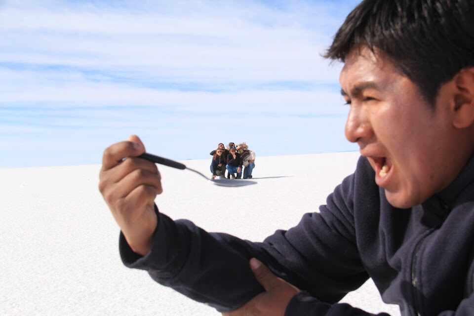
Afterwards it was time to make the perspective photos and kudos to Melissa as she took charge and without her I don’t think they would have been anywhere near as good.

After we finished playing around it was time to leave but not before we stopped past a lot of flags in the Salt Flats.

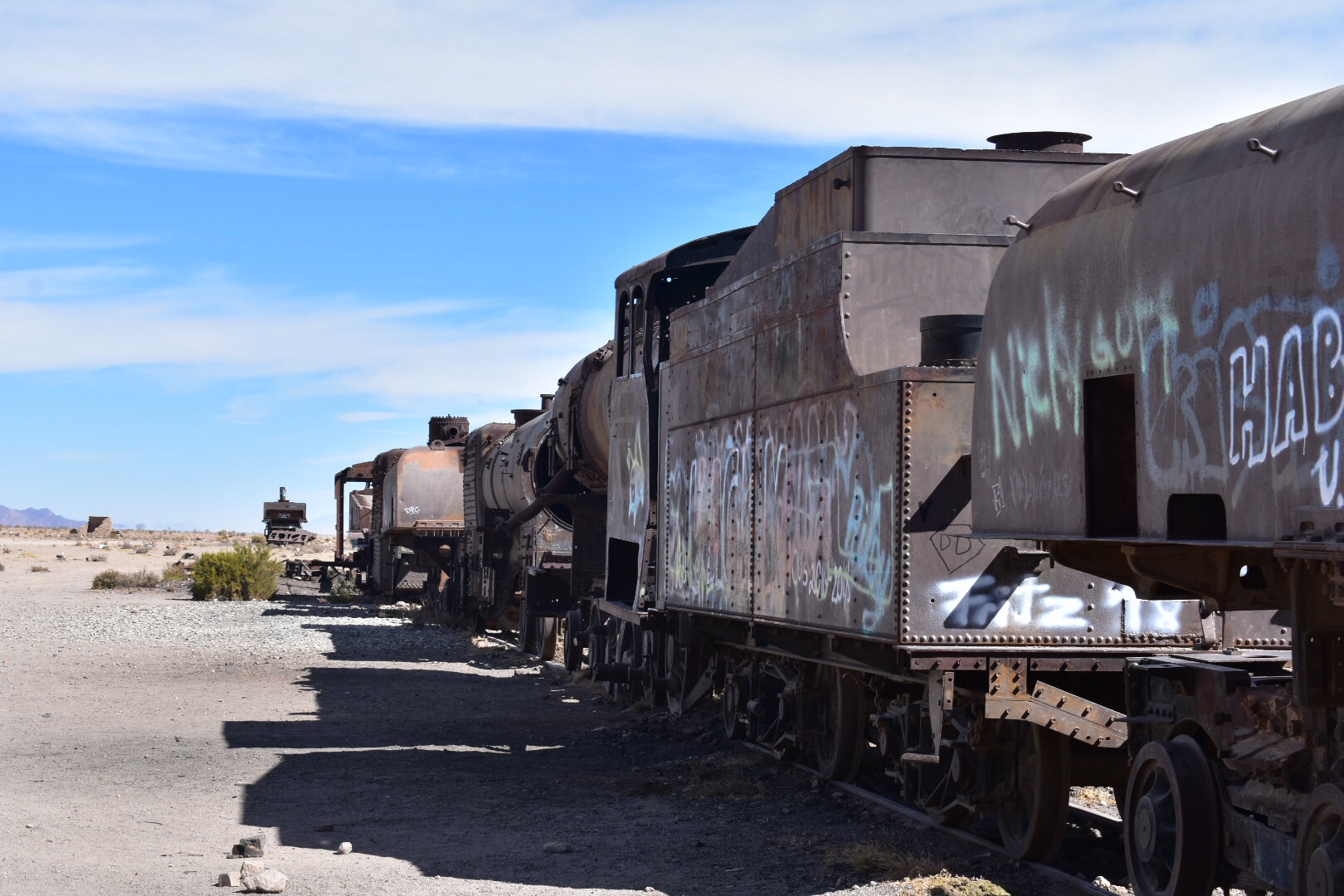
And then there was one last stop in Uyuni. A train cemetery. I’d like to write so much more but again this is crashing due to the amount of photos so I’ll leave them to do the talking.

Page 3 of 3

Powered by WordPress & Theme by Anders Norén