Exploring Latin America 🇦🇷 🇧🇴 🇨🇱 🇨🇴 🇪🇨 🇲🇽 🇵🇪 🇺🇾

Category: Peru

Colca Canyon

I had two more days in Cusco before my night bus to Arequipa and I decided to take full advantage to sort myself out. The next day I sorted my laundry, cleaned boots, brought supplies, by a bus ticket, checked and cleaned everything and repacked. Plus I had to sort and delete 1500 photos, transfer them to my phone, upload them to the cloud, upload them to the blog and write the blog. There is a lot of admin to do.

I had sorted a lot by 1pm so headed out to a Vegan Cafe to get some much needed vegetables. After I was meeting Miri and Arvid in a chocolate shop to swap notes on the Salankaty trek. I ended up having one of these and it was delicious.

After I headed back to relax and treated myself to a Chinese dinner as there is a lot of Asian food in Cusco.

The next day it was a case of packing and waiting for the bus. I went back to Jacks one last time just because I now knew it well and I wasn’t in the mood to find or try something new. I ordered a tuna melt which wasn’t quite what I expected but it came with a huge salad and I was happy to experience lots of vegetables.

After lunch I caught up with Claudia who i met in Santa Cruze and also happened to arrive in Cusco that day. We had some icecream before taking a tour of the market and supermarket before I sat in the hostel in the WIFI waiting for my night bus time.

Again I reassert how much I hate night busses. Despite taking Cruz del Sur, a company aimed at tourists that has increased security and comfy seats it was still a bumpy ride. There was a lot of traffic outside Arequipa so I ended up arriving two hours late. Jumped in a taxi, take one from outside the station as it’s half the price of the guys inside the bus station and still probably too much, and arrived at the hostel to meet Alice and Sam who I’d met on the Salankaty. They made me an amazing breakfast and soon after dropping our bags at the hostel we were in a taxi back to the bus station. One piece of advice I’d give anyone hiking Colca Canyon is that you don’t need to take your big bag, unless you are camping, but there really is no need as there are a lot of really budget hostels you can stay in and when you experience how steep it is I think you’ll appreciate that advice.

From the main terminal in Arequipa you can take a bus to Cabanaconde, which is the main town where the hikes begin. We actually had a place booked in a town called Yanque which is a beautifully picturesque town, although there is not a lot to do there. After having a quick shower and sorting ourselves out we went for a wonder around town while it was still light and brought some supplies.

We went back to the hostel for a delicious three course meal, where I tried my first Alpaca. I’ve been avoiding Llama and Alpaca meat as I’ve been told that the locals don’t eat it and it’s just for tourists. I don’t really want to get in on eating things that are just for tourists, although it might be different in Peru. I was told this in Chile and Argentina which both feel so far away now. It was delicious and we had an early night ahead of the early start tomorrow.

The bus to Cabanaconde left at 7:30am so we grabbed some food and headed to the square which was alive with tourists. It seems that all the towns stop off here where the locals sell their products and there were school children dancing around the fountain. I wasn’t sure how I felt about this all being put on for white tourists so I brought some empanadas and kept my distance waiting for the bus with Sam and Alice.

The bus soon arrived and it was a 90minute journey to our starting town. But we could see the canyon on the way there.

We had debated getting off the bus early at the Cóndor lookouts but had decided against it. This would have added 2 hours and 11km to the journey and meant walking up along the road. Luckily for us, and especially me, the bus stopped for a few minutes to let passengers on and I was able to get a great view sitting on this side.

A few minutes later when the bus was driving a Cóndor flew along side about five metres distance away. I wasn’t able to get my camera out quick enough trouble photograph it as obviously I had just put my camera away.

Se got off the bus at the main square. Popped to the tourism office to buy our tickets for 70 Soles and headed to the starting point. Again Alice and Sam had done all he thinking and planning so all I had to do was to find the trail on Maps me and follow it. We had a dog guide who wanted to show us the place he contemplates life so we followed him to find out what the view was like.

After taking the short diversion we headed back to the main path where a man checked our tickets. So remember to buy them. Our first destination was Llahur as we were doing a three day two night trek. Going this route there is a lot of down. We would actually be walking down all day. We didn’t actually start walking until around 10:30 and by this time it was already hot. The canyon is actually really hot and it’s best if you can to set off early.

We had been walking down for an hour or so and Alice and I were both beginning to feel the heat. I don’t know why but I felt exhausted even tho I’d just done what is supposed to be a harder trek. That night have been the reason. At this point the trek flattened out for a while but then the real down kicked in.

The steep down took us toward the river which is always annoying as it means you have to hit a really low point before going up again. In my experience of hiking rivers are bad. It seemed t take forever to get there and the river never seemed to get closer but somehow we eventually made it.

And here are the bridges to prove it. After crossing we took a gentleish up and for this part of the trek we had to walk along the road.

I’m really guessing now but maybe after another hour of walking we could see our destination. The one problem was there was more steep down and this we would have to walk up again the next day.

We reached the hostel and all nearly collapsed partly due to heat but it was also now nearly 3pm and we hadn’t eaten. Alice persuaded the owner to cook us lunch, which was cheap but really bland along with dinner but it’s food in the middle of nowhere so you can’t really argue. We were going to check out the various hotels but this one had hot springs which we made full use of. I think we went to bed at around 8pm right after dinner, but not before I photographed the cat.

The next day we had planned to set of early to beat the heat but by the time breakfast had been served it was 7:20 by the time we left. We decided to follow the trial on Maps me which was shorter but more steep. But I hate hiking up roads so for us it was the better way to go.

We reached the highest point of this side of the canyon and rested while a few others caught up with us.

All that was left to do was to trek down to the oasis. In the pictures below you can see both the path down and the path back up on the other side. That’s not a fire below its steam.

Around halfway down we reached a plateau. There is a shop and I made friends with a local spider.

There was another steep decent into the Oasis and we had reached our destination by 11am. We skipped the first place as the swimming pool was dirty and ended up at a hostel that was a little like paradise.

I actually found this day really difficult as I wanted to climb the remaining distance out of the valley. It’s not really like me to sit around in the sun and do nothing but I was with others so I took the opportunity to catch up on my reading. But being the only single person around lots of couples was actually quite hard. Weirdly on such a tough hike it’s one of the most resorty places I’ve been. It’s a paradise but I’m more into hiking than relaxing. Maybe that’s something I need to learn.

Luckily for me there was a kitten to harass so I concentrated on that.

We decided to start really early for the hike up to avoid the sun and it seemed that everyone else had exactly the same idea. Still we left early and Alice found out the better path to take. I ended up being the pace setter and we had some really fun conversations walking up one of the steepest paths I’ve ever had the privilege to witness.

It was supposed to take 3 hours but took less that 2:30 which meant we could get the 9am bus back to Arequipa.

The bus journey back to Arequipa takes the best part of 6 hours and goes up to nearly 5000 metres. It is however an absolute treat for the eyes. Sadly the sheep that were put in the luggage hold of the bus didn’t get to see any of this but I’ll let the pictures do the talking.

And everything you see below is up at over 5000 metres. Just look up at the sky and imagine.

And then we finally saw the other side of the volcano that is the picturesque view that you can see from Arequipa.

After the bus finally arrived we jumped into a taxi back to the hostel and all pretty much collapsed after a long hard hike and journey.

Choquequirao – how to hike solo

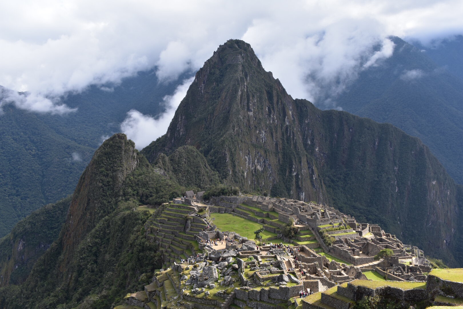
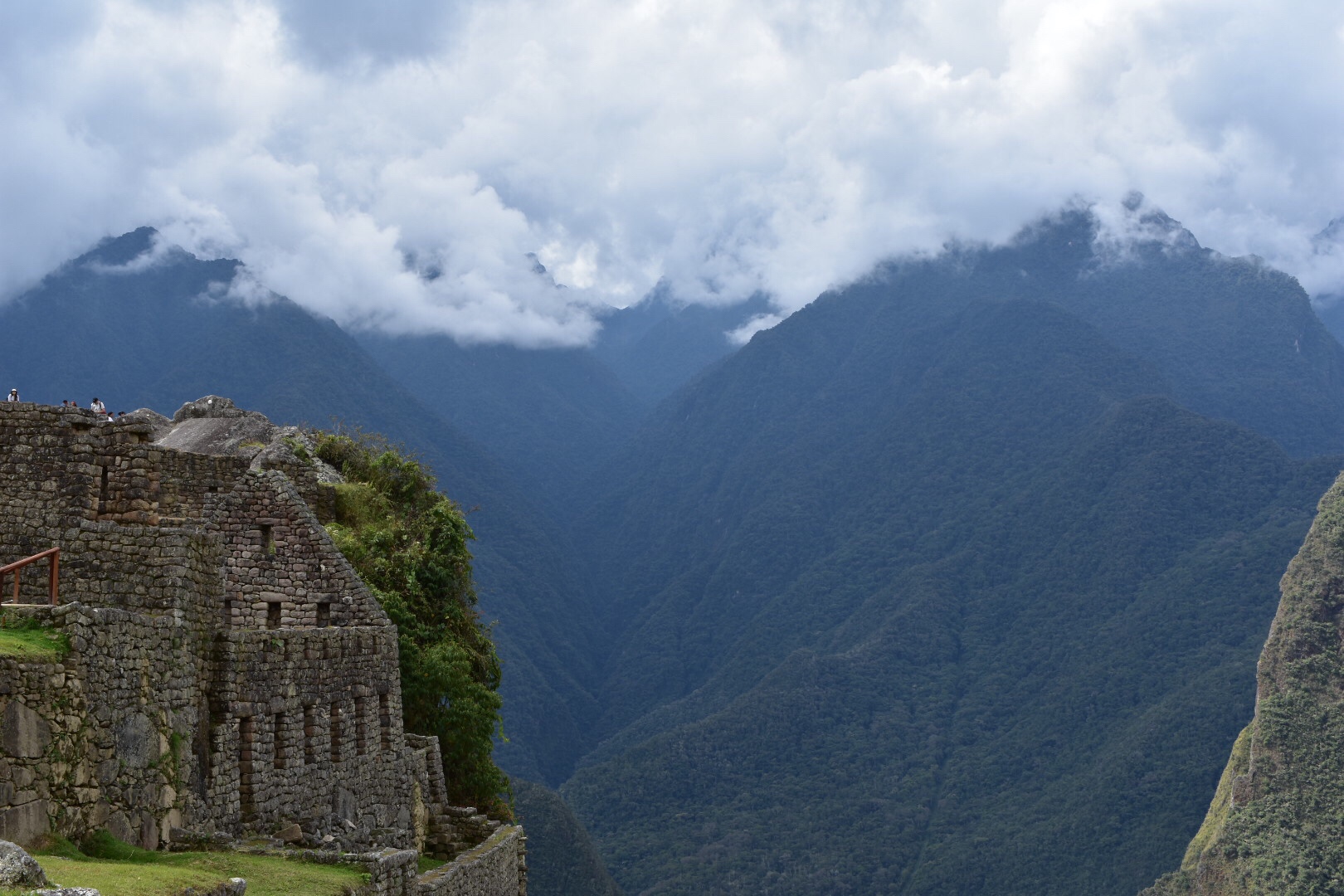
Choquequirao is another huge Inca city thought to be larger than Machu Picchu. Only 40% uncovered it is much more remote and receives fewer visitors due to the tough trek to get there which involves a steep decent of 1500 metres to a river and then a steep ascent of 1500 metres. Generally the trek is then repeated to get out. The valley is hot and full of mosquitos and it’s not an easy task, or so I was told. Renzo our guide on the Salankaty said if that was a 3 in difficulty then Choquequirao was a 4. I had wanted to take a guide on the trek as it seemed like a challenge but after speaking to several agencies I was told there were no tours. I contacted some Facebook groups and took advice from blogs and took the decision to go solo. It’s recommended that you hire a mule but to keep costs down I decided to carry everything, which to be fair everyone that I met hiking solo also did.

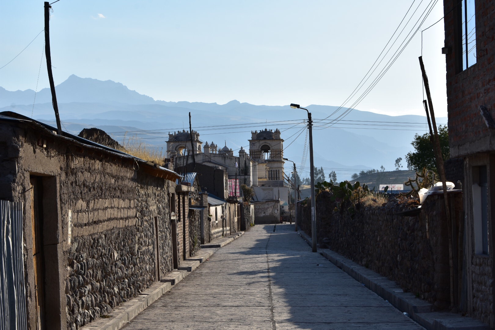
I arrived back from Urubamba around 2pm and had to sort everything for the trek the next day. I headed to the main bus terminal and purchased a ticket to Ramal de Cachora, all busses going to Abancay from Cusco will pass there. After I went to several supermarkets, the market and Rosly to hire camping equipment. I was all sorted in around 3 hours and met up with Jaz, Sam, Alice and Ennio for a coffee before they all left the city.

As I’d essentially brought sugar and carbs for the trek I went to Jack’s for dinner. Last time I was there I saw they did a chicken soup which had a lot of vegetables so thought I’d get them in before the trek. The waiter told me he used to be a guide on the trek and the first time he did it he cried. It nearly came to that for me but we will come to that later. He was impressed I was doing it solo and said I’d see the real Perú. And you know. By the time I returned to Cusco I think I had.

I returned to the hostel, repacked my bags again and had an early night. In the morning i headed to the bus station for my 9:15 bus and we headed to my destination. There was a salesman on the bus for the first hour who I think was selling powdered vitamins that you add to food as some kind of miracle cure. I have no idea what he said but it seemed to work as people brought the powder.

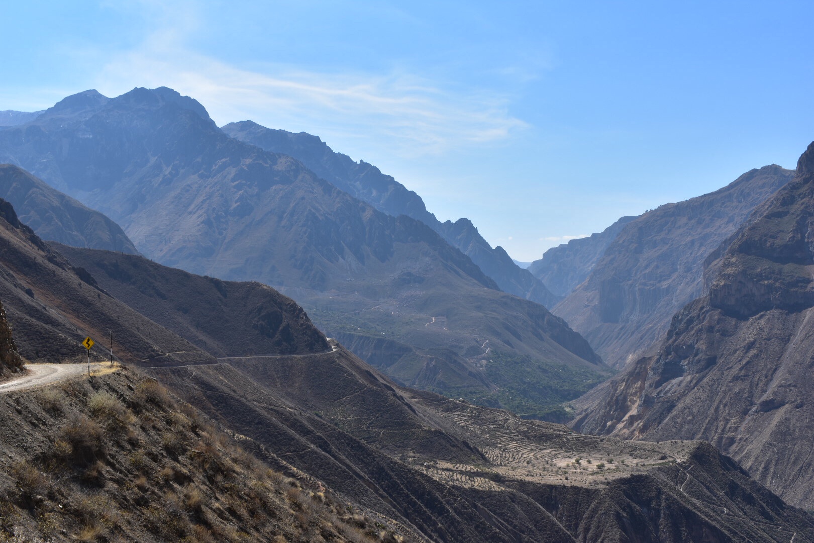
After about 4 hours I found myself at the side of the road in Ramal, a small clutch of restaurants by the side of the road and a couple of taxi drivers. I was charged 20 soles to reach my hostel and took it as I couldn’t see much transport but if you have time you could always try waiting for a collectivo. I did see some on the way back but they were not regular.

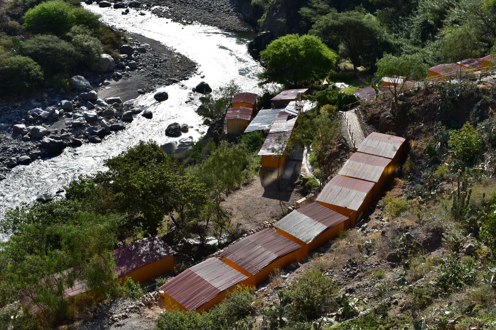
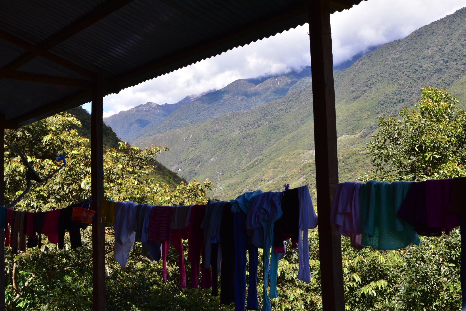
I arrived at the hostel and for now was the only guest and I think I found my happy place. I tested out my camping equipment as it was the first time I’d had space and then relaxed in a hammock and soaked up the view.

As it got dark I spoke to the hostel owners about last minute advice and it turned out that I needn’t have brought my own food, for which I silently cursed as it’s heavy and would have saved me hiring gas and a stove. The owner was kind enough to draw me a map and to set out a four day route.I had one final meal of lasagne and decided to finish packing for the trek and to take an early night. As I finished dinner a couple returned from the trek and they gave me some more advice and told me not to take the food to lighten the bag. I took the food and without water it weighed in at 13kg.

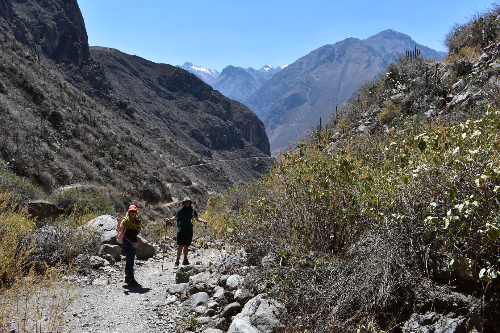
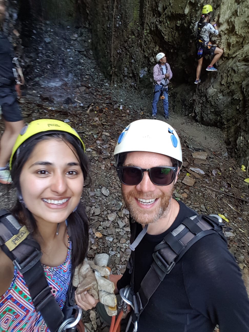
I awoke around 6am, had breakfast and took a taxi, 30 soles, for the first 11km if the trek, which is a road and you can hike if you want, to the trail head. Here I was left on my own but a French couple and four Peruvians started at the same time.

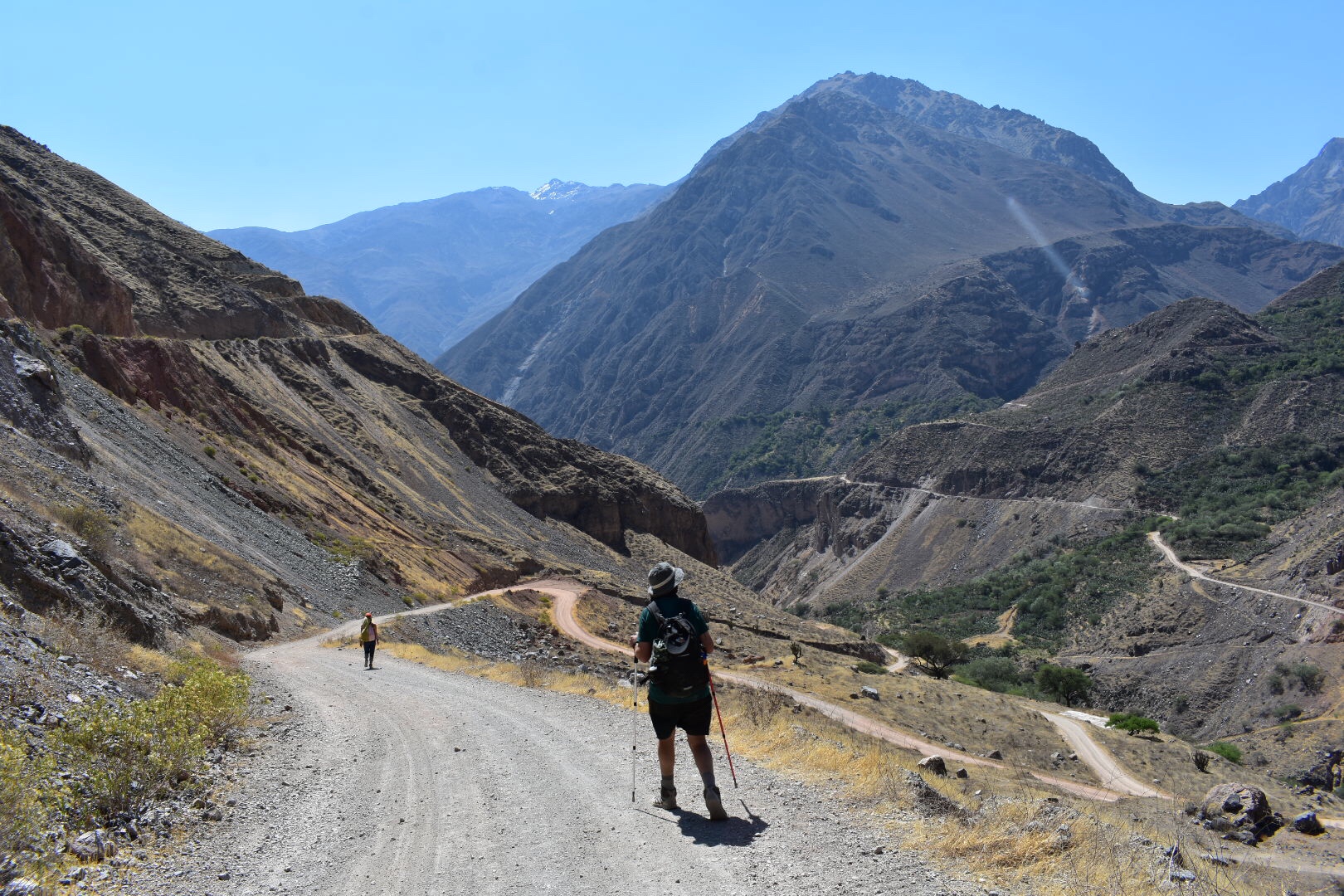
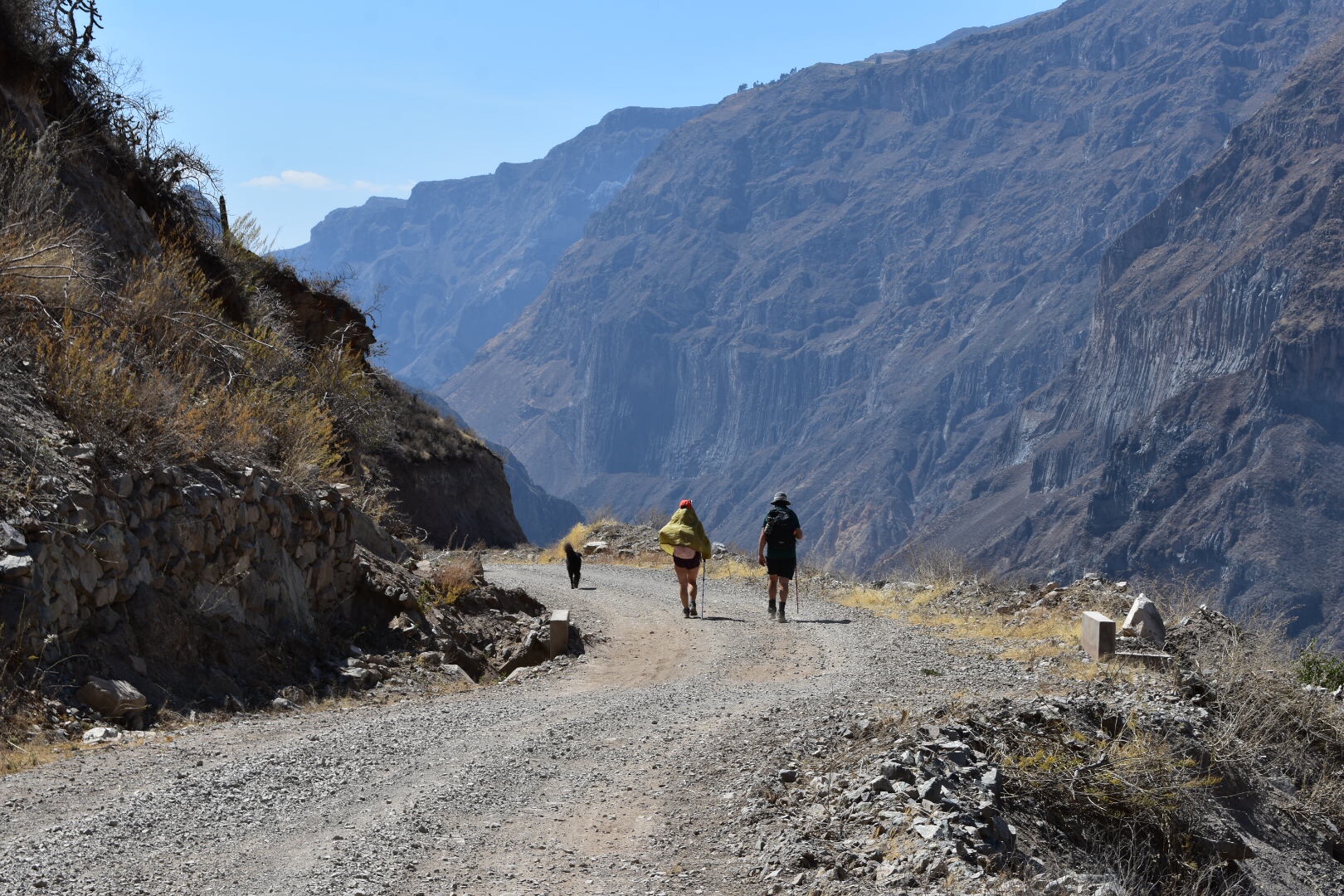
There is a 500 metre walk along the cliff until the first mirador where you have to sign in, which made me happy, and then the down starts. For the first few kilometres we jostled for places which was a little annoying as I wanted to walk at my own speed and the idea of doing the hike is that there are not many people but i was also very happy to have the company. As with any long distance trek eventually we all became separated.

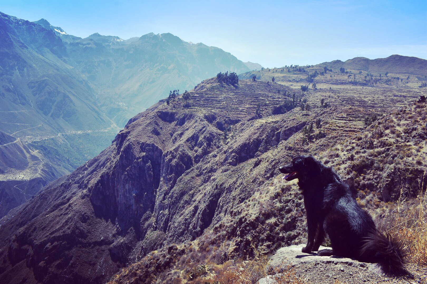
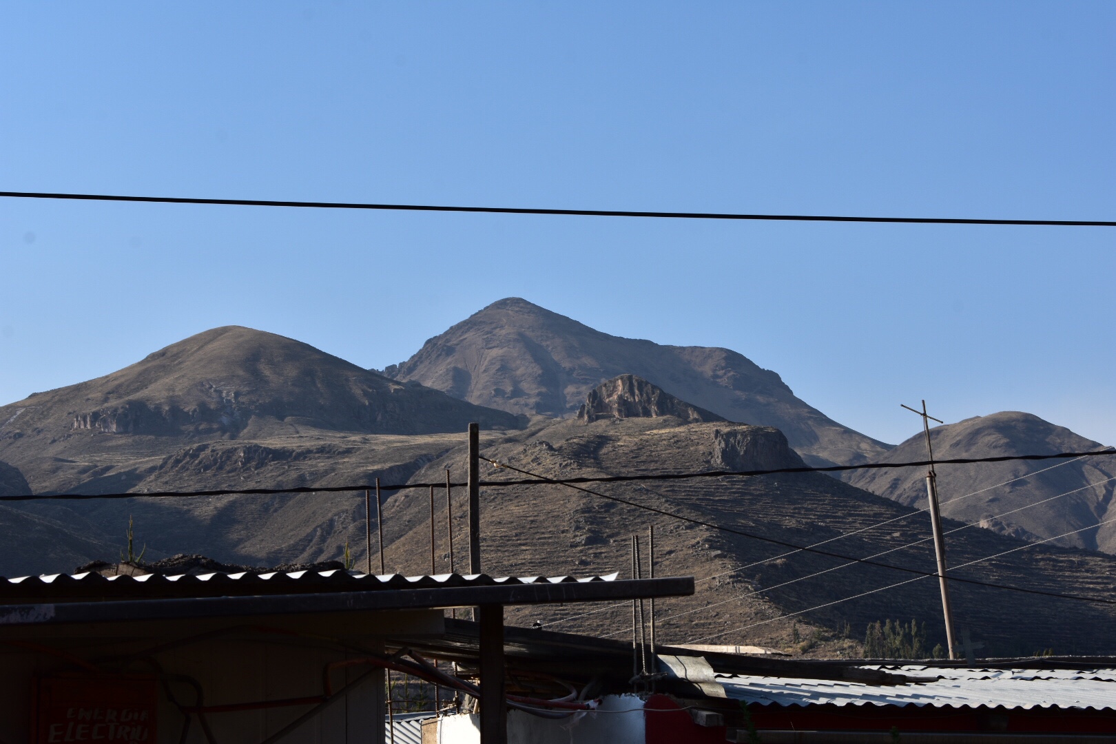
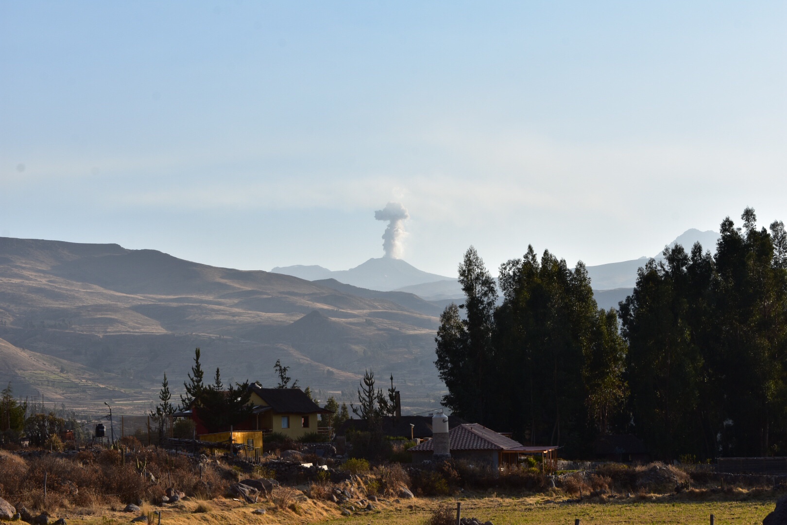
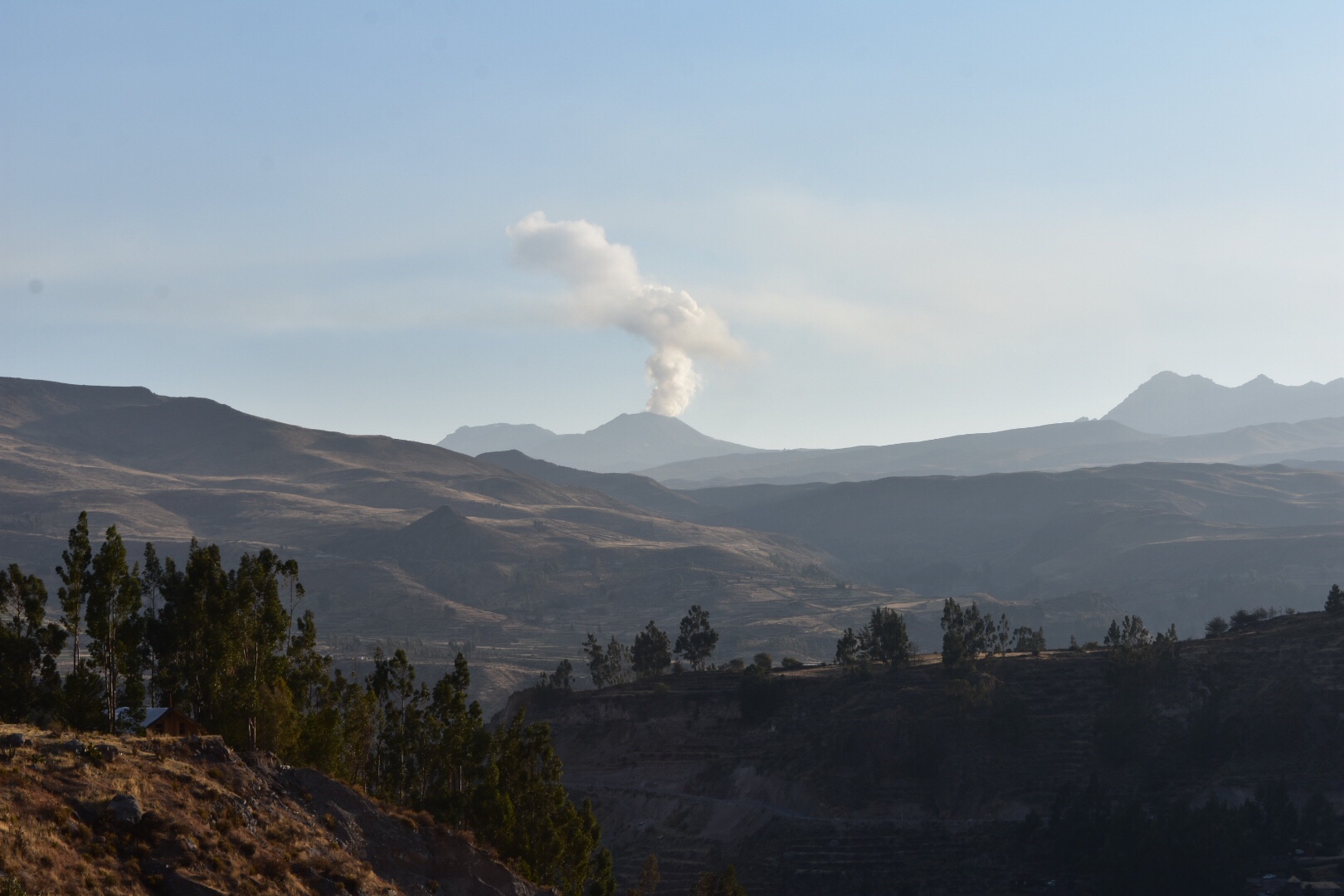
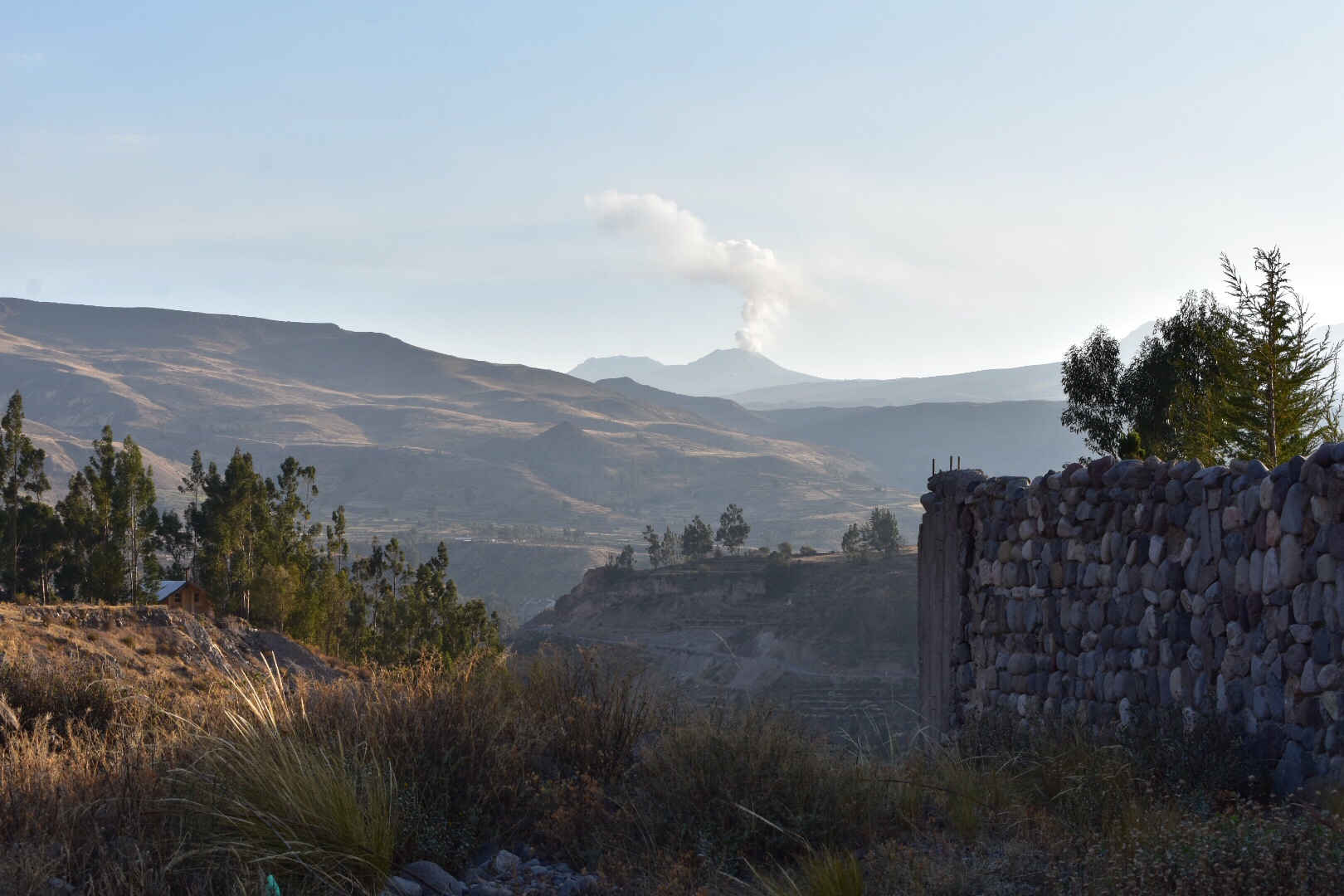
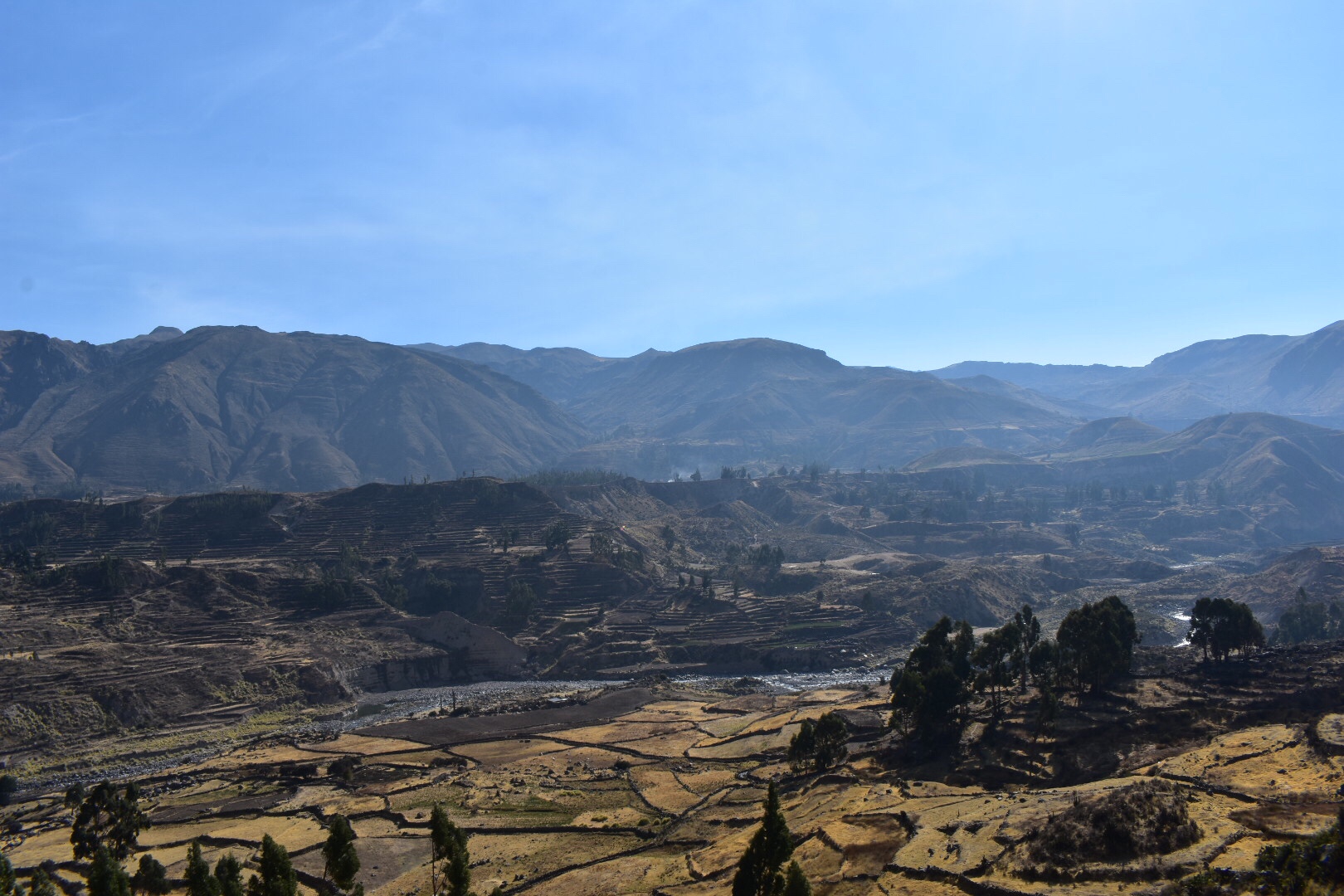
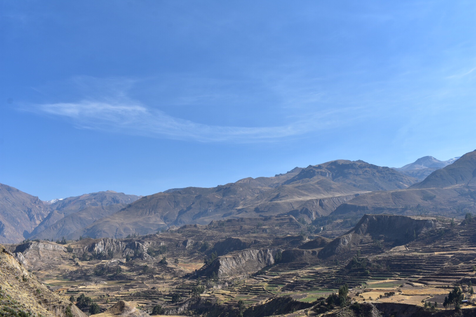
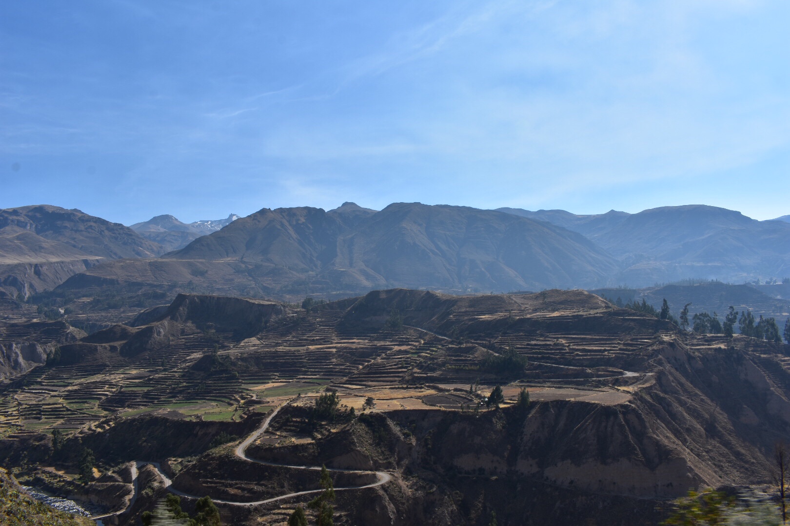
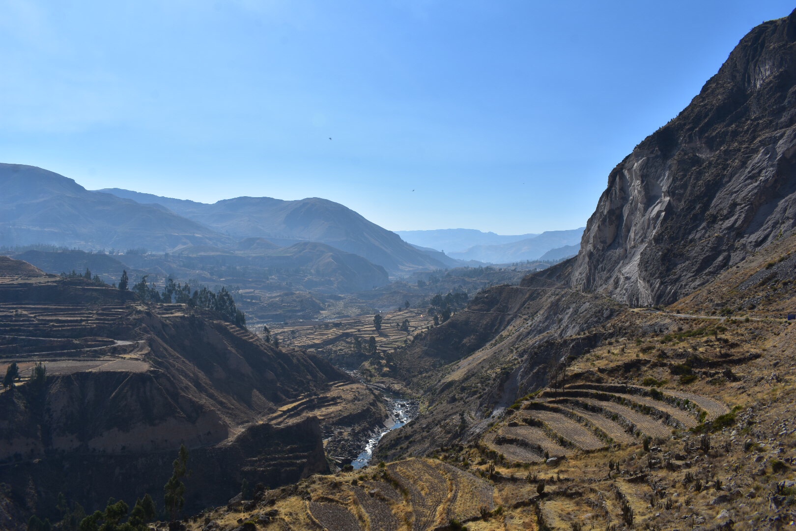
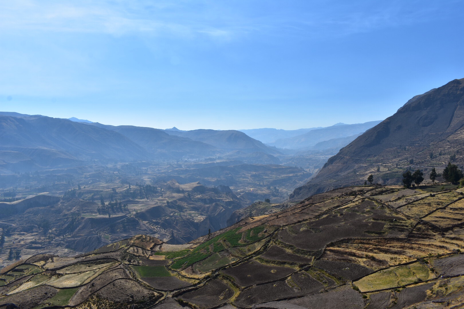
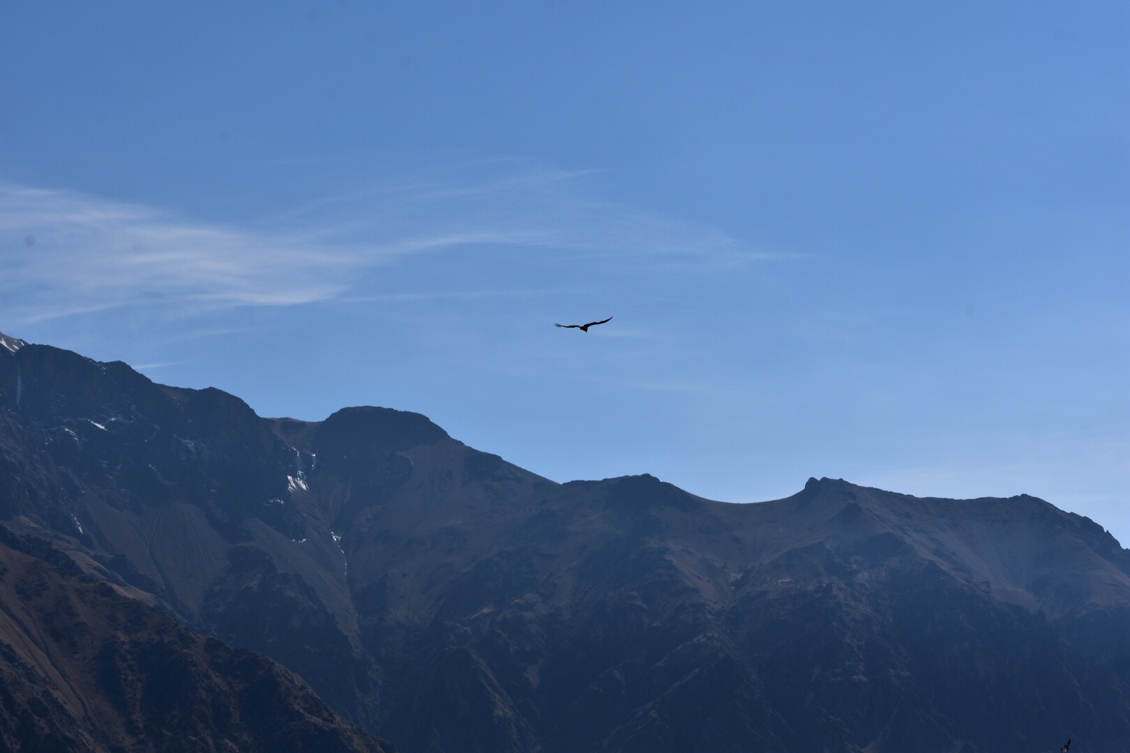
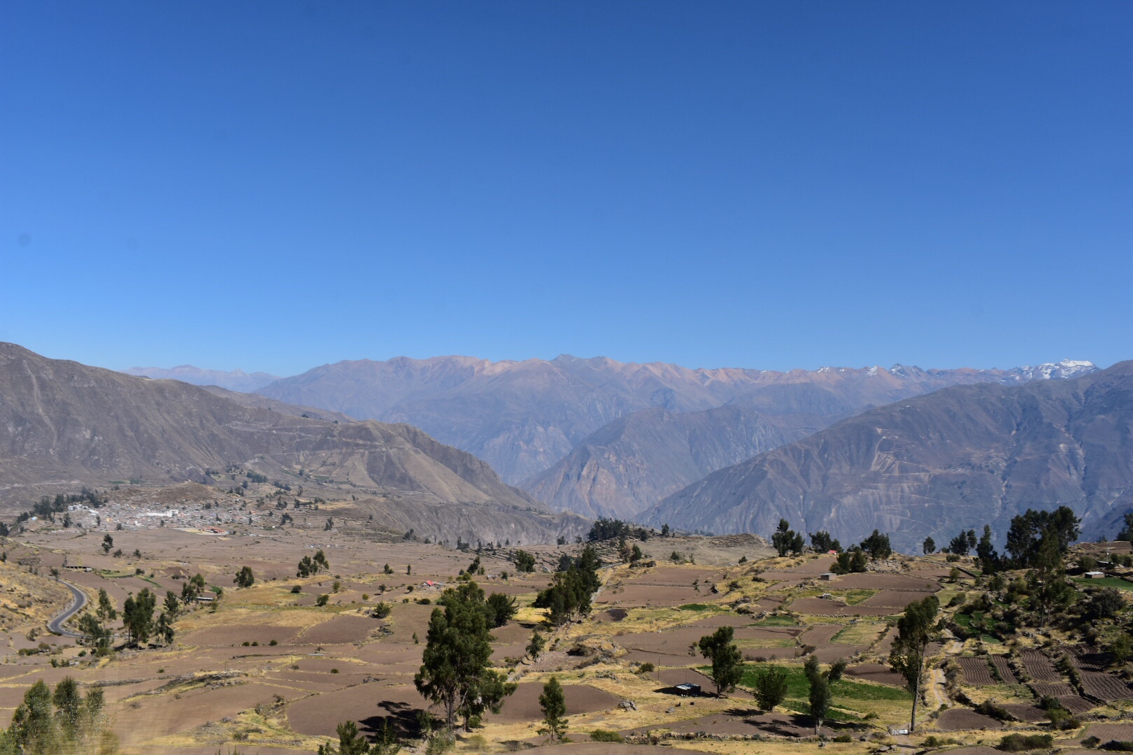
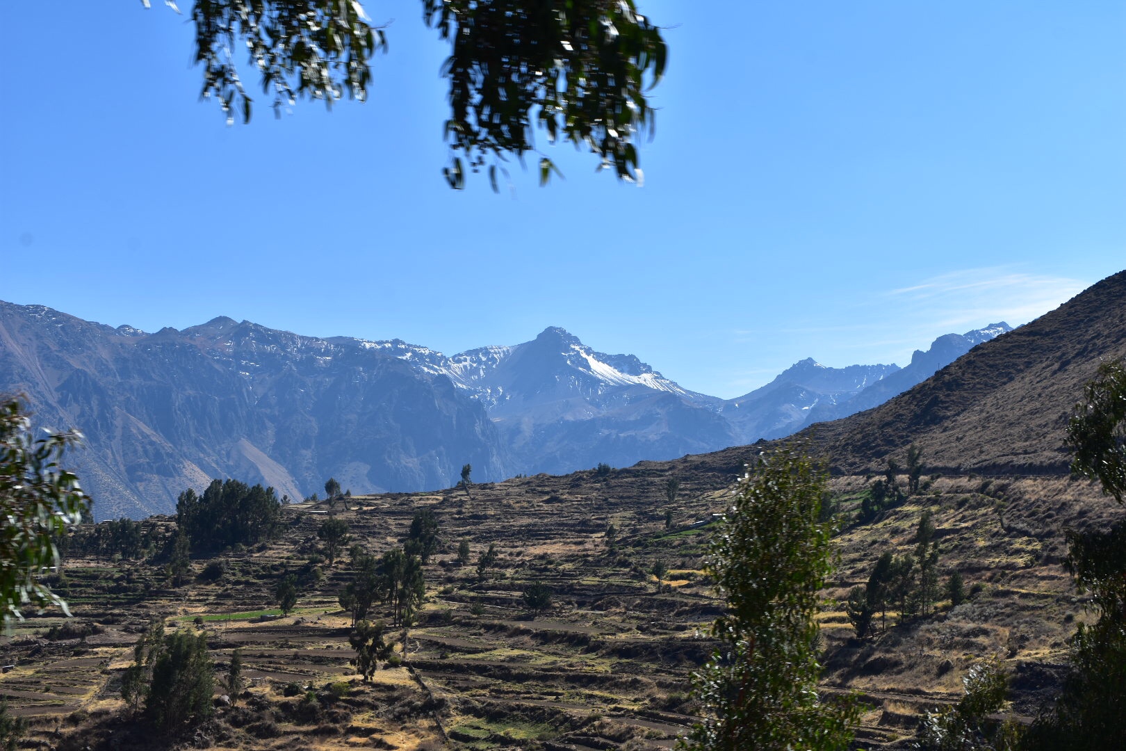
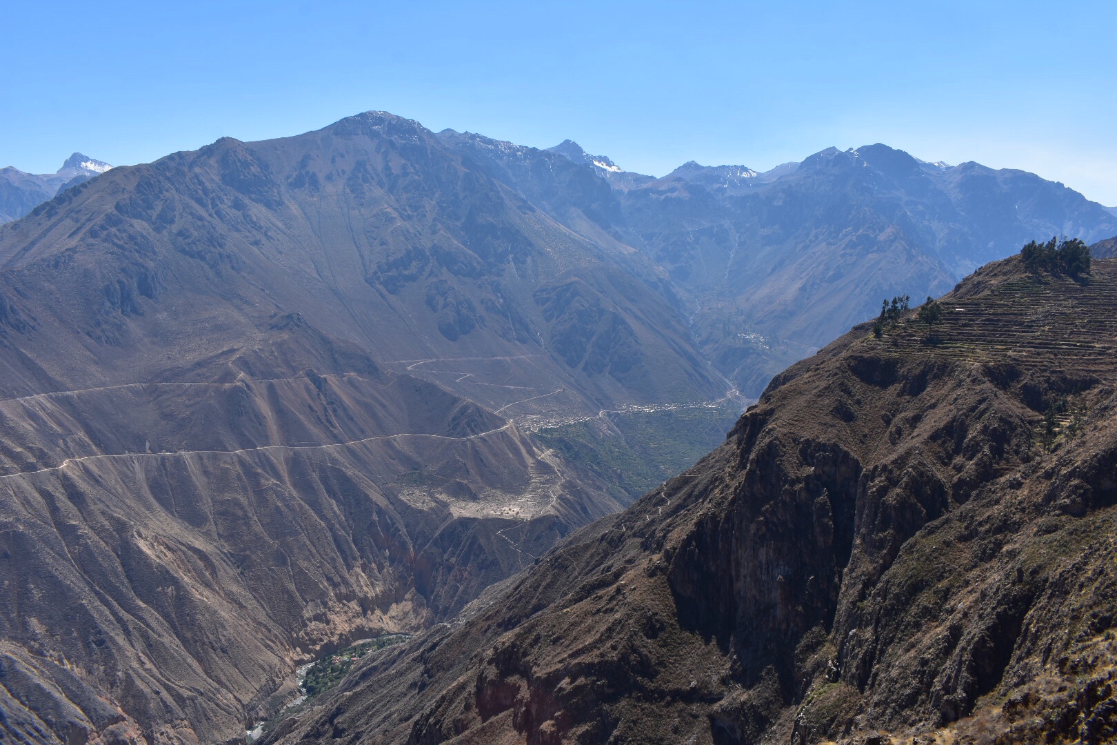
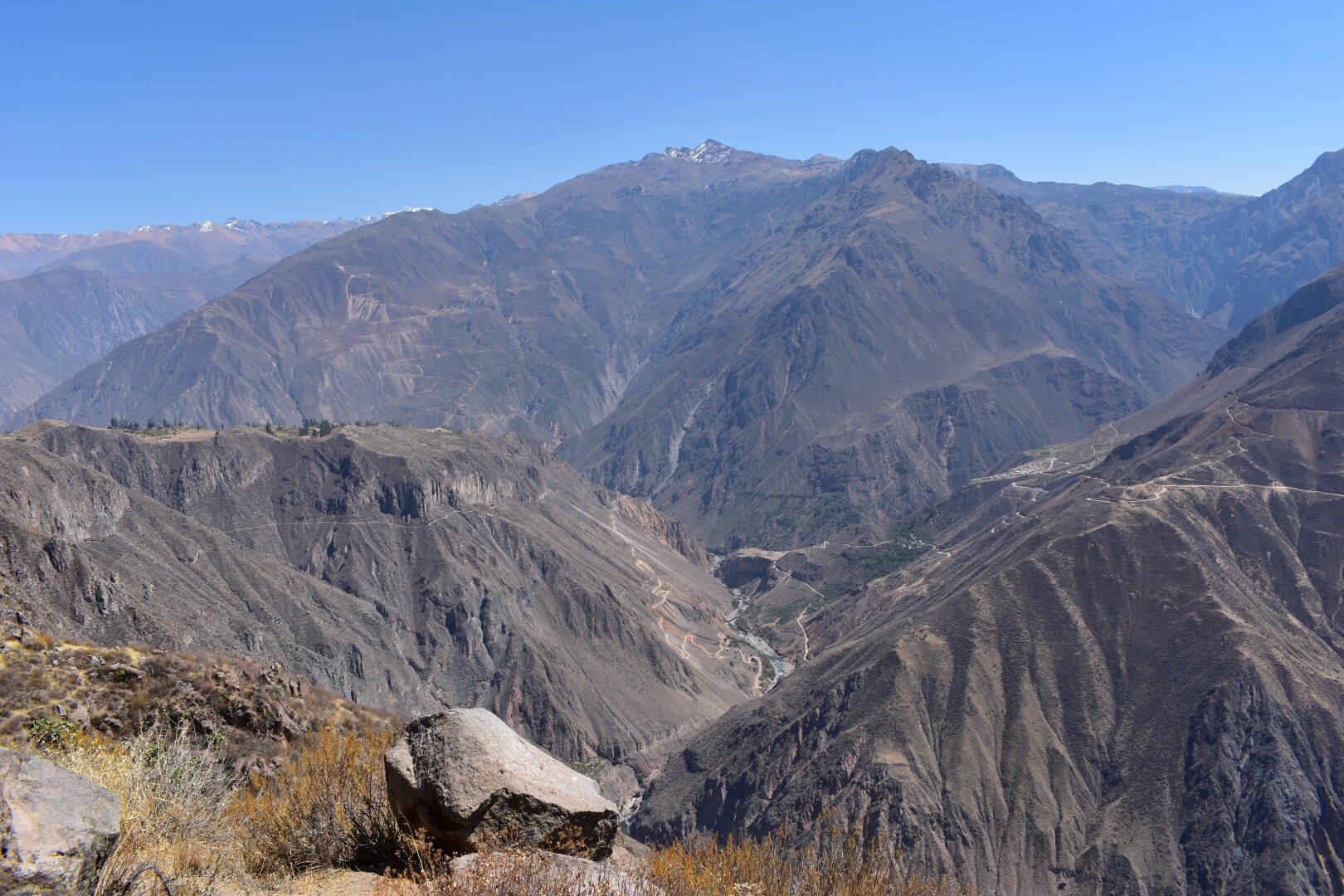
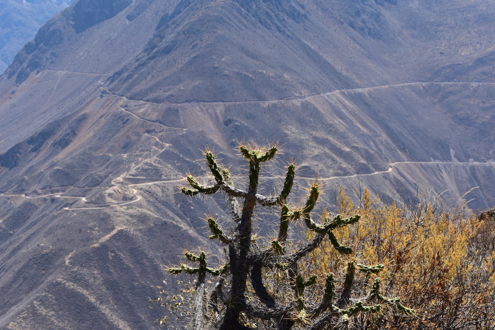
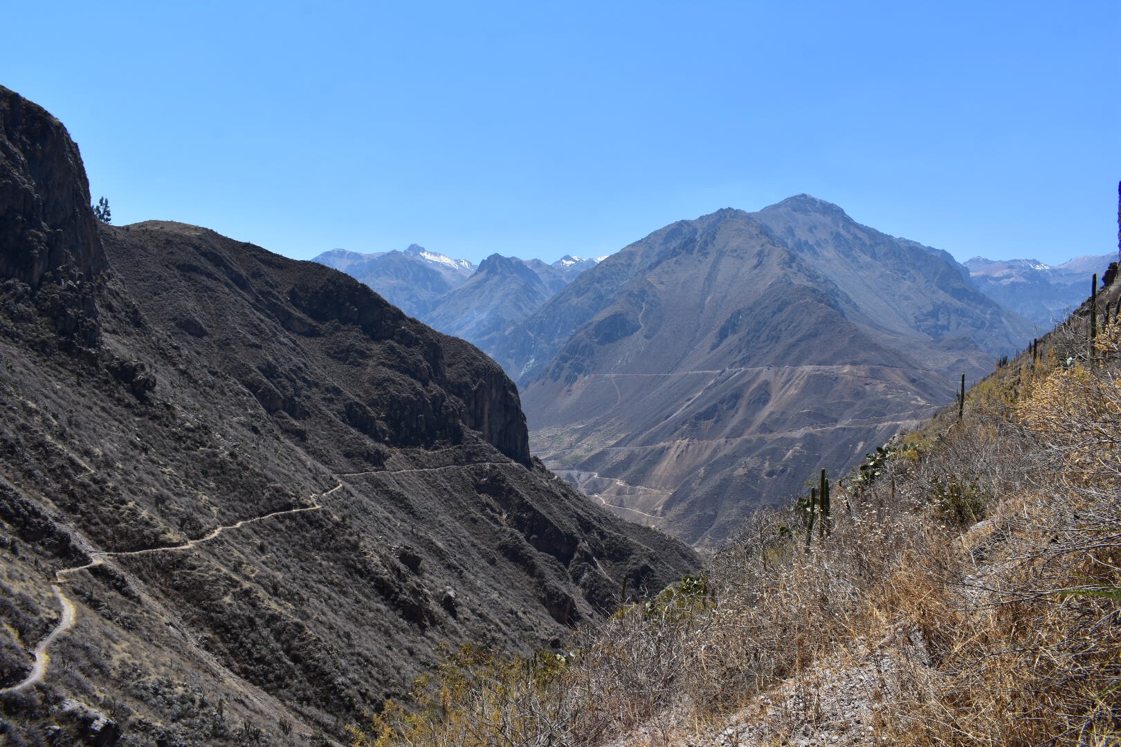
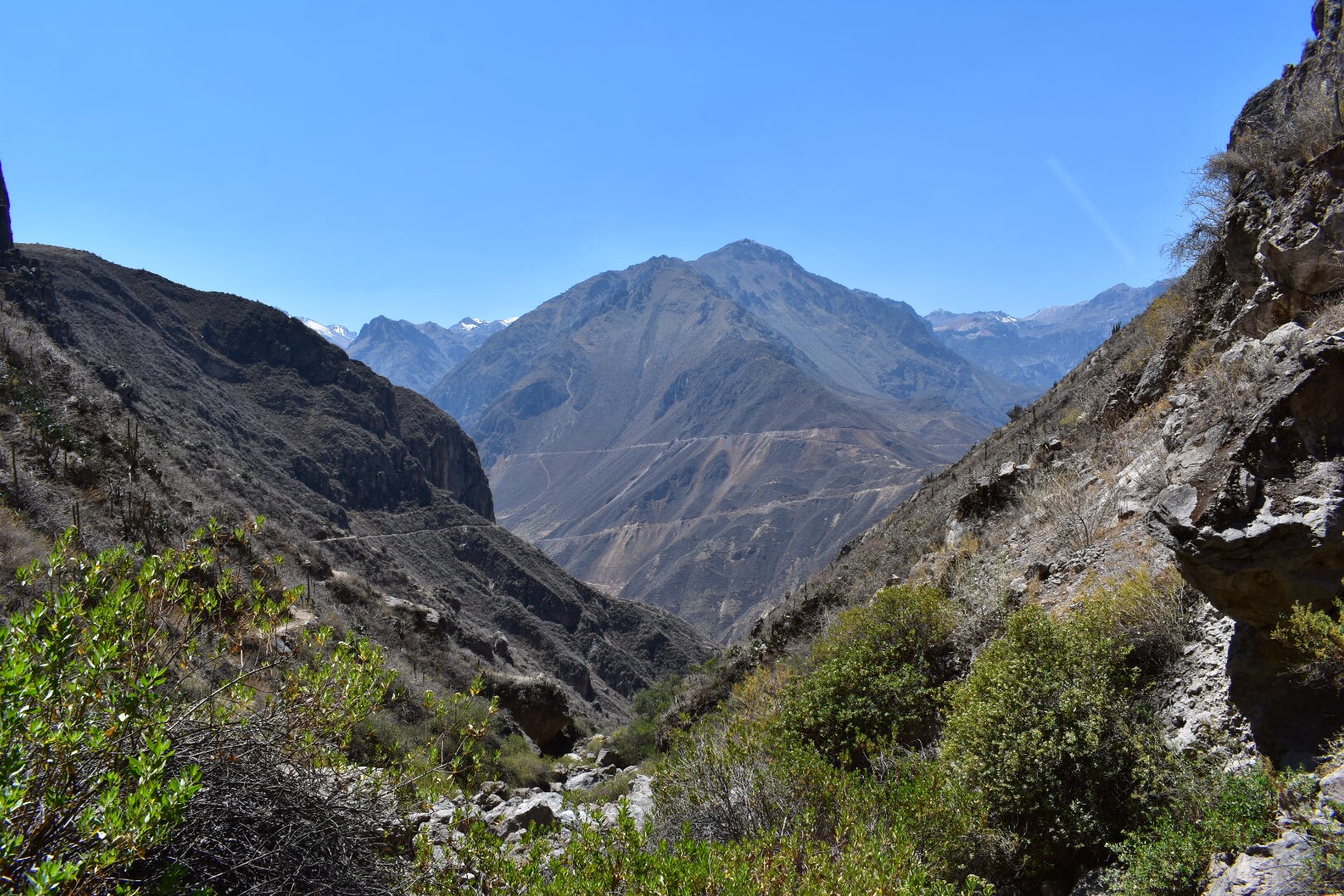
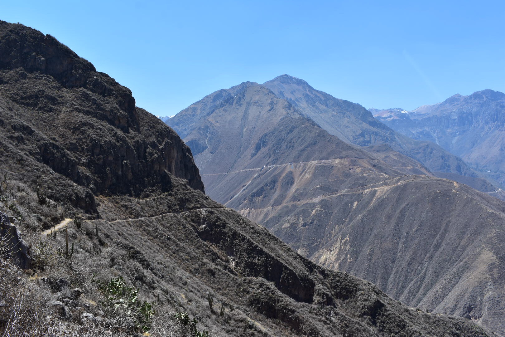
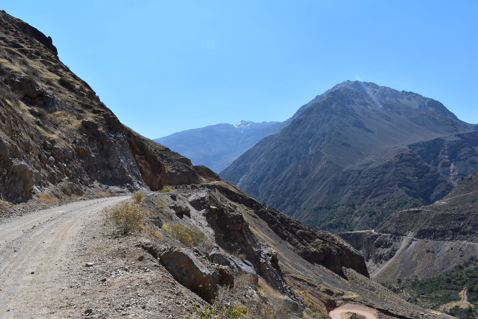
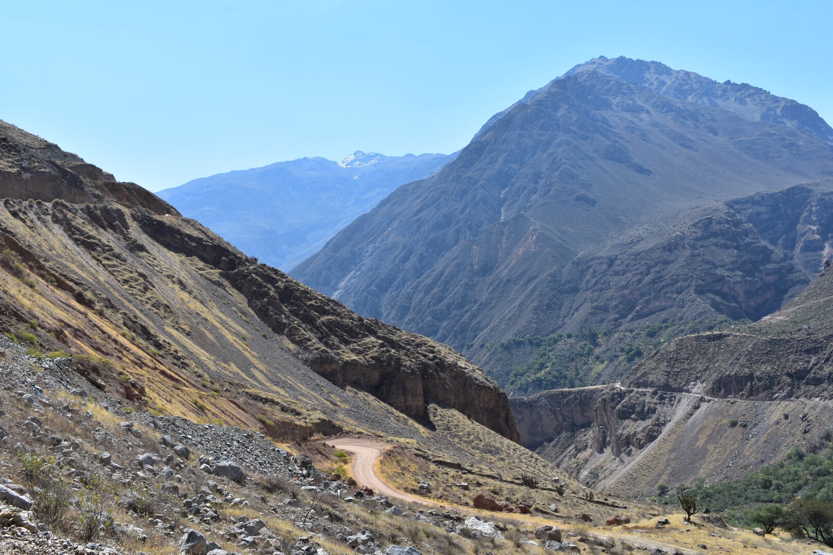
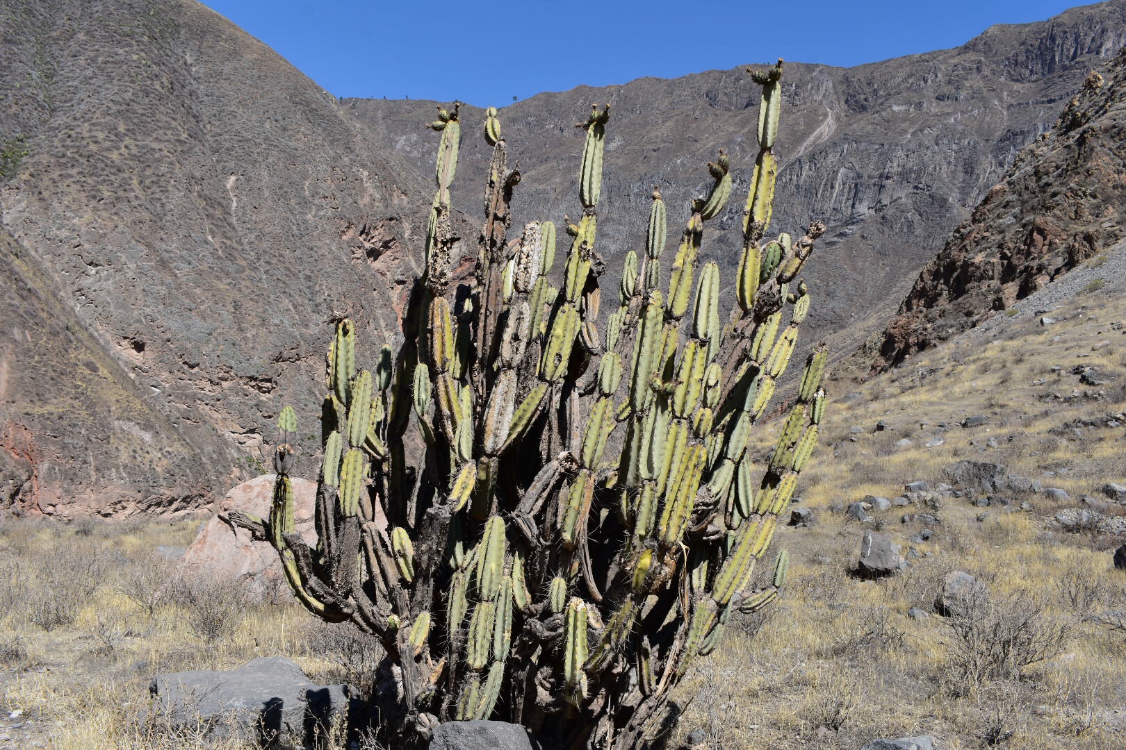
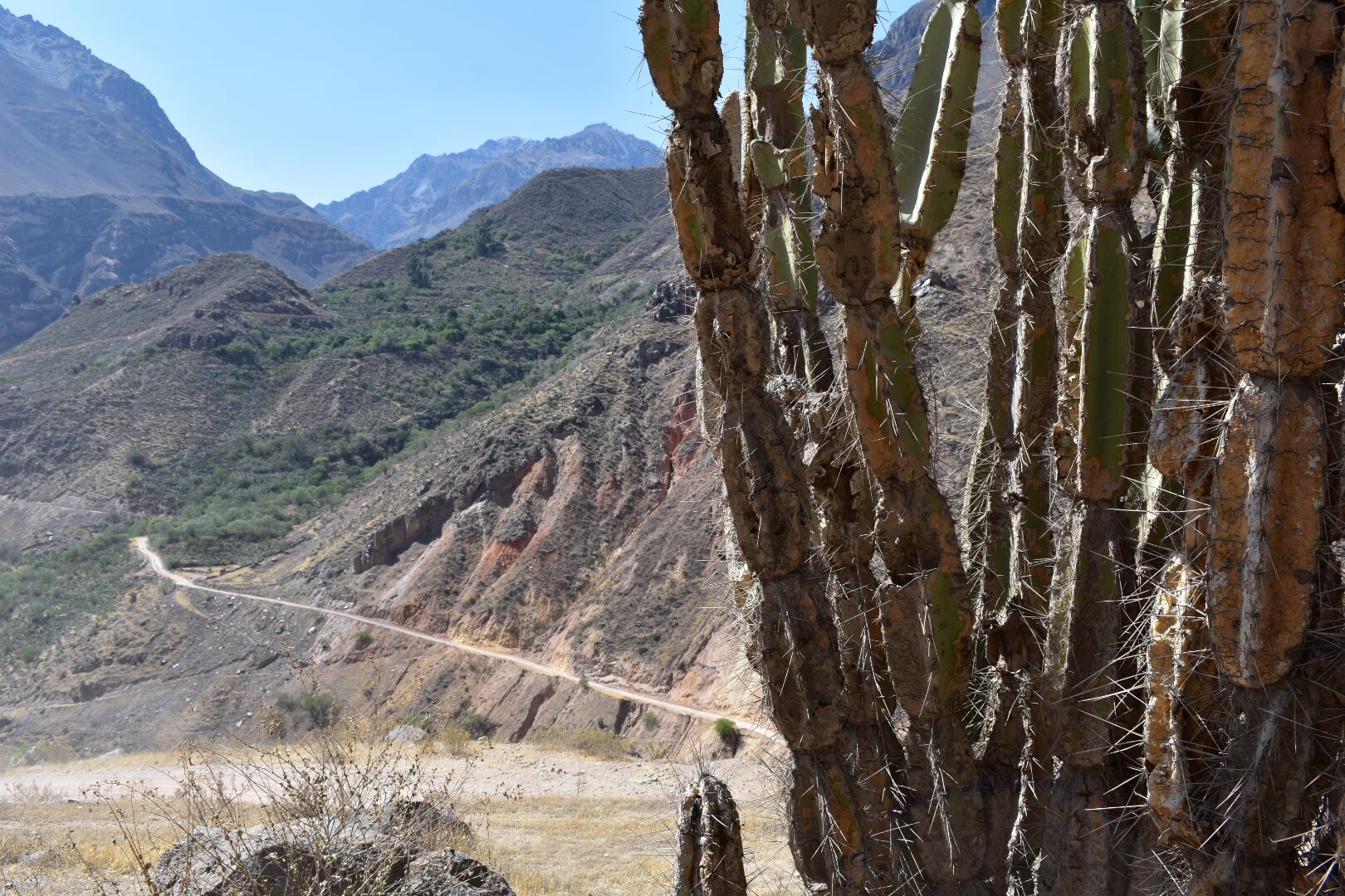
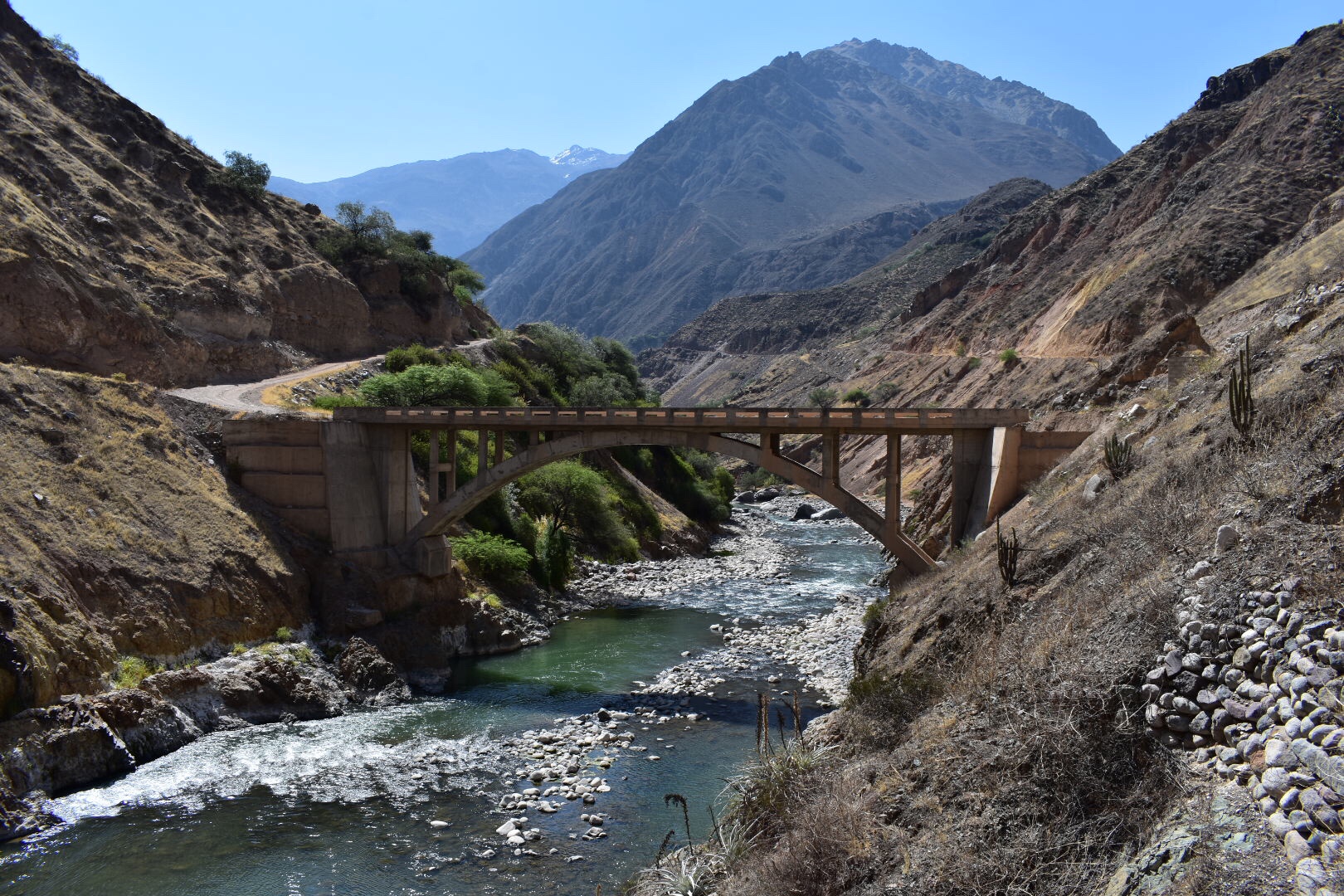
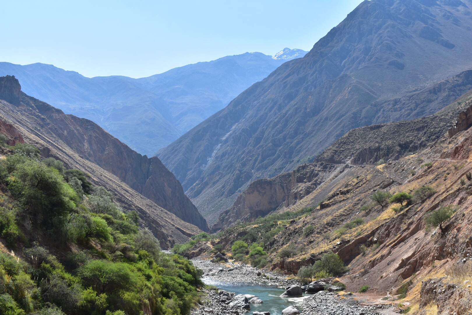
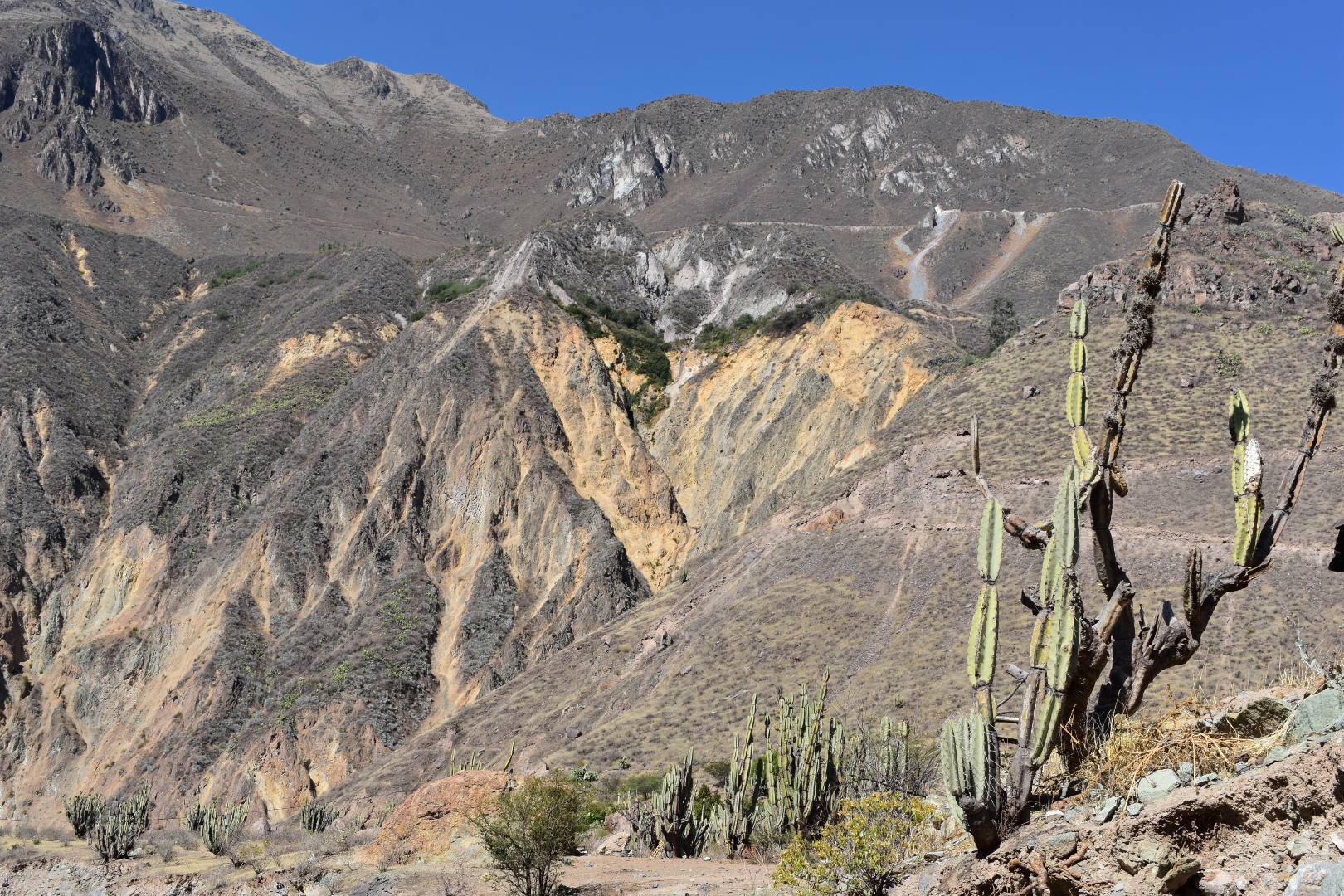
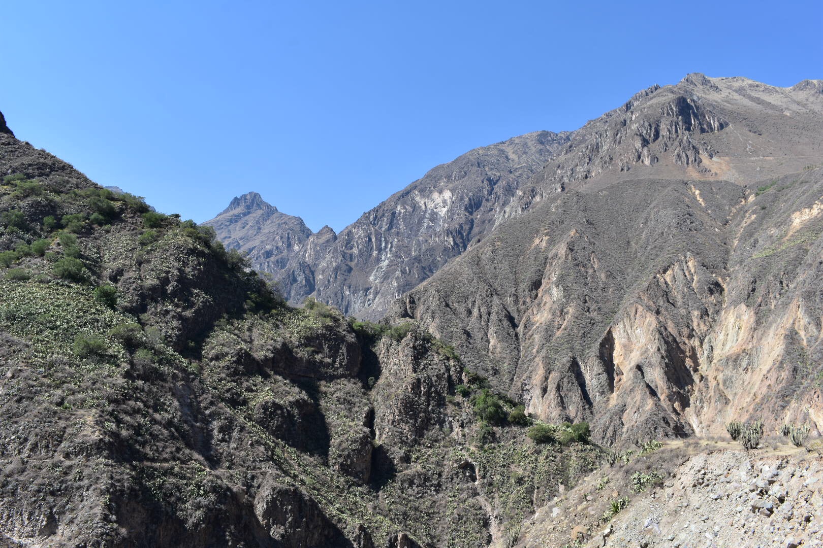
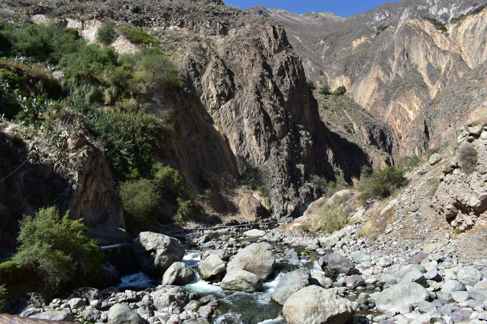
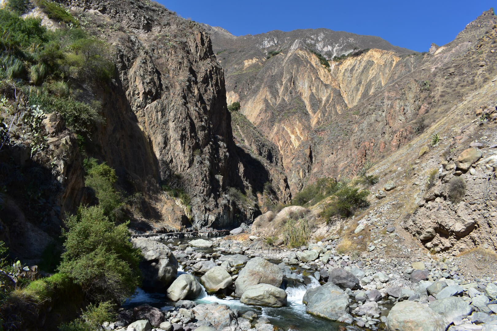
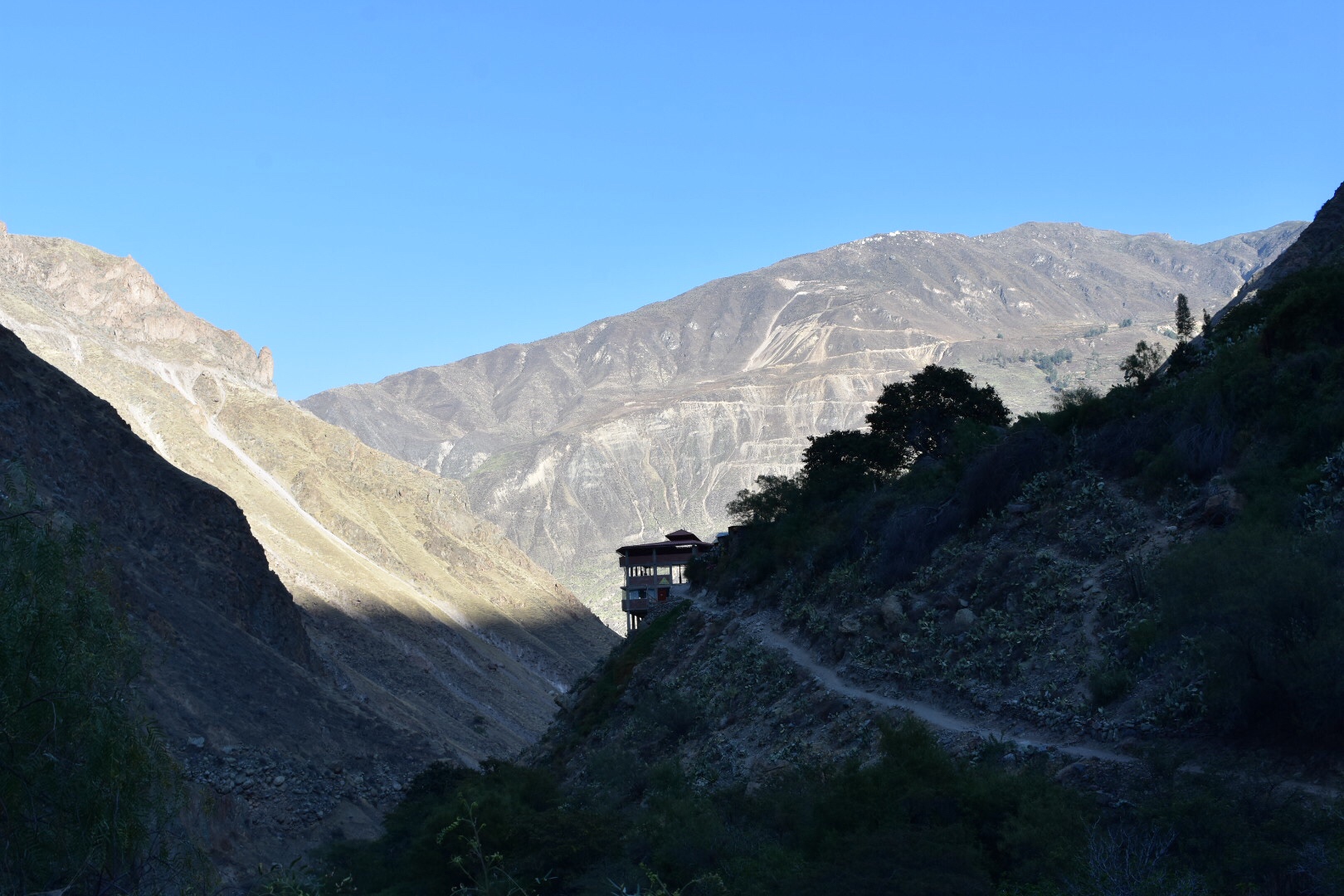
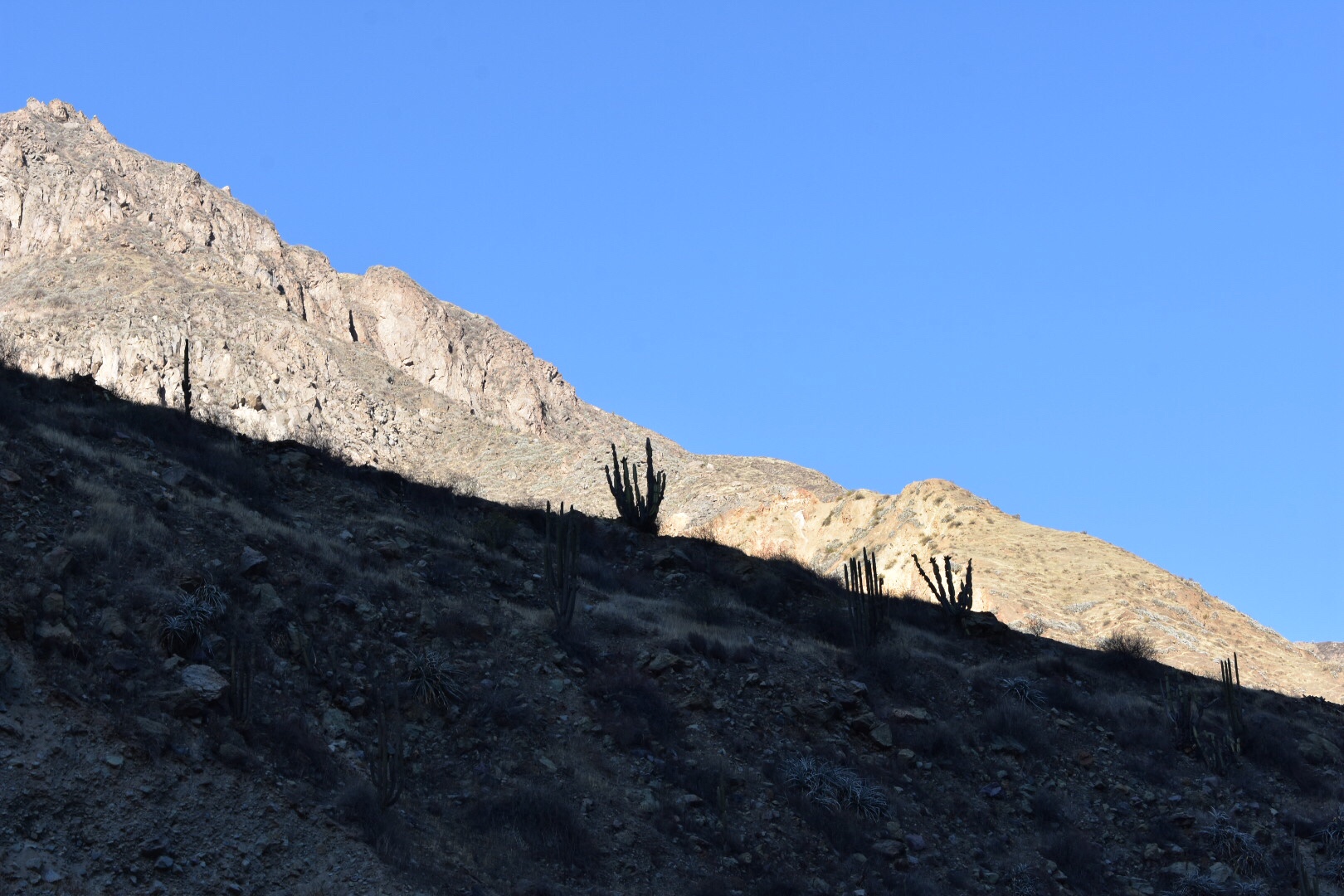
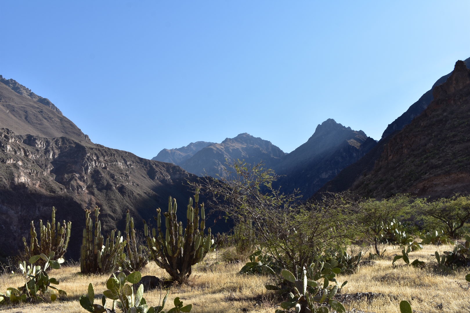
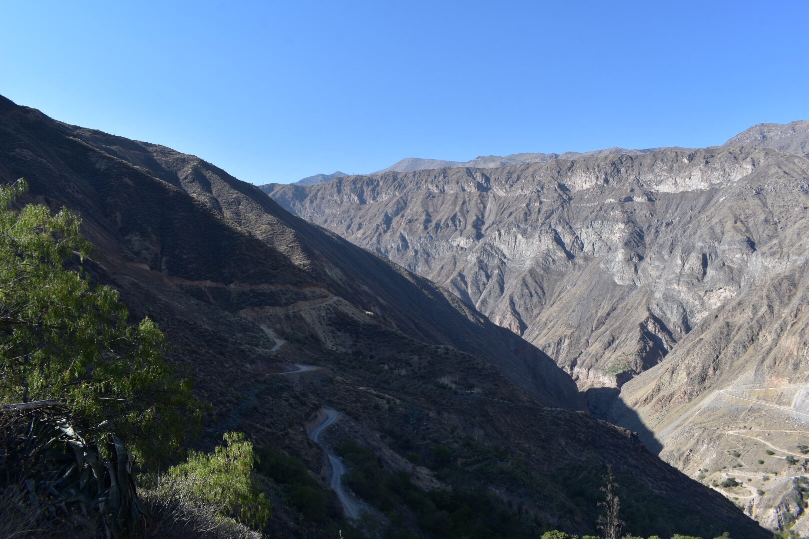
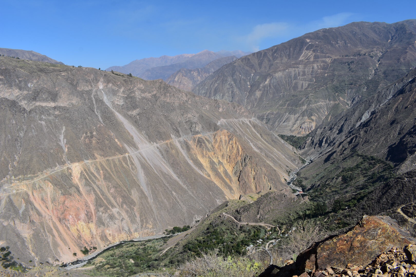
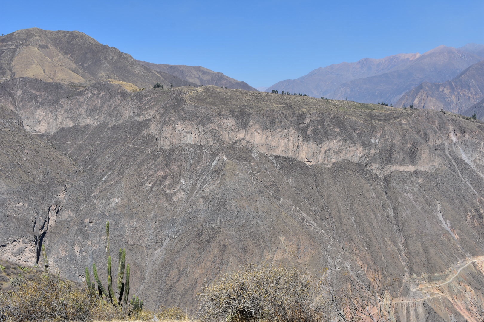
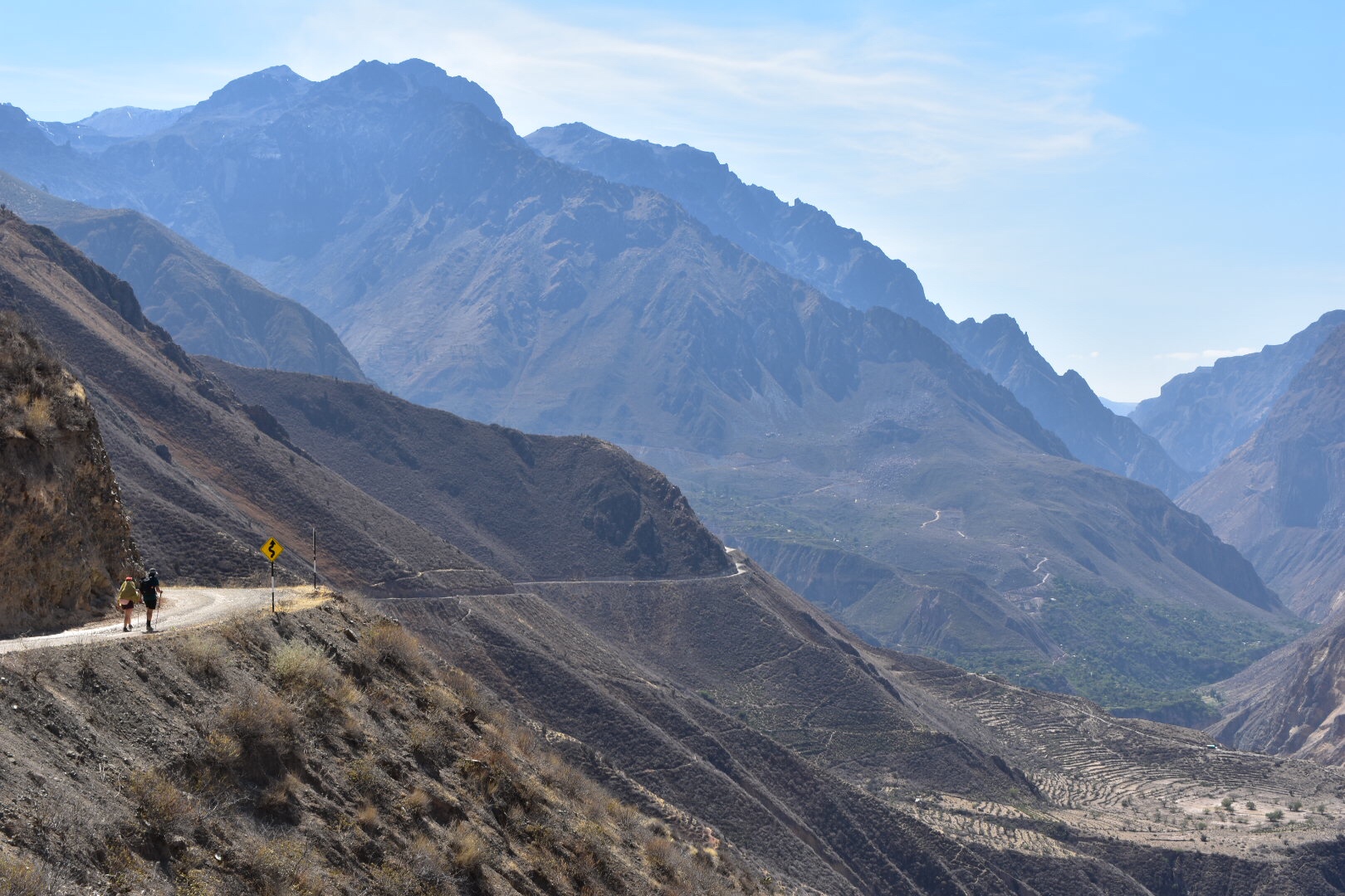
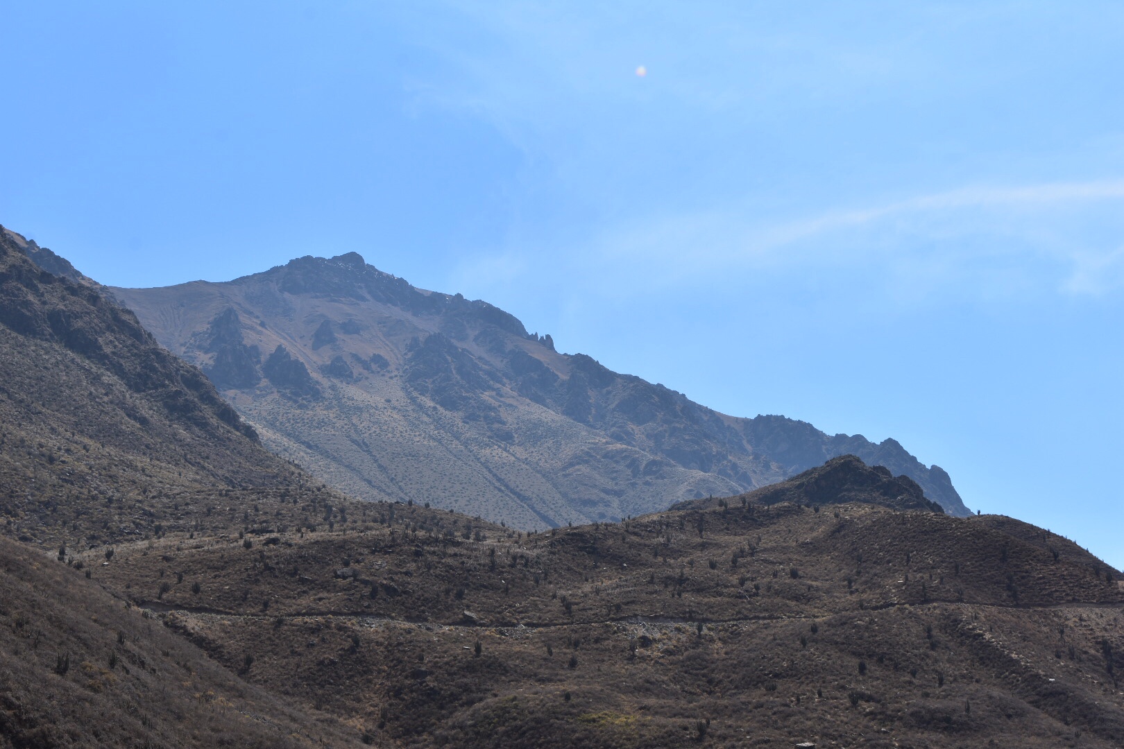
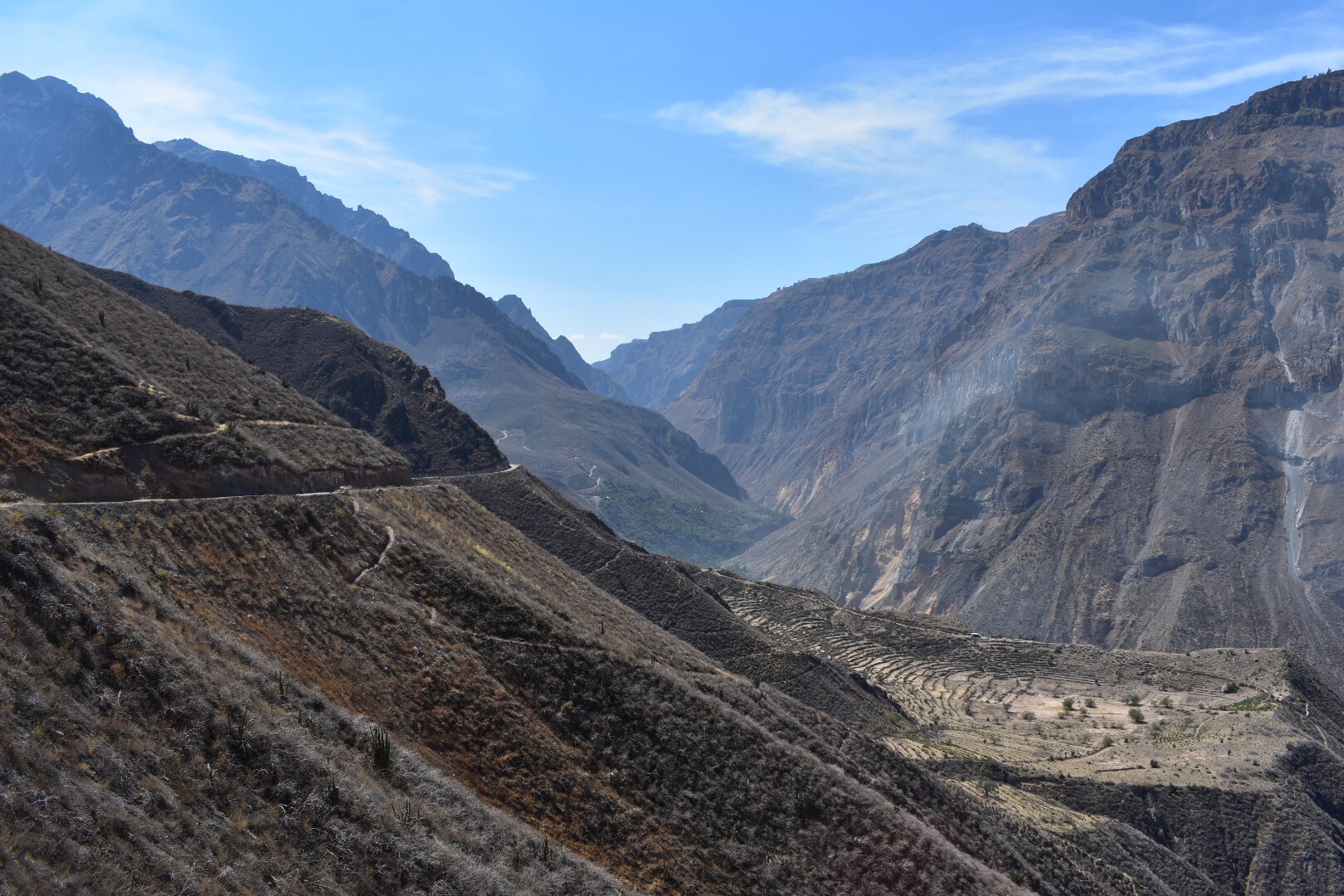
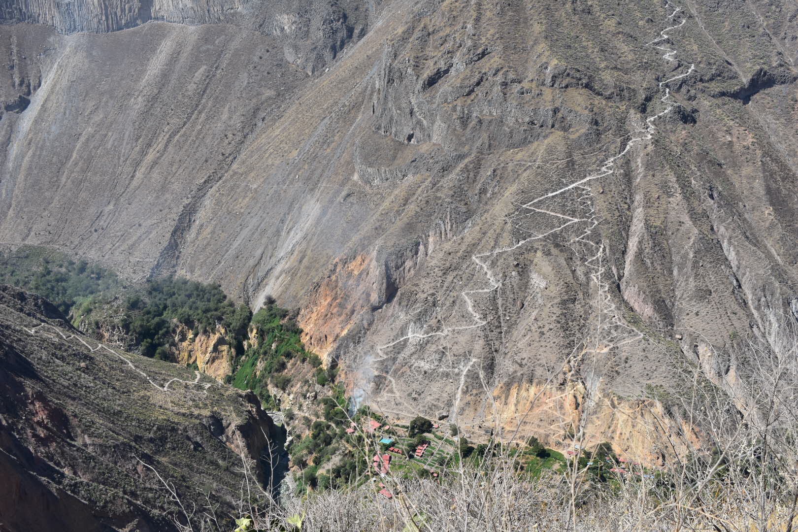
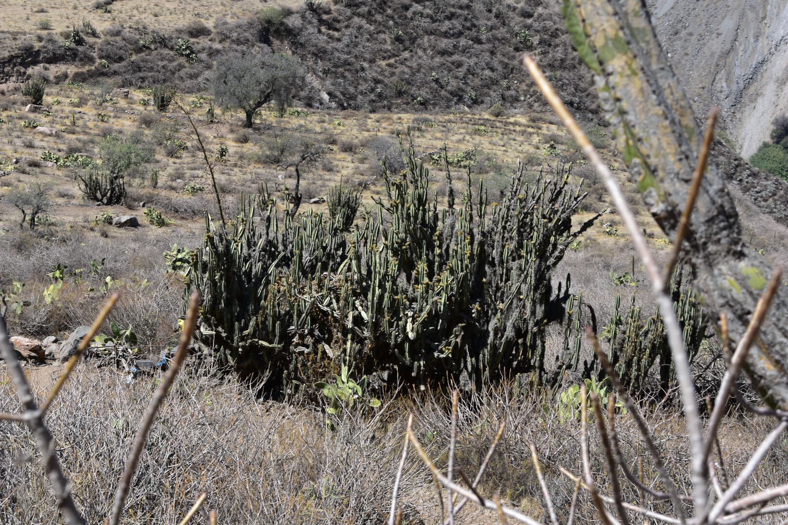
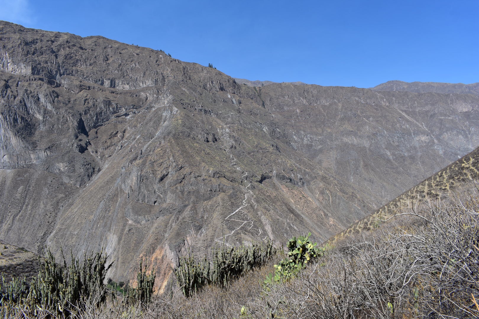
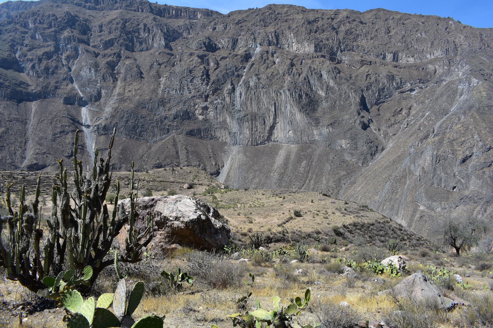
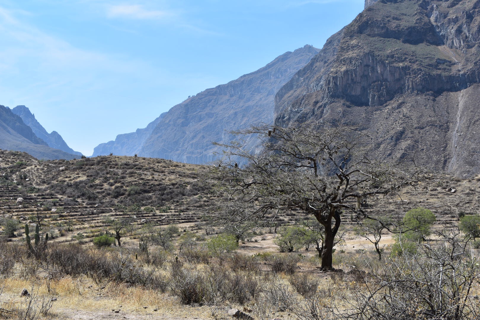
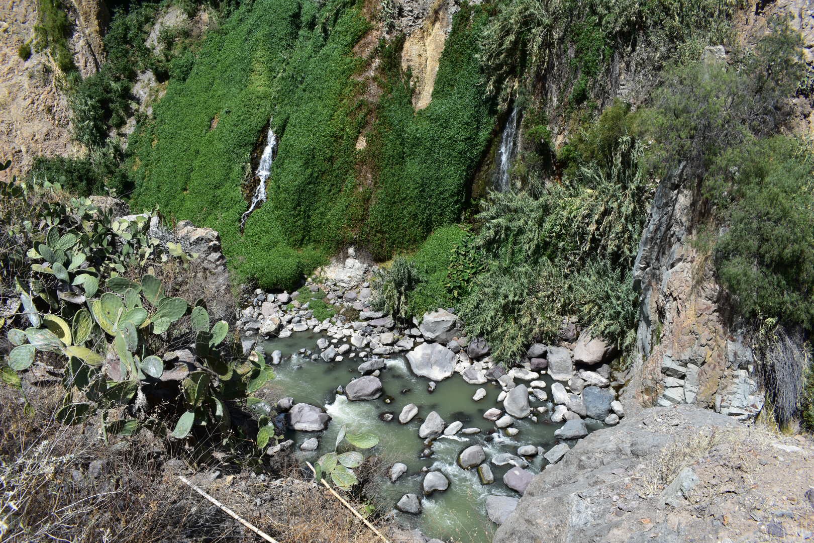
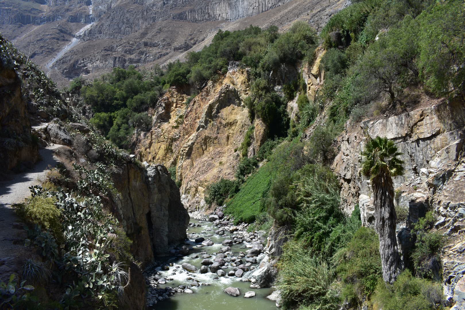
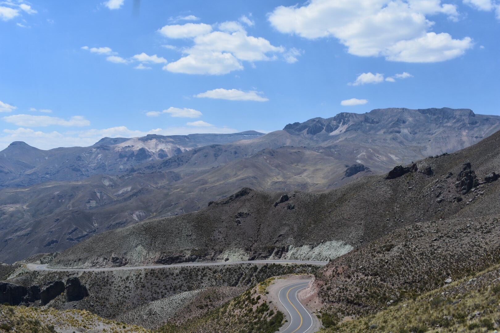
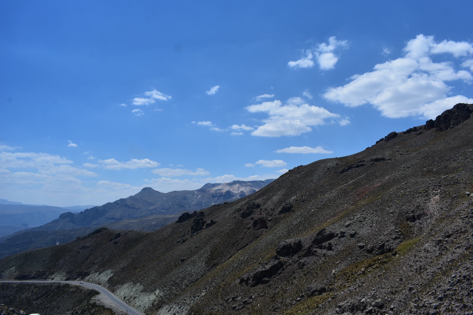
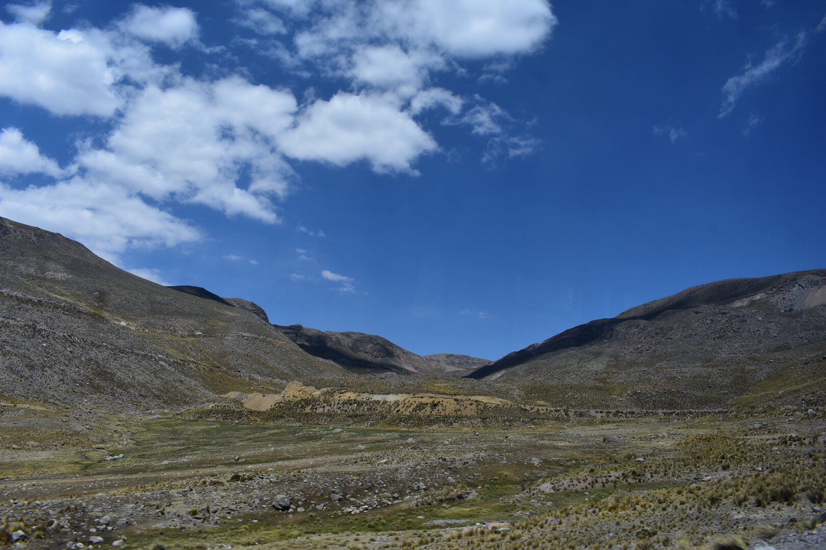
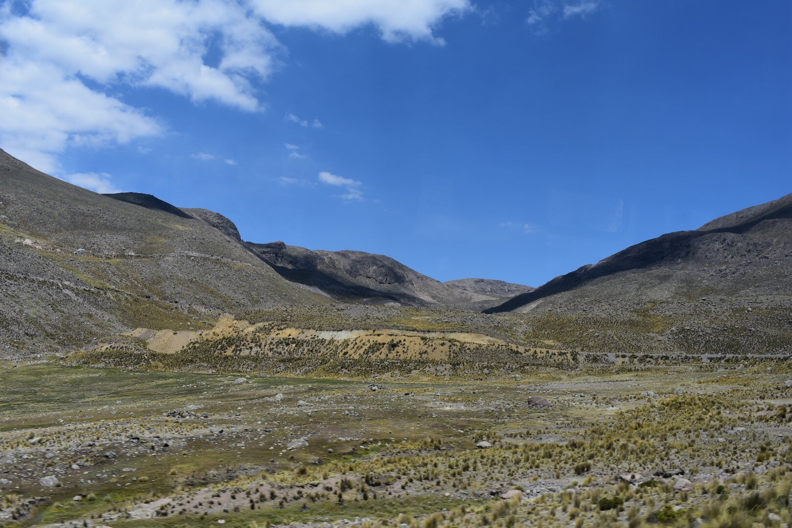
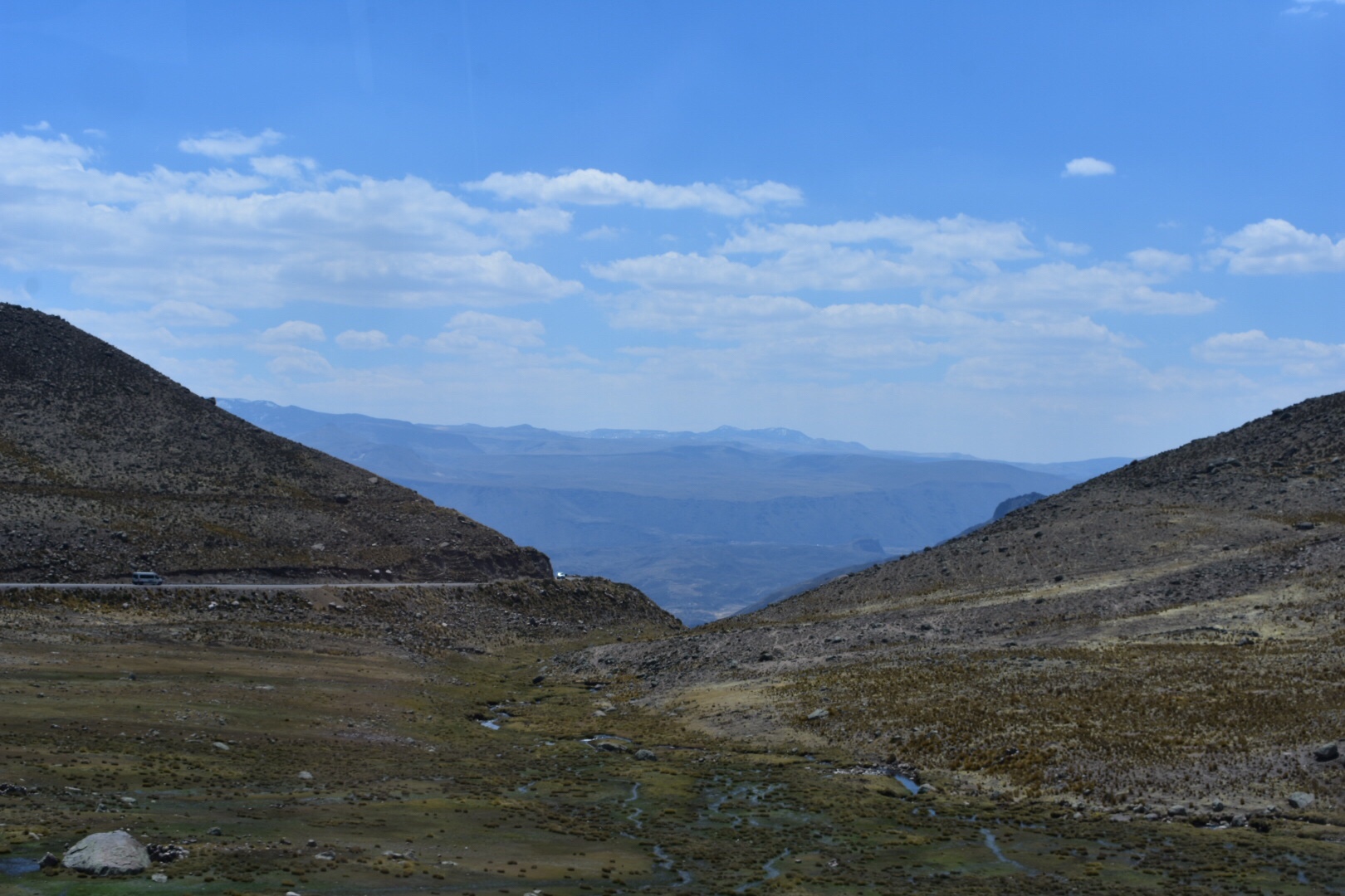
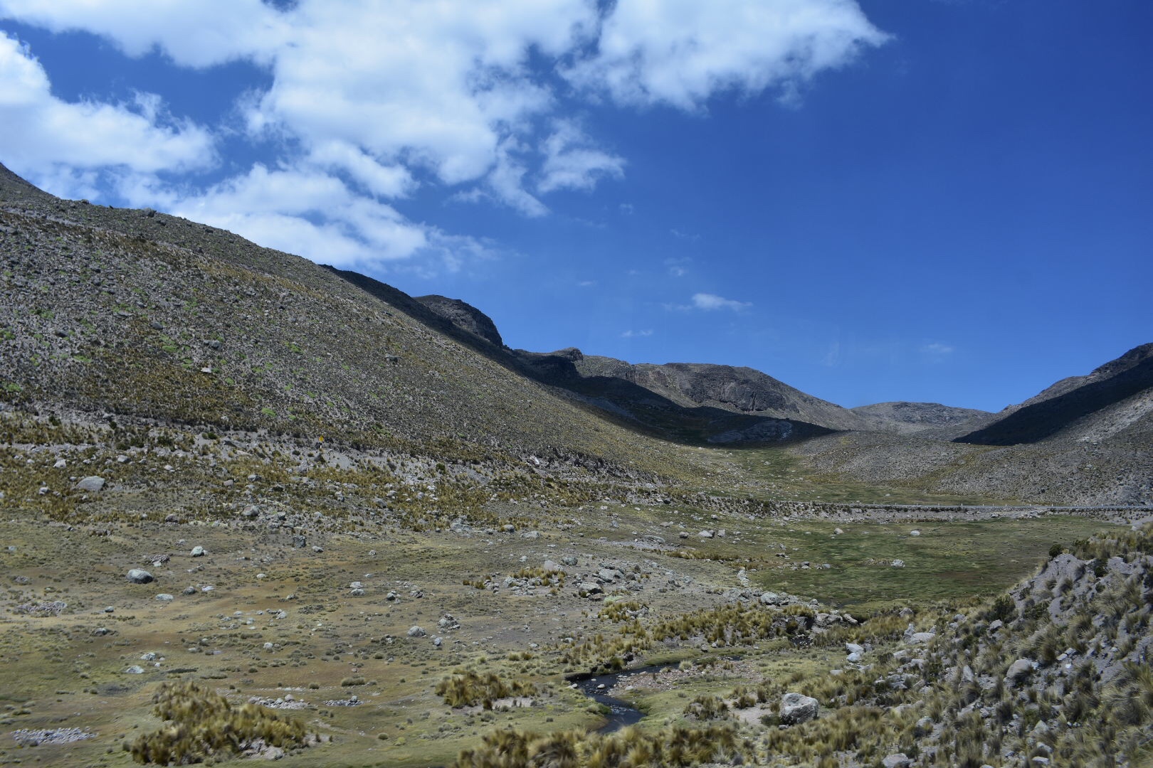
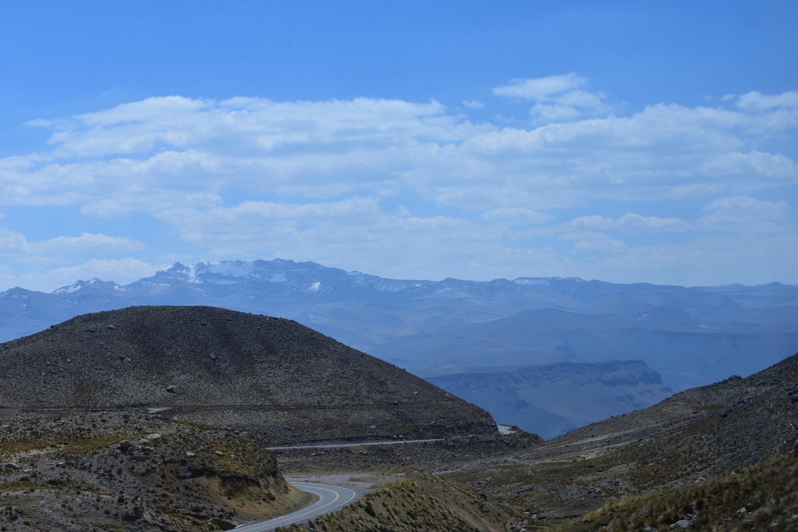
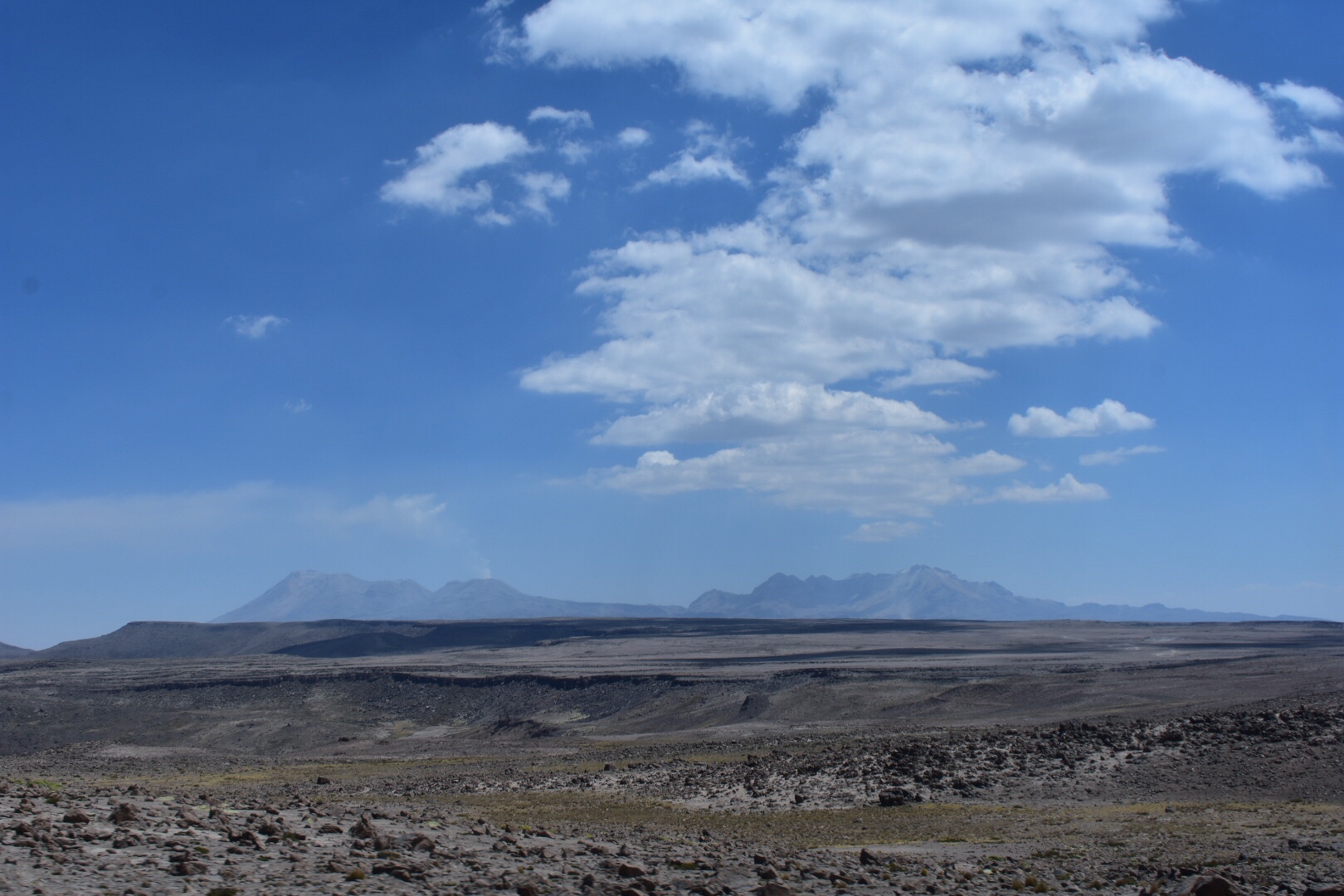
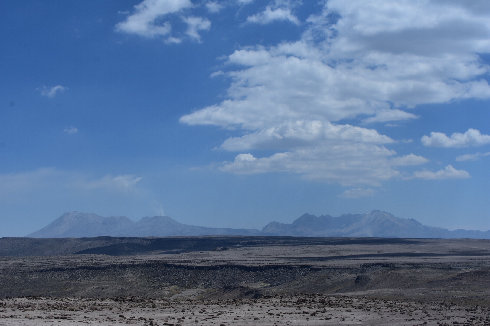
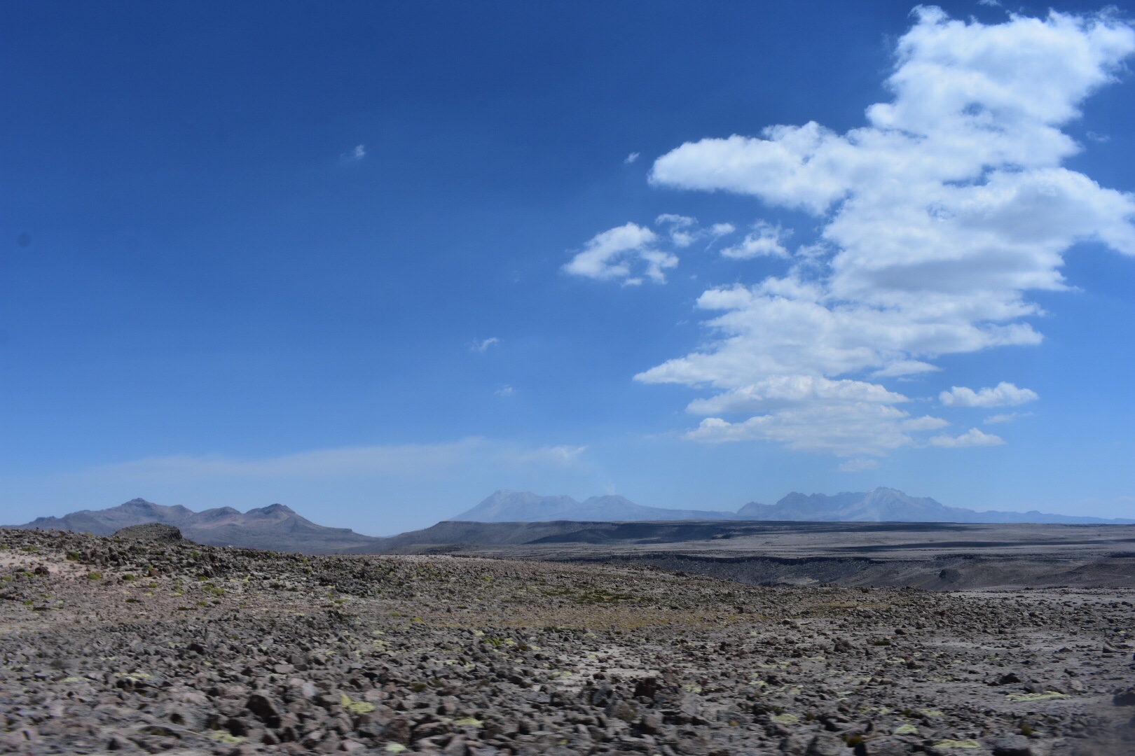
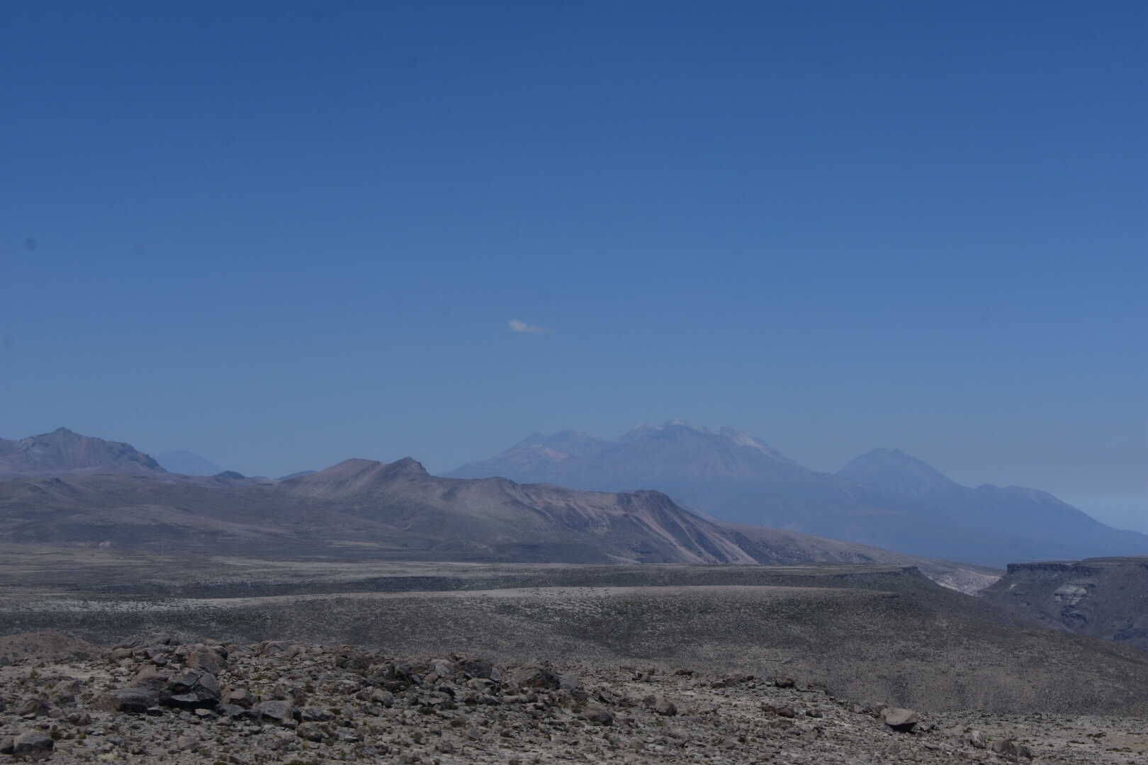
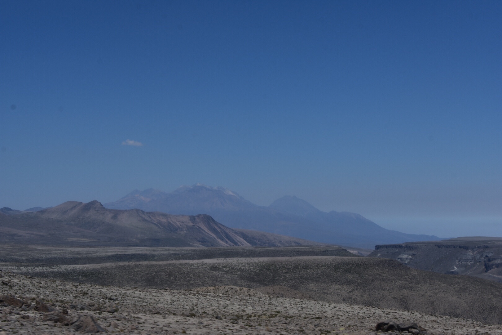
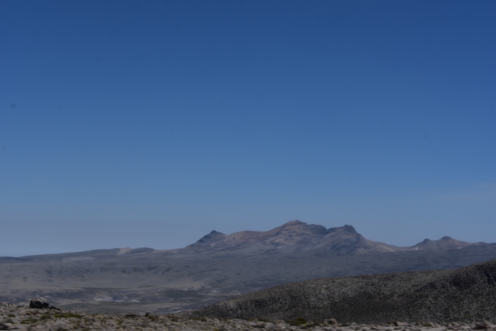
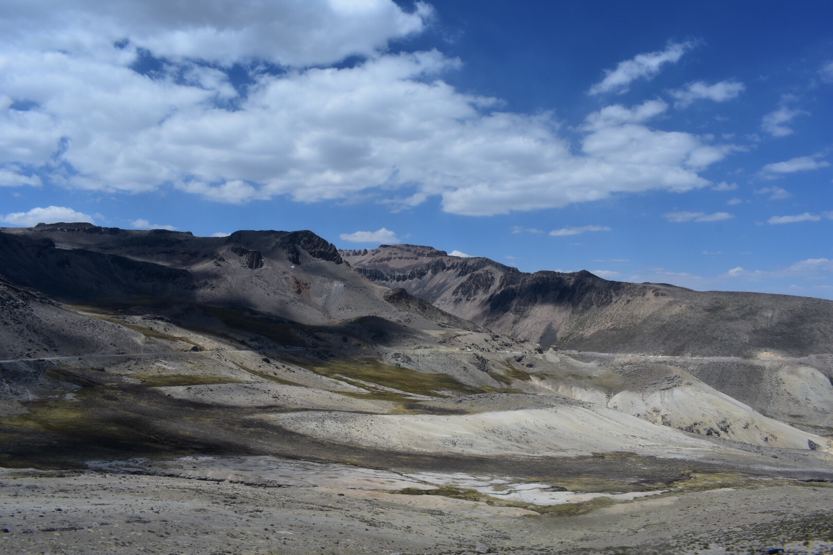
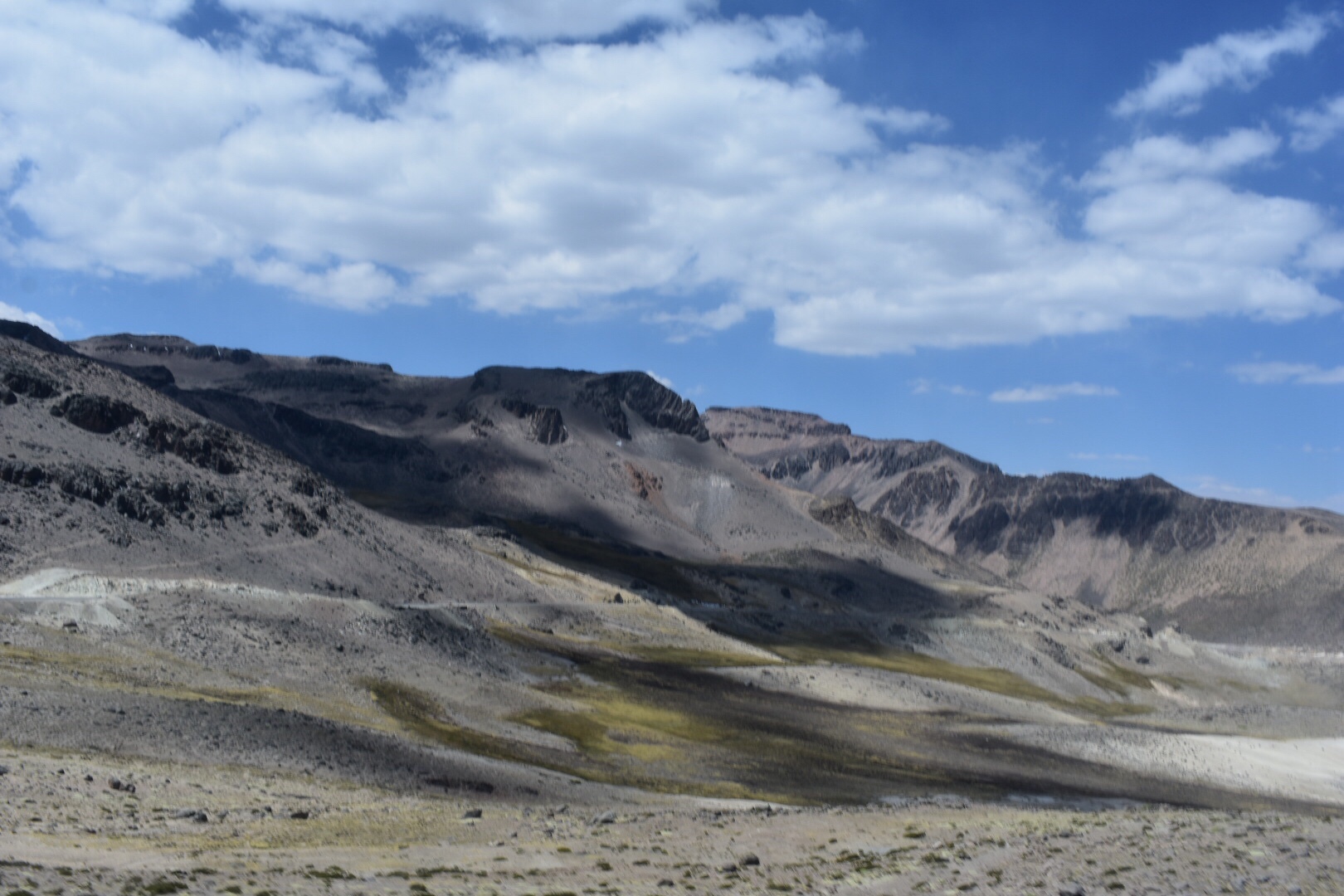
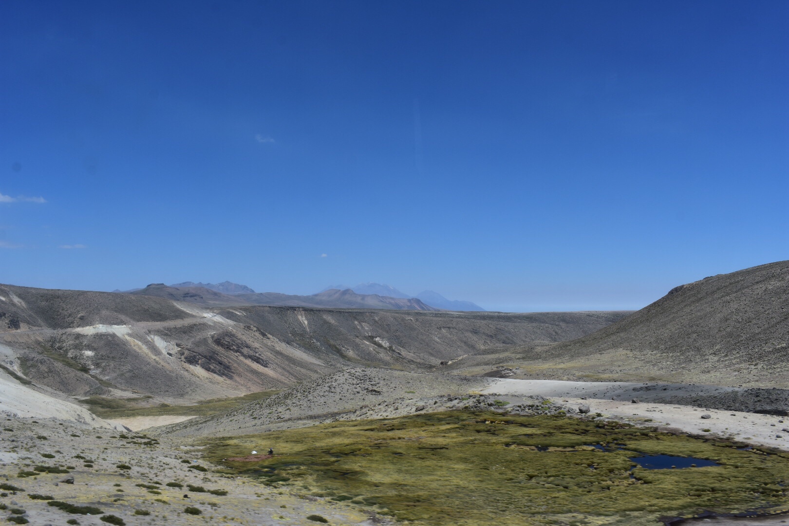
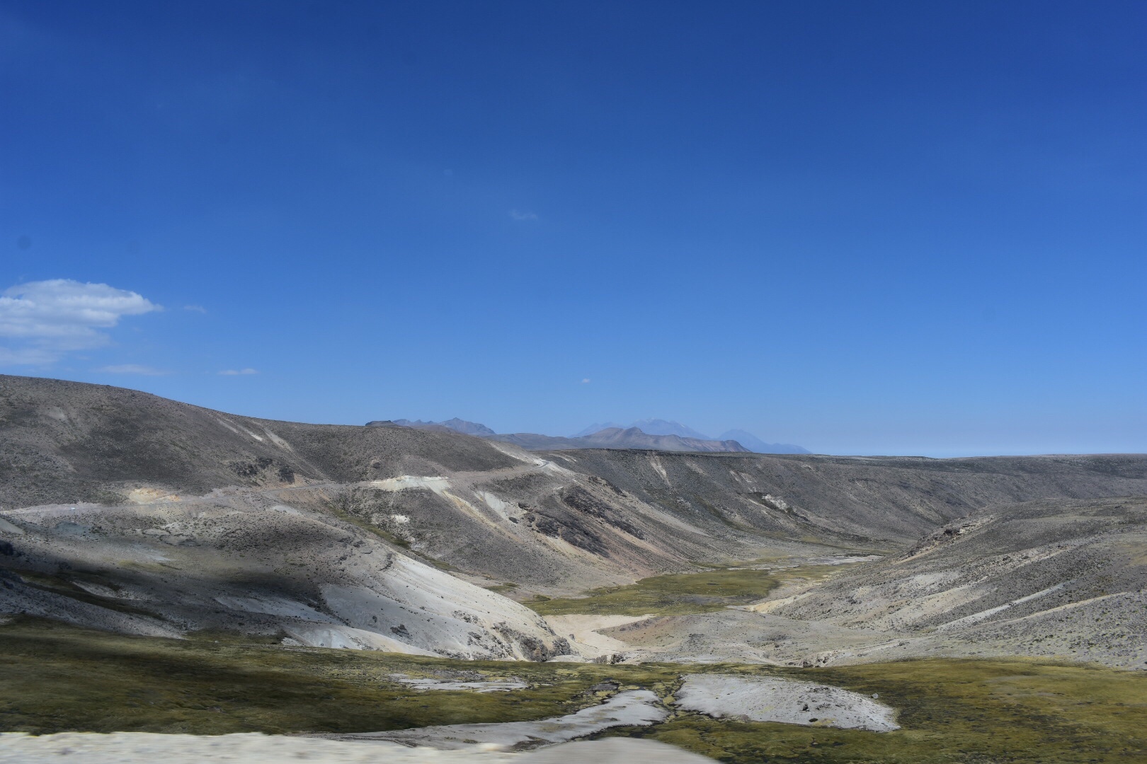
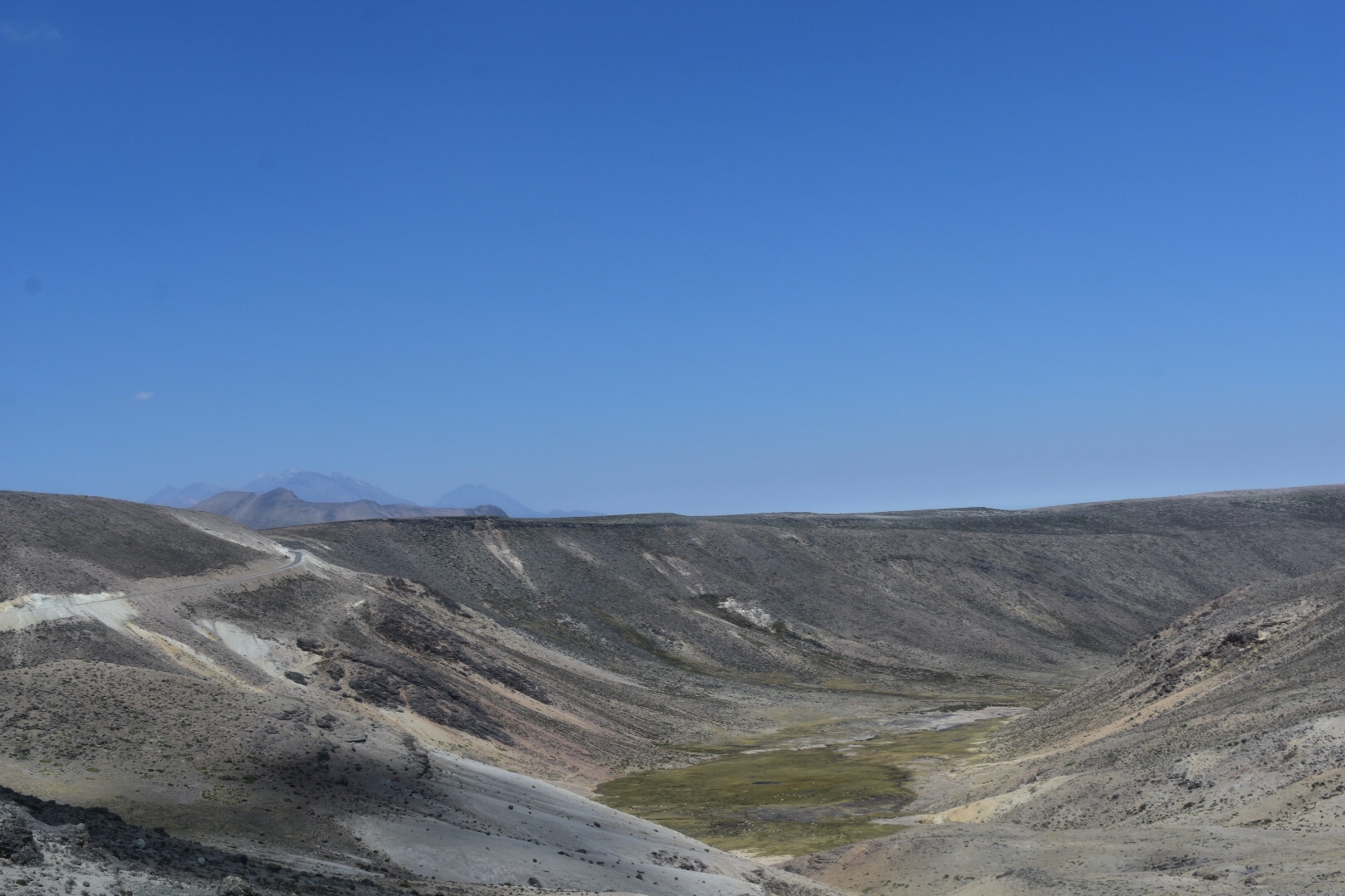
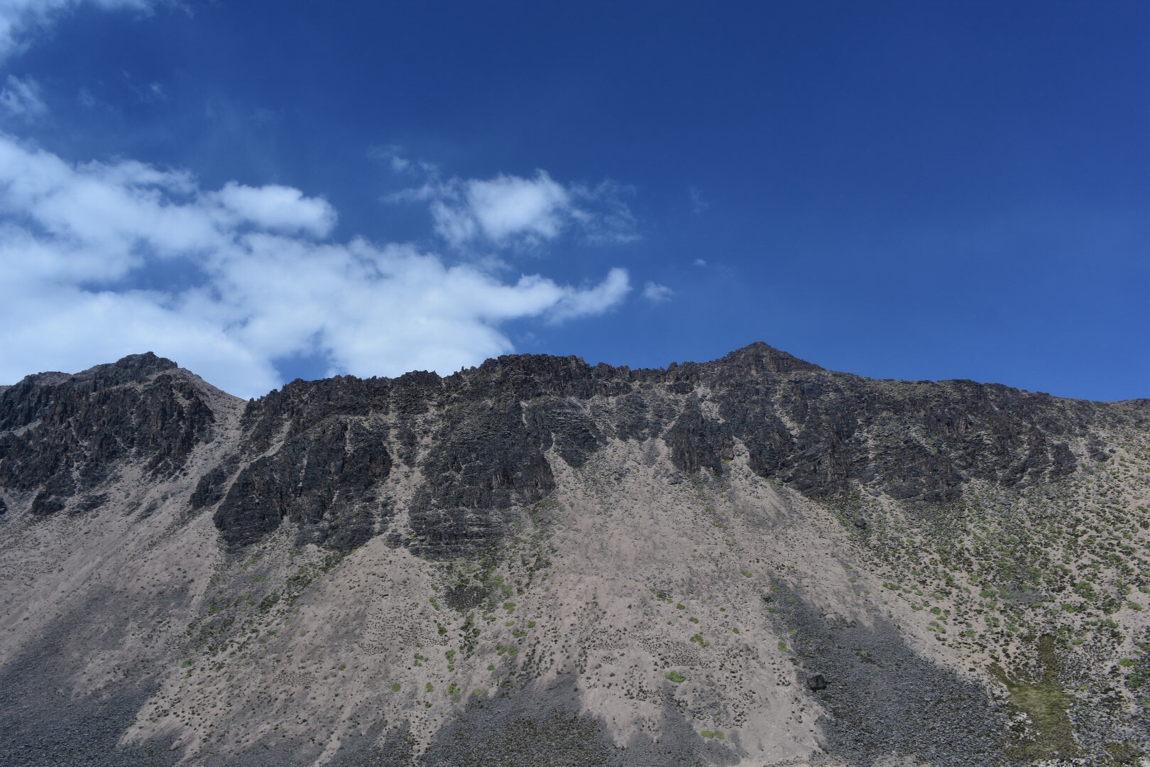
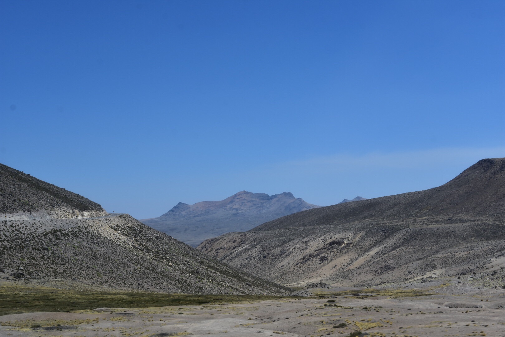
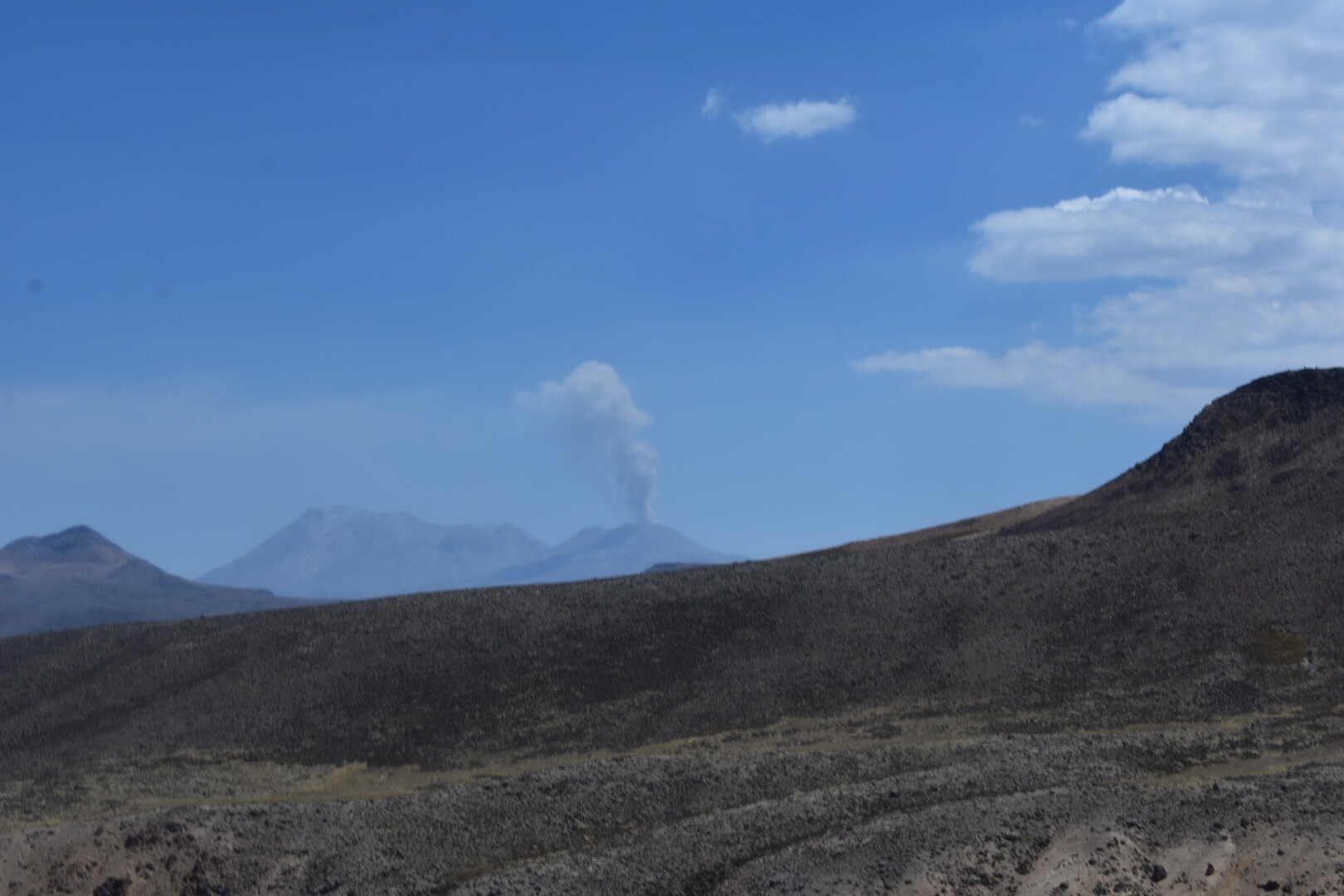
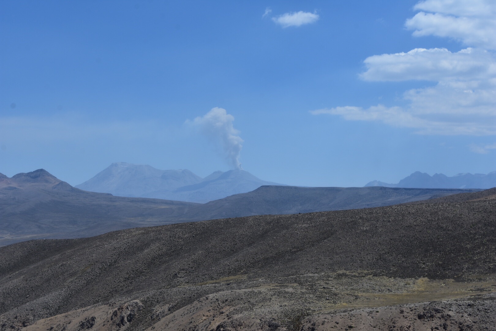
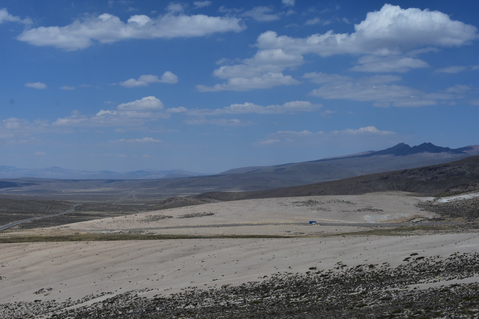
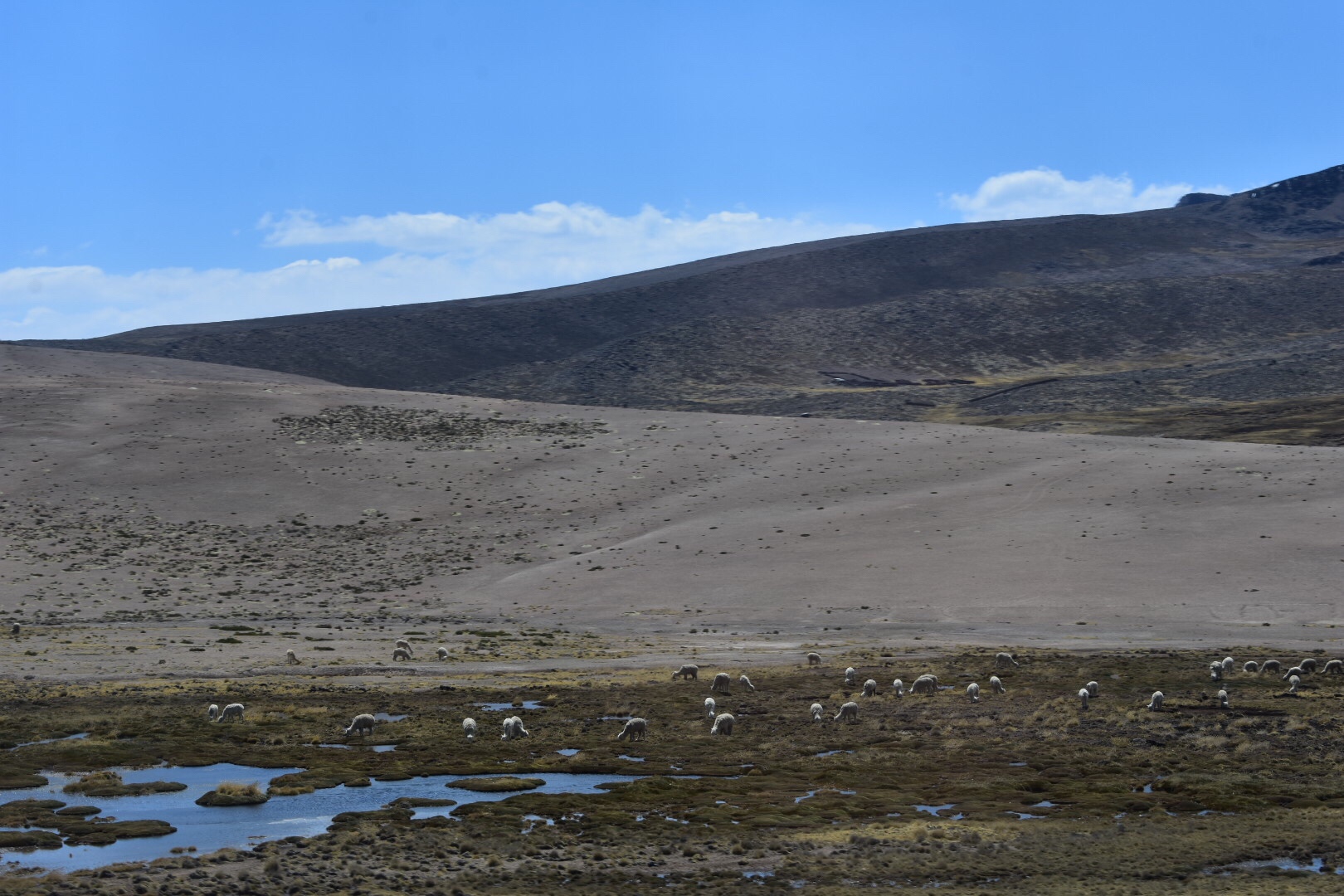
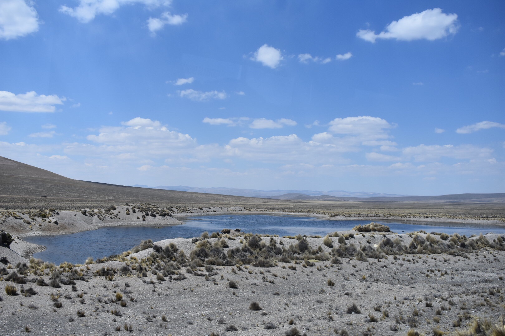
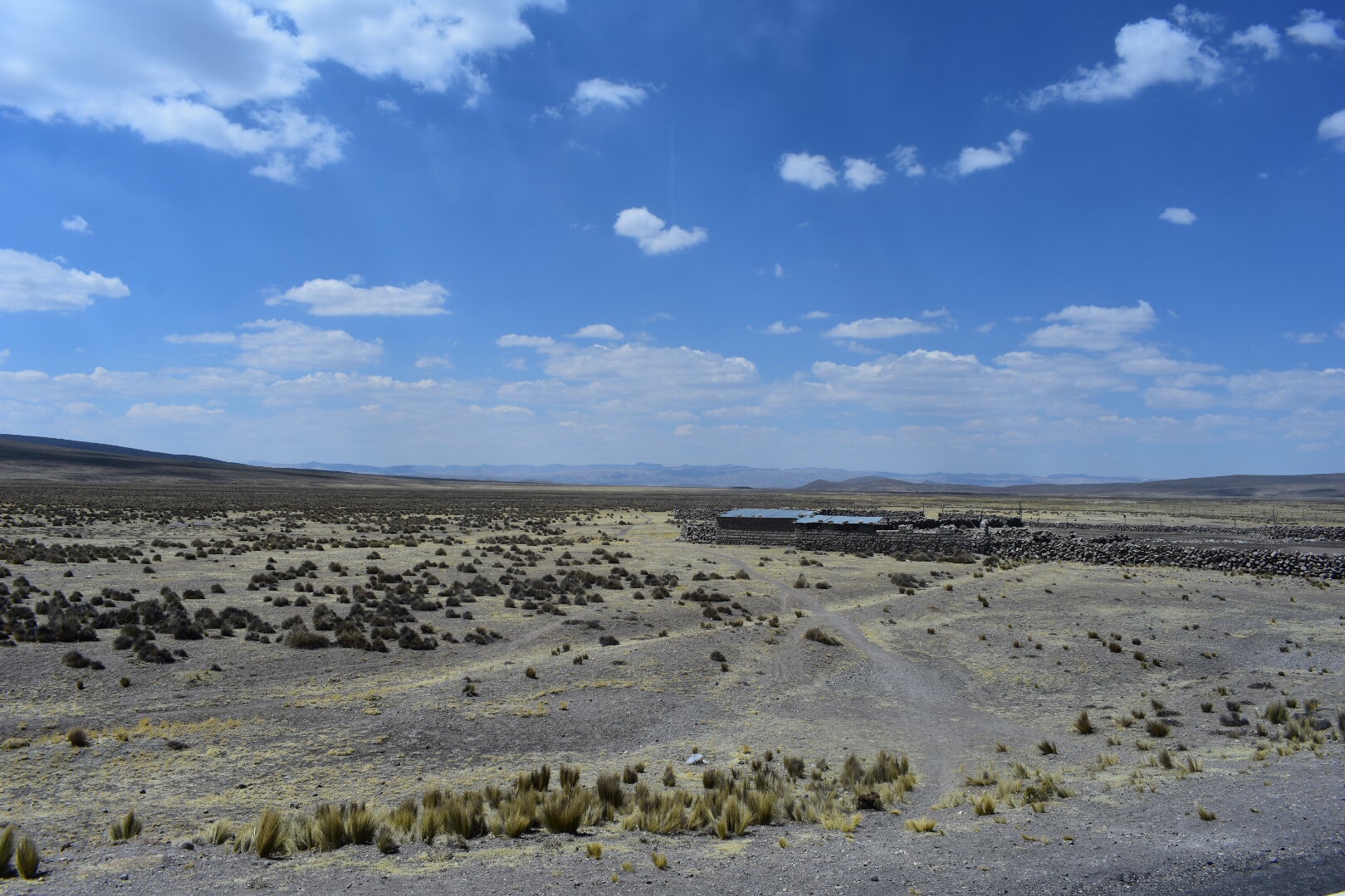
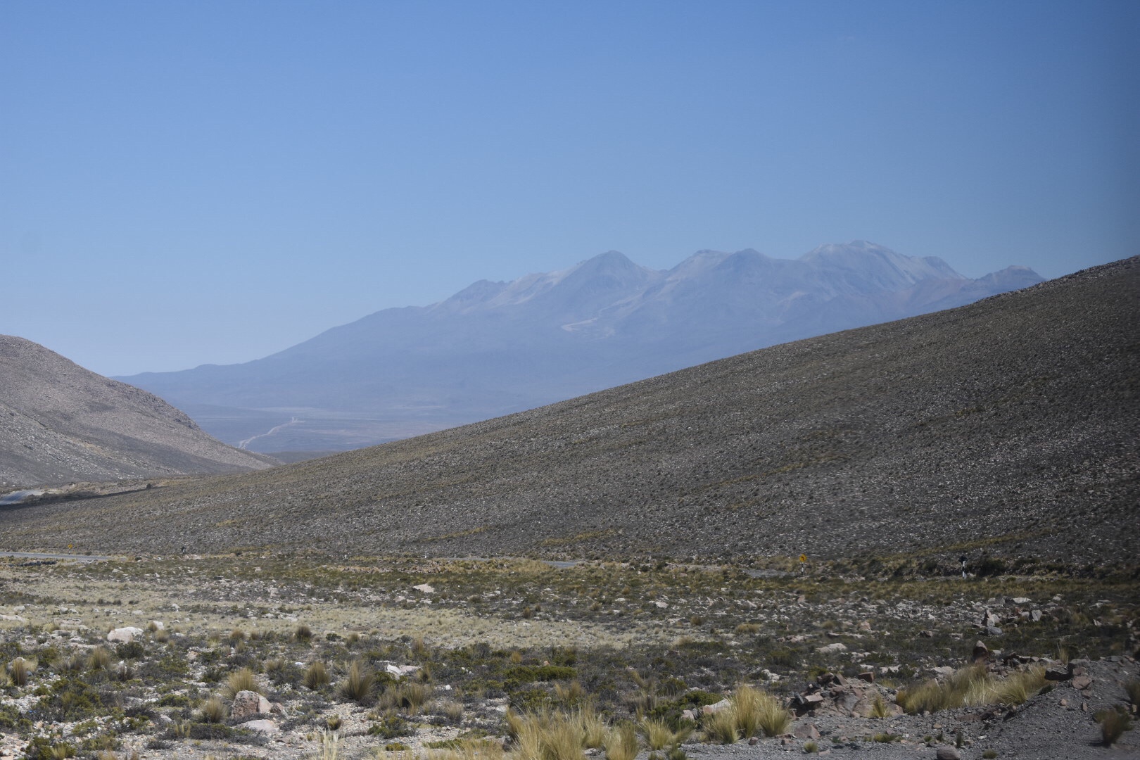
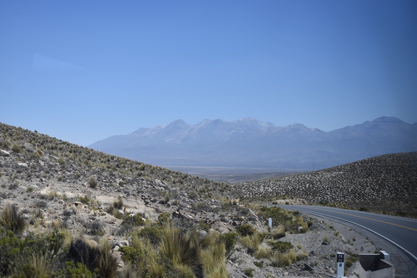
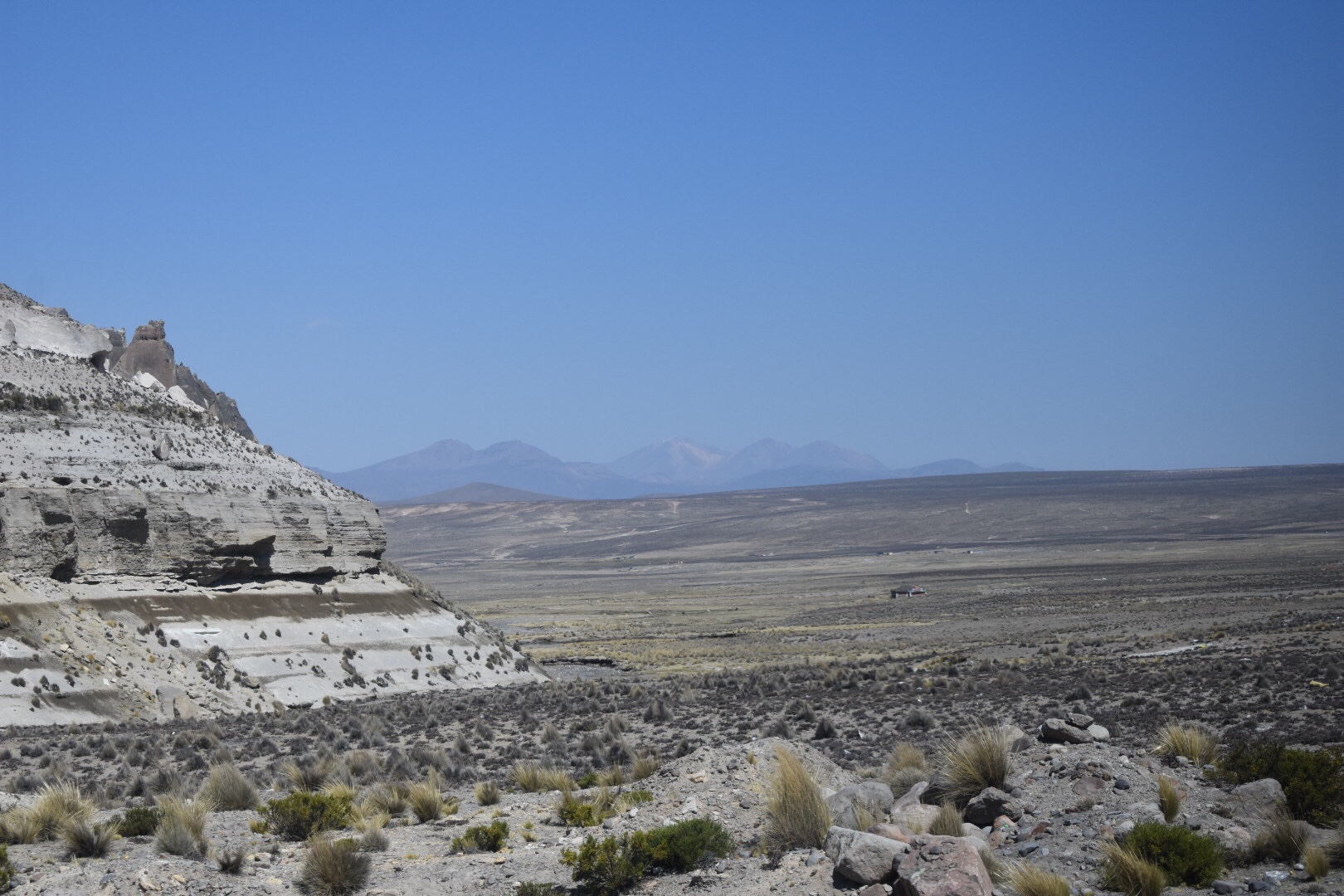
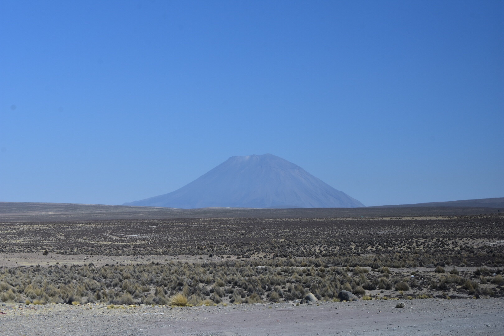
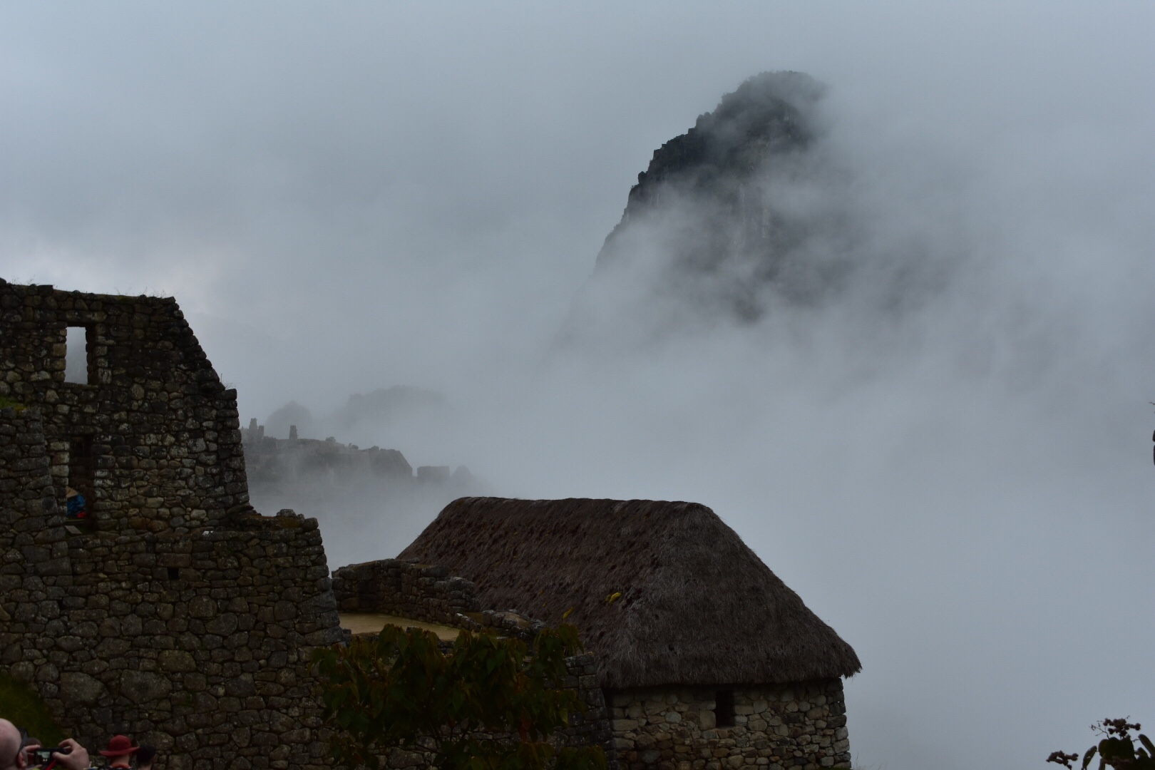
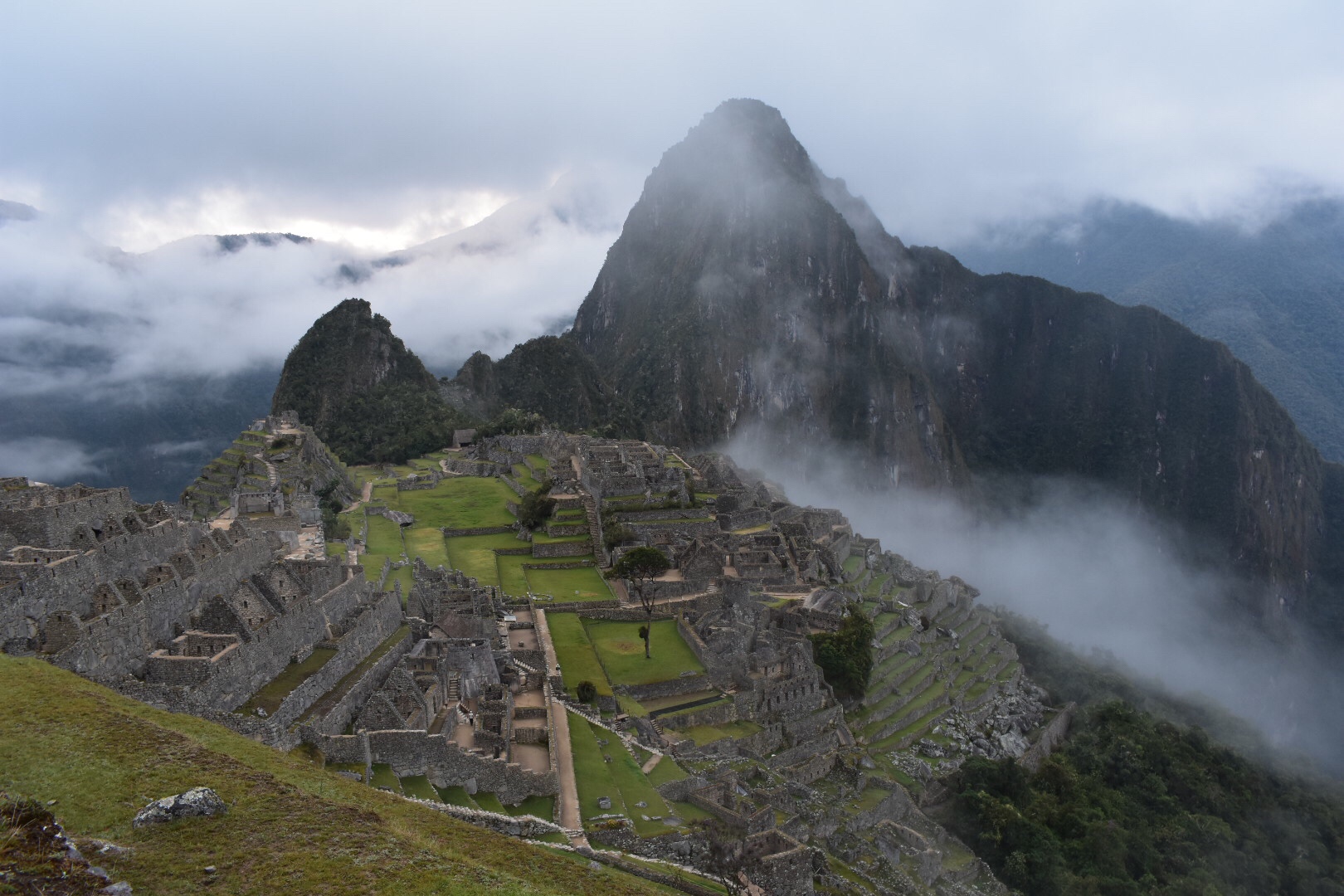
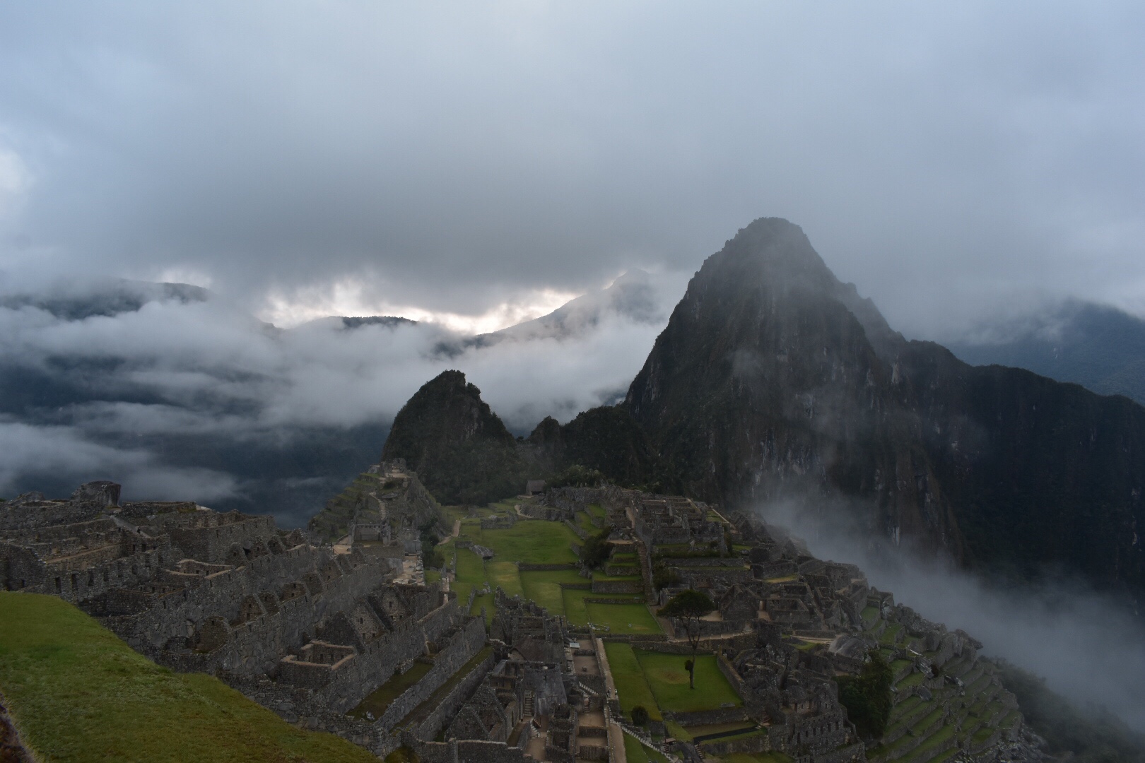
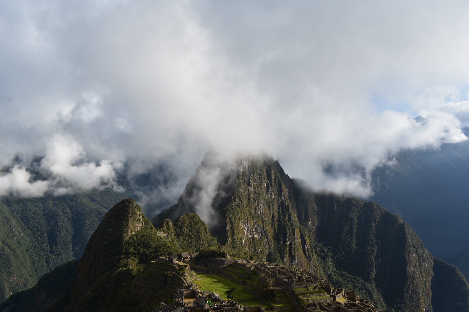
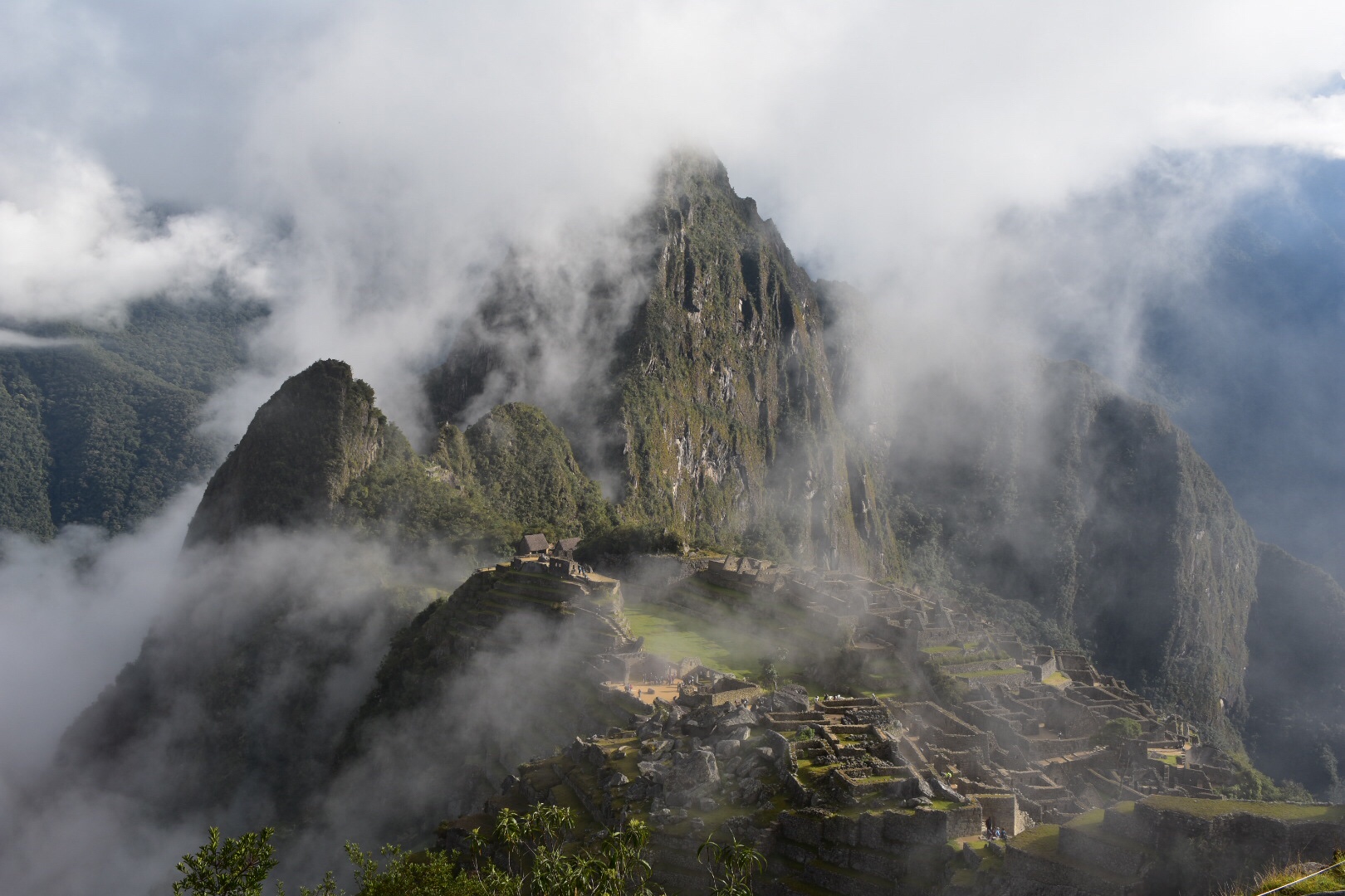
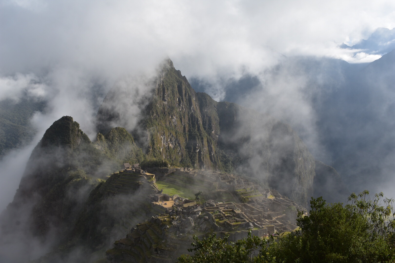
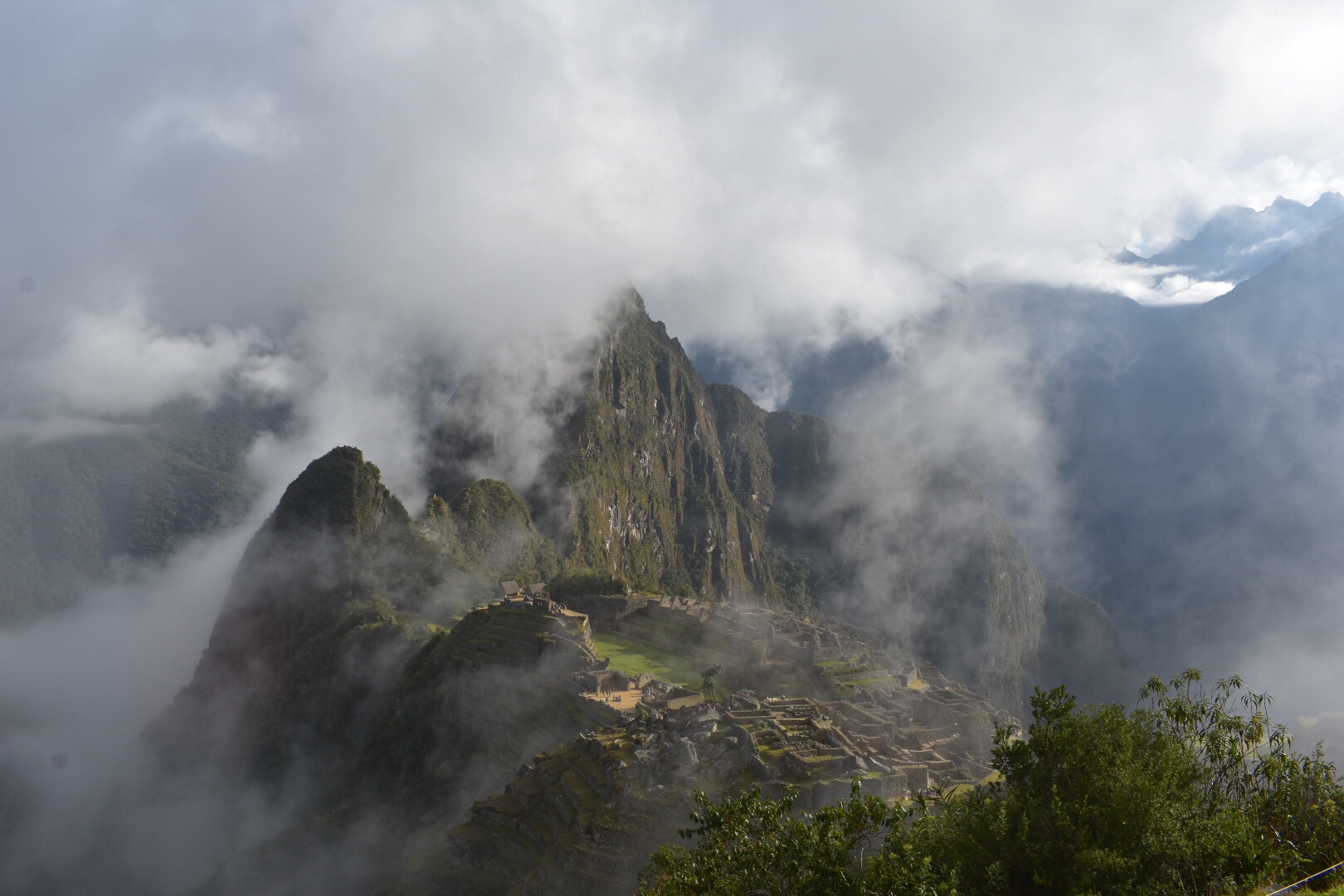
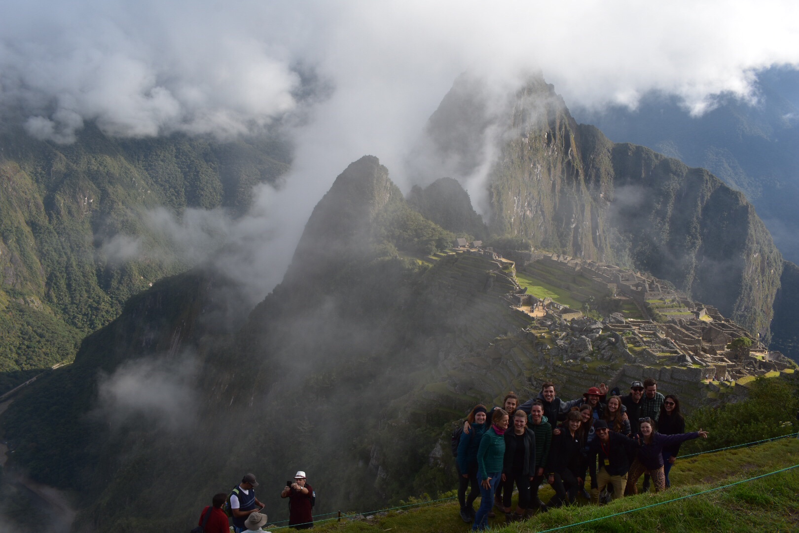
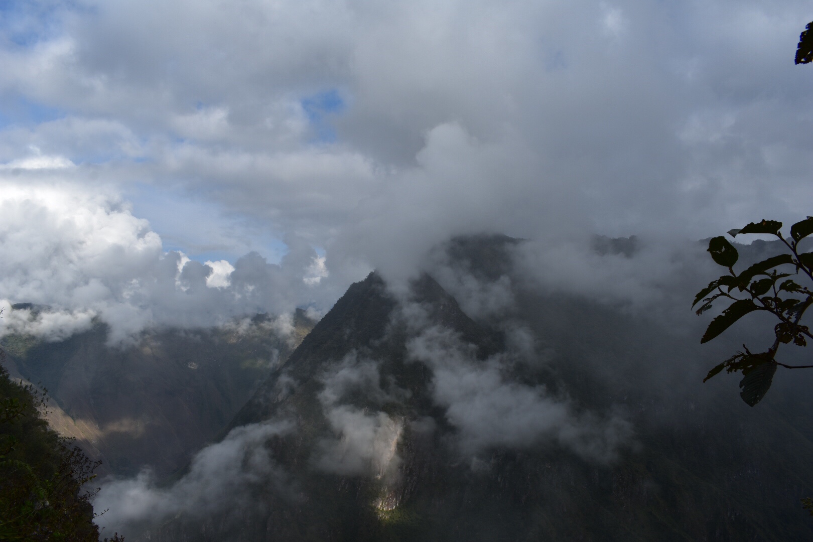
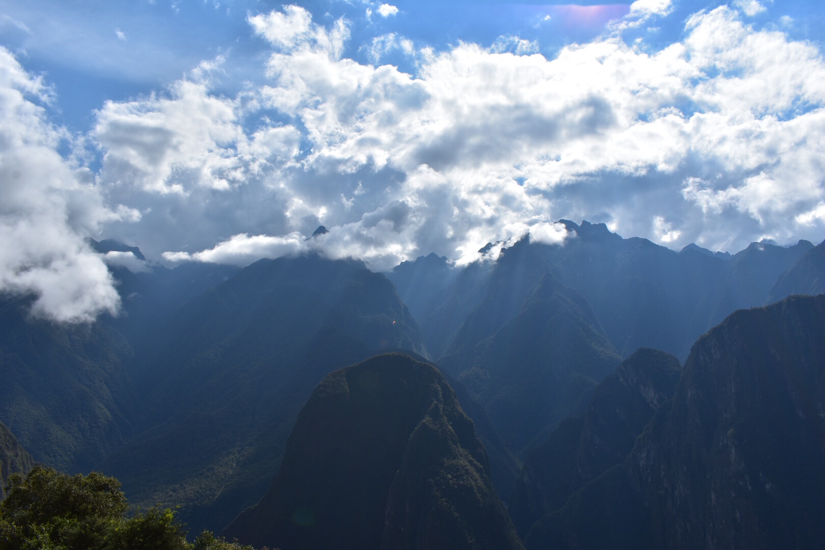
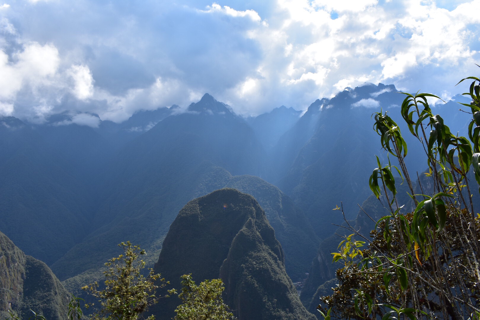
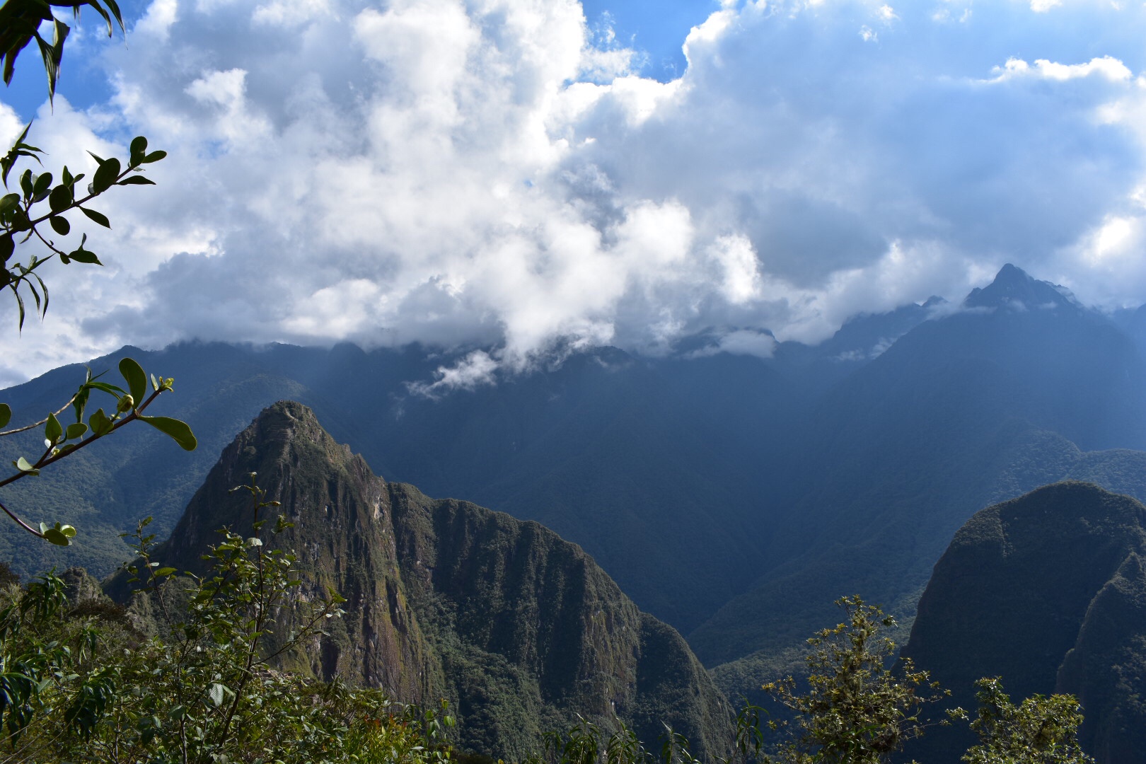
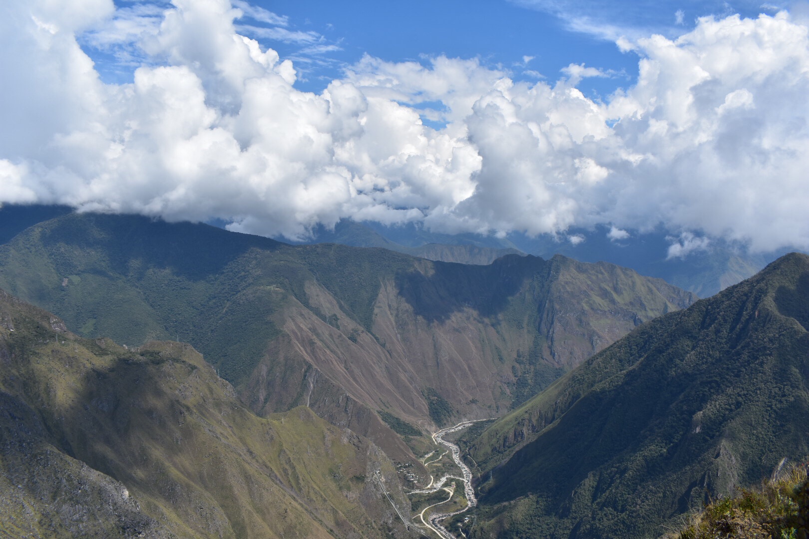
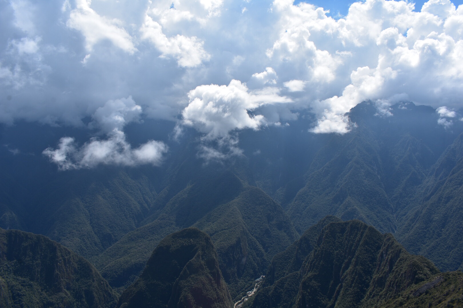
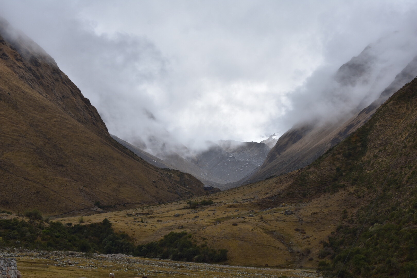
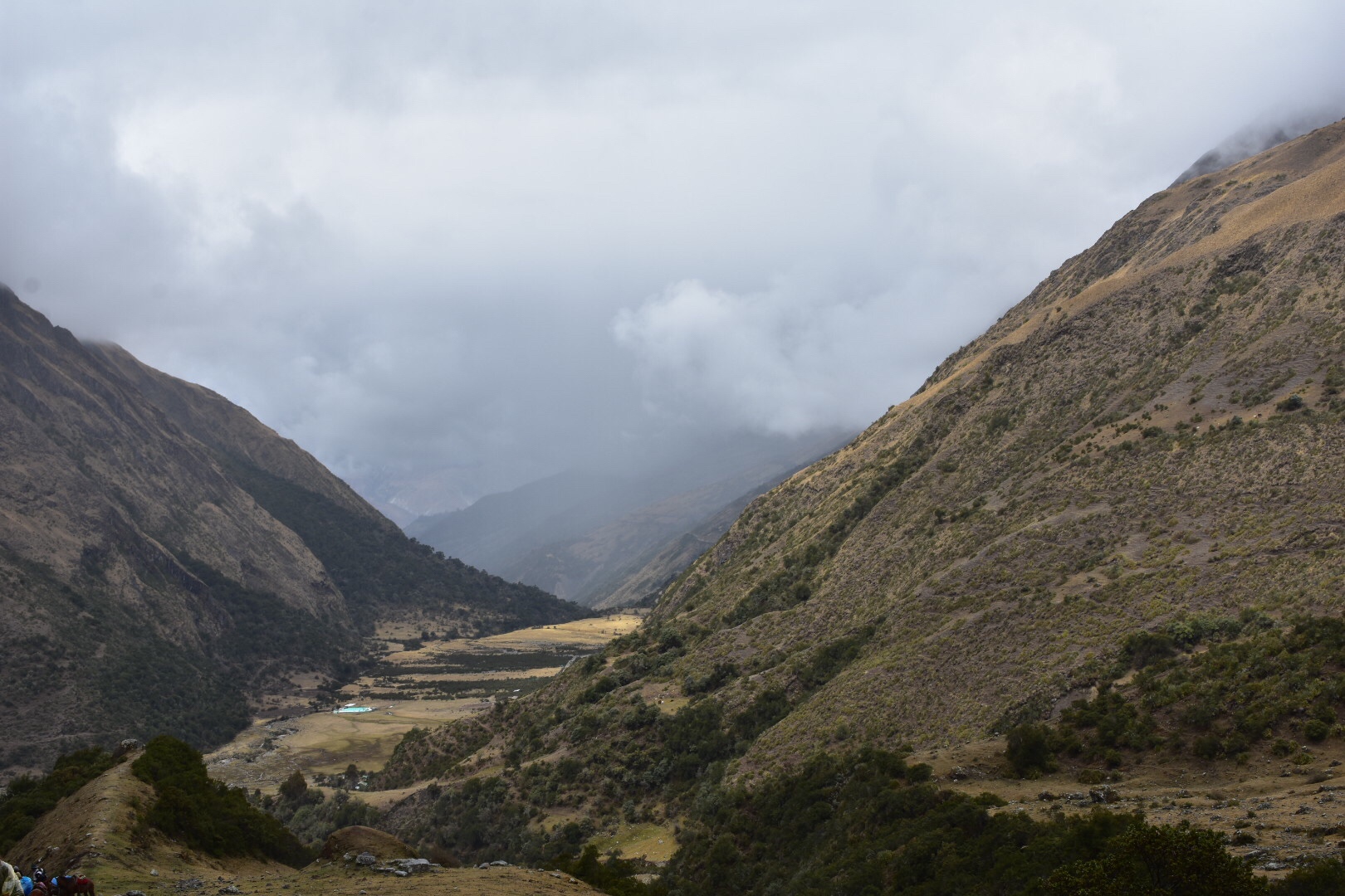
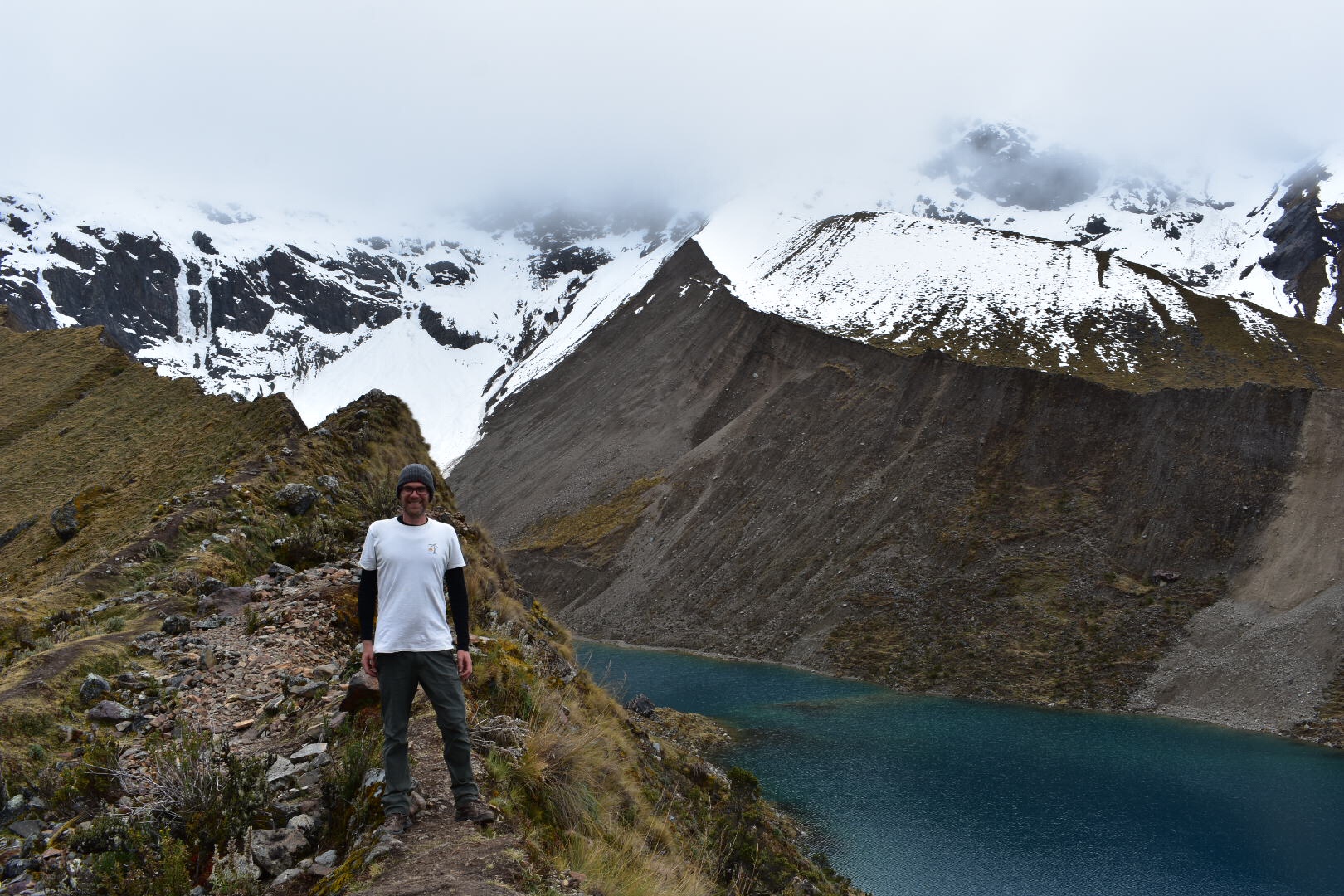
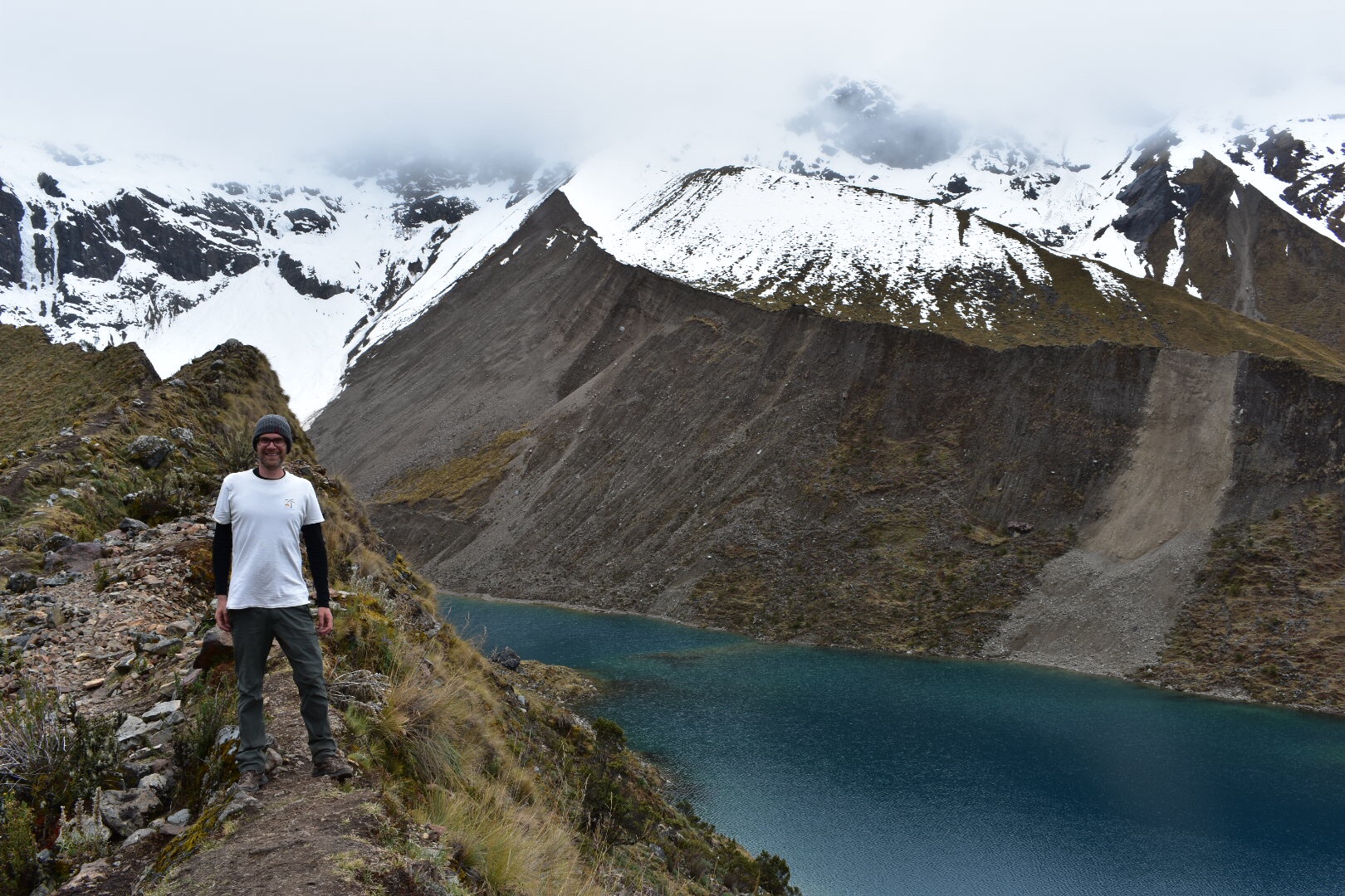
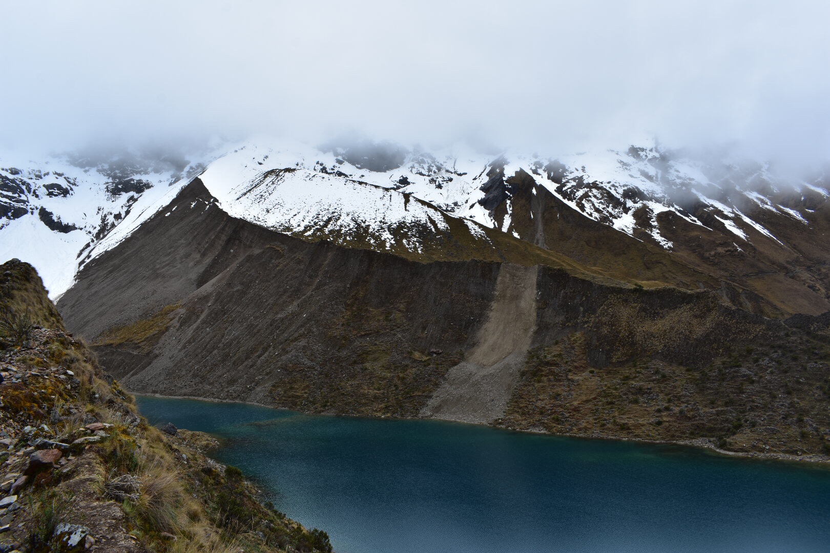
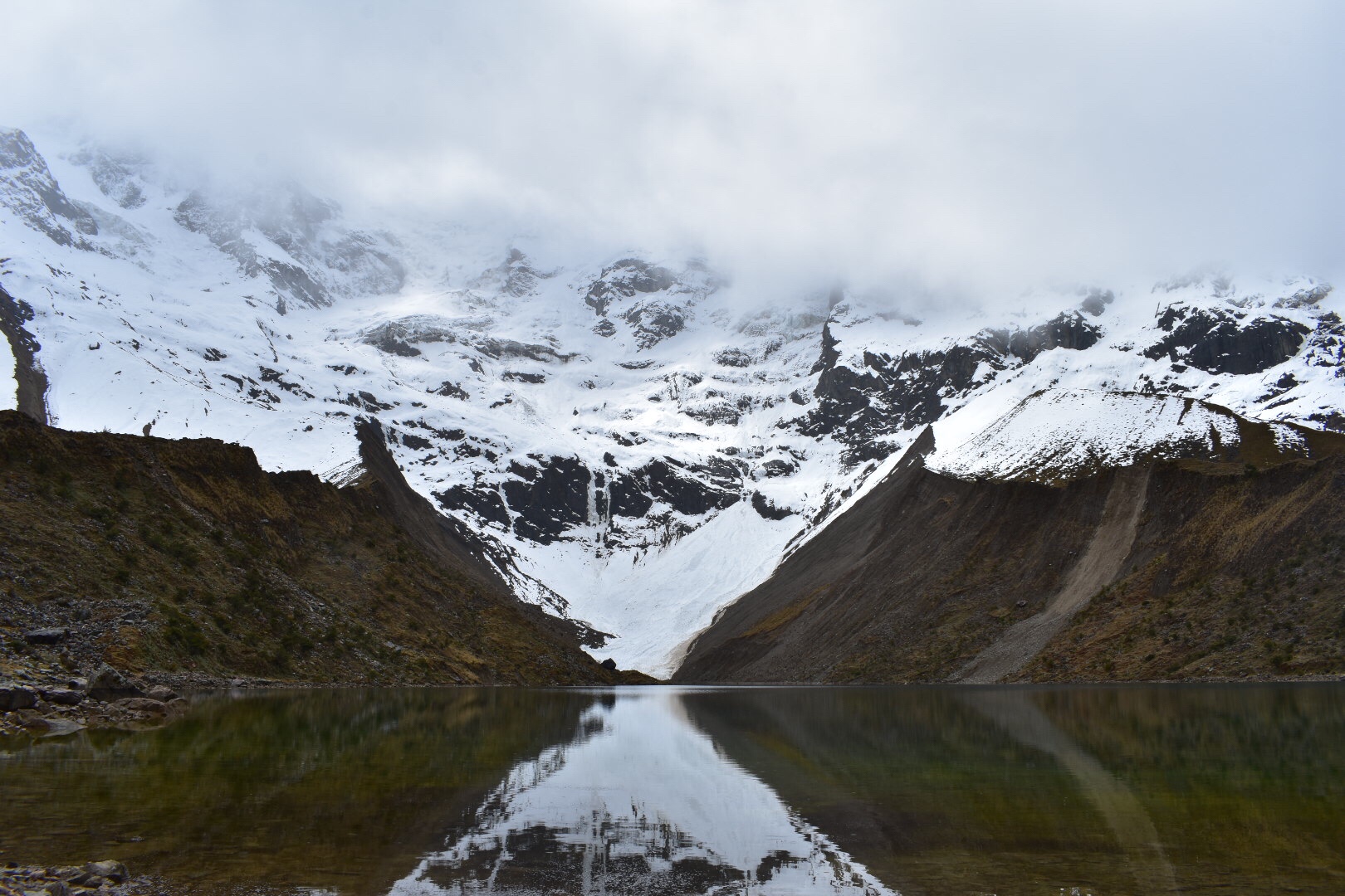
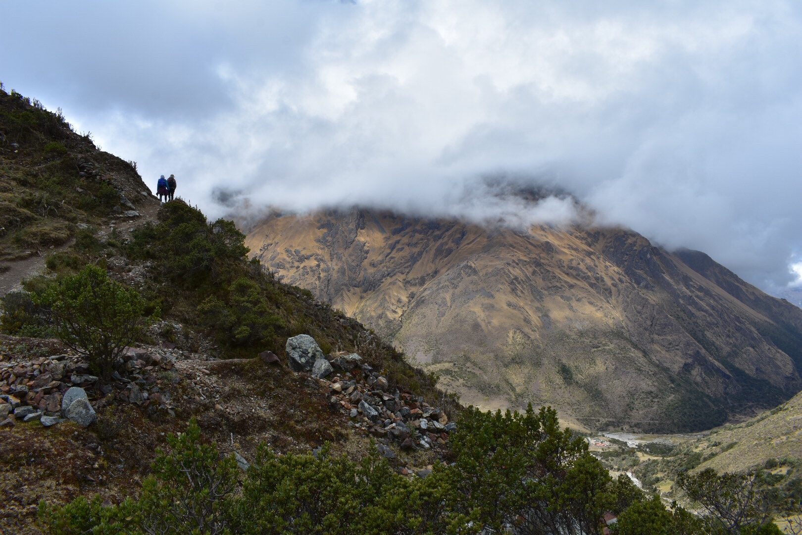
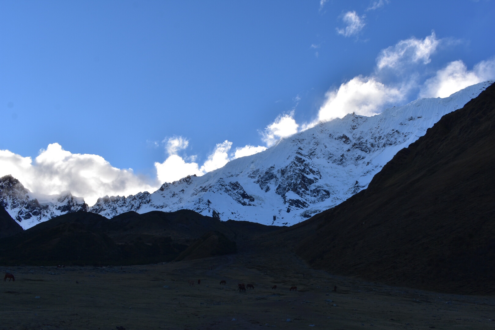
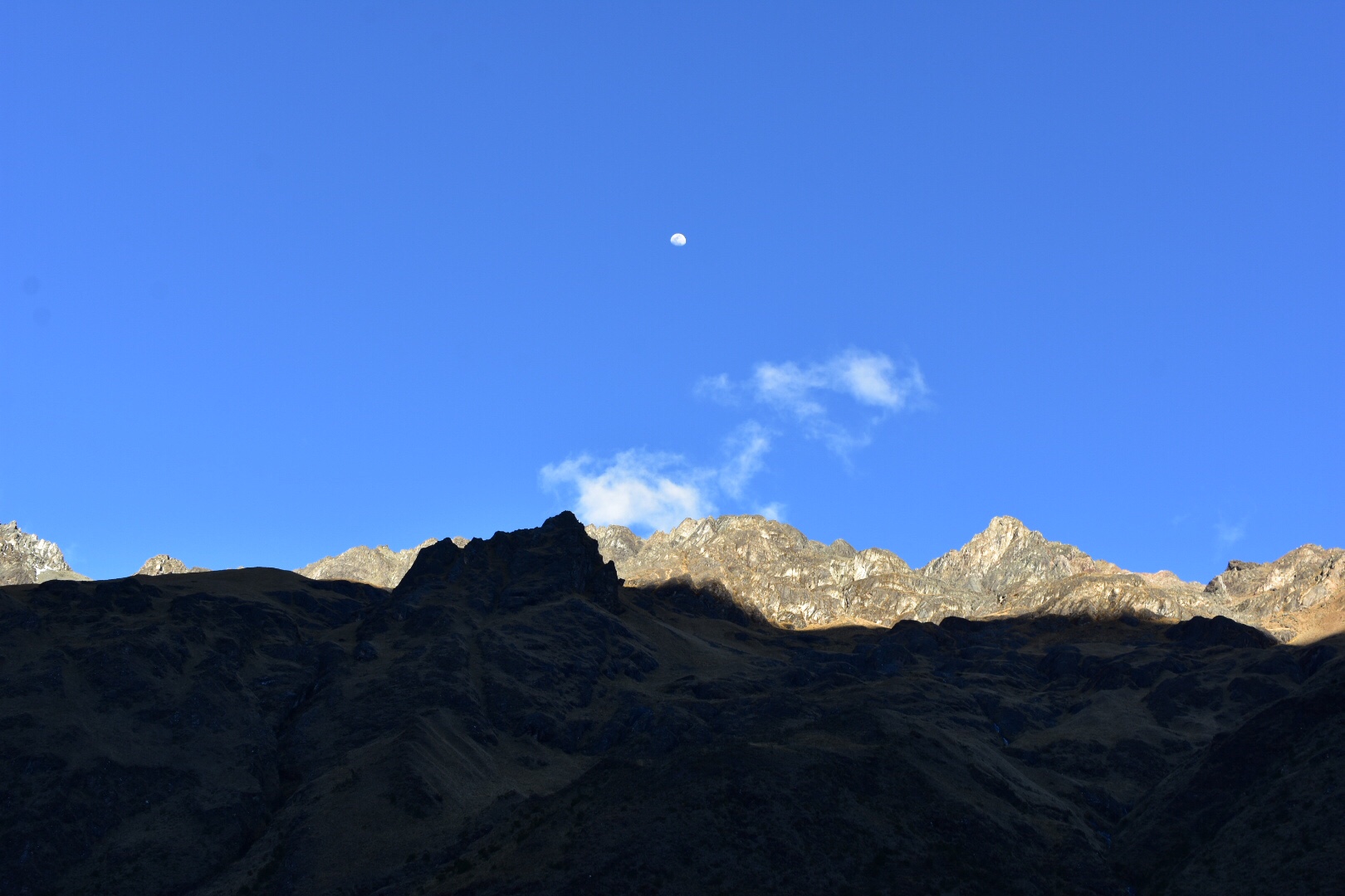
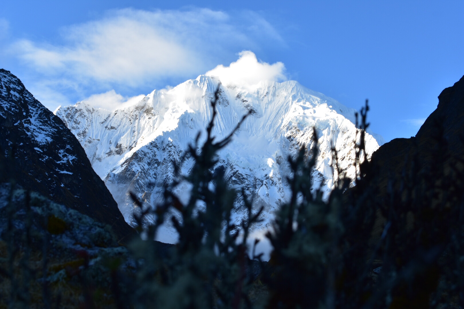
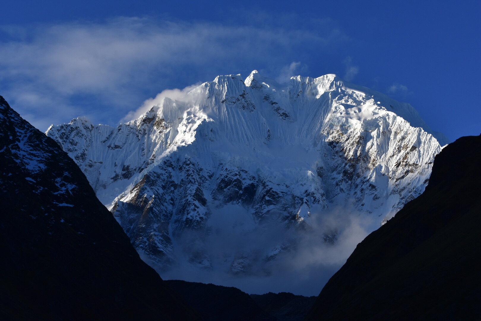
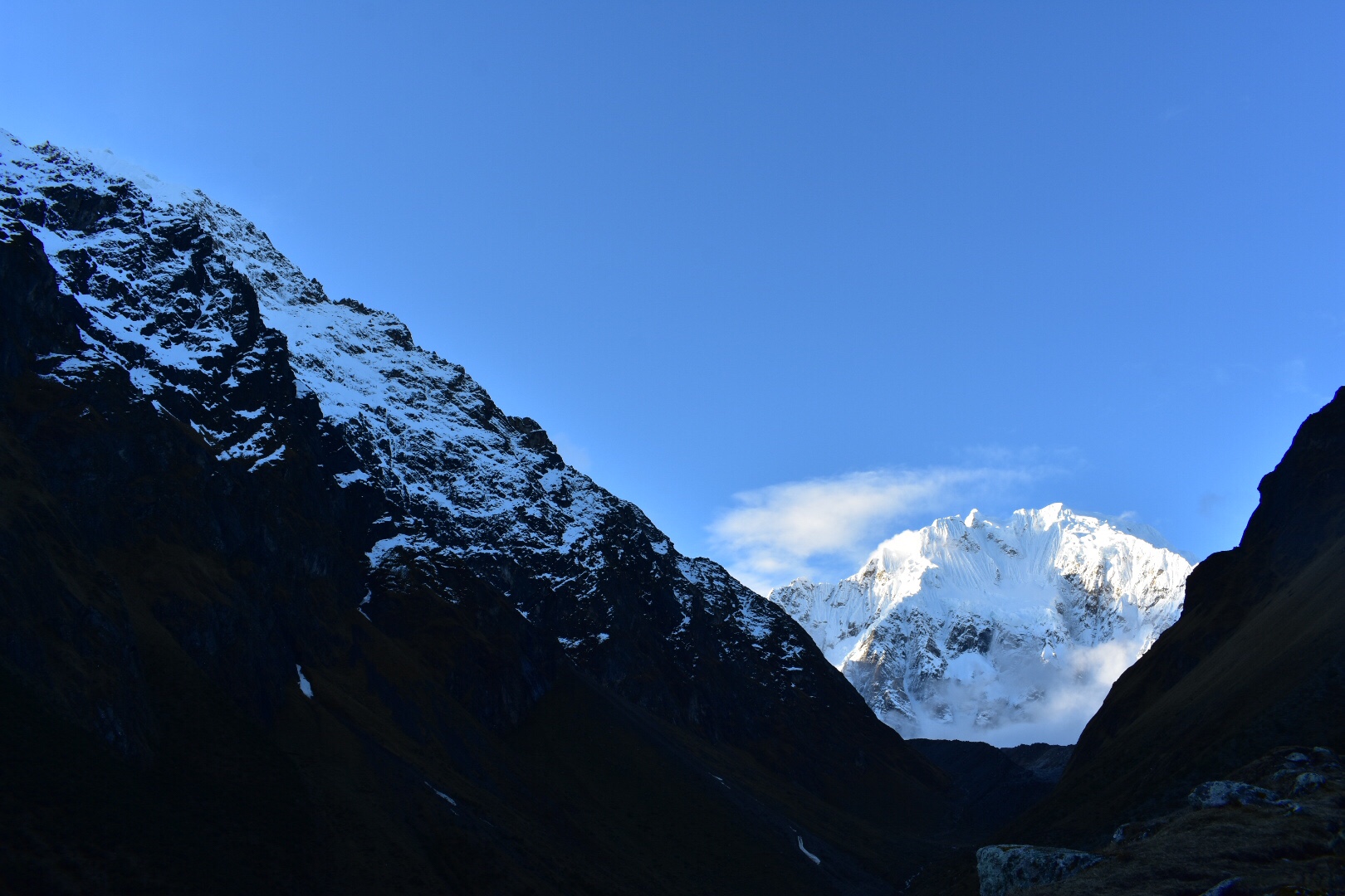
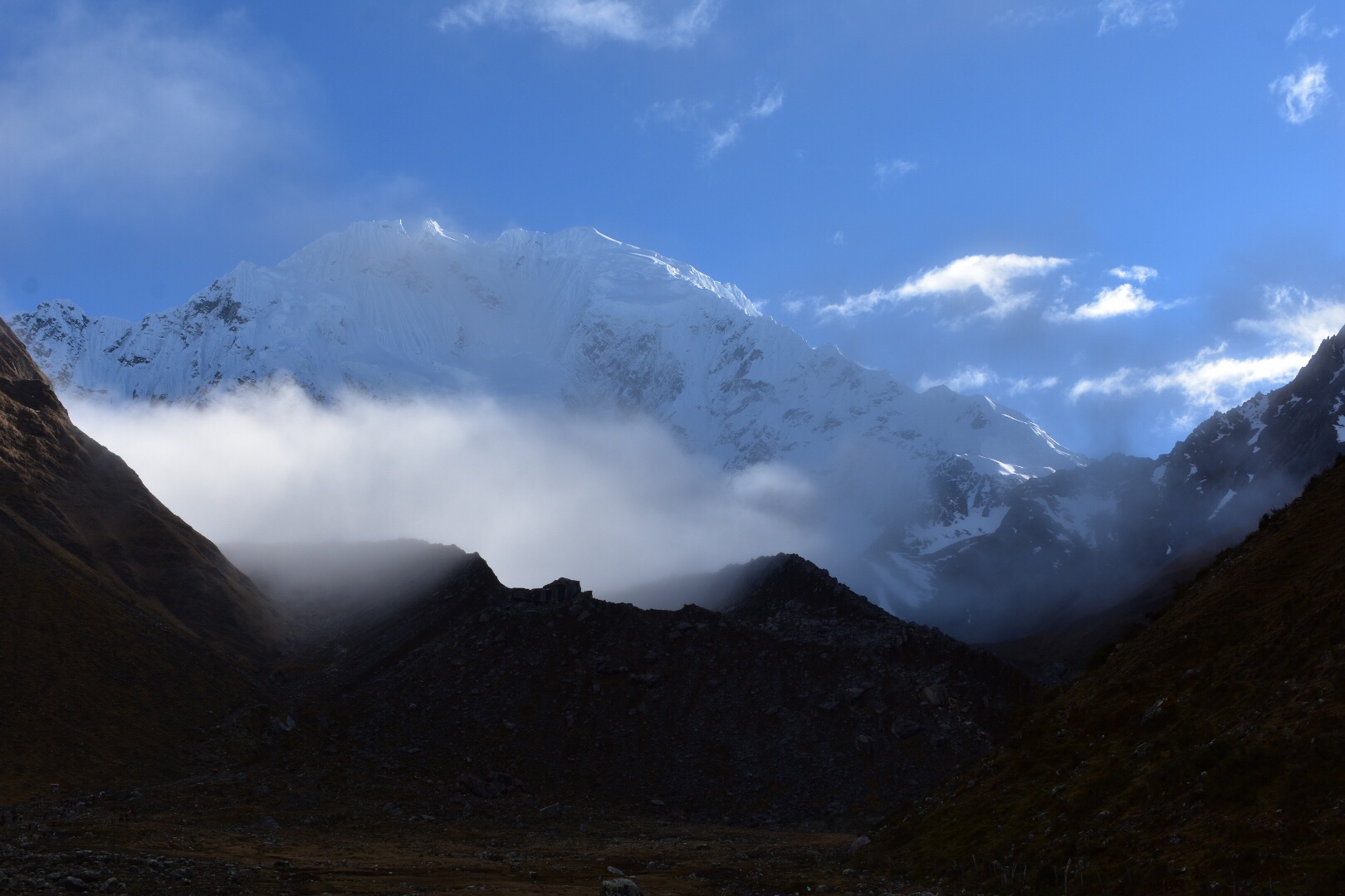
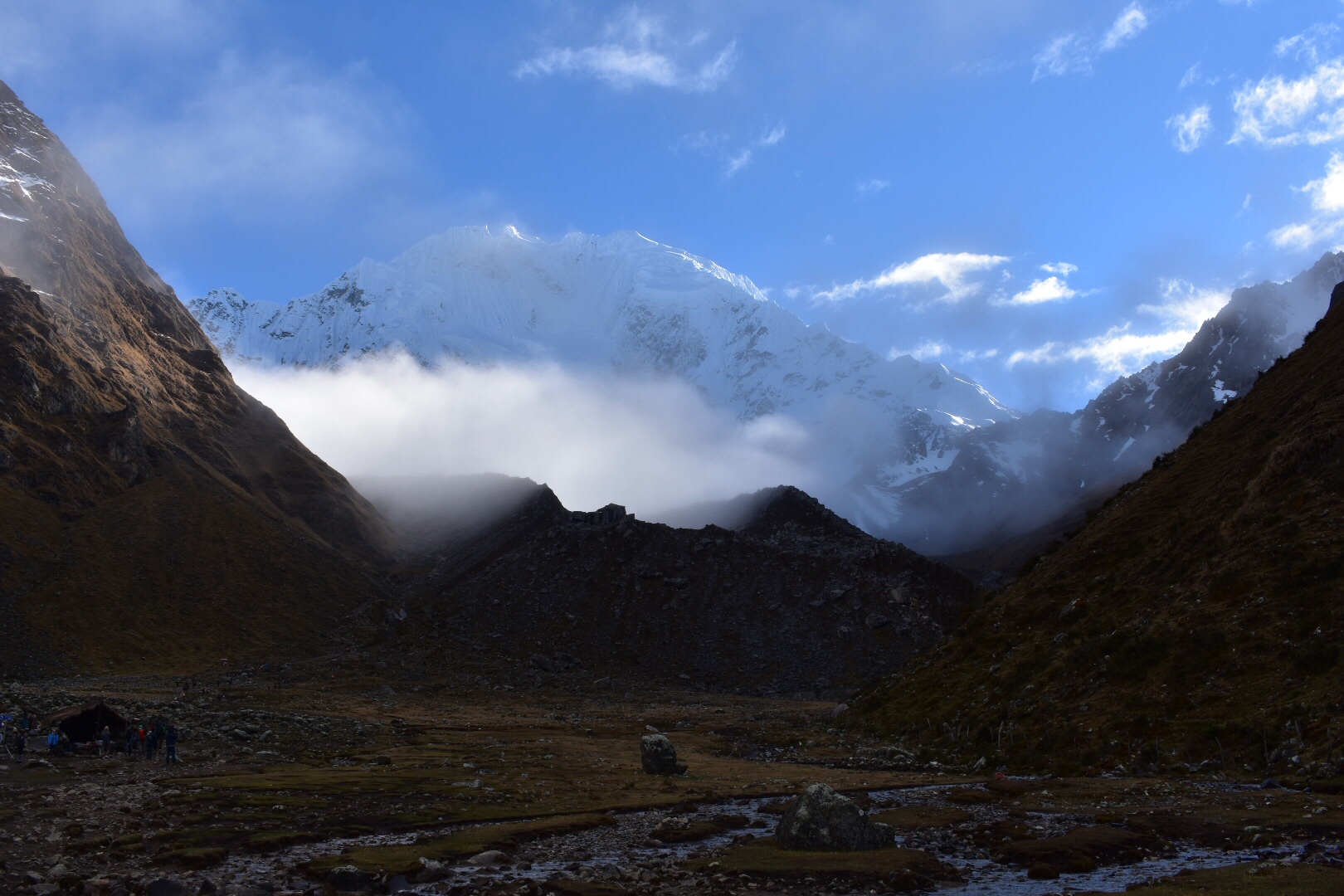
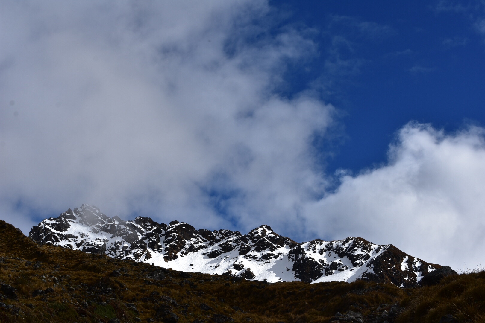
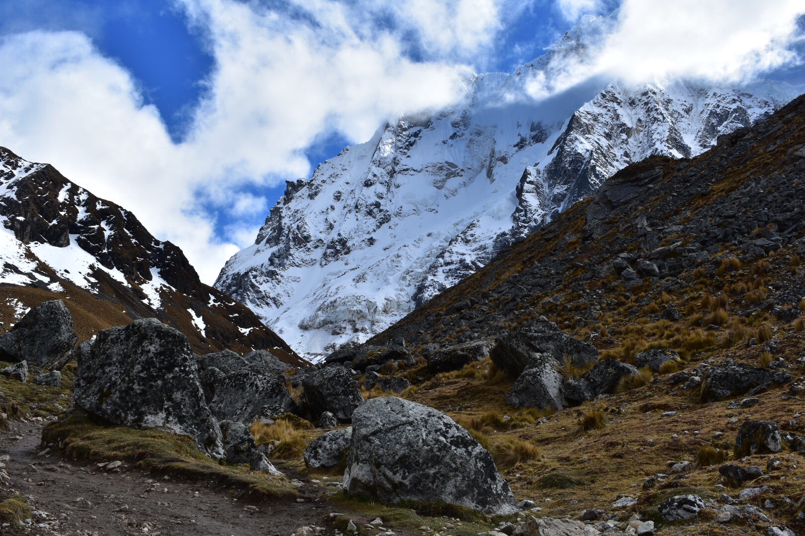
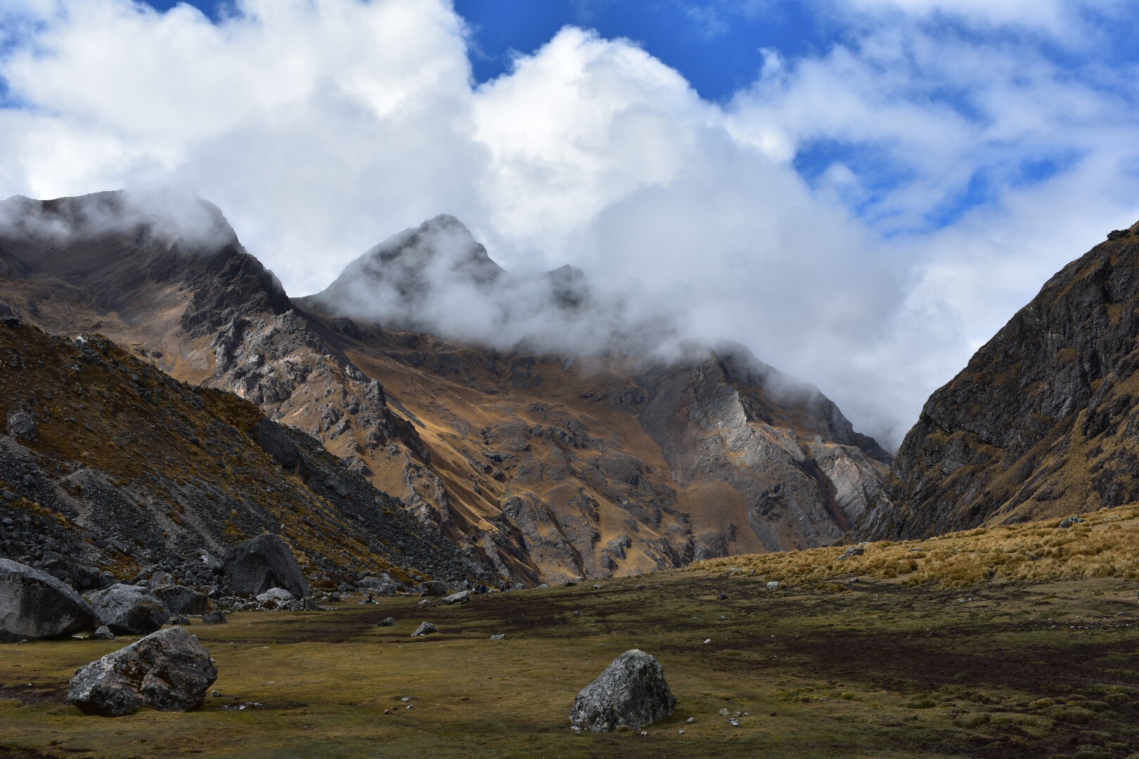
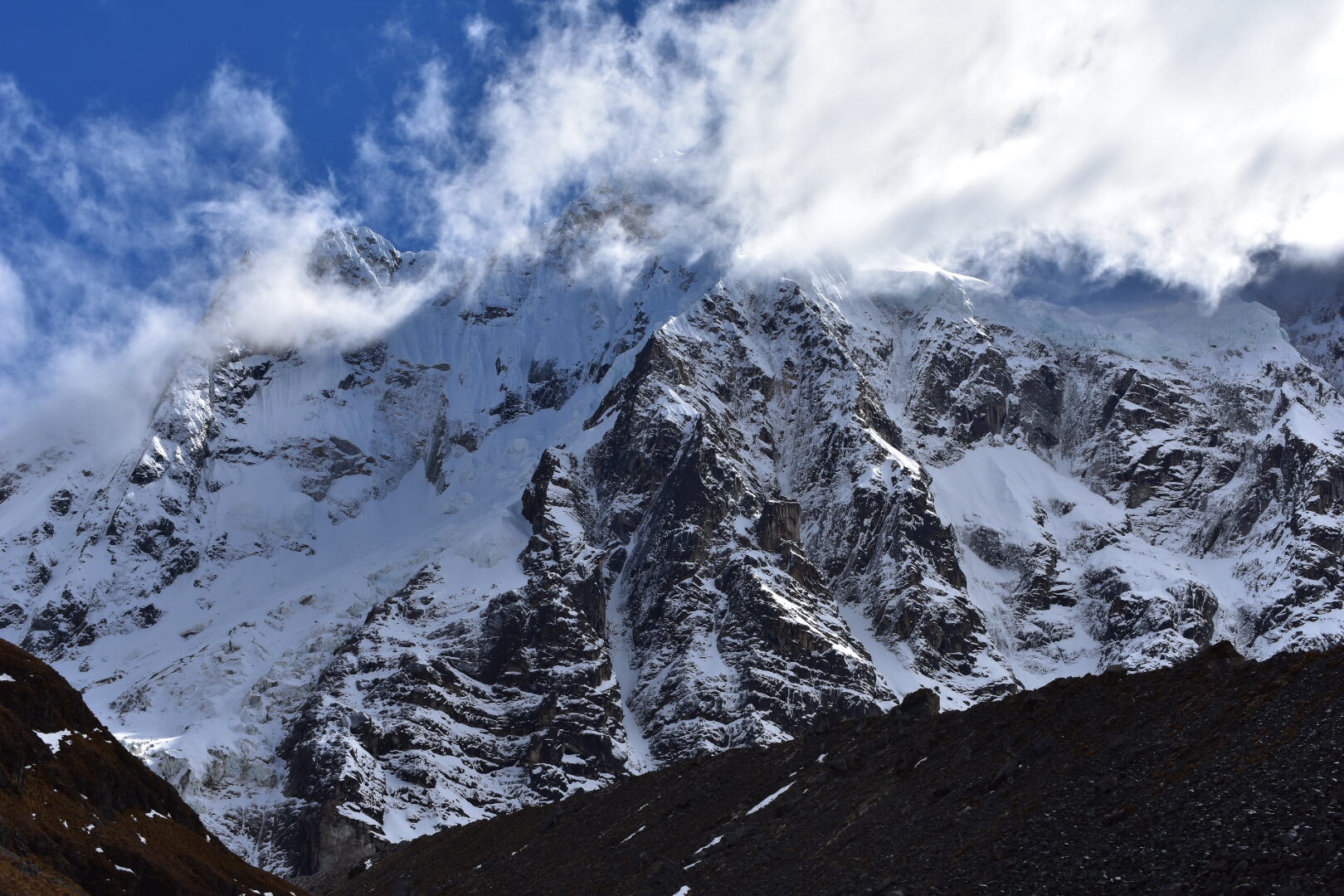
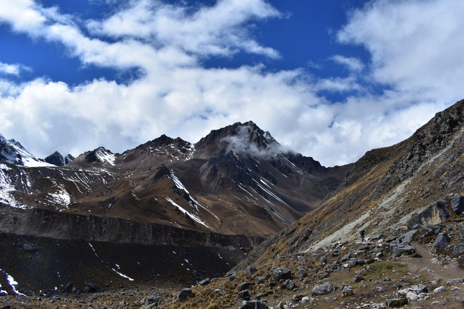
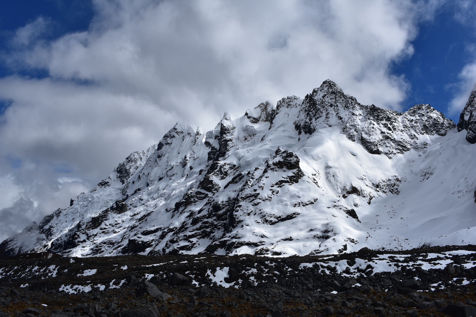
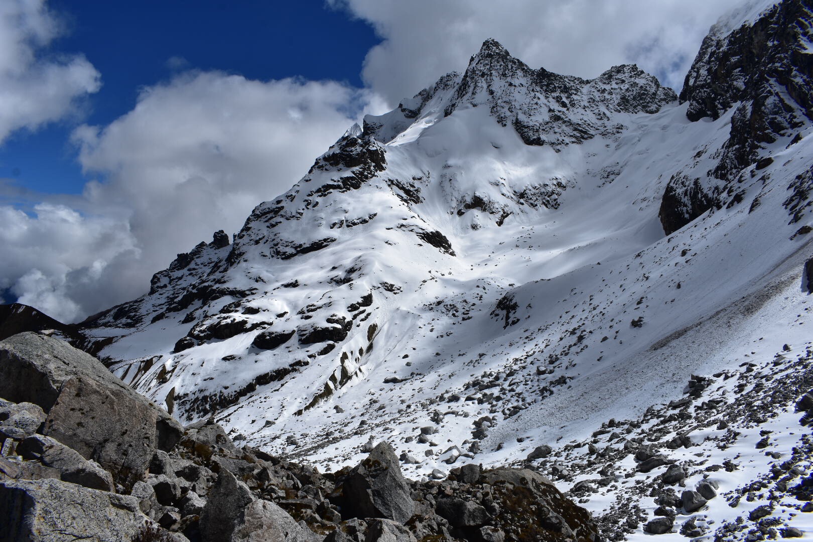
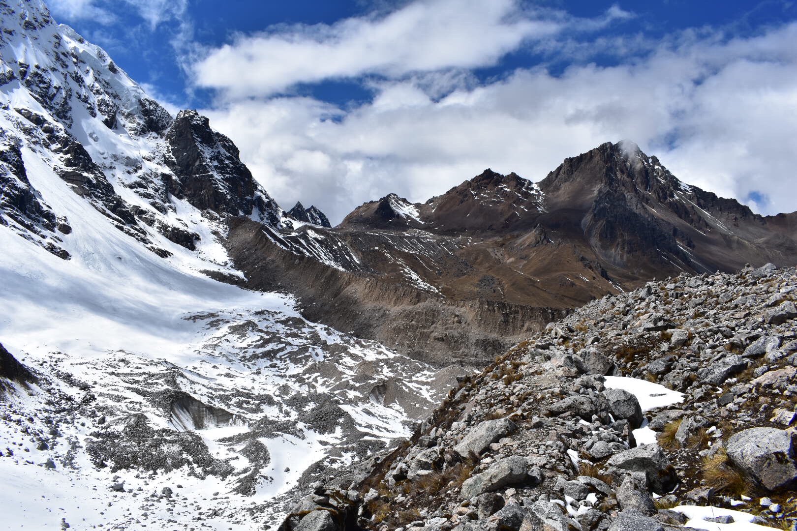
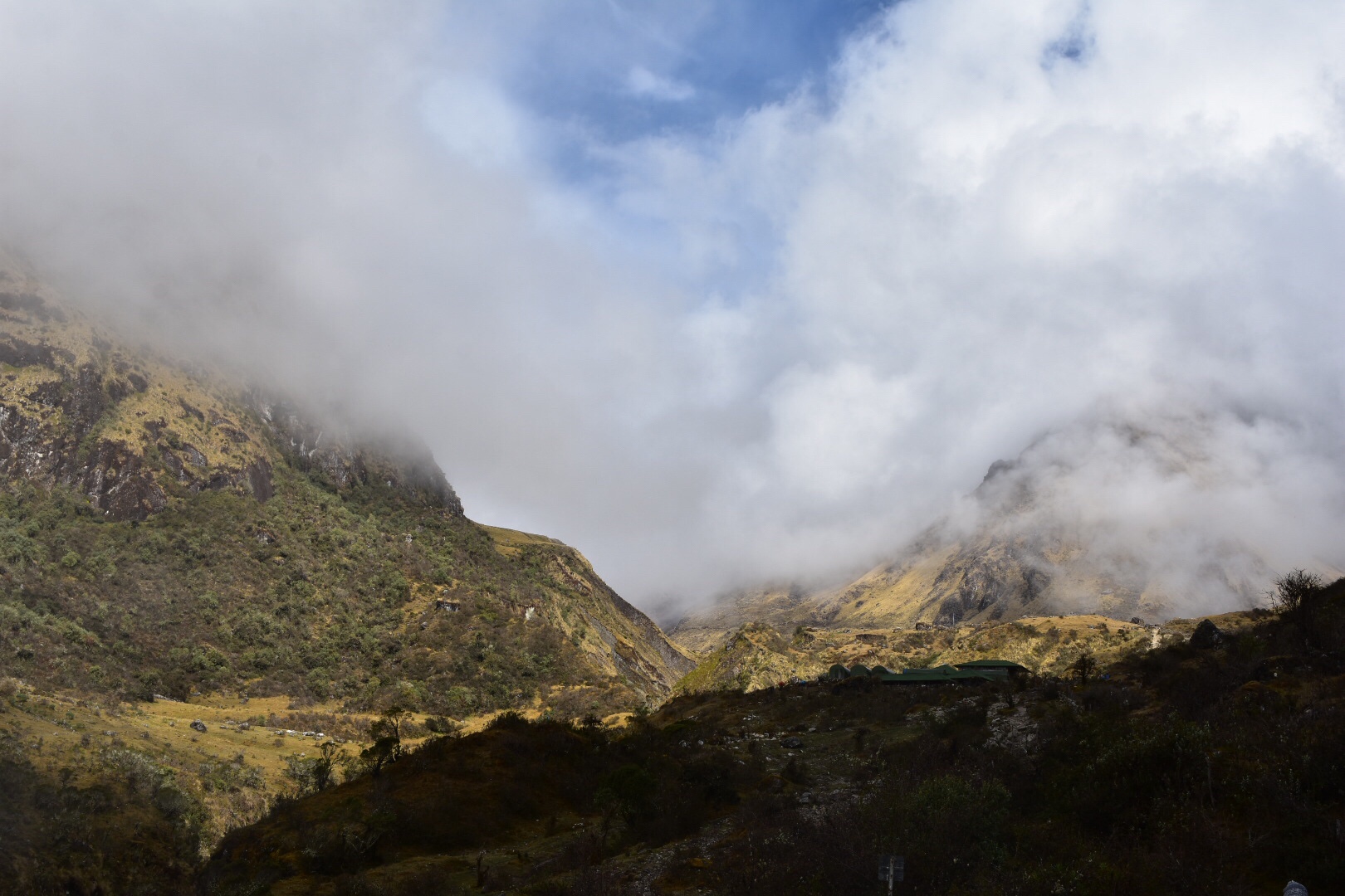
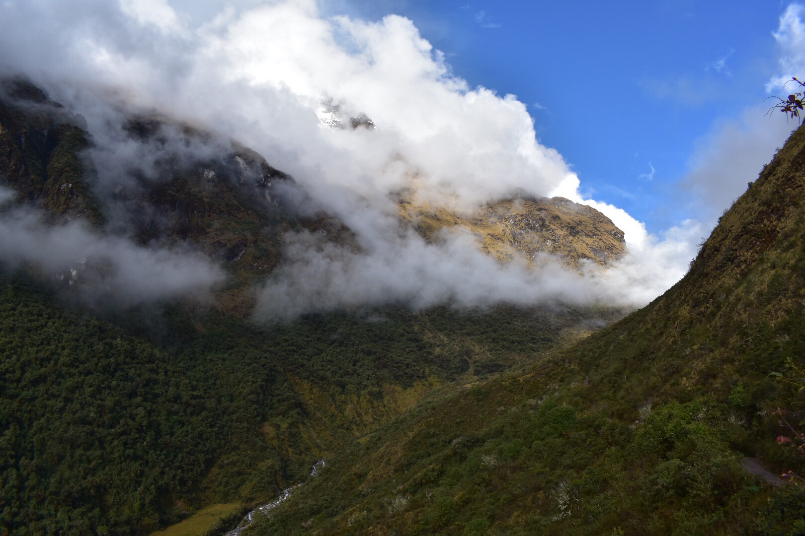
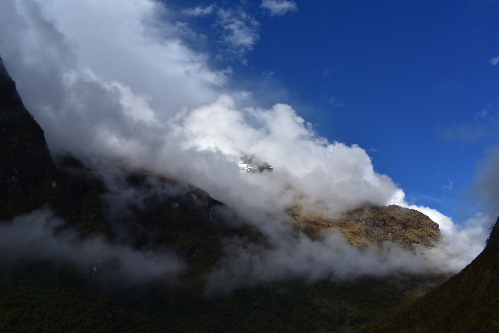
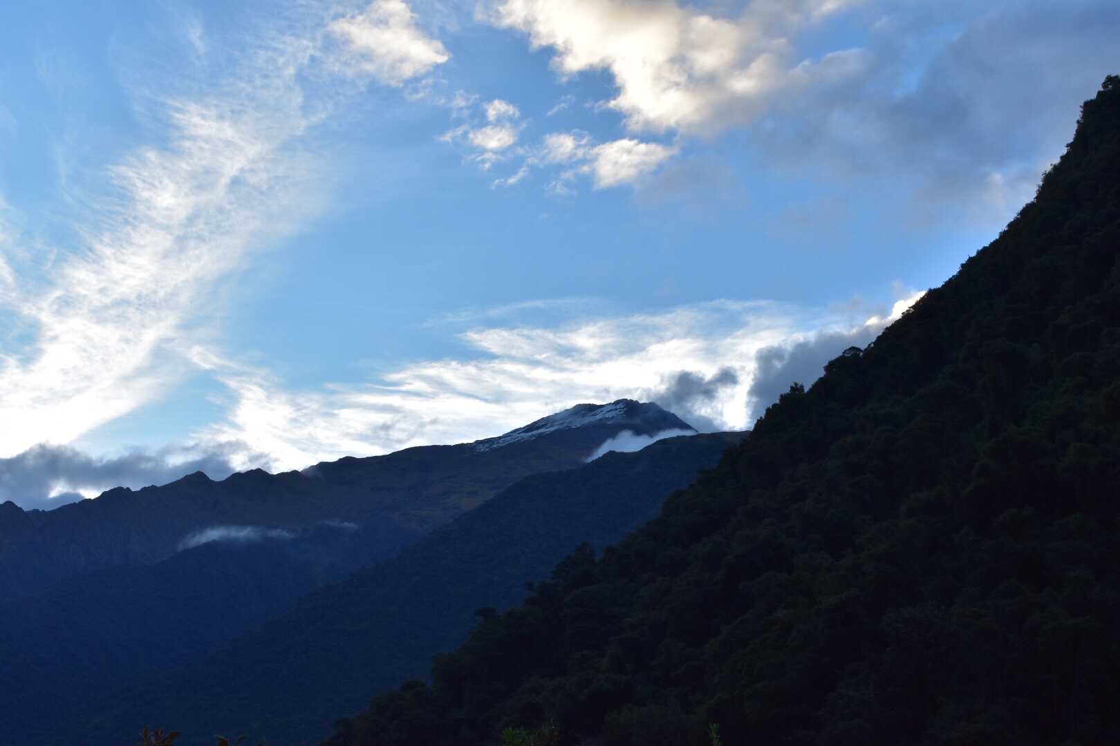
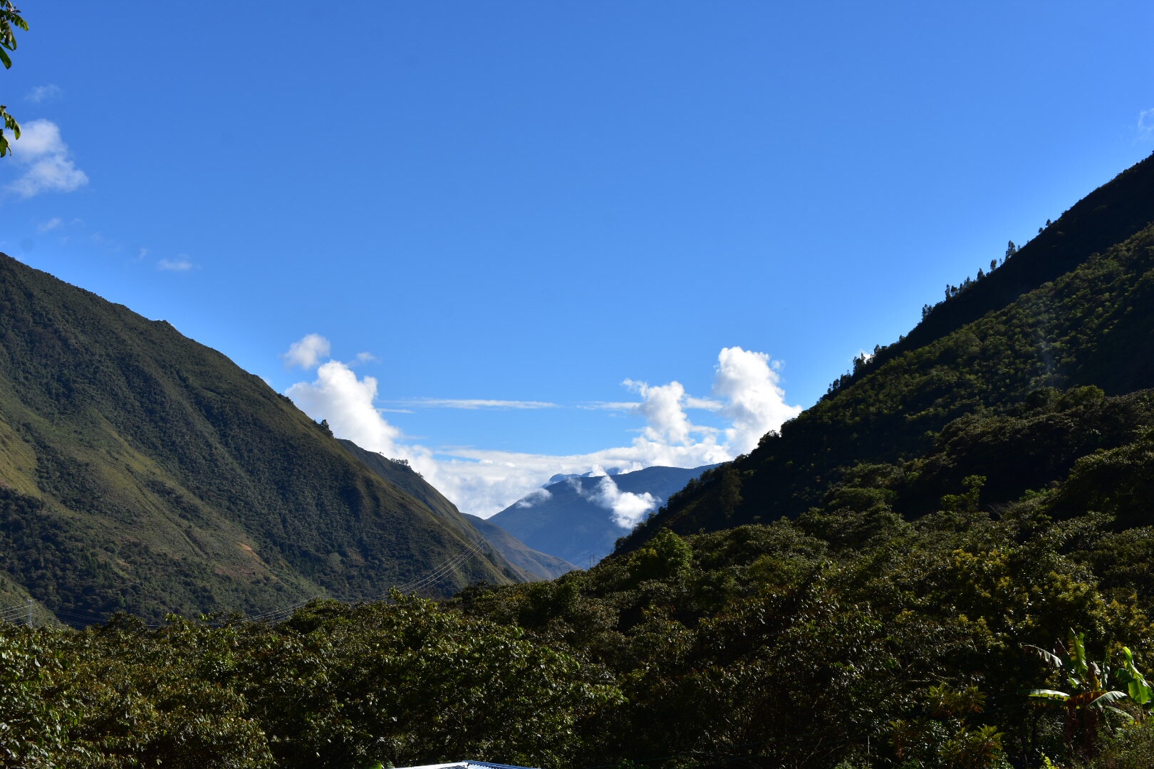
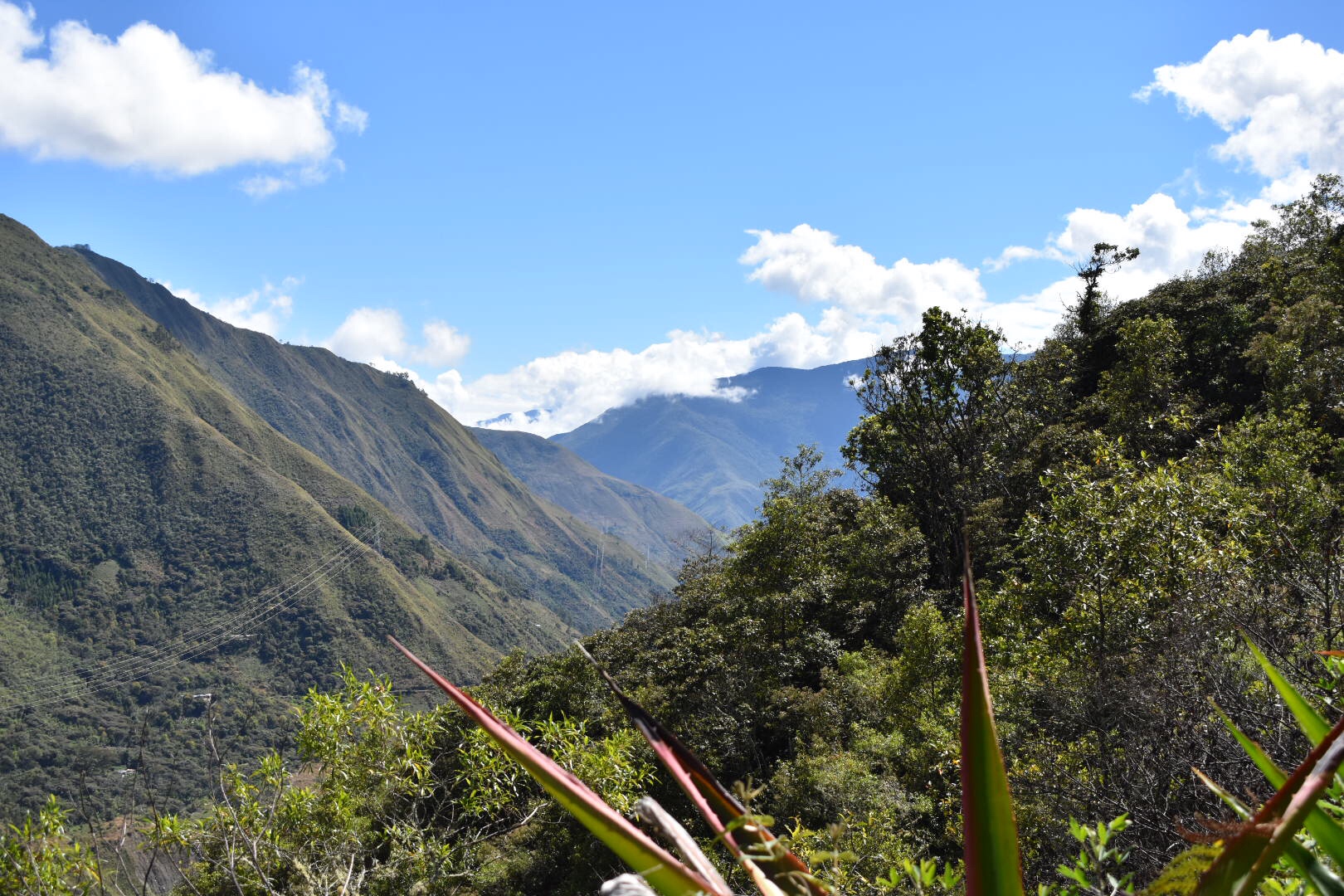
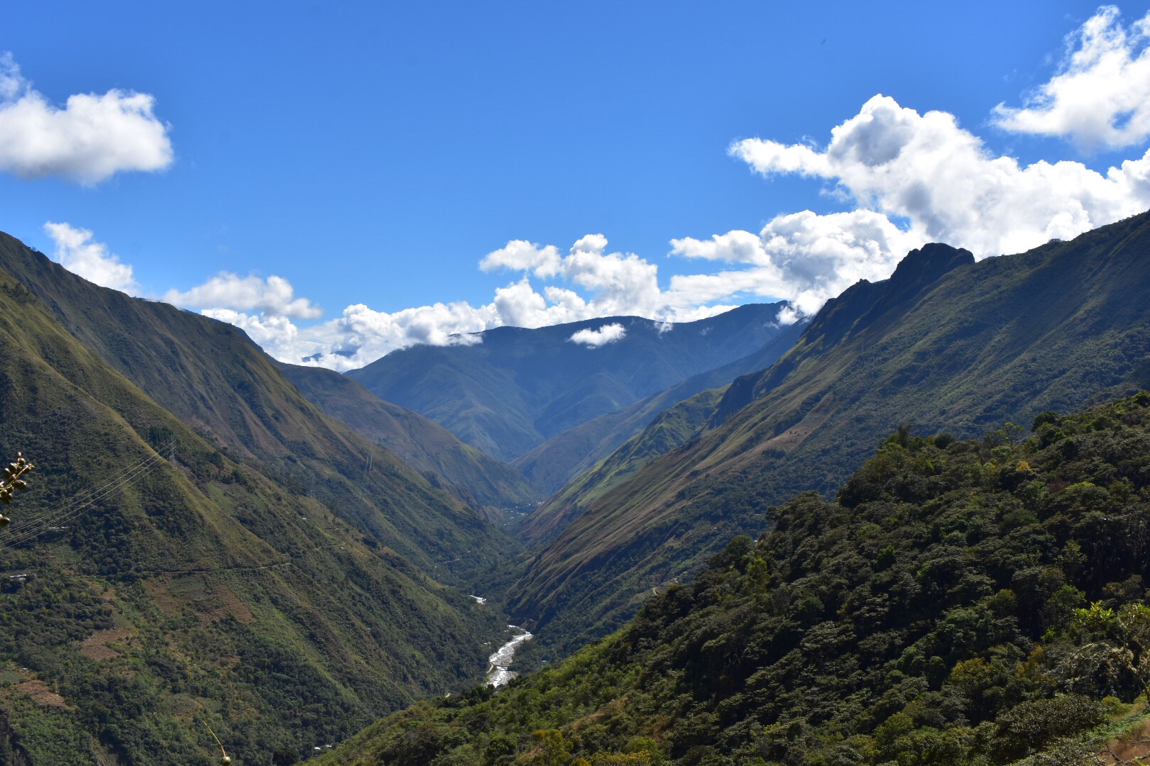
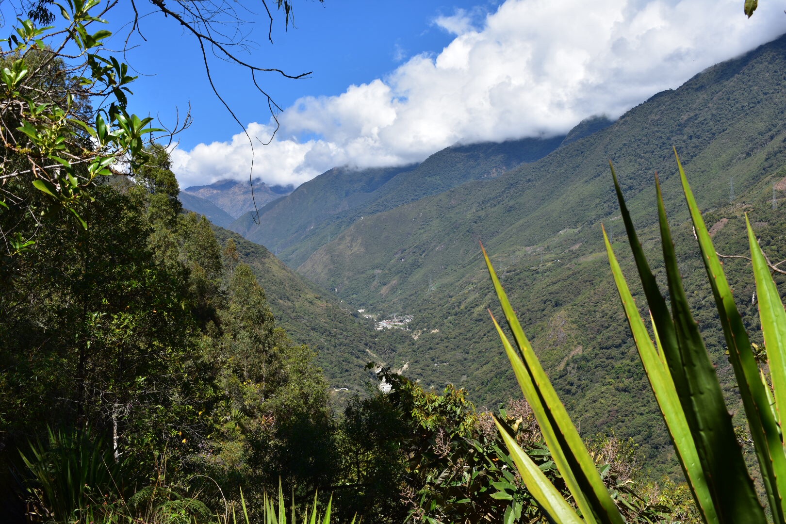
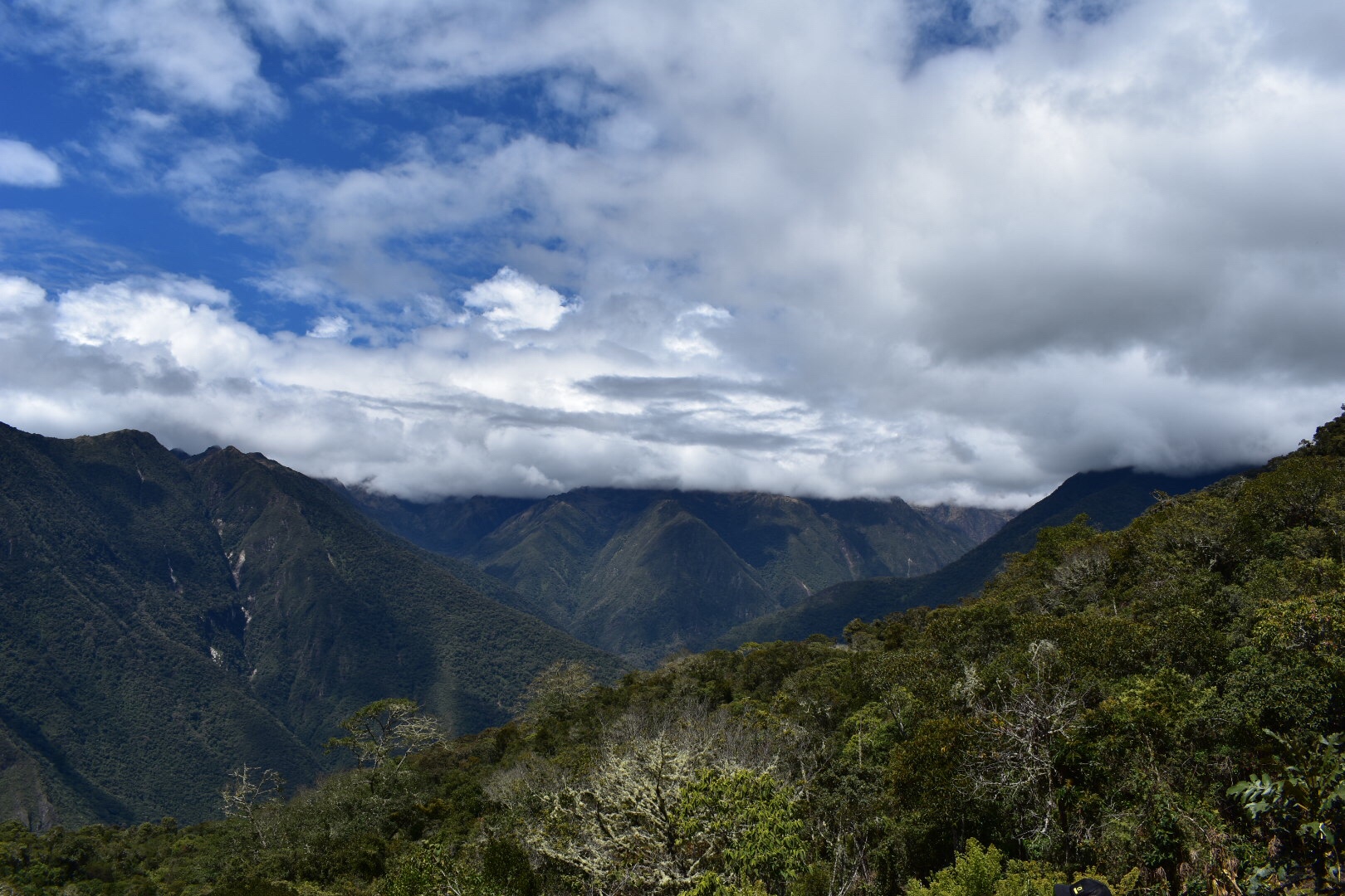
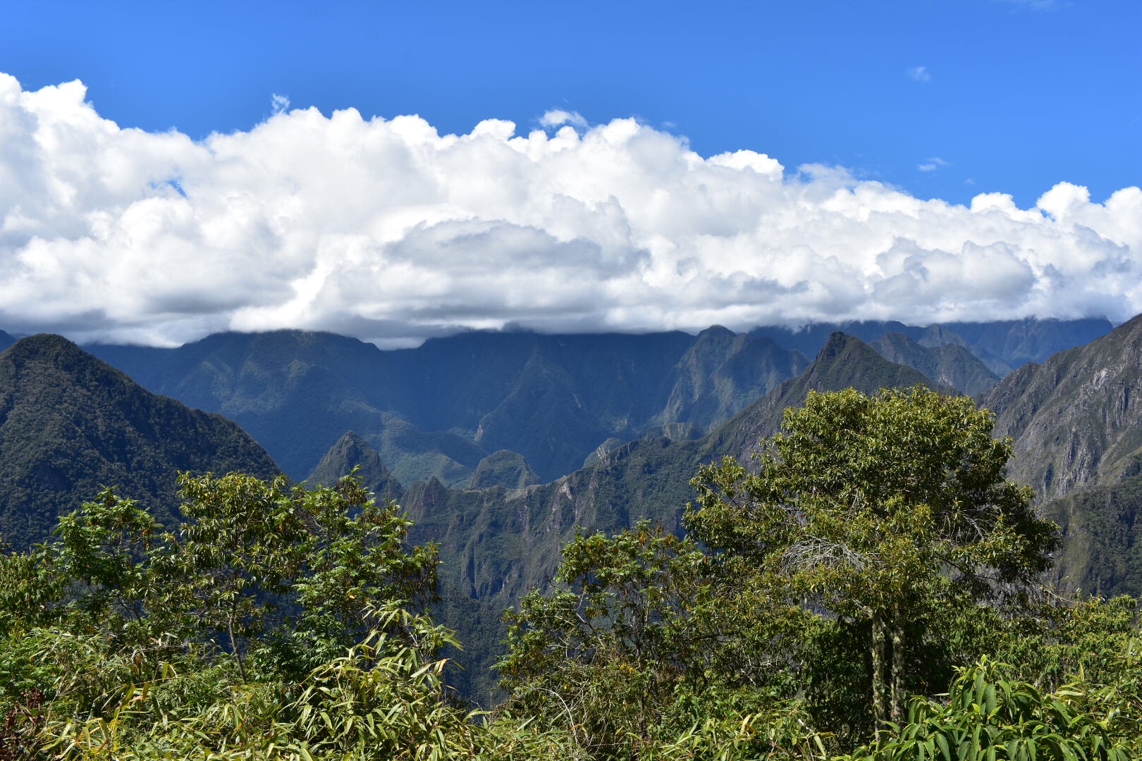
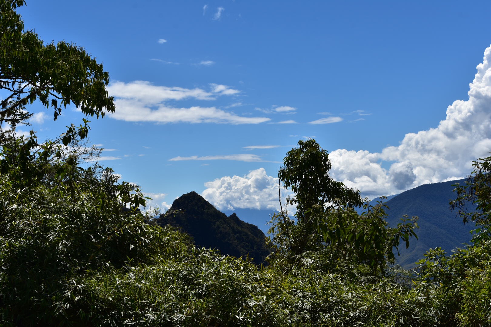
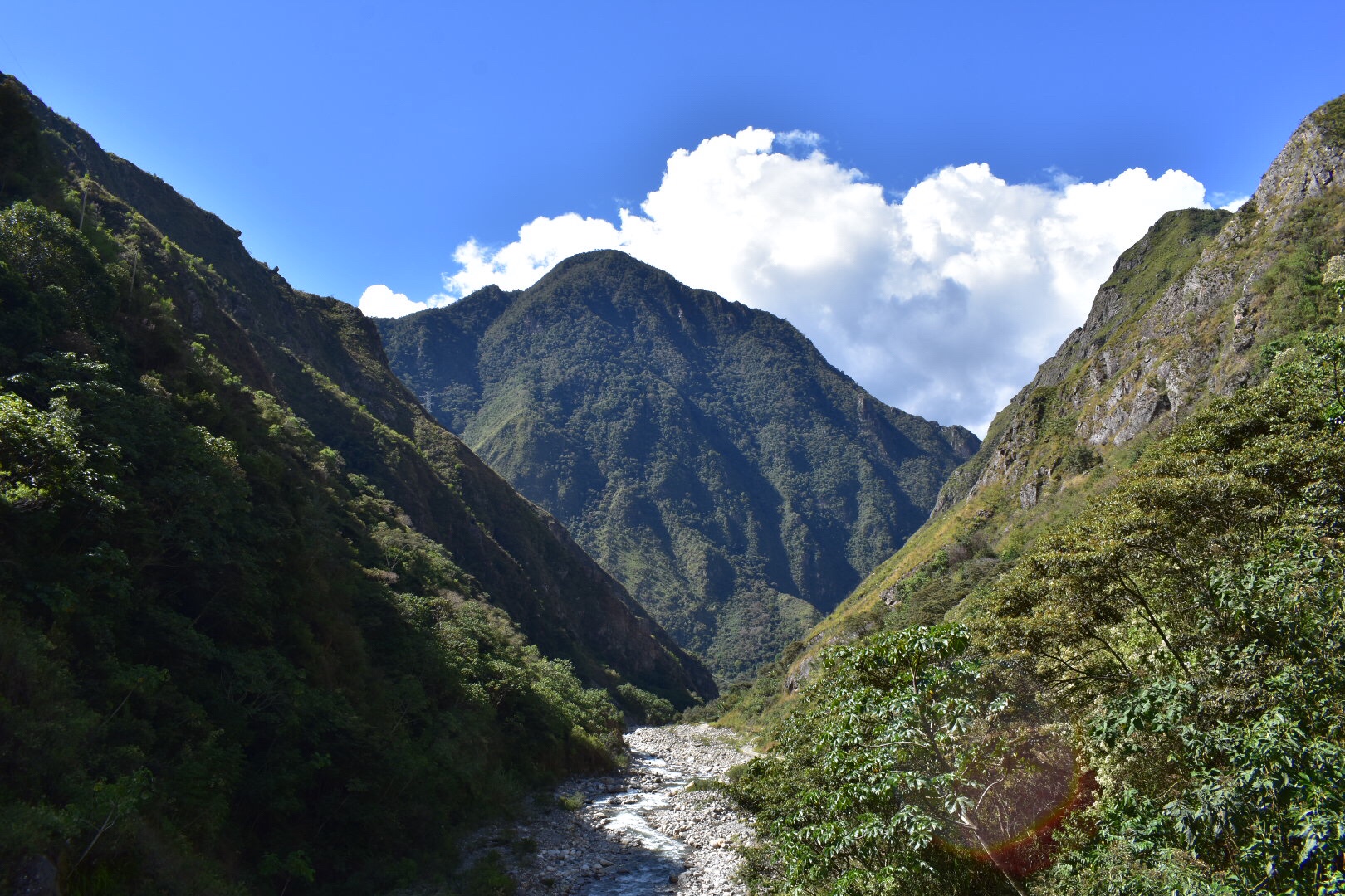
I was already really happy I’d decided to do this. The scenery was beautiful in the valley with the hostel and only for better during the drive and at the beginning of the trek. The only sad thing is that it was a little hazy but I’d take that to see more mountains. The descent was steep for the beginning and there is no way to sugar coat this. I really wasn’t sure how I’d get back up again but that was future David’s problem so for now I concentrated in getting down safely and reaching the river.

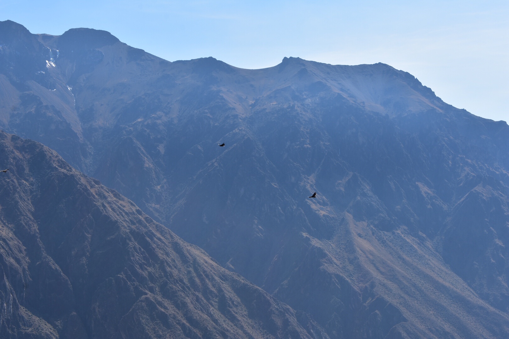
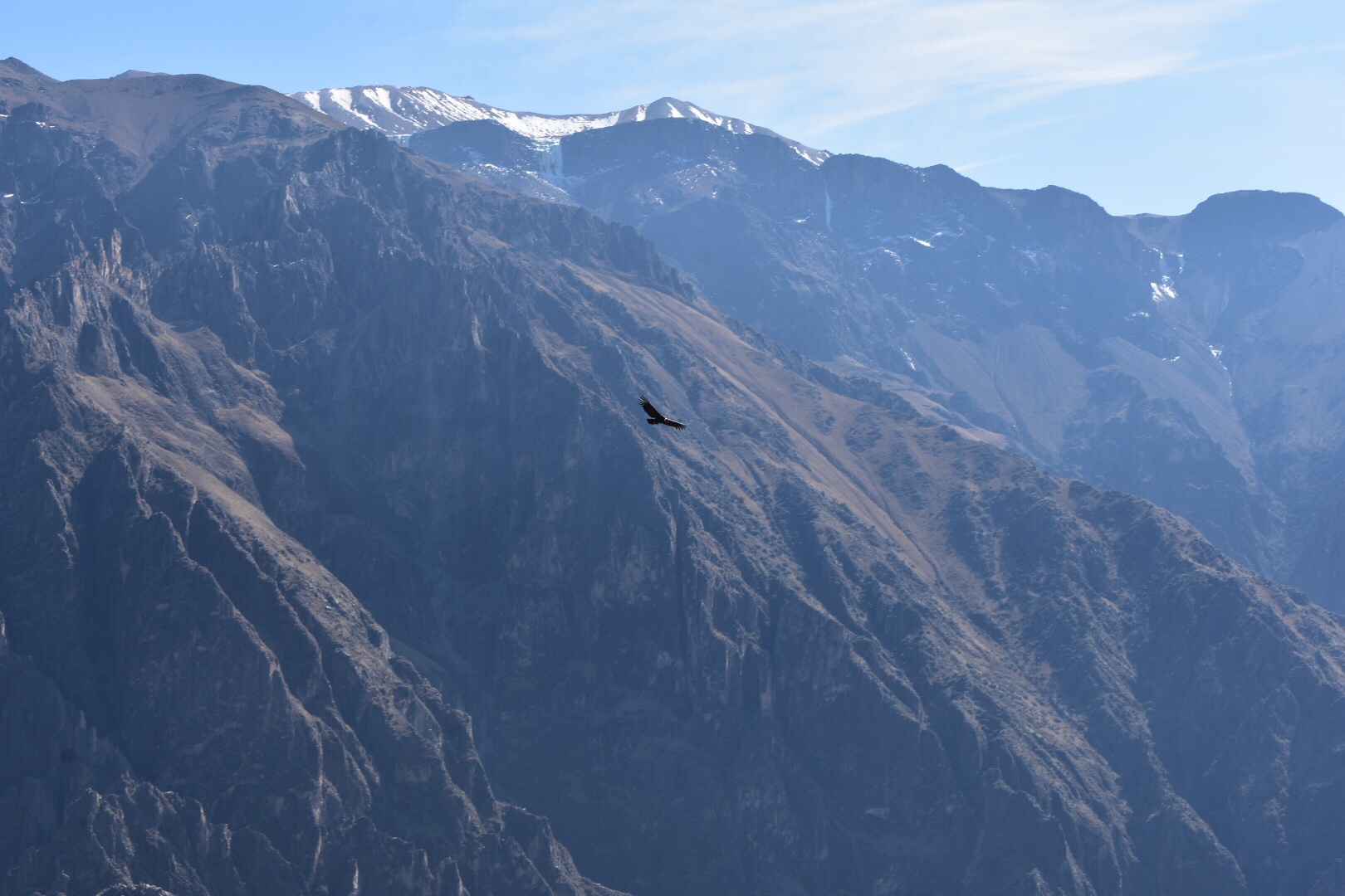
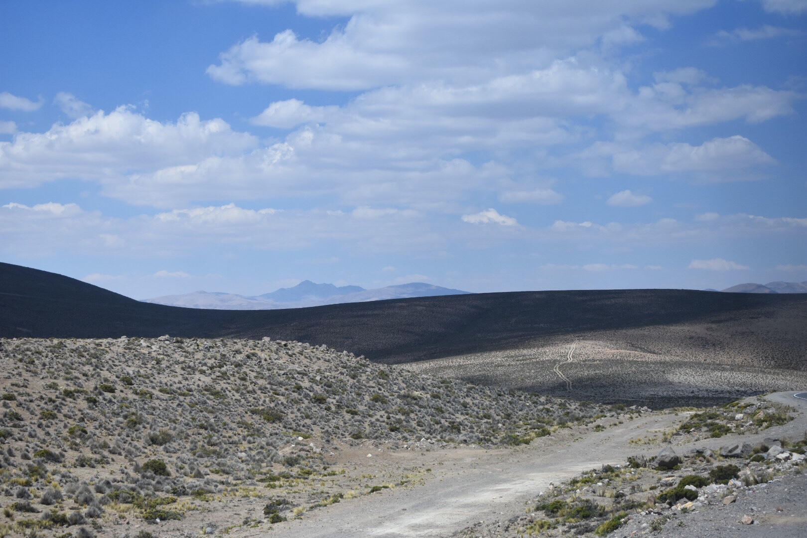
There is a bird watching view point 2km only the trail. You can actually see it in the above pictures if you look hard. I still had energy so decided to skip it and the path settled down for a while. I pushed on to te next viewpoint which is 4km and chatted to the Peruvians a little here before deciding to push on.

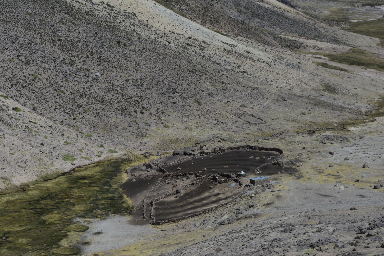
The first camp was not much further and after this was a small stream where I decided to stop and put my faith in my life straw. It seems to have worked fine.

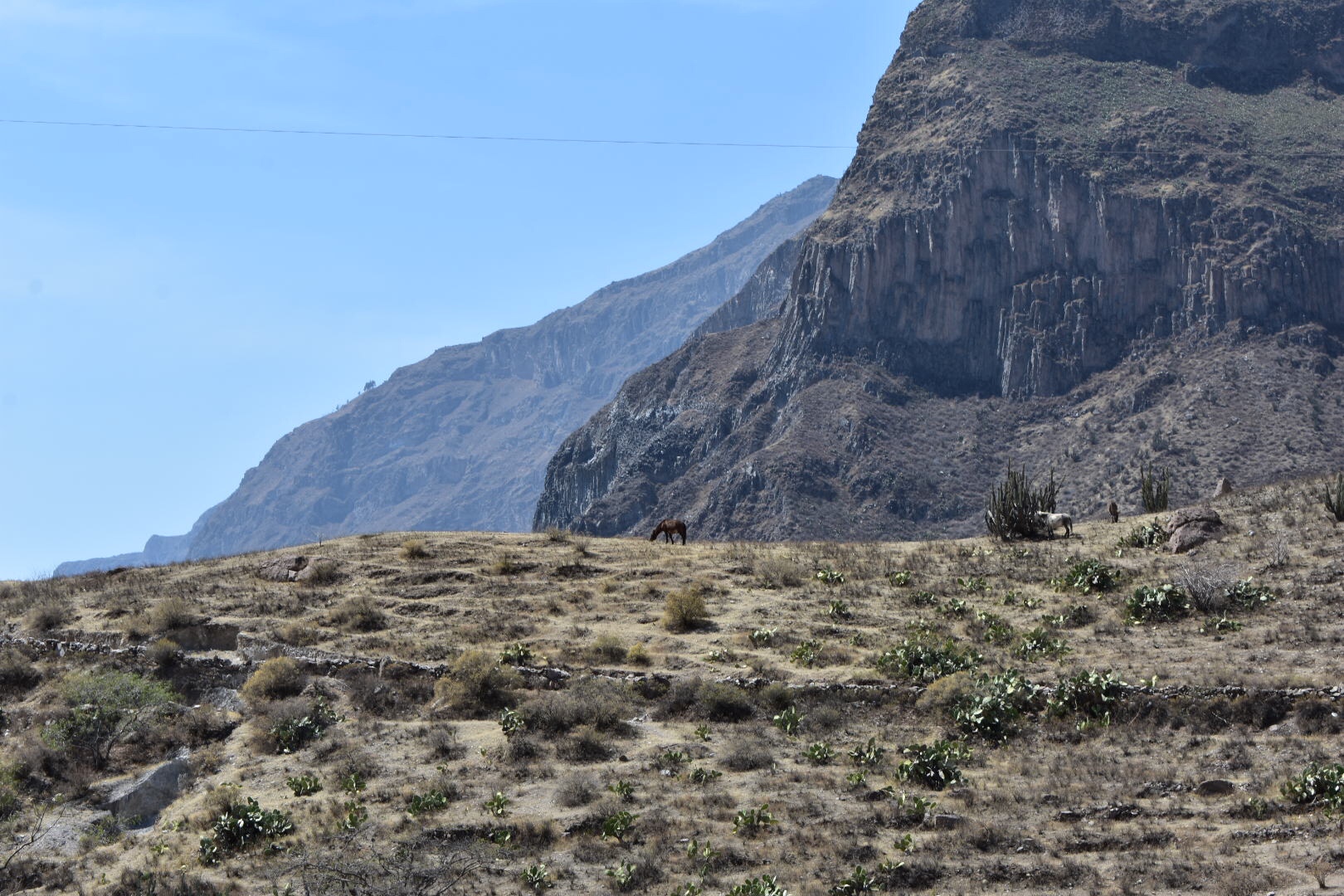
As I approached the camp I saw the first tour with horses. There are a fair few horses and mules on the path as it’s the only way to get supplies to the villages on the route and we saw a lot on the road when I was in the taxi. Which reminds me of you do see horses stay on the side of the path that is away from the cliff edge as they have been known to knock people off. This was the first tour i saw and I was going to see more. Part of me was upset I’d decided to go alone as I was already exhausted and hurting from the bag but another part wanted to complete the challenge alone.

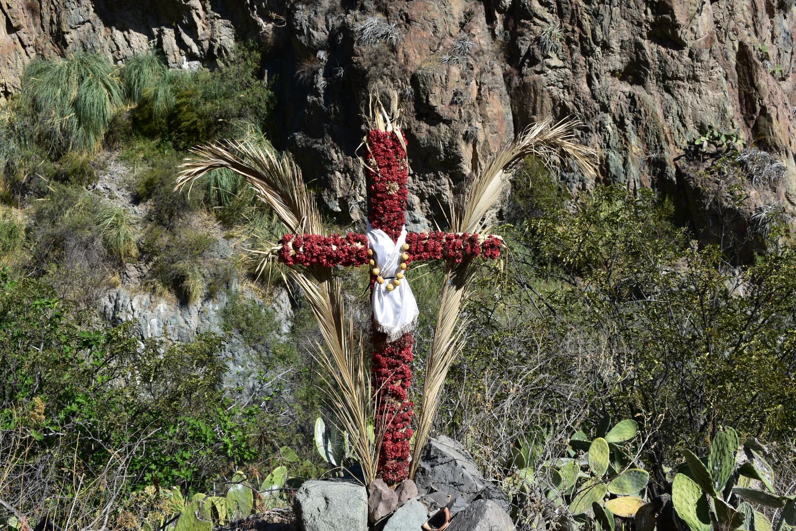
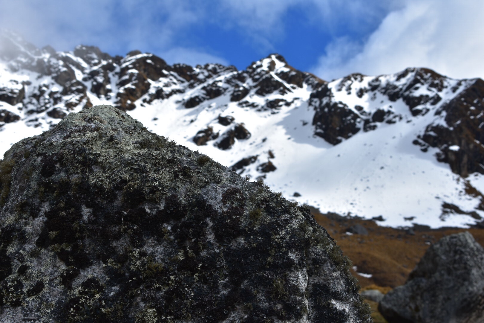
I saw a bunch of signs on the trek, most notably the one for avalanches which was heartwarming. I also like the mile markers, well kilometre markers but it didn’t have the same ring to it. I’ve no idea what the skull sign means, probably death, but my fave was the do as I say not as I do sign that told me not to lean. I’m assuming the translation is wrong somewhere.

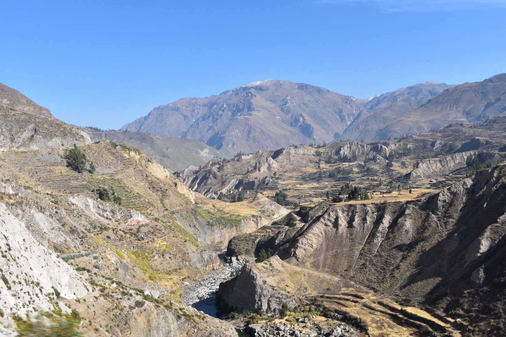
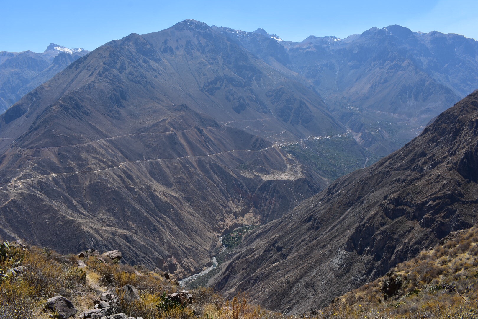
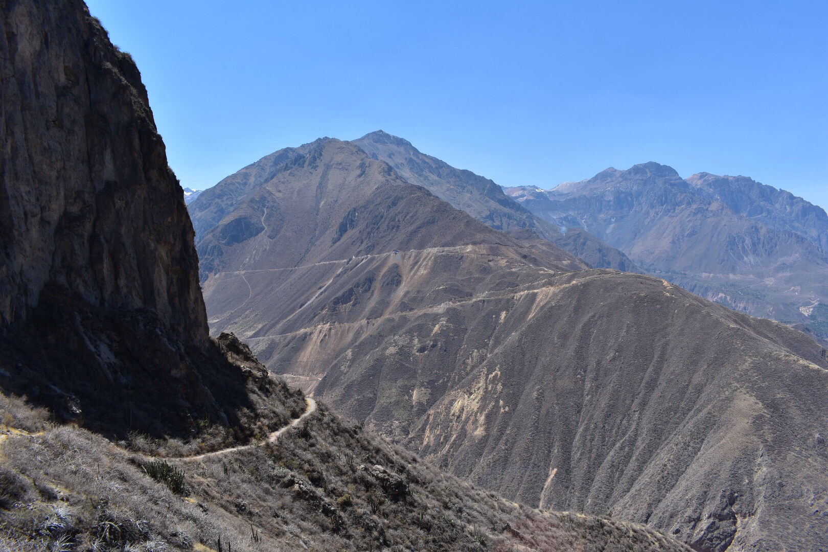
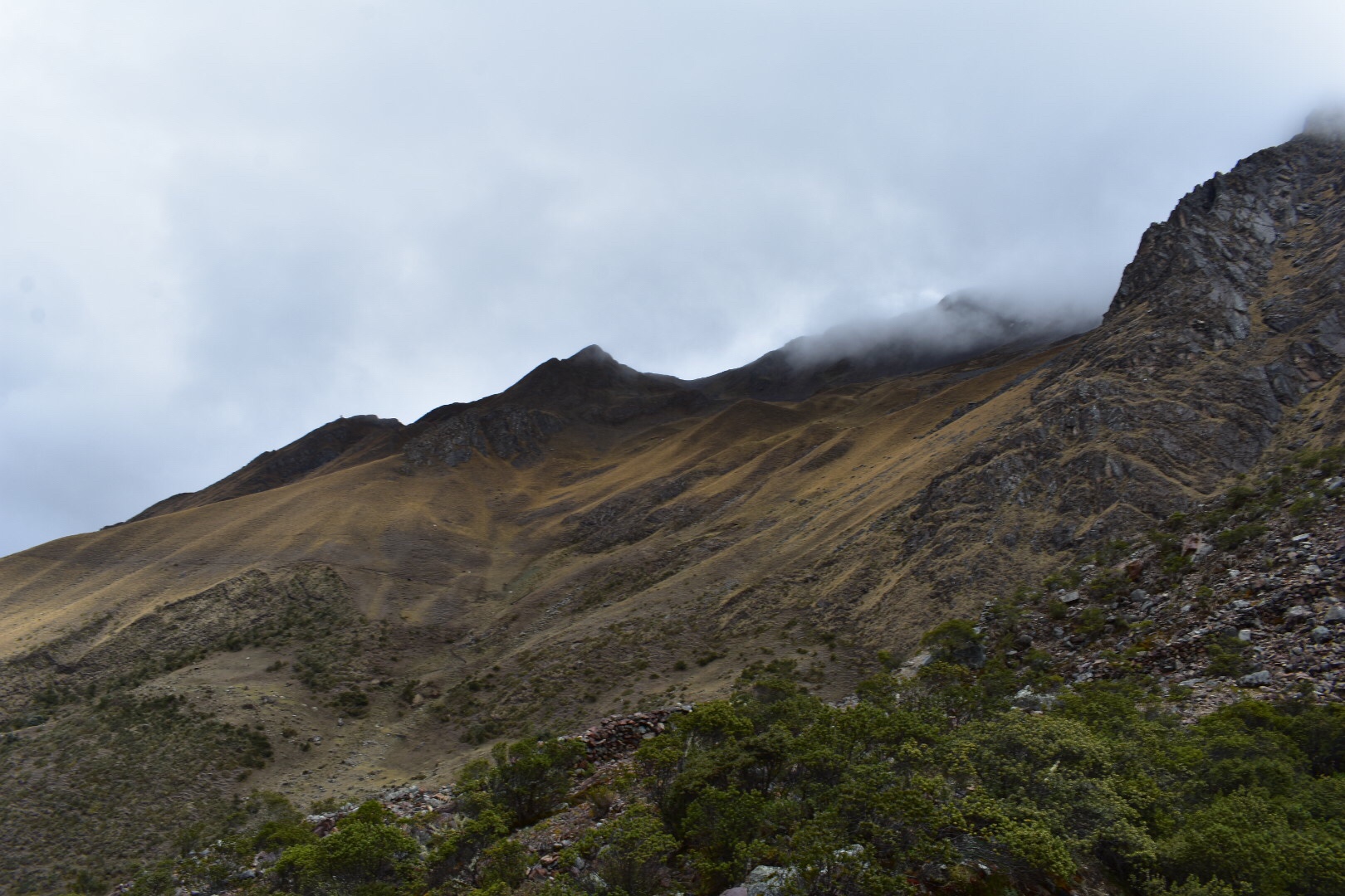
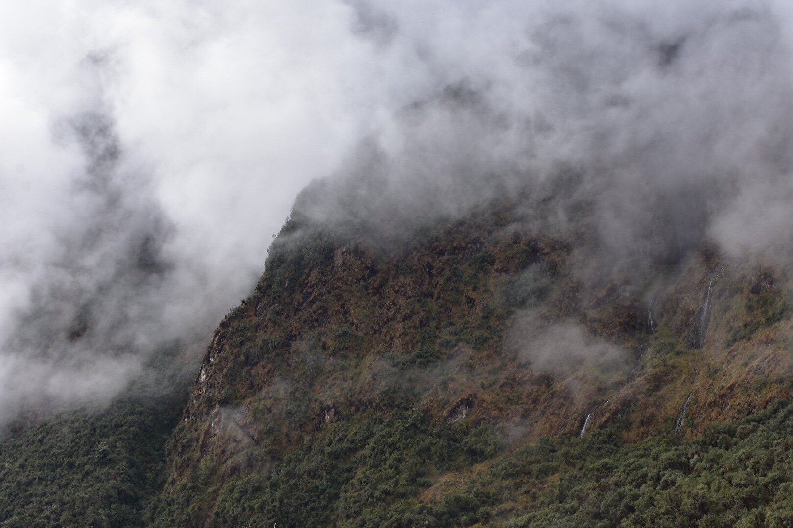
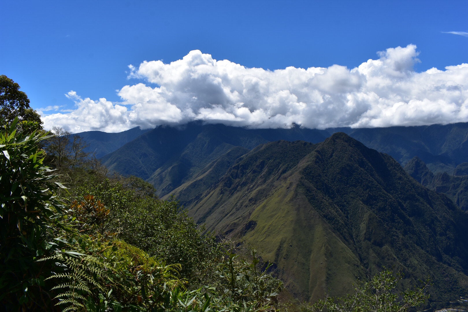
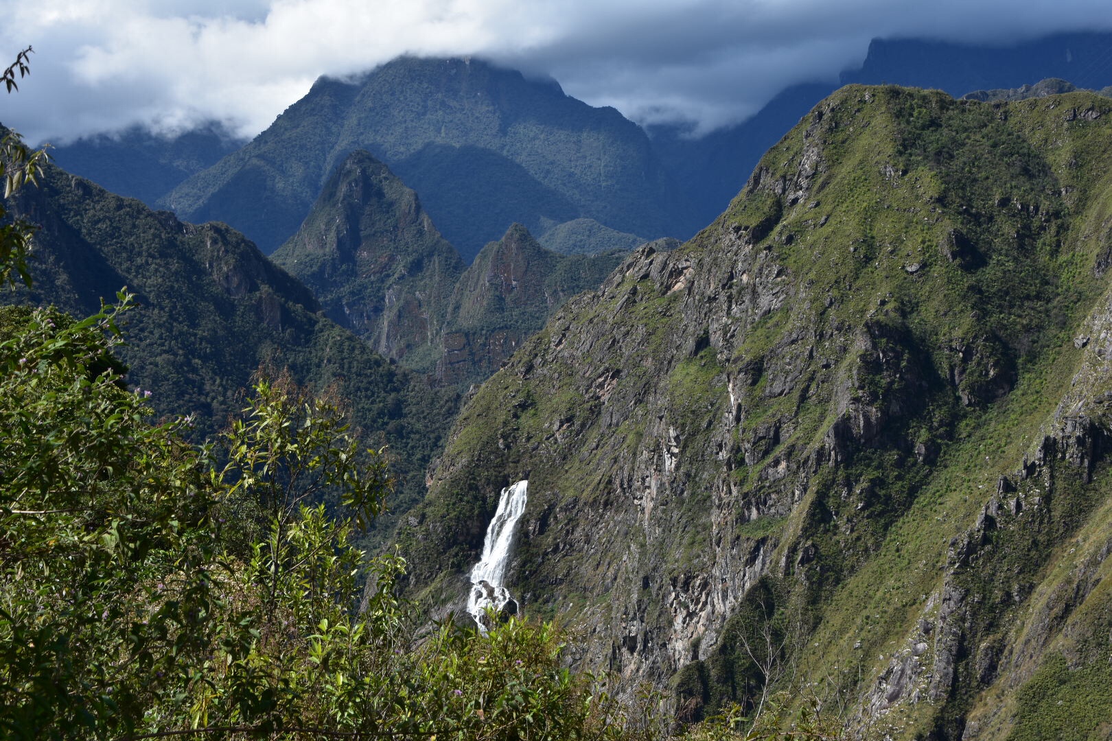
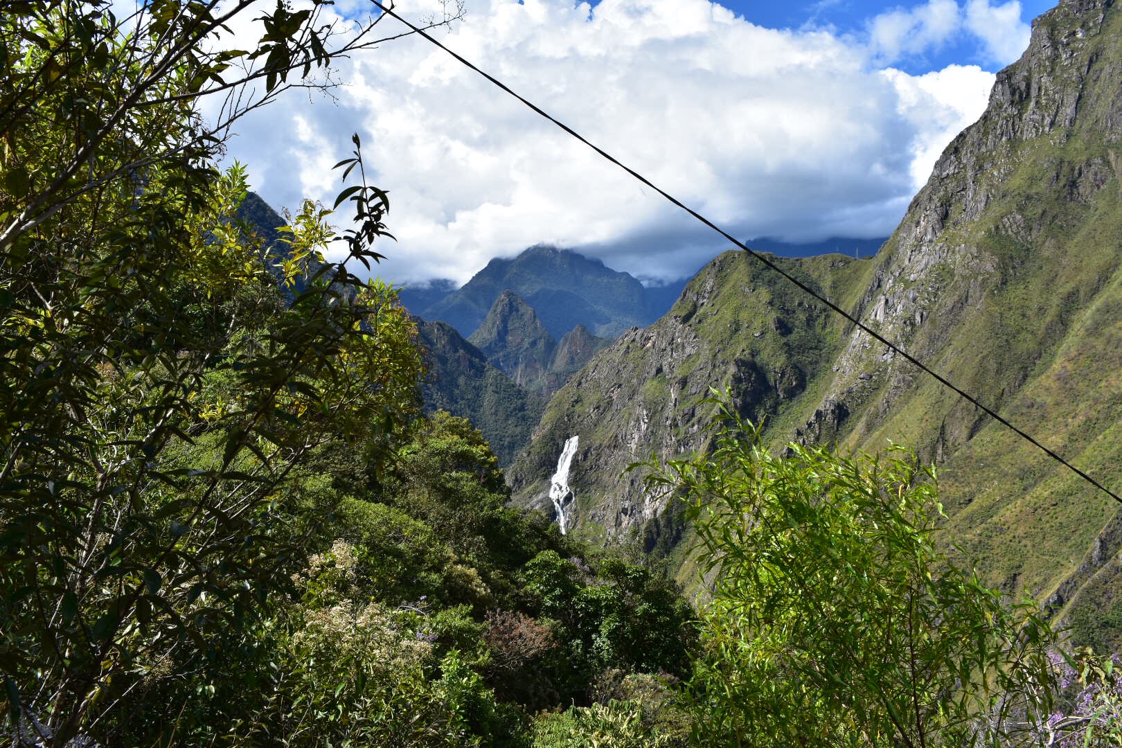
After the first camp the path is fairly flat for around 1.5km before a tonne of switchbacks kick in and the path gets really steep again. I’m not sure if the photos show how high up I was but there was a long way to go down.

The next camp is around 3 km further from the second and has a nice shaded area for you to relax in. On the way down I didn’t stop as I’d stopped at a second stream for water about 5 mins before. There were two water sources on the way down and they were both between the first two camps.

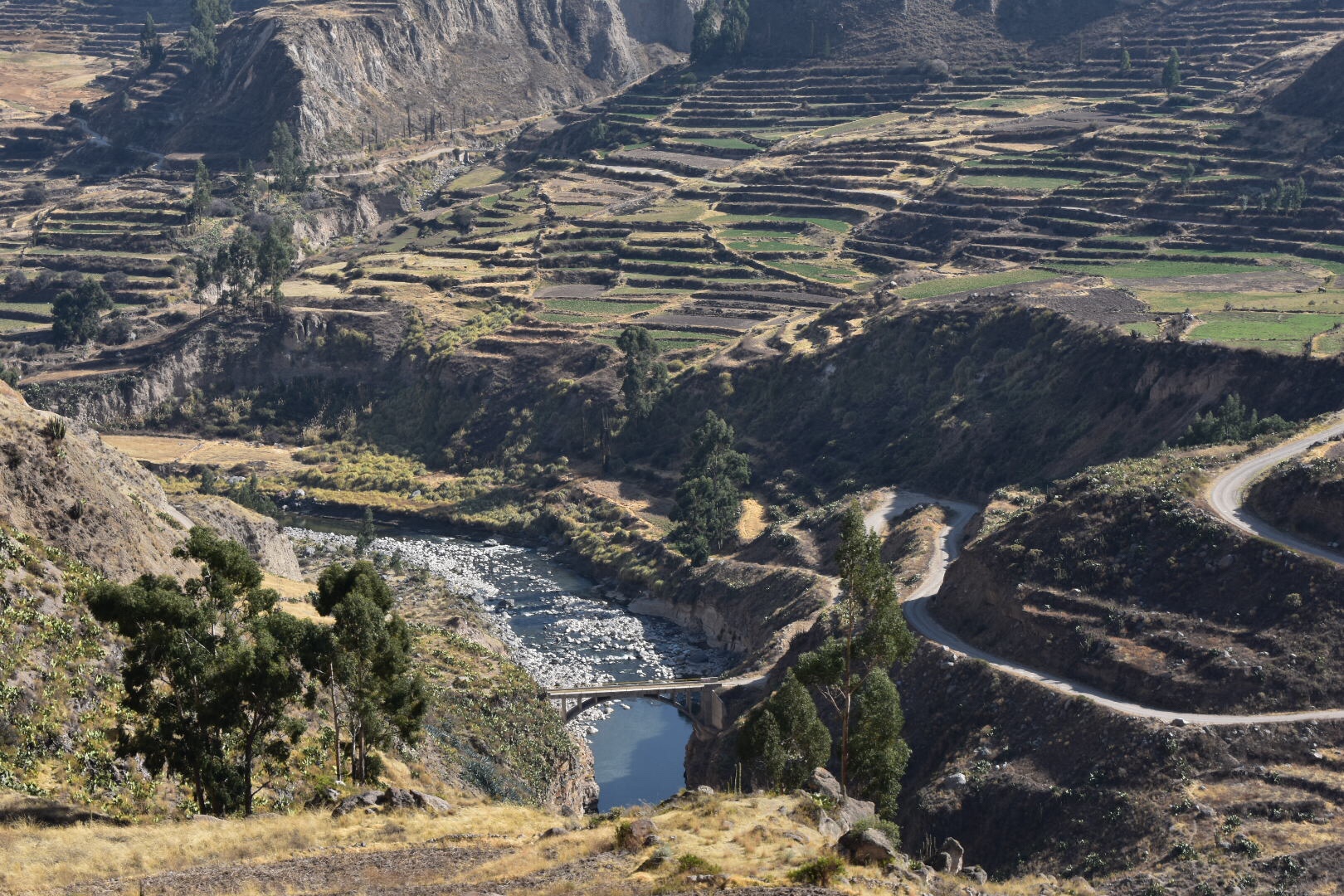
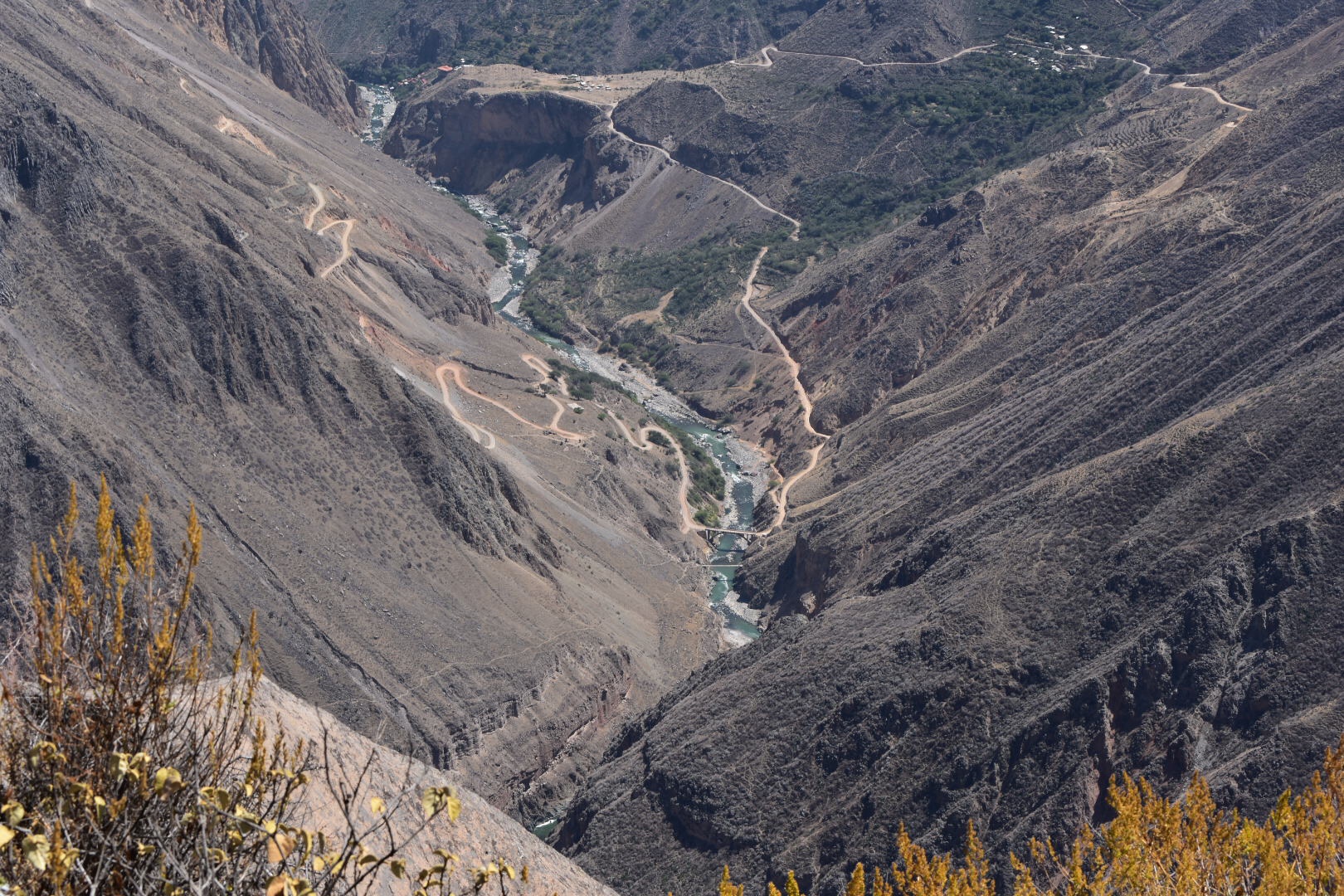
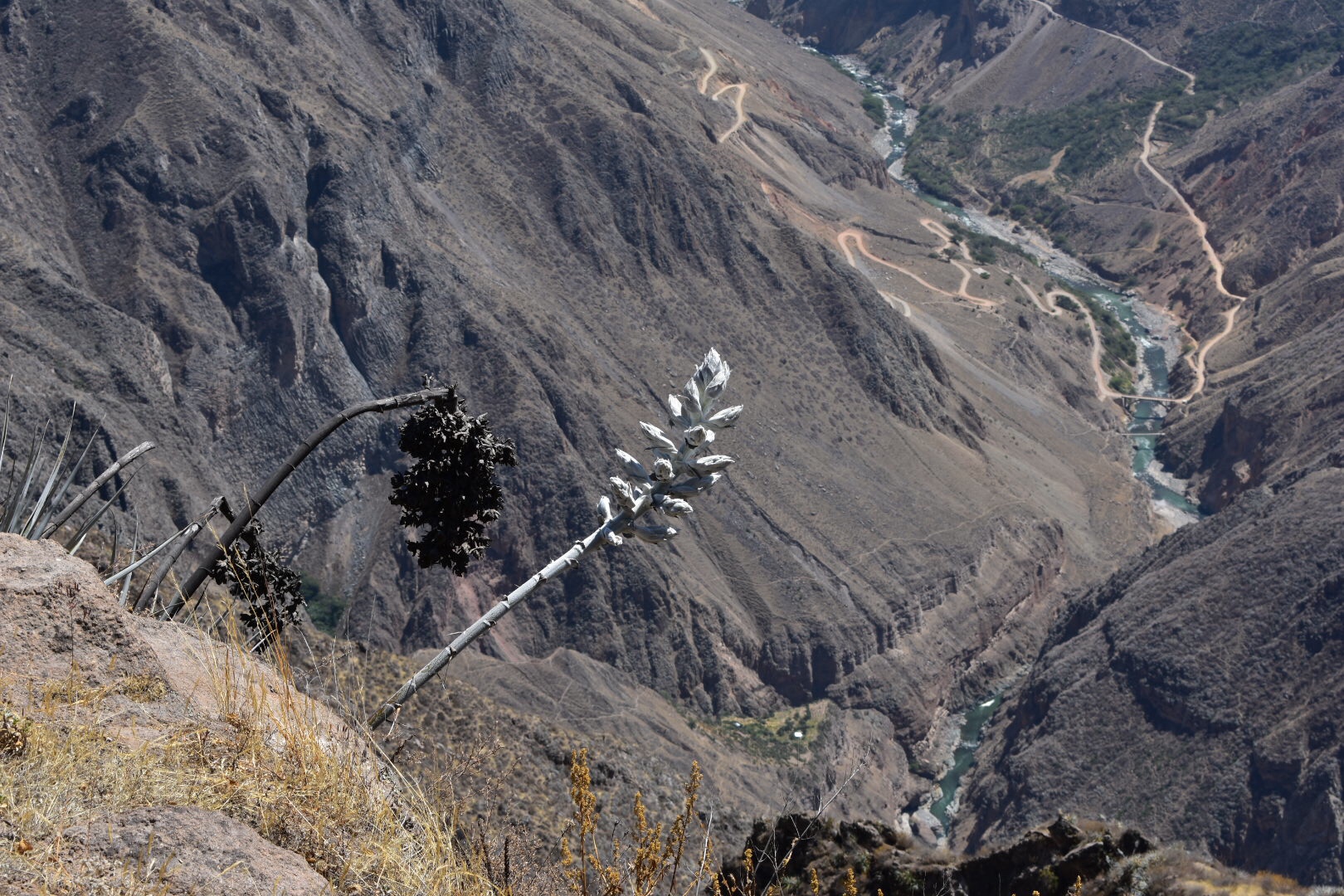
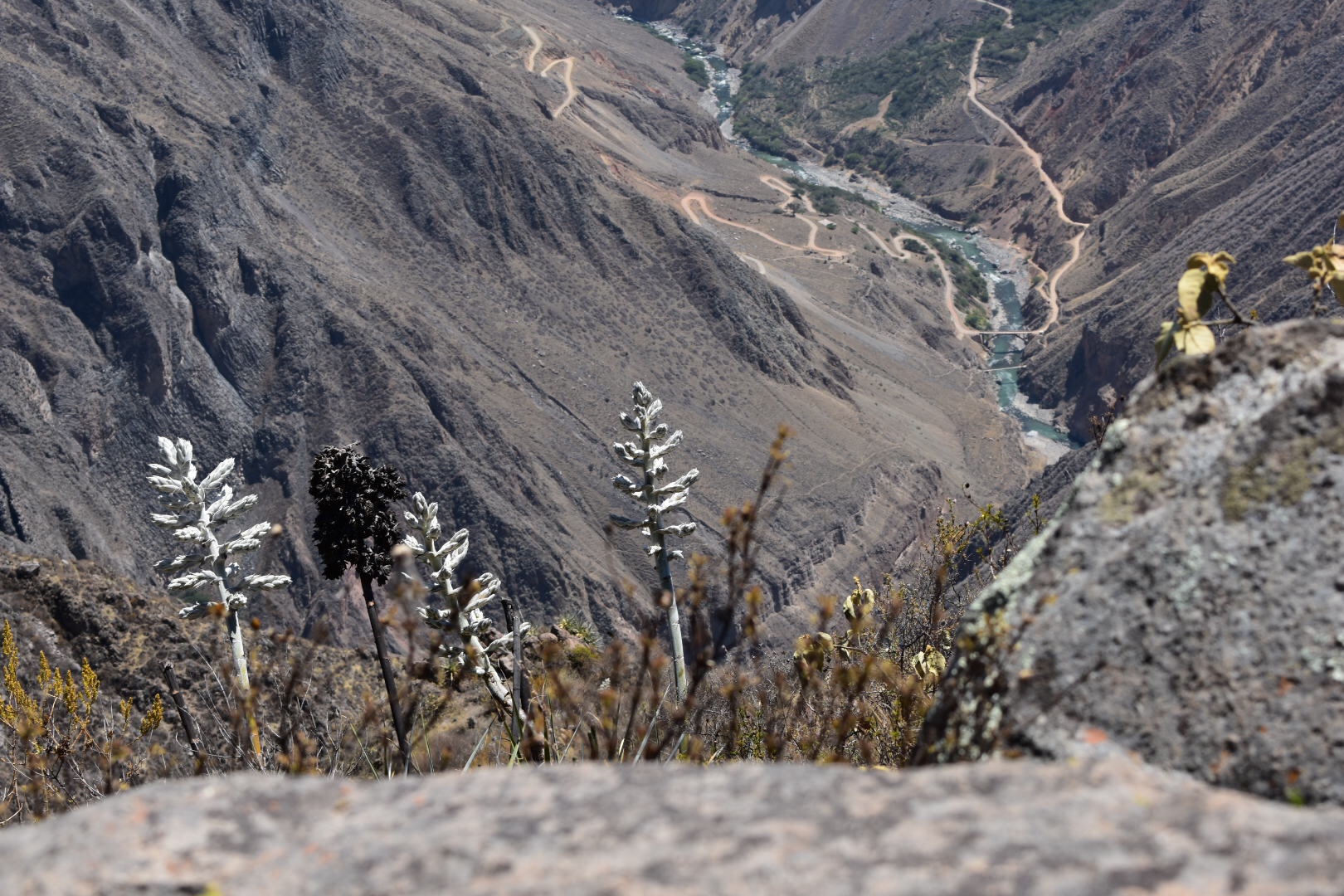
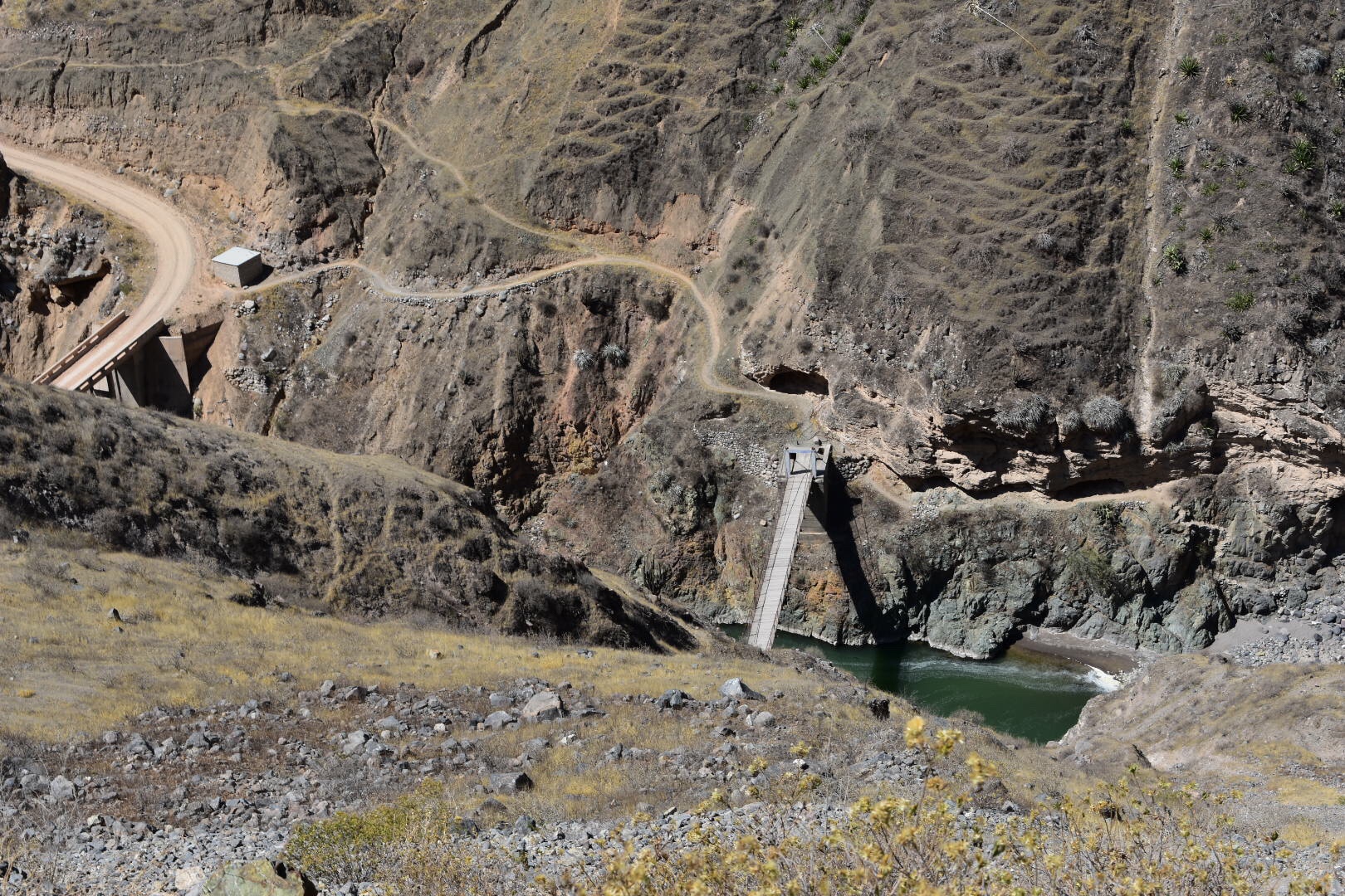
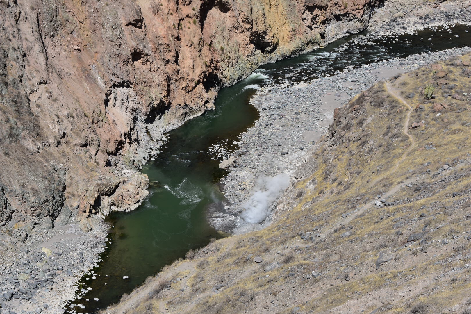
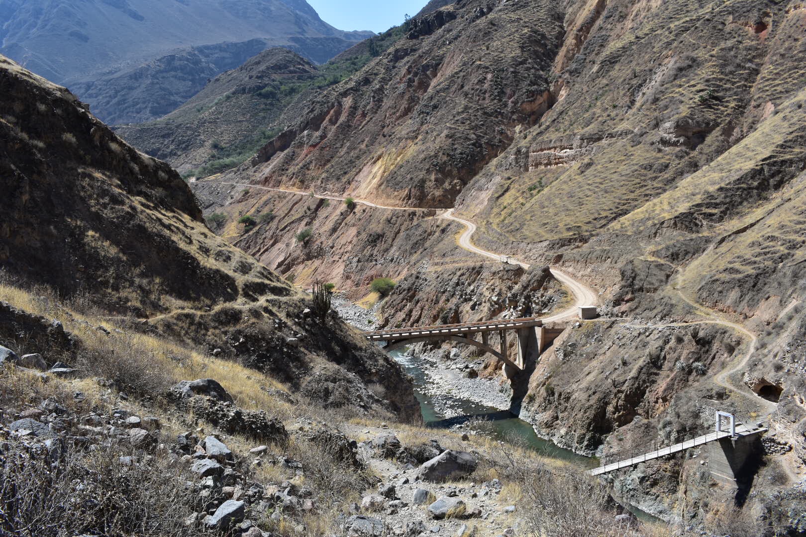
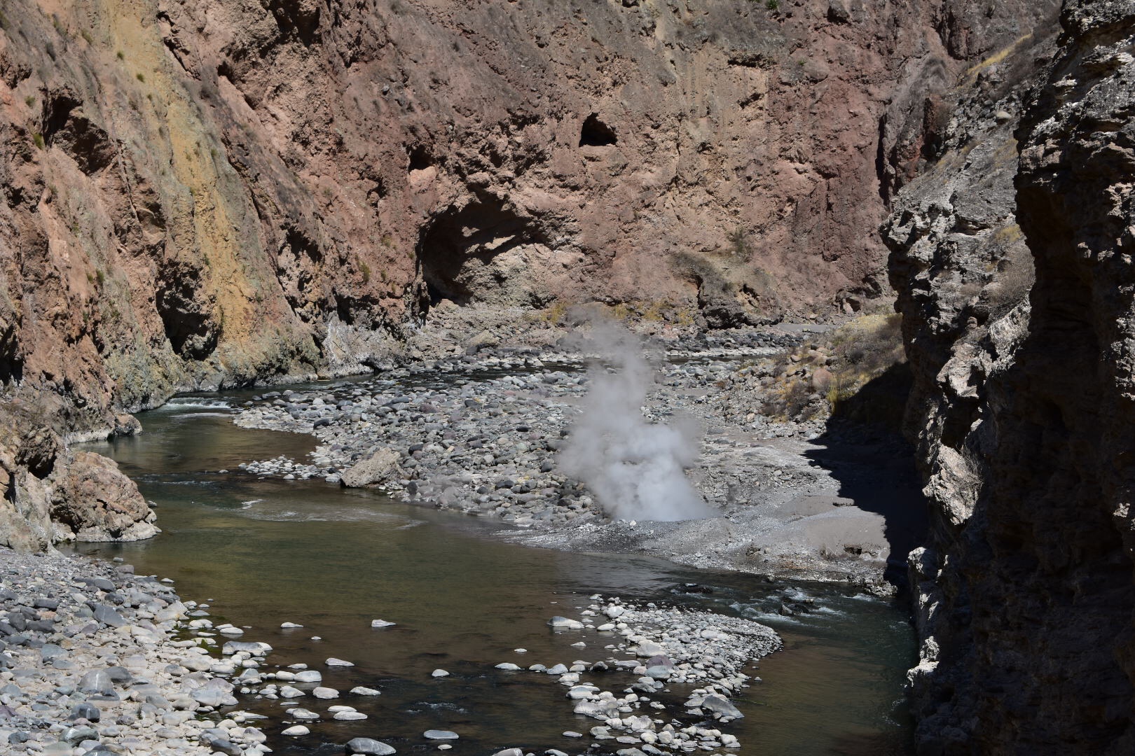
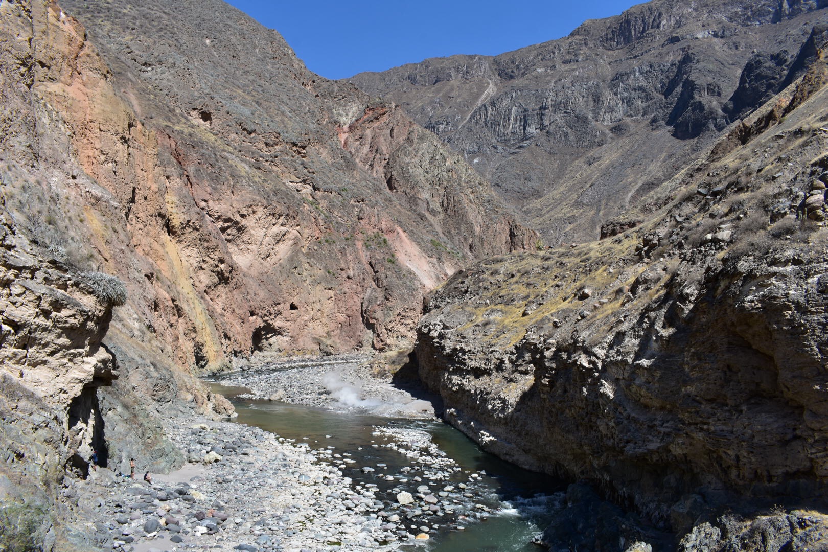
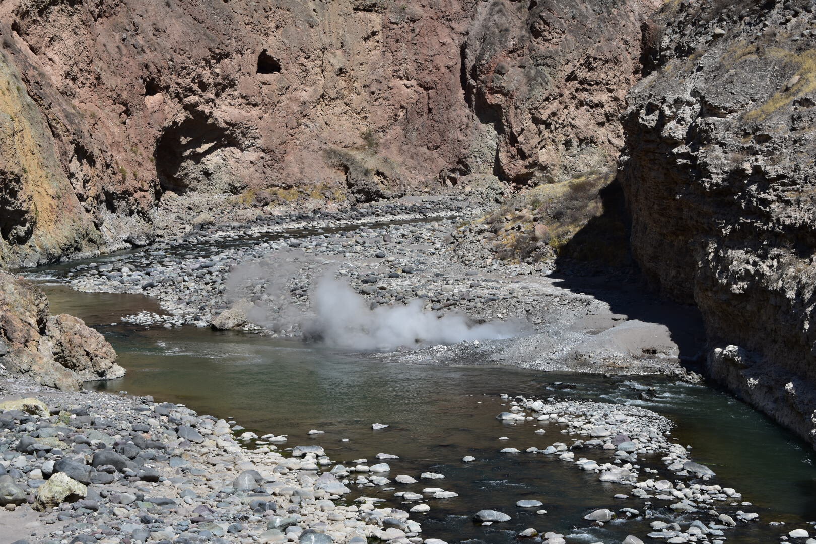
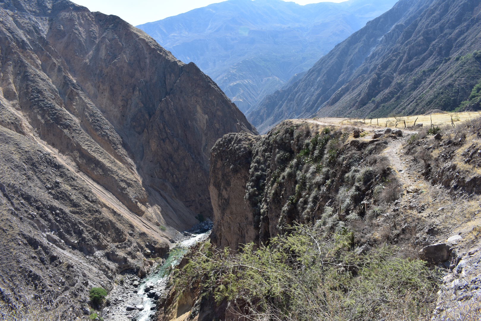
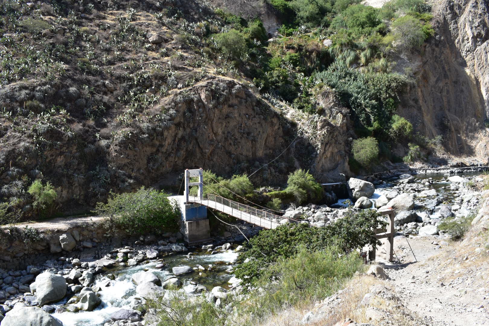
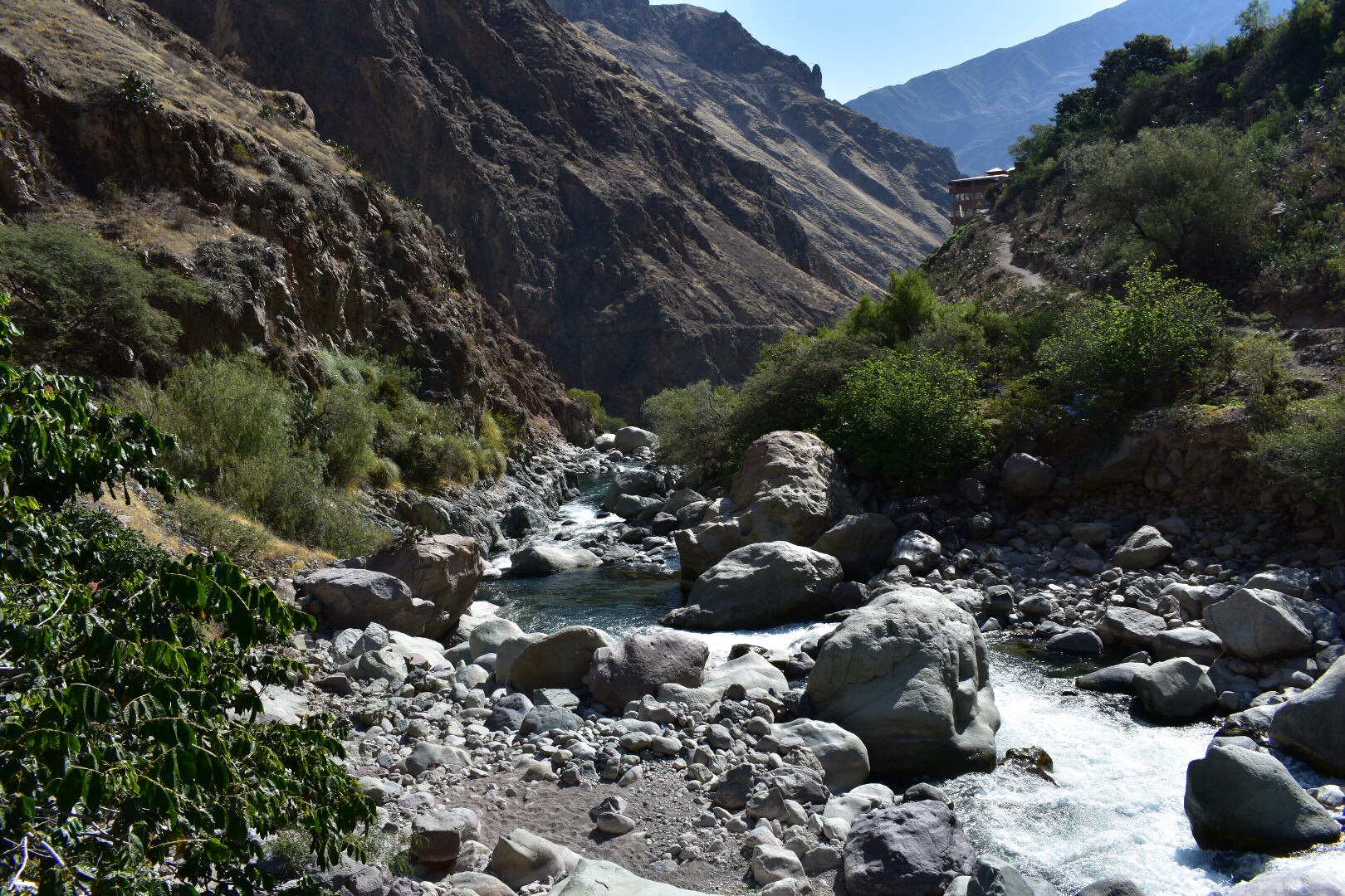
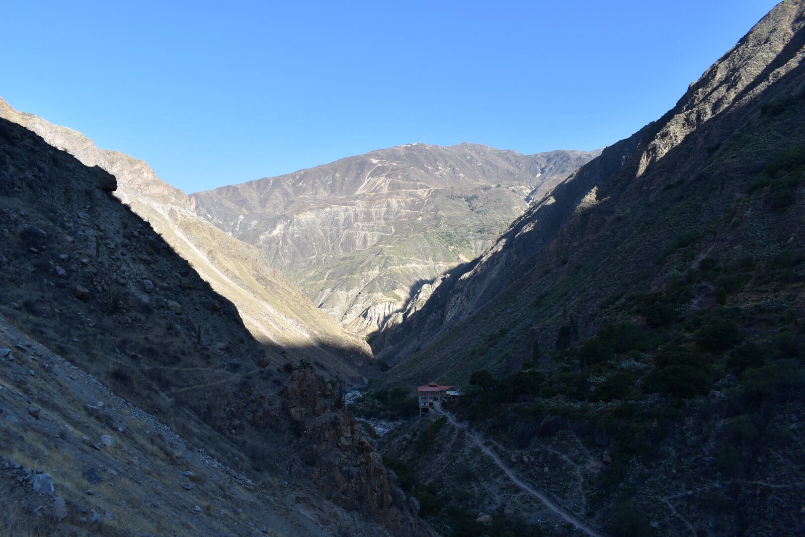
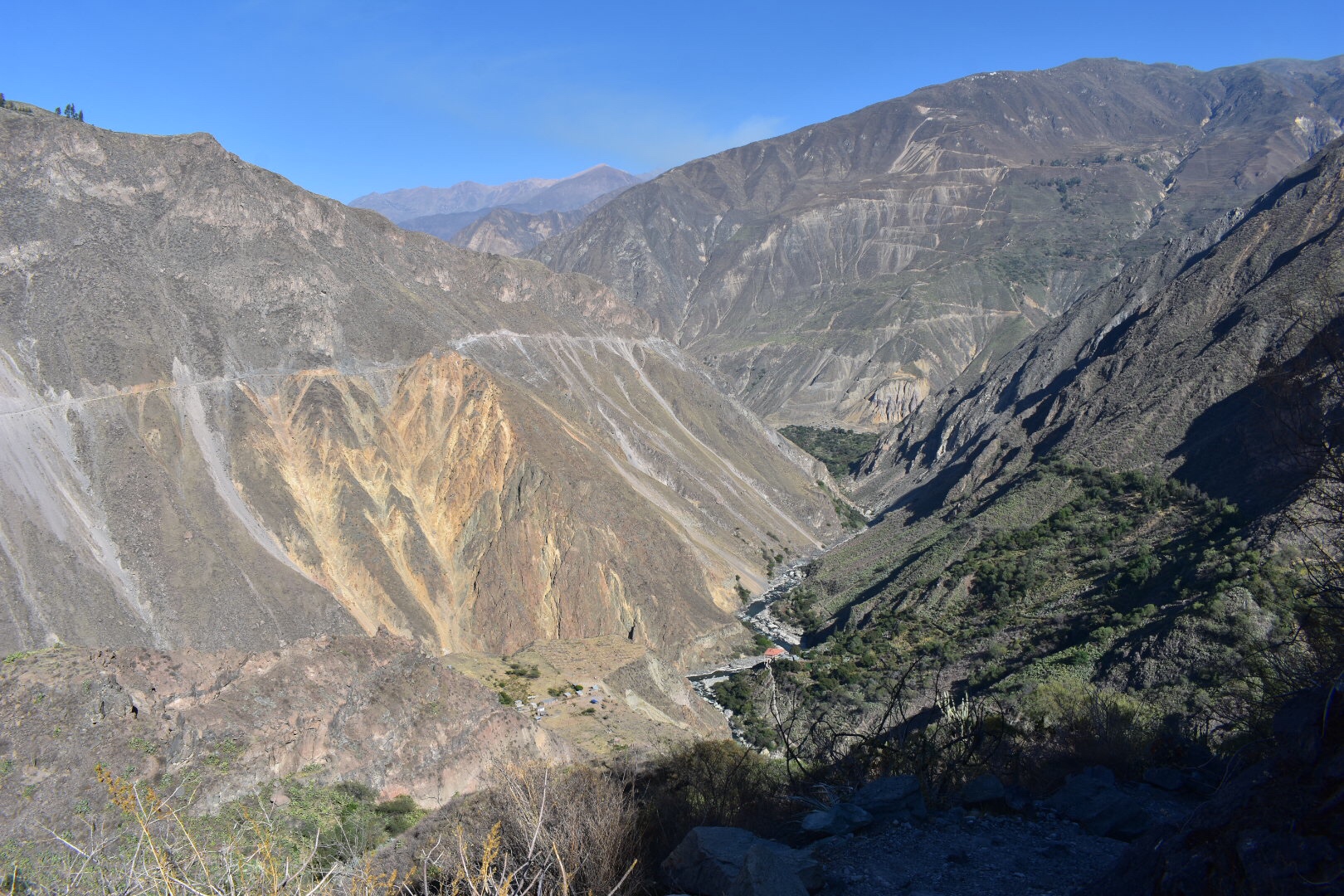
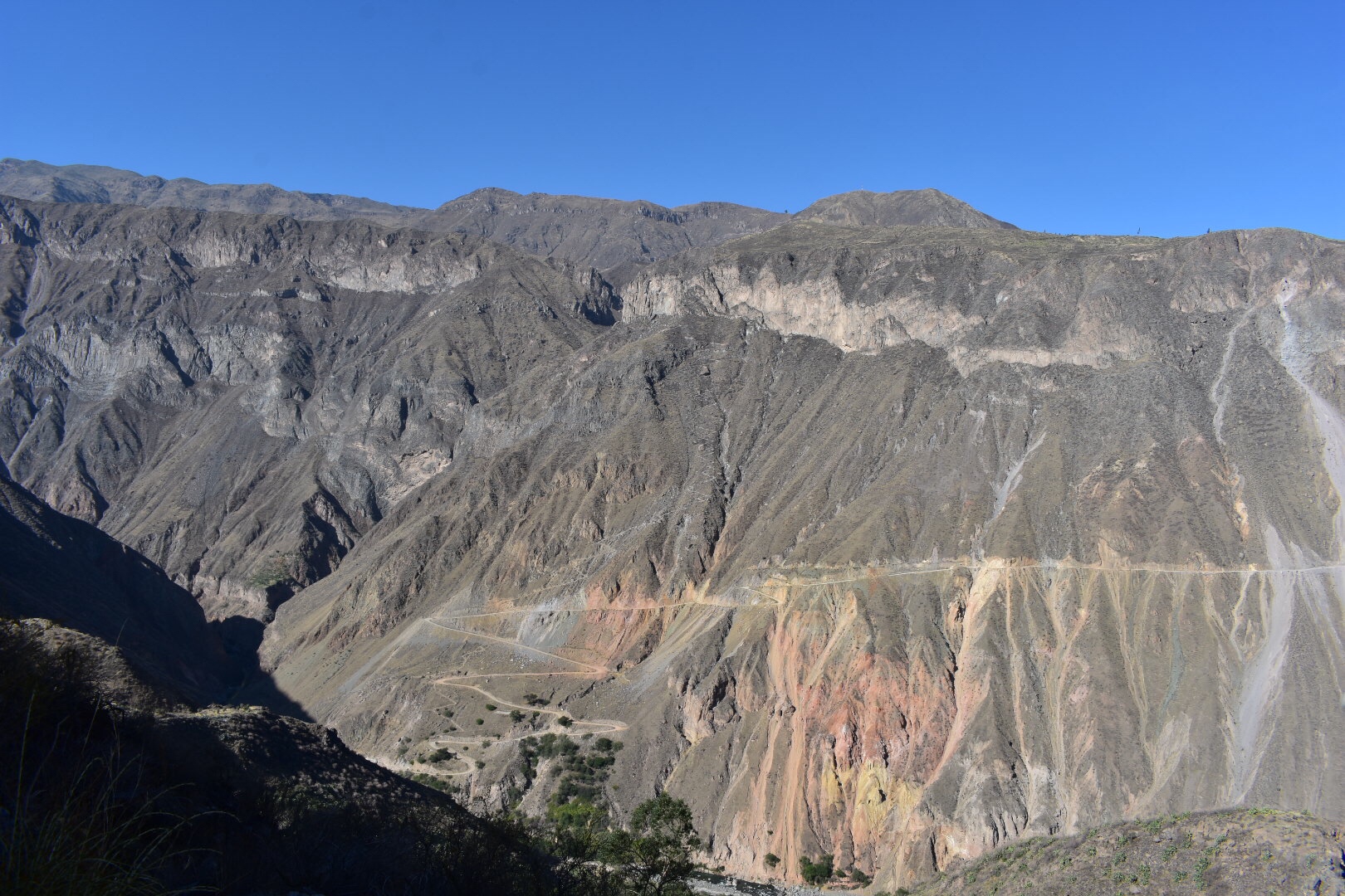
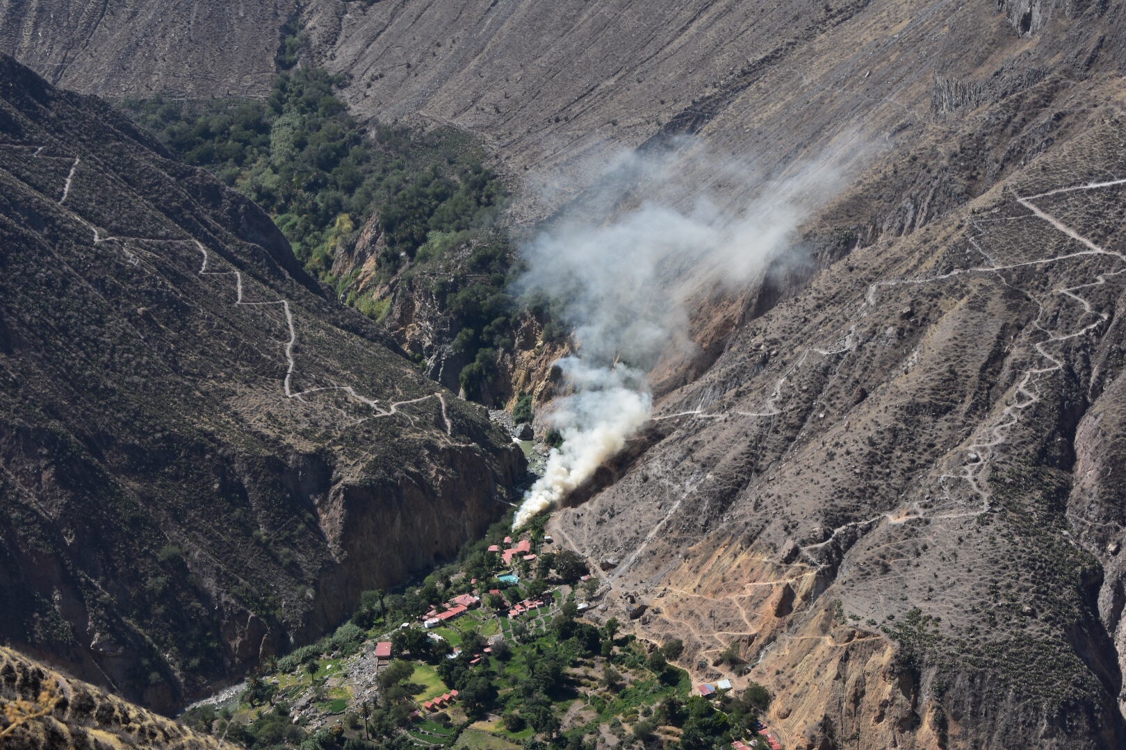
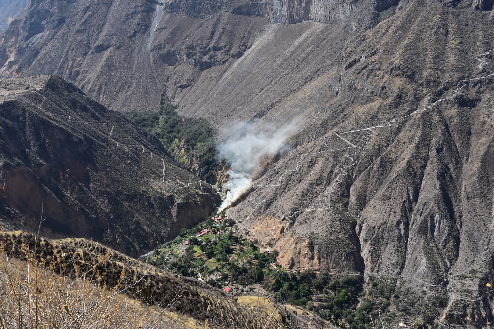
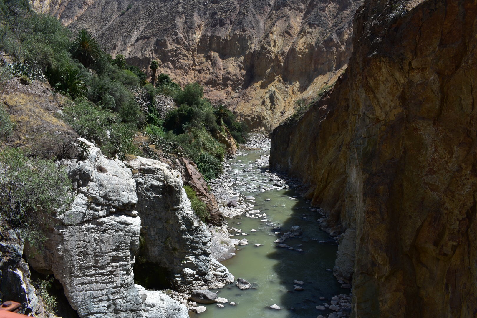
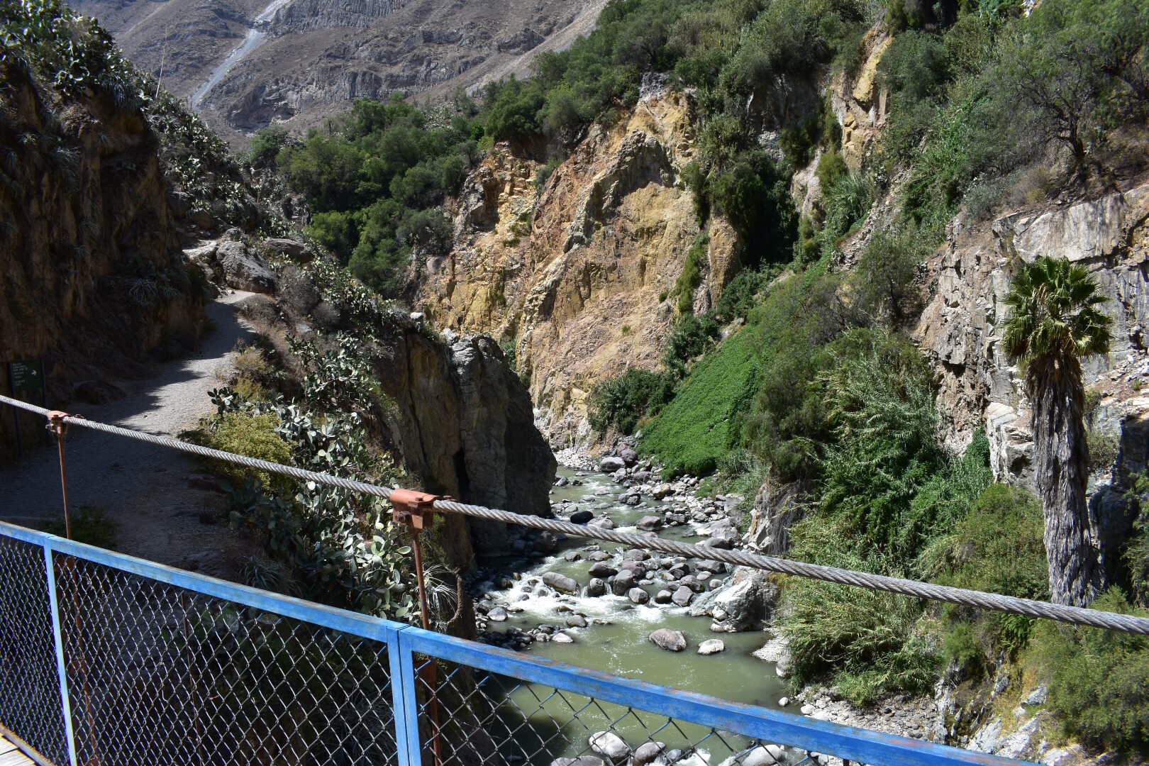
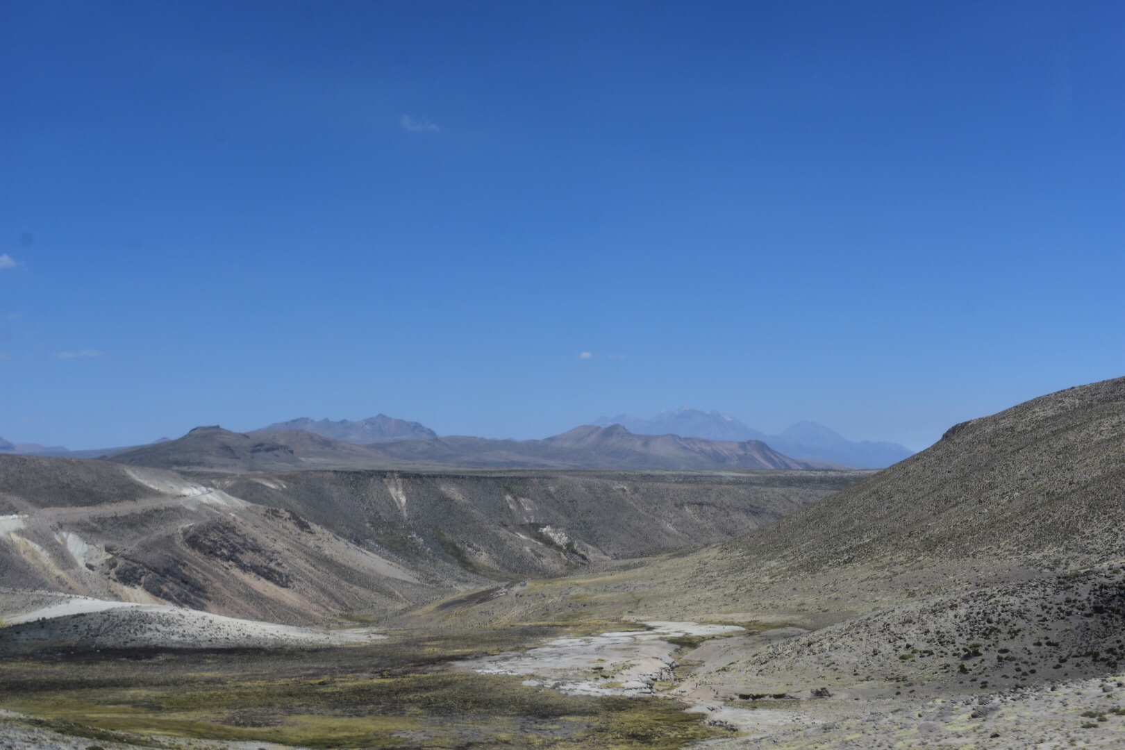
It was another 2.5 km to the river and there was another set of switchbacks to navigate. I think these are possibly the longest and steepest as they hit me hard on the way back. I crossed the bridge and found a shady spot to have lunch. And by lunch I mean eat my trail mix, which was essentially sweets. This is why I like hiking.

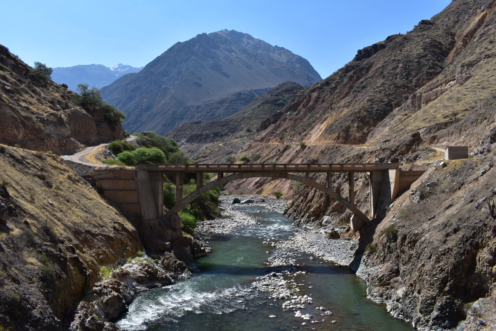
It took 3 hours to walk down, I started around 8:15 am and reached the river around 11:15. It was really hot in the valley and the heat kicked in big time about halfway down. This is something to factor in to your hike as the first down side has sun all day long and it will hit you on the way back up. I waited until my shade had disappeared and took a lot of photos of the bridge and started to head up the mountain at 11:40.

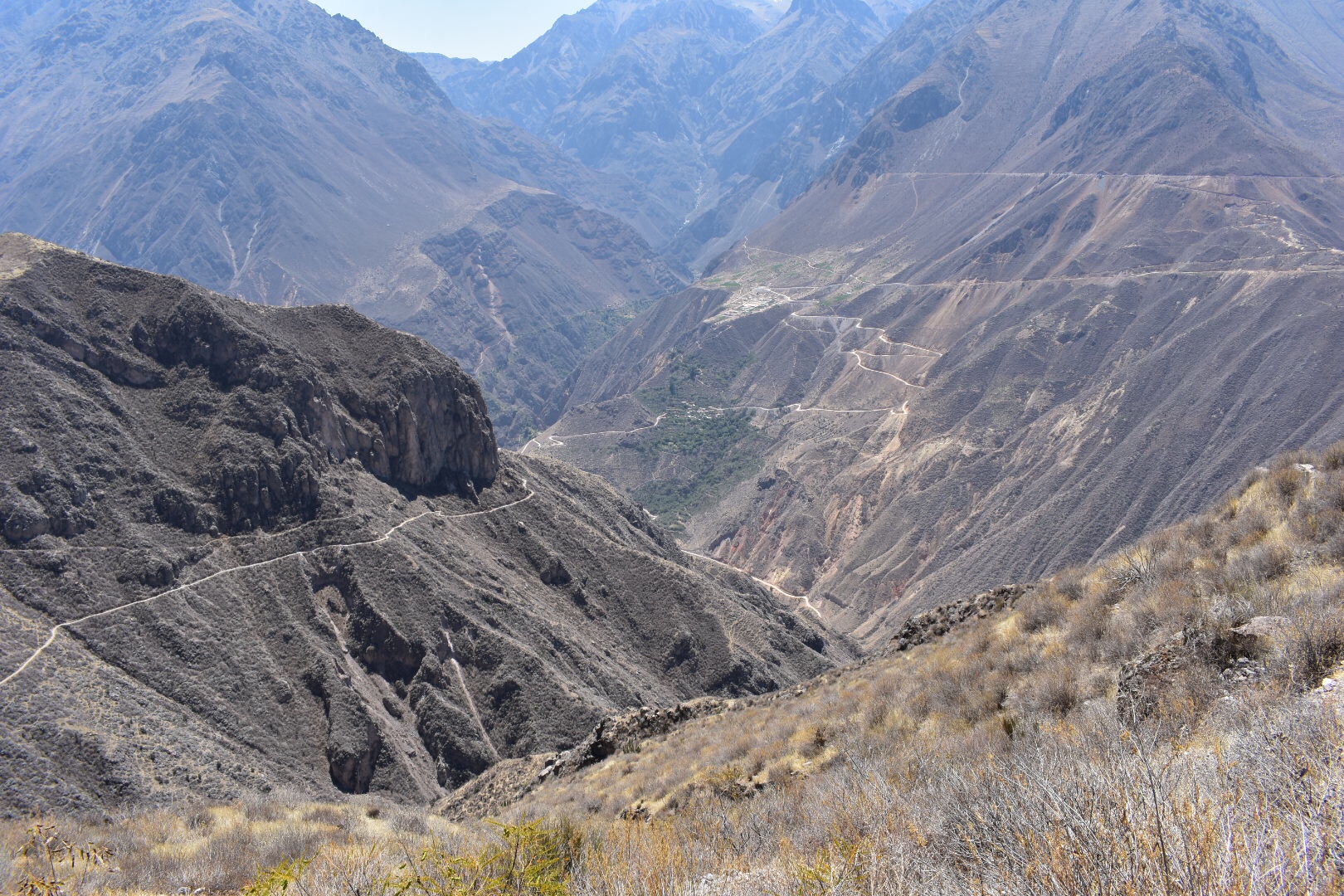
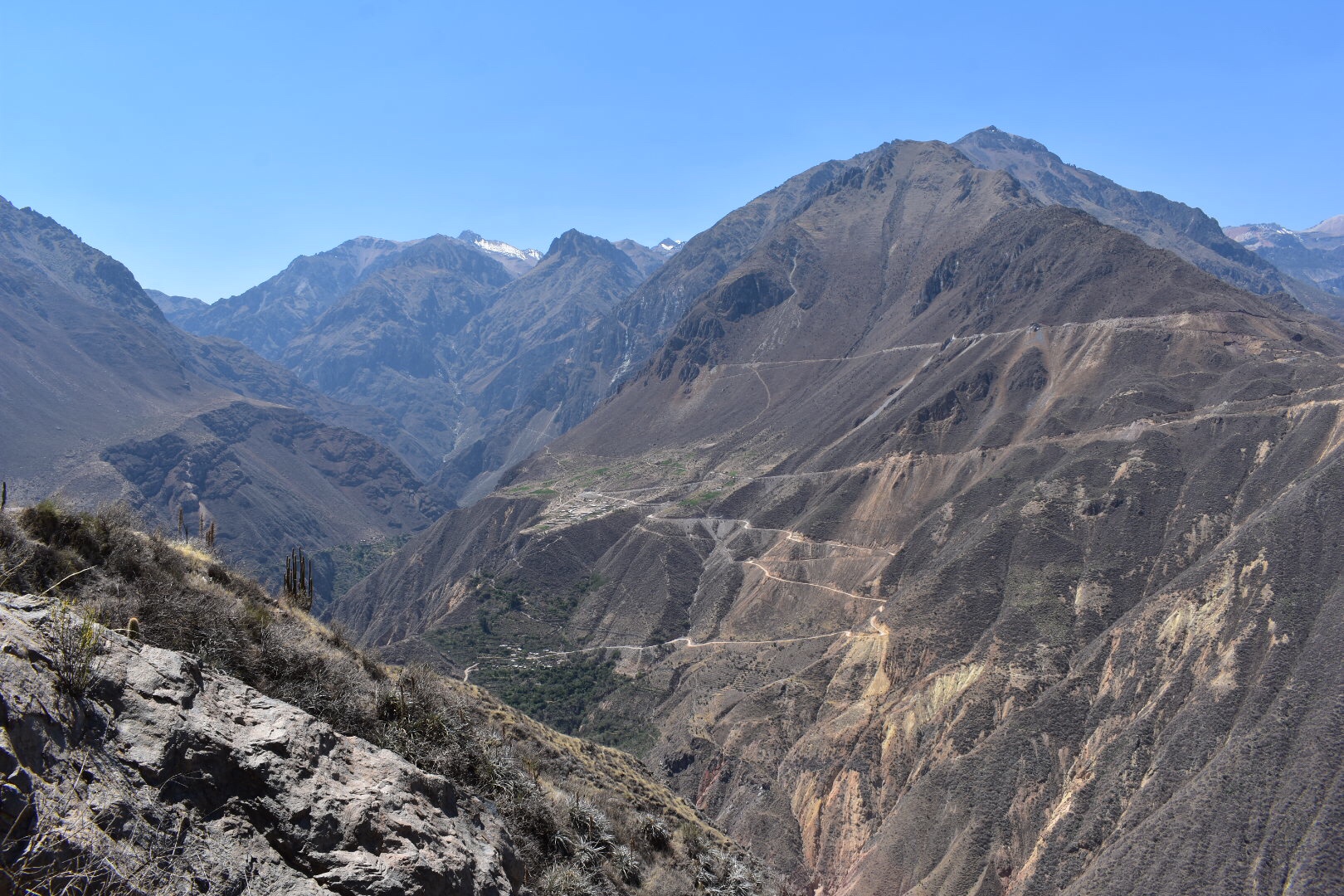
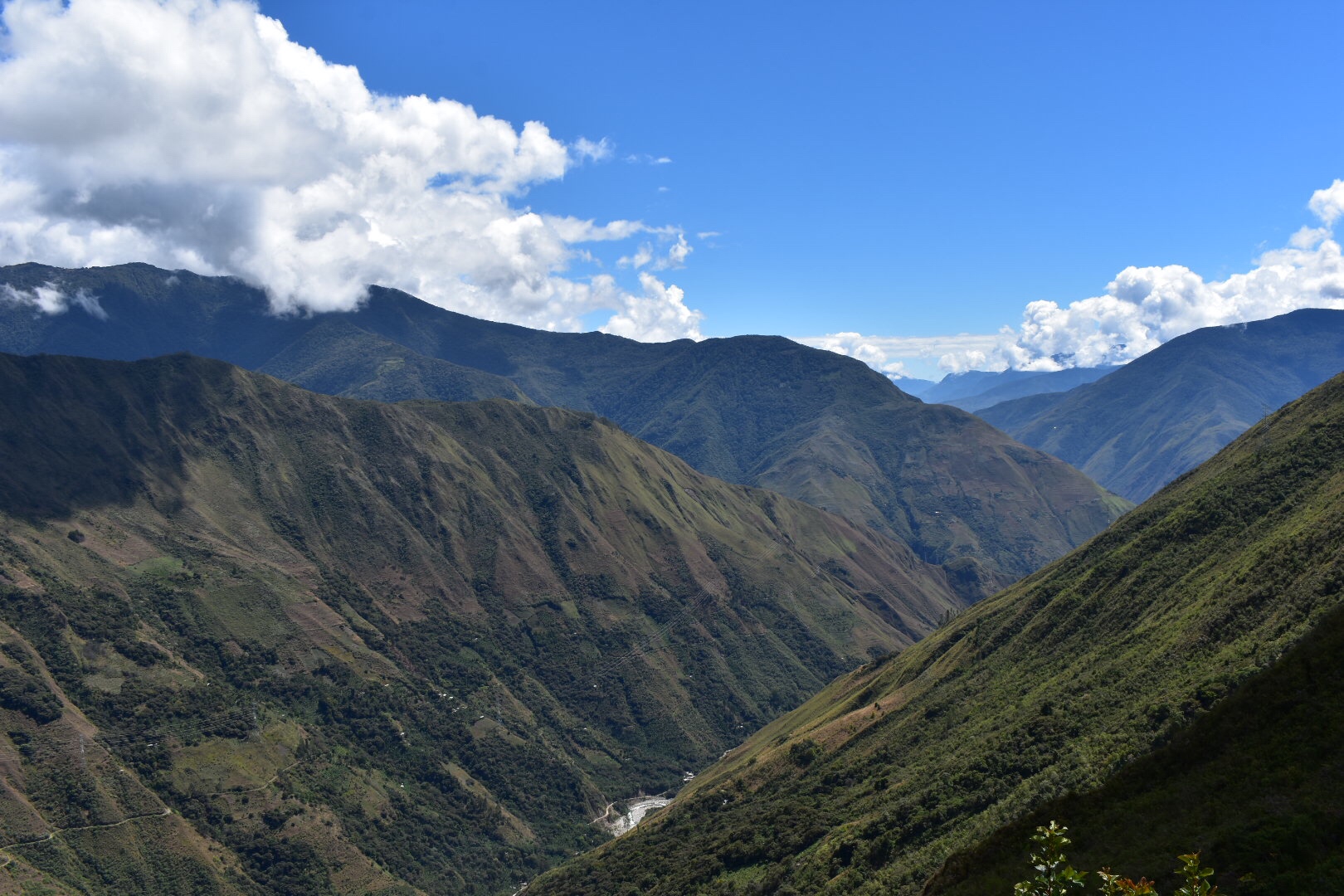
I think this initial climb is possibly the hardest things I’ve ever done. When the hostel owner drew the map the line for the down side was a nice declining angle and the up side was drawn much steeper. That’s because on one side it’s a 9km walk and on the other it’s 6km and the altitude change is roughly the same, 1500 metres.

By now the Sun was beating down on this side of the river, my water was hot and didn’t quench any first and I was exhausted by the time I reached the end of the first switchback. It was steep, my bag was heavy and I was already tired. I only had two kilometres to go so I decided to adopt a policy of four switchbacks, rest, four switchbacks, rest. The first camp was 2 km up and Santa Rosa Alta my destination was only another 800 metres so even if I only climbed 50 metres at a time I had plenty of time to make it up. It honestly got to the point where my lungs felt like they were on fire and I was willing myself for the last five metres to get to the end of the switchback before I collapsed. It felt like an age to get my breath back each time and I was going really slowly.

But a funny thing happens when you walk, each foot you out in front of the other gets you closer to the destination and eventually you arrive. I finally saw the sign for the first camp and had 200 metres to go. I couldn’t make it in one stretch but I arrived and brought some much needed water. As a consequence of all this I didn’t take too many photos on the way up.

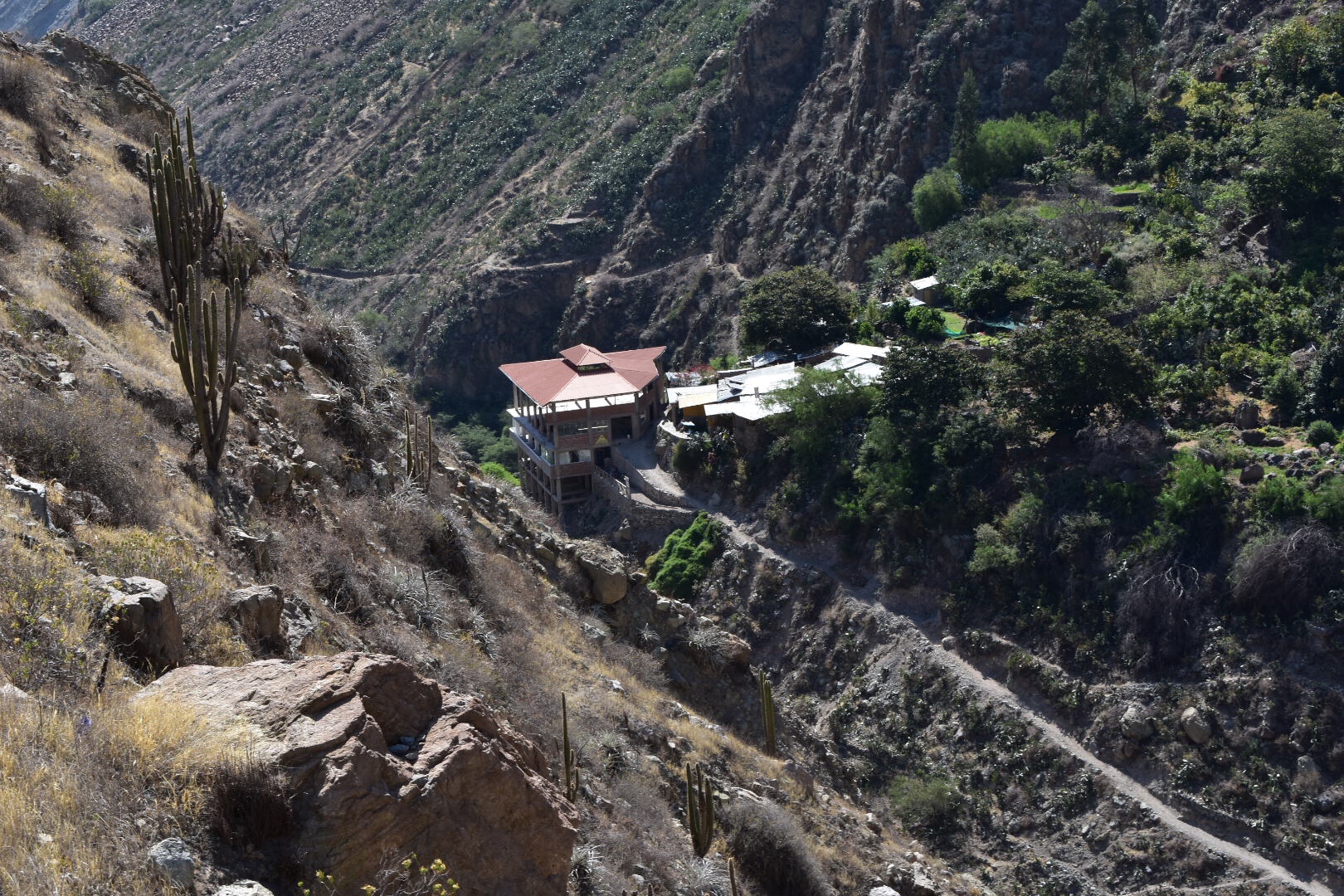
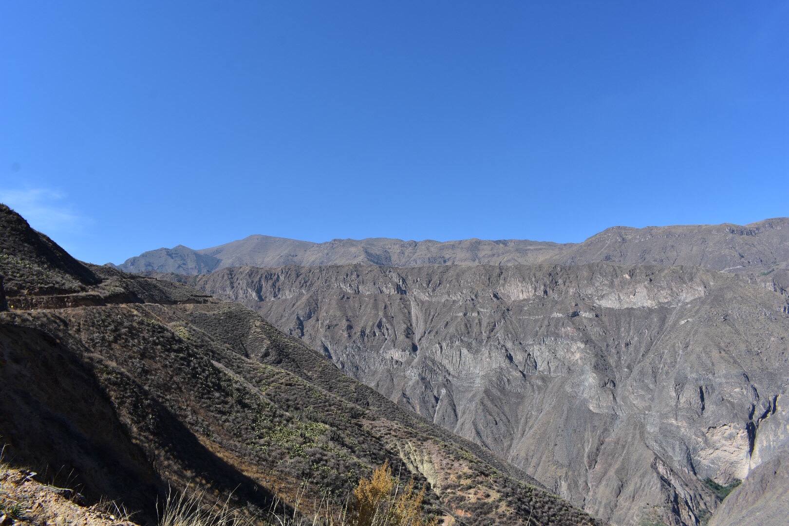
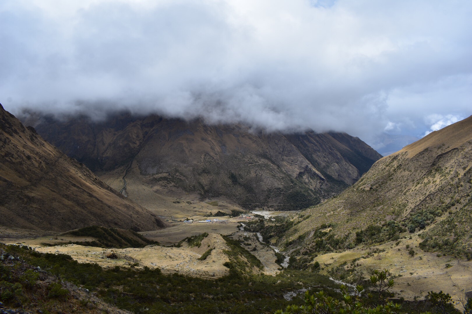
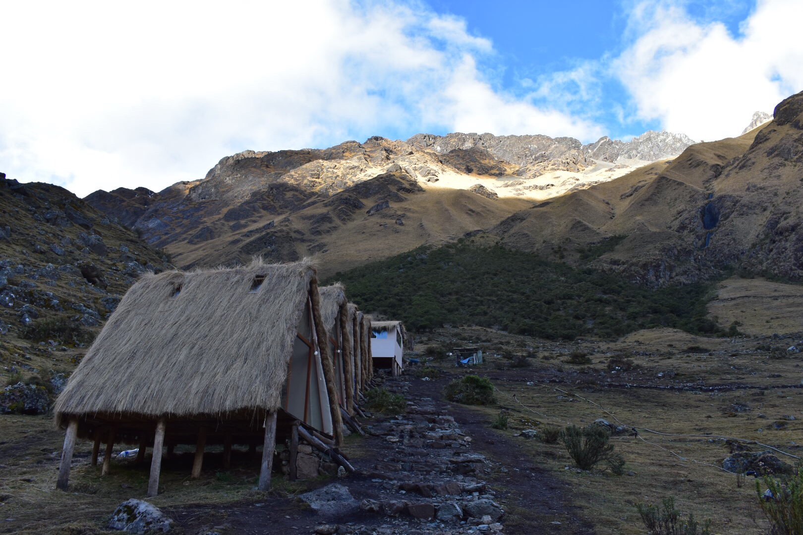
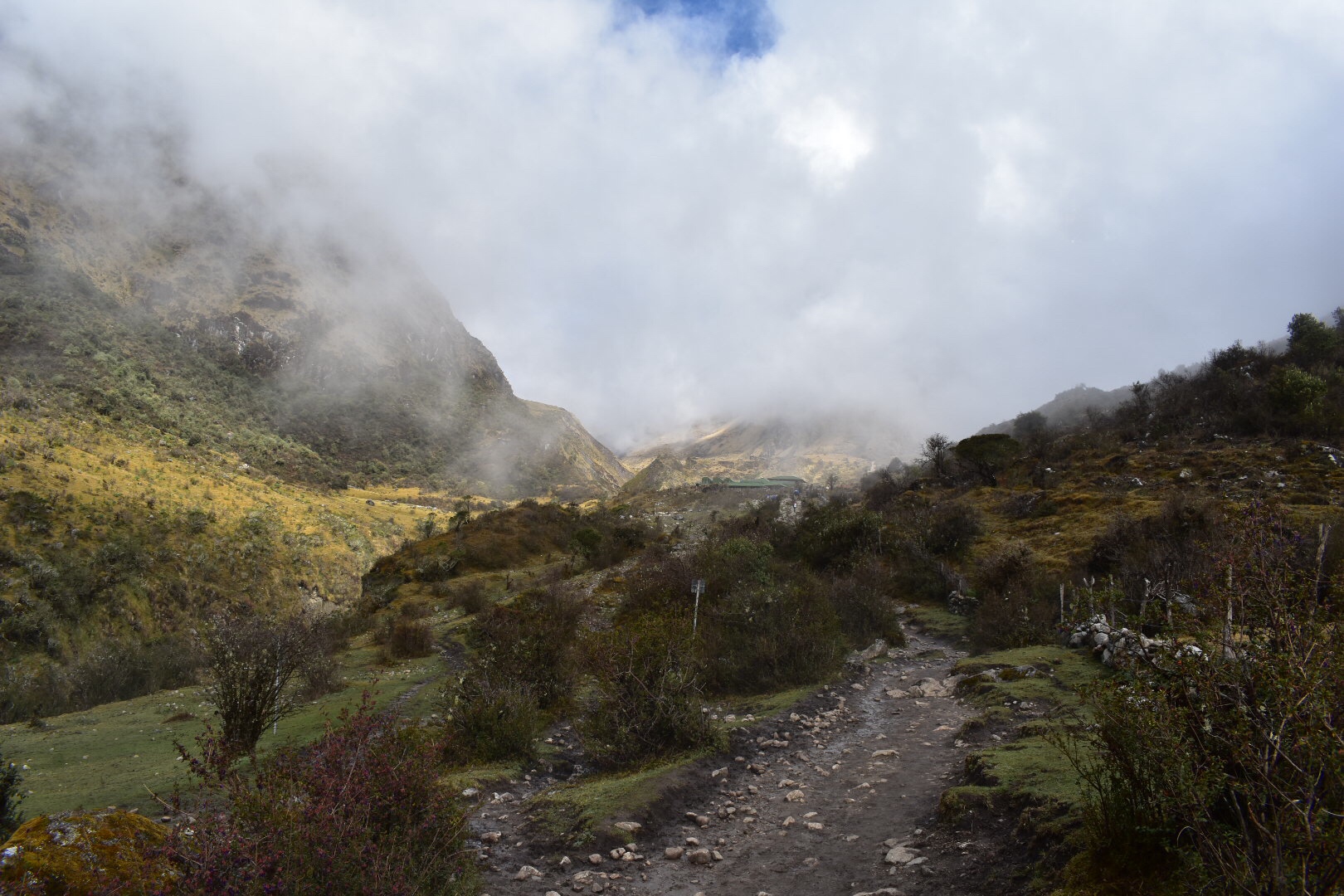
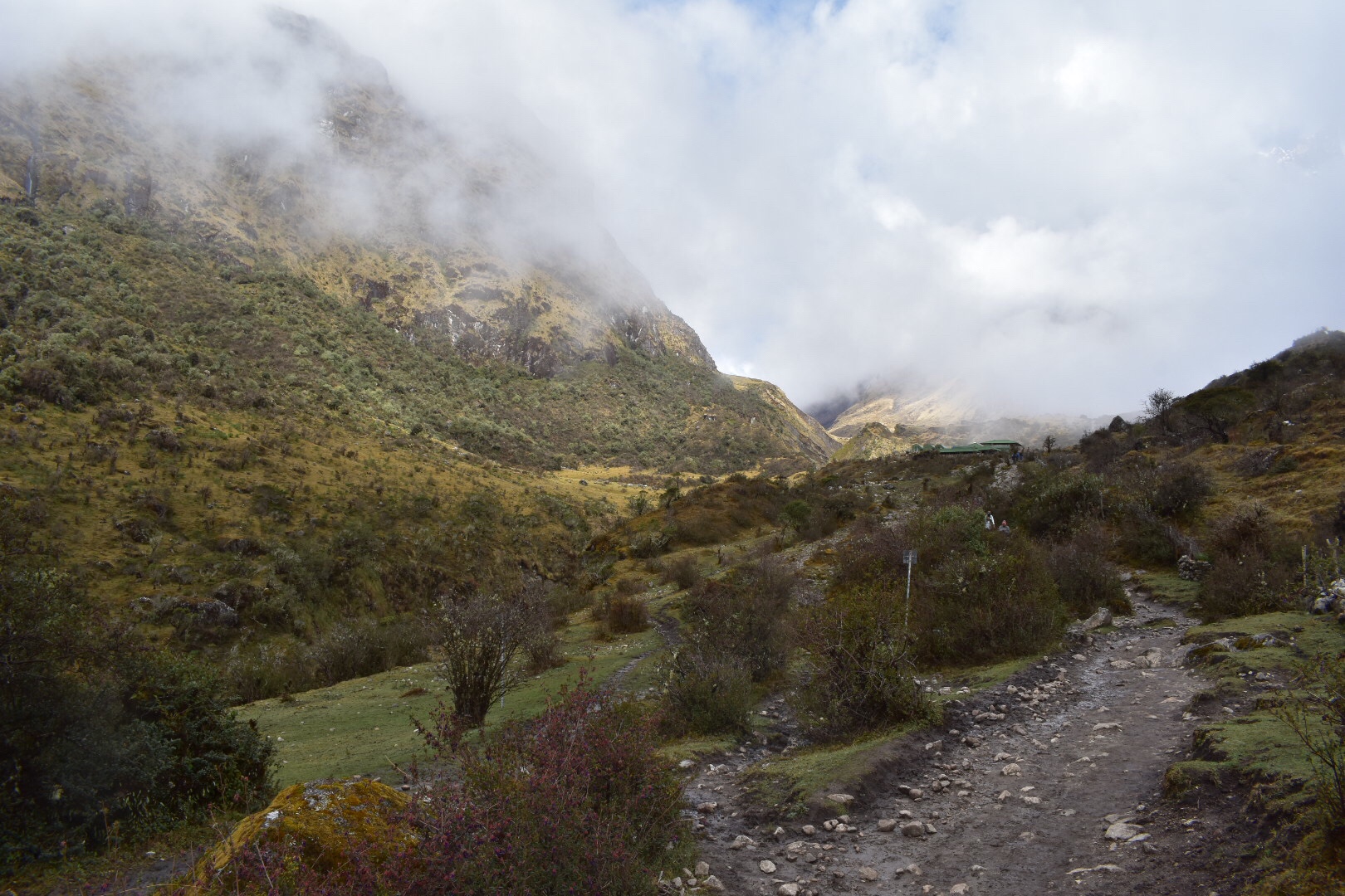
In the above shot you can see the path on the first mountain that I’d descended. I rested and some of the horsemen tried to speak to me in Spanish. I’d actually made it there in less than 90 minutes which is not bad considering how hard is found the climb. I continued up to Santa Rosa Alta only having to stop a few more times. It was easier going for some reason. Annoyingly I found the camp deserted and the next camp was another 3km. It was only about 1:40 at this stage and I had time but I wasn’t sure I’d make it so decided to go back to Santa Rosa where I pitched my tent and collapsed and fell asleep.

I awoke to lots of noise around me and suddenly the camp site was full of people and a hive of activity. Several tours had shown up and the cooks were busy setting everything up. I made a mental note to get up early, cooked my super noodles and pepperoni and had an early night. But not before watching the clear sky’s for the stars which I finally got a chance to see. As I got into the tent my foot got caught and in the struggle I managed to rip part of the tent off that held a tent peg. I found everything and it was easily fix but if it rained tonight I’d be screwed.

I awoke at 5am determined to leave and get ahead of the tours and started up an empty path. I had a 4 km climb ahead of me and was able to take full advantage of the morning shade. It was much easier going than the day before but sill I had to stop every four switchbacks. My bag was slightly lighter and I was fresher which helped. There were two more water sources on the way up and I stopped at both to refill.

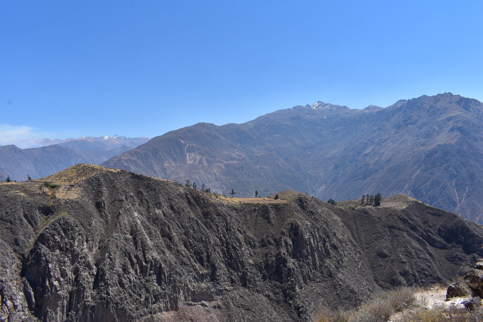
Eventually I managed to reach the top and was pleased to discover it only took two hours. The Sun was out by this point and the views were beautiful. I found my camp and stored my bag, having a rest and buying a litre of fresh water which I drank half and would later regret not buying more.

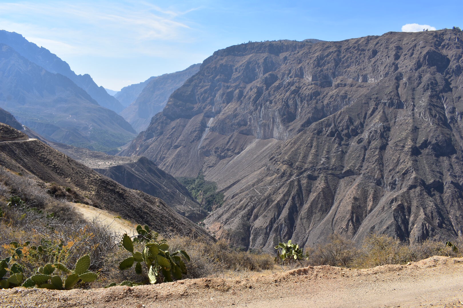
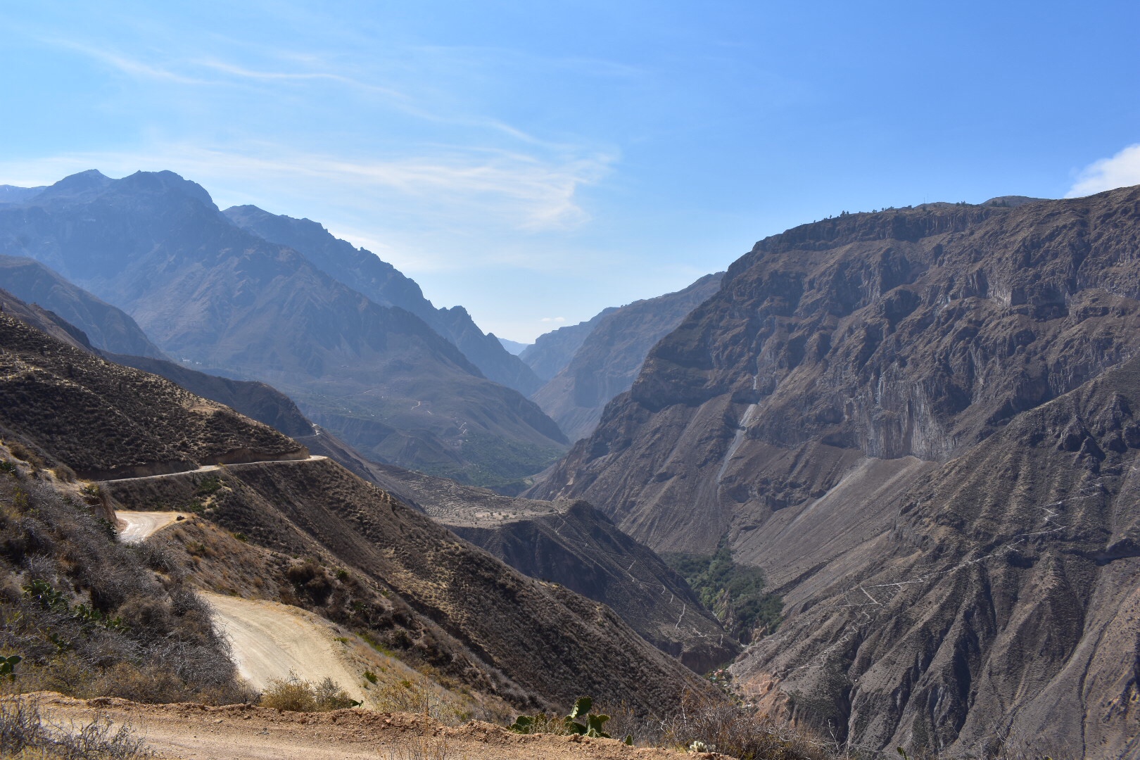
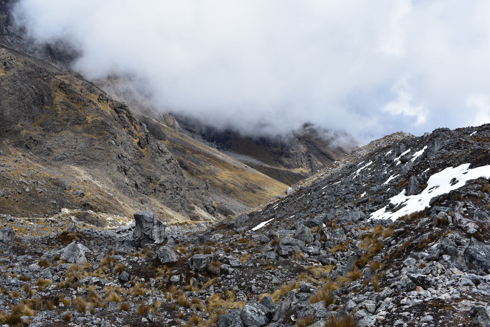
All I had between me and Choquequirao was 3.5 km of what I’d read was a fairly flat trail. It’s not flat people so brace yourself for more ups and downs.

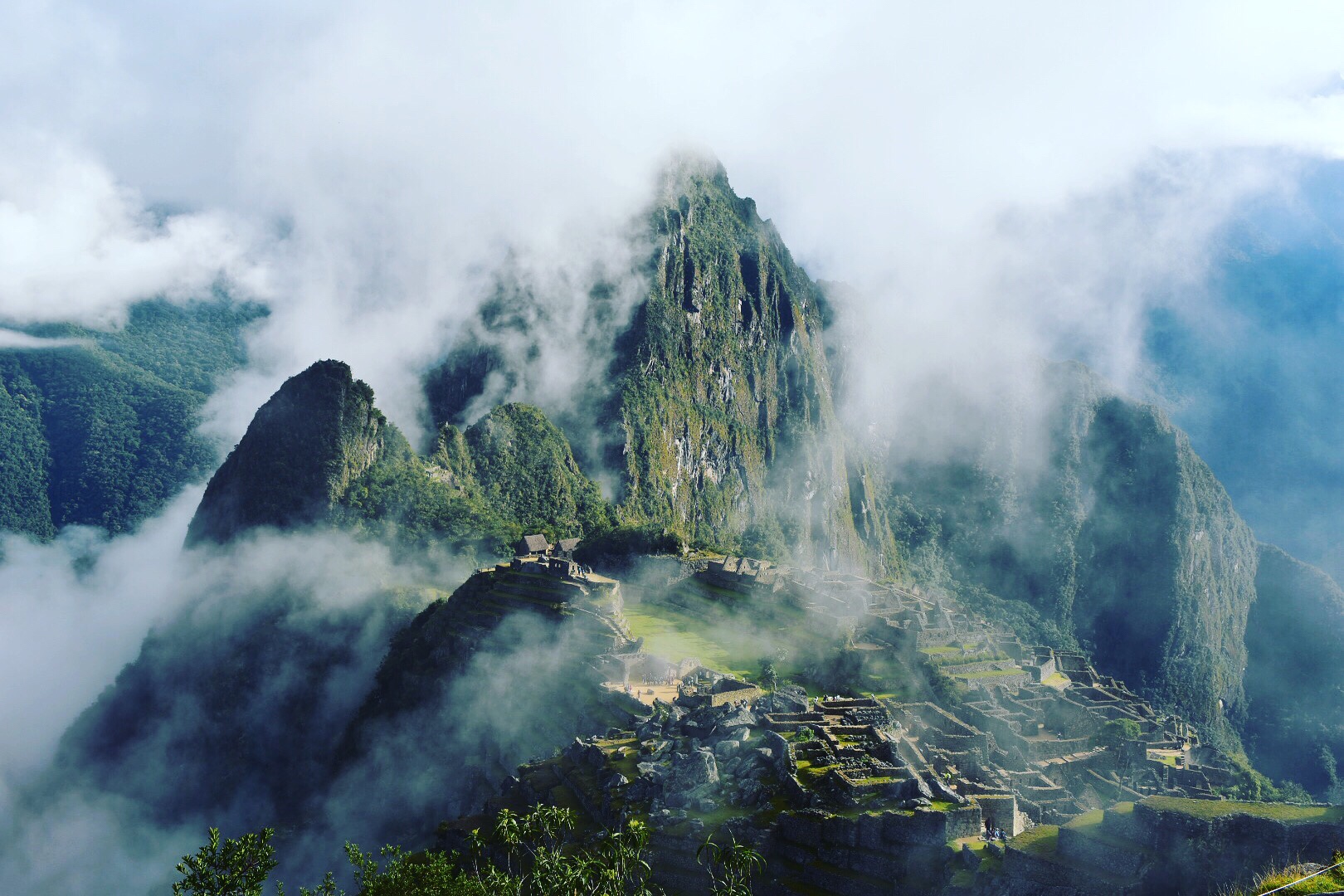
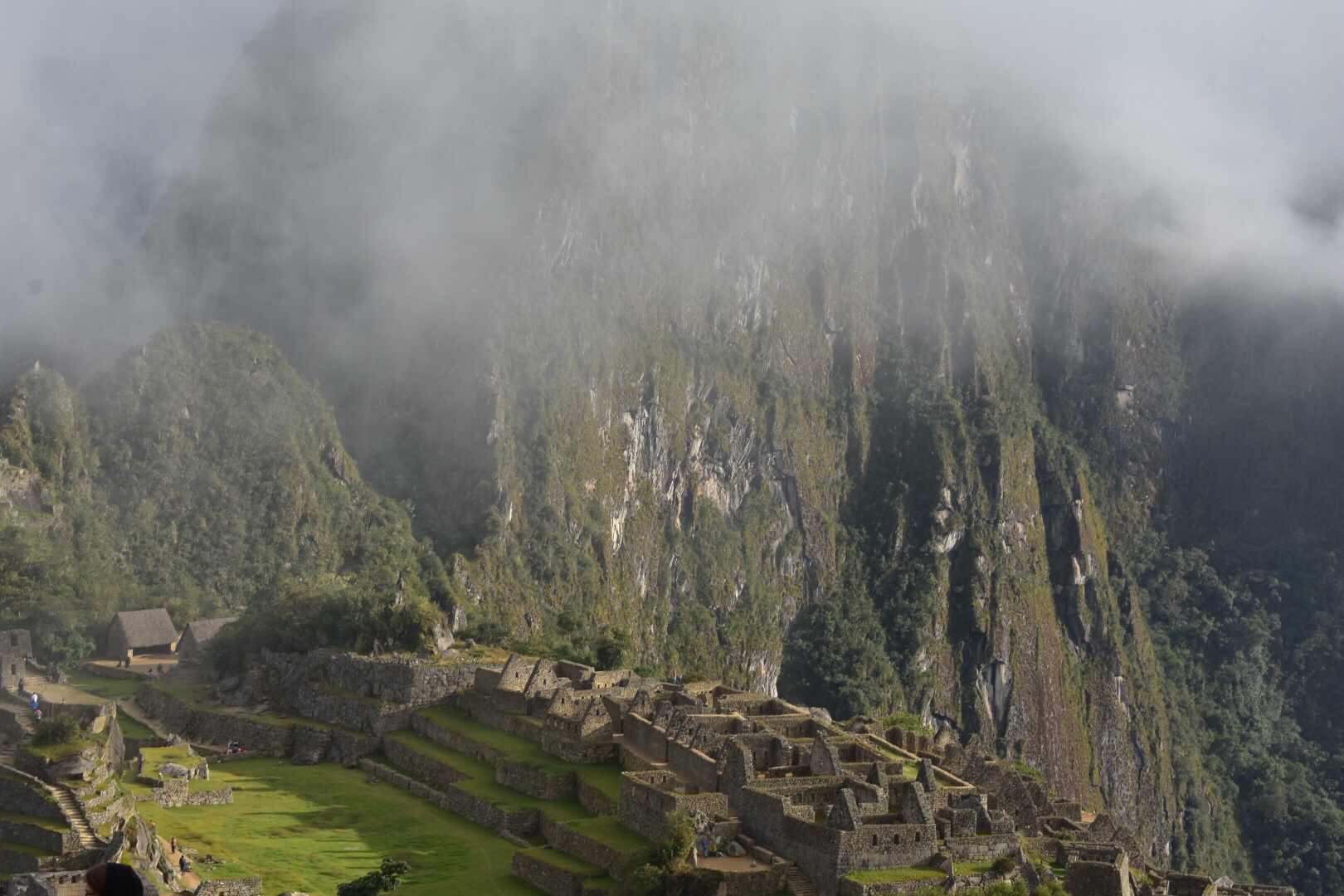
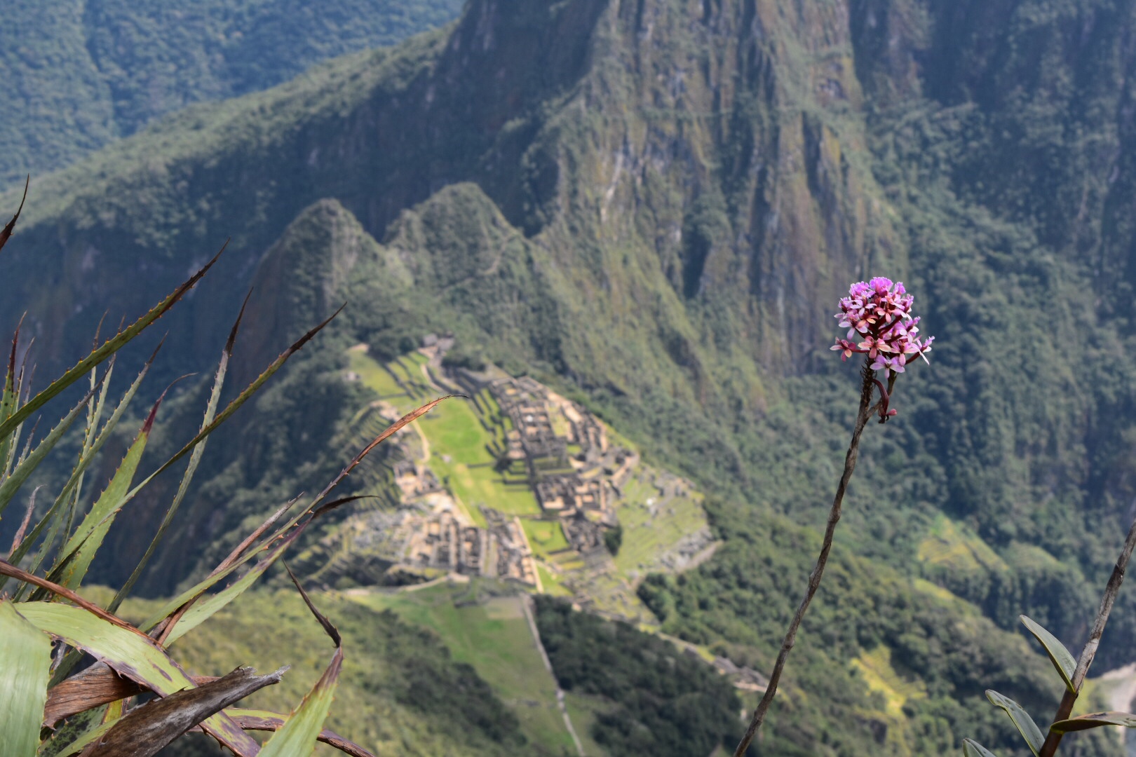
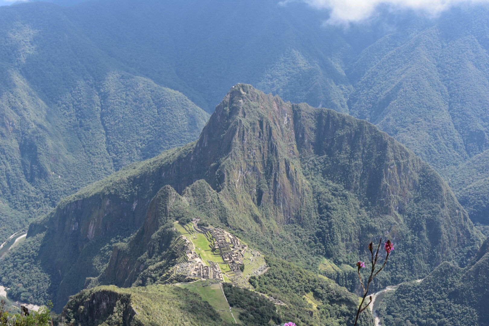
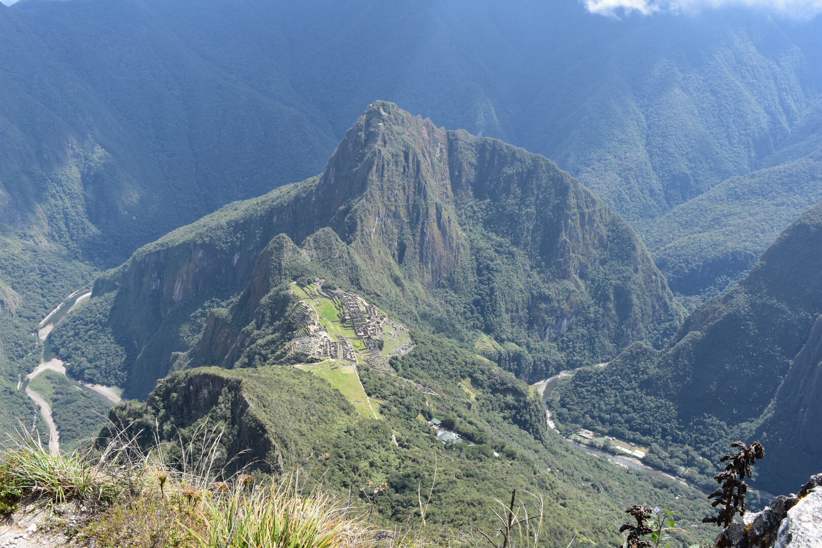
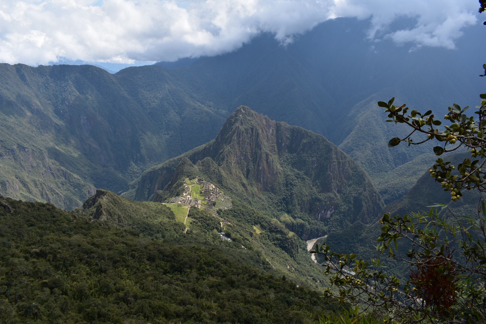
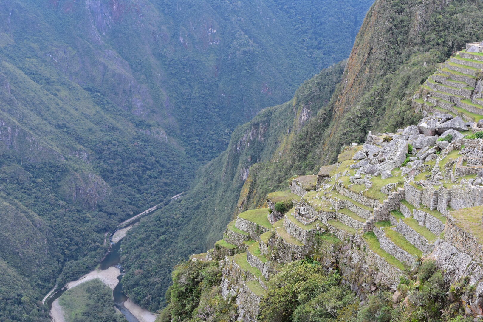
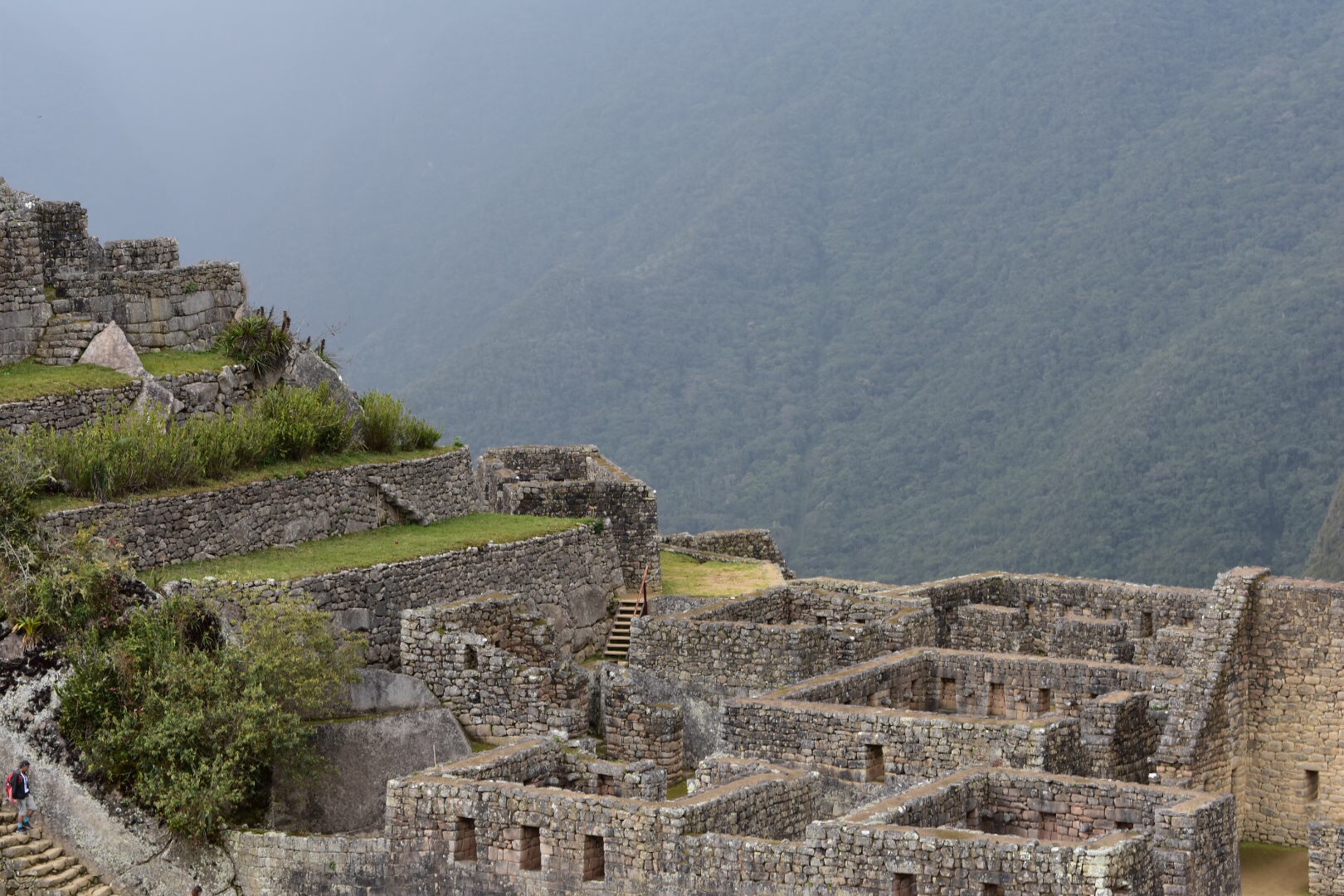
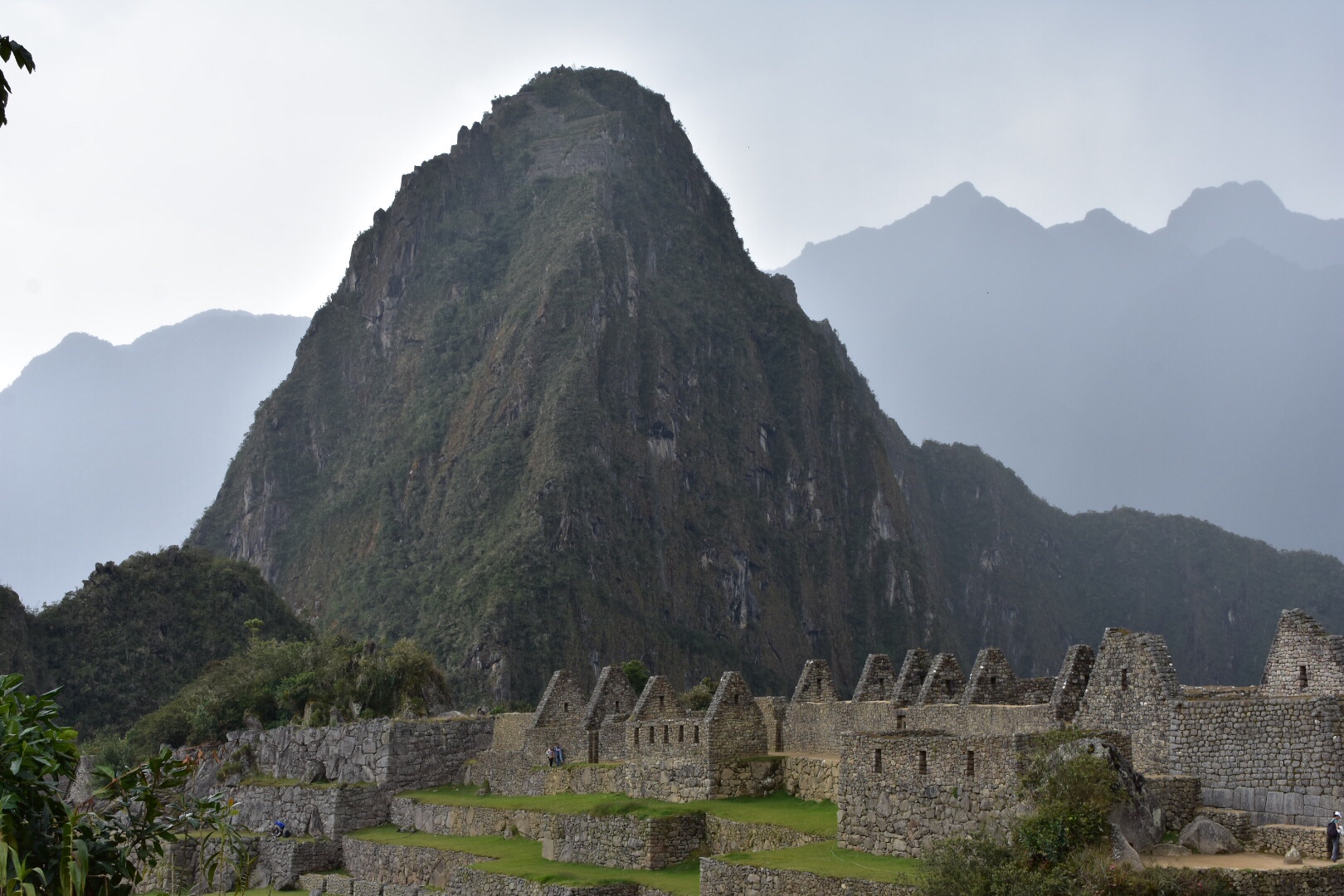
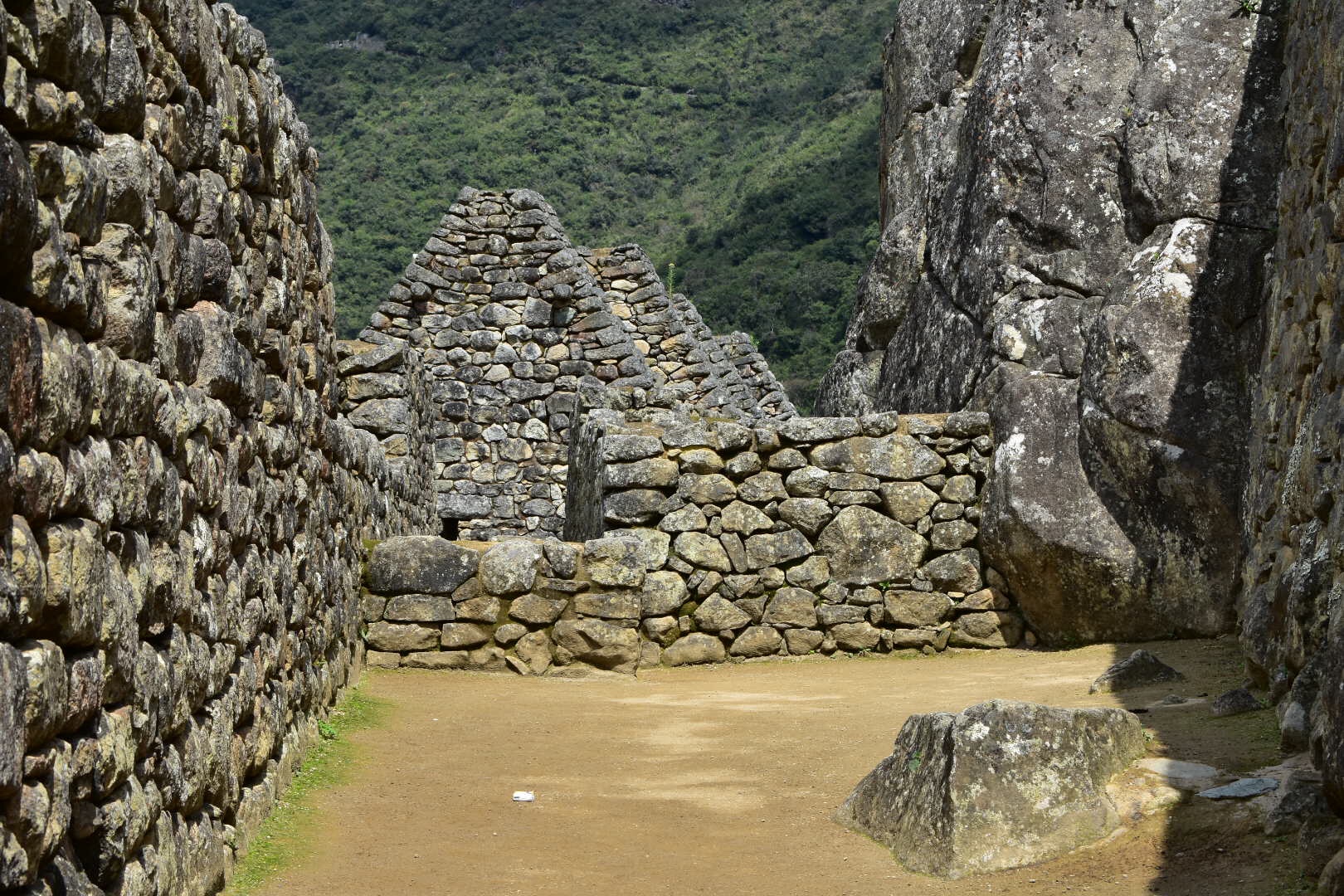
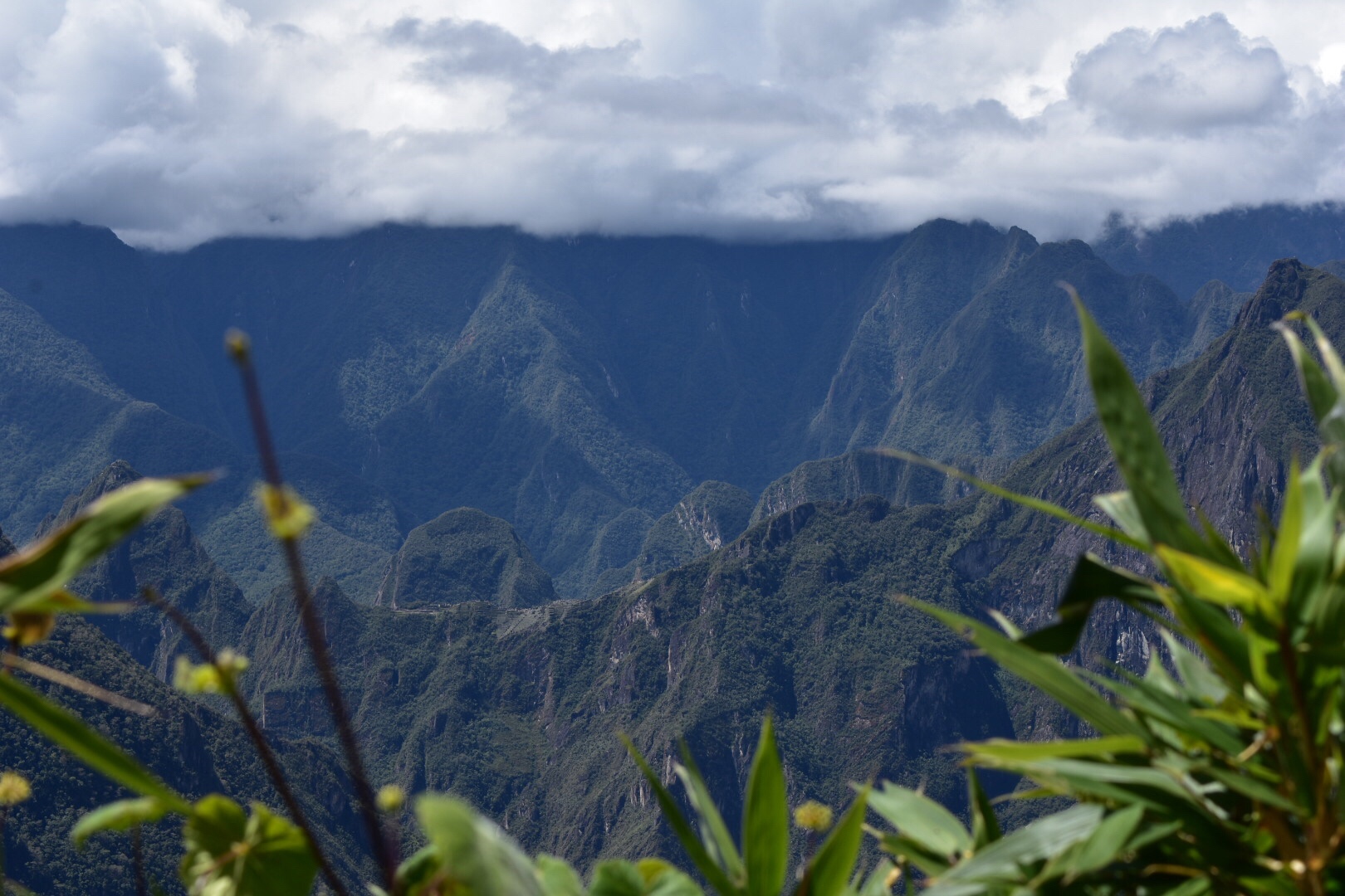
As I left the village i turned a corner and there was a small group of people taking photos. Already I was excited and you could see the ruins front his point.

It’s another kilometre to the ticket office, where you have to sign in and pay the entrance fee of 60 soles. From here it’s at least another 2 km along the winding trail the he site-although it depends on where you go. I was given the option to go up and down and having seen the size of the site and realising I could spend all day here I cursed myself for not bribing more water. I decided to head up to the plaza which meant I could visit the lower parts later and not have to do a big climb all in one go.

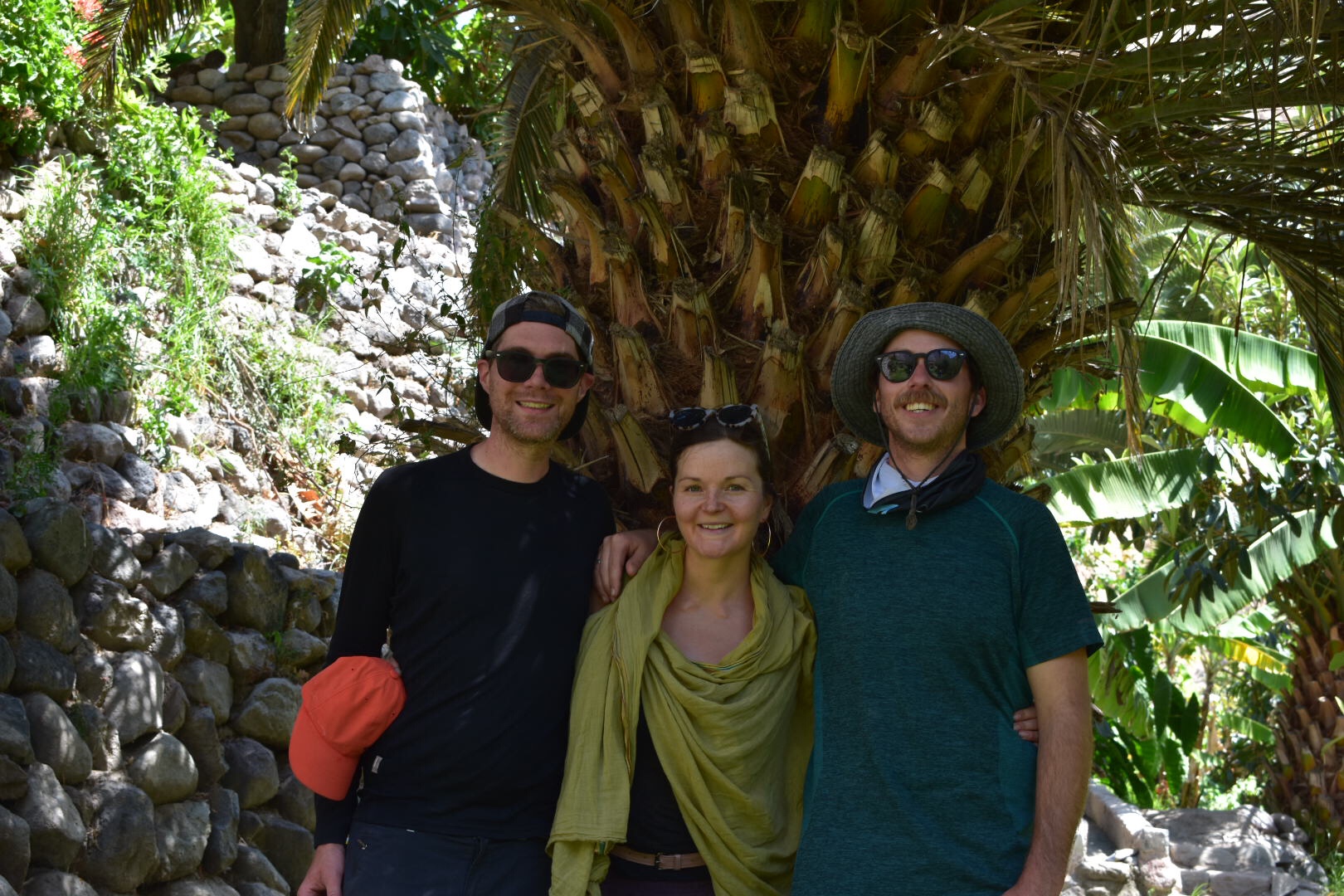
And then I arrived. After meeting some Americans, Germans and one of the tour guides I’d met the day before who all gave me some great advice.

Upon reaching the plaza there must have been less than 10 people and I felt as if we were in this exclusive club that had made it to this magical place in the andes. This would change later as more people showed up but I can’t imagine that more than 70 people visited in this day. The last British people to visit was 10 days ago, so guys do this and don’t let the side down!

I explored the plaza and chatted with some of the other tourists.

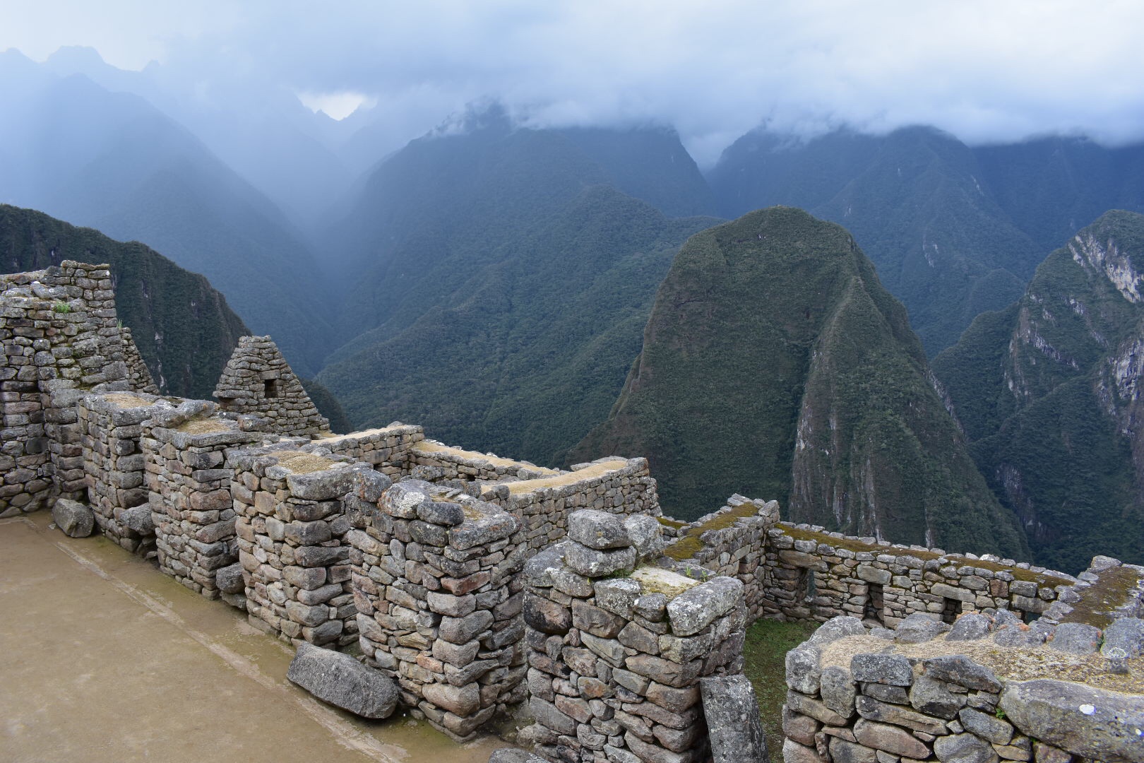
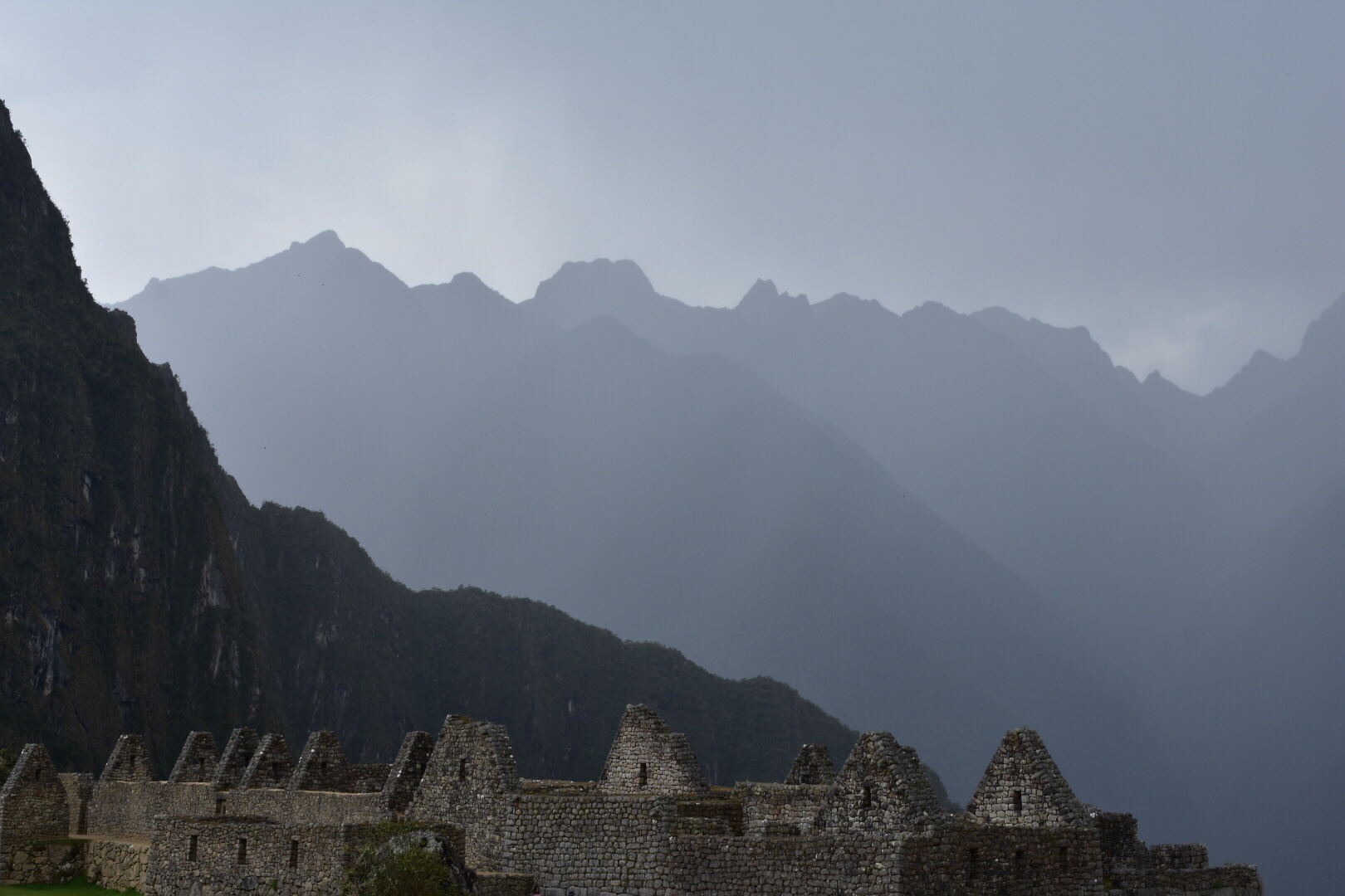
And then of course it was time to head up. When I reached the top i was completely alone and I stopped to enjoy the tranquility of the ruins. I was joined by a German lady and we chatted for a while. After she left I tried to go higher but found my path blocked.

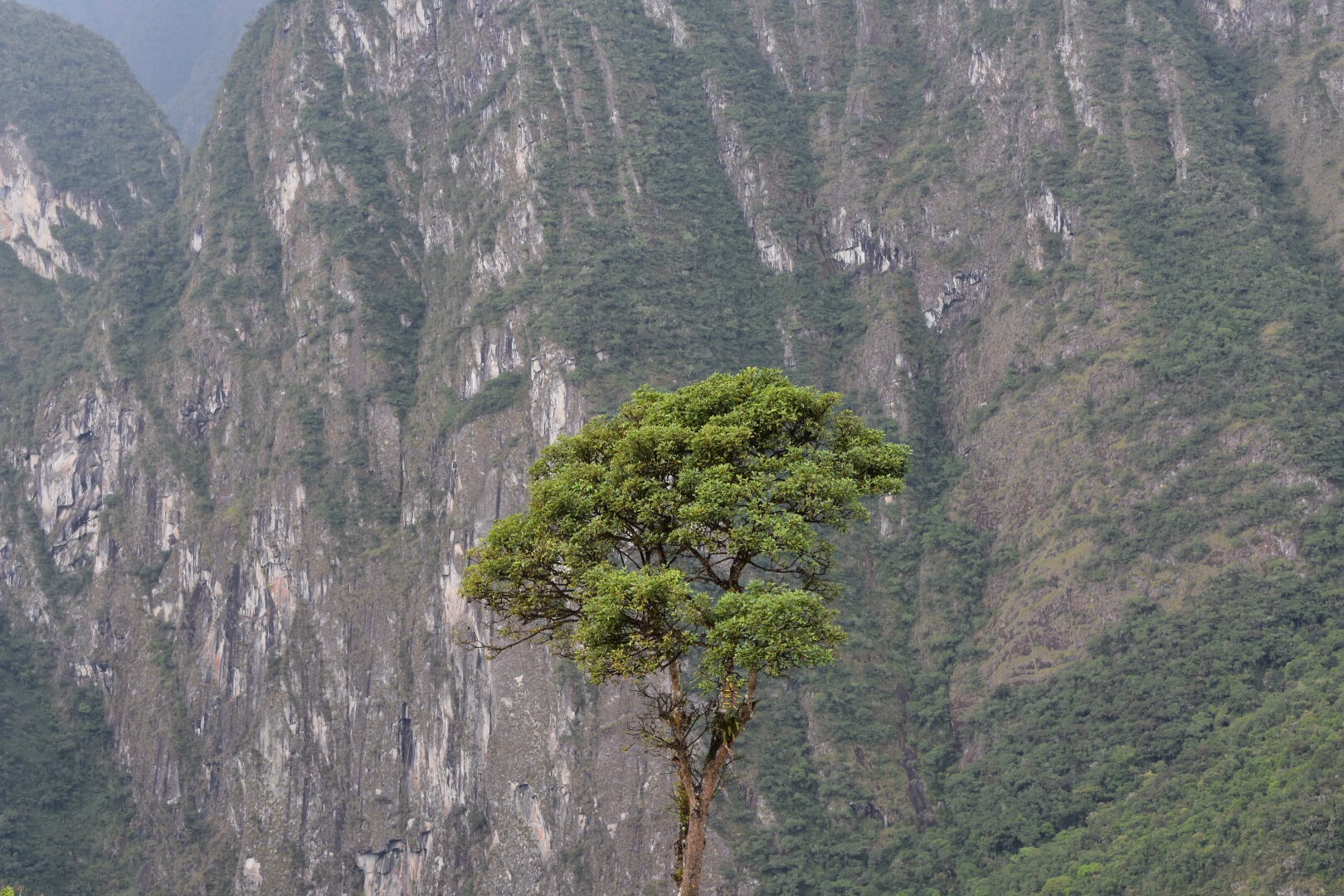
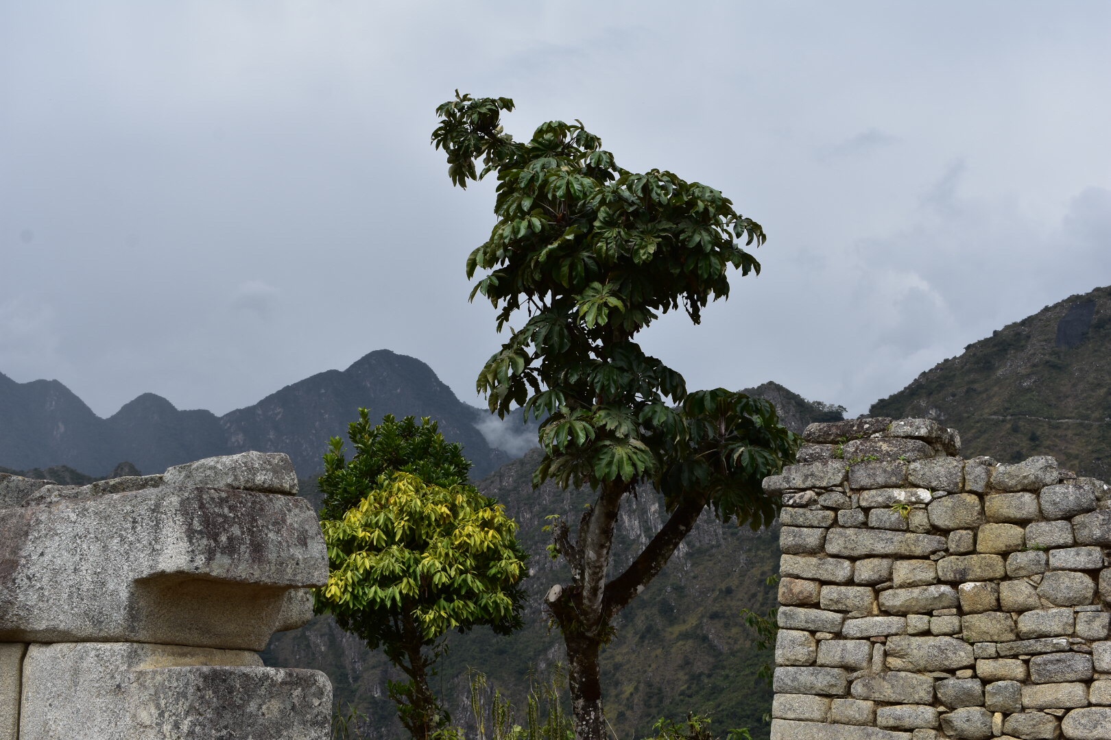
So I took a load of pictures of this tree that for some reason I really liked.

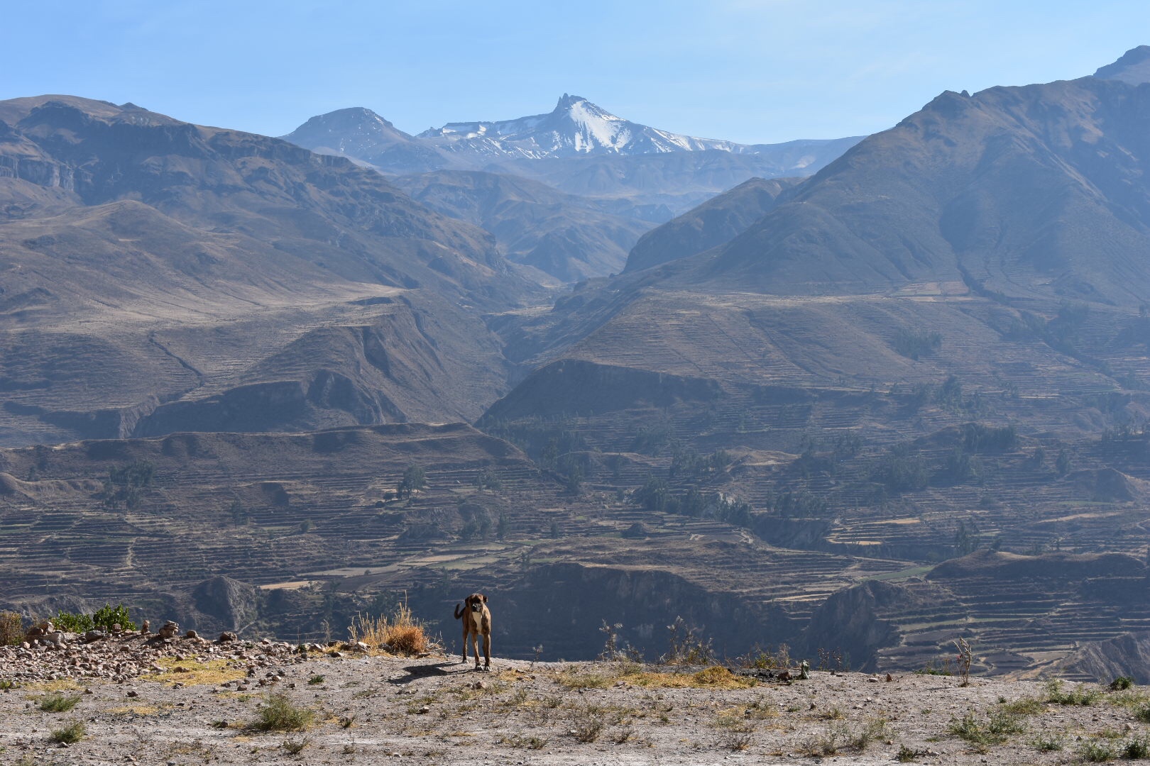
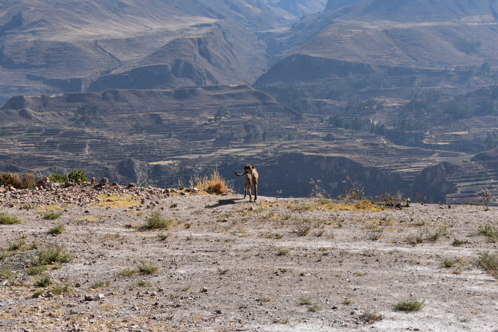
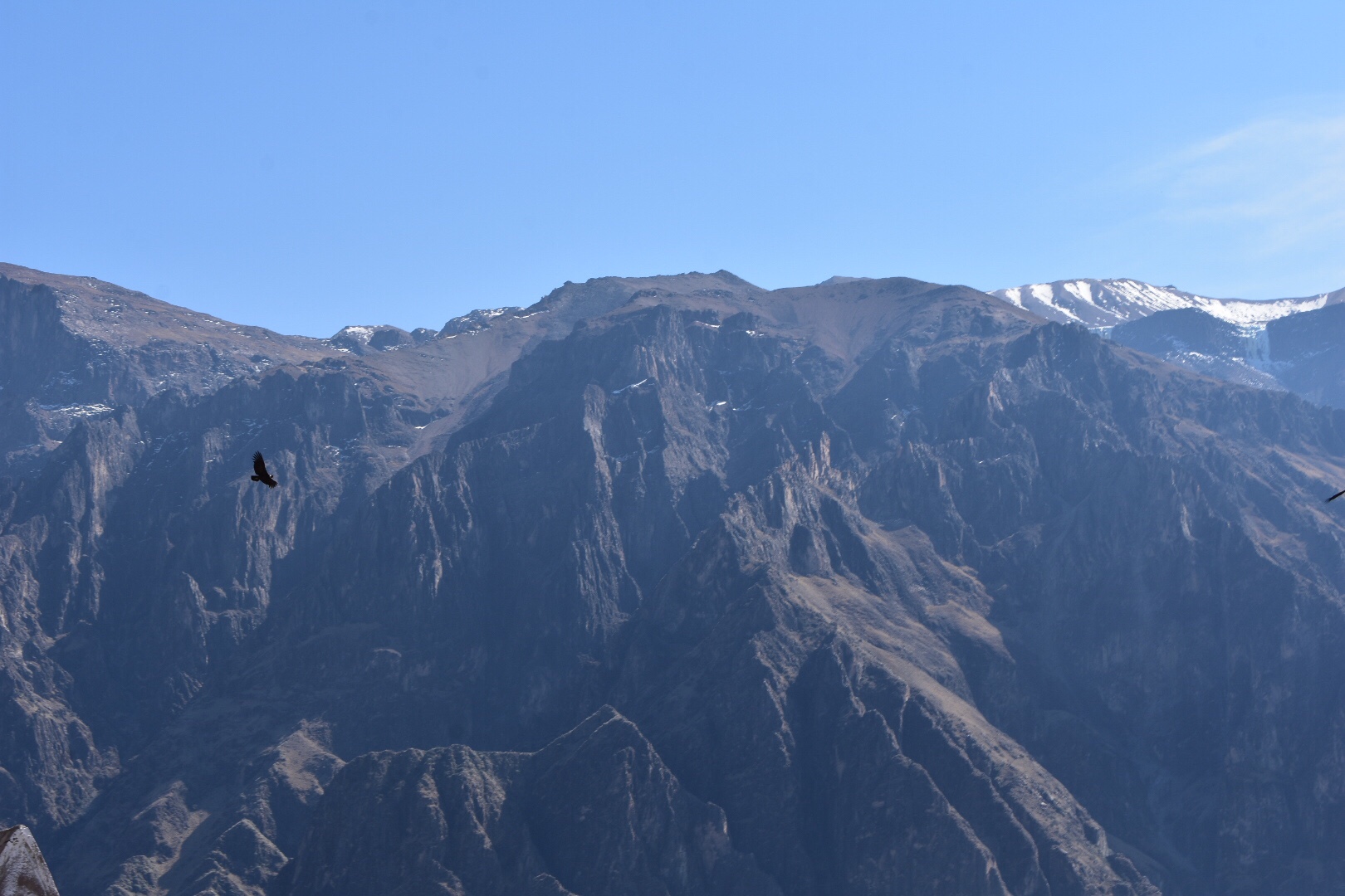
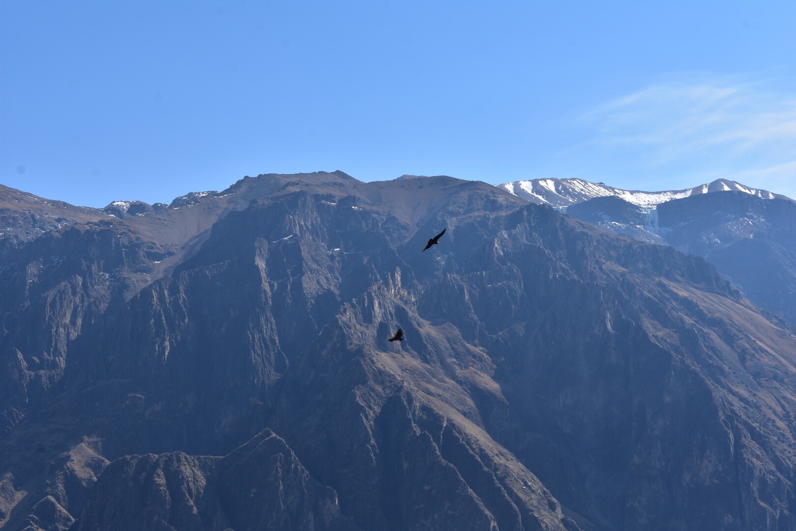
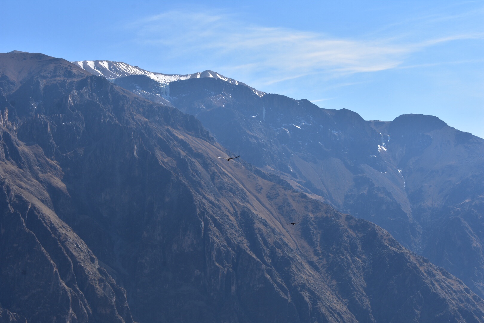
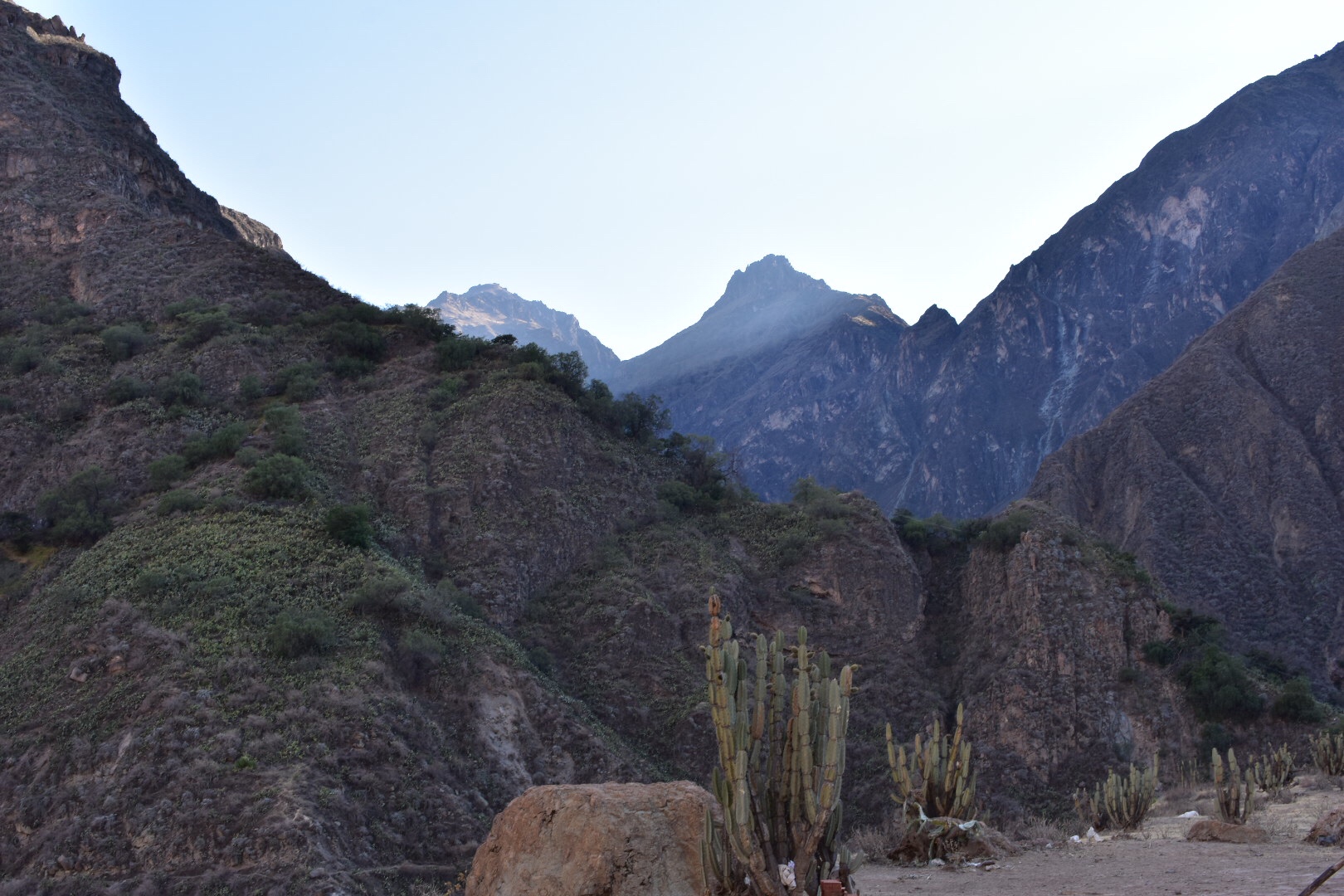
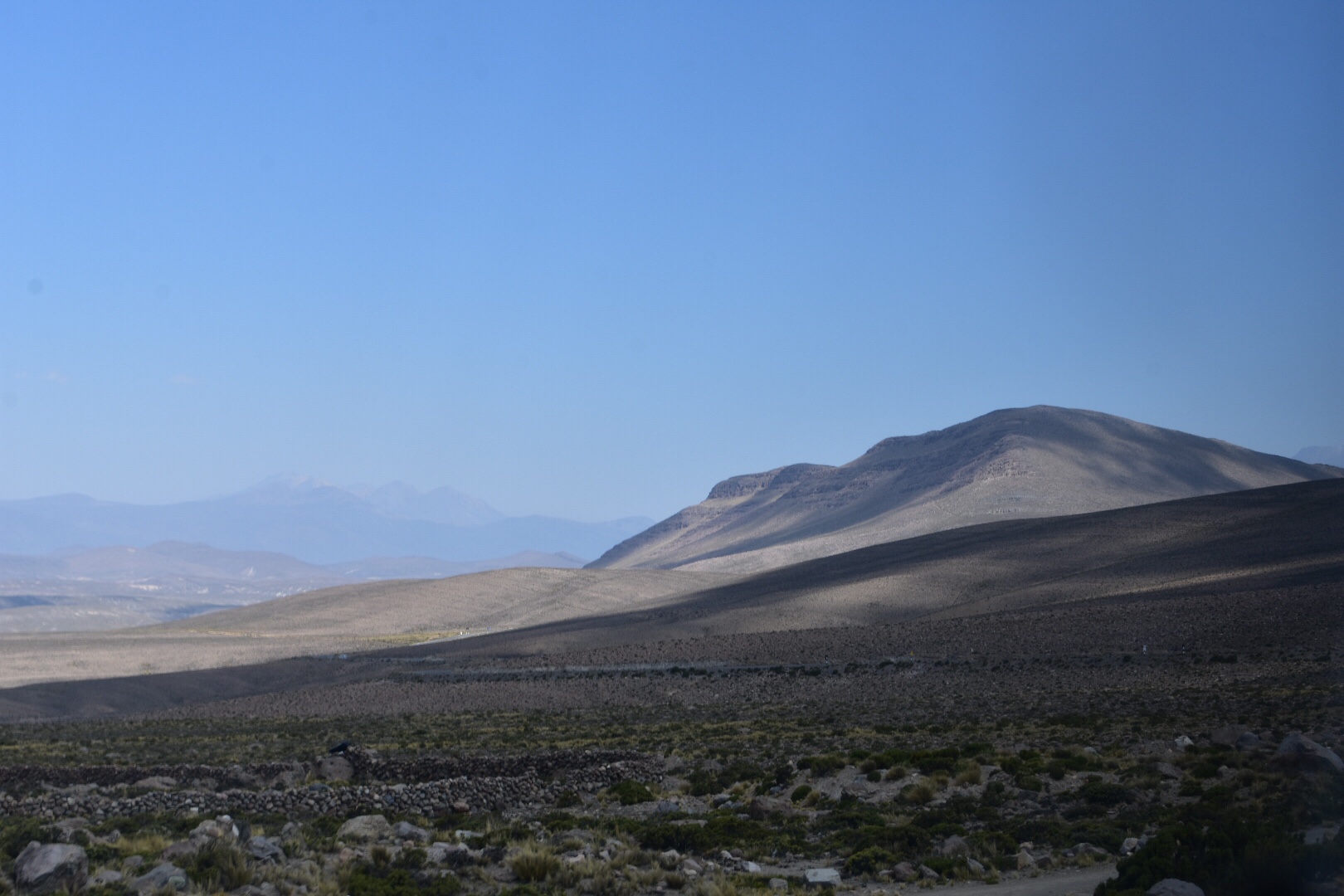
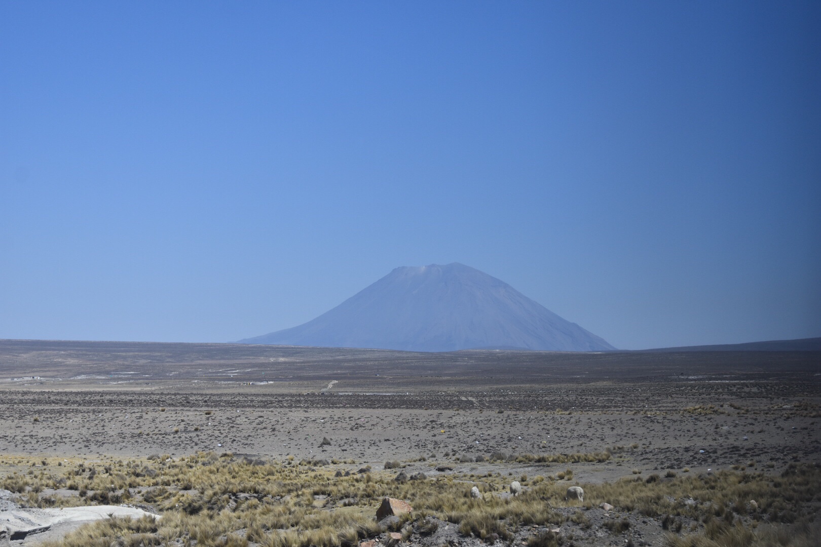
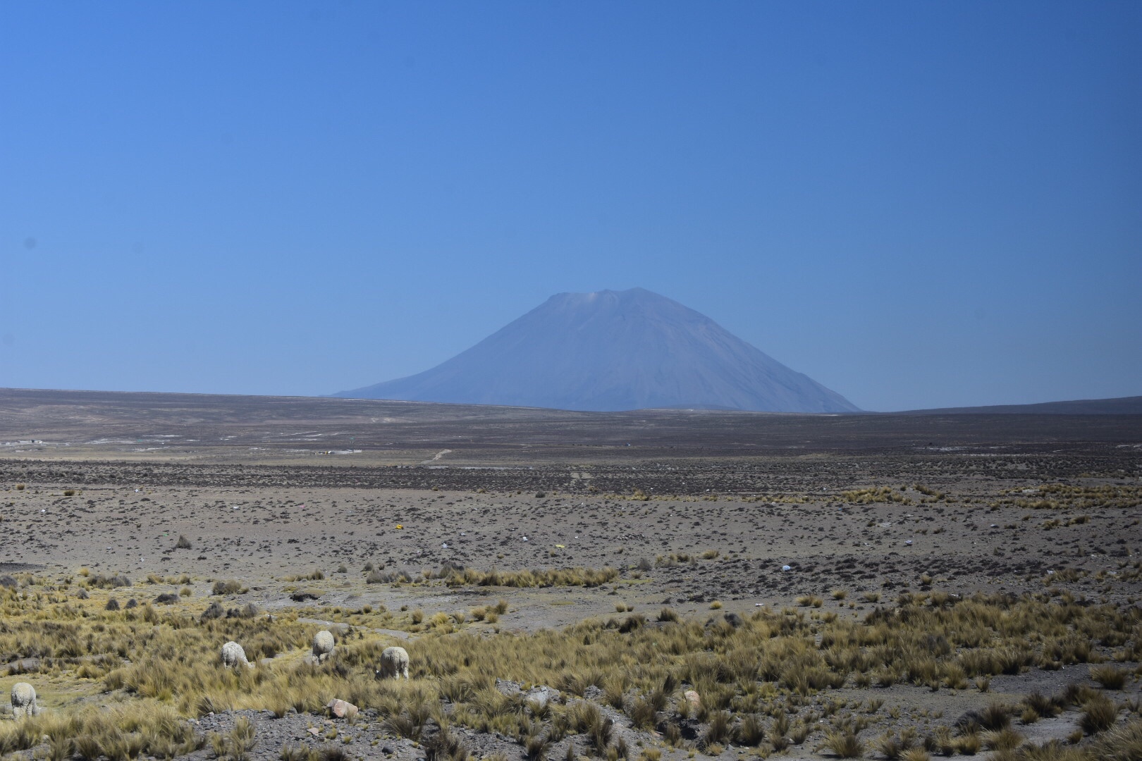
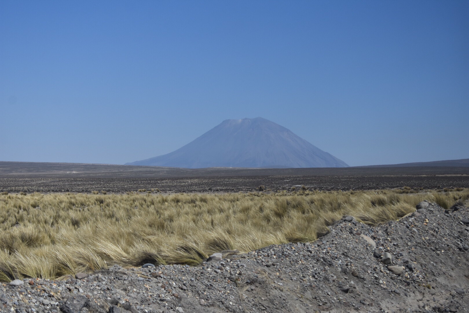
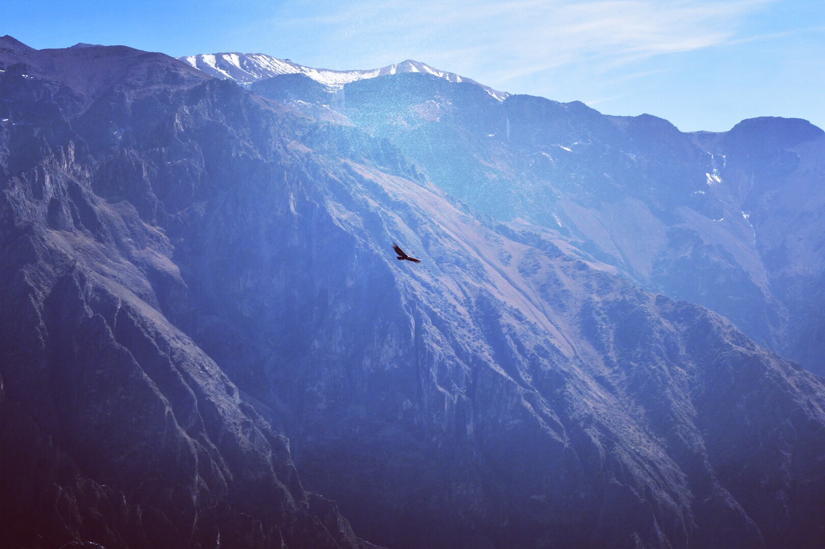
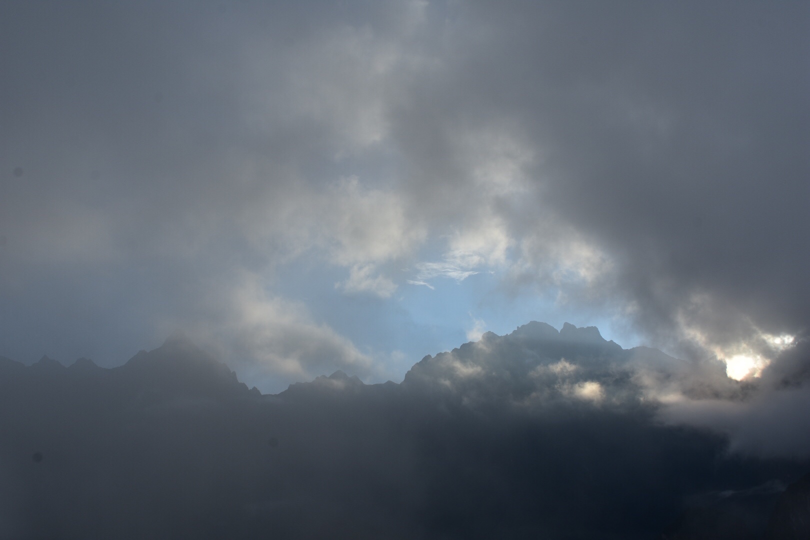
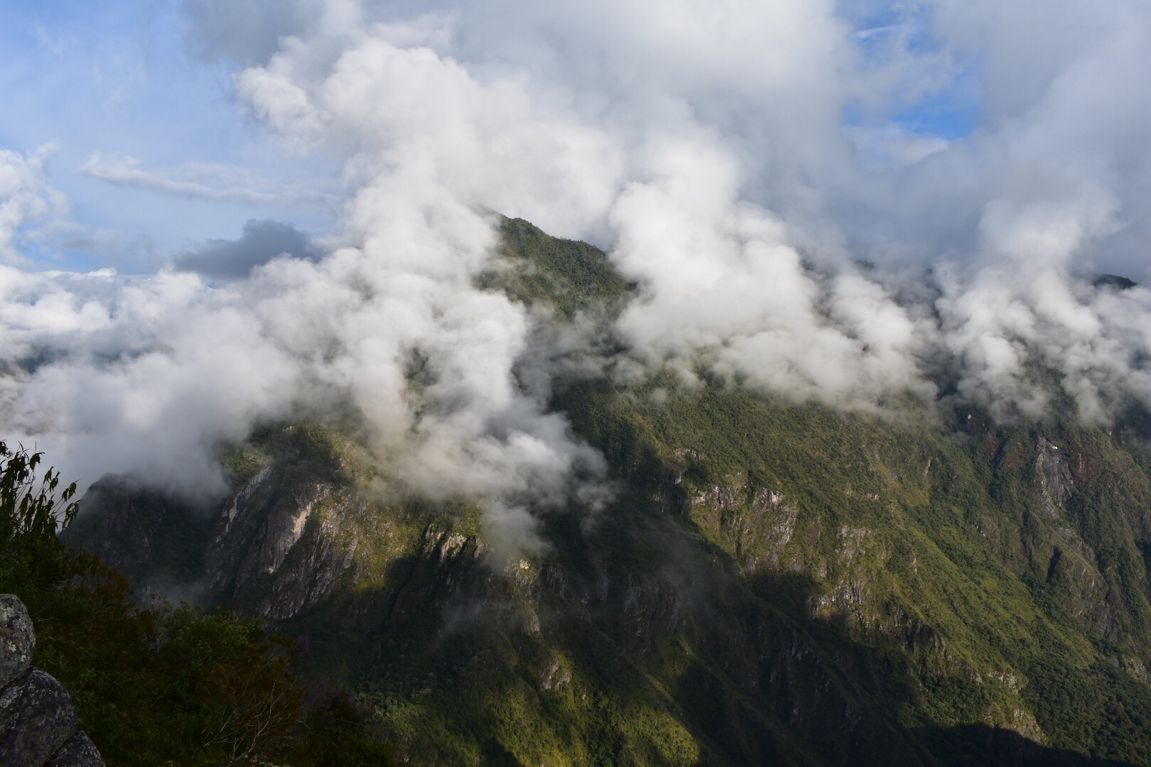
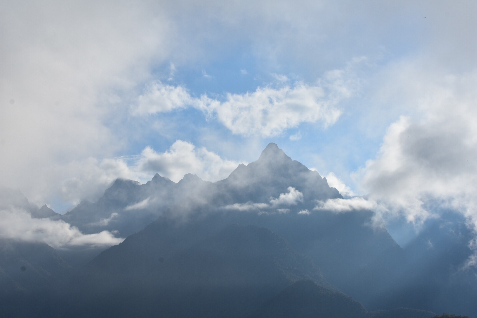
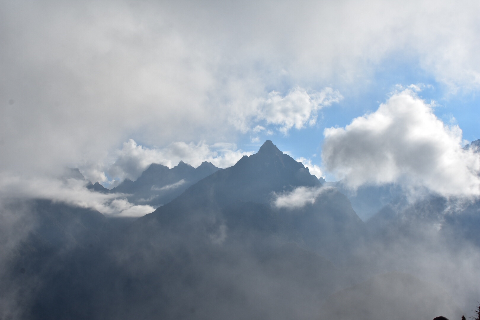
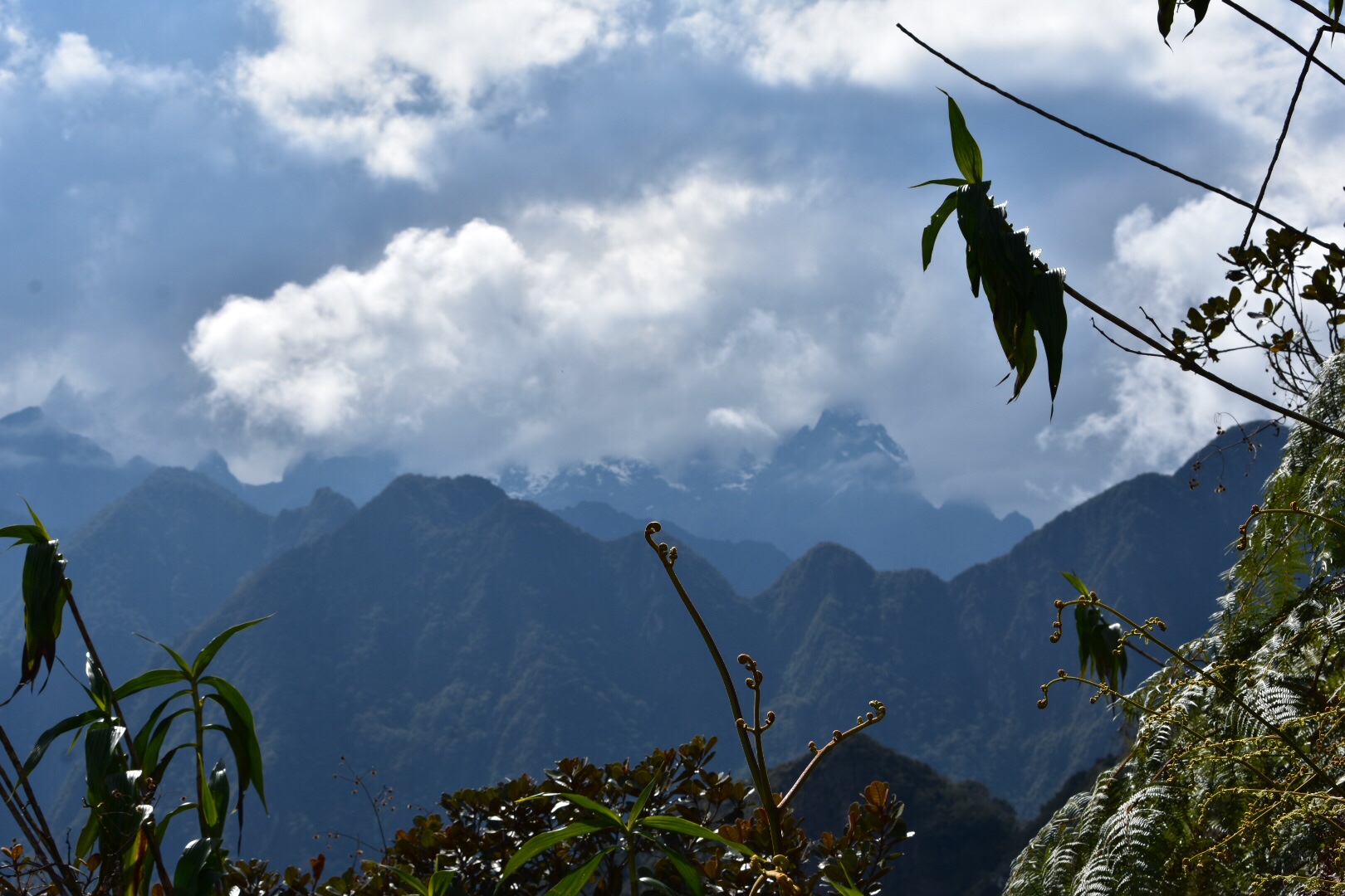
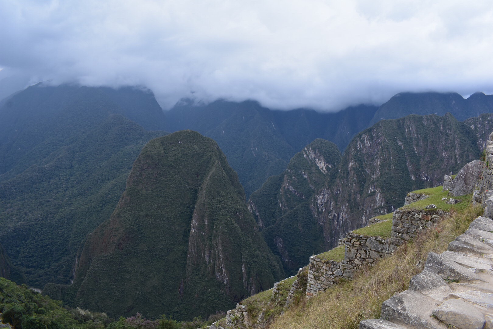
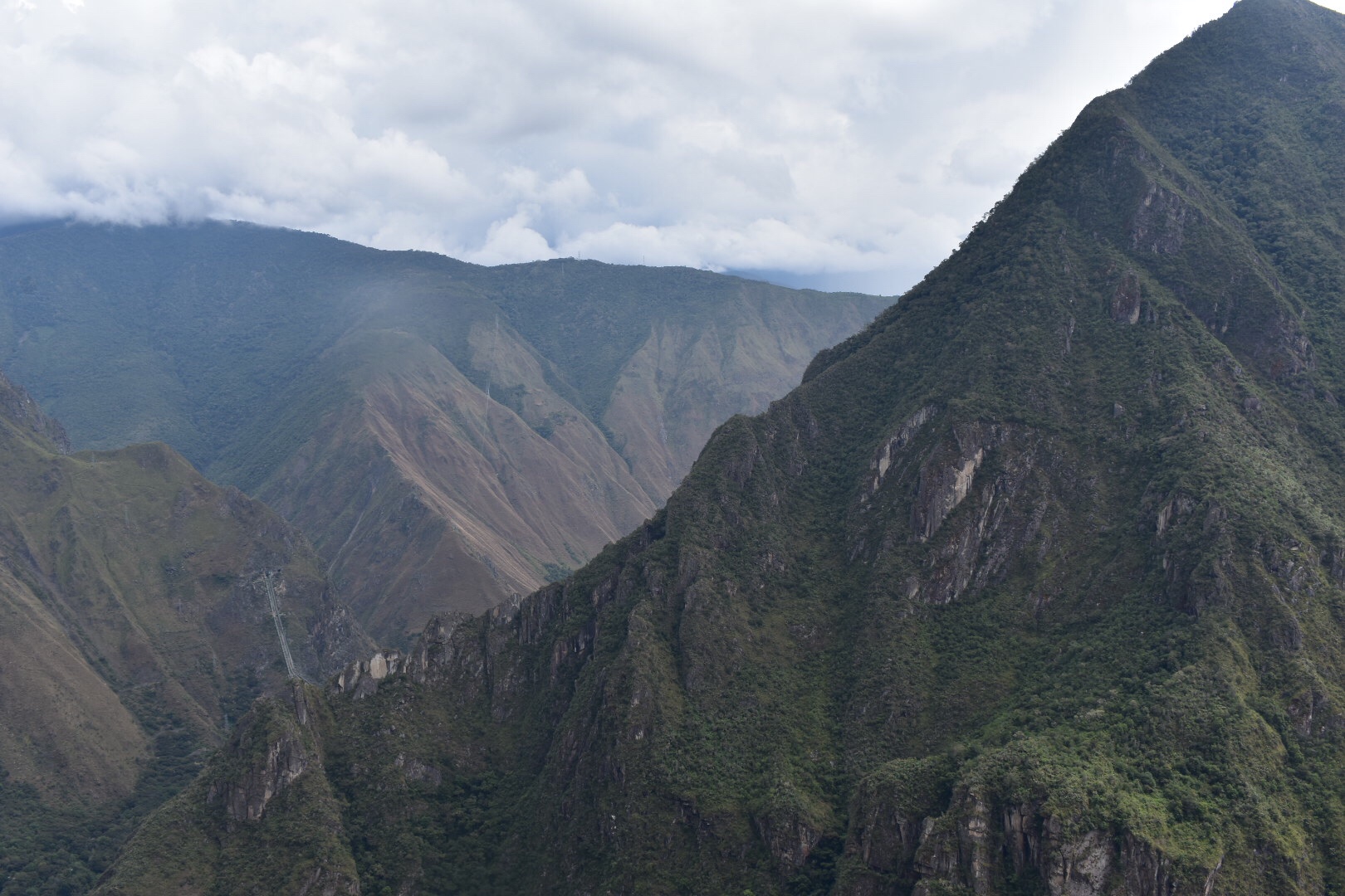
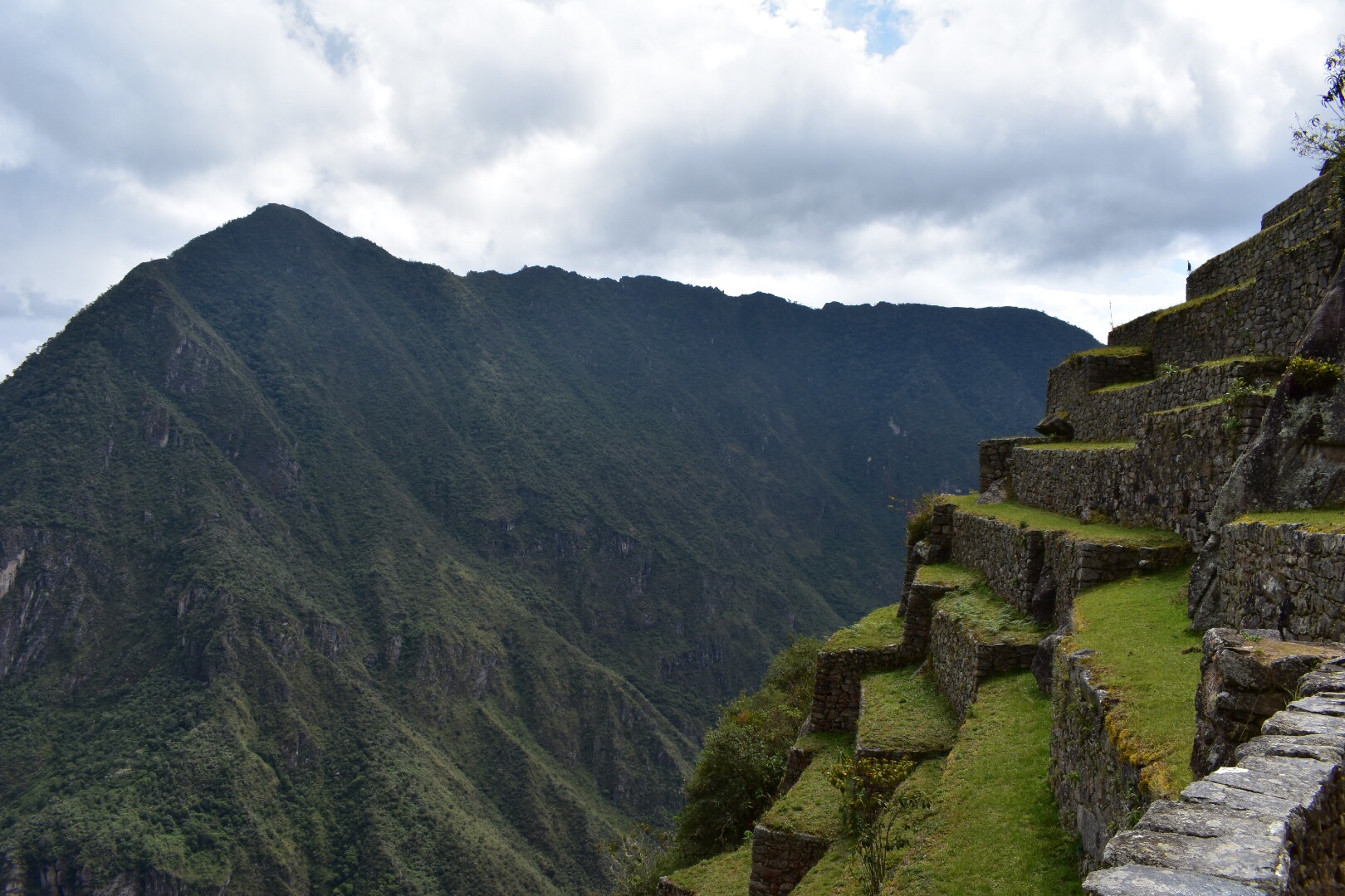
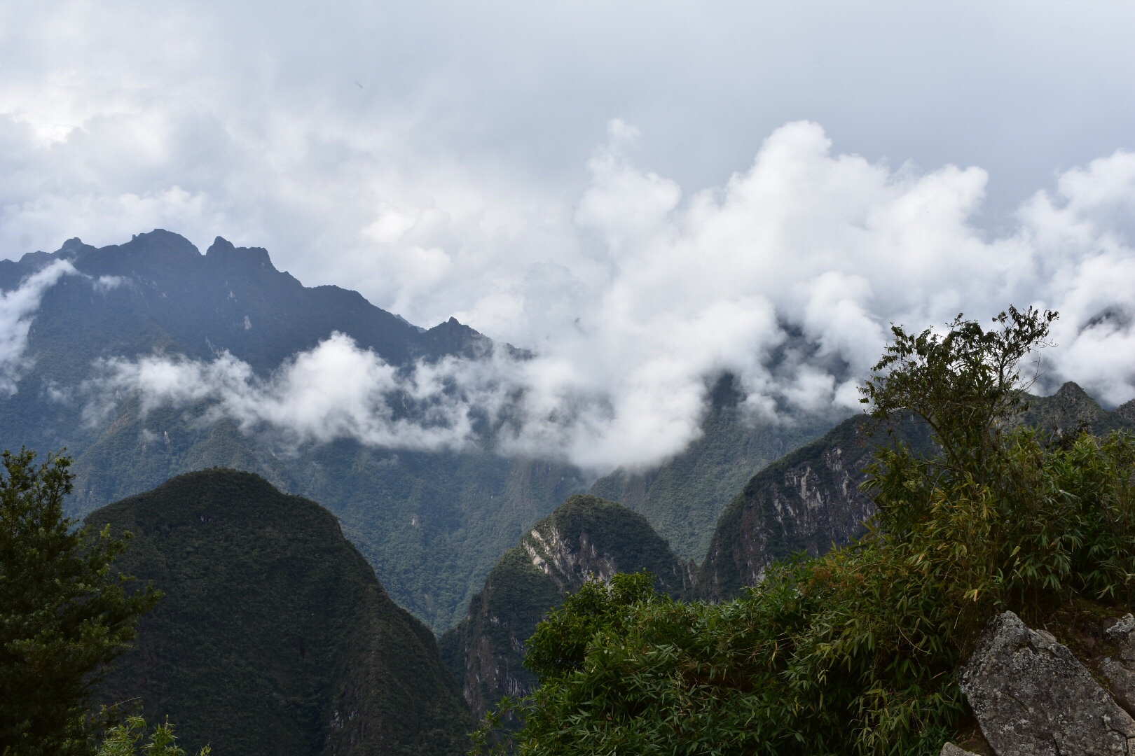
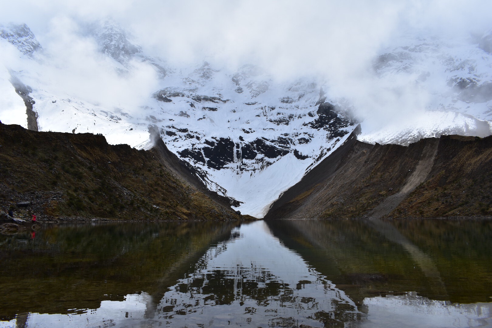
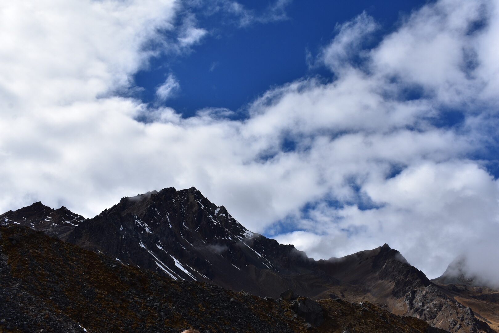
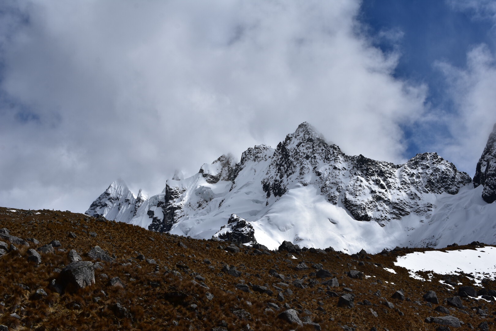
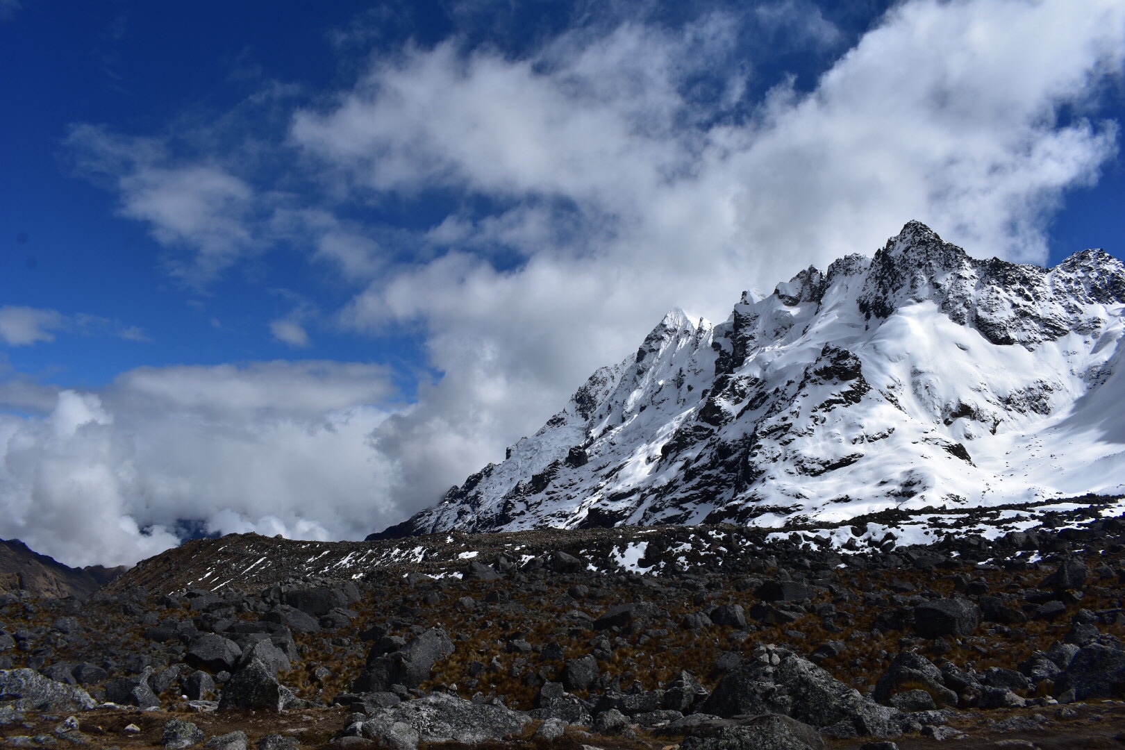
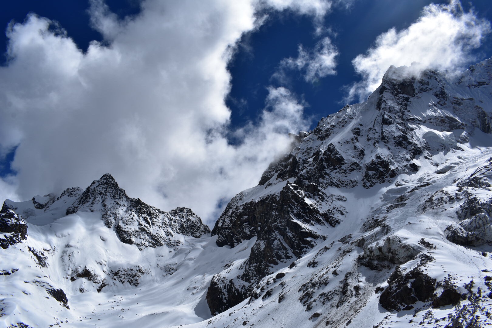
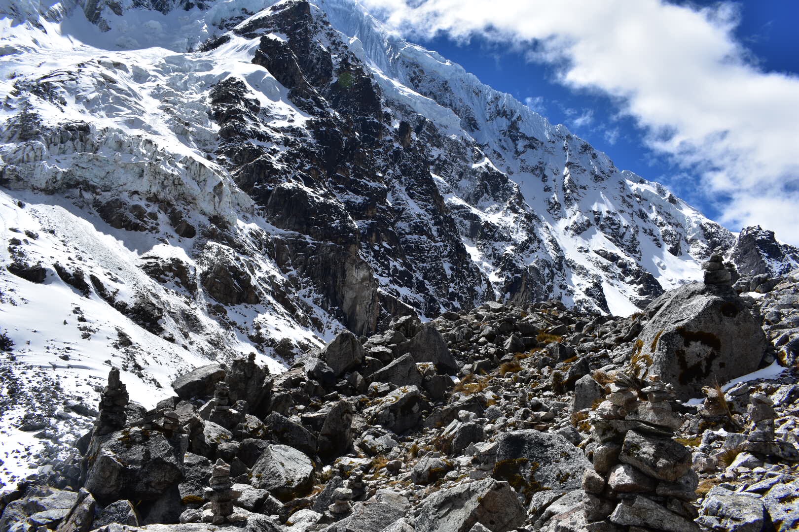
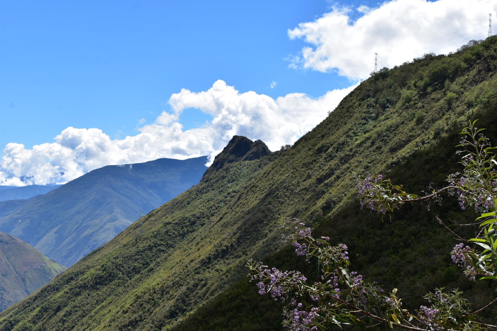
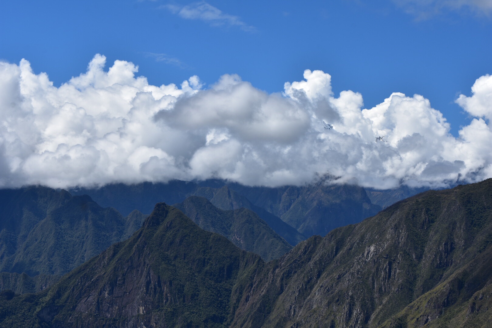
There was another hill with a fortification that I climbed up to. From here it was possible to spot the snowy peaks amoungst the clouds.

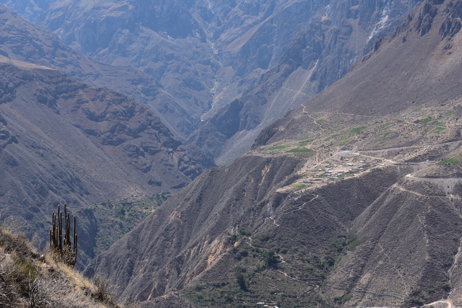
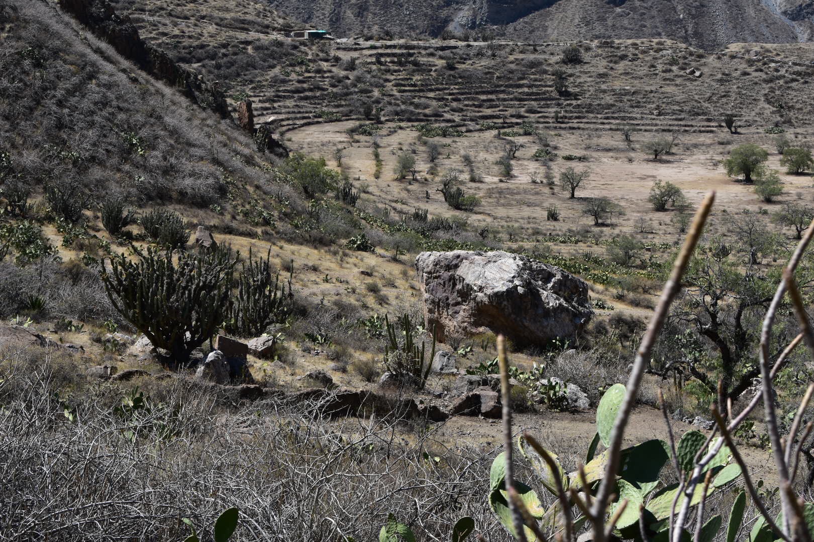
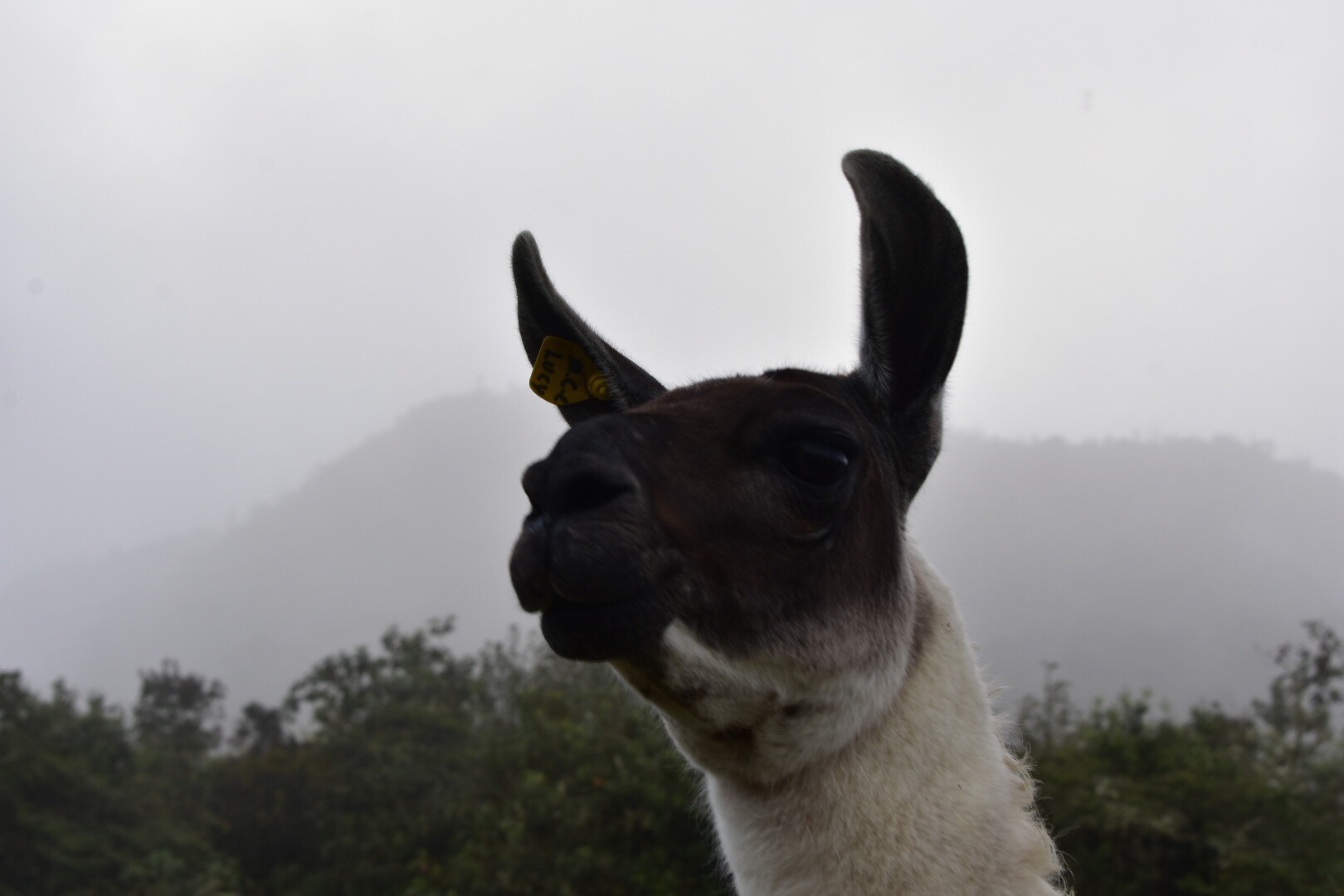
On the other side of the hill there is something called the Llama terraces. The Germans who I had met said they were worth visiting. I met the guide and group I’d got chatting to the day before and they said it wasn’t too far down. It looked pretty far but I wanted to go to the viewing platform I’d seen from above. It was really steep going down and I didn’t quite realise why it was called the llama terraces until I sat on the viewing platform. You can see for yourself in the photos below. It was hard work going back up, especially with the lack of water left, but eventually I made it.

Now i had run out of water I realised I needed to return back to the village. I wanted to see more of the ruins first so I took a quick sweep of the areas I’d not yet seen and then walked the 3.5km back to the town. It felt a lot harder than the Way there and there seem to be much more up than I remembered.

At the campsite l resupplied the water and ate. The lady who ran the camp site lent me a sewing needle so I could fix my tent. Afterwards I pitched it and had another early night.

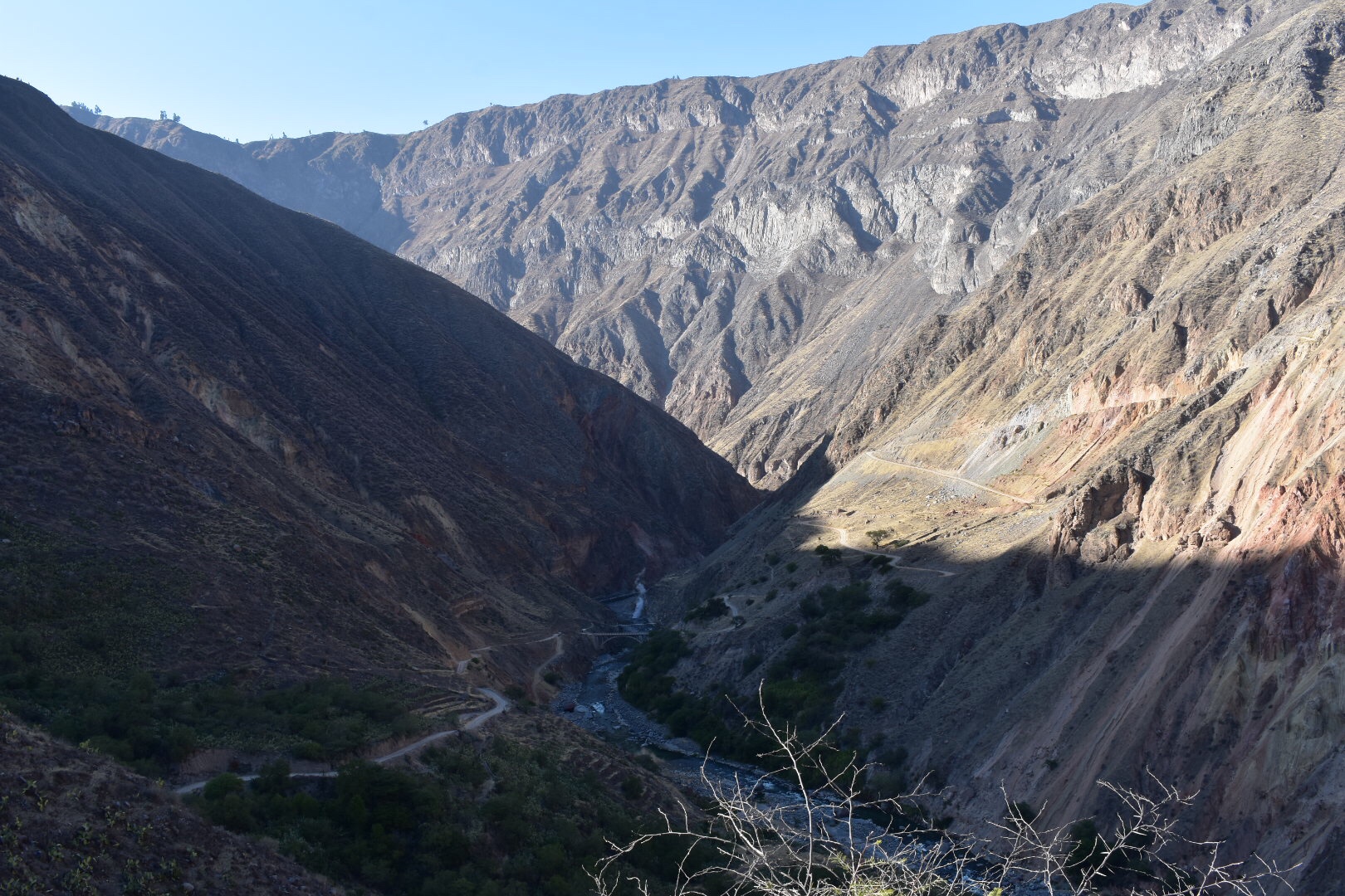
I couldn’t decide the night before whether to walk all the way back the next day or to camp as suggested by the guides. I awoke at 6, having a lie in, and left camp at 7am. I had to walk a full 16km to get out and 12km to the campsite I had planned to stay at. The first 6km was downhill and I hiked back to Santa Rosa in an hour. That was 4km and took me 2 hours on the way up. The last part was steeper and I took another 40mins to reach the river and had a decent rest.

I braced myself for the up and as I saw the whole mountain was now in the sun I kicked myself for not leaving earlier. It was only 2.8km to the next camp so I set that as my goal. I started across the bridge and there was a gentle incline for a distance which was harder than I thought and then the first switchback hit me. It was probably the steepest is the day but not really what I needed to help me get into the hike. I had counted 16 switchbacks but there ended up being more and soon I was up and the path was less steep to reach the next camp. I can’t remember how many times I stopped but I arrived much sooner than I thought. My water was hot so I replenished with a new bottle and stayed here for 30 minutes recovering.

My final camp was just over 3 km away and up another high set of switchbacks. I decided to go for it as even at around 10am it was getting really hot. By the time I had made it up the switchbacks I could clearly see the next camp which was just over 1km away and because I was feeling so tired and walking slowly I thought I’d stay there for the day. When I arrived a dog barked at me and changed my mind. It was only 11:20am and I’d walked 12 km so far with a heavy backpack. I thought I’d I could complete the route by 2pm then I’d be fine and I had 4km remaining.

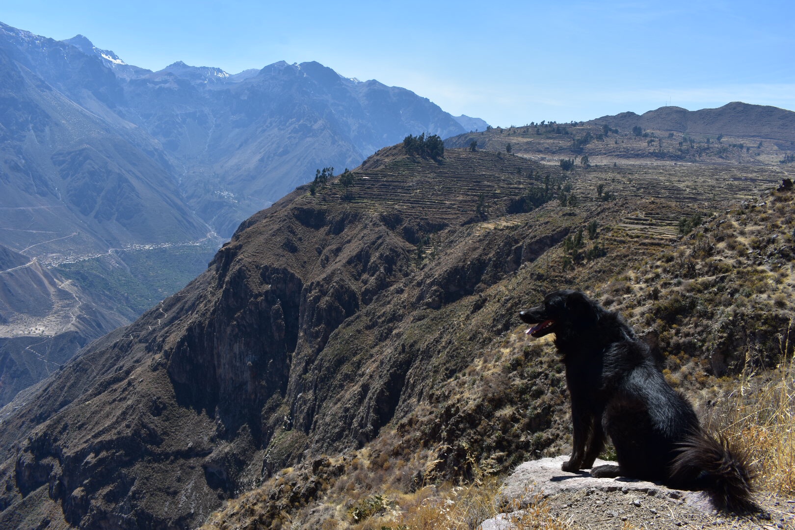
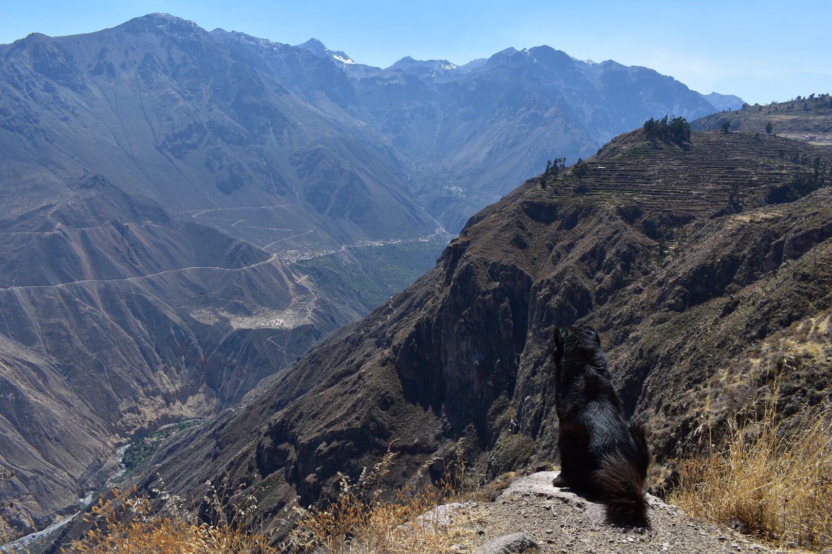
I replenished my water and set off at 12pm and by this point I’d gone slightly mad, talking to myself but just putting one foot in front of the other. I reached the top of the trail before 2pm and had been joined by a dog.

It was another 500 metres to walk back to the scattering of houses art eh start of the trail. There are a few shops/cafes and I chose one at random, ordering a coke. The lady ordered me a taxi which took nearly an hour to arrive, it’s a long way. We got chatting in Spanish. She was kind enough to speak really slowly and take the time to understand me. She let me go up on the roof to get better photos of the mountains and I showed her and her family photos of my trip. She had an older daughter and a younger daughter who was playing outside. At the end she gave me this Cóndor for luck for the rest of my trip.

I also took some photos of the mountains form the taxi. I returned to the hostel to meet the owner and she was surprised to see me so soon. I asked her advice on getting back to Cusco and took the taxi on to the main road. While there are collectivos you had to wait and it was at the point where it would be dark soon.

The taxi was dropped me on the main road, tried to give me the wrong change and left. And there I was standing by the side of the main road. It was quiet for a while and then a load of trucks passed and taxis. I was there for about 30 mins and it started getting cold and darker. A new grey car pulled up. I didn’t hear what was said but a lady in the cafe I was standing next to asked if I wanted to go to Cusco and indicated I should get in the car. So with that I decided I didn’t want to wait in the cold anymore.

I have since discovered all drivers are crazy in Peru. Thus man was driving from Lima to Cusco and seemed to be picking up passengers and dropping them off along the way. Did a while I thought I’d made a big mistake. He was nice but after showing me some, let’s just say interest Home made videos on his phone, I wasn’t sure I’d made the right decision. I decided that if I survived this journey then I could survive anything. There was one point when we stopped for food that I felt like I was in a movie and needed to escape. My Spanish wasn’t good enough to explain why I wanted my gag back, it was dark, I was in the middle of nowhere and he was going to Cusco so I decided to stay. After another hour 3 other people hit in who were going up Cusco so I felt safer and he did drop me off exactly where he said. Always trust in South America.

I returned to my hostel to get my things but it was booked out so I jumped in the taxi to another. By this time it was 9pm. I ended up in a dorm to myself, washed chAnged, went to McDonald’s and then to bed. It has been a long few days.

The Sacred Valley – Pisac, Urubamba, Ollantaytambo, Moray and Salineras de Maras

I was faced with a dilemma the day after returning from the Salkantay trek and Machu Picchu. I had three days left on my ticket, i brought a 10 day ticket for 130 sol, to see as many Inca sites as I possibly could but I was also exhausted and wanted to rest. I decided to male the most of both worlds and just head to Pisac which seemed to be the closest and luckily for me there was a colectivo just around the corner.

I don’t know hot much tours are to all of the ruins but I do know they run packages. I decided to go independently as often with tours you only get an hour or more to explore, although it meant I wouldn’t have a guide. I realise that some people find tours easier and better but I’ve been travelling long enough now to feel confident going alone and also I wanted to save as much money as I could and spreading the sites across three days suited me well. If you want to take a tour I’d suggest starting with the tour agency you used to book Machu Picchu as you will no doubt be able to negotiate a discount.

Pisac

You can easily reach the town of Pisac by collectivo. They leave from Puputi street which is on the east side of town and happily for me two streets away from my hostel Hospedaje Turístico Recoleta. It’s about a 15 min walk from the main plaza. There will be many companies wanting your custom and they leave when full, but you won’t wait long. Maybe try and find one that has passengers on board. The journey takes 45 mins and cost be 5 sols.

You’ll get dropped in the Main Street so head toward the main Plaza in Pisac and walk north from the left hand sided the town is quite touristy and you can easily make a day of it as they have markets on Sundays, which is the day I went, and buy lunch in town. I brought food from the market in Cusco which is one street across from where you catch the collectivo and there are lots of cheap delicious things on offer. The town is pretty scenic as you can see.

If you don’t have a ticket then you can buy one at the office, so just think if you want to buy a two day or ten day ticket.

You walk up to the ticket office from the left side of the square and then brace your self for lots of up from there. I actually thought this would be a nice relaxing afternoon but the site is huge, a lot of it is up high which seems to be the trend for Inca ruins. It seems they built their buildings for practical defensive reasons rather than considering the modern day tourist. I’d argue that’s an oversight on their part but nothing to be done now. Anyways I ended up walking 14 km that day and lots of the site is steep so wear decent shoes.

You start by walking up the terraces you can see below and then up a hill, more terraces and then follow a path that twists and turns past various buildings which are pretty spread out.

I saw some ruins that I thought were at the top so I decided to go up and then i could work my way down again. When I arrived I realised I wasn’t at the top and there was a path that worked it’s was along a ridge slowly going higher so logically I decided to follow this.

As you can see the path twisted and turned along the top of the hill. For the first time I saw that they had constructed stairs to assist with the ascent, so it must be challenging, and there was even a tunnel to squeeze though at one point. I was impressed by the Dad who decided to carry his baby along this route. I was using both my hands to balance and hold on but he seemed perfectly fine holding the baby and traversing the terrain.

I eventually reached the top and could see how large the whole complex was. Despite being tired the only logical thing to do was to go down and explore the rest which is exactly what I did.

I had a few false starts on my way back as I wanted to head back to the town without having to retrace my steps over the top of the mountains. The paths that appeared on my map that i tried first were all closed off to me but i found another path that went the long way around the ruins, but at least not the high way.

I eventually ended up retracing my stars back down to the town plaza and kept going straight. When i hit the main road there was a collectivo opposite that was going back to Cusco. I think you can also flag them down from the main road as they do go to other destinations. The return journey was also 45 mins and 5 soles and dropped me in the same location.

That night I went to Jacks and met up with everyone from the Salkantay trek who was still in town. The food there is great, I had cheese toasty, and although it’s not quite the same as back home it’s good if you are missing home comforts. I went back a few days later for some chicken soup.

Urubamba

The next day I had decided to travel to Urubamba a small town in the in the Sacred Valley. If you want to visit some of the ruins that are further from Cusco then it’s a good place to base yourself. I decided to take it easy and visit Ollantaytambo and Moray.

To get there I headed back to Puputi street and caught a collectivo, 6 soles, to Urubamba. It took the same route as the say before and passed through Pisac and after about an hour and forty minutes it arrived in Urubamba. I jumped out, left my bag in the hostel and returned to the bus station and caught a collectivo to Ollantaytambo, 2 soles, which is another 30 minute ride.

When I arrived I was dropped in the main plaza and there are ruins on either side of the valley. The ruins to the west of the plaza are what are known as Ollantaytambo so I had a little walk through the town and then headed there first and collected another punch hole in my ticket.

It was getting hot and I didn’t want to make the same mistake as yesterday so forgoing the option of a guide, one issue when you are alone is that it costs so much, I headed up to the highest point which surprise surprise was higher than I thought it would be. There is pretty much a one way route around the site so follow the arrows and you won’t miss anything.

If you do go all the way up to the highest point then it is well worth the effort as you get to see the Sun Temple but even more spectacular are the views. I even got to see a train wind it’s way through the valley as I realised this was the town that I had been dropped off in a few days before. Had I realised that I might have tried to plan the journey a little better.

On the way back down I spotted a church like building, it’s unlikely it was a church as the Incas were not Christian, but I decided to walk across the high pathway to get a closer look.

I had seen everything so I decided to check out the structures on the other hill. I had a quick walk across town and upon arriving I saw the sign that said it was dangerous and entry was at ones own risk. Still this was free so every cloud.

Again there was a steep climb and the steps were not the best, I suppose there is no funding to maintain this area, but there is a one way system to follow. When you can take the first right. Don’t do what I did and go the other way as you will just end up with people telling you that you are going in the wrong direction.

The path takes you around some fort Like structures on the right before winding around to the left and heading towards the bigger structures. It’s a very narrow party with some big drops so not for the faint hearted.

After feeling tired due to walking up mountains and running around for most of the day I decided to head back to Urubamba to relax. My hostel looked really nice and I wanted to take advantage of it. It took me a while to find the busses as the place I thought I was told and the stop on the map was not where they were. If you take the road from the south west corner of the plaza one block towards the market then you will find a load of collectivos heading back to Urubamba, again 2 soles.

I decided to do some home cooking and just have a small lunch of sandwiches so scouted town for supplies. I’ve still not quite worked out how Perú works with timings of shops and what each shop sells and this was the most difficult town so far but soon I found everything I needed and it enabled me to have a good look at this pretty touristish town.

I mentioned above that the hostel was a relaxing place to stay and with me being only one of two guests I had a private dorm and the place to myself.

And this was the view from my room.

Moray

The next day after breakfast I decided to visit Moray which is close to the town of Maras. Now there is no direct public transport to Maras from either Cusco or Urubamba. As I mentioned above there are several ways to visit but I’ll only outline the trip I took.

I went to the bus station and found a collectivo going to Cusco via Maras and it cost 5 sol to get there, which is expensive considering it’s not far. You get dropped off at the turnoff to Maras and there are taxis waiting to rip you off, I mean take you to the sites. I was quoted 70 soles to visit both sites and to be fair it is a 3 hour and 30 km trip. I was dithering about what to do and badly trying to negotiate a cheaper price when another car pulled up and Veronica from Uruguay stepped out. We decided to split the fair which meant we paid 35 soles each, still more than I wanted to pay but only half as bad. Again this is a situation where it’s cheaper to travel in a group. Anyways soon we had arrived and on the way I started to see the mountain range properly for the first time and I was really glad I had come.

Again I’ve not really done much research so when we arrived we went out separate ways and explored the site. It’s largely circles in the ground built as terraces, which at other sites would have been used for growing food. But I have a feeling this site has more signifance.

Above are photos from the main section but as you walk around there are a few other sections, again built as circles.

We spent and hour exploring and towards the end all the tour groups showed up. Again I don’t have a problem with that but if I can I like to explore with less people. It makes for better photos and means you don’t have to jostle with others for space.

Salineras de Maras

The last stop on my little tour was Salineras de Maras. Now this is a working site and I’ve been told that the salt harvested, no idea if that is the correct term, is sold in Cusco and across the world. I’ve not seen any evidence of this but I’ve not really looked for it elsewhere. Note that this site is not included on the Inca sites tickets and costs and addition 10 soles for entry. The taxi took is straight into the site but first we had a look from above.

We then went down into the valley and got to see the little fields upclose. There is water running through the whole site and you can see people working in the fields, creating big piles of salt that I then assume is packaged and sold. Veronica and I took our time and I was fascinated by the colours the salt creates on the mountain landscape.

Afterwards I treated myself to my first Inca Cola. It’s the best selling drink in Peru apparently, although still made by Coca-Cola, and is a bright yellow colour. I felt it tastes very similar to Iron Bru but it’s been a while since I’ve had one so don’t quote me on that. Just try it, you might like it.

We headed back to the main road in the taxi where we parted ways. Almost straight away a collectivo, 3 soles, pulled up to take me back to Urubamba where I returned to the hostel and collected my bags. Afterwards I headed back to the bus station and jumped in another collectivo to Cusco for 6 soles. This one took a different route and I was dropped 2km from my hostel which I decided to walk.

Machu Picchu

The alarm went off at 3:30 AM and despite having gone to bed early it still felt crazily early. We all met in reception as agreed at 4AM and there were already people outside heading towards to the entrance line. There are actually two lines, one for the busses in Aguas Caliente, and another by the bridge that forms the beginning of the path to walk up to the ruins. Not wanting to spend an extra $12 each way and having walked this far I of course opted for the latter as did everyone in my group. This meant you had to walk an extra 25 minutes out of town and then for around an hour up stairs to the location of Machu Picchu.

The doors at the bottom of the hill for walking open at 5AM, the doors to Machu Picchu open at 6AM and we were due to meet our guide, Renzo, at around 6:15AM by the guard dog as far as I could remember. The real name of the place changed so many times in my head during that climb that I decided to do what I normally do and just follow everyone else.

We arrived in the line around 4:30 and the doors opened for us just before 5 and then it was a long hard slog to the top. I know I always say I prefer going up, a lot of the time I lie and change my mind, and this was one of those times. It wasn’t easy. And the fact that most of it was giant steps didn’t make it easier. I do actually hate hiking on Inca Trails, mostly because walking on actual earth is 100 times easier than lopsided stones and broken steps. I suppose these guys didn’t really think to build things to last…joke.

We had one champion, Claudia, who is amazing at uphill climbs and she actually beat the first bus up. It took the rest of us around an hour and we overtook a tonne of people who stopped to rest ahead of us. I don’t think anyone stopped on the way up which is not easy going.

As we went up the sun began to rise and as I had feared when I couldn’t see any stars earlier there was a lot of cloud cover. Still I decided to keep the faith with my weather luck, that’s been blowing hot and cold recently to be fair, and you can see the sun trying to break through the clouds.

We waited patiently to enter and people pushed forward as they would to get into a theme park. We went up to the Guard House, that’s the name, as instructed and waited for Renzo to arrive. As the did instead of breaking through the clouds the weather took a turn for the worse. I actually found it quite funny and it was gave the ruins a really spooky atmosphere.

Then it got even worse and this was the view from the top.

But at this point Renzo arrived. He told us that this wasn’t unusual for the morning and he thought it would be a good day.

So the thing about Machu Picchu is that there are 4000 tickets available each day. 2000 in the morning and 2000 in the afternoon. You get to walk around everything once, however, as I had a Machu Picchu Mountain ticket it gave me extra time and meant I could leave once and return. It’s $15 extra and even if you don’t want to climb the mountain it’s worth buying as there are no toilets on the inside and if you leave, then that’s the end for you.

As we couldn’t have a guided tour of the complex, because it would have meant that we would all have had to leave after. So instead we sat at the top and Renzo gave us a history of the Incas and Machu Pichu. We had an extra friend join the group.

Luckily for me during the talk the sky began to clear slowly.

And then it was time to take some photos of the city with a better view.

We decided to head over to the Inca Bridge. I wasn’t and I’m still not 100% sure what it really is but it was beautiful.

We then walked around the mountain back to the city.

At this point it was time to say our goodbyes. I had to head up the mountain in my allotted time slot and the others needed to do some more exploring before they headed down to the bus at 11am. I was joined by Yara who also had tickets. It was a short walk and these were the views on the way.

A huge part of me couldn’t quite believe that I was about to climb yet another mountain after all I’d walked over the past two days. But here we were. It wasn’t far, less than two kilometres but I’d been caught out by that before. And so we started on the up, it was tough going, especially for me and the sun was hot. The path was really difficult at times plummeting away at times. But the views got better and better.

We were told it would take 90mins to 2 hours to reach the top. I think we did it in just over and hour and then we collapsed at the top to rest.

And then it was time to return the way that we had come. When we reached the bottom we started out to the Sun gate but it was at that point when we heard the thunder from across the valleys. We decided to see the city before the rain hit.

Tara and I started investigating the ruins and at this point the rain hit. I realised that I’d left my rain jacket in my bag in Aguas Calientes. I had brought my waterproof trousers so at least my bottom half would be dry. Luckily the rain didn’t last so after waiting it out I got to see more.

And we kept wondering more.

And found some evidence of how archeologists are rebuilding the site.

And there was more.

As we neared the exit there was a part which has yet to be rebuilt and you can see how the ruins would have been when they were first rediscovered.

And then is was time to leave and we started heading back down the stairs to Aguas Calientes. Yara pointed out that we have been walking on stairs for 5 hours that day. If I ever hear anyone from the office moaning about having to climb five flights of stairs when the lift is broken…

It took an hour to get back down. At which point it started raining so I put on my waterproof trousers to keep my bottom dry. I stripped down to my hiking shirt and wore sunglasses and a baseball cap. I have no idea how insane I looked to anyone else but I’m glad there were no mirrors. As we arrived in Aguas Caliente the downpour became really heavy and I just about made it back to the hostel as the real storm hit which I was lucky to escape.

I passed the time for the train by rewarding myself with a pizza before I joined a very soggy crowd of people in the station. On the way back I was treated to a man as a dancing bird and a fashion show. I was to tired at this stage to even contemplate this so did my best to ignore and I later found out that I must have been in first class as the other carriages did not get this treat. All of my batteries had died, so no phone, camera or anything else to distract.

The train took more than the 90minutes to get to Ollantaytambo, which I realised I ended up visiting two days later, and then I found my driver because he spotted me. We couldn’t find the others so he took me to the minibus and there I waited for him to locate the others. Having a card with our names on it seemed not to be an option. Still as with everything in South America it all worked find and he returned with the other passengers.

We drove back to Cusco arriving around 10:30 and I made it back to the hostel ending one of the longest days of the trip. Excluding he first one. And there we go, a magical experience and having ticked of visiting somewhere I’ve dreamed about for so long. Is it the best thing I’ve seen in South America, no, possibly not even I my top 10 but 100% worth it and I don’t think there is a possibility that I couldn’t go.

Salkantay Trek to Machu Picchu

I decided to take a guided tour of the Salankaty Trek to Machu Picchu with Machu Picchu reservations. It’s by far the most popular trek due to The Inka Trail, and let’s be honest there are hundreds of Inca trails, I’ve already walked them in Argentina and Bolivia, being booked up 6 months in advance and being 2-3 time the price. I’ve been told this is more beautiful but I’ve not hiked the Inca Trail so I don’t know. The main difference is that the Inca Trail takes you directly into Machu Picchu via the sin hate and you get to enter before the crowd. I’ll come to that in the next post about my time at the ruins but first I’ll show you how I arrived there.

There was a briefing in the office the night before at 7pm where we met our guide Renzo and everyone who would be on the trek. I was lucky enough to be sat next to Alice and Sam, an Australian couple who were heading home the Kong Way after having lived separately in London and Canada and were tonnes of fun. At the briefing they reiterated a few things to pack and gave us our bags for the horses. Yep we were gonna get pack animals which made a change for me. I went bag to the hostel and figured everything out ready for my 4am wake up.

I was the first on the bus as everyone else was staying in hostels close to the office. I was son joined by everyone and despite leaving a little late we were on our way to the breakfast site. It was around a two hour journey and then we arrived at a store to buy last minute supplies and then stopped for breakfast. I was pretty tired but made awkward conversation. There I met Alex and Yasmin from Germany, Henry, Kiera and Javneeka from England, Claudia from French Canada, Yara from Holland and Joe and Alisa from the US. There were 17 of us in the English speaking group. We were separated from the Spanish speaking group which was a shame as it’s one reason why you come travelling but we broke the rules and all joined up later on.

After breakfast we jumped back on be bus and there was one more hour until the starting point. On the way it began to rain so when we arrived I decked out in full waterproof clothing and quickly realised it wasn’t going to rain just yet so took them off again.

We stopped to take our first group pics.

There was a short walk along path before we reached the bottom of the hill we would have to walk up. Again, I use hill in the loosest possible terms. I can’t remember the exact elevations but everything was over 4000 metres. We were told today was a test day, that we could walk in our own time and to meet at Largo Humantay at the top, which is at the base of mountain Humantay. It was a steep climb and as I’m not used to hiking in a large group I wasn’t sure what pace to start at. I was talking to Alice afterwards as I was impressed with everyone’s hiking. Different people led, found it hard and found it easy at various points and as a group we were pretty good. I’ve done a lot of solo hiking and been able to keep my own pace but there were definitely people better than me and for some it was their first multi day hike. I found it tough at times when others found it easy so the lesson learnt is never underestimate anyone. So I set off at my own pase and I found i was at the front of the pack but I’d walked in this elevation before. And then it hit me. I was so out of breath, but at least I didn’t need the horses to reach the top.

And then we reached the top and all the pain was forgotten. We were given time to explore whilst everyone arrived so I looked around and then climbed up the ridge with Sam, Joe and Claudia. After Renzo introduced the area and waited for all the other groups to leave so that we had the lake to ourselves. There were also many day trips here as the lake is one you can do in a day if you wish.

After the talk we were told to meet at the bottom of the hill. I’m bad at going down and because the ground was a little wet it was made more challenging.

After we reached the bottom it was probably a few more kilometres to our camp and we headed in to the mess for lunch. The Spanish group was in the room next door and in true Latino style they were making a lot of noise and having a lot of fun. We however got to meet the animals, two puppies and a car who tried to eat all of our food.

The food on the trek was delicious, each meal had at least two courses one of which was a soup. Considering the chefs had to carry all of the food, cook for around 30 plus people on tiny camp stoves, clean up and then get to the next camp ahead of us I was hugely impressed. The food was so good.

We also discovered at this point that our bags had not arrived due to one of the horses running away. Luckily it didn’t have our baggage with it when it ran. Renzo and Tony, our other guide, managed to find some more guys with horses that brought them last minute and carried our bags saving the day. None of us minded as we couldn’t carry our own bags and if anything did go wrong it was sorted quickly.

As the group paired of into cabins I was left in an awkward position as the only single boy. Luckily for me Sam bad Alice offered for me to share with them so I didn’t freeze on the coldest night.

I had noticed that the sky had started to clear so went on a walk. I wanted to head back up to the lake as the whole mountain range was clear now but I was told it was not a good idea as we were rapidly losing light. It was probably a good thing too as I probably would have struggled to make it up there again. I took some photos from the bottom of the valley instead.

As I headed back to camp I Renzo was leaving with three girls form the Spanish group. Apparently one of them was really sick with altitude sickness and he was quick to get them down. I could see that Salkantay had also cleared. I walked up the hill behind our camp to get a better look and met Ennio and Alessandro from Chile and Timo from France and took the following pictures.

Arriving back at camp I was pleased to find that the luggage had arrived with the new set of horses. We were treated to tea where the groups mixed a little more and then separated again for dinner, after which everyone had an early night due to our 5am wake up call.

The next day we were woken at 5am with hot coca tea and as I left the tent the sky’s were clear but this was quickly replaced with mist that came rolling out of the valleys. Today would be different as there was no high level cloud so the sun made quick work of the most. After breakfast we started hiking and soon made it to our first stop where there was a clear view of the mountain and a chance to buy local goods.

As we left the valley we were told we could take the less scenic quick route or opt for the gringo killer which was a longer steeper path. I opted for the latter as I was told it would give better views and it didn’t disappoint. It was also on this section where we can across a lot of pack horses so I took the opportunity to photograph.

And now we had nearly made it to the top. After a short rest stop we started the final climb to the top of the Salkantay pass.

And here are the views from the top of the pass. Yep we had made it all the way up to 4600 metres.

We were given the option to spend more time at te top of the pass or take a short side trek to see another lake. Thinks something that not many groups do based on the amount of people there. I’m really glad we did as we got closer to the mountain, hiked in some snow and saw these amazing views. Sadly despite my nonstop stalking about it no one was really interested in helping me to build a snowman.

And from here it was all downhill to the lunch spot. We left the rocks and the snow behind and the valleys started to turn green again. The rest of the day for me was very reminiscent of the El Choro hike I did in Bolivia, which is not a bad thing as both are beautiful. Also there were some great boulders to be found.

We stopped again for lunch as the chefs had managed to get there ahead of us as well as clean up after breakfast and cook out food before we arrived. To be fair they were not taking photos but still its an amazing feat.

While we ate it started to rain a little and the clouds rolled in blocking the views of the mountains for the trip down. I was gutted as the scenery turned to jungle it would have been amazing to see the snow covered mountains and the same thing happened to be during El Choro. I later found out that the group that left the day before didn’t see the mountain at all so we were really lucky with the weather.

After a long 22km we finally reached camp and most people grabbed a beer as a reward. Again it was a quiet night as everyone was exhausted and needed to relax. It was much warmer here so I waited to find a tent to myself. I totally wast ditched in any way.

That night we were offered the chance to switch up the itinerary meaning that we traded a boring walk mostly along a road to have a harder hike on day 3 and a more restful day on day 4. Everyone went for the switch so on day 3 we hiked along the Inca path. It all started very sociably and we were invited to try some of the loca coffee and see a lot of how it was made.

Then after the coffee we had a gruelling walk up to the top of the mountain in the heat.

But yet again it was worth it and we had our first view of Matchu Pitchu.

And after a brief rest we started heading down and stopped at some ruins along the way. This was a defence outpost for Matchu Pitchu as there were only two entrances, with the inca trail being the other.

After hiking downhill a little more we came to the second viewpoint.

And then it was a long long hike down the mountain with tonnes of switchbacks which was hard on the knees. After an hour or more of steep downhill we made it to the end point for the day.

We were driven to the lodgings for the day, had an even more amazing lunch as our chef team had a proper kitchen this time and then something rather unusual for me, we went to some hot springs to relax. This hasn’t happened to me on a hike before and I have to say it was definitely a high point. Sadly I don’t have any photos but you don’t really want to see me in my trunks, well actually Sams as I had neglected to bring mine and he kindly offered me some. At this point Alice and Sam were looking after me like I was a child which is something I do seem to excel in!

When we got back we had dinner and then there was a party, when the WiFi could load the music. For once I was fairly well behaved as I was thinking about zip lining the next day. It was good to dance, mix groups and there was some limbo and even random line dancing broke out when another older group joined us on the dancefloor.

So we awoke the next day to a mysterious poo next to one of the tents, some hangovers and the most glorious blue skies of the hike. There was also a parrot hanging about over breakfast.

So to challenge my fear of heights I signed on to the ziplining with Alex, Yasmín, most the Spanish speaking crew and Jaz who would be my rock though the process. I was kinda fine until a saw the harnesses and realised that there was sewing between me and a nasty drop to the valley below. We kitted up and jumped in the van to the first line which was over 400 metres in length and it was at that point when both Jasmin and I thought we had made a huge mistake.

I couldn’t really bring my camera and I don’t know if the photos do it justice but the lines are so high over the valleys it’s crazy and also this is Peru. The last time I did anything like this was Centre Parks where I expect the safety standards are different and whilst I have full faith in the lines and the pulley, which I know can take a lot of weight, my mind kept coming back to the harness stitching.

The fearless Chileans went first and Jaz and I were second to last to give me plenty of time to think about death. This was compounded during the safety briefing that said if you didn’t make it to the other side then you needed to grab on or we would end up rolling back to the centre of the valley. All I could think about was flying around in the middle in the wind.

Needless to say I did the first one and it was so much fun to be flying so high across the valley sewing the river and all the houses below. There were 6 lines in total, a scary bridge and a 30 metre climb. My fear of heights is not quite conquered but it’s much better than it was.

We met up with the rest of the group, who had spent the morning trekking, for lunch and then started walking the final 11km along the train tracks to Aquas Caliente, a small town at the base of Machu Picchu. If you don’t do the Inca trail then you will end up here.

After a long hike we ended up at this sign thinking we had made it but there was still more to go. It wasn’t helped by the road being blocked due to a tourist bus having crashed earlier. Thankfully reports were saying that no one has been badly hurt but I’ve not seen any news reports to confirm this.

After another 30 mins we had finally made it to Aguas Caliente.

We would spend tonight in a hostel and glorious bed. All there was left to do was to buy supplies for the next day, eat dinner and be ready to get up at 3:30am for the trip up to Machu Picchu.

Cusco, Sacsayhuaman, Q’enqo, Chuspiyoq, Puka Pukara and Tambomachay

Leaving Bolivia was tough as I’d been in the country for over two months but also it was the longest time I’d been in one place due to me jumping back and forth between Chile and Argentina. The border crossing was easy and quick and although there was some kind of fiesta going on making this the must chaotic place I’ve crossed into any country we were soon in Peru with no bag checks, another hour travelled back in time and a new stamp in my passport. Although I took the night bus from Copacabana to Cusco there was a two hour stop in Puño where I was able to buy a SIM card and start getting used to Peru. I was sad to discover the crisp flavours were the same as Bolivia so this rules out staying here long term.

Back on board the bus i didn’t get s terrible nights sleep and this time after arriving at the bus stop at 6am I headed straight to the hostel. They let me in but I couldn’t check in until later so after killing a few hours online I headed out to find to get some breakfast and then find a city tour. I stopped at a cafe and had a delicious empanada.

There are a few city tours in Cusco and I had been given mixed messages about where to find them and which one to go on. Heading across to Plaza Mayor del Cusco I found a few people walking around looking for people to join them. I decided I wanted to join a tour with more than just me or two other people for once so I headed to the last location I’d been given, Plaza El Regocijo, and there I found a big group of people waiting to go on a tour. So I joined the Inman Milky Way tour. It was pretty good and took us around the major sites, despite the fact on this Sunday there was a huge celebration going on in the centre of town.

On the tour I met Camila and Fei and we decided to head to the market for lunch. After we decided to head up to the ruins on the top of the hill just outside of Cusco. The climb is quite steep but it does give you a beautiful view of the city.

Sacsayhuaman

Sacsayhuaman is a citadel that was built around 1100 and then used by the Incas. It’s the closest ruins just outside the city and it’s only a 30 minute walk up a steep hill, you can get the bus but unless you really can’t walk up the hill then getting the bus is cheating.

The entrance fee is either 70 or 130 soles. This gets you access to a multitude of attractions and I’ll be covering some of them in the next few blogs. The 70 sole ticket gets you two days to visit all of them and the 130 sole ticket gives you 10 days. Don’t do what I did and go on the Salkantay trek halfway through or you will be hard pressed to see everything.

After the fortress I went around town visiting the agencies I’d been recommended by various people. I was shocked to find they were much more expensive than I had anticipated. A couple of places were closed and I admitted defeat for the night and decided to try again the next morning. That night I went for a BBQ at Fuis hostel and as my new friends had early starts for their treks in the morning. I went to bed a little defeated as I hadn’t managed to book a trek and it was going to be much more expensive than I had anticipated. Then again, everything is.

I decided to sleep in a little, i wake up really early here, especially as I’m processing another time change, had breakfast. Packed for my hike and headed out to book a tour at 9am. I went to another agency that had been suggested and they seemed as if they didn’t really care wherever they had my custom or not so I headed back to Matchu Pitchu Excursions and booked. Following Alexas advice I decided to get the train home and booked a hike up to Matchu Pitchu mountain. This cost me an extra $100 but in the end it’s worth it. If you get the bus back you have to leave Matchu Pitchu at 11am, hike 11 kilometres, and spend up to 7 hours on the bus on the sketchiest of roads. My ticket enabled me to enter twice and stay longer but I’ll come to that in the post.

It was now close to 11am and I decided if i was going to start the hike it was now or never and I left feeling as if I had been ripped off as I’d spent twice as much as I thought I would. This is advice based on other travellers but they did the hikes in a quieter season where it is probably cheaper.

Q’enqo

I again hiked up the hill towards Q’enqo, my first stop, this time I followed steps and it was one of the steepest climbs I’ve made so far. I reached the top and nearly collapsed so decided to rest and have the first part of my lunch. I followed the trails on Maps.me to the site and found it nearly deserted. There was me, one other guy and a couple having wedding photos taken, you can see them in the photos below. I soon realised that I was on an area that was not quite part of the official site and climbed up to where I could see all the tours. A man pointed me to the entrance and I had a quick look around and had another hole punched in my ticket.

The next site on my list was Puka Pukara. It was only around a 4km walk so I followed the maps suggestion and I was glad that i did as I got to see some extra places. I walked up another hill and a man spoke to me. I thought he said that i couldn’t use the road but i realised he was offering me a horse ride. So if you don’t feel up to it then you can always take horses.

I continued up the road and saw some people in the field to my right in the distance. I quickly checked the map and it showed some ruins so I decided to follow and found some more things to look at.

There was a huge area to explore but knowing I was about to start a 5 day trek tomorrow and thinking I had to return by walking I decided to continue.

Chuspiyoq

After walking another kilometre I saw people down in the valley I had wanted to visit. I saw a wall and a few ruins so decided to hike down there from my position on the hill and was pleased to discover the small fortress of Chuspiyoq.

After spending a bit of time exploring I walked back up the hill/mountain. I have no idea what constitutes as what at this altitude. I found the path and continued through fields full of sheep and llamas and people working.

Puka Pukara

Before long I was starring at the ruins of Puka Pukara. Annoyingly there were lots of people walking around so I sat down in a field full of llamas ate my lunch and waited for the perfect shot to appear. One thing about Cusco is that as it is so busy you rarely get any views to yourself. After I went in and explored.

Tambomachay

The last place on my route for the day was Tambomachay. It was a short walk along the road and seemed to be a place where the Incas made water fountains. I suppose one problem with doing this all solo is that without a guide I didn’t really know what anything meant. It was also getting really cloudy and cold at this stage so I didn’t spend too long.

I noticed that there were a lot of busses running along the road and after some investigation, well asking some one, I discovered they all went back to Cusco at the cost of 1 Sole. I decided to forgo walking back and jumped on a bus that conveniently stopped near my hostel.

After a couple of hours of research and relaxing I was ready to go to the 7pm briefing for the trek. On the way I stopped for supplies and grabbed a burger. Then it was time to meet my hiking buddies for the next few days.

Page 2 of 2

Powered by WordPress & Theme by Anders Norén